
Northeast Cape Air Force Station, Alaska
The 712th Squadron maintained an island warning post with a coastal support camp, mountain radar and tramway above the Bering Sea.
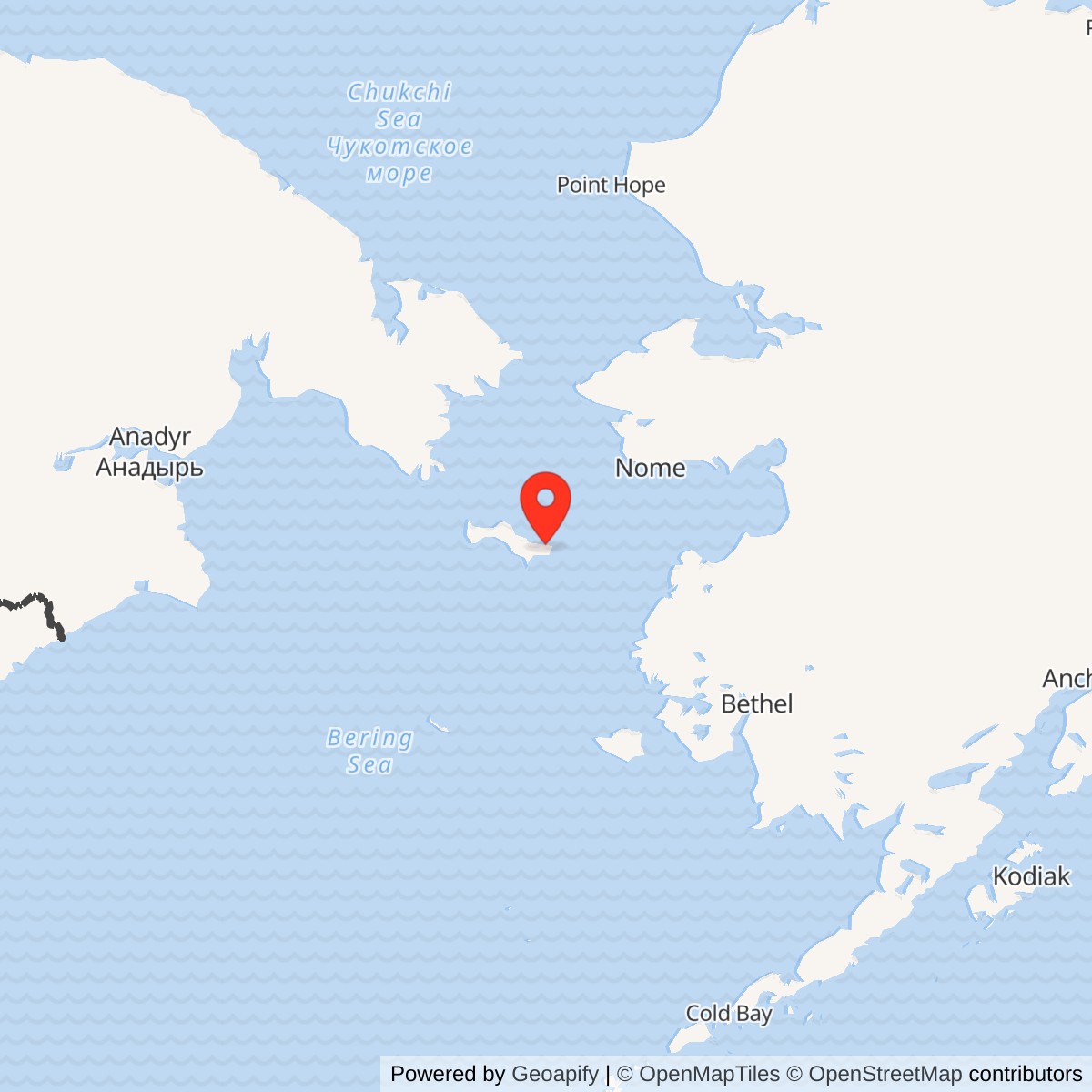
Longitude: -168.964278
Official Base Website: Former Northeast Cape Air Force Station
Current Role: Formerly Used Defense Site on St. Lawrence Island with continuing U.S. Army Corps of Engineers and Alaska DEC environmental review; not an operating radar station.
- Station code
- F-09 / F-9
- Military role
- Coastal early-warning station in the Alaska Aircraft Control and Warning system
- Operating unit
- 712th Aircraft Control and Warning Squadron
- Original radar
- AN/FPS-3 search radar
- 1963 replacement
- AN/FPS-20A search radar
- Military operating period
- Operational buildup 1952-1953; radar shutdown 1969
- Security tenant
- 6980th Security Squadron, listed in the July 1964 Air Force directory
- Communications relay
- Northeast Cape White Alice, opened 1958; final traffic 1974
- Principal support
- Lower camp, airfield, cargo beach, fuel and utilities, aerial tram and upper man-lift
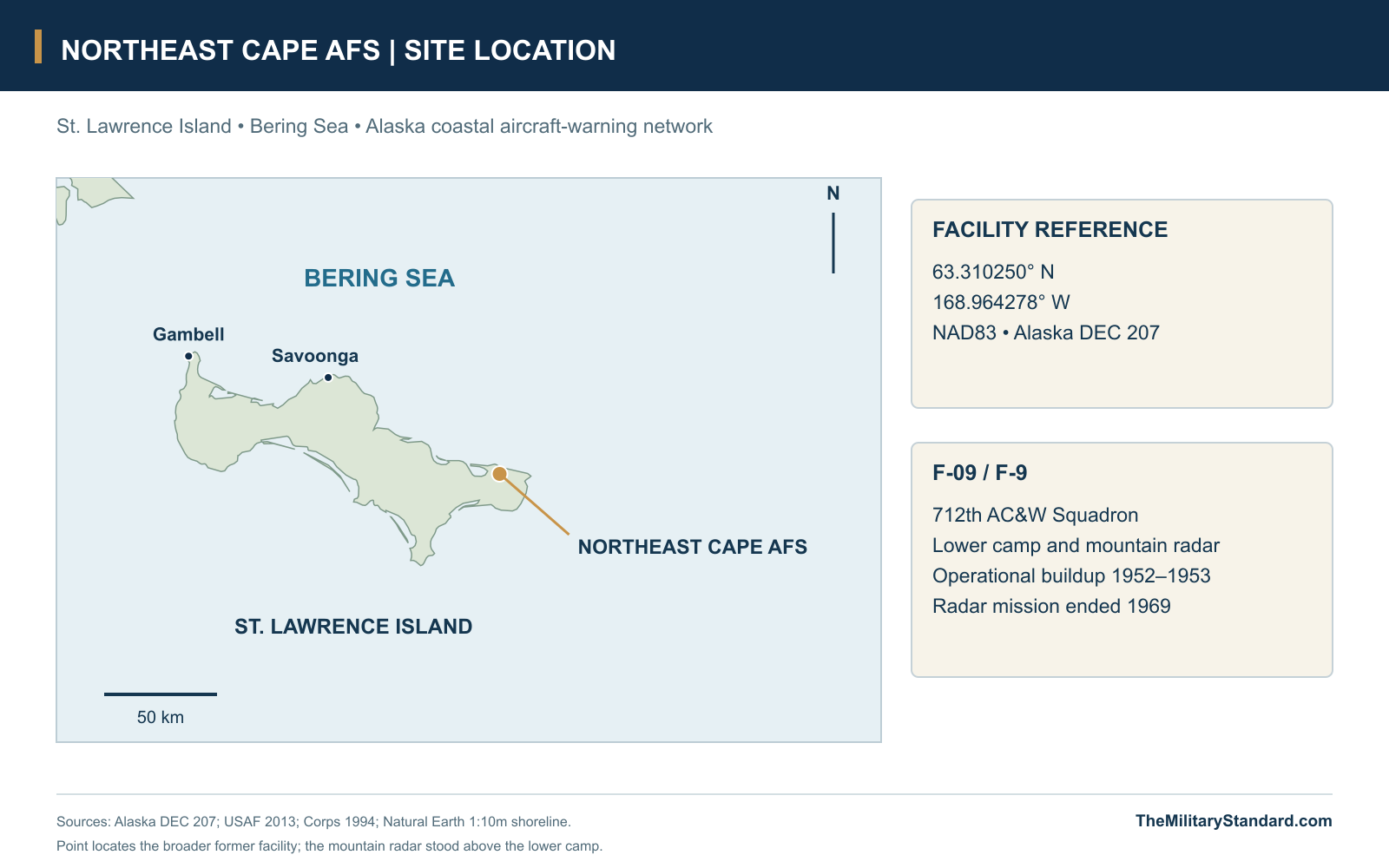
- Location
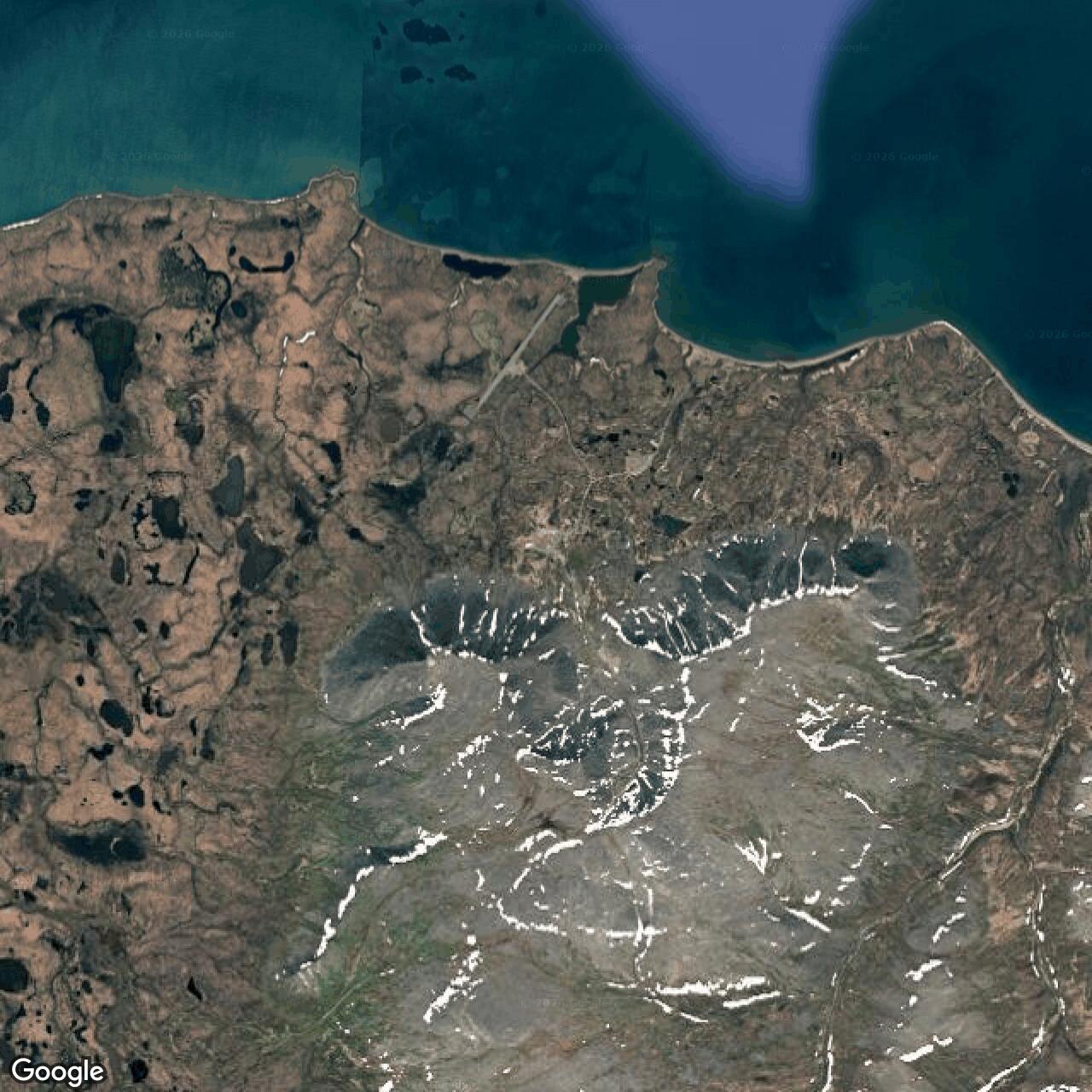
- Northeastern St. Lawrence Island, Bering Sea, Alaska
- Latitude / longitude
- 63.310250, -168.964278; NAD83 facility-wide reference (DEC 207)
A Radar Watch on St. Lawrence Island
Northeast Cape Air Force Station extended Alaska's Cold War aircraft-warning screen into the Bering Sea. On the northeastern side of St. Lawrence Island, a coastal camp supported a radar position high above it on Kangukhsam Mountain. The 712th Aircraft Control and Warning Squadron kept watch from a place where nearly every operating requirement depended on a long supply route, a dependable power plant and movement between two sharply different elevations. The station's history joins the development of Alaska's warning network with the practical work of keeping an isolated community on duty. [1] [2] [3]
The station occupied the seaward edge of the Alaska Aircraft Control and Warning system, reporting aircraft activity into a defense organized around warning and interception of approaching bombers. NORAD's 1958 roster identified Northeast Cape as early-warning station F-9. Its task was to provide observations for the wider control system; the men operating the radar belonged to a network whose headquarters, control centers and interceptor bases lay elsewhere. The nearby Northeast Cape White Alice site later strengthened the communications connections that made such remote observations useful. [1] [3] [9]
Building a Camp Between Sea and Mountain
Construction began in 1951 amid the accelerated creation of permanent warning stations around Alaska. The initial contract was awarded in January, with completion planned before the next winter. Heavy snow and strong winds upset that schedule, and the early military party had to establish itself before the permanent plant was ready. Detachment A-4 of the Air National Guard's 142nd Aircraft Control and Warning Squadron provided an early presence; its later designation as F-9 reflected the station numbering used across the warning system. [1] [2]
Ice and weather made the unfinished station especially vulnerable to interrupted transport. The Air Force history describes local Native residents using dog teams to carry light material to a small security detail during the winter and spring of 1952. That assistance connected the new military project with people who already understood travel and survival on St. Lawrence Island. The permanent station depended on outside engineering and equipment, but its first difficult season also depended on local knowledge and practical help. [1]
The operating force took shape during 1952-1953. The Air Force history dates the 712th Squadron's activation and station operation to December 1952, while the Corps' cultural-resources history places operational readiness in April 1953. Together these accounts describe the difficult transition from construction camp to a working radar post. The early plant included nineteen principal buildings and a reported station population of 212, creating a substantial military settlement beside a coast that had offered little existing infrastructure for it. [1] [2]
The Lower Camp and Its Outlying Facilities
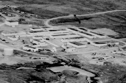
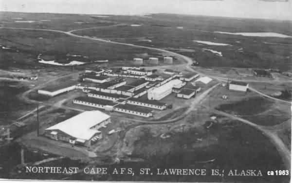
Most personnel lived and worked in the main operations camp on the coastal plain. Connected wooden buildings provided accommodation, offices, stores and work space, with covered passages reducing the need to go outdoors between routine activities. The nineteen-building early count included eighteen wood-frame structures and a steel-frame emergency-power building. Later plans show a more complicated landscape of additions, specialized buildings, tank areas and utilities, so the camp's appearance changed during its military service. [2] [4] [5]
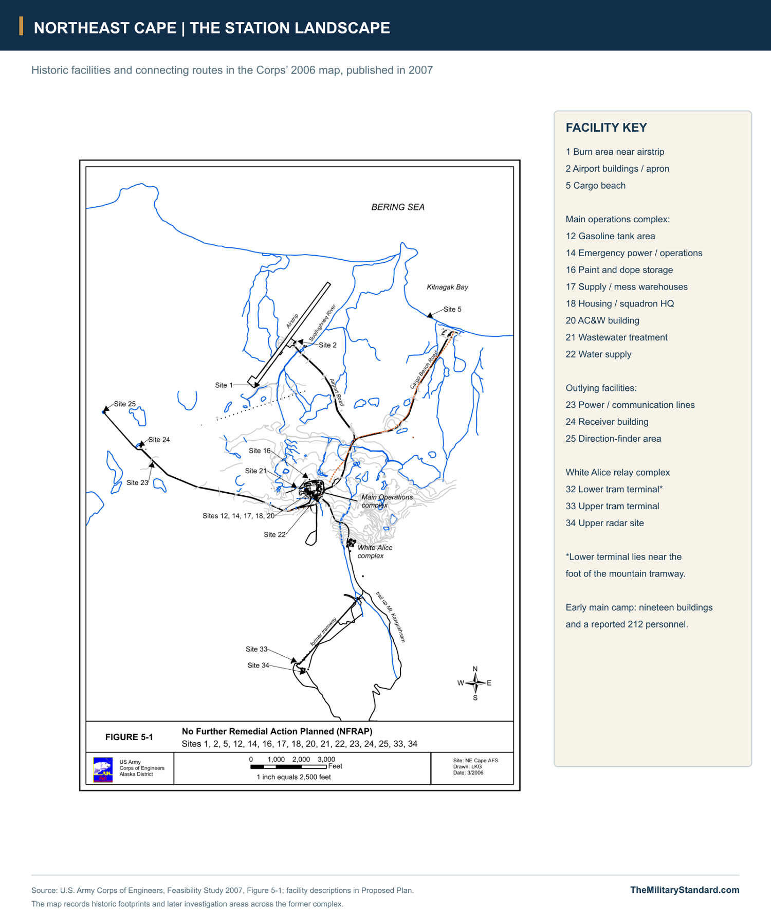
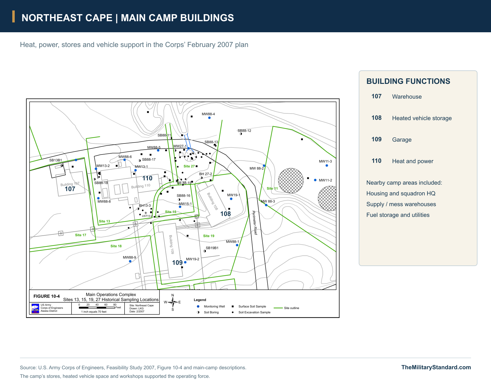
The camp's heat and power plant was as important to the watch as the radar itself. The later Corps inventory identifies Building 110 with heat and power, Building 107 as a warehouse, Building 108 with heated vehicle storage and Building 109 as a garage. Emergency power and operations occupied Building 98 elsewhere in the complex. Fuel storage, water-supply facilities, wastewater arrangements and maintenance areas completed the supporting plant, allowing the operating force to remain at the station through long periods between major deliveries. [4] [5]
Northeast Cape extended well beyond these connected buildings. An airfield and its operations facilities served the camp, while cargo landed at the beach moved inland along a separate road. A receiver building stood about a mile and a half west of the main camp, and a direction-finder area occupied another outlying position. White Alice stood uphill from the lower camp, while the tram and upper radar reached still higher ground. These separated functions explain why a complete view of the station includes roads, lines and terminals as well as the familiar barracks and radar dome. [4] [5] [9]
Radar Above the Coastal Plain
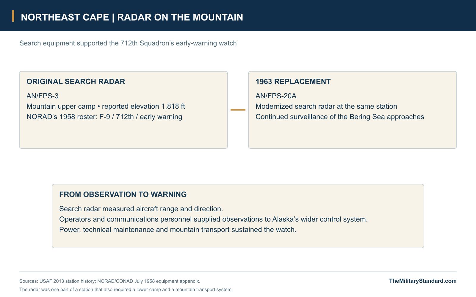
The original AN/FPS-3 search radar occupied the upper camp at a reported elevation of 1,818 feet. Its position gave the warning station an elevated view over the surrounding approaches, while forcing the support force to maintain a mountain installation above the main living area. Search-radar observations supplied range and direction information about aircraft. Operators and communications personnel then turned those observations into reports that could contribute to the wider Alaska air picture. [1] [3]
An AN/FPS-20A replaced the earlier equipment in 1963, part of the modernization of the Alaska warning network. The improved search set served the same basic geographic purpose: maintaining surveillance from an isolated position along the coastal screen. The change involved more than a different electronic set beneath the dome, because technicians, power crews and transport personnel all had to sustain the equipment at the upper camp. Radar performance depended on the whole installation continuing to function together. [1]
The Tramway to the Upper Camp
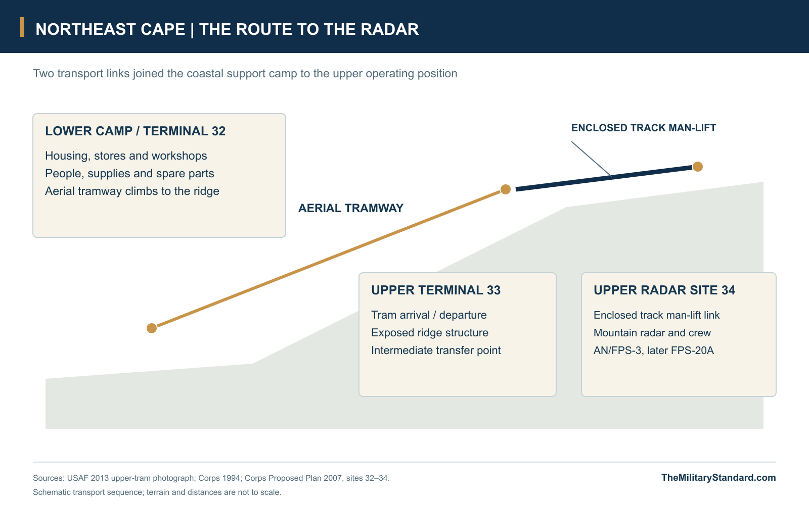
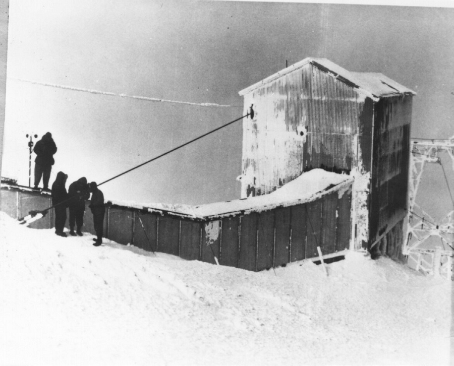
A tramway connected the lower station with the mountain facilities, carrying people and supplies across terrain that made ordinary road access difficult. The upper terminal was itself a substantial structure, exposed to icing and the weather of the ridge. An Air Force archival photograph shows men waiting beside its ice-covered framework, a reminder that each trip to or from the radar could become a conspicuous part of the working day. Maintaining the route was a direct contribution to maintaining the radar watch. [1] [2] [4]
The later Corps inventory distinguishes the lower tram terminal, upper tram terminal and radar site as separate locations. It also describes an enclosed, track-mounted man-lift connecting the upper terminal to the upper camp. That short final link and the longer aerial tram were different parts of the same transport chain. The arrangement brought food, spare parts and personnel upward while allowing the main housing, vehicle shops and bulk stores to remain on the more accessible coastal plain. [4] [5]
Security Squadron and Communications Relay
Aircraft warning was one military activity within a station that also supported specialized radio work. The July 1964 Air Force organizational directory places the 6980th Security Squadron at Northeast Cape under the 6981st Security Group. Veteran Arthur R. Leahy later identified his own 356-day tour there as a Morse-code intercept operator with the 6980th. His account brings a different kind of watch into the station's history: listening and intercept duty alongside the aircraft surveillance performed by the 712th. [7] [8]
White Alice supplied another distinct function. Opened on February 17, 1958, the nearby relay used four large tropospheric-scatter reflectors for links toward Anvil Mountain and Tin City. It drew housing and support from the AC&W community, joining a communications network that connected remote Alaska installations across distances and terrain poorly served by ordinary land lines. The lower camp consequently sustained both the radar station and communications infrastructure whose useful life continued beyond the end of the radar mission. [2] [9]
These overlapping duties made Northeast Cape a shared working landscape. Radar operators, security personnel, communications technicians and the support trades used different equipment for different purposes, while depending on many of the same roads, fuel supplies, stores and living facilities. The receiver and direction-finder sites, mountain radar and White Alice antennas occupied separate positions in that landscape. Their physical separation helped accommodate specialized functions, while the common camp made the isolated installation practical to operate. [4] [5] [7] [9]
Keeping the Station Supplied
Bulk supplies arrived during the ice-free season through the annual Mona Lisa program, later known as Cool Barge. Beach unloading, storage tanks and truck movement converted a brief shipping opportunity into months of fuel, food and operating materials. The cargo beach and fuel-transfer facilities were therefore integral parts of the air-defense post. A shortage or breakdown in this support chain could affect heating, electrical generation, vehicles and radar service at the same time. [1] [4] [5]
Air transport provided another connection for personnel and supplies, but wind, snow and icing could interrupt it. The runway, apron and airport buildings formed one part of a dispersed support system, with roads leading to the main camp and other facilities. Inside the station, mechanics kept vehicles available, utility personnel maintained heat and water, and the power crew sustained the electronic plant. The remote location made those familiar base services unusually consequential: the men depended on them for daily life as well as for the mission. [1] [4] [5]
Life at The Rock
The Air Force's 1964 station description called Northeast Cape "The Rock," a nickname that captured its remoteness and demanding surroundings. The same guide described a gymnasium used for basketball, volleyball and badminton, hobby shops and the station's own television service. These facilities gave personnel places to meet and activities beyond their duty sections. In a camp where work, meals and off-duty hours took place within a small community, recreation helped give shape to a long isolated tour. [6]
The station's layout reinforced that communal life. Connected accommodation and service buildings concentrated daily routines in the lower camp, while the mountain watch and detached radio facilities drew some personnel away for their shifts. The contrast between an indoor social world and the exposed journey to an operating position was part of the station's character. Archival views of the barracks and tram terminal preserve both sides of that experience: a settled military community on the coastal plain and a watch sustained in a much harsher setting above it. [1] [4] [6]
The Radar Closes and White Alice Continues
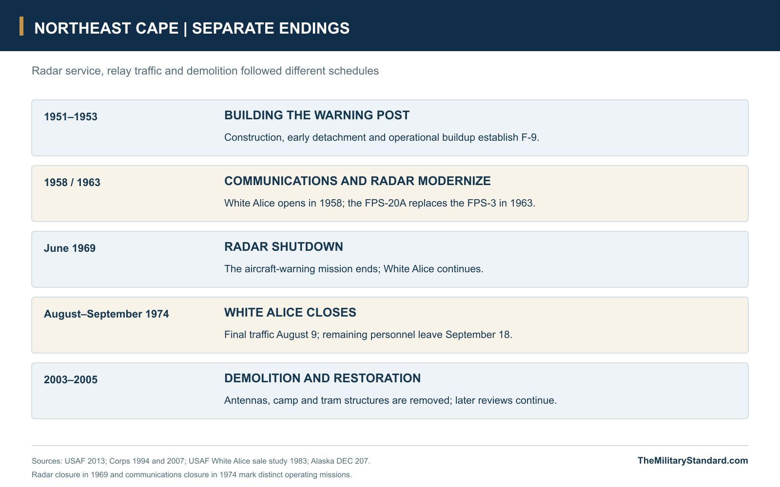
The radar mission ended in 1969 as Alaska's air-defense system contracted and redistributed its responsibilities. The Corps history dates the radar shutdown to June, with most military personnel gone by the end of the year. The 712th Squadron's departure ended the staffed aircraft-warning station, but the connected White Alice operation still required support. Northeast Cape therefore passed through a period in which much of the old radar community had departed while a smaller communications function remained. [1] [2] [9]
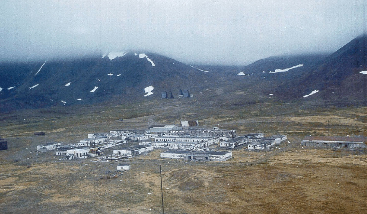
The detailed White Alice study records final communications traffic on August 9, 1974 and evacuation of the remaining personnel on September 18. Those dates mark a later ending than the radar shutdown. Once the relay was abandoned, the costs and difficulties that had complicated construction also complicated removal: substantial buildings, equipment and other materials remained far from economical transport. The camp and antennas became an abandoned military landscape that would require repeated visits for assessment, demolition and restoration. [4] [5] [9]
Demolition and the Former Station
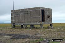
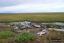
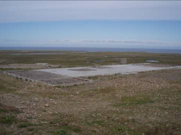
Removal took place in stages rather than in one final clearance. Corps photographs document the receiver building and outlying antenna poles before removal, White Alice antenna demolition in 2003 and further work at power and tram facilities in 2005. These projects dismantled the physical chain that had sustained the watch, from the connected lower camp to the mountain transport structures. Later views of concrete pads and roads show how a recognizable military community was reduced to a much more fragmentary footprint. [4] [5] [10]
Restoration continued after the conspicuous buildings and antennas were gone. Separate investigations and decisions addressed fuel areas, drainage, disposal sites and other former military uses across the complex, with St. Lawrence Island residents involved in the public process. The state's facility-wide record includes work on periodic reviews in 2025. The continuing administrative and environmental history belongs to the former installation's afterlife, while the aircraft-warning and White Alice operating periods remain clearly earlier chapters. [4] [10]
Northeast Cape demonstrates how much infrastructure lay behind a remote radar return. A mountain search set needed a tram, electric power, communications and a coastal support community; that community needed a runway, beach access, fuel, water, maintenance and people willing to spend an isolated tour there. The separate security and relay functions added to the site's importance without changing the 712th Squadron's basic warning role. Its surviving records and photographs preserve an unusually complete view of the relationship between military technology, island geography and daily work in Cold War Alaska. [1] [2] [4] [5] [7] [9]
Chronology
- 1951 Construction begins for the Northeast Cape warning station. [1] [2]
- Winter 1951-1952 An early military detachment occupies the unfinished camp; local dog-team assistance helps sustain the security detail. [1]
- December 1952 The Air Force history dates activation of the 712th Squadron and station operation to this month. [1]
- April 1953 The Corps cultural-resources history records operational readiness in this month. [2]
- February 17, 1958 The separate Northeast Cape White Alice relay opens. [2] [9]
- July 1958 NORAD lists F-9, the 712th Squadron and FPS-3(A) early-warning radar. [3]
- 1963 The AN/FPS-20A replaces the original AN/FPS-3. [1]
- July 31, 1964 The Air Force organizational directory lists the 6980th Security Squadron at Northeast Cape. [7]
- October 26, 1964 The Air Force station guide describes the gymnasium, hobby shops and local television. [6]
- June 1969 The Corps history dates the radar shutdown to this month. [2]
- 1969 The staffed AC&W mission ends and the 712th Squadron is inactivated. [1]
- August 9, 1974 The White Alice station handles its final communications traffic. [9]
- September 18, 1974 The remaining White Alice personnel leave the station. [9]
- 2003 Demolition removes the White Alice antennas and the receiver building. [4]
- 2005 Further demolition removes power and tram facilities. [4]
- November 20, 2025 DEC records preparation of two periodic-review reports for the former complex. [10]
Related Sites
Information sources (12)
- PDFU.S. Air Force, History of the Aircraft Control and Warning System in Alaska: Air Defense of Arctic Skies, Argonne 2002, updated CEMML 2013
Station history, printed pages 51-53: construction, 142nd and 712th squadrons, early dog-team supply, mountain radar elevation, FPS-3/FPS-20A sequence, resupply and 1969 closure. Includes lower-camp aerial circa 1963 and upper-tram photograph.
- PDFU.S. Army Corps of Engineers, D. Colt Denfeld, The Cold War in Alaska: A Management Plan for Cultural Resources, 1994
Printed pages 162 and 240-241: construction, April 1953 operational account, 212 personnel, nineteen early buildings, tram-supported upper camp and June 1969 radar shutdown.
- PDFHeadquarters NORAD/CONAD, Historical Summary, January-June 1958
Original July 1958 equipment appendix, PDF page 149, identifies Northeast Cape F-9, the 712th Squadron and FPS-3(A) early-warning equipment.
- PDFU.S. Army Corps of Engineers, Northeast Cape Proposed Plan, July 2007
Original facility descriptions and dated photographs: main operations camp, airport and beach, fuel, receiver and direction-finder sites, White Alice, tram terminals, upper radar and demolition. PDF pages 1-14 and 25-29.
- PDFU.S. Army Corps of Engineers, Northeast Cape Feasibility Study, Volume I, 2007
Historical property and building descriptions; original Figure 5-1 overall site plan and Figure 10-4 main-camp building footprints, PDF pages 224 and 235.
- WEBU.S. Air Force, Information on Alaska for Air Force Personnel and Their Families, AFP 34-8-6, October 26, 1964, Northeast Cape entry
Contemporary 712th Squadron station description, nickname The Rock, gymnasium sports, hobby shops and local television; original government text transcribed by the Online Air Defense Radar Museum.
- PDFU.S. Air Force, Directory of USAF Organizations, July 31, 1964
Printed page 56 lists the 6980th Security Squadron at Northeast Cape under the 6981st Security Group.
- WEBArthur R. Leahy, Don't Finish Third: A Cold War Story, American Legion Legiontown, September 29, 2015
Firsthand identification of a 356-day tour as a Morse-code intercept operator in the 6980th Security Squadron.
- PDFU.S. Air Force, Special Study of the White Alice Communications System Sale, October 1983
Early Northeast Cape survey, shared AC&W support and detailed final traffic/personnel dates in August and September 1974. Relay opening and reflector/path configuration are also documented in the Corps' 1994 history.
- WEBAlaska Department of Environmental Conservation, St Law NEC Facility Wide, Hazard ID 207
Facility-wide NAD83 reference 63.310250/-168.964278; demolition and continuing restoration chronology. Record checked November 7, 2026; November 20, 2025 entry describes periodic reviews in preparation.
- WEBU.S. Army Corps of Engineers, Northeast Cape photograph, 1999, Wikimedia Commons source record
Government photograph shows the lower camp and the four White Alice reflectors uphill in 1999, before their later removal.
- WEBNatural Earth, 1:10m Admin 0 Countries
Public-domain coastline geometry for the separate St. Lawrence Island and Bering Sea location diagram. The facility reference point comes from DEC source 10.