
Santa Rosa Island Air Force Station, California
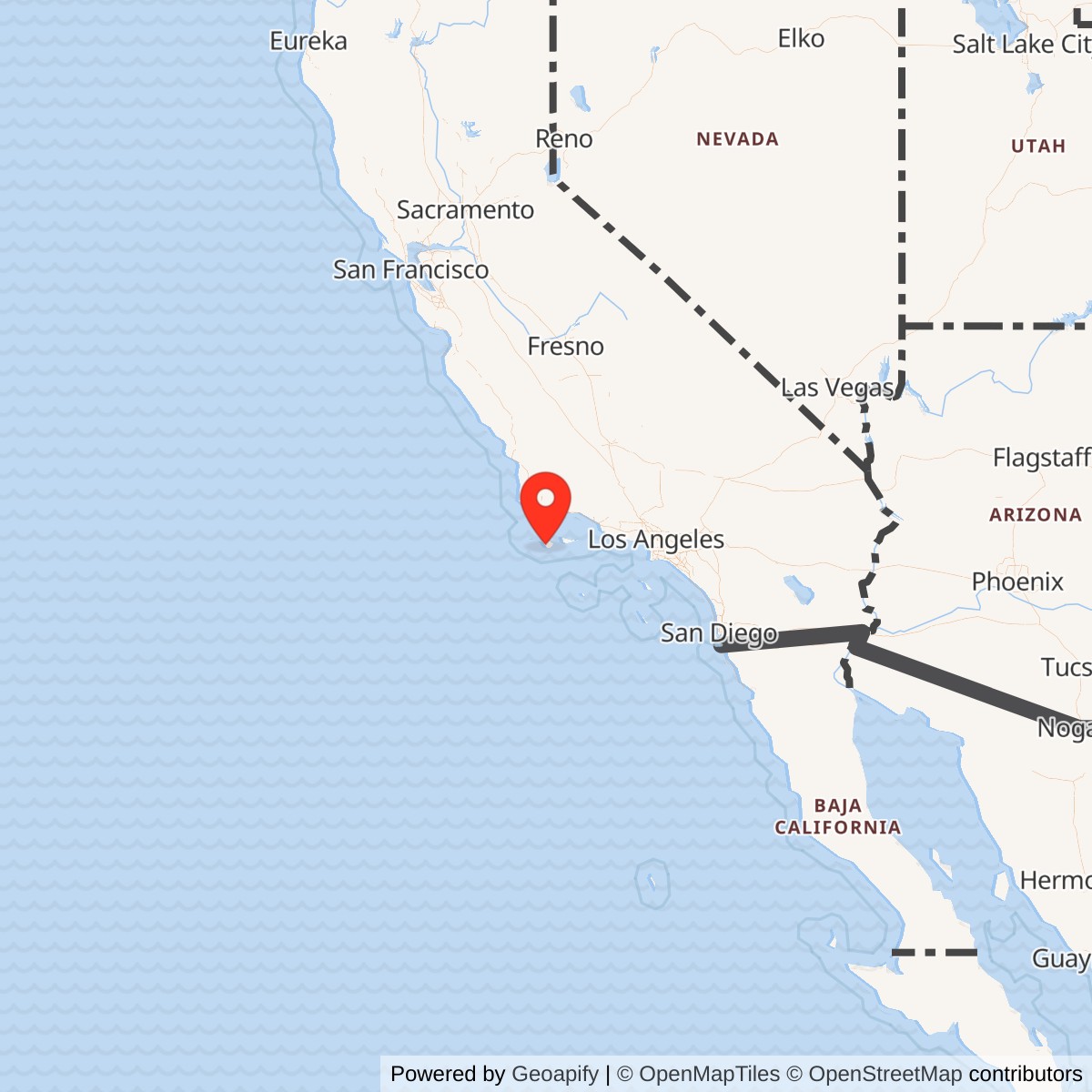
Longitude: -120.11725
Site Number: P-15
Official Base Website: Channel Islands National Park / former Santa Rosa Island Air Force Station sites
Current Role: Channel Islands National Park cultural landscape. Main radar and cantonment areas are mostly removed/revegetated; former Vehicle Maintenance Shop Building 147 survives as an NPS storage/research-support building.
Installation Identity
Santa Rosa Island Air Force Station was a permanent U.S. Air Force Air Defense Command general-surveillance and Ground-Control Intercept radar station on Santa Rosa Island, one of California's northern Channel Islands. The station formed an isolated forward warning outpost more than twenty miles offshore, where the 669th Aircraft Control and Warning Squadron watched Pacific approaches to Southern California and provided detection, identification, tracking, and fighter-control support during the most intense early years of the Cold War. The Air Force designated the installation P-15.
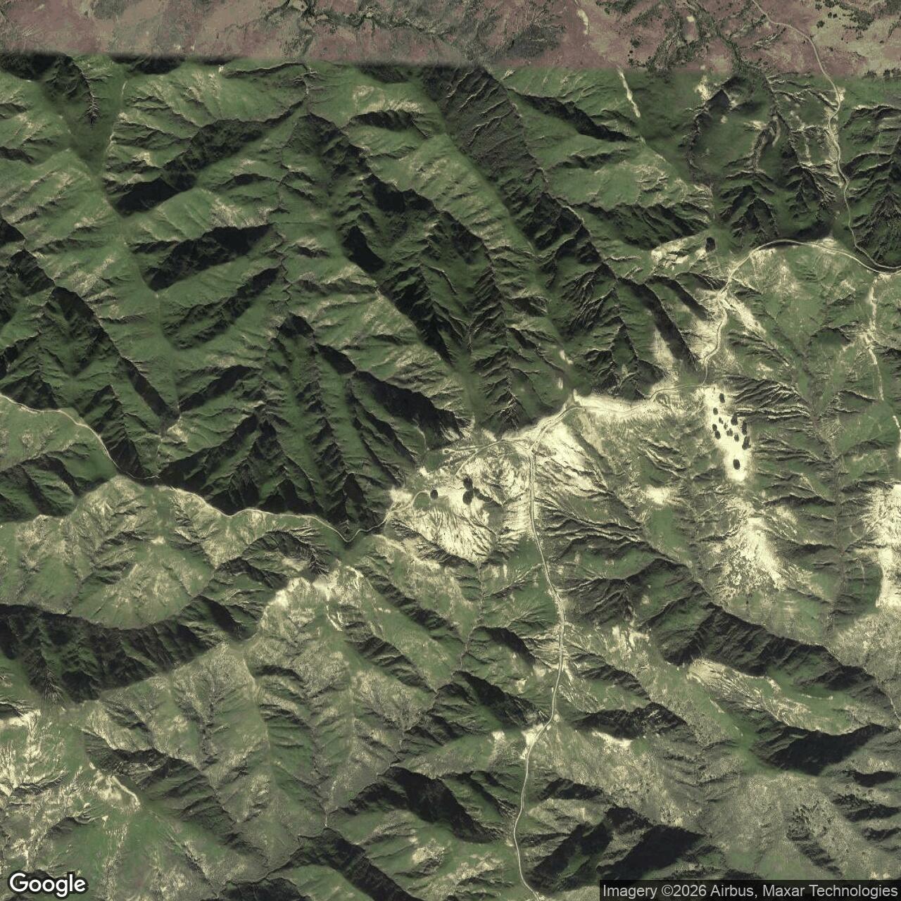
The station was physically divided into several components rather than concentrated in one compact compound. Radar operations, transmitting and receiving equipment, and the principal technical facilities were located high on Vail Peak. The main cantonment at Johnsons Lee near the south shore contained barracks, dining and recreation facilities, medical support, warehouses, maintenance buildings, water and utility systems, and a large concrete pier. Additional radio and communications functions occupied separate hilltop sites. A paved military road tied the shore facilities to the technical area.
Santa Rosa Island AFS replaced temporary radar coverage that had been created quickly during the Korean War emergency. Initial operation of the island station with AN/CPS-6B equipment allowed Air Defense Command to retire the Camp Cooke Lashup site L-41 and Port Hueneme Lashup site L-42. The island station therefore marks the transition from improvised temporary warning sites to the permanent continental radar network on California's central and southern coast.
The principal unit was the 669th Aircraft Control and Warning Squadron. The squadron had been activated at Fort MacArthur on 1950-05-05 and later prepared for the move offshore. Official and compiled histories give slightly different dates for the squadron's physical move to Santa Rosa Island, with 1952-02-11 and 1952-02-13 both appearing. The strongest operational milestone is 1952-02-16, when the station was accepted into the Air Defense Net and officially went on line.
Selection of Santa Rosa Island
Santa Rosa Island offered an important geographic advantage. A radar on the island could look west and southwest over open ocean before approaching aircraft reached the mainland. The resulting forward position gave Southern California's air-defense system additional warning time and reduced the coastal coverage limitations that affected mainland radars.
The location also imposed severe logistical penalties. Nearly every major item needed by the station had to arrive by air or water. Personnel, mail, rations, fuel, construction material, replacement radar components, and eventually much of the fresh water supply depended on transport from the mainland. Weather and sea conditions could interrupt those movements, and high winds on the island could damage power and communications infrastructure.
The Air Force negotiated a lease with Vail & Vickers, the private ranching company that owned Santa Rosa Island. National Park Service historical material states that the lease covered 336.5 acres in several parcels and cost the government $20,000 per year. The lease provided exclusive and joint-use areas for the radar, communications sites, cantonment, coastline, roadways, utilities, and access. The same historical narrative publishes parcel figures that do not arithmetically reconcile with the stated 336.5-acre total. The stated lease total is therefore preserved as the historical acreage while the internal parcel discrepancy is explicitly qualified rather than silently corrected.
The lease reflected the unusual relationship between a strategic military station and an operating cattle ranch. The Air Force had to avoid interfering unnecessarily with ranch operations, control garbage and introduced plants or animals, observe access restrictions, and coordinate road and pier use. Some portions of the island remained in joint use. Ranch personnel continued working around a growing military presence that included fenced technical compounds, roads, utility lines, security checkpoints, and a shore cantonment.
Construction
The Air Force hired Morrison-Knudsen to construct the station. Work included the mountaintop radar area, transmitting and receiving sites, cantonment, pier, roads, utilities, water facilities, maintenance buildings, and living quarters. Construction was substantially complete by the end of 1951, although technical installation and testing continued into early 1952.
The cantonment at Johnsons Lee included five two-story enlisted barracks, dining facilities, offices, warehouses, training and recreation buildings, a dispensary, maintenance facilities, and a motor pool. The shore complex also included a substantial concrete pier designed to handle personnel and heavy supplies. A landing strip was attempted on the island, but the difficult terrain and wind environment made aviation support less dependable than the station's sea connection.
The technical area occupied the island's high central ridge. Vail Peak, sometimes called Radar Mountain in later sources, rises to about 1,589 feet. Radar towers, transmitting and receiving antennas, operations buildings, backup power, and related electronics occupied the summit area. The high elevation created excellent radar exposure over the Pacific but made the road from Johnsons Lee long, steep, and vulnerable to erosion and landslides.
Construction itself produced several serious incidents. Wind damaged the AN/CPS-6 tower while it was being erected, forcing redesign and delay. A civilian construction worker was seriously injured in a fall. A Navy boat struck and damaged the new pier while unloading cargo. A construction engineer was killed when an aircraft crashed while attempting to land on the island. These incidents illustrate the difficulty of building a technically sophisticated radar station on an isolated island with limited transportation and harsh weather.
By December 1951 electrical power had been turned on for equipment testing. A small group of squadron personnel was already working on the island, while the majority of the 669th remained at Fort MacArthur awaiting the final move.
Activation and Air Defense Net Acceptance
The move to Santa Rosa Island took place during February 1952. The official organizational summary places the move on 1952-02-11, while the detailed station history places the formal squadron move on 1952-02-13 after Major Charles F. Hobart assumed command and inspected the site. Both dates belong to the transition period and are preserved as such.
The clearer operational milestone came on 1952-02-16. At 1100 hours the station was accepted into the Air Defense Net and officially went on line. Sixty airmen and ten officers were initially working continuous shifts, with the station operating every day. Personnel soon had to overcome problems associated with unfamiliar equipment, construction defects, weather-damaged communications, and shortages of trained technicians.
The station's early radar performance was not immediately satisfactory. Calibration teams identified deficiencies, and new radar mechanics were brought in. Technical instructors and field representatives from equipment manufacturers supported the unit while Air Force personnel learned the systems and corrected installation problems. Tracking efficiency improved as the crews gained experience.
The island station's activation permitted the shutdown of the Camp Cooke L-41 and Port Hueneme L-42 Lashup sites. This was an important regional network change. The temporary sites had provided emergency warning coverage while the permanent system was being built. P-15 gave Air Defense Command a stronger offshore sensor with a permanent operating organization.
Mission and Ground-Control Intercept
The 669th's central responsibility was to detect, identify, and track aircraft approaching Southern California. Radar operators maintained surveillance of military, commercial, and private aircraft. Identification personnel compared observed tracks against known flight information. Unknown or suspicious tracks could be passed into the fighter-control system for interception.
Ground-Control Intercept made the station an active part of the weapons-control chain rather than a passive warning sensor. Radar operators and controllers had to maintain range and azimuth, determine altitude with height-finding equipment, identify the contact, and communicate the track to interceptor forces and higher command centers. The island's forward position was valuable because it could detect over-water traffic before that traffic reached the coast.
During the manual air-defense era, much of the track interpretation and fighter-control process depended on local operators and voice communications. By the late 1950s the regional system was becoming increasingly automated through SAGE direction centers, but Santa Rosa Island itself never completed a full SAGE conversion before closure. The 669th transferred to the Los Angeles Air Defense Sector on 1959-10-01 and continued to provide radar information within the sector's broader command network.
The island site remained operationally successful despite the difficulty of supporting it. The 669th received Western Air Defense Force "A" awards for performance during inspections in 1959 and 1960. In 1961 the unit recorded 7,363 intercepts and ranked among the leading aircraft-control-and-warning squadrons in the Air Force. Inspection and readiness reports from the final years continued to rate the squadron highly.
Radar Equipment
Santa Rosa Island AFS is especially important for the radar-equipment project because it documents several successive early Cold War systems in one installation.
The initial station used AN/CPS-6B equipment. The CPS-6 family combined search and height-related functions through multiple beam patterns and represented a major improvement over the emergency Lashup radars it replaced. Initial P-15 operation with CPS-6B was sufficient to permit retirement of the Camp Cooke and Port Hueneme temporary sites.
By 1952 the 669th also operated two AN/FPS-10 radars. AN/FPS-10 represented the fixed-site member of the mature AN/TPS-10 and AN/FPS-4 height-finder lineage, although early Air Defense Command equipment tables sometimes used the designation in mixed operational contexts. The Santa Rosa Island equipment record must therefore be interpreted with the station's complete radar sequence rather than by assuming each set served the same function throughout its service.
In 1955 the Air Force added AN/FPS-3 search radar. The FPS-3 was a major long-range search radar of the first permanent continental network and gave P-15 a more conventional search-radar architecture. During 1956 an AN/GPS-3 was added or replaced the FPS-3, depending on the source wording. The 669th unit history contains both formulations in different passages.
The AN/GPS-3 was an integrated fixed radar system related to the AN/FPS-8 family. Its presence shows that Santa Rosa Island continued receiving modernized search capability rather than remaining frozen in its early 1952 configuration.
In 1958 the Air Force added an AN/MPS-14 long-range height finder. The MPS-14 was the mobile counterpart of the AN/FPS-6 family and gave the station a powerful S-band altitude-measurement capability. Its use at a fixed island site demonstrates that "mobile" equipment designations did not prevent long-term installation at semi-permanent or permanent locations when operational needs required it.
An AN/FPS-27 frequency-diversity search radar was later planned for Santa Rosa Island but never installed. The cancellation is significant because it occurred while Air Defense Command was deciding whether to modernize the expensive island site or move the mission to the mainland. The decision ultimately favored relocation.
Communications and Identification
Radar coverage only had value if tracks could be identified and transmitted. Santa Rosa Island therefore depended on communications circuits linking the island to the mainland air-defense network. The station maintained transmitting and receiving facilities on the high ground and used telephone, radio, and other circuits for operations, administration, and logistics.
A staffed cryptographic and communications center began operating during 1952. The island's communications systems suffered from wind damage, contractor-installation problems, and manpower shortages during the early months. Those difficulties were gradually corrected.
The island also hosted Navy communications and missile-tracking activity that must be distinguished from the Air Force P-15 mission. The Navy established a communications station on Navy Hill in 1952 in connection with missile testing from Point Mugu and San Nicolas Island. Air Force and Navy facilities occupied the same island and sometimes shared roads, security relationships, and communications infrastructure, but they remained separate service activities.
Port Hueneme Logistics Support
Santa Rosa Island could not have operated without sustained Navy support from Port Hueneme. Navy boats carried personnel, rations, mail, cargo, and water between the mainland and the island. A fast former PT-type boat commonly made the approximately fifty-four-mile trip several times a week, with travel times varying sharply according to sea conditions.Heavy equipment and bulk supplies moved by barge. Passengers arriving at Johnsons Lee were transferred between boat and pier using a crane-mounted cage because the pier configuration and sea state could make direct boarding difficult. The arrangement became one of the most memorable features of station life.
The logistical connection also ties Santa Rosa Island directly to the earlier Port Hueneme Lashup radar history. Port Hueneme L-42 ceased radar operations when P-15 took over regional coverage, yet the Navy base continued to support the replacement station physically. Radar coverage moved offshore while much of the logistical lifeline remained at Port Hueneme.
Water and Power
Fresh water was one of the station's most persistent problems. The Air Force's well could not support the full population. Navy barges carried water to the island, but bad weather could interrupt deliveries. During one early shortage, water use had to be severely restricted.
To reduce dependence on barges, the station installed salt-water conversion equipment capable of producing fresh water. The system itself required maintenance and could fail. In 1959 a breakdown forced major emergency water shipments. In December 1960 a large water barge was lost during its approach, requiring emergency use of the conversion plant. By the final years of the station, imported water remained expensive and operationally burdensome.
Electrical power also had to be generated locally. Diesel generation supported the radar and cantonment. High winds could damage power lines and transformers. The cost of generating power, transporting fuel, maintaining equipment, and repairing weather damage became a major argument for moving the station to the mainland.
Roads and Internal Transportation
The paved road between Johnsons Lee and the summit facilities was indispensable. Shift workers had to travel several miles between barracks and the radar area. Erosion, poor drainage, and landslides repeatedly damaged the route.
A major landslide in March 1952 blocked the road. Personnel used trucks on opposite sides of the obstruction to move between sections while large boulders were removed. During bad weather the trip between cantonment and technical facilities could take close to an hour.
The road also passed near other military and ranch features, including older World War II radar remains and communications sites. Security gates and checkpoints controlled movement. Ranch workers retained certain access rights under the lease, creating an unusual mixture of military security and civilian ranch operations.
Life at Johnsons Lee
Santa Rosa Island AFS supported a community far larger than the small group that initially went on line in February 1952. The station eventually averaged about 200 personnel and at times supported as many as 300 people, including roughly thirty civilians.
Airmen generally served eighteen-month tours. Transportation to the mainland was limited by sea conditions and military schedules. Families did not live on the island. The lease specifically restricted school-age residents, and the isolation made the station effectively an unaccompanied assignment.
The Air Force built recreation and morale facilities to compensate. Personnel had access to movies, a library, hobby activities, sports, fishing when conditions permitted, pool, ping-pong, and organized social events. Clergy visited periodically. The dispensary provided routine medical support, while a dentist visited regularly.
The station maintained a commissary and dining facilities. Civilian employees performed much maintenance and service work. Relationships with the Vail & Vickers ranch operation were generally cooperative. Ranch workers and Air Force personnel interacted socially, and salvaged military materials later became deeply incorporated into ranch infrastructure.
Commanders and Leadership
The public record does not provide a complete commander chronology.
Major Charles F. Hobart assumed command immediately before the squadron's February 1952 move to the permanent P-15 site and authorized the final relocation after inspecting the station.
A later unit-history compilation identifies Major Clark A. English in connection with the squadron around 1954.
By 1956 Major Charles E. VanBibber was identified publicly as the station commander during a Los Angeles Times visit.
National Park Service historical material identifies Colonel Jack Blacker as the last commandant of the base. The surviving list is incomplete, and no attempt should be made to infer the commanders between these documented officers.
Relationship with the Regional Air-Defense Network
Santa Rosa Island did not operate independently. It was one sensor within a network that included mainland radar sites, interceptor bases, communications facilities, direction centers, and later SAGE installations.
When P-15 opened, it replaced the emergency warning coverage of Camp Cooke L-41 and Port Hueneme L-42. Other California stations covered adjacent sectors. As Air Defense Command reorganized, the 669th came under the 27th Air Division and later the Los Angeles Air Defense Sector.
By the early 1960s the Los Angeles sector increasingly relied on SAGE Direction Center DC-17 at Norton Air Force Base. Santa Rosa Island remained a manual radar site, but its surveillance data contributed to the same regional air-defense picture. The planned mainland replacement at Lompoc would fit the modernizing system more efficiently and would receive direct support from nearby Vandenberg Air Force Base.
Isolation, Cost, and the Decision to Relocate
The strategic value of the island had to be weighed against the high cost of supporting it. By the early 1960s, improved radar technology and the expansion of mainland coverage made it possible to consider replacing Santa Rosa Island with a mainland radar site without creating an unacceptable warning gap.
An Air Force study in 1962 concluded that the mission could be relocated to the Point Conception area without significant sacrifice of radar coverage. The financial argument was strong. Every shipment of fuel, water, personnel, construction material, and technical equipment required special transport. Electrical power had to be generated locally. Construction bids were expensive because contractors had to move labor and equipment offshore. Some contractors were reluctant to bid at all.
Personnel problems also mattered. The unaccompanied island assignment separated airmen from families and required travel to the mainland for leave. Although morale programs reduced the impact, the island remained a difficult duty location.
The study concluded that mainland savings would eventually offset the cost of constructing the replacement station. Headquarters approved closure in late 1962 and established 1963-03-31 as the target date.
Closure and Move to Lompoc
Santa Rosa Island AFS completed its final operational day on 1963-03-31. The 669th moved to Lompoc Air Force Station, RP-15, on 1963-04-01. The relocation was planned to maintain regional radar coverage without interruption.
The unit was redesignated the 669th Radar Squadron (SAGE) as it entered the Lompoc phase. Lompoc's mainland location allowed easier connection to Vandenberg Air Force Base support and reduced the exceptional logistics costs that had burdened P-15.
The transfer closed an eleven-year operational chapter on Santa Rosa Island. The 669th left with an unusually strong record of operational inspections and interceptions. Its move represented the broader Air Defense Command trend away from first-generation isolated stations toward sites better suited for SAGE integration, modern radar equipment, and economical support.
Phaseout and Property Disposal
Closure of radar operations did not immediately empty the installation. A small group remained for phaseout, and a Ground Electronics Engineering Agency team from Norton AFB removed technical equipment. Usable material was redistributed to other military units.
The General Services Administration accepted the Air Force report of excess in April 1963. The lease with Vail & Vickers was cancelled effective 1963-06-30, more than two years before its scheduled expiration.
Removing the buildings to the mainland was considered economically impractical. The installation represented millions of dollars in government construction, roads, utilities, and building space, but the cost of dismantling and transporting the structures exceeded their residual value. As a result, much of the physical plant was left to the landowners.
At abandonment, the former station contained at least forty buildings and structures. Vail & Vickers reused the property extensively. Ranch workers moved smaller buildings, salvaged windows and doors, reused road guardrails in corrals, and adopted military utility and maintenance equipment. The former Air Force infrastructure became part of Santa Rosa Island's ranching landscape for decades.
National Park Service Era
Channel Islands National Park was created in 1980, and the National Park Service purchased Santa Rosa Island from Vail & Vickers in 1986. The surviving Air Force station buildings presented both opportunities and liabilities. Some were used briefly by park staff, while others contained asbestos, deteriorated utilities, underground fuel systems, and structures that no longer served a practical purpose.
In the late 1980s the Army Corps of Engineers removed asbestos and underground storage tanks. The National Park Service then removed or burned most of the remaining Air Force buildings. During 1991 and 1992, remaining foundations were buried, pier ruins were removed, and disturbed terrain was revegetated.
The cleanup dramatically changed the appearance of Johnsons Lee and the radar summit. Unlike former ADC stations where towers and barracks still dominate the landscape, much of P-15 was intentionally returned toward a natural appearance.
One important Air Force building survives. The former Vehicle Maintenance Shop, Building 147, was rehabilitated by the National Park Service around 1987 or 1988 and later used for storage and as an outpost for park researchers. NPS cultural-landscape documentation identifies it as the principal surviving Air Force building at Johnsons Lee.
Environmental Restoration
The Department of Defense tracks the former installation as Santa Rosa Island AFS, FUDS property CA99799F533500. Defense Environmental Restoration Program reporting lists one Installation Restoration Program site and no Munitions Response Program site.
The property is listed among Formerly Used Defense Sites that achieved final response complete status before fiscal year 2023. Reported environmental costs through FY2023 were approximately $195,000. The FUDS record and the National Park Service demolition program addressed different aspects of the former military footprint, including hazardous building material and fuel-storage issues.
Current Status
Santa Rosa Island Air Force Station is closed. The former P-15 radar site, communications areas, and Johnsons Lee cantonment are now within Channel Islands National Park and have no military mission.
Most visible Air Force structures have been removed. Radar towers and principal operations buildings are gone, foundations were buried, and much of the disturbed ground was revegetated. Portions of the old road network remain visible in the island landscape, and the former Vehicle Maintenance Shop survives as the principal Air Force building associated with the station.
The installation should therefore be described neither as completely erased nor as an intact abandoned base. Most of the operational complex has been intentionally removed, while selected physical evidence, road alignments, documentary records, archaeological traces, and one major support building preserve the history.
Distinction from Other Santa Rosa Island Military Sites
Santa Rosa Island contains several military layers that must not be merged into one installation record.
During World War II the U.S. Army established an earlier radar station at what is now called Signal Hill. That 1943 to 1945 radar installation was physically and historically distinct from the Cold War Air Force P-15 station.
The Navy also maintained communications and missile-tracking facilities on the island beginning in the 1950s, particularly around Navy Hill. Those facilities supported the Point Mugu and San Nicolas Island missile-test network and remained after the Air Force left. They were not part of the 669th's P-15 radar equipment inventory.
Chronology
- 1950-05-05 The 669th Aircraft Control and Warning Squadron activates at Fort MacArthur, California.
- 1950-12-01 Government lease DA-04-353-ENG-2247 begins for Air Force use of Santa Rosa Island property owned by Vail & Vickers.
- 1951 Construction of the permanent P-15 radar station, communications areas, Johnsons Lee cantonment, pier, roads and utilities advances across the south side of Santa Rosa Island.
- 1951-11 High winds damage the AN/CPS-6 radar tower under construction and force repair and redesign work.
- 1951-12 Electrical power is turned on for technical equipment testing.
- 1952-02-11/13 Official and compiled histories give differing dates for the 669th's physical move from Fort MacArthur to Santa Rosa Island.
- 1952-02-16 Santa Rosa Island AFS is accepted into the Air Defense Net and officially goes on line at 1100 hours.
- 1952 Initial AN/CPS-6B coverage permits closure of Camp Cooke L-41 and Port Hueneme L-42 Lashup radar operations.
- 1952 The 669th operates two AN/FPS-10 radar sets at P-15.
- 1952-03-18 A landslide blocks the military road between the Johnsons Lee cantonment and the mountaintop technical area.
- 1954 Major Clark A. English is documented as a commander of the 669th during this period.
- 1955 AN/FPS-3 search radar is added at Santa Rosa Island.
- 1956 AN/GPS-3 equipment is added or replaces the FPS-3, depending on source wording; Major Charles E. VanBibber is identified as station commander during a press visit.
- 1958 AN/MPS-14 long-range height-finder radar is added.
- 1958 Air Defense Command begins considering relocation of the 669th from the expensive island station to the mainland.
- 1959-10-01 The 669th transfers to the Los Angeles Air Defense Sector.
- 1959 The station receives a Western Air Defense Force "A" award for operational performance.
- 1960 The 669th receives a second consecutive Western Air Defense Force "A" award.
- 1960-12 Loss of a large water barge forces emergency reliance on the station's salt-water conversion plant.
- 1961 The 669th records 7,363 intercepts and ranks among the Air Force's leading aircraft-control-and-warning units for intercept activity.
- 1962 An Air Force study concludes that the mission can be moved to the Point Conception area without significant loss of radar coverage and with major operating savings.
- 1962 Headquarters approves closure of Santa Rosa Island AFS with a target date of 1963-03-31.
- 1963-03-31 The 669th conducts its final day of radar operations at Santa Rosa Island AFS.
- 1963-04-01 The 669th moves to Lompoc Air Force Station RP-15 and enters the mainland SAGE-era phase of its history.
- 1963-04-22 The General Services Administration accepts the Air Force report of excess property.
- 1963-06-30 The Santa Rosa Island Air Force lease is cancelled.
- 1963-1960s Vail & Vickers salvages buildings, fixtures, guardrails, utilities and materials from the former station for ranch use.
- 1980 Channel Islands National Park is established with boundaries including Santa Rosa Island.
- 1986 The National Park Service purchases Santa Rosa Island from Vail & Vickers.
- 1987-1988 The National Park Service rehabilitates the former Air Force Vehicle Maintenance Shop for park use.
- late 1980s The Army Corps of Engineers removes asbestos and underground storage tanks from the former Air Force property.
- 1991-1992 The National Park Service removes additional ruins, buries remaining foundations and revegetates much of the former station landscape.
- before FY2023 DoD records Santa Rosa Island AFS FUDS CA99799F533500 as final response complete.
- Present The former P-15 station is part of Channel Islands National Park. Most Air Force structures are gone, while Building 147 and landscape traces preserve portions of the site's history.
Information sources (9)
- PDF669 Radar Squadron (SAGE) unit history
Detailed compilation preserving 669th lineage, move dates, commanders, P-15 radar sequence, Air Defense Net activation, operational performance, logistics, closure, and extensive National Park Service historical material.
- WEBJohnson's Lee, U.S. National Park Service
Official NPS history of the Air Force cantonment, Vail Peak technical site, station population, logistics, 1963 closure, ranch reuse, and Santa Rosa Island military landscape.
- WEBSanta Rosa Island History and Culture, Channel Islands National Park
Official NPS overview placing the 1950-1963 Air Force lease and radar mission within the larger military and ranching history of Santa Rosa Island.
- PDFSanta Rosa Island Interpretive Guide, Channel Islands National Park
Official NPS interpretive publication with historical photographs and details of the Johnsons Lee Air Force station and personnel facilities.
- PDFSanta Rosa Island Ranching District Cultural Landscape Inventory
NPS cultural-landscape documentation identifying the surviving Air Force Vehicle Maintenance Shop, later NPS use, and the loss of most remaining P-15 integrity after 1990s removal work.
- PDFHistorical Data of the Aerospace Defense Command, 1946-1973
Primary ADC statistical reference for continental radar-site and equipment context, including the permanent and temporary California warning network.
- WEBSanta Rosa Island AFS, Radomes.org
Specialist radar-station reference for P-15, call sign Art, coordinates, 669th identity, radar equipment, closure, photographs and site documentation.
- WEBSanta Rosa Island Air Force Station, FortWiki
Specialist installation history summarizing lease, physical layout, radar area, cantonment, closure, demolition, surviving Building 147 and current condition.
- PDFDefense Environmental Restoration Program, Table 9
DoD environmental source listing Santa Rosa Island AFS FUDS CA99799F533500 with one IRP site, no MMRP site, and final response complete status before FY2023.