
Montauk Air Force Station, New York
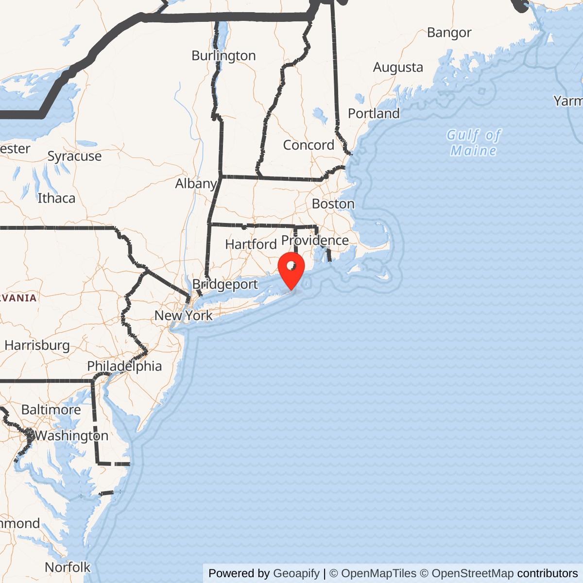
Longitude: -71.874444
Site Number: L-10; LP-45; P-45; Z-45
Official Base Website: Camp Hero State Park / former Montauk Air Force Station
Current Role: Predominantly Camp Hero State Park, with related parcels transferred to the Town of East Hampton and the U.S. Department of Transportation for Coast Guard purposes; surviving AN/FPS-35 tower and antenna preserved as a National Register-listed historic resource
- Radar designations
- L-10, LP-45, P-45 and Z-45 at the same main station
- Principal unit
- 773rd Aircraft Control and Warning Squadron, later 773rd Radar Squadron (SAGE)
- Air Force operation
- May 1950 to final station activity in 1982; main radar mission reduced in July 1980
- Surviving landmark
- AN/FPS-35 Radar Tower and Antenna, National Register-listed in 2002
- Approximate Air Force tract
- 307.65 acres transferred from the Army; not the entire Camp Hero reservation
- Representative radar point
- 41.062500 N, 71.874444 W; National Register AN/FPS-35 location, not a property centroid or boundary
Historical Overview
Montauk Air Force Station occupied the eastern end of Long Island at Camp Hero, a former Army coast-defense reservation overlooking the Atlantic Ocean and Block Island Sound. From the opening of Lashup radar site L-10 in May 1950 through the final termination of military activities in 1982, the station watched the seaward approaches to New York and southern New England. Its location gave Air Defense Command early warning over an ocean sector from which Soviet bombers might approach the metropolitan region. [1] [3]
The station passed through three principal operational forms. It began as a manually operated Lashup and Permanent System site using transportable and early fixed radars. It became a Semi-Automatic Ground Environment, or SAGE, surveillance station linked to a computerized direction center. It then operated the first production AN/FPS-35 frequency-diversity search radar, whose immense antenna and concrete tower became the most recognizable surviving feature of the installation. [1] [3]
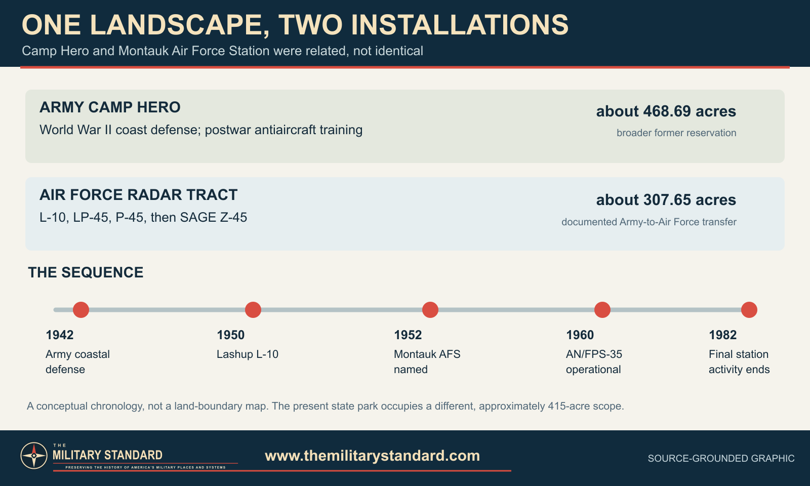
Montauk Air Force Station was not identical to the entire Camp Hero reservation. Camp Hero included Army coastal artillery, antiaircraft training areas, bunkers, batteries, and support property in addition to the Air Force radar tract. Federal records report that approximately 307.65 acres were transferred from the Army to the Air Force. The broader former Camp Hero property was approximately 468.69 acres, and the present state park is approximately 415 acres. Those figures describe different boundaries and must not be substituted for one another. [1] [3]
World War II Camp Hero
The Army developed Camp Hero during World War II as part of the Harbor Defenses of Long Island Sound. Its concealed coastal batteries protected the approaches to New York, while fire-control stations, observation points, roads, utilities, barracks, and support buildings occupied the upland behind the ocean bluffs. Buildings were designed to resemble civilian structures when viewed from the air, helping disguise the military character of the reservation. [3] [4]
The wartime installation included heavy coast-defense weapons and later antiaircraft training activity. After the war, the Army placed Camp Hero on inactive status on 1947-07-31 and declared it excess on 1949-12-31. The same day, federal authority was granted to transfer a portion of the property to the Air Force for an aircraft control and warning station. This created overlapping Army and Air Force histories at one larger military landscape. [3] [4]
The Army withdrew Camp Hero from excess status on 1951-01-24 and made it a Class I subinstallation of Fort Totten. Army antiaircraft units used firing positions on the southern bluffs for training with 90 mm and 120 mm guns, quad .50 caliber weapons, and 3.5-inch rockets. That activity continued through 1957 while the Air Force operated its radar mission on the transferred portion of the reservation. [3] [4]
Lashup Radar Site L-10
Air Defense Command established a temporary network of radar stations while the more elaborate Permanent System was being built. Headquarters ADC historical data identifies Camp Hero as Lashup site L-10 and records operations beginning in May 1950. The documented Lashup equipment included an AN/TPS-1B search radar, followed by an AN/CPS-5 search radar and an AN/TPS-10A height finder. These sets gave controllers range, azimuth, and altitude information for aircraft approaching from the ocean. [1] [3]
The 773rd Aircraft Control and Warning Squadron activated at Camp Hero on 1950-11-27 under the Eastern Air Defense Force. Its personnel operated radar and communications equipment, maintained the site, plotted aircraft tracks, and passed warning and control information into the regional air-defense system. The squadron supplied the permanent organization that transformed an emergency Lashup position into a staffed Air Force installation. [1] [3]
The Camp Hero radar site also appears as LP-45 during the transition from the Lashup network to the Permanent System. Headquarters ADC tables connect L-10 and LP-45 directly with permanent station P-45. These were successive network designations for the same principal radar installation, not three independent bases. [1] [3]
Creation of Montauk Air Force Station
Air Force facilities were substantially completed by 1952-02-06, when the Air Force property was renamed Montauk Air Force Station. Federal site records describe accommodations for approximately sixteen officers and 160 airmen. Construction and adaptation provided billeting, administration, station support, utilities, maintenance space, communications, and the radar facilities required for continuous aircraft detection and control. [3]
The station's exposed coastal setting shaped daily work. Salt air, wind, storms, and corrosion challenged antennas, mechanical drives, electrical equipment, and buildings. Radar crews and maintenance specialists had to keep the site operating around the clock despite weather that could affect both the equipment and the communications circuits connecting Montauk with higher headquarters and interceptor-control facilities. [3]
Permanent System P-45
Montauk became Permanent System site P-45. Headquarters ADC equipment histories document AN/FPS-3 and AN/FPS-5 search radars during the early permanent period. By the mid-1950s, equipment included the AN/FPS-3, AN/FPS-6 height finders, and an AN/FPS-8 search radar with its AN/GPS-3 modification. The sequence reflects repeated efforts to extend detection range, improve altitude measurement, and provide more reliable coverage over the ocean. [1]
In 1957 Montauk received an AN/FPS-20 search radar and two AN/FPS-6 height finders. The AN/FPS-20 supplied improved long-range search information, while separate height-finding radars allowed operators to determine altitude for identification and interception. The combination supported the manual air picture immediately before the station entered the SAGE system. [1]
The 773rd detected, identified, tracked, and reported aircraft within its assigned sector. Unknown tracks could be referred for identification and, when necessary, interception. Montauk's radars did not operate in isolation. Their value came from communications links that combined the local radar picture with information from neighboring stations, control centers, fighter bases, antiaircraft defenses, and later the Federal Aviation Administration. [1]
Transition to SAGE
The 773rd was assigned to the New York Air Defense Sector on 1958-01-08 while preparations continued for SAGE. The unit was redesignated the 773rd Radar Squadron (SAGE) on 1958-10-01. Montauk then transmitted digitized radar information to the New York sector's computerized direction center at McGuire Air Force Base, New Jersey, where computers assembled a wider regional air picture and supported weapons assignment. [1] [3]
SAGE changed the station's relationship to the air-defense network. Local operators still maintained the radars, selected and tracked returns, and ensured accurate data, but regional computers and direction-center crews integrated Montauk's coverage with other stations. The system reduced delays inherent in manual reporting and helped controllers direct interceptors against faster aircraft over a much larger defended area. [1] [3]
The SAGE-era site designation became Z-45. P-45 and Z-45 describe successive operational classifications of Montauk Air Force Station. Manorville, New York, operated as the separate P-45A and later Z-45A gap-filler annex. Chilmark, Massachusetts, also carried a related P-45B designation during part of its history. Neither annex was physically part of the Montauk station. [1] [3]
The AN/FPS-35
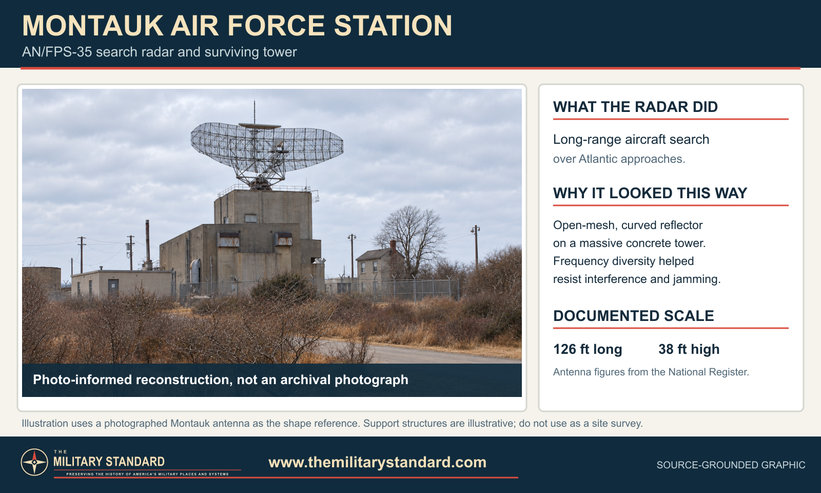
The defining technological development at Montauk was the AN/FPS-35, a Sperry-built frequency-diversity long-range search radar. The first production example became operational at Montauk in December 1960 after prototype evaluation elsewhere. Frequency diversity was intended to reduce vulnerability to jamming and interference by transmitting on multiple frequencies rather than relying on a single fixed operating frequency. [7] [8] [11]
The radar's antenna was approximately 126 feet long and 38 feet high. It rotated above a massive reinforced-concrete tower containing several operating and equipment levels. Four drive motors turned the antenna, and the structure supported the heavy mechanical and electronic equipment needed for long-range surveillance. The scale of the installation made it a landmark visible from land and sea. [7] [8] [11]
The new radar did not enter service without difficulty. Its powerful emissions produced radio-frequency interference in the surrounding area, and secondary histories report that the set was taken out of service during 1961 while the problems were corrected. It returned to operation in 1962. The episode illustrates the practical challenge of introducing high-power frequency-diversity equipment near established civilian communications and navigation users. [7] [8] [11]
By 1963 the principal radar suite included the AN/FPS-35 search radar, an AN/FPS-6 height finder, and an AN/FPS-26 frequency-diversity height finder. The AN/FPS-26 improved altitude coverage and complemented the frequency-diversity search set. Equipment configurations changed over time as radars were modified, replaced, or removed, but the AN/FPS-35 remained the station's central search system through the end of the mission. [7] [8] [11]
Radar Operations and Wider Coverage
Montauk's ocean-facing position supported surveillance across the Atlantic approaches, Block Island Sound, and the waters between Long Island and southern New England. Its radar coverage overlapped neighboring stations to reduce gaps and provide track continuity. The station also parented or supported gap fillers that watched low-altitude areas obscured by terrain or radar geometry from the main site. [1] [11] [12]
The Manorville Gap-Filler Annex stood near the center of Long Island and used an AN/FPS-14 radar to strengthen low-altitude coverage. Chilmark on Martha's Vineyard covered another exposed coastal sector. Headquarters ADC records repeatedly distinguish these annexes from Z-45, confirming that their equipment, properties, and operating periods should not be absorbed into the Montauk main-station record. [1] [11] [12]
Montauk participated in joint military and civil surveillance during part of the 1960s. Available station histories place an FAA and Air Defense Command joint-use period beginning in 1963 and ending after the FAA established other coverage. Military and civil requirements overlapped because the same long-range returns could support both defense warning and management of increasingly busy air routes near New York. [1] [11] [12]
Role in the Wider Military Network
Montauk formed the eastern seaward edge of the New York regional radar network. Its early reports supported manual control centers, including the developing New York-area system. Under SAGE, Z-45 fed the New York Air Defense Sector direction center at McGuire. Controllers used the combined air picture to evaluate tracks and direct fighter interceptors from regional air bases rather than treating each radar station as a self-contained defense. [1] [3]
The station's coverage supported continental air defense organizations that changed names and boundaries over three decades. Eastern Air Defense Force, Air Defense Command, Aerospace Defense Command, the 26th Air Division, and the New York Air Defense Sector were among the higher organizations associated with the mission. These changes reflected repeated efforts to organize radar, command centers, interceptors, missiles, and communications against evolving bomber and missile threats. [1] [3]
Montauk also existed beside a layered Army defense landscape. Camp Hero's coast artillery belonged to the World War II harbor-defense system, and postwar Army antiaircraft training continued while the Air Force radar station operated. New York-area Nike missile defenses were part of the wider regional network, but no Nike launcher or Integrated Fire Control installation was associated with Montauk Air Force Station. [1] [3]
Later Service and Declining Mission
As the strategic threat and national radar network changed, older staffed stations were consolidated or replaced by newer joint-use systems. Automation reduced manpower requirements, while the Joint Surveillance System combined Air Force and FAA sensors. Montauk retained value because of its coastal position and powerful radar, but its aging equipment and isolated facilities became increasingly expensive to sustain. [3] [11]
Air defense responsibilities transferred from Aerospace Defense Command to Tactical Air Command in 1979. This administrative change did not immediately close Montauk, but it placed the station within the final reorganization of the continental radar system. The AN/FPS-35 at Montauk was the last example of its type remaining in the Air Force inventory. [3] [11]
On 1980-07-01 the station's major radar mission was drastically reduced. Federal site history states that five personnel remained to operate a ground-to-air radio facility. Secondary radar histories place inactivation of the 773rd Radar Squadron on 1981-01-31. These were distinct events: the principal radar mission ended first, the operating squadron then inactivated, and residual military activity continued for a limited period. [3] [11]
Federal environmental and real-estate histories state that all station activities terminated in 1982. The replacement regional radar function passed to the newer Joint Surveillance System site at Riverhead in Suffolk County. [3] [11]
Facilities and Physical Plant
The station combined inherited Army buildings with purpose-built Air Force construction. Its physical plant included the radar operations area, antenna towers, communications facilities, administrative and maintenance space, electrical and heating systems, roads, security features, and living and support accommodations for the squadron. The isolated location required substantial on-site support because routine operation could not depend on immediate services from a neighboring city or air base. [4] [8]
The AN/FPS-35 tower was the most specialized structure. Its concrete mass carried the antenna above local obstructions and housed equipment needed to operate the radar. Other radar towers and station buildings were less monumental but equally necessary to height finding, communications, maintenance, power distribution, and crew support. Some facilities reused or occupied the same broader landscape as earlier Camp Hero construction. [4] [8]
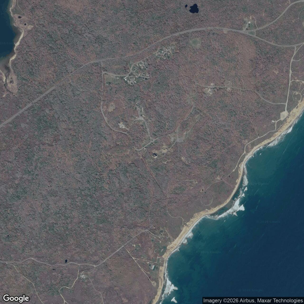
The station's appearance today does not reproduce its Cold War operating layout. Many buildings and radar structures were removed, deteriorated, or adapted after closure. Surviving roads, foundations, utilities, bunkers, support buildings, and the AN/FPS-35 tower preserve portions of several military periods, but each surviving feature requires identification before it can be assigned specifically to the Army or Air Force phase. [4] [8]
Property Disposal and Public Park Conversion
Federal property transfers occurred in stages from 1974 through 1984. Real-estate records summarized by the Corps report 415.35 acres transferred to New York State, 46.19 acres transferred to the Town of East Hampton, and 6.29 acres transferred to the Department of Transportation for Coast Guard purposes. A residual 0.86-acre discrepancy was attributed to survey limitations or coastal erosion. [3] [4] [10]
The acreage transferred during disposal covers the broader Camp Hero property and cannot be treated as the surveyed acreage of Montauk Air Force Station alone. The federal inventory history identifies 307.65 acres for the Air Force tract because that amount was the portion transferred from the Army to the Air Force. [3] [4] [10]
Most of the former military landscape became Camp Hero State Park. New York State Parks describes the current park as approximately 415 acres of maritime forest, freshwater wetlands, ocean shoreline, bluffs, trails, and historic military resources. Public recreation includes hiking, bicycling, horseback riding, picnicking, bird watching, surfing, and permit-regulated fishing, subject to park rules and closures. [3] [4] [10]
Historic Preservation
The AN/FPS-35 Radar Tower and Antenna was listed in the National Register of Historic Places on 2002-06-04 under reference number 02000615. The nomination recognized its significance in military history and engineering and identified 1960 as the principal significant year. The listed boundary corresponds to the approximate area swept by the antenna rather than the historic boundary of the entire Air Force station. [7] [8]
The nomination documents the antenna, tower, drive motors, equipment spaces, surviving electronics, and relationship to the former command center. It describes the resource as the surviving example of an important Cold War radar type. National Register listing recognizes historical significance but does not by itself restore the equipment, reopen the tower, or make every part of the structure safe for public access. [7] [8]
Camp Hero's surviving military fabric also includes Army coast-defense resources. Preservation and interpretation must therefore explain two related but different stories: the World War II harbor-defense reservation and the Cold War Air Force radar station. The AN/FPS-35 tower is the clearest Air Force landmark, while batteries, bunkers, and disguised Army buildings represent the earlier mission. [7] [8]
Environmental Investigation and Remediation
The former Camp Hero property is addressed under the Defense Environmental Restoration Program for Formerly Used Defense Sites. The Army is the Department of Defense executive agent for FUDS, and the Corps of Engineers manages investigation and response work even though the property included both Army and Air Force uses. FUDS project C02NY002403 covers hazardous, toxic, and radioactive waste concerns at the former installation. [2] [5] [6]
Historical investigations identified concerns involving petroleum storage and handling, transformers, polychlorinated biphenyls, stained concrete, building materials, and former military operations. Earlier sampling found PCBs in limited oil-stained concrete areas within Building 5 and the radar tower. Response work removed underground storage tanks and transformers and demolished selected buildings, while separate munitions investigations addressed ordnance and explosive hazards. [2] [5] [6]
The Corps completed a site-wide remedial investigation in 2019 after evaluating soil, sediment, surface water, and groundwater. Although the Corps proposed no further action for many areas, New York regulators required additional work for specific concerns, including light nonaqueous-phase liquid near Building 203, PCB contamination near transformer remnants, and weathered fuel associated with Battery 113. The environmental record should therefore not be summarized simply as fully cleaned or completely closed. [2] [5] [6]
A New York decision document signed in 2022 records the selected approach and the remaining site-specific issues. Environmental conclusions apply to defined areas of concern and decision units, not automatically to every structure or parcel. Current park use coexists with continuing institutional, maintenance, safety, and environmental responsibilities inherited from the former military property. [2] [5] [6]
Current Status
Montauk Air Force Station is closed. Its former property is divided principally among Camp Hero State Park, Town of East Hampton holdings, and a small federal Coast Guard-related transfer. The state park is active and open for regulated public recreation, but individual military structures and environmentally managed areas may remain closed, fenced, stabilized, or inaccessible. [2] [7] [10]
The AN/FPS-35 antenna and tower remain the dominant Air Force-era features. They are preserved as historic resources rather than operating radar equipment. The former station no longer performs an Air Force mission, and no active Air Force installation should be inferred from the continued presence of the tower, antennas, utility structures, or the park's occasional use of the term air station on visitor maps. [2] [7] [10]
The Montauk Project Claims and the Documented Record
Camp Hero and Montauk Air Force Station have become the setting for stories about a purported "Montauk Project," including claims of mind-control experiments, time travel, and secret underground facilities. These claims became widely associated with the site after Preston B. Nichols and Peter Moon published The Montauk Project: Experiments in Time in 1992, a decade after documented Air Force activity ended. The book is evidence that the stories were being circulated, not evidence that the alleged experiments occurred. [3] [8] [9]
The military and preservation records reviewed document Camp Hero's Army coast-defense and antiaircraft uses, followed by the Air Force radar, interception-control, SAGE, communications, and property-disposal missions described above. The National Register nomination explains the surviving AN/FPS-35 tower and antenna as radar equipment. The Corps of Engineers property and environmental records identify buildings, batteries, former operational areas, and investigated hazards. None of these reviewed records substantiates the Montauk Project claims. This is a statement about the available evidence, not a claim that every classified record from the Cold War has been examined. [3] [8] [9]
The stories are part of the site's later cultural history and help explain public interest in the closed station. They should be clearly separated from its verified military history. The documented radar station, the World War II Army reservation, and the surviving structures are historically significant without treating the later allegations as established events. [3] [8] [9]
Historical Assessment
Montauk Air Force Station was a distinct and nationally significant element of continental air defense. Its progression from L-10 through LP-45, P-45, and Z-45 traces the development of American radar defense from emergency manual warning to computerized SAGE surveillance. The 773rd provided the organizational continuity that connected early transportable equipment with the powerful frequency-diversity radar of the 1960s and 1970s. [1] [3] [8]
The station's history also demonstrates why installation boundaries and closure dates require careful labeling. The Air Force tract occupied part of a larger Army reservation, shutdown unfolded from 1980 through 1982, and disposal continued through 1984. Today the site combines public recreation, historic preservation, environmental management, and surviving military structures within the broader Camp Hero landscape. [1] [3] [8]
Chronology
- 1942 The Army develops Camp Hero as a World War II coast-defense reservation at Montauk Point.
- 1947-07-31 Camp Hero is placed on inactive status after World War II.
- 1949-12-31 The Army declares Camp Hero excess and authorizes transfer of a portion for an Air Force aircraft control and warning station.
- 1950-05 Headquarters Air Defense Command records radar operation at Camp Hero as Lashup site L-10.
- 1950-11-27 The 773rd Aircraft Control and Warning Squadron activates at Camp Hero.
- 1951-01-24 The remaining Army property is withdrawn from excess status for use as a Fort Totten subinstallation and antiaircraft training area.
- 1951 AN/CPS-5 search and AN/TPS-10A height-finding equipment strengthen the transitional radar site.
- 1952-02-06 Air Force station facilities are substantially complete and the Air Force property is named Montauk Air Force Station.
- 1952-05 Headquarters ADC records completion of the transition from L-10 to permanent site P-45.
- 1957 Montauk receives an AN/FPS-20 search radar and two AN/FPS-6 height finders.
- 1957-12-31 The remaining Army portion of Camp Hero is placed in inactive status after postwar antiaircraft training ends.
- 1958-01-08 The 773rd is assigned to the New York Air Defense Sector in preparation for SAGE.
- 1958-10-01 The unit is redesignated the 773rd Radar Squadron (SAGE).
- 1960-12 The first production AN/FPS-35 frequency-diversity search radar becomes operational at Montauk.
- 1961 Radio-frequency interference problems temporarily interrupt AN/FPS-35 service while corrective work proceeds.
- 1962 The AN/FPS-35 returns to operational service.
- 1963 Montauk operates AN/FPS-35, AN/FPS-6, and AN/FPS-26 radars and participates in joint military and civil surveillance.
- 1974-07-18 The documented period of staged federal property transfers begins.
- 1979 Continental radar responsibilities, including Montauk, transfer from Aerospace Defense Command to Tactical Air Command.
- 1980-07-01 The principal Montauk radar mission is drastically reduced, leaving a small ground-to-air radio operation.
- 1981-01-31 Secondary radar histories place inactivation of the 773rd Radar Squadron on this date.
- 1982 Federal property and environmental histories state that all station activities terminate.
- 1984-09-10 The documented disposal period ends after transfers to state, local, and federal recipients.
- 1992 Preston B. Nichols and Peter Moon publish The Montauk Project: Experiments in Time, bringing later unsupported claims about the former station to a wider audience.
- 2002-06-04 The AN/FPS-35 Radar Tower and Antenna is listed in the National Register of Historic Places.
- 2019 The Corps completes the principal site-wide remedial investigation of former Camp Hero.
- 2022-11-21 New York issues the final signed environmental decision document addressing the investigated areas and remaining response requirements.
Historical Photographs and Visual Evidence
A verified photograph of the surviving Montauk AN/FPS-35 tower was made by Ronald Diel in 2013 and is available through Wikimedia Commons under CC BY-SA 3.0. It documents the tower after closure, not the radar in 1960s service. The National Register nomination and Army Corps reports also contain dated historic images and facility figures. The two graphics on this page explain the radar form and overlapping installation identities; the radar scene is an illustration, and the chronology is not a property survey. [8]

Information sources (12)
- WEBHeadquarters Air Defense Command Historical Study, ADC Radar Sites and Equipment
Uploaded authoritative ADC historical data for L-10, LP-45, P-45, Z-45, the 773rd, operating dates, and radar equipment.
- WEBU.S. Army Corps of Engineers, Camp Hero FUDS
Official current summary of military history, property disposition, investigation, response actions, and current public use.
- PDFU.S. Army Corps of Engineers, Site Visit Report and Work Task Proposal
Federal chronology for Army and Air Force use, 773rd organization, SAGE, AN/FPS-35 operation, staffing, shutdown, and property transfers.
- PDFU.S. Army Corps of Engineers, Final Data Collection Report
Federal source for installation boundaries, disposal, structures, sampling, PCBs, petroleum concerns, and earlier environmental conclusions.
- PDFU.S. Army Corps of Engineers, Remedial Investigation Report, Camp Hero
Official 2019 investigation of areas of concern, soil, sediment, surface water, groundwater, human-health risk, and ecological risk.
- PDFNew York State Department of Environmental Conservation, Final Signed Decision Document
Official 2022 environmental decision and regulator findings for remaining petroleum, PCB, transformer, and fuel concerns.
- WEBNational Park Service, AN/FPS-35 Radar Tower and Antenna National Register record
Official listing date, significance, reference number 02000615, and historic-resource classification.
- PDFNational Register of Historic Places Registration Form, AN/FPS-35 Radar Tower and Antenna
Detailed tower, antenna, drive, equipment, boundary, historical-significance, and photographic documentation.
- WEBWorldCat, The Montauk Project: Experiments in Time
Bibliographic record establishing the 1992 publication by Preston B. Nichols and Peter Moon; used only to date and identify the later claims, not to substantiate them.
- WEBNew York State Parks, Camp Hero State Park
Current official park acreage, ownership, setting, public recreation, address, and visitor information.
- WEBRadar Museum, Montauk Air Force Station
Secondary technical chronology used cautiously for equipment transitions, FAA joint use, interference, 773rd inactivation, and Riverhead replacement.
- PDFU.S. Air Force, Installations Directory, 31 March 1957
Official directory identifying Manorville Gap Filler Annex P-45A as an installation distinct from Montauk Air Force Station P-45.