
Atlas D Site 565-C Missile Silo, Granite Canyon Wyoming
Longitude: -105.1458620748946
Site Type: Atlas D three-missile launch complex
Missile Type: SM-65D Atlas
Number of Launchers/Missiles: 3
Parent Base: F.E. Warren AFB
Missile Wing: 706th Strategic Missile Wing; 389th Strategic Missile Wing after 1961-07-01
Missile Squadron: 565th Strategic Missile Squadron
Approximate Base Size: approx. 703 acquired acres
Current Site Use: Former Atlas D Site 4 / 565-C missile complex within the Belvoir Ranch landscape; FUDS/CERCLA environmental cleanup area with documented TCE groundwater plume; ranch/wind-energy context.
Site Ownership: City of Cheyenne / Cheyenne Board of Public Utilities Belvoir Ranch context; former federal property disposed after missile use.
Accessible: No unrestricted public access / environmental cleanup area
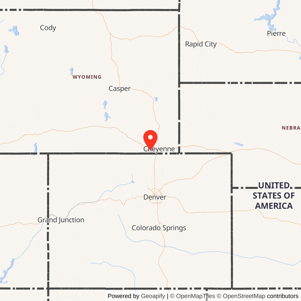
Atlas D Site 565-C was a three-launcher SM-65D Atlas intercontinental ballistic missile complex operated by the 565th Strategic Missile Squadron at F.E. Warren Air Force Base, Wyoming. The site was part of the Warren II Atlas D deployment and was located near Granite Canyon, Laramie County, Wyoming, west of Cheyenne.
The site is no longer an active missile installation. It was removed from active Atlas service during the accelerated 1964 phaseout of the first-generation Atlas D force. The 565th Strategic Missile Squadron's official unit-history summary records turnover to SAC on 1961-03-04, operational status on 1961-03-07, the first ICBM off alert on 1964-07-01, the last ICBM shipped on 1964-08-01, and squadron inactivation on 1964-12-01. It lies within or adjacent to the Belvoir Ranch area west of Cheyenne and is not an active Air Force missile facility.
Location, Landscape, and Site Description
Atlas D Site 565-C stood in the rolling high-plains landscape west of Cheyenne and near Granite Canyon, south of Interstate 80 and west of Interstate 25. The Atlas Site 4 public-information site describes the former missile property as approximately 18 miles west of Cheyenne and one mile south of Granite, Wyoming. The local setting is open ranchland cut by shallow drainages and low ridges, a typical Warren missile-field landscape in which large hardened launch complexes could be dispersed outside the main base while remaining close enough to F.E. Warren AFB for security, maintenance, logistics, and command support.
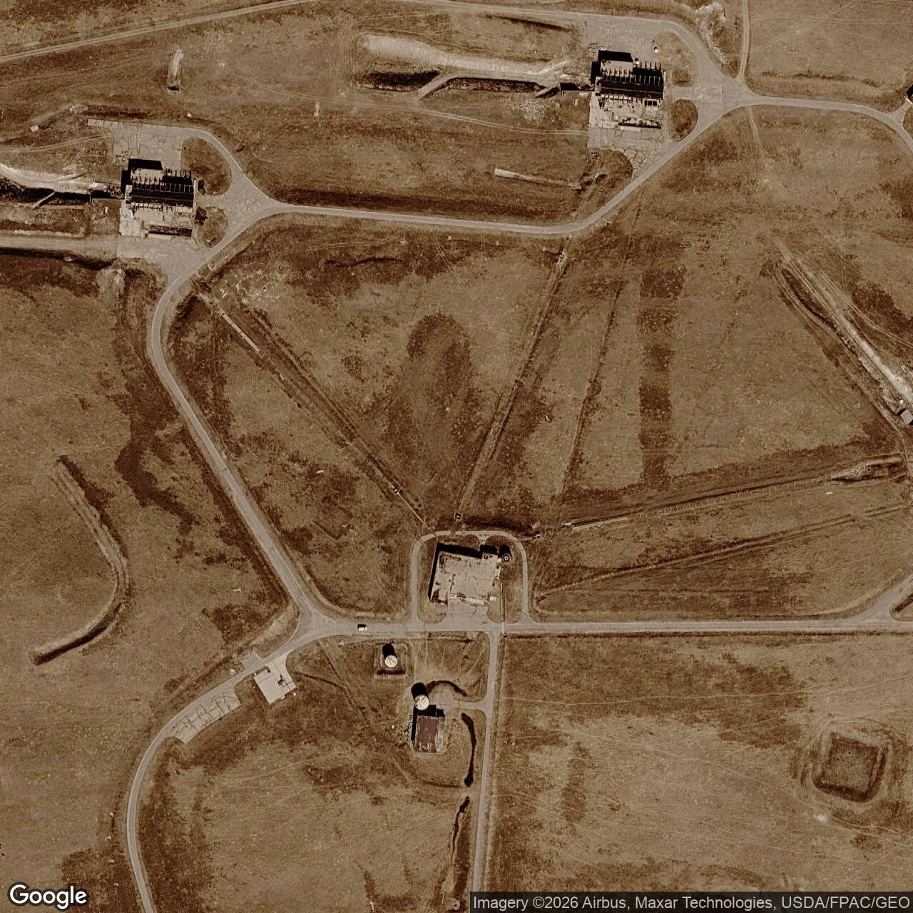
Unlike a later Minuteman launch facility, 565-C was not one unmanned silo controlled from a remote Launch Control Center. It was an Atlas D "coffin launcher" complex with three Launch and Service Buildings, a shared control building, and associated support facilities. The Atlas Site 4 LSB-area map, based on 2022 USDA aerial photography, shows the three Launch and Service Buildings arranged around a roughly 5,000-foot paved loop road, with the missile control building and physical/heating plant also located on the loop. Each LSB had a long flame pit extending from it. The figure identifies the flame pits as approximately 500 feet long, 10 to 20 feet deep, and 40 to 100 feet wide.
The Atlas Site 4 overview states that the original property consisted of approximately 703 acres acquired by the United States in the late 1950s and developed between 1959 and 1962. By the post-military period, the former missile site had become part of the broader Belvoir Ranch landscape, which was later acquired by the City of Cheyenne and the Cheyenne Board of Public Utilities. Modern site maps divide the cleanup project into Area A, the Transition Area, Area B, and an Expanded Study Area. Area A contains the former Launch and Service Building source area; the environmental plume extends eastward from that source area across a much larger area.
Strategic and Cold War Context
Atlas D Site 565-C existed because the United States was racing to field an operational ICBM force at the end of the 1950s. The Atlas was the Air Force's first operational intercontinental ballistic missile. It reached service while U.S. policy makers were concerned about Soviet long-range missile capability, the political shock of Sputnik, and the need to create a survivable nuclear deterrent that did not rely entirely on manned bombers.
The Atlas D was a first-generation, liquid-fueled system. It was a major technological achievement, but it was also complicated, manpower-intensive, and relatively vulnerable compared with later solid-fuel Minuteman systems. National Park Service summaries describe the Atlas D as a one-and-one-half-stage missile stored either in vertical gantry launchers or horizontal aboveground "coffin" shelters. At the Warren II complexes, including 565-C, the missiles were kept horizontally in coffin-style launchers. To fire, a launcher roof was opened, the missile was raised to the vertical, fueled with RP-1 and liquid oxygen, checked, and launched. This process was much slower and more exposed than the later Minuteman launch-from-silo concept, but in 1961 it represented one of the United States' earliest deployed ICBM alert postures.
The 565th Strategic Missile Squadron's three Atlas D complexes embodied the 3-by-3 dispersal pattern: three geographically separate complexes, each with three missiles and one control center. This distributed the squadron's nine missiles around the Cheyenne area rather than concentrating them on the main base. The arrangement provided some dispersal and hardened sheltering, but it still required large surface facilities, liquid-oxygen support, propellant handling, and significant crew and maintenance presence.
Construction and Activation
The 565th Strategic Missile Squadron was activated at F.E. Warren AFB on 1958-12-01 as an SM-65D Atlas unit. The official unit-history summary notes that this activation implemented the 3-by-3 dispersal configuration for the first time. The Warren II construction program produced three Atlas D launch complexes for the squadron. Each site was designed to operate three Atlas D missiles from a shared complex with a control center and three Launch and Service Buildings.
The available public sources do not provide a fully documented exact construction-start date for 565-C. The strongest exact operational dates come from the official 565th Strategic Missile Squadron unit-history summary: turnover to SAC on 1961-03-04 and operational status on 1961-03-07.
Construction at Atlas D Site 565-C created a complex that was closer to a small industrial plant than to a simple missile hole in the ground. It required launcher-service buildings, fuel and oxidizer systems, electrical and heating support, roads, drainage, control facilities, flame pits, and communications links. The later environmental record makes clear that the site's operational infrastructure included underground fuel-related systems and waste-handling features whose effects persisted after the missile mission ended.
Missile System and Technical Role
Site 565-C housed three SM-65D Atlas missiles. The Atlas D was a liquid-fueled, one-and-one-half-stage ICBM. Public National Park Service material describes the Atlas D as 75 feet tall, with a range of about 5,500 miles, a 1.44-megaton warhead, and a launch response time of approximately 15 minutes. The National Museum of the U.S. Air Force gives the Atlas D's ICBM range as over 6,300 miles and lists Atlas D specifications including a 10-foot diameter, maximum launch weight of about 260,000 pounds, and Rocketdyne booster, sustainer, and vernier engines. Air Force Global Strike Command's historical summary describes the Atlas family as equipped with a W49 1.44-megaton warhead.
For the 565th Strategic Missile Squadron specifically, the 565th SMS historical site identifies the Atlas D as carrying a General Electric Mark III reentry vehicle and a W-49 nuclear warhead with an approximate 1.44-megaton yield. Atlas D was a first-generation, liquid-fueled, intercontinental-range ICBM armed with a single thermonuclear warhead.
The missile's liquid-fuel operating concept shaped the site. The Atlas Site 4 overview states that during readiness exercises at the three LSBs, RP-1 was pumped from an underground tank into the missiles and then pumped back into the tank. Liquid oxygen served as the oxidizer. TCE was used as a solvent to clean rocket fuel tanks, engines, and liquid oxygen lines because it was non-flammable and reduced explosion risk. The same practices that supported alert readiness later became central to the environmental history of the site.
Operational History
The 565th Strategic Missile Squadron operated from F.E. Warren AFB as part of the 706th Strategic Missile Wing and, after 1961-07-01, the 389th Strategic Missile Wing. The squadron's missile force consisted of three three-launcher Atlas D complexes: 565-A near Hillsdale, 565-B near Carpenter, and 565-C near Granite Canyon. The unit-history summary records the squadron's SM-65D Atlas weapon system in 1960, turnover to SAC on 1961-03-04, and operational status on 1961-03-07.
At 565-C, daily operational life centered on maintaining three large liquid-fueled ICBMs, the launcher-service buildings, support equipment, control systems, communications, fuel and oxidizer handling equipment, security, and site utilities. The Atlas D was not a passive missile that could simply sit unattended in a sealed silo. It required pressure maintenance, propellant-handling capability, periodic testing, and large support crews. The 565th SMS historical site states that the squadron's sites were manned around the clock during the squadron's active period. That is consistent with the Atlas D's demanding operating concept and the National Park Service description of Atlas D crews controlling three missiles, a control center, and a radio-guidance system.
Site 565-C also had a lasting operational-environmental footprint. The Atlas Site 4 overview explains that readiness exercises at each LSB involved moving RP-1 into and out of the missiles, cleaning rocket fuel tanks, engines, and liquid-oxygen lines with TCE, and disposing of spent TCE and other wastes into unlined flame pits. Those practices were part of the period's normal launch-site operations, but they later caused significant groundwater contamination.
A second site-specific event occurred decades after deactivation: the long environmental investigation and cleanup program at Atlas D Missile Site 4. The Atlas Site 4 public website states that the U.S. Army Corps of Engineers, Omaha District, in partnership with Wyoming DEQ and EPA Region 8, maintains the public-information site to support investigation, cleanup, public involvement, and document access. The site-report index shows a long sequence of environmental reports, beginning with a 1993 underground storage tank removal phase-out report and continuing through remedial investigations, monitoring events, groundwater modeling, residential well monitoring, and pilot-study documentation.
The site also became part of broader public discussions about Cheyenne-area groundwater contamination. The Atlas Site 4 news page includes a 2017 notice about airborne aquifer mapping over Belvoir Ranch and multiple news items from 2009 and later concerning the TCE plume and cleanup costs. A 2019 road near the LSB area, shown on the Atlas Site 4 LSB-area map, was installed as part of wind-farm turbine construction on Belvoir Ranch. Those later events are not military operations, but they are significant to the site's post-decommissioning history.
Deactivation and Disposal
The phaseout of 565-C was part of the rapid retirement of the first-generation Atlas D force. By the early 1960s, Atlas D had been eclipsed by more survivable and efficient systems, especially solid-fuel Minuteman. The National Park Service notes that Atlas peaked nationally from December 1962 through May 1964 and then was phased out in favor of Minuteman and Titan ICBMs. Air Force Global Strike Command similarly emphasizes that Atlas had a short service life because its liquid-fuel system, large support requirements, and expensive operating model made it less attractive than solid-fuel Minuteman.
The exact decommissioning chronology depends on which stage is being described. The 565th Strategic Missile Squadron official unit-history summary records the first ICBM off alert on 1964-07-01, the last ICBM shipped on 1964-08-01, and the squadron inactivated on 1964-12-01. The Atlas operational alert and missile removal were effectively complete in 1964, while administrative, disposal, salvage, or site-closeout processes may have extended beyond that date.
After the missiles were removed, the site did not become a museum or remain an operational military installation. The broader pattern for Atlas and Titan I facilities, described in To Defend and Deter, was that the Air Force removed salvageable materials and turned many first-generation missile sites over to the General Services Administration for disposal. Atlas Site 4's later public record shows that the former military property passed into civilian/ranch use and, by 1976, had been incorporated into the much larger Belvoir Ranch. The City of Cheyenne and the Cheyenne Board of Public Utilities acquired Belvoir Ranch in 2003.
The physical structures were not fully erased. The 2022 LSB-area map and publicly available aerial imagery show the remains of the three Launch and Service Buildings, the control building area, the physical/heating plant area, roads, flame pits, monitoring wells, and other site features. The installation's afterlife therefore differs from an arms-control demolition case such as many later Minuteman silos: 565-C's aboveground/near-surface Atlas D complex survived sufficiently to become both a visible historic landscape and a long-term environmental remediation area.
The environmental decommissioning story is unusually important at 565-C. Atlas Site 4 is a FUDS/CERCLA site with TCE groundwater contamination. The Atlas Site 4 overview states that spent TCE and other wastes generated during readiness exercises drained into long unlined flame pits 15 to 20 feet deep. It estimates that, assuming all three LSBs were tested each of the three years of operation, the amount of TCE that may have been released to the subsurface could range from 450 to 16,200 gallons. The same overview states that the TCE plume extends 11 miles east from the LSB area. EPA lists the site as a federal facility, not on the National Priorities List, with federal-facility-led cleanup activity and EPA ID WY0009138948.
Current Status and Site Use
Today 565-C is best described as a decommissioned Atlas D missile complex, a Formerly Used Defense Site, and an environmental cleanup area within the broader Belvoir Ranch landscape. It is not an active Air Force installation and should not be treated as publicly accessible military heritage property. The City of Cheyenne and Cheyenne Board of Public Utilities own Belvoir Ranch, and the ranch supports seasonal cattle grazing and wind-energy use. The Atlas Site 4 overview states that an electricity generation company operates 88 wind turbines on the ranch.
The former missile site remains physically legible in aerial imagery. The three Launch and Service Building areas, loop road, flame pits, control-building area, physical/heating-plant area, and monitoring-well network are visible or documented in the Atlas Site 4 maps. The site has also been subdivided administratively for cleanup into Area A, Transition Area, Area B, and the Expanded Study Area. Area A is the source area and includes the former LSB complex; downgradient areas extend eastward toward the Borie Well Field.
The former military site is part of an environmental project area and ranch landscape, not a normal public museum site. Any future recreation access to Belvoir Ranch should not be assumed to include unrestricted access to the former missile structures, cleanup areas, monitoring wells, or environmental controls.
Chronology
- 1958-12-01 The 565th Strategic Missile Squadron was activated at Francis E. Warren AFB as an Atlas D unit.
- 1959-1962 The former Atlas D Missile Site 4 property was acquired and developed for missile use, according to the Atlas Site 4 overview.
- 1960 The 565th Strategic Missile Squadron's official unit-history summary lists SM-65D Atlas as its weapon system.
- 1960 The 565th SMS Site C page indicates that construction began sometime in 1960, but does not provide a verified month or day.
- 1961 The 565th SMS Site C page indicates that Site C was turned over to the Air Force sometime in 1961, but does not provide a verified month or day.
- 1961-03-04 The 565th Strategic Missile Squadron was turned over to Strategic Air Command.
- 1961-03-07 The 565th Strategic Missile Squadron became operational.
- 1962 During the Cuban Missile Crisis, the 565th SMS historical site states that all 565th sites were at a high alert level and ready to launch if required.
- 1964-07-01 The official 565th SMS unit-history summary records the first ICBM off alert.
- 1964-08-01 The official 565th SMS unit-history summary records the last ICBM shipped.
- 1964-09-01 The Military Standard lists 565-C as deactivated on this date.
- 1964-12-01 The 565th Strategic Missile Squadron was inactivated.
- 1965-03-25 The 565th SMS Site C page lists Site C as decommissioned on this date; this likely reflects a later site-closeout stage rather than the end of operational alert.
- 1976 The Atlas Site 4 overview states that the abandoned missile site had been incorporated into the larger Belvoir Ranch by this year.
- 1993 The Atlas Site 4 report index lists a Phase Out Report for underground storage tank removal at Site 4.
- 2003 The City of Cheyenne and the Cheyenne Board of Public Utilities acquired Belvoir Ranch, which includes the former missile-site landscape.
- 2006 The Atlas Site 4 Area A page identifies remedial-investigation drilling and soil-vapor/soil sampling in Area A during this period.
- 2007-present The Atlas Site 4 Area A page states that groundwater sampling from 2007 to present has documented TCE in groundwater samples.
- 2017 The Atlas Site 4 news page reported an airborne aquifer-mapping project over the Belvoir Ranch area.
- 2019 The Atlas Site 4 LSB-area map notes that a gray-colored road along the east edge of the LSB area was installed as part of the Belvoir Ranch wind-farm turbine construction project.
- 2022 The Atlas Site 4 LSB-area map used USDA aerial photography to document the former Launch and Service Building area, flame pits, control building, physical/heating plant, and monitoring wells.
- 2024 The Atlas Site 4 report index lists recent USACE long-term monitoring and pilot-study documentation, showing that environmental monitoring and cleanup planning remained active.
Read about the Atlas at F.E. Warren AFB
All Atlas Missile Silo Locations