
Atlas E Site 566-2 Missile Silo, Meriden / La Grange Wyoming
Longitude: -104.299130998842
Site Type: Atlas E single-missile coffin launcher complex
Missile Type: SM-65E Atlas
Number of Launchers/Missiles: 1
Parent Base: F.E. Warren AFB
Missile Wing: 389th Strategic Missile Wing
Missile Squadron: 566th Strategic Missile Squadron
Approximate Base Size: 251 acquired acres
Current Site Use: Former Atlas E launch complex on private property; documented FUDS/CERCLA groundwater investigation and monitoring.
Site Ownership: Private ownership after GSA conveyance; formerly federal property.
Accessible: No public access / private property.
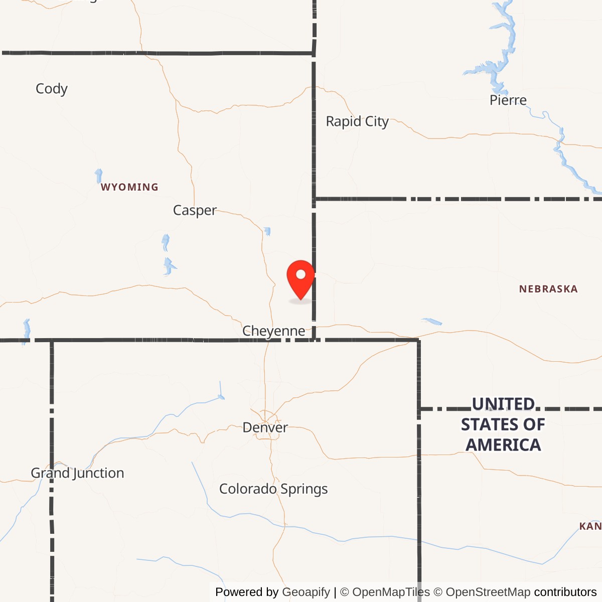
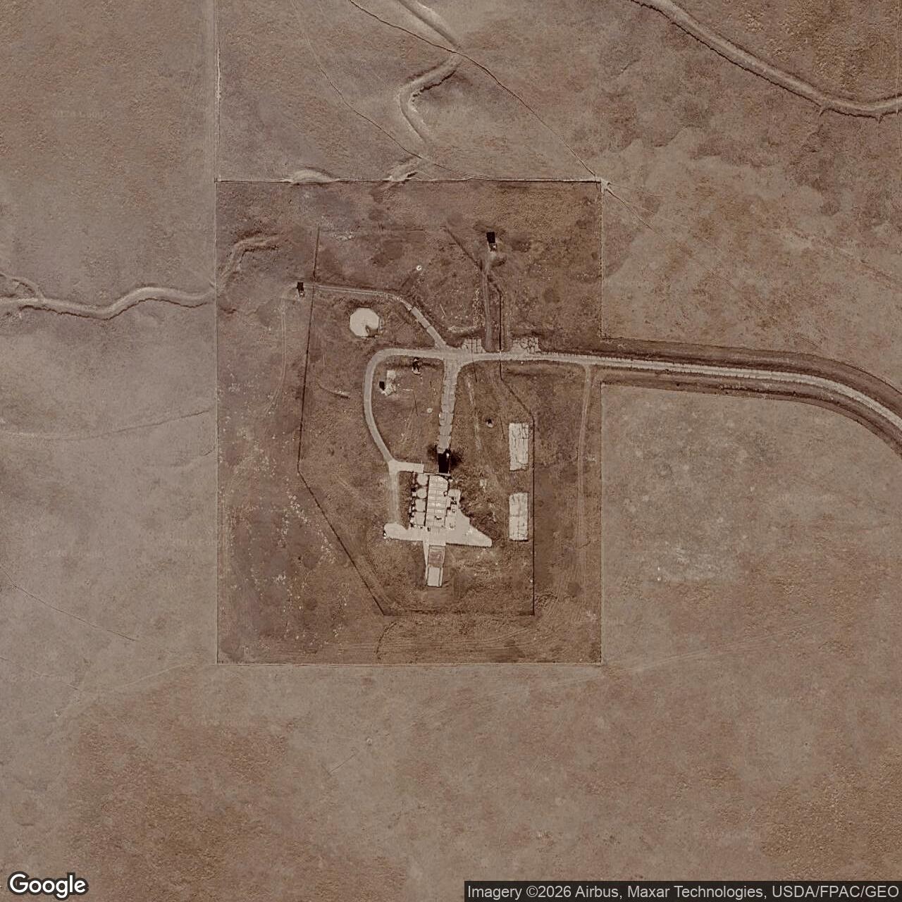
Atlas E Site 566-2 was a single-missile SM-65E Atlas intercontinental ballistic missile launch complex operated by the 566th Strategic Missile Squadron from the F.E. Warren Air Force Base missile field. It was one of the nine Atlas E sites assigned to the 566th SMS and the 389th Strategic Missile Wing. The site is commonly listed in missile-site references as Site 2, LaGrange, Wyoming, but U.S. Army Corps of Engineers and EPA environmental records identify the former property as the Meriden, Laramie County, Wyoming, former Atlas E Missile Site 6.
The site is no longer an active missile installation. It was decommissioned after the Atlas E force was withdrawn from alert in 1964 and 1965, and the property was later conveyed into private ownership by the General Services Administration. It remains a former missile complex on private property and is also documented as a Formerly Used Defense Site / CERCLA cleanup location because of trichloroethene groundwater contamination.
Location, Landscape, and Site Description
Site 566-2 lies in rural southeastern Wyoming, northeast of Meriden and southwest of LaGrange, in Laramie County. The site sits in open High Plains ranchland along the U.S. Highway 85 corridor, separated from F.E. Warren AFB by enough distance to serve the Atlas program's dispersed-survivability concept while still remaining close enough to be supported from the Cheyenne base.Unlike the three-launcher Atlas D complexes completed earlier at F.E. Warren and Offutt, an Atlas E site was an individual launch complex. Site 566-2 therefore represented one missile, one launch and service building, and its own associated launch-operations and support infrastructure. U.S. Army Corps of Engineers documentation describes the former Meriden Atlas E site as a 251-acre property acquired between July 1960 and January 1964. Its improvements included one underground launch operations building, one launch and service building, two water wells and pump stations, segregated storage buildings, a sentry house, a helicopter pad, a spray pond, roads, walks, fences, and water, sewer, and electrical systems.
The Atlas E "coffin" concept kept the missile horizontal in a semi-hardened underground or below-grade shelter. To launch, the large roof or door of the coffin structure opened, the missile was raised upright, and the vehicle was then fueled with RP-1 kerosene and liquid oxygen. This layout was a transitional step between the exposed Atlas D gantry/coffin sites and the more protected Atlas F vertical silo-lift sites.
Strategic and Cold War Context
The Atlas program represented the first operational American ICBM force. Its purpose was to place a nuclear-armed missile on alert inside the continental United States that could reach intercontinental targets without reliance on forward bomber bases or overseas missile deployments. F.E. Warren became one of the earliest and most important Atlas bases because it combined open land, central continental geography, rail and road access, and an existing military installation that could be converted to Strategic Air Command missile operations.The Atlas E improved on the Atlas D by using individual launch complexes and inertial guidance. This made each missile more independent from shared radio-guidance arrangements and reduced the vulnerability created by grouping multiple missiles in one complex. The National Park Service describes Atlas E as an individual-complex, inertially guided missile deployed in below-ground coffins with an approximate fifteen-minute launch response time. At the same time, Atlas remained a first-generation liquid-fueled system. It required extensive maintenance, careful pressurization of its thin stainless-steel airframe, and fueling with liquid oxygen before launch. Those characteristics explain both its short operational life and its rapid replacement by solid-fueled Minuteman missiles.
Construction and Activation
The 566th Strategic Missile Squadron was activated on 15 August 1959 and later assigned to F.E. Warren AFB. The official 566th SMS unit summary records turnover to Strategic Air Command and operational status for the squadron on 1961-03-30.Construction of Site 566-2 required far more than a missile shelter. The 251-acre federal acquisition included the launch and service building, the underground launch operations building, water and pump systems, storage buildings, security and access-control facilities, utilities, roads, fencing, and support infrastructure. The isolated rural location also meant that the site had to operate as a self-contained alert facility for its assigned missile crew and maintenance/support teams.
Missile System and Technical Role
Site 566-2 housed one SM-65E Atlas missile in a coffin-style launch complex. The Association of Air Force Missileers describes Atlas E as using an all-inertial guidance system, with each missile deployed singly and paired with one control center. It also describes the coffin roof as being at ground level, providing limited blast protection. Combat crews for Atlas E sites included two officers and three enlisted members, and crews stood 24-hour alerts before being relieved by a replacement crew from the main base.The Atlas E was a liquid-fueled, intercontinental-range missile. Its propellants were RP-1 kerosene and liquid oxygen. The missile remained unfueled until launch preparations, because liquid oxygen was cryogenic and could not practically remain loaded for long periods. The launch sequence therefore required opening the coffin, raising the missile, loading propellants, and completing launch preparations. Public missile-history sources describe Atlas E as having an approximately fifteen-minute launch response time.
Atlas E was an early liquid-fueled ICBM designed to deliver a single nuclear warhead at intercontinental range. The National Park Service describes Atlas E as an individual-complex, inertially guided ICBM, while the 566th SMS source identifies the Atlas E as using a Mark IV reentry vehicle and W-38 nuclear warhead with an approximately 3.8-megaton yield. The Smithsonian's National Air and Space Museum identifies the Mark 4 reentry vehicle as carrying a W-38 nuclear warhead with a yield of about 3.75 megatons.
Operational History
Site 566-2 served as part of the 566th Strategic Missile Squadron's nine-site Atlas E ring around F.E. Warren AFB. The 566th SMS was one of the Atlas units that made F.E. Warren a central early ICBM base. The base's official history records that F.E. Warren received its first Atlas D missile in October 1959, became the nation's first operational ICBM base, and saw the 706th Strategic Missile Wing redesignated as the 389th Strategic Missile Wing on 1961-07-01.The operational routine at Site 566-2 would have centered on continuous alert, site security, missile readiness, equipment maintenance, crew relief, and the demanding handling requirements of a liquid-fueled Atlas missile. The launch crew worked at the remote site, not from a later Minuteman-style launch-control-center network. The crew's responsibility was to keep one Atlas E weapon system ready for rapid launch if ordered. Maintenance support had to keep the missile pressurized, the guidance and power systems ready, the coffin launcher operable, and the fueling/support systems capable of supporting a launch sequence.
The site's active service was brief but intense. Atlas E became operational during the same period in which the United States and Soviet Union were entering the most dangerous years of the Cold War. During the Cuban Missile Crisis in October 1962, the F.E. Warren official base history states that the 389th Strategic Missile Wing placed all of its Atlas missiles in launch configuration and maintained a ready posture until 1962-11-27. That statement applies to the wing's Atlas force rather than proving a separate, site-specific event at Site 566-2, but it is directly relevant to understanding the alert role of the 566th SMS sites during the crisis.
Site-Specific and Squadron-Specific Events
The most important documented squadron-level event affecting Site 566-2 was the Cuban Missile Crisis alert posture. The 566th SMS site history describes all 566th SMS sites as being at a high level of alert during the crisis, and the official F.E. Warren base history states that the 389th Strategic Missile Wing placed all its Atlas missiles in launch configuration until the crisis abated on 1962-11-27. Because the available sources describe this at squadron or wing level, it should be understood as a 566th SMS / 389th SMW event, not as a separately documented incident unique to Site 566-2.The 566th SMS unit history also preserves useful identity details for the squadron. Its Atlas-era emblem, approved in 1962, used a mole emerging from the earth while carrying a missile, with nine stars representing the nine dispersed launch sites. That imagery was a visual summary of the Atlas E mission: underground or semi-hardened missile crews standing alert at a ring of remote sites around F.E. Warren.
Deactivation and Disposal
The Atlas E force at F.E. Warren was short-lived. The official 566th SMS summary records the first squadron ICBM off alert on 1964-10-01 and the last ICBM shipped on 1964-10-22. It lists the squadron as inactivated on 1964-12-15, while the station entry runs to 1965-03-25.USACE records state that the Meriden former Atlas E Missile Site 6 (USACE designation for 566-2) was excessed in 1965 and conveyed to private ownership by the General Services Administration. That was the normal post-Atlas pattern for many dispersed Atlas sites: missiles and military equipment were removed, the federal government declared the property excess, and the remaining real estate and structures passed into non-federal hands. For Site 566-2, the available USACE source confirms the excessing and private conveyance but does not give a detailed equipment-removal inventory or demolition record.
After its military use ended, the site entered the long environmental-restoration history common to many former Atlas properties. USACE identifies trichloroethene groundwater contamination and says a Hazardous, Toxic and Radioactive Waste project was initiated under the Defense Environmental Restoration Program for Formerly Used Defense Sites. A U.S. Army Corps of Engineers contract was awarded in fiscal year 2010 for biannual interim monitoring under the remedial-design phase. USACE's 2015 fact sheet described continued monitoring, supplemental well installation to evaluate possible deeper-aquifer impacts, proposed planning and decision-document development, and state/EPA concern over the TCE-contaminated groundwater plume. It also noted that the remedial investigation found limited surface and subsurface soil contamination within EPA acceptable-risk calculations, while WDEQ nevertheless favored soil removal.
Current Status and Site Use
Site 566-2 is a decommissioned former Atlas E launch complex on private property. EPA identifies the CERCLA site as WARREN F.E. AFB ATLAS "E" MISSILE SITE #6, EPA ID WY0009138968, located at 3680 Highway 85, two miles northeast of Meriden, in Laramie County. EPA lists the site as not on the National Priorities List and as a federal-facility-lead cleanup location.The site should not be treated as publicly accessible. It is a former military property under private ownership, and the available public sources do not identify any museum, public access program, or preserved interpretive use. The surviving physical character is best understood from environmental records and aerial/site imagery: the former launch complex remains identifiable enough to be documented by USACE/EPA and by missile-site photo sources, but the military mission, missile, and Air Force alert function ended in the mid-1960s.
Chronology
- 1959-08-15 The 566th Strategic Missile Squadron was activated.
- 1960 Construction began at Site 566-2.
- 1961 Site 566-2 was turned over to the Air Force, according to the site-specific summary; the exact month and day were not identified in that source.
- 1961-03-30 The 566th SMS was turned over to Strategic Air Command and recorded as operational in the official unit summary.
- 1961-07-01 The 566th SMS was assigned to F.E. Warren AFB under the 389th Strategic Missile Wing.
- 1962-03-02 The Atlas-era 566th SMS emblem with nine stars representing the nine dispersed launch sites was approved.
- 1962-10 During the Cuban Missile Crisis, the 389th Strategic Missile Wing placed its Atlas missiles in launch configuration.
- 1962-11-27 F.E. Warren's Atlas crisis posture ended after the Cuban Missile Crisis abated.
- 1964-10-01 The first 566th SMS ICBM was removed from alert.
- 1964-10-22 The last 566th SMS ICBM was shipped.
- 1964-12-15 The 566th Strategic Missile Squadron was inactivated.
- 1965-03-25 Site 566-2 is listed as decommissioned.
- 1965 USACE records state that the former Meriden Atlas E site was excessed and conveyed to private ownership by the General Services Administration.
- 2010 USACE awarded a contract for biannual interim groundwater monitoring under the remedial-design phase.
- 2015 USACE described ongoing monitoring, supplemental well installation, and remedy planning for TCE-contaminated groundwater at the former site.
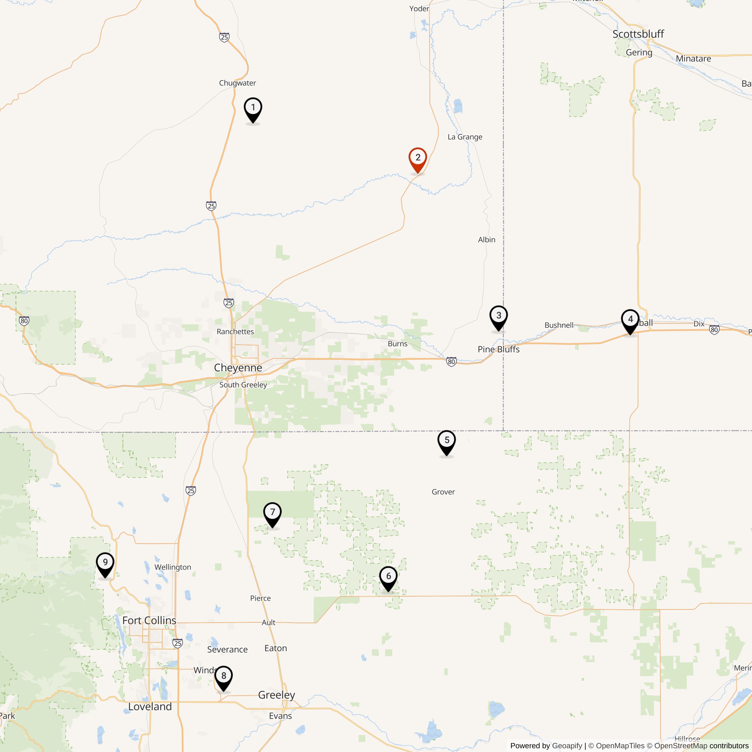
Read about the Atlas at F.E. Warren AFB
All Atlas Missile Silo Locations