Nike Missile Site T-86 Launcher, Fairfield / Cement Hill California
Longitude: -122.002577761843
This location was part of the Travis AFB Defense Area
Site ID: T-86
Missile / battery configuration: Nike 1B,2C/30A/12L-UA,(8L-U)
The missiles at this Launch Area were controlled by the Integrated Fire Control site located here.
Site Role: Launcher
A typical Nike air defense site consisted of two separate parcels of land. One area was known as the Integrated Fire Control (IFC) Area. This site contained the Nike system's ground-based radar and computer systems designed to detect and track hostile aircraft, and to guide the missiles to their targets.
The second parcel of land was known as the Launcher Area. At the launcher area, Nike missiles were stored horizontally within heavily constructed underground missile magazines. A large, missile elevator brought the Nikes to the surface of the site where they would be pushed across twin steel rails to one of four satellite launchers.
Elaboration on how Nike worked here.
Missile Type: Ajax/Hercules
The Nike Ajax was the first in the Army's family of guided missiles, and the world's first operational, guided, surface-to-air missile system. Nike Ajax had a burnout speed of Mach 2.3, a range of 25-30 miles, and a ceiling of 65,000 feet.
Designed to carry either nuclear and/or high-explosive warheads, the Nike Hercules missile could attack supersonic aircraft operating at altitudes in excess of 150,000 feet and at a range of more than 87 miles.
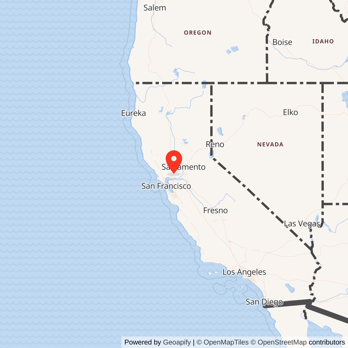
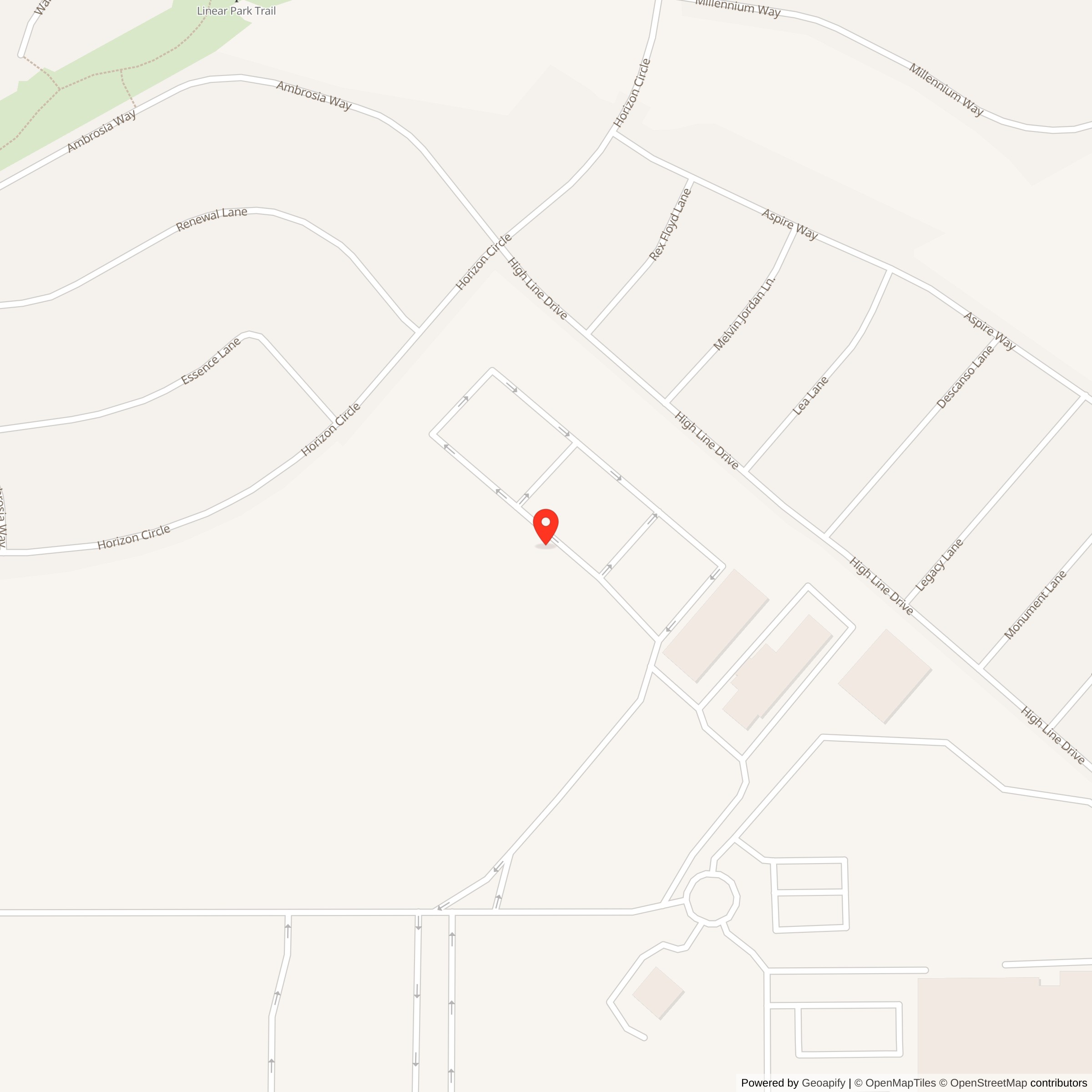
T-86 is the Travis Nike site whose operating life best captures the transformation of the base it defended. The battery opened in 1958, when strategic bombers and their support infrastructure made Travis Air Force Base an obvious Cold War target. It remained alert as Travis became a major global airlift hub, weathered the Berlin and Cuban missile crises, supported the expanding Vietnam airlift, watched the last resident B-52s leave, and saw the first C-5 Galaxy arrive. The missiles changed as well. T-86 began with liquid-fueled Nike Ajax and converted two of its three underground magazines and eight launcher positions for the faster, longer-ranged, solid-fueled Nike Hercules.
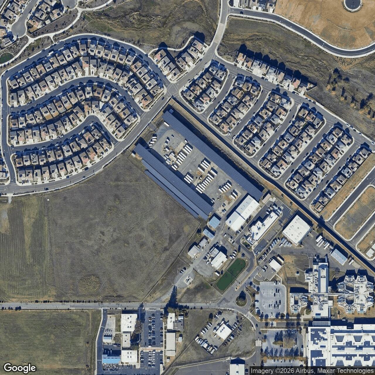
Its physical afterlife is equally revealing. The fire-control compound stood on Cement Hill, while the launcher and support area occupied the Clay Bank Road corridor north of Fairfield. After Army use ended, the broad former installation passed into school-district and county hands. The hill became a county communications site. The lower area and its surroundings came to include educational, transportation, correctional, and animal-care functions. A Cold War weapon landscape was not simply abandoned. It was divided, adapted, and absorbed into the public infrastructure of a growing community.
T-86 also demands precise language. The launcher had horizontal underground magazines, not vertical missile silos. Its Hercules conversion made the battery nuclear-capable, but no reviewed site-specific record proves that nuclear warheads were actually stored there or establishes a local warhead inventory. A leaking fuel tank found in 1988 belongs to the site's postmilitary reuse history.
Why Travis needed T-86
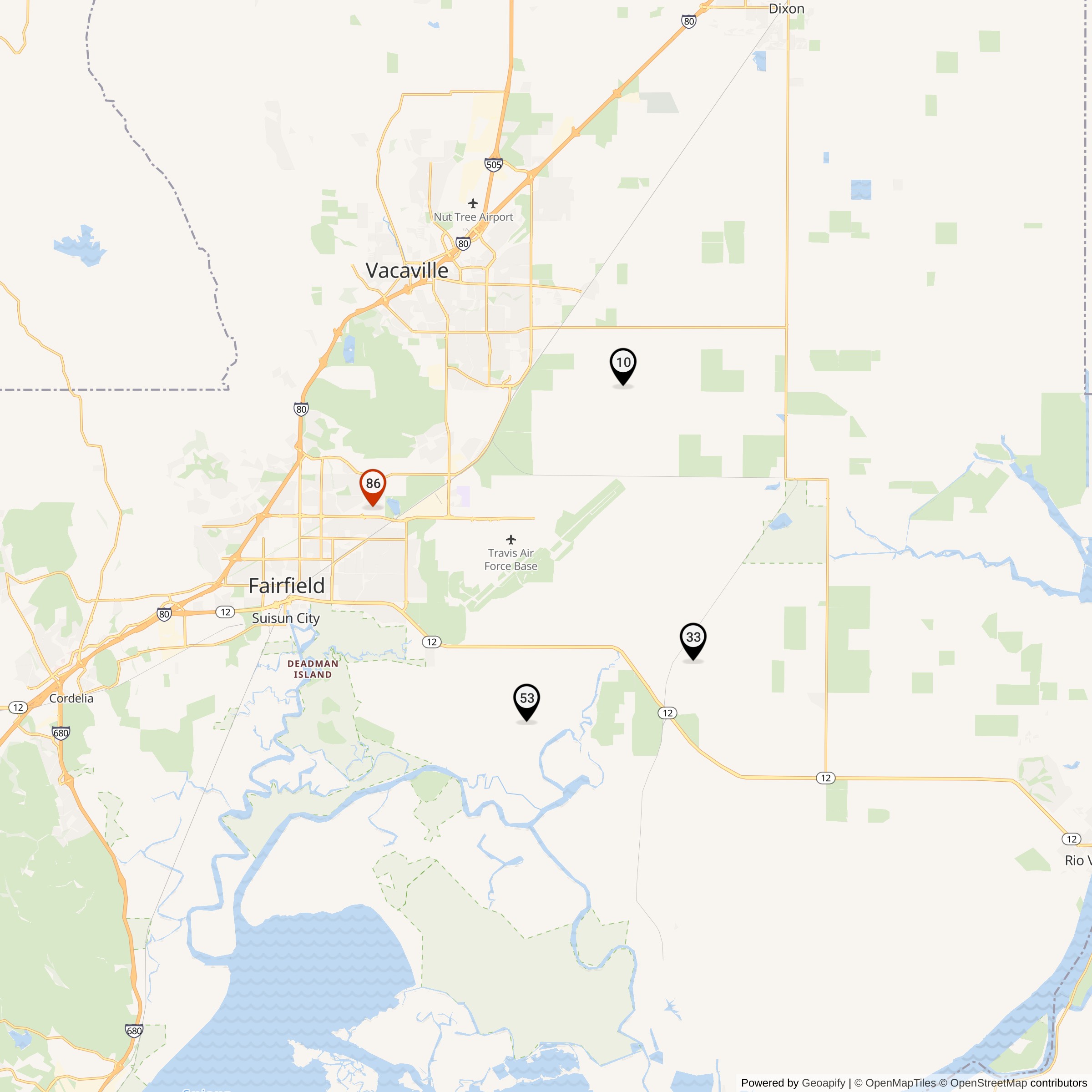
Travis was one of the military installations whose concentrated aircraft, fuel, communications, maintenance, and personnel made it a potential target for Soviet bomber attack. Strategic Air Command had controlled the base since 1949. By the late 1950s, B-52 bombers and KC-135 tankers were entering the Travis mission, adding modern nuclear deterrent forces to an installation that already had a major strategic role.The Army formed a four-position Regular Army Nike defense around the base. T-10 stood near Elmira, T-33 near Dixon and Lambie, T-53 in the Potrero Hills, and T-86 north of Fairfield at Cement Hill. Defense headquarters was at Travis. The sites were overlapping parts of one engagement network, not independent shields assigned to individual runways. Their combined geometry gave the defense multiple radar viewpoints and launch sectors around the air base.
T-86 occupied the western side of the ring. Its fire-control radars gained elevation on Cement Hill, while the lower launcher compound had room for magazines, launchers, assembly and maintenance work, administration, housing, and security. This separation was deliberate. Radar line of sight favored the hill. Explosives handling and missile operations favored a larger lower tract. Communications connected the two components into a single weapon system.
The defended mission began changing almost as soon as T-86 opened. Military Air Transport Service resumed command of Travis on 1 July 1958, while Strategic Air Command's 5th Bombardment Wing remained as a tenant. The first C-133 Cargomaster arrived that October. The first B-52G arrived in February 1959, and a Strategic Air Command alert facility opened in February 1960. T-86 therefore guarded a base that simultaneously supported nuclear deterrence and long-range transport.
That combination became especially important during crises. Travis airlift units deployed fighters to Europe during the 1961 Berlin Crisis. In October 1962, the base went to Defense Condition 2 during the Cuban missile crisis. Its B-52 and KC-135 forces maintained heightened alert while transport activity surged. Later, C-141 operations and the Vietnam airlift made Travis one of the principal movement points between the continental United States and the western Pacific. T-86 remained active through all of those changes.
The Two-Component Installation
The former T-86 property comprised 117.65 acres in the Army Corps of Engineers Formerly Used Defense Sites record. The launcher and facility area accounted for 82.31 acres. The Integrated Fire Control, or IFC, area accounted for 35.34 acres. The launcher lay along the Air Base Parkway and Clay Bank Road corridor north of Fairfield. The IFC occupied Cement Hill to the north.The Army acquired a mixture of fee interests, licenses, easements, and transferred land between the 1950s and 1970. The largest documented early fee acquisition was 46.90 acres obtained from the estate of Frank H. Tooby on 21 December 1955. Another 6.48 acres came from Norman S. Andrew on 20 May 1957. Additional agreements provided access, utilities, clearance, and other interests needed to make the two separated components function together.
The lower facility was more than a set of launch pads. The Corps inventory describes assembly and maintenance functions, housing, barracks, a mess hall, officer quarters, and recreation space. Missile crews needed protected storage and launch equipment, but an around-the-clock battery also required power, communications, administration, vehicle access, food service, security, and living support. T-86 was a small military post organized around one air-defense mission.
The IFC was the battery's sensing and command component. Its radars acquired aircraft, tracked the selected target, tracked the outbound missile, and supported the computer that calculated the intercept and transmitted steering commands. The Cement Hill position provided a useful horizon and reduced radar masking. The launcher crew could not fight without the IFC's track and commands, and the IFC could not complete an engagement without a ready missile at the lower compound.
The supplied geographic inventory and specialist field reports preserve the paired relationship. They do not establish public access. Both components passed into active public uses, and the hilltop remains a controlled communications property. Historic boundaries also included easements and surplus fringe parcels. Modern road addresses and neighboring public buildings should not automatically be equated with individual Nike buildings without parcel research and a measured site plan.
Ajax configuration and the meaning of the code
The official inventory records T-86 as "Nike 1B,2C/30A/12L-UA,(8L-U)." Read with the Hercules conversion appendix and field research, the notation documents a large permanent launcher plant:1B,2C: One B-type and two C-type underground missile magazines. The letters identify magazine designs within the Nike construction program, not different missiles.
30A: Thirty Nike Ajax missiles in the original recorded allowance.
12L-UA: Twelve launch positions in a mixed universal and Ajax launcher layout.
(8L-U): Eight universal launcher positions associated with the Hercules modification. Two magazines and eight launchers were converted for Hercules service.
These magazines were reinforced horizontal storage rooms below grade. Elevators raised missiles to the surface, where crews moved them to exposed launch rails. The installation was not a field of vertical silos. Surface launcher positions, rails, paved handling space, ready areas, a missile assembly building, fueling facilities, and the administrative compound formed the visible part of the lower site.
The notation should not be used to invent a Hercules inventory. It establishes the original Ajax allowance and the scale of the modified launcher plant. It does not give a verified site-specific number of Hercules missiles or nuclear warheads. General Nike technical manuals explain what a converted magazine could hold, but a design capacity is not proof of T-86's day-to-day load.
The three-magazine plant gave T-86 more physical depth than a temporary or above-ground battery. It also helped make the site adaptable after closure. School-district vehicles and maintenance activity later occupied the launcher area, while the substantial former Army buildings and paved circulation could be reused for storage and public operations.
From Ajax to Hercules
T-86 entered service with Nike Ajax in 1958. Ajax was a command-guided antiaircraft missile with a solid booster, liquid-fueled sustainer, and conventional fragmentation warheads. The battery's radars and computer guided it from launch to a calculated intercept. Its liquid fuel and corrosive oxidizer imposed exacting handling and maintenance requirements on launcher crews.The Army selected T-86 and T-10 for Nike Hercules conversion while T-33 and T-53 closed. Specialist field research dates construction at T-86 from December 1960 through June 1961. The Army conversion document lists T-86 as operational with Hercules in October 1961.
Conversion modified two magazines and eight launcher positions. Hercules was larger and heavier than Ajax, so crews needed altered storage racks, rails, elevators, and launch equipment. The new missile used solid propellant in both booster and sustainer, reducing the liquid-fuel handling burden. It flew faster, higher, and farther than Ajax, allowing two Hercules batteries to cover the Travis mission that had initially used four Ajax positions.
Hercules retained the command-guidance principle. The target-tracking radar followed the aircraft. The missile-tracking radar followed the outbound missile. The computer compared the two tracks, calculated steering corrections, and transmitted commands. A target-ranging radar helped counter jamming by supplying another way to measure the target's range. T-86 also had an AN/FPS-75 Alternate Battery Acquisition Radar, or ABAR, which provided an alternate search capability.
The reviewed T-86 evidence does not identify a High Power Acquisition Radar installation. Hercules sites did not all receive every element of the later Improved Hercules program, and a general description of HIPAR should not be assigned to Cement Hill without site-specific documentation. The AN/FPS-75 ABAR is the acquisition-radar feature specifically associated with T-86 in the field report.
Hercules and Nuclear Capability
Nike Hercules could carry either a high-explosive fragmentation warhead or a nuclear warhead. Its nuclear option was intended to destroy formations of hostile aircraft and to improve effectiveness in difficult electronic and tactical conditions. Conversion therefore made T-86 a nuclear-capable installation in weapon-system terms.Capability is not the same as a verified local inventory. No reviewed unit record, custody log, warhead-storage report, or declassified deployment list proves that nuclear warheads were present at T-86 on a particular date or in a particular quantity.
Hercules altered the strategic meaning of the battery. T-86 no longer defended Travis only with conventionally armed Ajax. It became part of an air-defense system designed to engage high-altitude and massed bomber threats with a missile whose available payloads included nuclear options. That capability placed greater emphasis on secure custody, reliable identification, and disciplined command and control across the Nike force.
Units, Personnel, and Daily Readiness
Battery C, 436th Antiaircraft Artillery Missile Battalion initially operated T-86 in 1958. In September 1958, Battery C, 1st Missile Battalion, 61st Artillery replaced it. The latter battery remained through the June 1971 closure. Army branch terminology evolved during this period, and later references may use Air Defense Artillery for the 1st Battalion, 61st lineage.The battery had to maintain a continuous chain of readiness. At the IFC, acquisition and tracking crews searched, identified, and followed aircraft. Radar and computer mechanics kept sensitive electronics calibrated. Communications personnel maintained the connection to the launcher and higher control network. At the lower site, missile crewmen inspected missiles, operated elevators and launch equipment, assembled components, and maintained power and support systems. Guards, mechanics, cooks, supply staff, and administrators kept both compounds functioning.
Two veteran entries provide small, personal windows into that work. Dennie Anderson recorded service at T-86 from June 1967 to October 1970, progressing from launcher crewman, or "pit rat," to section chief with military occupational specialty 16B30. Walter Anderson recorded service from August 1969 to December 1970 as a 24Q20 IFC radar mechanic. These are veteran-submitted roster entries rather than official personnel files, but the jobs align with the launcher and radar functions documented for the site.
Readiness involved repeated drills, technical checks, inspections, security, and coordination. A successful engagement required the radar picture, computer solution, communications link, missile, launcher, and crew to work as one system. A fault at either compound could break the sequence. T-86's thirteen-year life also meant recurring training and personnel turnover as the equipment and base mission changed.
No verified roster of battery commanders, annual firing scores, inspection ratings, alert logs, or T-86 practice-firing record was found. Nike units commonly fired at Army ranges, but that national practice does not establish when this battery traveled, what it fired, or how it scored. Those details require unit morning reports, operational summaries, or records from the 1st Battalion, 61st Artillery.
Defending a base in transition
T-86's greatest site-specific significance lies in the period it spans. Its first years coincided with Travis's combined bomber, tanker, and transport missions. The first B-52G arrived on 13 February 1959. A Strategic Air Command alert facility opened exactly one year later. In September 1961, B-52s gained Hound Dog air-launched missiles, followed by Quail decoys in November. T-86's Hercules conversion reached operational status during this modernization of the bomber force.The Cuban missile crisis made the relationship between local defense and global operations especially visible. Travis raised its readiness to Defense Condition 2 on 23 October 1962. B-52 and KC-135 forces maintained round-the-clock alert, while transport operations supported the broader response. T-86 was one part of the layered defense protecting the aircraft, fuel, command links, maintenance base, and personnel needed to sustain that posture.
The balance then shifted toward airlift. The first operational C-141 Starlifter arrived on 23 April 1965. The 60th Military Airlift Wing was reactivated at Travis on 27 December. From August 1965, daily C-141 flights to Tan Son Nhut became part of the expanding Vietnam pipeline. Personnel and cargo passed through Travis in enormous volume, giving the Nike defense a mobility mission to protect as well as a remaining bomber mission.
The last 5th Bombardment Wing B-52s departed on 26 July 1968 after the unit's final Travis alert. T-86 continued for nearly three years after the resident bomber force left. The first C-5A Galaxy arrived on 24 October 1970, so the battery's final months covered the beginning of a new heavy-airlift era. The site had opened to defend a strategic-bomber base and closed while guarding an installation publicly identified above all with global mobility.
Closure in June 1971
The official Nike inventory gives June 1971 as T-86's closing month. The Travis heritage pamphlet records the departure of the 1st Battalion, 61st Air Defense Artillery on 1 June 1971. Together, these sources place the end of T-86 service at the beginning of that month, although a separate site deactivation order with an exact effective hour was not found.T-10 remained operational until 1974. The June 1971 battalion departure therefore ended the specific Travis Nike organization associated with T-86, but it did not mean that every missile position around Travis closed on the same day. T-10 continued under the reorganized San Francisco defense. This distinction matters when describing the end of the Travis Defense Area.
The causes were broader than any documented failure at Cement Hill. By the early 1970s, the Soviet threat had shifted toward intercontinental ballistic missiles, against which Nike Hercules was not the local answer. Fighter defenses, warning systems, and Army air-defense organization also changed. The Army consolidated sites nationally. No T-86-specific closure memorandum was found, so the relative importance of strategic change, budgets, manpower, and local coverage should not be assigned without further records.
A local Cement Hill history rounds the deactivation to 1970. The official Army inventory and official Travis history support June 1971. The local date is useful evidence of community memory, but it should not replace the more precise federal record.
Land disposal and public ownership
T-86's property history began to fragment even while the battery was active. The Army declared a 6.48-acre fringe parcel excess on 18 April 1958. It was conveyed to the Armijo Joint High School District on 30 October. A license covering 0.84 acre terminated on 15 March 1959. These actions should not be mistaken for closure of the operational launcher and IFC, which remained active for another twelve years.After deactivation, the Army declared 107.54 acres excess on 23 May 1972. A 1.55-acre easement went to a private owner in April 1973. On 15 and 16 June 1975, fee and easement interests were conveyed to the Fairfield-Suisun Unified School District, Travis Unified School District, and Solano County. The General Services Administration ended accountability for the remaining small interests on 13 January 1984.
The current Corps record summarizes the result: the school district owns the former facility area, and Solano County controls the IFC. That division follows the site's original functional geography. The lower launcher and support area could support vehicle, education, storage, and maintenance uses. The elevated IFC could support public-safety and communications equipment.
Administrative disposal did not erase the underground and surface plant. It changed responsibility for structures, access, and later environmental conditions. The modern public-facility corridor contains several agencies and uses, but the historical record does not justify assigning every current building or address to the former Army compound. The broad area and the exact Nike parcels must be distinguished.
The lower site after the aArmy
A Corps contractor inspected T-86 on 8 July 1988. The former facility-area buildings were in good condition and were being used by the school district for equipment storage. The launcher area served school-bus maintenance and parking. Former military buildings remained, and the area was described as well maintained. These observations show substantial adaptive reuse seventeen years after closure.Mark Morgan's 22 December 1988 field notes described the launcher and administration area along Clay Bank Road as intact. He associated the former administration area with the Solano County Detention Center and Animal Shelter, and the adjacent launcher with the school district's bus-maintenance yard. A March 2002 visit again found buses parked over the former magazines and launcher positions. The assembly building survived with an addition, the fueling area remained recognizable, and the former protective berms had been leveled.
Those are dated surveys, not a 2026 preservation inventory. Current official county pages place the Stanton Correctional Facility, Golden Hills Education Center, and Solano County Animal Care Services along Clay Bank Road. They confirm that the corridor remains a concentration of public uses. They do not prove that each current building occupies a specific Nike foundation or that school buses still cover the magazines.
The safest current characterization is "partially intact under public-facility reuse." The underground magazine footprints and surviving Army-era buildings documented in 1988 and 2002 may persist, but a recent authorized architectural survey was not found. Physical condition, filled or open elevator pits, and the exact boundary between school-district and county operations remain to be verified.
Cement Hill Radio Site
The former IFC found a new use that drew on the same topography the Army had valued. Height and broad line of sight that once served acquisition and tracking radars also made Cement Hill useful for communications. Specialist and local histories identify antenna and tower reuse at the hilltop after Nike operations.An official Solano County Board of Supervisors agenda from 14 November 2006 identifies the County-owned Cement Hill Radio Site. It addressed a telecommunications license with Fairfield and Vacaville for shared use of a new radio-equipment facility, with an initial term covering 2007 through 2016. This public record establishes county communications reuse more securely than trying to identify current commercial carriers from historical tower photographs.
Communications tenants and equipment have changed over time. A local history associates the hill with broadcast and public-safety antennas, but individual carrier assignments are not treated as current without a recent county inventory. The Corps record confirms that Solano County controls the former IFC. Its best present description is therefore "partially intact; Solano County Cement Hill Radio Site."
The reuse preserves the site's strategic logic even as its mission changes. Cement Hill still supports systems that depend on elevation, coverage, power, access, and secure equipment space. Antenna development may also have altered or replaced Army features. A professional survey would be needed to separate surviving Nike buildings and pads from later communications construction.
The 1988 Fuel-Tank Release and FUDS review
Environmental evidence at T-86 centers on former support facilities, especially petroleum storage, rather than a documented missile or warhead accident. During its July 1988 survey, the Corps contractor identified probable underground storage tanks, possible asbestos, an aboveground diesel tank at the IFC, and seven former Army oil-filled transformers at the facility area. The report proposed locating and removing tanks and inspecting the transformers for polychlorinated biphenyls.One 4,200-gallon underground tank had been installed by the military. The school district used it for bus fuel beginning in 1979. In June 1988, the tank was found to be leaking. Approximately 1,800 gallons were recovered, and groundwater contamination and a recovery system were reported. Because the owner had made beneficial postmilitary use of the tank, the 1988 Corps report said the resulting remediation did not qualify for FUDS action under the policy then applied.
This history requires careful attribution. The tank was a former military feature, but the documented release was discovered after years of school-district fuel use. It was not a Nike missile mishap. The old report also records conditions and policy at one point in time, not a permanent conclusion about legal responsibility or later cleanup.
The current fiscal year 2024 Corps record lists T-86 as eligible under property number J09CA0977 and installation identifier CA99799F588200. It reports that all projects at the site have reached site closeout and that the property is not on the National Priorities List. That is the strongest available current federal status statement. It does not prove the absence of every environmental condition created by later owners, eliminate ordinary regulatory responsibilities, or substitute for a current environmental assessment.
Current condition, access, and preservation
T-86 survives as a divided public landscape rather than a preserved museum. The IFC is controlled by Solano County and used as the Cement Hill Radio Site. The facility and launcher area is associated in the current Corps record with school-district ownership, while the broader Clay Bank Road corridor includes county correctional, education, and animal-care facilities. Public ownership does not make restricted operational areas open to casual exploration.The strongest physical descriptions are the 1988 Corps survey and the 1988 and 2002 specialist visits. They documented surviving buildings, magazines, launcher surfaces, an assembly building, and the recognizable separation between administration and missile handling. More than two decades have passed since the latest of those observations. A current conditions survey, historical parcel overlay, and consultation with the county and school district would materially improve the record.
Preservation opportunities are unusually strong because the components still serve public agencies. A nonintrusive interpretation program could explain the launcher layout without opening underground spaces, while the radio site could interpret the relationship between radar elevation and later communications reuse. Any such effort would need to respect correctional security, school operations, animal-care functions, communications security, environmental conditions, and the safety of below-grade structures.
List of all Nike Installations in the Travis AFB Defense Area
List of all Nike Installations in California
Chronology
- 21 December 1955 The Army acquired 46.90 acres from the estate of Frank H. Tooby for the T-86 installation.
- 20 May 1957 The Army acquired an additional 6.48-acre parcel from Norman S. Andrew.
- 1958 T-86 entered service as a Nike Ajax battery in the Travis Air Force Base Defense Area.
- 1958 Battery C, 436th Antiaircraft Artillery Missile Battalion initially operated the site.
- 18 April 1958 The Army declared a 6.48-acre fringe parcel excess while the core battery remained operational.
- 1 July 1958 Military Air Transport Service resumed command of Travis while Strategic Air Command's 5th Bombardment Wing remained as a tenant.
- September 1958 Battery C, 1st Missile Battalion, 61st Artillery replaced Battery C, 436th Antiaircraft Artillery Missile Battalion at T-86.
- 15 October 1958 The first C-133 Cargomaster arrived at Travis, expanding the heavy-airlift mission protected by the Nike ring.
- 30 October 1958 The Army conveyed the previously excess 6.48-acre parcel to the Armijo Joint High School District.
- 13 February 1959 The first B-52G arrived at Travis.
- 15 March 1959 A 0.84-acre license associated with the T-86 property terminated.
- 13 February 1960 Strategic Air Command opened a new alert facility at Travis.
- December 1960 Construction began to modify two T-86 magazines and eight launcher positions for Nike Hercules.
- June 1961 The documented Hercules construction interval ended.
- October 1961 The Army conversion appendix records T-86 operational with Nike Hercules.
- 23 October 1962 Travis raised its readiness to Defense Condition 2 during the Cuban missile crisis.
- 23 April 1965 The first operational C-141 Starlifter arrived at Travis.
- 3 August 1965 Daily C-141 flights from Travis to Tan Son Nhut began as the Vietnam airlift expanded.
- 27 December 1965 The 60th Military Airlift Wing was reactivated at Travis.
- 26 July 1968 The final 5th Bombardment Wing B-52s departed Travis after the unit's last local alert.
- 24 October 1970 The first C-5A Galaxy arrived at Travis.
- 1 June 1971 The 1st Battalion, 61st Air Defense Artillery departed Travis, marking the end of T-86's recorded June 1971 service while T-10 remained active.
- 23 May 1972 The Army declared 107.54 acres of the former T-86 property excess.
- 16 April 1973 A 1.55-acre easement was conveyed to a private owner.
- 15 June 1975 Former T-86 fee and easement interests began passing to local school districts and Solano County.
- 16 June 1975 Additional public conveyances completed the principal 1975 disposal actions.
- 1979 The school district began using a former 4,200-gallon military underground tank for bus fuel.
- 13 January 1984 The General Services Administration ended accountability for the remaining small property interests.
- June 1988 A leak was discovered in the former military fuel tank after its postmilitary school-district use, and fuel recovery and groundwater response followed.
- 8 July 1988 A Corps contractor documented school-district storage, bus maintenance and parking, surviving buildings, tanks, transformers, and possible asbestos.
- 22 December 1988 Specialist field notes described the administration and launcher areas as intact and recorded county and school-district reuse.
- March 2002 A field visit found buses over the launcher area, the assembly building surviving with an addition, and former magazine and fueling features recognizable.
- 14 November 2006 A Solano County agenda documented the County-owned Cement Hill Radio Site and proposed shared use of a new communications facility.
- Fiscal year 2024 The Corps FUDS record reported all T-86 projects at site closeout and confirmed that the property was not on the National Priorities List.
- 2026 Official county pages continued to identify correctional, education, and animal-care operations in the Clay Bank Road public-facility corridor.
Sources & References
- PDF Mark A. Berhow and Mark L. Morgan, To Defend and Deter: The Legacy of the United States Cold War Missile Program The official Department of Defense history identifies the four-site Travis defense, T-86's Hercules modification, June 1971 closure, configuration, and recorded reuse.
- WEB Mark L. Morgan, 2002 Nike Site Field Trip Report The specialist survey supplies the unit succession, ABAR identification, Hercules construction interval, magazine conversion, layout, and observed condition in March 2002.
- WEB Mark L. Morgan, Travis Air Force Base Nike Sites Field Notes The 1988 notes document the paired Cement Hill and Clay Bank Road components and then-current county and school-district reuse.
- WEB U.S. Army Corps of Engineers, Formerly Used Defense Sites Property Record J09CA0977 The fiscal year 2024 record supplies acreage, acquisition and disposal totals, current public ownership, eligibility, project closeout status, and National Priorities List status.
- WEB U.S. Army Corps of Engineers, Travis AFB Nike Battery 86 Inventory Project Report The official report scan supplies tract transactions, facility functions, the 1988 condition survey, public reuse, fuel-tank release, and proposed FUDS work.
- PDF 60th Air Mobility Wing History Office, Travis Air Force Base Heritage Pamphlet The official base history documents bomber, tanker, airlift, crisis, Vietnam, C-5, and air-defense milestones that define T-86's defended mission.
- WEB U.S. Army Aviation and Missile Command History Office, Nike Hercules The official technical history explains Hercules propulsion, performance, command guidance, warhead capability, alternate acquisition radar, and conversion requirements.
- WEB U.S. Army Aviation and Missile Command History Office, Nike Ajax The official technical history explains Ajax radar control, command guidance, liquid-fueled sustainer, and conventional fragmentation warheads.
- WEB National Park Service, Nike Missile Site SF-88 The National Park Service overview explains Nike's role as the last local defense against bomber attack and the separation of fire-control and launcher functions.
- WEB Solano County Board of Supervisors, Agenda for 14 November 2006 The official agenda identifies the County-owned Cement Hill Radio Site and documents proposed shared use of a new radio-equipment facility.
- WEB Solano County Sheriff-Coroner, Animal Care Services The current official page confirms county animal-care operations at 2510 Clay Bank Road in the broader former facility corridor.
- WEB Solano County Sheriff-Coroner, Stanton Correctional Facility The current official page confirms the correctional facility at 2450 Claybank Road within the modern public-facility corridor.
- WEB Solano County Office of Education, Schools and Educational Options The current official page identifies Golden Hills Education Center at 2460 Clay Bank Road and describes its present educational role.
- WEB Solano County Genealogical Society, Cement Hill The local history connects the former IFC with Cement Hill's communications reuse while preserving a community deactivation date that conflicts with official records.
- WEB Ed Thelen's Nike Missile Web Site, Nike People C Page The veteran-submitted roster provides dated T-86 service entries for a launcher section chief and an IFC radar mechanic.