Nike Missile Site W-83 IFC, Herndon Virginia
Longitude: -77.3267088405156
This location was part of the Washington Defense Area
Site ID: W-83
This site controlled the missiles at the Launch Area located here.
Site Role: IFC
A typical Nike air defense site consisted of two separate parcels of land. One area was known as the Integrated Fire Control (IFC) Area. This site contained the Nike system's ground-based radar and computer systems designed to detect and track hostile aircraft, and to guide the missiles to their targets.
The second parcel of land was known as the Launcher Area. At the launcher area, Nike missiles were stored horizontally within heavily constructed underground missile magazines. A large, missile elevator brought the Nikes to the surface of the site where they would be pushed across twin steel rails to one of four satellite launchers.
Elaboration on how Nike worked here.
Current site status: Turner Farm Park
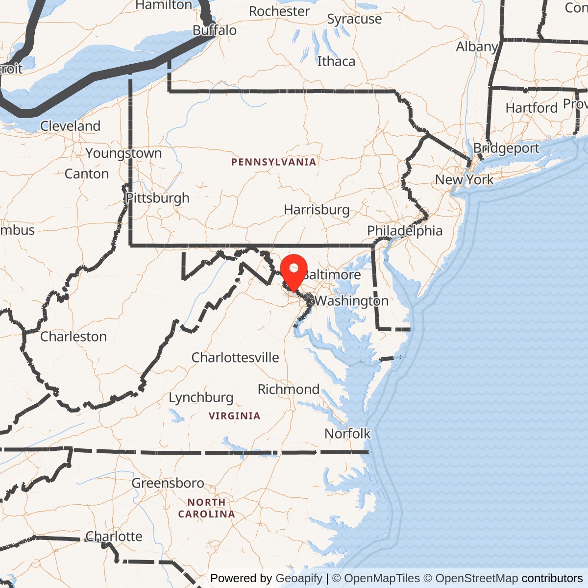

Nike Missile Site W-83 was a former U.S. Army Nike Ajax surface-to-air missile installation in northern Fairfax County, Virginia, generally identified in Nike records as Herndon/Dranesville and often described locally as the Great Falls Nike site. It was part of the Washington-Baltimore Defense Area, the Cold War ring of Nike missile batteries built around Washington, D.C., Baltimore, and the surrounding strategic region to defend the national capital area against Soviet bomber attack. It was closed as a Nike missile battery in November 1962, after only a brief operational life, and its two major parcels were later reused as a mapping/geodetic research facility, a public observatory park, an elementary-school site, and a county park.
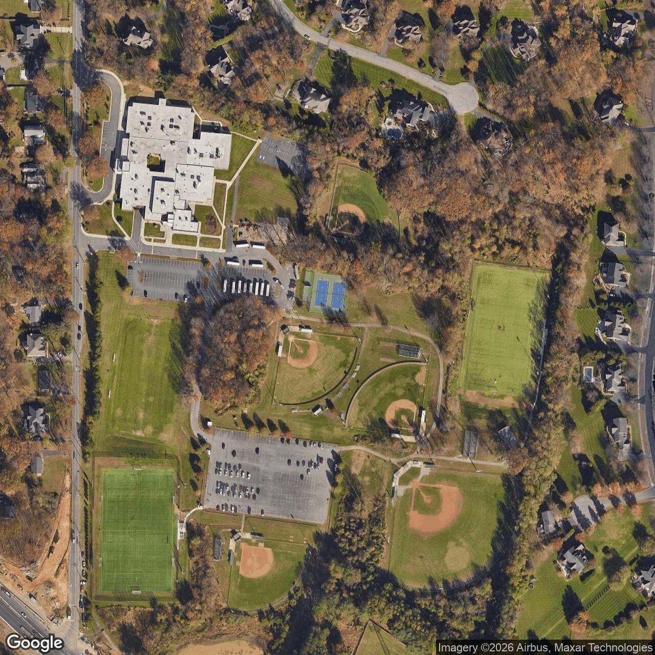
The site should be treated as a two-part Nike installation, not as a single point. The launcher area was west of the fire-control area near Utterback Store Road and what is now Great Falls Nike Park and Forestville Elementary School. The integrated fire control area was east of the launcher, on Springvale Road, within what is now Turner Farm Park.
This split is important because the physical remnants and later uses differ sharply between the two parcels. The launcher parcel held the missiles, readying and fueling areas, above-ground launchers, and associated support functions. The IFC parcel held the radars, computers, communications equipment, control crews, and support buildings that located and tracked aircraft, tracked the missile in flight, and generated the steering commands that guided the missile to an intercept. A Nike missile site functioned as a weapon system only when the two parcels worked together.
W-83 was not a general Army post, airfield, depot, or training camp. It was a fixed air-defense battery designed for one narrow mission: to engage hostile aircraft approaching the national capital region. Its role was part of a much larger air-defense architecture that included early-warning radars, fighter-interceptor control, Army missile command-and-control, and multiple Nike batteries deployed around the Washington-Baltimore region.
Unlike Lorton W-64, W-83 was not one of the long-lived Virginia Nike Hercules batteries. The technical site listing normally identifies W-83 as an Ajax configuration, Nike 1B, 2C/30A/12L-A. In that notation, the final "A" identifies the site as an Ajax site rather than a Hercules site. W-83 does not appear in the Appendix D Hercules conversion list used for ARADCOM converted sites. Some modern local summaries mention both Ajax and Hercules in connection with the Great Falls site, but the stronger technical evidence indicates that W-83 should be recorded as an Ajax site that closed before the Virginia part of the Washington Defense Area consolidated around the Hercules-capable Lorton battery.
Mission Evolution
W-83 grew out of the same Cold War pressure that produced the national Nike program. After the Soviet Union acquired atomic weapons and long-range aviation improved, Washington could no longer assume that the continental United States was immune from direct attack. The national capital region was an obvious priority target because it contained the federal government, military command agencies, transportation corridors, communications facilities, and symbolic national institutions. The Army's answer was a ring of Nike batteries around the region, broadly echoing the capital's earlier Civil War defense ring but using radars, missiles, and computers rather than earthwork forts and artillery.
Nike Ajax was the first operational U.S. guided surface-to-air missile system. It was developed to replace or supplement gun-based antiaircraft defense around major targets. Ajax was a command-guided missile: the ground equipment found the target, tracked it, tracked the outgoing missile, and generated steering commands. The missile itself was only part of the system. The radars, analog computers, communications circuits, generator systems, and trained crews at the IFC area were just as important as the launchers and missiles.
At W-83, the launcher and IFC positions were separated by roughly a mile. That separation was normal for Nike sites because the launch area needed clear storage, fueling, and launch space while the IFC area needed favorable radar siting, a clear field of view, and protection from the hazards of missile fueling and launch. The IFC at Springvale Road was on high, open former farm land, well suited for radar use in the 1950s. The launcher at Utterback Store Road was far enough away to reduce interference and safety conflicts but close enough to be controlled as part of the same battery.
The mission was short-lived because air-defense priorities changed quickly. Nike Ajax was designed primarily against aircraft, but by the late 1950s and early 1960s the strategic threat was shifting toward ballistic missiles, which fixed Ajax batteries could not defeat. The Washington area retained some Nike Hercules sites longer, particularly Lorton, but the Herndon/Dranesville battery closed in November 1962. Its closure reflects the national pattern in which many Ajax-only batteries were removed from service as Hercules conversions, command-and-control modernization, cost reductions, and changing threat assessments reshaped the Nike network.
Operational Role and Command Relationships
W-83 formed the northwestern Virginia portion of the Washington-Baltimore Nike ring. It helped cover approaches through northern Fairfax County and the Potomac River corridor west and northwest of Washington. In practical air-defense terms, it complemented the other Fairfax County Nike positions at Lorton and Fairfax/Pohick and the Maryland and District of Columbia-area sites across the broader defense area. No single battery defended Washington by itself. The system depended on overlapping coverage, rapid target assignment, and coordinated engagement control.
The site was initially manned by Regular Army air-defense troops. Public Nike summaries list W-83's operating units as Battery B, 71st Antiaircraft Artillery Missile Battalion from July 1954 to September 1958, followed by Battery B, 1st Missile Battalion, 71st Artillery from September 1958 to November 1962. Those dates fit the known operational period and the closure date. Because W-83 closed in 1962, it did not have the long later Virginia Army National Guard operating history associated with Lorton W-64.
The battery's daily operations would have involved continuous readiness, radar checks, communications checks, site security, generator maintenance, missile handling, fueling readiness, crew drills, fire-control training, and coordination with regional air-defense command channels. The crews were not simply guarding stored missiles. They were maintaining a complex electromechanical combat system that had to be ready to receive an engagement order, acquire and track a target, prepare missiles, and fire quickly if ordered.
The Washington-Baltimore region's Nike network also depended on public acceptance of missile sites placed in suburban and rural communities. W-83 sat in an area that was still recognizably agricultural in the 1950s. The Springvale Road IFC was built on land taken from the Turner Farm, and the Utterback Store Road launcher was built in an area that later became heavily shaped by suburban development, school construction, and park use. That transition from farm land to Cold War defense land to suburban public use is one of the most important historical patterns at W-83.
Physical Layout and Facilities
The launch area was the western parcel. It was located off Utterback Store Road, near the present Great Falls Nike Park and Forestville Elementary School. Public site summaries and school-history material describe the active launch area as containing twelve above-ground launchers, with the later tennis-court area occupying the spot where those launchers once stood. The missile type/configuration summary for W-83, Nike 1B, 2C/30A/12L-A, indicates an above-ground Ajax launch layout rather than an underground Hercules conversion battery.
Because W-83 used first-generation Ajax missiles, the launch area's hazards and support requirements differed from later Hercules sites. Ajax used liquid-fuel components that required careful handling. Many Nike Ajax launch areas had fueling and readying features, blast and safety clearances, fencing, guard control, missile assembly/check functions, and storage/support buildings. The Great Falls Nike Park landscape retains an earthen/refueling berm, which is one of the strongest visible reminders of the former launch function.
The IFC area was the eastern parcel at Springvale Road, now part of Turner Farm Park. During Nike service it included radar towers and control/support buildings. Modern accounts and Fairfax County planning records identify two surviving towers. Earlier versions of the two observatory towers were part of the Nike Missile Control Site and were later retrofitted by the Defense Mapping Agency for its mission. The original Nike-era buildings were later removed, but the towers preserve the most visible physical connection to the Cold War fire-control site.
The two parcels were visually and functionally connected by the Nike system's line-of-sight and command-guidance requirements. A Nike battery depended on clear radar tracking and reliable communications between the IFC and launch area. The IFC's acquisition radar found aircraft; target-tracking radar followed the selected target; missile-tracking radar tracked the outgoing missile; and the ground computer calculated the intercept path. The launch area stored and fired the missile, but the IFC did the thinking and steering.
The site's post-Nike landscape is now divided between public recreation and educational use. Forestville Elementary School occupies part of the former launch-site land. The nearby Great Falls Nike Park includes athletic fields, tennis courts, remaining perimeter/fence traces, the earthen berm, and a radar dome displayed on the ground. Turner Farm Park includes the former IFC/observatory area and broader farm landscape. The current surface landscape therefore does not look like an intact missile battery, but enough documentary, coordinate, and remnant evidence exists to reconstruct the installation's original arrangement.
Land Acquisition and Local Setting
The Herndon/Dranesville site was built in a part of Fairfax County that was changing rapidly. Before the Cold War, the Turner Farm area reflected the county's rural and dairy-farming landscape. Fairfax County's Turner Farm master plan states that Mark Turner continued the family dairy business and that the farm was considered a model dairy farm. The same planning document explains that World War II and the early Cold War dramatically altered Fairfax County as federal growth brought employees and families into the region, stimulating suburban development.
In 1955, the federal government took 11.7 acres of Turner Farm to build the Nike Missile Control Center W-83. Fairfax County identifies it as one of the first of thirteen surface-to-air missile sites installed for the defense of Washington, D.C. That local land history is important because it shows how Cold War defense was imposed directly onto the agricultural landscape surrounding the capital. W-83 was not placed on an existing large Army reservation. It was inserted into a working rural/suburban community because the air-defense geometry demanded that the battery be there.
The launcher parcel followed a similar pattern of Cold War use followed by suburban transformation. Once the missiles were removed and the site was sanitized, the land no longer had a military purpose. Buildings and visible launch features deteriorated or were removed. By the late 1970s and early 1980s, surrounding development, school construction, and county park development had changed the former launch parcel into a public and educational landscape.
Post-Closure Reuse and Current Status
W-83 closed as a Nike battery in November 1962. After missile operations ended, the site did not simply disappear from federal use. The former IFC became important to the U.S. Army Map Service and later the Defense Mapping Agency. Fairfax County's Turner Farm master plan states that in 1961, the U.S. Army Map Service, later known as the Defense Mapping Agency, took over management of the Nike Missile Control Center. There, the Map Service built on the guidance system for Nike missiles and developed work connected to what became the Global Positioning System now used by civilians.
Public histories of the site expand on that later mapping mission. They describe the former IFC as a geolocation and navigation research station where the Army Map Service initiated a satellite-tracking program that became part of the Defense Mapping Agency in 1972. The same histories connect the collected data to establishing precise geographic reference points, refining estimates of the earth's shape, and understanding variations in the earth's gravity field. For the purposes of this project, the safest phrasing is that W-83's former IFC became a significant Army Map Service/Defense Mapping Agency geodetic and satellite-tracking site associated with GPS-era geospatial development; it should not be described as the single birthplace of GPS.
The mapping facility closed in 1993. Fairfax County states that the federal government decided to divest the DMA site after closure and that the Park Authority acquired it in 1999 with community support. The Park Authority later acquired the remainder of the Turner Farm property in 2010. The former IFC is now part of Turner Farm Park and is associated with public astronomy and observatory use. The two surviving tower structures are the key visible remnants. One was adapted for telescope/observatory use, and a later roll-top observatory building was added nearby.
The former launcher area became Great Falls Nike Park and part of the Forestville Elementary School landscape. Atlas Obscura and local site histories report that the launcher buildings were torn down, the missile magazine hatches were buried, the park acquired sports fields and tennis courts, and Forestville Elementary School was built on the former barracks area. Forestville Elementary School's own history page notes that the school occupies a portion of the former launch-site land and that the tennis courts in the park behind the school were built where twelve missile launchers once stood.
Chronology
- 1945 Bell Laboratories proposed the Nike line-of-sight antiaircraft missile concept, beginning the development path that produced Nike Ajax.
- 1949 The Soviet atomic test and worsening Cold War tensions increased U.S. concern about continental air defense.
- 1950 The Korean War and the broader U.S. rearmament program accelerated air-defense planning and deployment.
- 1951 A Nike missile successfully intercepted a QB-17 target drone over White Sands, demonstrating the feasibility of guided missile air defense.
- 1953 The first Nike Ajax missile battery became operational at Fort Meade, Maryland, establishing the model for the nationwide deployment program.
- 1954 Construction and deployment activity began for W-83 in the Herndon/Dranesville-Great Falls area.
- July 1954 Battery B, 71st Antiaircraft Artillery Missile Battalion began the first unit period commonly associated with W-83.
- 1955 The federal government took 11.7 acres of Turner Farm for the Nike Missile Control Center W-83.
- 1955 W-83 became active as one of the Washington-area Nike sites defending the national capital region.
- 1955 The IFC at Springvale Road and the launch area at Utterback Store Road functioned as the two major operational parcels of the battery.
- 1958 The unit designation changed to Battery B, 1st Missile Battalion, 71st Artillery.
- 1958 Nike Hercules entered broader service elsewhere in the Nike network, but W-83 remained best documented as an Ajax configuration and was not one of the long-lived Hercules conversion sites.
- 1961 According to Fairfax County's Turner Farm planning history, the U.S. Army Map Service, later the Defense Mapping Agency, took over management of the Nike Missile Control Center.
- November 1962 W-83 closed as an operational Nike battery.
- 1962 The launch and fire-control sites ceased their original missile-defense function.
- 1960s-1970s The former IFC was reused for Army Map Service/Defense Mapping Agency geodetic, navigation, and satellite-tracking work.
- 1972 The Defense Mapping Agency was created, absorbing relevant mapping/geodetic functions.
- 1975 Fairfax County Park Authority acquired the first parcel for Turner Farm Park from developers who had obtained a portion of the Turner property.
- Late 1970s-early 1980s Suburban development and public-facility construction transformed the former launch-site area.
- 1980 Forestville Elementary School was built on part of the former launch-site/barracks land.
- 1993 The former Defense Mapping Agency facility at the W-83 IFC closed.
- 1999 Fairfax County Park Authority acquired the former DMA site along with another portion of the Turner Farm property.
- 2000-2002 Public site histories report that the former IFC buildings were demolished, with the two radar/observatory towers left standing.
- 2010 Fairfax County Park Authority acquired the remainder of the Turner Farm property, including the farmhouse and associated outbuildings.
- 2010 Public histories report that the older observatory dome on the southern tower was replaced with newer telescope equipment.
- 2016 A roll-top observatory building was constructed near the southern tower at Turner Farm Park.
- 2018 Fairfax County approved the Turner Farm Park Master Plan Revision, preserving the Nike Missile Control Center W-83 history as part of the park background.
- Present The site is inactive as a military installation; the IFC is part of Turner Farm Park and observatory use, while the launch area is represented by Great Falls Nike Park, Forestville Elementary School, and surviving/remnant landscape features.
List of all Nike Installations in Virginia