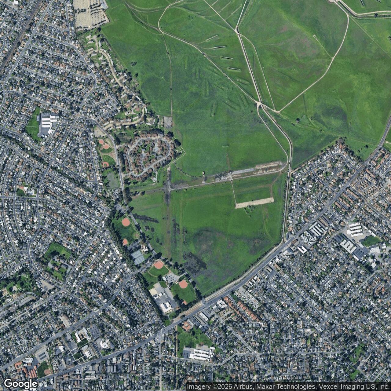
Naval Outlying Field Concord, California
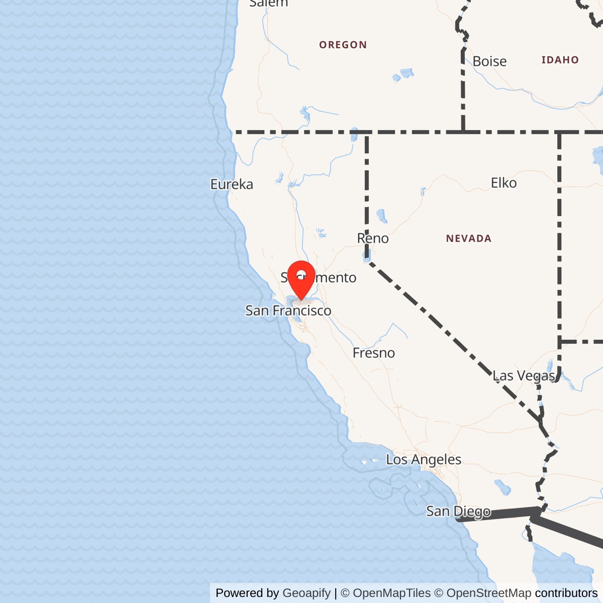
Longitude: -122.016312
Current Role: Former NAS Alameda auxiliary/outlying airfield on the southern edge of the Concord Naval Weapons Station, used for practice takeoffs and landings in the wartime Alameda auxiliary-field network; later inactive with runway and ramp remnants documented in the former Inland Area.
Naval Outlying Field Concord was not the large ammunition base most people now associate with the name Concord. It was a small, hard-surface naval aviation field built into the wartime operating system of Naval Air Station Alameda. Its job was simple, repetitive, and essential: give Navy pilots a place to practice takeoffs, landings, and field operations away from the congestion of the main Alameda base and the busy waters and airspace of San Francisco Bay.
That distinction matters. Concord had two Navy stories on the same general landscape. One was the ordnance story of U.S. Naval Magazine, Port Chicago, later Naval Weapons Station Concord, tied to ammunition storage, ship loading, the 1944 Port Chicago disaster, Cold War weapons handling, and eventual transfer of the Tidal Area to the Army as Military Ocean Terminal Concord. The other was this aviation story, a compact outlying field on the southern edge of the weapons station area. The two were physically related, and later records describe the former airfield as part of the Concord Naval Weapons Station landscape, but they were not the same installation in function.
Physical Layout and Facilities
The best compact physical description of the field is the January 1945 directory extract reproduced on the California Military Museum's Naval Outlying Field Concord page. That extract labels the site as "Alameda Naval Air Station Auxiliary, Concord Outlying Field" and places it 1.2 miles northeast of Concord by air line. It describes a Navy-operated, U.S. Government-owned field of about 300 acres, with an irregular shape and two asphalt runways. The north-south runway measured about 4,000 by 150 feet, and the east-west runway measured about 3,600 by 200 feet. The same diagram shows the two runways crossing near the center of the field, with taxiways and parking or apron areas arranged around the crossing.The facilities were deliberately minimal. The directory extract lists no hangars, no shops, no gasoline or oil available at the airport, no radio range, no control tower, no ground-air radio, and no instrument approach or letdown procedure. Gasoline and oil were available only "in vicinity" at Alameda Naval Air Station. Personnel accommodations were not at the field itself, but in the vicinity at Concord. That profile tells us a great deal about the installation's purpose. Concord was not built to be a self-contained air station. It was a landing field, a practice field, and a dispersal/satellite facility whose support system depended on Alameda and the surrounding Navy network.
Its runway design also reflects the Navy's wartime training needs. Carrier aviation demanded repeated approach, landing, waveoff, and takeoff practice. A simple cross-runway field inland from the Bay could absorb training sorties that would have been inefficient or unsafe at the main naval air station. The 1943 and 1944 photographs reproduced by the California Military Museum show the type of aircraft that used the field, including an F6F Hellcat, a Douglas SBD-5 Dauntless, a North American SNJ, Beech SNB aircraft, and other Navy utility or training types. Those aircraft point to a mixed training and familiarization environment rather than a single specialized mission.
Mission and Operations
Naval Outlying Field Concord's mission was to extend the usable flight-training capacity of NAS Alameda. A recollection preserved on the California Military Museum page states that Alameda operated the outlying field for practice takeoffs and landings. That wording is important because it frames the field as an Alameda satellite, not a stand-alone station with its own broad command mission. Its value was measured in runway time, training repetitions, and safe separation from the main station's crowded operating tempo.By 1942 the Navy was expanding faster than its prewar infrastructure could carry. Carrier air groups, patrol units, utility squadrons, transport activity, and shore-based training all placed new pressure on main naval air stations. Alameda was especially important because it sat in the San Francisco Bay naval operating area, close to shipyards, supply depots, embarkation facilities, and fleet activity. The Navy needed its main station for operational aircraft, maintenance, administration, ferrying, and support. Outlying fields like Concord let pilots practice patterns and landings without occupying the main Alameda field every time an aircraft needed repetitions.
The field's lack of hangars and shops suggests that aircraft generally did not stay for major servicing. They came to operate, train, land, take off, and return to their parent base or another supporting station. That was common for smaller outlying fields. Their purpose was not to duplicate the entire air station but to offload the most land-intensive and repetitive parts of flying training.
Concord's known wartime aircraft activity also shows the Navy's broad training mix. The F6F Hellcat was the Navy's dominant late-war carrier fighter. The SBD Dauntless remained a familiar dive bomber and training aircraft even as newer types entered service. The SNJ was the Navy's version of the North American T-6 Texan, widely used for advanced training. Beech SNB aircraft and Cessna JRC utility aircraft filled transport, instrument, and support roles. A field that could handle this range of aircraft gave NAS Alameda flexibility across pilot training, familiarization, utility flying, and carrier-aircraft practice.
Relationship to Naval Weapons Station Concord
The airfield's relationship to Naval Weapons Station Concord should be treated carefully. The outlying field was part of the naval aviation network, while the weapons station was part of the Navy's ordnance and ammunition network. Both existed in the Concord area during World War II, and later descriptions place the former airfield on the southern edge of the Concord Naval Weapons Station. But the airfield was not the same thing as the Port Chicago magazine, the weapons depot, or the later Military Ocean Terminal Concord.Naval Weapons Station Concord began in 1942 as U.S. Naval Magazine, Port Chicago, an annex to Mare Island's magazine system. It built up rapidly to support the enormous explosives demand of the Pacific war. In July 1944, the Port Chicago disaster destroyed the pier and two munitions ships, killing 320 people and leading to the Port Chicago work stoppage and mutiny trial. After the disaster, the Navy expanded and dispersed the weapons-station footprint, including the inland magazine and support areas. The City of Concord's reuse history notes that the Inland Area eventually contained magazines, administration buildings, barracks, a weapons laboratory, rail infrastructure, and a small airfield.
This means Concord's airfield history sits at the edge of two systems. In aviation terms, it was an Alameda outlying field. In land-use and postwar records, its physical remains became part of the Concord Naval Weapons Station Inland Area.
Role in the Wider Military Network
Naval Outlying Field Concord is a good example of how small wartime airfields supported much larger naval systems. NAS Alameda was the hub. It handled fleet aviation, carrier-related activity, and support functions within one of the Navy's most important West Coast port and industrial regions. Alameda could not efficiently absorb every training circuit, touch-and-go, or practice landing that wartime carrier aviation required. The Navy's answer was a distributed auxiliary-field network.Concord's nearest system peers were Cotati and Hollister, both identified in the same spring 1942 auxiliary-field expansion. The larger later Alameda network also included Crows Landing, Santa Rosa, South San Francisco, and other fields in different roles and levels of development. Some grew into substantial auxiliary air stations or landing fields with more extensive support. Concord stayed closer to the basic end of the spectrum: a paved outlying field with little local support and a practical training mission.
The field also linked the Navy's air and ordnance geographies in the East Bay. Concord sat near a growing weapons-station landscape, rail corridors, and open lands east of the central Bay. That made it easier to place a field away from Alameda's urban and waterfront constraints. It also means the history of the airfield cannot be read only from surviving runway pavement. It has to be read as a wartime solution to crowded airspace, expanding naval aviation, and the Navy's wider use of the Contra Costa County interior.
Closure and Current Status
The field's closure date is not precisely documented in the readily available public sources. The California Military Museum page states that the Concord Navy Airfield still appeared on the 1946 sectional chart, though downgraded to an auxiliary airfield, and that it was apparently closed sometime between 1946 and 1949 because it was not depicted as an active airfield on later charts from 1949, 1955, 1956, 1957, or 1966.The airfield did not disappear immediately. The same source notes that the field appeared on the 1959 USGS topographic map, but without an active-airfield label, suggesting inactive physical remains rather than an operating facility. A 2003 field report quoted by the California Military Museum described the field as still evident, with fresh yellow X markings on the asphalt runways, the east-west runway in better condition than the overgrown north-south runway, and the remains visible from East Olivera Road. A 2004 USGS aerial view showed much of the primary east-west runway and parking ramp still present, while residential development had covered part of the north-south runway.
The former airfield now belongs to the larger cleanup and reuse history of the former Naval Weapons Station Concord Inland Area. EPA's Superfund profile identifies a Runway Debris Area tied to the former airfield, with north-south and east-west runways, taxiways, an abandoned rail bed, airfield buffer areas, and a former aircraft firing range known as the Bore Sighting Range. That environmental record confirms that the airfield is not merely a map curiosity. It remains a defined former-use area within the larger former weapons-station cleanup landscape.
Chronology
- 1942 spring The Navy's Alameda auxiliary-field expansion put fields at Cotati, Concord, and Hollister under construction.
- 1942 U.S. Naval Magazine, Port Chicago, was established nearby as the Navy's major Contra Costa County ammunition installation. This was a separate ordnance installation, not the outlying airfield.
- 1943 The earliest located photograph of the Concord outlying field shows Navy aircraft operating there, including an F6F Hellcat and other aircraft types.
- 1944 A U.S. Navy aerial photograph showed the cross-runway field layout at OLF Concord.
- 1944-07-17 The Port Chicago disaster occurred at the nearby naval magazine, killing 320 people and reshaping the weapons-station landscape. This was not an airfield event, but it is central to the history of the surrounding Navy installation.
- 1945-01 The airfield appeared in an airfield directory extract as Alameda Naval Air Station Auxiliary, Concord Outlying Field, with about 300 acres and two asphalt runways.
- 1946 The field still appeared on a sectional chart, but it was downgraded to auxiliary-airfield status.
- 1946-1949 The field appears to have closed during this period, based on its absence from later active-airfield charts.
- 1959 The former field appeared on a USGS topographic map without an active-airfield label.
- 1999 Concord Naval Weapons Station was placed in reduced operational status, placing the former airfield into the broader inactive/reuse landscape of the weapons station's Inland Area.
- 2003 A field report described visible but inactive runway remains, including yellow X markings and overgrown pavement.
- 2004 A USGS aerial image showed much of the primary east-west runway and parking ramp still visible.
- 2005-2008 BRAC closure actions affected the Concord Naval Weapons Station Inland Area, while the Tidal Area and retained support property transferred to the Army as Military Ocean Terminal Concord.
- Present Naval Outlying Field Concord is a closed former naval aviation field. Its physical remnants and environmental context are part of the former Concord Naval Weapons Station Inland Area cleanup and reuse landscape.