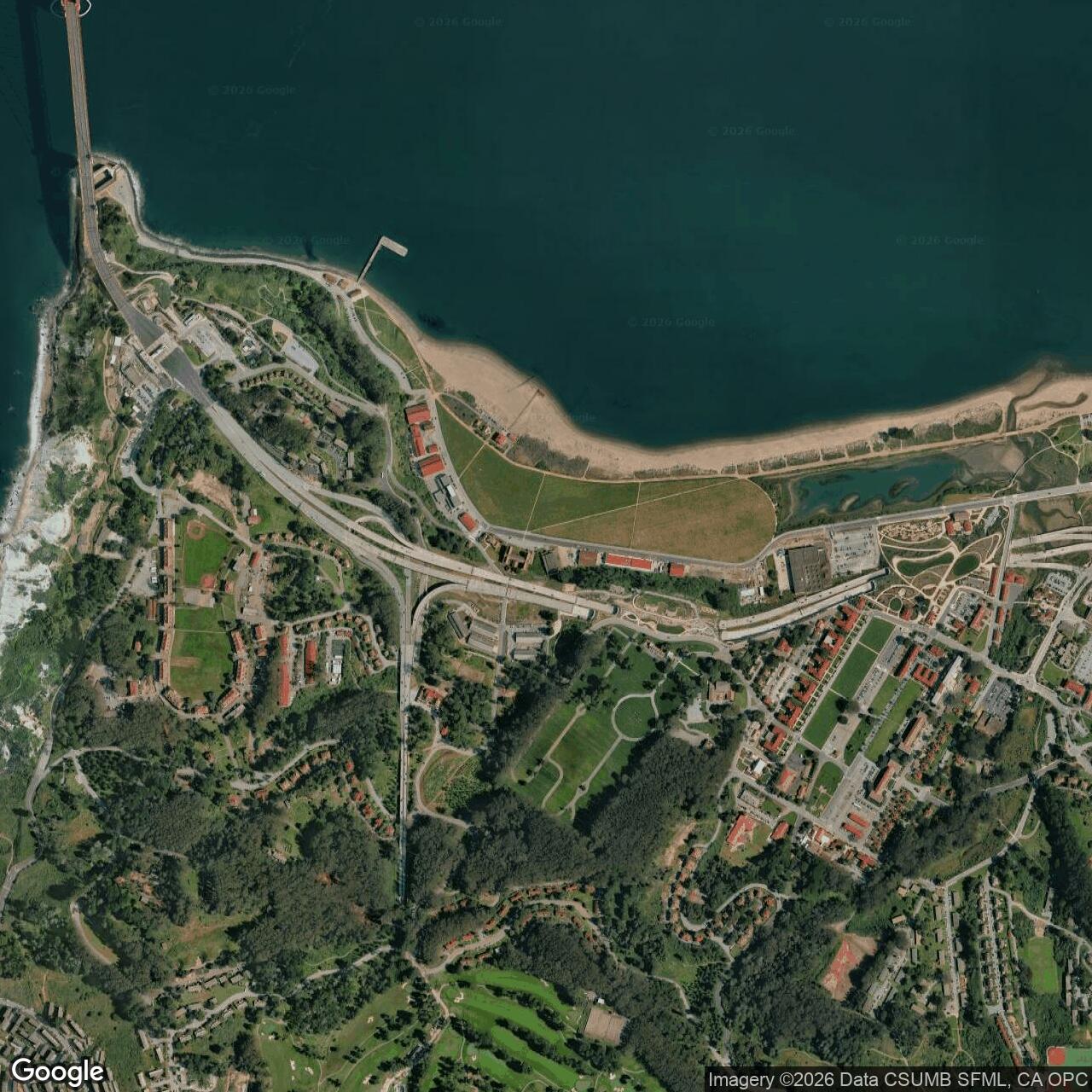
Crissy Field Army Air Field, San Francisco California
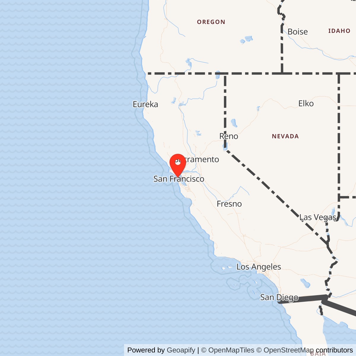
Longitude: -122.4659
Official Base Website: https://www.nps.gov/places/000/crissy-field.htm
Current Role: Presidio of San Francisco / Golden Gate National Recreation Area public waterfront park; restored Crissy Marsh, East Beach, West Bluff, Golden Gate Promenade, environmental education, recreation, and preserved historic aviation buildings.
Crissy Field was the Presidio of San Francisco's Army airfield and one of the most important early military-aviation landscapes on the Pacific Coast. It occupied low, flat bayfront ground that had once been tidal marsh and seasonal Indigenous use area, then Presidio support ground, then the filled western portion of the 1915 Panama-Pacific International Exposition. The Army began airfield work there after World War I, named the field in 1919 for Major Dana H. Crissy, and completed permanent Air Service facilities in 1921. Its military identity should be understood as a Presidio sub-installation rather than as an independent fort. It was part of the larger Presidio reservation, but it had a distinct mission, physical plant, unit history, aviation identity, and later public landscape legacy.
The Army airfield closed to fixed-wing airplane operations in 1974. The broader Presidio remained an active Army post until its 1994 transfer to the National Park Service after base closure. Crissy Field therefore has two important closure dates. The aviation field ceased functioning as an Army airfield in 1974, while the land passed from the Army into the national park system with the Presidio in 1994. Today the former airfield is no longer an Army installation. It is a restored public landscape within the Presidio and Golden Gate National Recreation Area, managed through the Presidio / National Park Service / Golden Gate National Parks Conservancy partnership. Its current use includes beaches, trails, Crissy Marsh, the Golden Gate Promenade, education programs, restored hangars and historic buildings, recreation, public access to the northern waterfront, and interpretation of the Presidio's military aviation history.
Crissy Field mattered because it connected three systems that usually appear separately in military history: coast defense, aviation, and urban waterfront logistics. The field's first military purpose was not simply to give Army aviators a scenic place to fly. It was built as an Air Coast Defense Station to assist the Harbor Defenses of San Francisco. Aircraft could observe artillery fire, photograph targets and terrain, support command communication, and extend the eyes of the Coast Artillery beyond what could be seen from fixed stations around the Golden Gate. In the 1920s this made Crissy Field a living experiment in how aircraft would alter the older gun-and-fort system. Later, as aircraft grew larger and faster, the same geography that first made the field attractive became a constraint. The bayfront setting, fog, wind, short landing area, water exposure, and the coming Golden Gate Bridge all pushed first-line Army aviation north to Hamilton Field.
The field also mattered because it became a nationally visible stage for early aviation. Between 1921 and 1936, Crissy Field hosted or supported record flights, long-distance aviation tests, photographic missions, air races, publicity flights, search-and-rescue work, and early transoceanic attempts. It was associated with Henry H. "Hap" Arnold, George H. Brett, Carl A. "Tooey" Spaatz, Delos C. Emmons, Lowell H. Smith, Russell L. Maughan, Lester J. Maitland, Albert F. Hegenberger, and other officers who helped define Army aviation before the creation of an independent Air Force. That interwar aviation story makes Crissy Field much more than a local Presidio landing strip. It was one of the places where the Army learned how aircraft could serve command, reconnaissance, coast defense, public demonstration, and long-range military mobility.
Mission Evolution
The first military use of the Crissy Field lowlands was not aviation. During the Spanish, Mexican, and early U.S. Army periods, the northern waterfront served as anchorage and support ground for the Presidio. After the United States took control of the Presidio, the Army used the damp lowland for stables, warehouses, refuse, and utilitarian support functions. The area remained difficult ground because it was low, marshy, and exposed to bay winds. Army officers wanted the tidal sloughs filled because flat land inside the Presidio was scarce, and a filled bayfront plain could support buildings, logistics, and later aviation in ways the steep ridges of the Presidio could not.
The 1915 Panama-Pacific International Exposition changed that landscape. The city filled and reshaped the marsh for exposition use, placing pavilions, livestock grounds, and an automobile racetrack on what became the airfield area. After the exposition closed and World War I mobilization began, the same cleared and filled ground became useful to the Army. Temporary barracks for thousands of soldiers training at the Presidio spread across the former fair site. By 1919, with wartime temporary structures being removed and Army aviation looking for a West Coast coast-defense site, the former racetrack and filled field offered a ready-made open landing area.
The airfield mission began in 1919, but the fully developed station dates to 1921. The Air Service had used the field for several years before permanent construction was completed. In September 1921, the Army completed an air coast defense station with quarters, hangars, workshops, repair shops, radio masts, a seaplane ramp, administrative buildings, and support structures. It was named for Major Dana H. Crissy, a former Presidio coast artilleryman who entered aviation, commanded Mather Field, and died with Sergeant First Class Virgil Thomas in a DH-4 crash near Salt Lake City on October 8, 1919, during the Transcontinental Reliability and Endurance Test. Henry H. Arnold, then closely involved with Western Department aviation, helped secure the naming. The name therefore tied the field to the risks of early military flight as well as to the Presidio's coast-artillery community.
Crissy Field's initial mission was air coast defense. Its aircraft were intended to support the Harbor Defenses of San Francisco by observing and adjusting fire, conducting aerial photography, providing liaison service for headquarters, supporting search-and-rescue or public-cooperation missions, and assisting the developing air-mail system. The field's central operating unit during this period was the 91st Observation Squadron, while the 15th Photo Section conducted broad aerial photography work across the West. The airfield was not designed as a bomber base or a mass combat airfield. It was designed as a specialized support station where aircraft could make San Francisco's coast-defense network more capable.
By the mid-1920s the mission had expanded from coast-defense support into aviation demonstration, experimentation, and record-setting. The field hosted spectacular events because San Francisco was a major city and because Crissy Field sat directly on the bayfront, visible to the public and accessible to Army leadership. Flights that ended, staged, or passed through Crissy Field showed the public that aviation could cross continents, oceans, and ultimately the world. The first successful dawn-to-dusk transcontinental flight ended there in 1924. The U.S. Army Air Service World Flight stopped there the same year. The first attempt to fly from the continental United States to Hawaii staged from Crissy in 1925. In 1927, the Fokker C-2 Bird of Paradise, prepared at Crissy Field and flown by Lieutenants Lester Maitland and Albert Hegenberger, completed the first successful flight from the mainland United States to Hawaii. Those events gave the field a national aviation identity beyond its formal coast-defense mission.
The mission changed again in 1936. Hamilton Field opened in Marin County and took over first-line Army air operations in the Bay Area. The reasons were practical and doctrinal. Aircraft were becoming heavier, faster, and less tolerant of short, cramped fields. Crissy's location beside the bay made it vulnerable to ship attack, while the same water, fog, wind, and winter mud that had challenged biplane pilots became more serious as aircraft performance increased. Construction of the Golden Gate Bridge created an additional obstruction at the western approach. Crissy Field did not close entirely, but it stopped being a first-line Army air base. The headquarters of the 30th U.S. Infantry Regiment occupied the administration building, and the field itself became a mobilization and assembly area.
World War II gave the former first-line airfield a new role. Temporary wooden barracks rose again at both ends of the field. The former air-mail hangar was converted into barracks and classrooms for the Military Intelligence Service Language School, where Nisei soldiers trained for battlefield interpretation and intelligence work in the war against Japan. The field also supported training, helicopter deployment, organization, troop assembly, and general Presidio support functions. The wartime story of Crissy Field was therefore not simply an aviation epilogue. It became part of the Presidio's mobilization, intelligence, and Pacific-war support system.
After World War II, the airfield survived in a reduced but still useful form. A paved runway replaced the earlier grass landing field, and the Sixth Army Flight Detachment used Crissy Field for light utility aircraft, passenger flights, helicopters, and liaison work. During the Vietnam War era, the Army used the field for liaison flights and medical evacuation connections between Travis Air Force Base and Letterman Army Hospital. In that role, Crissy Field served Army medical and command mobility rather than coast defense. Helicopters and light aircraft could move personnel and patients through the Presidio faster than surface traffic through San Francisco. The field finally closed to airplanes in 1974, ending more than five decades of Army aviation use.
Operations and Military Activity
Crissy Field's earliest daily operations were modest by later air-base standards but important for the Army that existed in the 1920s. The field was grassy and kidney-shaped, still showing the outline of the old exposition racetrack. Hangars, workshops, and garages lined the southern and western edges. Administrative space, barracks, a guardhouse, and support buildings anchored the post. Officers' quarters stood above the field on the bluff, where the pilots could look down over the bay and landing ground. The field was not a vast aviation city. It was a compact, experimental Army aviation station built inside an older infantry and coast-artillery post.
The most important operating pattern was observation in support of coast artillery. Before radar and modern air-defense sensors, finding targets, observing splashes, and correcting fire were essential parts of seacoast artillery. Aircraft gave the defenders of San Francisco Bay a new method of seeing over the horizon and beyond terrain masking. Pilots could observe artillery fall, photograph defenses and approaches, communicate information, and support exercises linking aircraft with guns, searchlights, fire-control stations, and command posts. Crissy Field thus stood at the transition between the age of fixed masonry and concrete batteries and the age of mobile, aerial, and electronic warfare.
The 91st Observation Squadron was central to that work. Assigned to the field in the 1920s, it conducted observation duties, artillery spotting, liaison flying, and general Army aviation missions. Its aircraft changed with the technology of the period, including De Havilland types and later Douglas observation aircraft. The squadron's operations trained pilots and observers who had to understand both flying and artillery requirements. They were not merely aviators in isolation; they were part of a combined coast-defense system. Every flight for target observation or photographic mapping tested the relationship between the Air Service and older Army branches.
The 15th Photo Section added a second major operational layer. Its aerial photography work extended across the West, from Alaska to the Mexican border. Such photography was valuable for mapping, planning, construction, intelligence, and training. In an age when aerial survey was still relatively new, a photo section at Crissy Field meant that the Presidio airfield was not just supporting local defense. It was generating visual knowledge for a region. That mission also foreshadowed the growing importance of aerial reconnaissance in World War II.
Crissy Field also supported the U.S. Air Mail Service and civilian-cooperation missions. The air-mail connection is visible in Building 640, the former air mail hangar along Mason Street. Air mail was not a combat mission, but it mattered to Army aviation because early pilots, maintenance crews, route planners, and weather observers all learned from the same fragile aviation environment. Support for air mail placed Crissy Field inside the broader development of transcontinental aviation infrastructure, while public flights, rescue missions, and air races helped normalize the presence of aircraft in American life.
The field's record-setting events were operational demonstrations as much as publicity. Lieutenant Russell L. Maughan's 1924 dawn-to-dusk transcontinental flight showed that aircraft could connect the continent within one day of sunlight. The U.S. Army Air Service World Flight, which stopped at Crissy Field in September 1924, turned the field into a stage for the first successful aerial circumnavigation of the globe by a U.S. team. The 1925 Hawaii attempt by Navy seaplanes exposed both the promise and danger of long-range oceanic flight. Maitland and Hegenberger's 1927 Bird of Paradise flight showed that the mainland-to-Hawaii route could be flown successfully. These flights were not entertainment alone. They helped prove navigation, endurance, aircrew skill, logistical preparation, and the practical value of military aviation over continental and oceanic distances.
The field's physical limitations shaped operations from the beginning. San Francisco fog could close visibility quickly. Bay winds made approaches difficult. The unsurfaced landing ground could become muddy during winter rain and dusty in summer. The site was also cramped by the bay, Presidio slopes, surrounding buildings, and later the Golden Gate Bridge. Early biplanes could tolerate short grassy fields better than later monoplanes. As the Air Corps modernized, Crissy became increasingly unsafe and unsuitable for first-line aircraft. The Army did not abandon aviation in the Bay Area; it moved the leading mission to Hamilton Field, which offered more room and better long-term expansion potential.
During World War II, operations shifted away from first-line aviation and toward mobilization. The field's open ground became assembly space. Temporary barracks housed troops. The former air mail hangar became part of the Military Intelligence Service Language School. Nisei soldiers trained there as translators and interpreters for the Pacific War. This is one of Crissy Field's most important wartime stories because it places the site at the intersection of military intelligence, language training, Japanese American military service, and the contradictions of a war fought while many Japanese American families were incarcerated. The Crissy Field classrooms trained soldiers whose language skills were essential in interrogations, document translation, battlefield intelligence, psychological operations, and occupation duties.
After the war, the Sixth Army Flight Detachment kept Crissy Field operational in a smaller aviation role. The flights were not as glamorous as the interwar records, but they were practical. Light aircraft and helicopters supported command movement, liaison, passenger transportation, and medical evacuation. Letterman Army Hospital's location at the Presidio made aviation access valuable during the Vietnam era. Wounded personnel flown from overseas to Travis Air Force Base could be transferred by air toward the Presidio rather than relying entirely on surface transportation through Bay Area traffic. This late use gave Crissy Field a medical-support role linked to one of the Presidio's major postwar missions.
Units, Organizations, and Systems
Crissy Field's first identity was tied to the Air Service and the Western Department. Henry H. Arnold's involvement in establishing the field connected it directly to the small group of officers who would define American air power during the interwar period and World War II. Arnold later became commanding general of the Army Air Forces, but at Crissy Field he was working in an Army still struggling to understand how aviation fit into older command structures. His role in selecting, developing, and naming the field gives Crissy a direct connection to the institutional birth of American military air power.
The 91st Observation Squadron was the field's core operational aviation unit during the air coast-defense period. Its work linked aircraft to coast artillery, target observation, liaison, and training. Observation squadrons were critical in the interwar Army because they provided the eyes of ground commanders. At Crissy Field that relationship was literal: aircraft from the field supported guns defending San Francisco Bay. The squadron's presence should be read as part of the Harbor Defenses of San Francisco system rather than merely as a local flying club.
The 15th Photo Section was equally important for mapping and reconnaissance. Tens of thousands of aerial photographs across the West came from its work. This unit gives Crissy Field a technical and informational mission. It was not only operating planes; it was collecting and producing geographic information. In that respect, Crissy Field's aviation mission overlapped with engineering, intelligence, and planning.
The 30th U.S. Infantry Regiment became part of the post-airfield story when its headquarters occupied the former airfield administration building after the Air Corps left. That transition illustrates the practical reuse of Crissy's buildings inside the Presidio. When the field no longer served first-line aviation, the Army adapted its facilities for infantry administration and mobilization rather than abandoning them.
The Military Intelligence Service Language School gave Crissy Field one of its most consequential World War II roles. The school trained Japanese-language personnel, many of them Nisei soldiers, for service in the Pacific. The use of Crissy Field buildings for this school reflected the Presidio's larger administrative and training capacity. It also connected the former aviation field to intelligence work that had direct operational effects overseas. The school's presence means Crissy Field should be read not only as an aviation site, but also as a World War II intelligence-training site.
The Sixth Army Flight Detachment represents the postwar system. After the creation of the Sixth Army headquarters role in the western United States, Crissy Field provided air mobility inside the command's Presidio environment. Its light aircraft and helicopter operations supported headquarters, liaison, medical, and utility missions. The detachment's use of the field into the Vietnam era kept aviation alive at Crissy long after the 1936 shift to Hamilton Field ended its first-line status.
Facilities and Physical Layout
Crissy Field's physical layout expressed its hybrid origin. The field was not placed on empty prairie. It was inserted into a filled marsh, former exposition grounds, and active Presidio shoreline. The resulting landing area was broad enough for early aircraft but constrained by water to the north, Presidio slopes and buildings to the south, Fort Point and the Golden Gate approach to the west, and the Main Post / waterfront district to the east. The kidney-shaped grassy field retained traces of the old exposition racetrack. That unusual form gave the site character but also limited its future as aviation technology changed.
The 1921 Air Service buildout created the core historic aviation landscape. Hangars, workshops, and a garage lined the southern edge. A cluster of administration, enlisted barracks, flagstaff, and guardhouse buildings lay farther east. Officers' quarters stood on the bluff above. A seaplane ramp linked the airfield to the bay, reflecting the Army's initial interest in both landplanes and seaplanes. Radio masts and support facilities gave the station the infrastructure needed for aviation operations. The whole complex cost more than a million dollars and consisted of dozens of buildings and specialized support structures.
The hangars are among the most important surviving features. Buildings 926 and 937 were constructed in 1921 at the west end of the field. Each was a large steel-and-concrete structure of about 17,000 square feet, with oversized doors, monitor windows, and space for aircraft storage and maintenance. Building 926 functioned as a landplane hangar. Building 937 served as the seaplane hangar near the bay and ramp. The planned use of amphibian and seaplane aircraft never became as important as the Army first expected because currents and sand buildup made seaplane operations difficult, but the seaplane hangar and ramp remain crucial evidence of the station's original combined land-and-water aviation concept.
Building 640, the air mail hangar, represents another layer of aviation infrastructure. Constructed for the Post Office's transcontinental air mail activity, it shows how Army and civilian aviation infrastructure overlapped at Crissy Field. During World War II, its conversion into classroom and barracks space for the Military Intelligence Service Language School gave the building a second major military significance. The same structure that once supported air mail became a wartime intelligence-training facility.
Buildings 642 and 643, constructed as Air Reserve hangars in 1923, show how quickly the aviation complex expanded. Their roofs were painted with "CRISSY" and "FIELD" to help pilots find the landing ground through fog. Later the Army converted the two buildings into a larger Post Engineer Shop. This adaptation is typical of Crissy Field: the physical plant repeatedly changed use as the field's military mission changed.
The field itself changed physically after World War II. A paved runway replaced the grass landing ground, better suiting light aircraft and helicopters even though the site was no longer a first-line air base. Temporary wartime barracks remained along parts of the field for decades, contributing to the industrial and neglected appearance that later restoration planners confronted after the 1994 transfer. The Army's long use left asphalt, concrete, fill, contamination, utility lines, and altered drainage across what had once been marsh.
The post-1994 restoration changed the landscape again. The National Park Service and Golden Gate National Parks Conservancy restored the historic airfield form while also recreating a portion of tidal marsh. Crissy Marsh reopened in 2000, and the larger public landscape opened in 2001. Restoration reused historic structures, removed hazardous materials, created trails and promenade access, planted native vegetation, and reconnected the public to the northern waterfront. The result is not a return to a pre-military marsh and not a frozen 1920s airfield. It is a layered landscape where historic aviation buildings, open field, restored marsh, beach, promenade, and public education occupy the same ground.
Role in the Wider Military Network
Crissy Field belonged first to the Presidio system. The Presidio was a Spanish, Mexican, and U.S. Army post before Crissy Field existed, and the airfield never became independent from that older post. Soldiers, supplies, roads, utilities, headquarters, medical facilities, and command relationships all linked the field to the Presidio. Treating Crissy as a separate entry does not mean separating it from the Presidio; it means recognizing that the Presidio contained distinct sub-installations whose missions were large enough to stand alone.
The field also belonged to the Harbor Defenses of San Francisco. Fort Winfield Scott, Fort Point, Fort Baker, Fort Barry, Fort Cronkhite, Fort Funston, Fort Miley, and other posts and batteries formed a defensive system around the Golden Gate. Crissy Field added aircraft to that system. Its planes supported artillery observation, photography, and liaison. This makes it one of the most direct examples on the Pacific Coast of aviation being built into the coast-defense network rather than replacing it immediately. In the 1920s, the Army did not yet know exactly how aircraft would transform seacoast warfare. Crissy Field was one of the places where that transformation was tested.
It also belonged to the national Army aviation system. Its association with Arnold, Spaatz, Brett, Emmons, Smith, Maughan, Maitland, Hegenberger, and other early flyers places it inside the lineage of Army aviation before the Air Force. These officers and missions linked Crissy to Mather Field, Hamilton Field, transcontinental routes, Hawaii flights, and global demonstration flights. The field's importance therefore reaches beyond San Francisco. It was part of the institutional learning process that produced the air arm used in World War II.
During World War II, Crissy Field entered the Military Intelligence Service system. The language school's use of former aviation buildings connected the site to the Pacific War's intelligence apparatus and to Japanese American military service. This system context is especially important because it shows that Crissy's significance did not end when first-line flying moved away. It became a place where the Army prepared specialized personnel whose skills were urgently needed overseas.
During the Cold War and Vietnam era, Crissy belonged to the Sixth Army, Letterman Army Hospital, and Presidio headquarters support systems. Its light aircraft and helicopter operations served command and medical mobility. This late role was less visually dramatic than interwar record flights, but it was operationally meaningful. The field supported the functioning of a major Army headquarters and medical center inside a dense urban region.
Finally, Crissy Field belongs to the post-to-park system. The Presidio's closure and transfer created one of the most important military-to-public-land transformations in the United States. Crissy Field became the showcase of that transformation. Its restoration proved that a contaminated, asphalt-covered former military airfield could become a public waterfront, ecological restoration project, historic landscape, and education site without erasing the military history that made it significant.
Closure, Transfer, and Current Status
Crissy Field's first-line aviation role ended in 1936, but the field did not close then. It remained an Army landscape for mobilization, training, support, administration, and later light aviation. The decisive aviation closure came in 1974, when the Army closed the field to airplanes. Helicopter-related activity and Presidio support uses continued for a time, but the age of Crissy Field as an operating Army airfield was over.
The final Army transfer came with the Presidio's closure in 1994. By then Crissy Field had become a neglected industrial waterfront landscape, with asphalt, aging buildings, former military infrastructure, and environmental problems. The transfer to the National Park Service placed the field inside Golden Gate National Recreation Area and opened the possibility of a major public restoration. Planning emphasized cultural and natural resources, public access, recreation, education, and the recovery of marsh habitat.
The restoration was one of the signature achievements of the Presidio's conversion from post to park. The Crissy Field project was completed in 2001 after major funding, planning, hazardous-materials removal, community involvement, landscape design, and volunteer planting. The project restored approximately 100 acres of waterfront parkland, recreated a tidal marsh, reused historic buildings, and created the Golden Gate Promenade. The restoration did not erase the military past. It made the field's open aviation landscape visible while also restoring ecological functions that the Army and the exposition had buried under fill.
Today Crissy Field is public parkland rather than a military installation. It includes Crissy Marsh, East Beach, West Bluff, the Warming Hut, the Golden Gate Promenade / Bay Trail, recreational tenants in former military buildings, youth and environmental education programs, and views of the Golden Gate Bridge, Alcatraz, Angel Island, Fort Point, and San Francisco Bay. Crissy Field Center, opened in 2001 and later refreshed, uses the former military landscape as a classroom for environmental learning and youth engagement. Wildlife protection, especially for western snowy plovers, is now part of the site's management.
Chronology
- 1776 Spanish forces established the Presidio of San Francisco, beginning the military use of the broader reservation that later included the Crissy Field lowlands.
- 1846 U.S. forces took control of the Presidio, and the bayfront marsh area later used for Crissy Field became part of the U.S. Army post.
- 1870s The U.S. Life-Saving Service station opened near the west end of the later Crissy Field area, and the Army continued using the lowlands for support functions.
- 1915 The Panama-Pacific International Exposition used the filled Crissy Field lowlands for pavilions, livestock areas, and an automobile racetrack.
- 1917-1918 World War I mobilization brought temporary barracks and support buildings for thousands of Presidio soldiers onto the former exposition ground.
- 1919 Construction of the Army airfield began where the old exposition racetrack had stood.
- 1919-10-08 Major Dana H. Crissy and Sergeant First Class Virgil Thomas died in a DH-4 crash near Salt Lake City during the Transcontinental Reliability and Endurance Test.
- 1919 The Presidio airfield was named Crissy Field in honor of Major Dana H. Crissy.
- 1921-06-24 The completed Air Service buildings at Crissy Field were handed over to the Army Air Service.
- 1921-09-17 The Army held the official dedication for the Crissy Field air coast-defense station.
- 1921 Crissy Field began its main operating period as the Pacific Coast air coast-defense station supporting the Harbor Defenses of San Francisco.
- 1921 Buildings 926 and 937 were constructed as the landplane and seaplane hangars at the west end of the field.
- 1923 Buildings 642 and 643 were constructed as Air Reserve hangars.
- 1924-06-23 Lieutenant Russell L. Maughan completed the first successful dawn-to-dusk transcontinental flight at Crissy Field.
- 1924-09-24 The U.S. Army Air Service World Flight stopped at Crissy Field during the first successful aerial circumnavigation by a U.S. team.
- 1925-08-31 Navy Commander John Rodgers's PN-9 Hawaii flight attempt staged from the Crissy Field / San Francisco Bay area.
- 1927-06-28 Lieutenants Lester Maitland and Albert Hegenberger flew the Bird of Paradise from the mainland United States to Hawaii after preparations associated with Crissy Field.
- 1930 Douglas O-25 observation aircraft replaced older De Havillands in the 91st Observation Squadron at Crissy Field.
- 1933 Construction of the Golden Gate Bridge began, worsening the long-term aviation constraints at Crissy Field.
- 1936 Hamilton Field took over first-line Army air operations in the Bay Area, and Crissy Field ceased to function as the region's first-line air base.
- 1937 The Golden Gate Bridge opened, confirming that Crissy Field's western flight approaches were permanently constrained.
- 1941 The Army established the Military Intelligence Service Language School, and Crissy Field's former air mail hangar was converted for classroom and barracks use.
- 1942 Nisei soldiers of the Military Intelligence Service trained in the former air mail hangar at Crissy Field.
- 1941-1945 Temporary World War II barracks and support functions filled portions of the Crissy Field area, while the field supported training, organization, and Presidio mobilization.
- Post-1945 A paved runway replaced the grass field, and the Sixth Army Flight Detachment used Crissy Field for light utility aircraft, passenger planes, liaison flights, and helicopter operations.
- Vietnam War era Crissy Field supported liaison and medical evacuation flights connected to Letterman Army Hospital and Travis Air Force Base.
- 1974 The Army closed Crissy Field to airplane operations.
- 1994 The Presidio transferred from the Army to the National Park Service; Crissy Field entered the Golden Gate National Recreation Area / Presidio post-to-park system.
- 2000 Crissy Marsh reopened as part of the restoration of the former military airfield landscape.
- 2001-05-06 The restored Crissy Field waterfront park opened to the public.
- 2022 A refreshed Crissy Field Center reopened as part of the wider Presidio Tunnel Tops / youth-education landscape.
- Present Crissy Field remains a restored public park, marsh, beach, promenade, historic aviation landscape, and education site within the Presidio of San Francisco and Golden Gate National Recreation Area.