
Nike Missile Site D-51 Launcher, NAS Grosse Ile Michigan
Longitude: -83.1543948390155
This location was part of the Detroit Defense Area
Site ID: D-51
The missiles at this Launch Area were controlled by the Integrated Fire Control site located here.
Site Role: Launcher
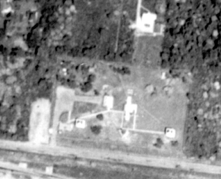
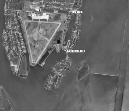
A typical Nike air defense site consisted of two separate parcels of land. One area was known as the Integrated Fire Control (IFC) Area. This site contained the Nike system's ground-based radar and computer systems designed to detect and track hostile aircraft, and to guide the missiles to their targets.
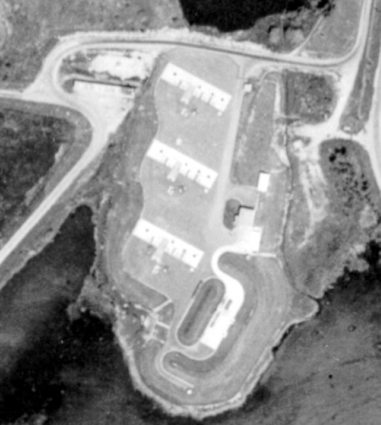
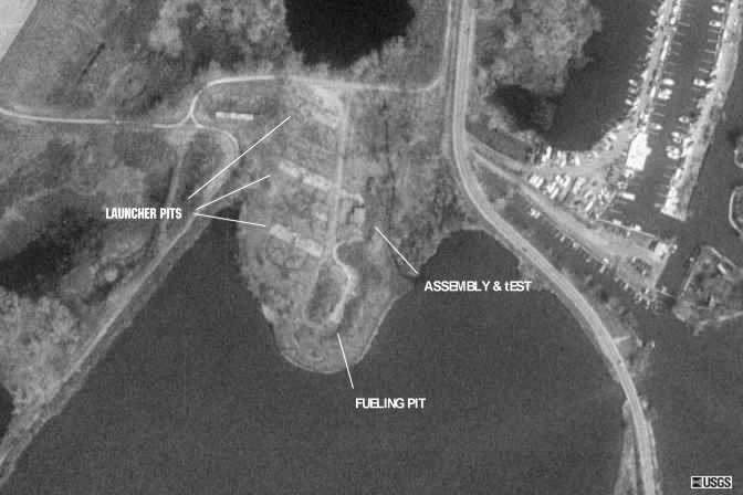
The second parcel of land was known as the Launcher Area. At the launcher area, Nike missiles were stored horizontally within heavily constructed underground missile magazines. A large, missile elevator brought the Nikes to the surface of the site where they would be pushed across twin steel rails to one of four satellite launchers.
Elaboration on how Nike worked here.
Missile Type: Ajax
The Nike Ajax was the first in the Army's family of guided missiles, and the world's first operational, guided, surface-to-air missile system. Nike Ajax had a burnout speed of Mach 2.3, a range of 25-30 miles, and a ceiling of 65,000 feet.
Designed to carry either nuclear and/or high-explosive warheads, the Nike Hercules missile could attack supersonic aircraft operating at altitudes in excess of 150,000 feet and at a range of more than 87 miles.
Battery Type: single
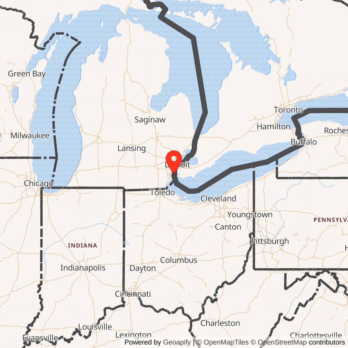
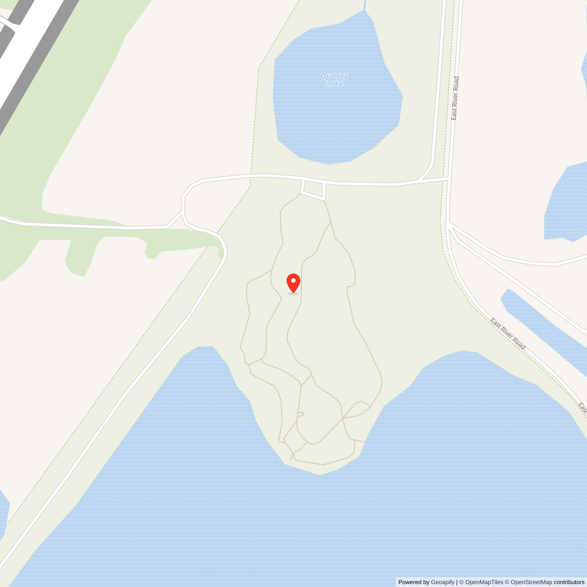
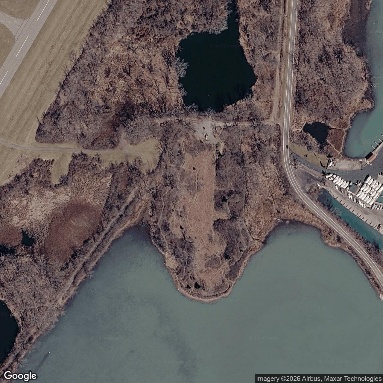
At the south end of Grosse Ile, one of the Detroit Defense Area's earliest Nike batteries occupied the edge of a naval air station and faced the lower Detroit River. Today, the launch compound is gone. Grassland, shoreline plants, birds, and fish habitat cover its former footprint, and visitors can walk through the Gibraltar Bay Unit of the Detroit River International Wildlife Refuge. The former fire-control ground followed a different course inside the airport and commerce-park landscape. D-51 is therefore more than the story of an Ajax battery. It is also an unusually well-documented example of a military property divided after closure, with one half absorbed into civilian aviation and business use and the other deliberately restored as public wildlife habitat.
Nike Site D-51 stood on southern Grosse Ile in Wayne County, Michigan. Grosse Ile is a long island in the Detroit River, downstream from central Detroit and close to the river's outlet into Lake Erie. During the Cold War, the island's airfield was Naval Air Station Grosse Ile. It later became Grosse Ile Municipal Airport and the surrounding Grosse Ile Commerce Park.
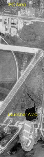
The Army divided D-51 into the two functional properties typical of a Nike battery. The Integrated Fire Control area, or IFC, was on the north side of Groh Road near the eastern side of the airfield. The launcher was roughly a mile to the south, on the southeast side of the airport beside Gibraltar Bay and near the former naval seaplane facilities. The separation protected the control crews and radars from a missile accident while keeping the two areas close enough for dedicated communications and routine movement between them.
This setting gave D-51 a clear tactical purpose. Aircraft approaching the Detroit industrial region from the south or southeast could cross Lake Erie and the lower Detroit River. From Grosse Ile, the Army could place acquisition and tracking radar in a relatively open airfield environment and position missiles close to the river corridor. D-51 did not defend only the island or the naval station. It was one component of a ring intended to protect Detroit's population, factories, transportation network, and military facilities from Soviet bomber attack.
From Naval Air Station to Nike Battery
The military landscape existed before Nike. The Navy acquired land on Grosse Ile between 1929 and 1942 and developed a major air station with runways, hangars, support buildings, and seaplane facilities. During the Second World War, the station supported aircraft, seaplane, blimp, and Coast Guard rescue activities. Its runways and open approaches remained useful in the postwar period.In 1954, the Navy transferred approximately fifty-two acres to the Army so it could establish D-51. A former federal property description later characterized the Nike portion as about forty acres with three missile-storage structures and five buildings, within a much larger former air-station property. The difference between the acreage figures reflects the transferred parcel and the smaller launch or project area rather than two competing descriptions of one boundary.
The choice illustrates how the Army fitted Nike into existing federal land. Using part of an operating air station reduced some acquisition and access problems, but it also required cooperation with the Navy. Soldiers, missiles, fuel, maintenance vehicles, and security operations had to coexist with aviation activity. The IFC and launcher were Army installations within a wider naval property, not Navy-operated missile sites.
D-51 became active in January 1955. It was an early Nike Ajax battery, entering service while the Detroit Defense Area was still building out its first generation of permanent sites. The specialized D-51 history identifies Battery C, 85th Antiaircraft Artillery Missile Battalion as the operating organization from January 1955 to September 1958. It then lists Battery A, 2nd Missile Battalion, 517th Artillery from September 1958 through the site's February 1963 closure. The September 1958 change reflects the Army's Combat Arms Regimental System redesignations and reorganization, not a physical relocation of the battery.
Physical Layout
The IFC was the battery's sensing and computing center. It included an operations building, electrical and communications support, acquisition radar, target- and missile-tracking radars, and the towers or mounts that gave tracking equipment the necessary lines of sight. The specialized site record identifies the acquisition radar as LOPAR. Historic aerials show the compound on the airfield's eastern side, enclosed and distinct from the launch area to the south.The launcher was the guarded missile-handling and firing property. Site-specific evidence identifies three underground storage magazines, one B type and two C types. Each magazine used an elevator to raise missiles from protected storage to the surface. Crews then moved missiles along rails or handling paths to launchers, prepared them, and elevated them only when required by the alert state or an exercise.
The launch compound also required missile assembly and maintenance space, fueling and servicing areas appropriate to liquid-fueled Ajax, generators, communications, ready facilities, security controls, and internal roads. Its location beside the old seaplane base and Gibraltar Bay placed it near water and wetland, but the missiles themselves remained in a controlled Army compound rather than on an open shoreline.
The 1961 site imagery is especially valuable because it shows D-51 late in its operating life. Separate views document the complete installation, the launcher, and the IFC. Later photographs and aerial images show the same properties during civilian reuse and demolition. Taken together, they provide a stronger physical record than the compressed national inventory line alone.
Site Configuration
D-51 was an Ajax-only battery: Nike 1B,2C/30A/12L-AThis means one B-type underground magazine and two C-type underground magazines, an allowance of thirty Nike Ajax missiles, and twelve Ajax launchers. The final A indicates Ajax rather than Hercules equipment.
How the Ajax System Worked
Nike Ajax was a command-guided antiaircraft missile. The battery did not launch a missile that independently found its target. Radar crews and an analog computer on the ground remained part of the engagement from detection through intercept.The acquisition radar searched for aircraft and helped the crew bring a designated target into the IFC's tracking system. The target-tracking radar then followed the aircraft. After launch, the missile-tracking radar followed a beacon response associated with the missile. The analog computer continuously compared target and missile positions, calculated a predicted intercept, and sent steering commands to the missile by radio. At the calculated point, the system transmitted the burst command.
This arrangement explains why the IFC and launcher could be separated. The radars and computer did not have to stand beside the magazines, but dependable communications between the two compounds were essential. If target data, missile status, launch orders, or guidance links failed, the battery could not perform its mission as designed.
Ajax used a solid-propellant booster to start the missile and a liquid-fueled sustainer for flight. The sustainer's propellants required careful handling, protective equipment, trained crews, and disciplined maintenance. The booster produced the initial acceleration needed to leave the launcher. After separation, ground-based guidance directed the missile toward the computed intercept. Multiple conventional fragmentation warheads were intended to create a lethal pattern against a bomber.
The Ajax system at D-51 was built to engage aircraft, not intercontinental ballistic missiles. Its presence represented one layer in a broader continental air-defense system that also included warning radars, fighter interceptors, command centers, communications networks, and other Nike batteries.
The People Who Operated D-51
Battery C of the 85th and Battery A of the 2nd Battalion, 517th Artillery were Regular Army organizations in the reviewed site history. No Michigan Army National Guard handoff is documented for D-51. The site's eight years of operation therefore differ from Detroit batteries that later passed to Guard control.The change of unit designation in September 1958 should not be read as a complete replacement of the installation or every person assigned to it on one day. Army reorganizations could change the administrative name, regimental affiliation, and chain of command while experienced crews continued to operate the same radars, computer, magazines, and launchers.
A Nike battery required far more people than the visible launch crew. Radar operators maintained acquisition and tracking contact. Computer personnel checked analog circuits and engagement solutions. Launcher crews inspected elevators, rails, erecting mechanisms, launchers, cables, and missiles. Missile specialists handled assembly, testing, propellants, and warheads according to strict procedures. Generator and electrical personnel prepared for commercial-power failure. Communications technicians maintained the link between the IFC and launcher and connected the battery to higher headquarters. Guards protected both compounds, while mechanics, medics, cooks, clerks, and leaders sustained continuous operations.
Daily Readiness Beside the Airfield
Most days at D-51 were defined by inspection, calibration, drill, and alert rather than launch. IFC crews checked radar alignment, tested the computer, verified communications, and practiced target acquisition and tracking. Launcher crews inspected missiles and mechanical equipment, maintained the magazines, tested elevators and launchers, and monitored propellant and electrical systems. Security and accountability procedures governed movement into both compounds.The adjacent naval airfield made coordination especially important. Radar operation and aircraft movement had to share a crowded electromagnetic and physical environment. Army vehicles used roads within or beside a naval installation. The launcher lay near former seaplane facilities and sensitive wetland terrain. Routine access, drainage, fire protection, and emergency planning therefore connected the battery to the larger station.
Exercises could run through most of the engagement sequence without firing a missile over Grosse Ile. A simulated warning would pass through the command system, the IFC would acquire and track a practice target, the computer would develop an intercept solution, and launcher crews would report readiness. Live qualification firings took place at designated ranges, not across metropolitan Detroit.
D-51 never fired at an enemy aircraft. That fact does not mean it was idle. Its deterrent value depended on maintaining a credible ability to engage bombers on short notice. The work was repetitive because the system had to function correctly during the one alert that might not be a drill.
D-51 in the Detroit Defense Area
D-51 was only one part of a dense defensive ring. Nearby batteries covered overlapping sectors around Detroit, Selfridge, industrial corridors, and the approaches from Canada and the Great Lakes. Overlap gave commanders alternatives if a battery was unavailable or if several aircraft approached at once.Early Nike defense depended heavily on voice communication, plotting, and manual target assignment. In 1960, Missile Master at Selfridge added automated data handling and displays for regional coordination. It helped the defense-area commander assign targets and reduce duplication. It did not replace D-51's local radars and computer. Once assigned a target, the Grosse Ile battery still had to acquire it, guide its own missile, and complete the engagement.
Grosse Ile's position made it a southern river battery rather than a central command site. Its role was to place an armed firing unit along an approach to Detroit. Administrative support, maintenance, warning, and target assignment linked it to the larger Army Air Defense Command system, but the decisive local work occurred in the IFC and launch compounds.
Why D-51 Closed
D-51 deactivated in February 1963. The closure came as the Army reduced the number of Ajax-only sites and concentrated the Detroit defense in batteries converted to Nike Hercules. Hercules offered greater range, altitude, and destructive power, allowing a smaller number of modernized sites to cover territory that had required a denser Ajax ring.Its three magazines and twelve Ajax launchers remained part of the first-generation system until the battery closed. The end of D-51 did not end Detroit's Nike defense. Hercules batteries elsewhere in the defense area continued for years.
The larger strategic problem was also changing. Nike was designed primarily to counter bomber attack. By the early 1960s, intercontinental ballistic missiles had become a central threat, one the existing local Nike network could not comprehensively stop. The United States still valued air defense, but it no longer needed every early Ajax position. D-51's location remained useful land, yet its exact missile configuration was no longer necessary to the reorganized defense.
Return to the Navy and Civilian Conversion
After closure, the Army returned the D-51 property to the Navy. Naval Air Station Grosse Ile itself was decommissioned in 1969. The airfield and much of the surrounding property passed into civilian use around 1970, becoming Grosse Ile Municipal Airport and the Grosse Ile Commerce Park.The current airport and commerce-park landscape preserves the aviation function without preserving the air station as a complete military installation. Historic hangars and buildings remain elsewhere on the former station, while businesses and civilian aircraft use the property. This broader reuse is important when describing D-51, but it does not establish that any particular Nike feature survives.
The two Nike components then followed separate ownership and reuse paths. The IFC became Township property in the airport or commerce-park area. The launch tract moved from the Navy to the U.S. Environmental Protection Agency in 1972 and ultimately to the U.S. Fish and Wildlife Service. A single shorthand condition such as former defense site cannot describe both properties accurately.
The IFC After Nike
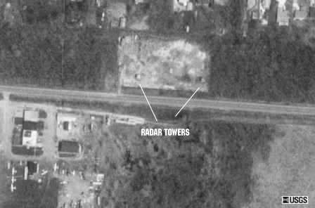
Historic post-closure accounts report that the Township-owned IFC was leased for use by a landscaping company. Photographs show two former tracking-radar towers or tower bases standing along the old compound boundary. The site history says those towers remained until fall 1998, when they were removed. A 1999 observer report similarly described their recent disappearance and noted that parts of the original fence and main-gate area still appeared legible while landscape-storage use continued.Those observations establish the late-twentieth-century condition, not the exact present condition. No current parcel-level survey or official inventory was located that confirms which fence lines, foundations, utilities, or buildings remain.
The wider former air station is currently occupied by the municipal airport and commerce park and is nonresidential. In May 2026, the U.S. Army Corps of Engineers published a current Formerly Used Defense Sites page for former NAS Grosse Ile, identified as FUDS E05MI0123. It states that the Department of Defense and Michigan's environmental agency are assessing potential environmental issues associated with former defense activities. That project covers the broader former naval air-station property. It should not be interpreted as proof of a specific unresolved hazard at the old IFC, nor should it be confused with the completed risk work that supported transfer of the former launch parcel to the wildlife refuge.
The Launcher Becomes a Nature Area
The launch area changed more dramatically. In 1972, the Navy transferred the property to the Environmental Protection Agency for wetland research and stewardship. Local conservation accounts describe approximately six acres of pavement, large steel magazine doors, and three underground storage structures still visible in 1990. Their language about the vaults should not be read to mean armed missiles remained underground. The site's missiles and military equipment had been removed after deactivation; the account is most useful as evidence for the three-magazine physical layout and the scale of the remaining concrete.Removal and restoration occurred in phases. Local accounts say the doors were removed and concrete was hauled away beginning in 1990. An Army Corps history says road and building demolition began in 1991 and was completed in 1993. The Fish and Wildlife Service describes site cleanup as complete in 1998, followed by restoration to grassland habitat. These dates are compatible if demolition began in the early 1990s and the larger cleanup and restoration process continued through 1998.
In 1993, the Environmental Protection Agency granted local stewardship responsibilities to the Grosse Ile Nature and Land Conservancy. The conservancy and public agencies protected the parcel while environmental studies continued. Shoreline habitat work in the mid-2000s introduced native plants and improved the ecological edge of Gibraltar Bay.
The U.S. Fish and Wildlife Service completed preliminary acquisition surveys before taking ownership in January 2008. The Corps completed an ecological risk assessment that year for two areas of concern associated with the former missile site. According to the Army's 2010 account, the assessment found no unacceptable ecological risk and supported transfer without environmental liability to the refuge. A dedication on October 23, 2010 marked the Gibraltar Bay Unit's addition to the Detroit River International Wildlife Refuge.
Current Condition and Public Access
The former launcher is now the 40.53-acre Gibraltar Bay Unit of the Detroit River International Wildlife Refuge. The Fish and Wildlife Service says the embankment protecting Gibraltar Bay remains and continues to protect the former launch area. Grassland, forest edge, shoreline vegetation, wetland, and open-water habitat have replaced the paved missile compound.The bay supports aquatic plants and habitat for fish, while the uplands provide stopover and feeding areas for birds. The Army's transfer history describes the property as supporting wetlands, meadow, prairie, and upland habitat and records extensive wildlife use. This ecological value is not incidental to the site's afterlife. It is the reason the former launcher was preserved in federal ownership.
The unit is open year-round for self-guided exploration. The easy, roughly one-third-mile Bayview Trail leads from the visitor area through forest to views of Gibraltar Bay. Visitors should expect a wildlife refuge, not an intact missile museum. The magazines, launcher buildings, roads, and radar equipment are gone. The surviving embankment and the shape of the restored open ground are the main physical clues, and historic aerials are essential for understanding the former military layout.
The adjacent Airport Natural Area is Township-owned and linked by pedestrian access. It adds trails and habitat to the setting but should not be confused with the federally owned Gibraltar Bay Unit or with the former IFC on the north side of Groh Road.
The Gibraltar Bay Unit's completed launcher-area risk assessment also does not close every question about the broader former NAS. The current Corps project continues to assess potential issues associated with the larger defense property.
What Remains and What Has Been Lost
At the launcher, no above-ground Nike building, magazine door, rail system, or launcher is documented as surviving. Demolition and restoration removed the operational plant. The bay embankment remains, and the restored field retains a landscape relationship to the old compound, but visitors need maps and photographs to see the Cold War site in the present refuge.At the IFC, the two radar towers visible into the 1990s were removed in fall 1998. Historical photographs preserve their appearance and placement. Fence or gate traces were reported in 1999, but their present survival has not been verified. Current airport and commerce-park descriptions confirm the surrounding land use, not the condition of every D-51 foundation.
Archival research can recover more of what demolition erased. The National Archives at Chicago lists a D-51 Grosse Ile property file in Record Group 291, accession 66A102, Box 15. That file is a promising source for acquisition, disposal, buildings, and property boundaries. As-built plans, unit records, morning reports, maintenance logs, and environmental administrative records may further refine the history.
Chronology
- 1929 to 1942 The Navy acquires land on Grosse Ile and develops the naval air station. The station later supports aircraft, seaplane, blimp, and rescue activity during the Second World War.
- 1954 Approximately fifty-two acres of Naval Air Station Grosse Ile are transferred to the Army for Nike Site D-51. The Nike project includes a roughly fort-acre launch area with three missile-storage structures and supporting buildings.
- January 1955 D-51 becomes active as a Nike Ajax battery. The specialized site history assigns Battery C, 85th Antiaircraft Artillery Missile Battalion
- 1955 to 1957 Melvin F. Smith serves as a launcher crewman at D-51, according to the site's identified personnel list.
- September 1958 The specialized unit chronology changes to Battery A, 2nd Missile Battalion, 517th Artillery as Army air-defense units are reorganized.
- 1960 Missile Master becomes operational at Selfridge, adding automated regional target coordination to the Detroit Defense Area while local batteries retain their own engagement radars and computers.
- 1961 Site-specific aerial photographs document the D-51 IFC, launcher, and their relationship to the Grosse Ile airfield.
- February 1963 D-51 deactivates without a documented Hercules conversion. The Army returns the property to the Navy.
- 1969 Naval Air Station Grosse Ile is decommissioned.
- Around 1970 The airfield and much of the former station transfer into civilian use as Grosse Ile Municipal Airport and the Grosse Ile Commerce Park.
- 1972 The Navy transfers the former D-51 launch property to the U.S. Environmental Protection Agency for wetland research and stewardship.
- 1990 Local conservation accounts document pavement, large steel doors, and three underground magazine structures at the former launcher. Door and concrete removal begins.
- 1991 to 1993 The U.S. Army Corps of Engineers carries out road and building demolition at the launch property.
- 1993 The Environmental Protection Agency grants stewardship of the nature area to the Grosse Ile Nature and Land Conservancy. Aerial imagery documents the former IFC and launch properties during the transition period.
- Fall 1998 The remaining D-51 tracking-radar towers at the IFC are removed. The Fish and Wildlife Service dates completion of launch-site cleanup to 1998, after which the property is restored to grassland habitat.
- 1999 An observer report describes the IFC's landscape-storage reuse, recently removed towers, and apparent gate or fence traces. Present survival of those traces has not been verified.
- Mid-2000s A shoreline habitat project introduces native plants at Gibraltar Bay.
- January 2008 The U.S. Fish and Wildlife Service takes ownership of the former launch parcel after preliminary acquisition surveys.
- 2008 The Corps completes an ecological risk assessment for two areas of concern at the former Nike launch property and reports no unacceptable ecological risk for the transfer.
- October 23, 2010 A dedication marks the 40.53-acre Gibraltar Bay Unit's addition to the Detroit River International Wildlife Refuge.
- 2023 Access improvements connect the adjacent Township-owned Airport Natural Area for pedestrian and bicycle use.
- May 19, 2026 The Army Corps publishes a current project page for former NAS Grosse Ile, FUDS E05MI0123, stating that the Department of Defense and Michigan environmental agency are assessing potential issues associated with past defense activities across the broader property.
- Present Grosse Ile Municipal Airport and Commerce Park occupy the wider former air-station landscape. The former launcher is federally owned refuge habitat open for self-guided exploration. The former IFC is Township property; its two radar towers are gone and current survival of lesser Nike features is unverified.
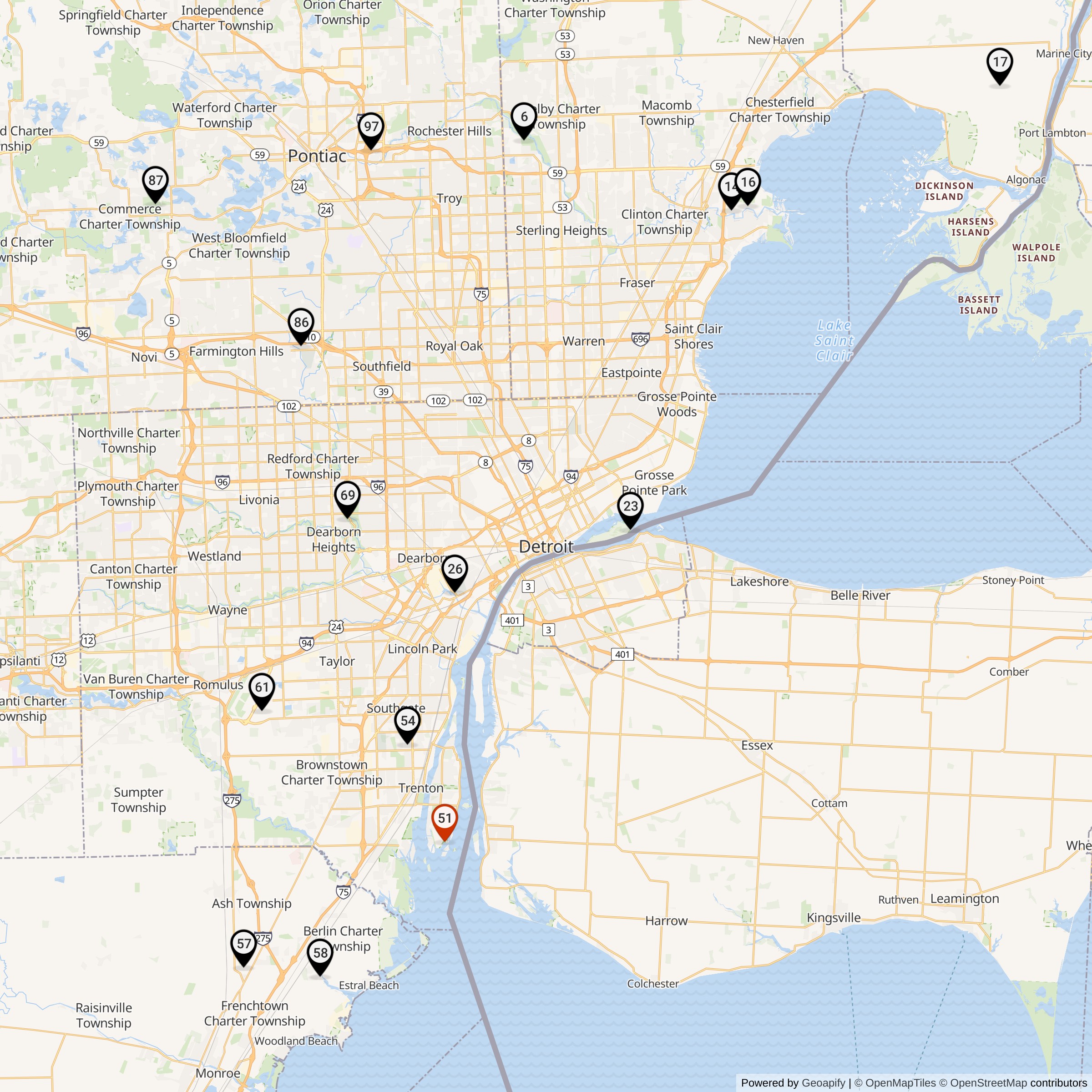
List of all Nike Installations in Michigan
Sources & References
- PDF Defend and Deter: The Legacy of the United States Cold War Missile Program Source for the Detroit Defense Area, the compressed D-51 inventory code, February 1963 closure, Army branch, and former-defense-site condition shorthand.
- WEB U.S. Fish and Wildlife Service, Detroit River International Wildlife Refuge Current federal source for the Gibraltar Bay Unit's D-51 identity.
- WEB U.S. Army Corps of Engineers Louisville District, Corps project added to international wildlife refuge, November 15, 2010 Source for the 1954 Army transfer, 1963 return to the Navy, 1972 EPA transfer, 1991 to 1993 demolition, 2008 Fish and Wildlife Service ownership.
- WEB U.S. Army Corps of Engineers, Great Lakes and Ohio River Division, NAS Grosse Ile, published May 19, 2026 Current official source for FUDS E05MI0123, the municipal airport and commerce-park use.
- WEB Grosse Ile Nature and Land Conservancy, Our Protected Lands Local source for 1990 launcher conditions and removal work.
- WEB Grosse Ile Municipal Airport and Commerce Park, Commerce Park Current Township source for the civilian airport and business-park setting and present commerce-park activity.
- WEB National Archives at Chicago, Nike Missile Sites finding aid Identifies the D-51 Grosse Ile property file in Record Group 291, accession 66A102, Box 15.
- WEB Ed Thelen, Locations of Former Nike Missile Sites in Michigan Secondary compilation and observer evidence for the D-51 component locations, post-service IFC observations, radar-tower removal, and launcher nature-area reuse.