
Bullen Point DEW Line Station / Bullen Point Short Range Radar Site, Alaska
On the Beaufort Sea coast, POW-3 preserved an early DEW Line station design and later hosted a smaller North Warning System radar.
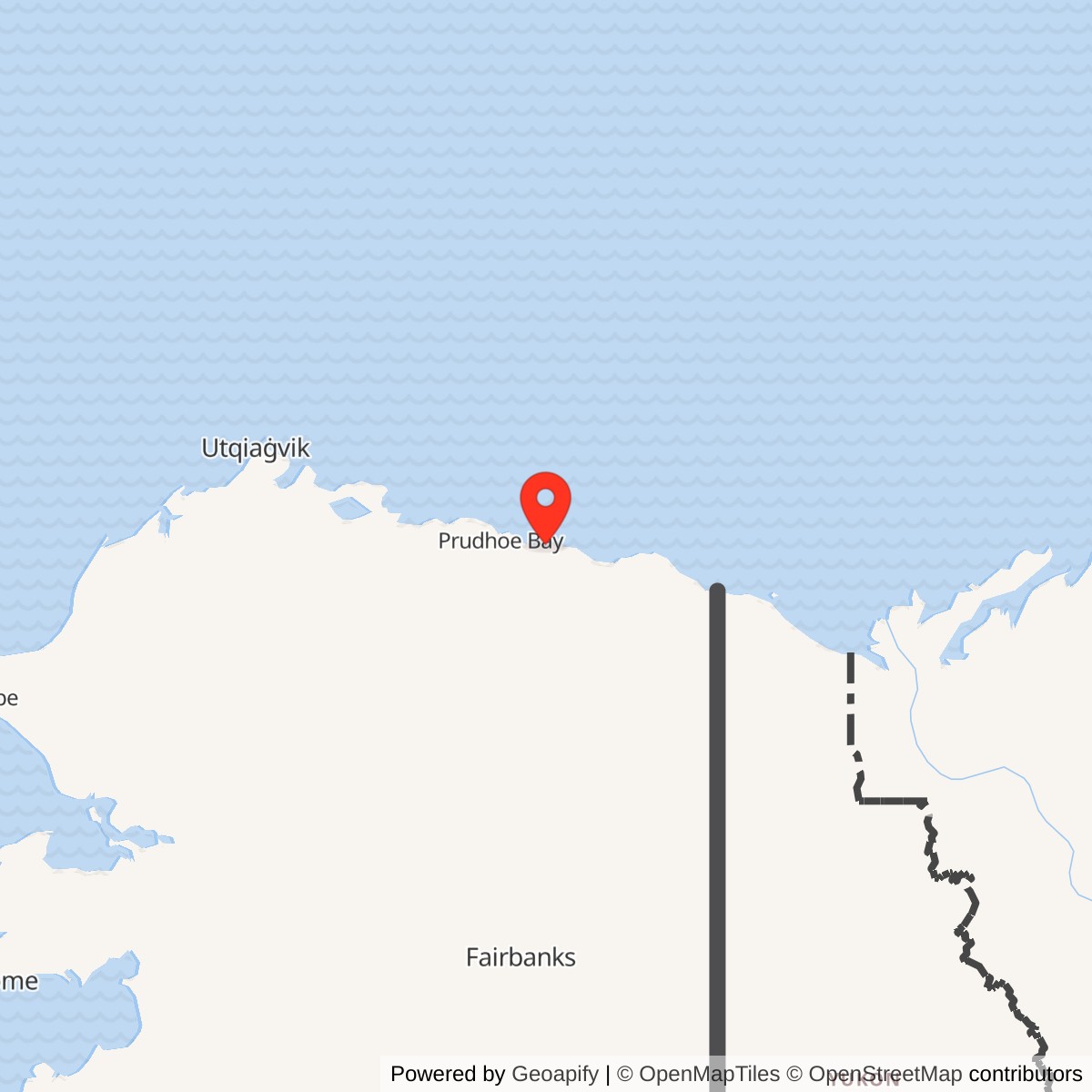
Longitude: -146.854718
Site Number: POW-3 / A-20
Current Role: Former DEW Line and North Warning System radar station
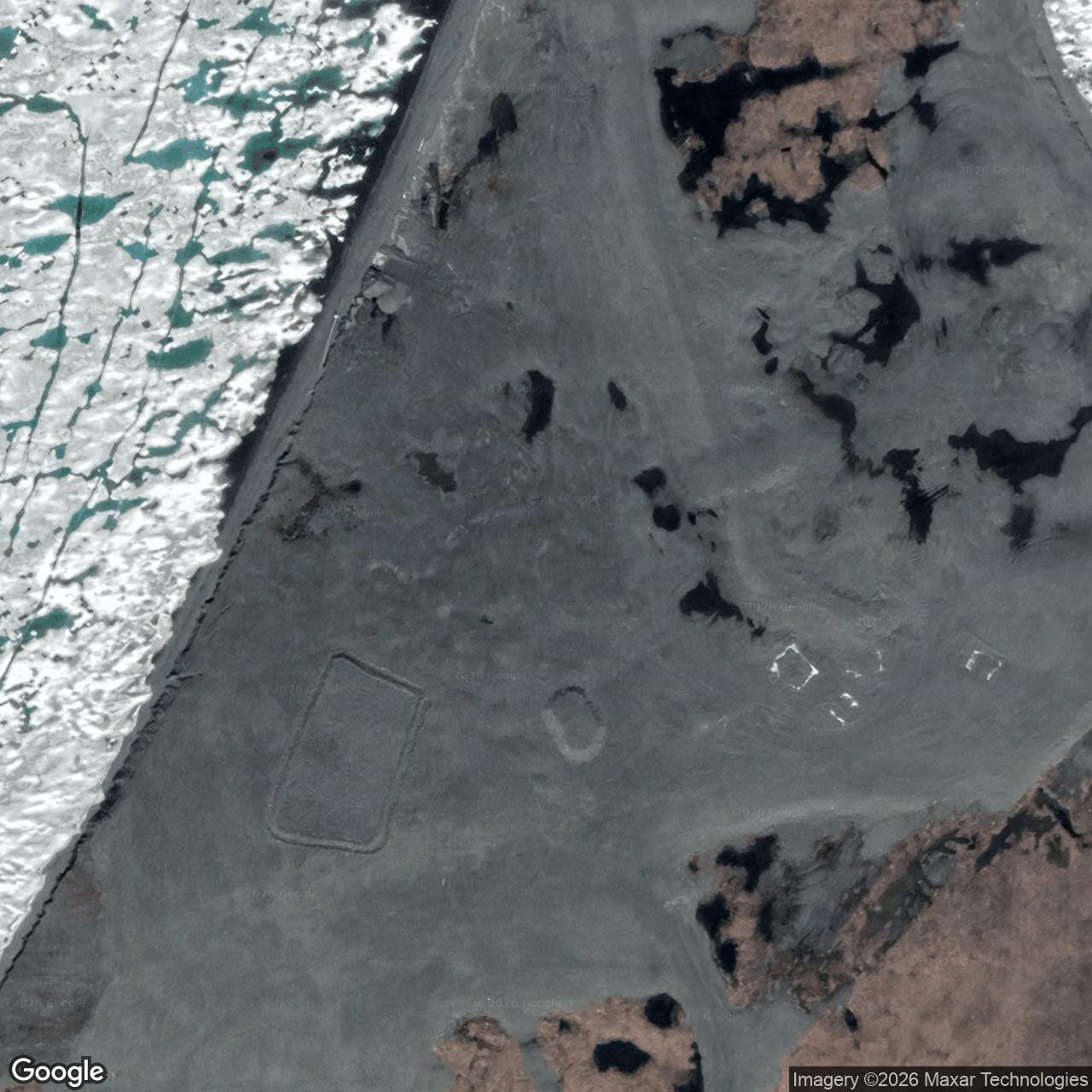
Bullen Point was an auxiliary station of the Distant Early Warning Line, built on the Alaska mainland opposite Flaxman Island. Air Force records also called the station Flaxman Island. The site entered the Arctic warning network in August 1957 as POW-3 and ended its original staffed DEW mission in 1971-72. A smaller radar was installed in 1994, reached operational capability in 1995, and closed in 2007. [1] [3] [9]
- DEW Line designation
- POW-3; also called Flaxman Island.
- Later designation
- North Warning System short-range radar site A-20.
- Original radar
- AN/FPS-19 search radar; AN/FPS-23 gap coverage in the sector.
- Later radar
- AN/FPS-124 unattended short-range radar.
- Original DEW service
- August 1957 to 1971-72.
- Later radar service
- Installed 1994; operational capability 1995; closed 2007.
- Location
- Bullen Point, Alaska mainland, east of Flaxman Island.
An Early DEW Line Design
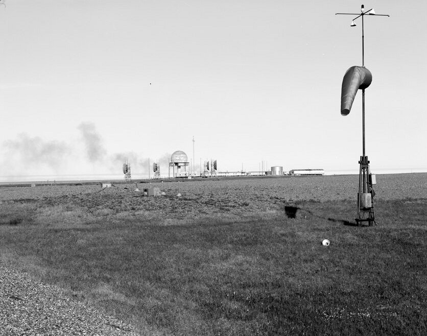
Construction crews reached Bullen Point during the 1953 building season, and the station was built in 1954. The low, marshy site faces Flaxman Island across the coastal water. The station occupied about 620 acres, with its airstrip on ground slightly higher than the module train. A separate staging area at Griffin Point held materials before barges brought them to Bullen Point. [1] [5]
POW-3 was among the first Alaska DEW stations built to the Air Force's original site plan. Once crews began using these early buildings, the Air Force found that the module arrangement and some construction materials worked poorly in Arctic conditions. Later stations used revised designs. Because Bullen Point left staffed service early, its original arrangement survived long enough to be photographed and studied in detail. [1] [2]
The Buildings at POW-3
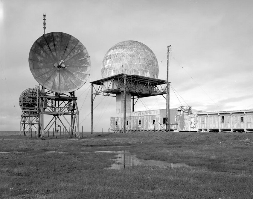
The station was a connected complex of prefabricated buildings and enclosed corridors. Its raised radome and antennas marked the radar work area, while separate spaces held generators, electrical equipment, heating and water systems, stores, and living quarters. The 1992 federal survey recorded eleven numbered buildings along with fuel tanks and pump houses. [1] [2]
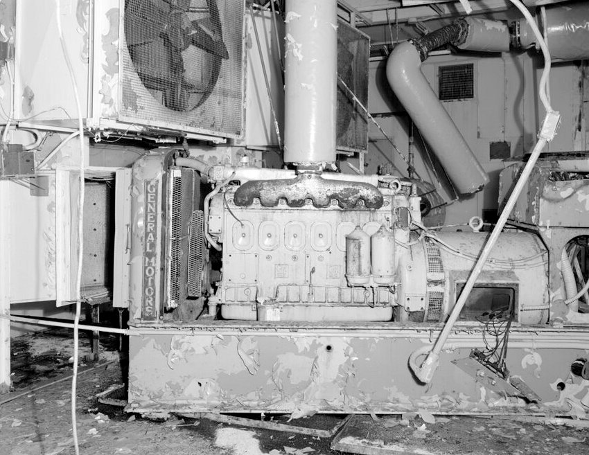
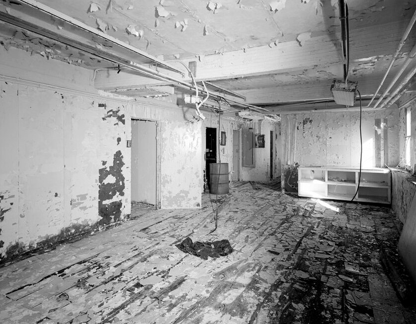
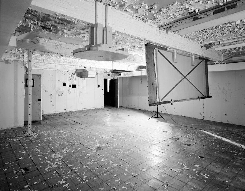
Building 2 contained generators, batteries, ventilation equipment, and fire-suppression tanks. Building 3 held a master electrical panel and another generator. Building 5 contained the kitchen, dining room, laundry, and rooms identified in the survey as a bar, music room, and game room. Building 6 held a freezer, refrigerator, movie room, and projection room. Building 7 included bedrooms and washrooms. The survey also identified a water pump house at Building 9, the radar dome and office at Building 10, and warehouse and heating spaces at Building 11. [2]
The Crew and Daily Life
Although the Air Force directed the warning mission, civilian contractors operated the DEW Line day to day. Veteran accounts put a typical early auxiliary-station crew at about 20 to 25 people. A station chief coordinated radar technicians, mechanics, cooks, and support workers. At Bullen Point, bedrooms and communal rooms were connected to the technical buildings by enclosed corridors. [2] [6]
Radar watches continued through Arctic winter darkness and the summer shipping season. Crew members lived close to the equipment they maintained. Dining, movies, music, games, and the small bar gave them places to gather after their shifts. The surviving dining and movie rooms illustrate how much of a remote station's floor area served daily life as well as radar operations. [2] [6] [7]
Aircraft brought people, mail, and fresh food when weather allowed. Dry stores and heavy equipment arrived during the brief summer marine supply window. Delay was a routine part of life on the line: a missed flight could postpone mail, replacement parts, or a crew change for days. [7]
Water, Fuel, and Supply
Bullen Point's water system was a major part of keeping the station open. During summer, crews hauled water on a roughly three-mile round trip and filled a 250,000-gallon steel tank beside the module train. Hot water circulated from a large boiler to keep the tank from freezing. Fuel tanks, a pump house, and the nearby airstrip supported continuous operation through storms and long periods between deliveries. [2] [5]
Radar and Communications
POW-3 was the easternmost auxiliary station of the Point Barrow sector, beyond Oliktok Point POW-2 and before Barter Island BAR-Main. Its AN/FPS-19 search radar watched the northern approach. The sector also used AN/FPS-23 equipment to fill low-altitude gaps; that system ended in the Point Barrow sector in July 1963. Reports from the coastal stations moved through the DEW communications network toward air-defense command centers. [1] [8]
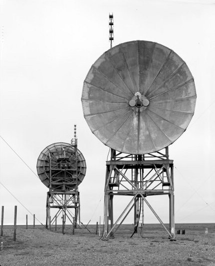
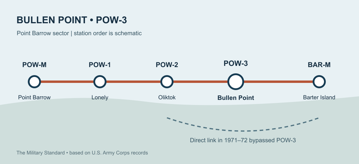
The original POW-3 station closed in 1971-72 as a direct troposcatter communications link between Oliktok Point and Barter Island replaced the route through Bullen Point. A veteran who worked in the sector recalls the link upgrade in 1971 and operation by 1972. The Coast Guard later used a tall tower at the former station for a navigation beacon, and the tower subsequently aided offshore vessels. [1] [5]
The Later Radar Site
During modernization of the northern warning network, the Air Force built an unattended short-range radar at Bullen Point. The new A-20 station used an AN/FPS-124. The radar was installed in 1994 and reached operational capability on June 15, 1995. It was a much smaller installation than the staffed DEW station. The U.S. Geological Survey dates its closure to 2007. [1] [3] [9] [10]
Federal and state projects subsequently removed structures and addressed contamination at the former station. [4]
Chronology
- 1953-1954: Construction begins at Bullen Point and the early-design auxiliary station takes shape. [1] [5]
- August 1957: POW-3 joins the operating DEW Line. [1]
- July 1963: The Point Barrow-sector AN/FPS-23 gap-filling system ends. [1]
- 1971-1972: The original staffed station closes as a direct Oliktok-Barter Island communications link comes into service. [1] [3] [5]
- August 1992: The Historic American Buildings Survey photographs the former station, its radar structure, equipment rooms, and living spaces. [2]
- 1994: The Air Force installs an AN/FPS-124 unattended short-range radar. [1] [9]
- June 15, 1995: The three Alaska AN/FPS-124 stations, including Bullen Point, achieve operational capability. [9]
- 2007: The short-range radar closes. [3]
Related Sites
- AN/FPS-124 radar histories
Information sources (10)
- WEB[1] U.S. Army Corps of Engineers, The Cold War in Alaska: A Management Plan for Cultural Resources, 1994, pp. 69, 187, 193-194, 198
https://www.poa.usace.army.mil/Portals/34/docs/civilworks/archive/TheColdWarInAlaskaAManagementPlanForCulturalResourcesAug1994a.pdf
- WEB[2] Historic American Buildings Survey, POW-3 Distant Early Warning Line Station, HABS AK-201, index to photographs, August 1992
https://tile.loc.gov/storage-services/master/pnp/habshaer/ak/ak0400/ak0453/data/ak0453cap.pdf
- WEB[3] U.S. Geological Survey, National Assessment of Shoreline Change: Historical Shoreline Changes along the North Coast of Alaska, 2015, p. 38
https://pubs.usgs.gov/of/2015/1048/pdf/ofr2015-1048.pdf
- WEB[4] Alaska Department of Environmental Conservation, Bullen Point SRRS, hazard ID 4682
https://dec.alaska.gov/Applications/SPAR/PublicMVC/CSP/SiteReport/4682
- WEB[5] DEWLineAdventures, POW-3 historical description and Clive Beckmann's 2017 account
https://lswilson.dewlineadventures.com/pow3/
- WEB[6] Paul Kelley, DEW Line veteran, A Brief Introduction
https://lswilson.dewlineadventures.com/a-brief-introduction/
- WEB[7] Lynden T. Harris, DEWLine History
https://lswilson.dewlineadventures.com/dewhist-a/
- WEB[8] Aerospace Defense Command History Office, Historical Data of the Aerospace Defense Command, 1946-1973, 1973
https://www.governmentattic.org/NORAD-NORTHCOM/ADC%20Historical%20Data%201946-1973.pdf
- WEB[9] John H. Cloe, Top Cover and Global Engagement, Eleventh Air Force historical booklet, 2001, p. 21
https://www.frontiernet.net/~marshagantz/UTO/topcover.pdf
- WEB[10] Radomes, Bullen Point A-20 recent photographs and station equipment identification
https://www.radomes.org/museum/parsehtml.php?key=BullenPointAK.html&type=recent_html