
Donnelly Dome Radio Relay Station, Alaska
A White Alice microwave repeater on the Clear warning network, with a documented early satellite-program assignment.
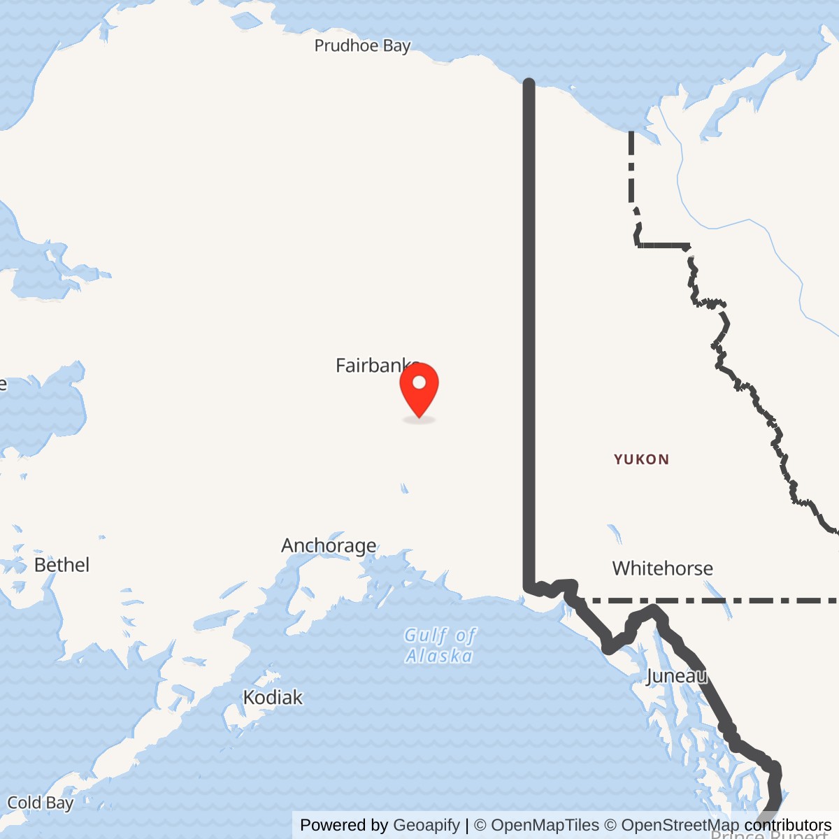
Longitude: -145.863611
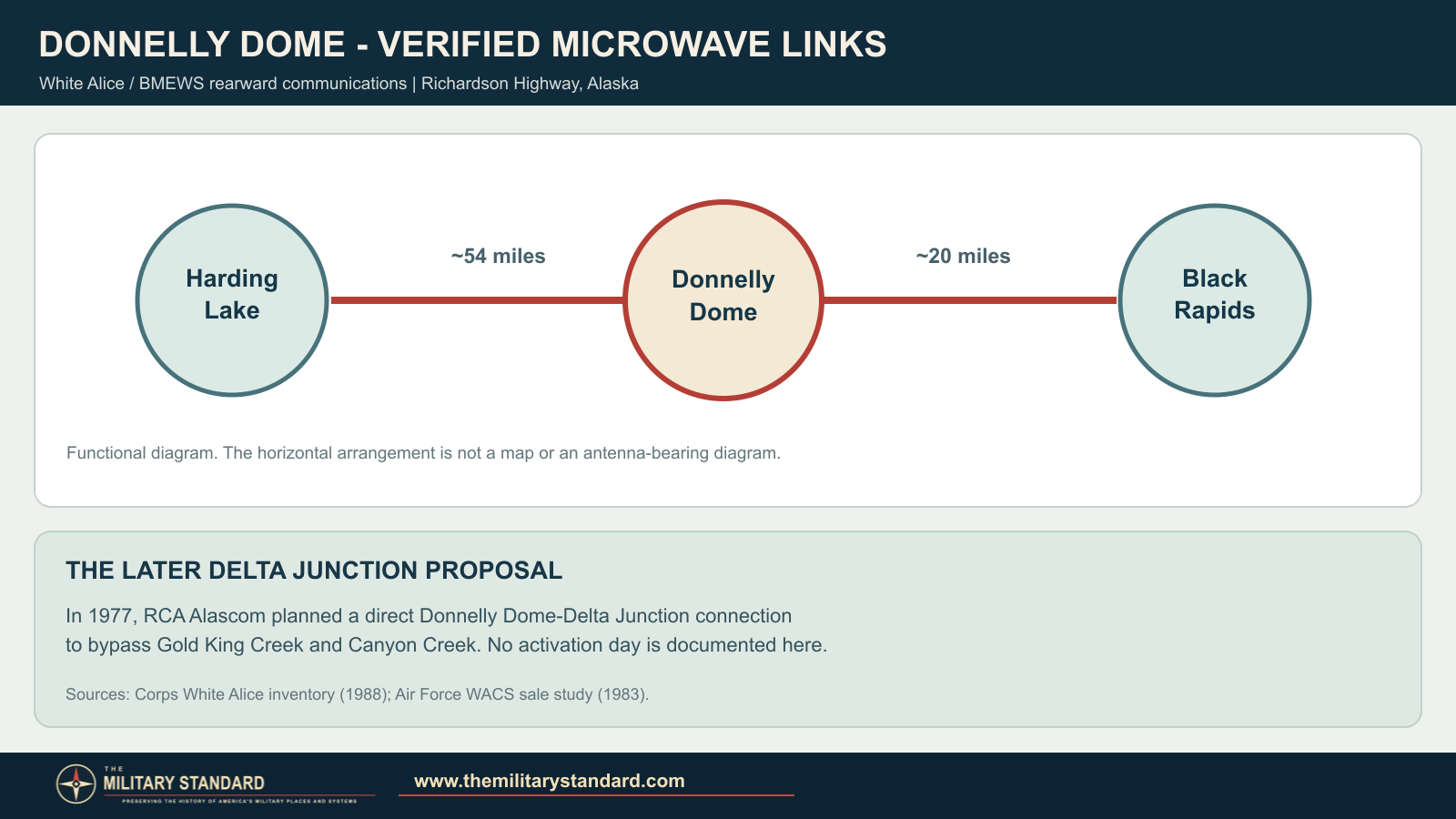
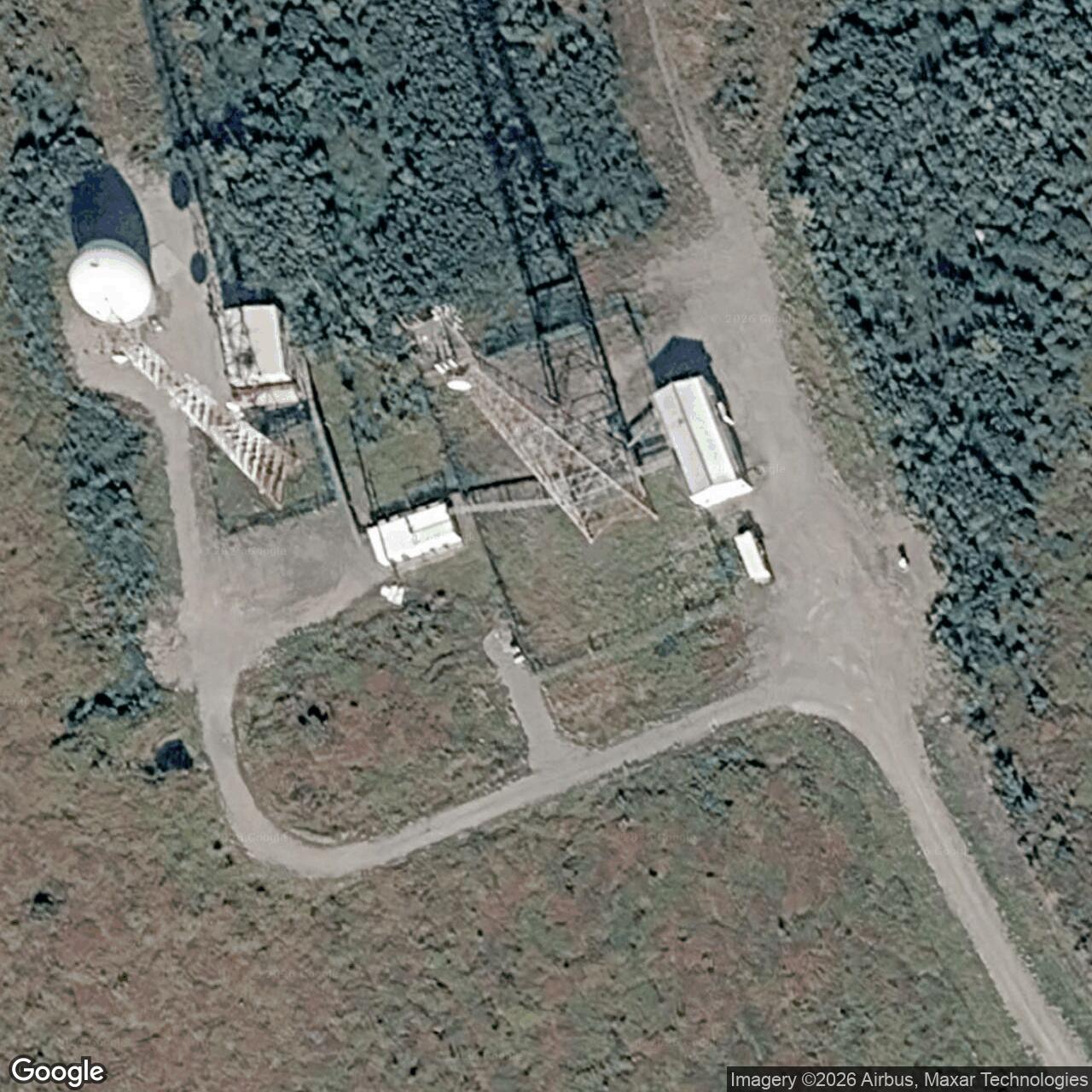
Donnelly Dome Radio Relay Station was a U.S. Air Force communications site south of Delta Junction, Alaska. Its White Alice TD-2 microwave link joined Harding Lake and Black Rapids on the rearward communications network serving Clear's ballistic-missile-warning mission. The station also hosted an Air Force aerospace-test-wing detachment beginning in 1962. [1] [2] [3]
- Military role
- White Alice/BMEWS rearward communications.
- Radio system
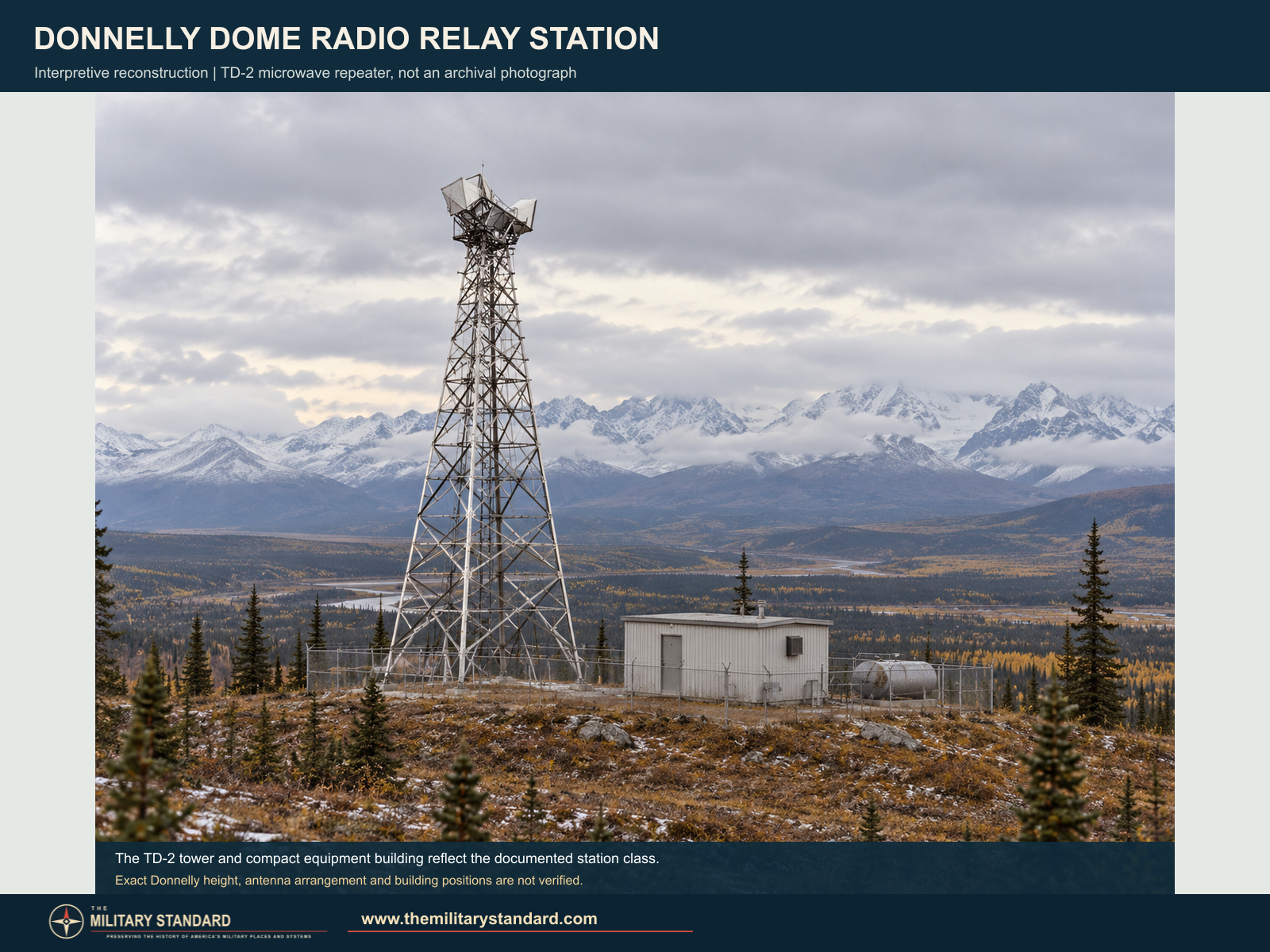
- TD-2 line-of-sight microwave repeater, not a billboard-reflector troposcatter station.
- Direct route neighbors
- Harding Lake, about 54 miles; Black Rapids, about 20 miles.
- Additional assignment
- Detachment 1, 6594th Aerospace Test Wing, from April 15, 1962.
- Approximate location
- 63.787222, -145.861667. A published 1974 radio-license point, not a surveyed property boundary.
Military Construction and Mission
The Air Force expanded the White Alice Communications System in 1960-1961 to provide rearward communications for the Ballistic Missile Early Warning System (BMEWS) installation at Clear. Donnelly Dome was a TD-2 line-of-sight microwave repeater on that network. It did not use the large billboard-shaped troposcatter reflectors found at many other White Alice sites. A Corps inventory identifies Harding Lake and Black Rapids as its adjoining radio stations, approximately 54 and 20 miles away. A later Air Force study calls Donnelly an unattended two-way repeater between those stations. [1] [2]
The station stood near the Richardson Highway south of Delta Junction. A 1974 federal radio-license notice placed its White Alice site near highway mile 248 and published a point at 63 degrees 47 minutes 14 seconds north, 145 degrees 51 minutes 42 seconds west. This identifies the vicinity of the relay, not its surveyed property limits. [4]
An Additional Space-Program Assignment
An official Air Force history records that Detachment 1 of the 6594th Aerospace Test Wing joined the wing at Donnelly Radio Relay Site on April 15, 1962. This assignment gave the installation a place in the early Air Force satellite-support organization alongside its White Alice communications mission. [3]
Changing Routes and Civilian Use
RCA Alascom leased the White Alice system in 1976. Federal radio notices recorded microwave channel proposals between Donnelly, Harding Lake and Black Rapids. In 1977 RCA also planned a direct link from Donnelly Dome to Delta Junction, bypassing Gold King Creek and Canyon Creek. A later Corps route table listed Delta Junction among Donnelly's connections, while the Air Force's 1983 description still called Donnelly a two-way Harding Lake-Black Rapids repeater. [1] [2] [5]
The Air Force included Donnelly Dome in an appraisal of White Alice microwave property considered for sale. On June 17, 1982, the Army declined to concur in a proposed sale of Donnelly Dome and Black Rapids land to Alascom. Alaska's fuel-tank registry still lists an AT&T Donnelly Dome Microwave Repeater in 2026, indicating later named telecommunications use at the site. [2] [6]
The Site in the Historical Record
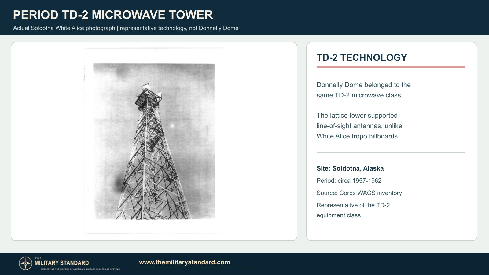
An Army cultural-resources report records a 1988 survey of the Donnelly Dome White Alice site. The University of Alaska Anchorage's William F. McDowell papers also catalog Air Force real-property photographs that include Donnelly Dome. The period photograph below shows a similar TD-2 tower at Soldotna, not Donnelly itself. [7] [8] [1]
Chronology
- 1960-1961 The BMEWS rearward-communications TD-2 network is constructed and opened, including Donnelly Dome.
- April 15, 1962 Detachment 1 of the 6594th Aerospace Test Wing joins the wing at Donnelly Radio Relay Site.
- May 17, 1974 A federal radio notice identifies the Donnelly White Alice site and its licensed location.
- 1976 RCA Alascom leases the White Alice system.
- December 27, 1976 A federal notice records microwave-channel proposals toward Harding Lake and Black Rapids.
- 1977 RCA plans a direct Donnelly Dome-Delta Junction bypass.
- June 17, 1982 The Army declines to concur in the proposed sale of Donnelly Dome White Alice land.
- 1988 An Army cultural-resources survey documents the Donnelly Dome White Alice site.
Information sources (8)
- PDF[1] Historical Overview and Inventory: White Alice Communications System, U.S. Army Corps of Engineers, 1988
Source for: BMEWS route, TD-2 repeater class, Harding Lake and Black Rapids links, and general 1960-1961 construction/activation period.
- PDF[2] A Special Study of the Sale of the White Alice Communications System, 1931st Communications Group / U.S. Air Force, October 1983
Source for: station description and milepost, 1976 lease, 1977 bypass plan, appraisal, and 1982 Army land-sale objection.
- PDF[3] Schriever Air Force Base: A History in Pictures, U.S. Air Force
Source for: Detachment 1 of the 6594th Aerospace Test Wing at Donnelly Radio Relay Site beginning April 15, 1962.
- PDF[4] Federal Register, May 17, 1974, radio applications
Source for: Donnelly Dome White Alice highway-mile and 63 degrees 47 minutes 14 seconds N, 145 degrees 51 minutes 42 seconds W license point.
- PDF[5] Federal Register, December 27, 1976, RCA Alascom microwave applications
Source for: proposed Donnelly Dome microwave frequencies and Harding Lake/Black Rapids directions.
- WEB[6] Underground Storage Tank Facilities with Proof of Financial Responsibility, Alaska Department of Environmental Conservation
Source for: 2026 listing of AT&T Donnelly Dome Microwave Repeater, facility 1695.
- PDF[7] Donnelly Training Area Cultural Resources Annual Report, U.S. Army Alaska, 2006
Source for: 1988 Reynolds survey of Donnelly Dome WACS as one archaeological site.
- WEB[8] William F. McDowell Papers finding aid, University of Alaska Anchorage Archives and Special Collections
Source for: cataloged real-property photographs including Donnelly Dome.