
Icy Cape DEW Line Intermediate Station, Alaska
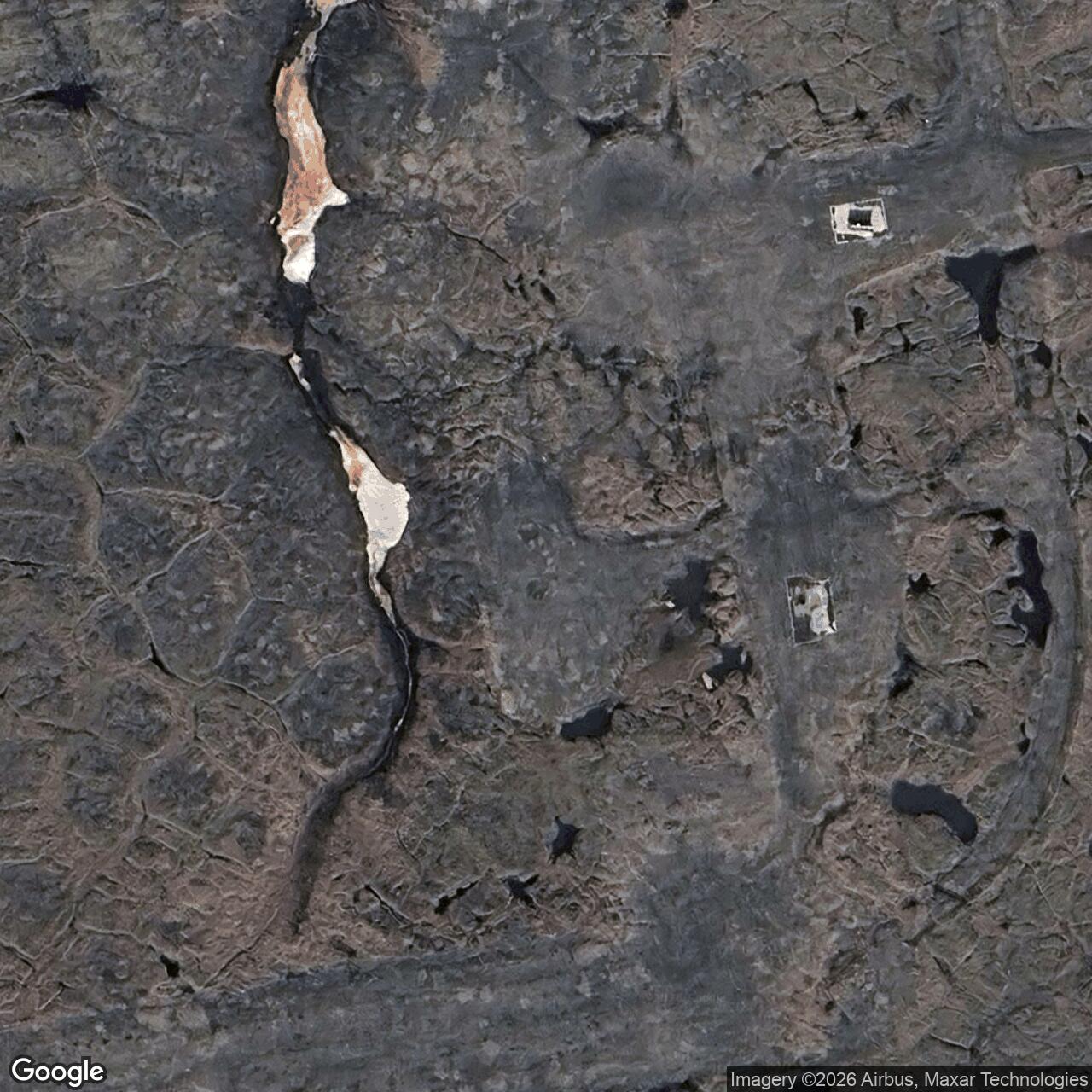
A tall radar tower, two gravel landing strips, and a handful of buildings formed a small link in the western Arctic warning line.
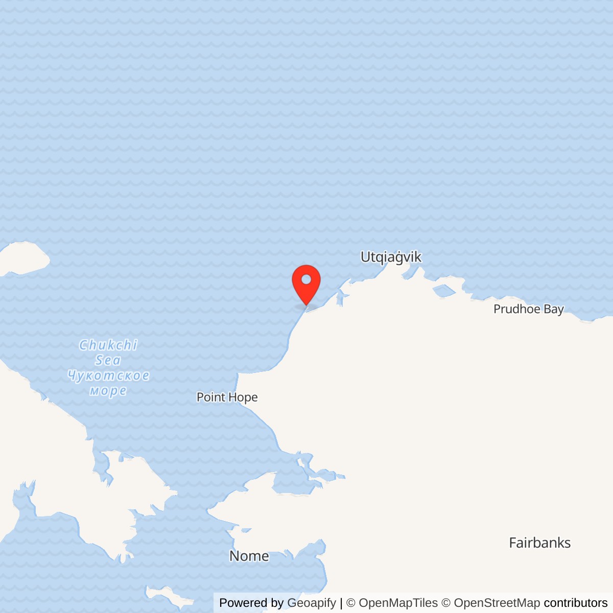
Longitude: -161.912279
Site Number: LIZ-B
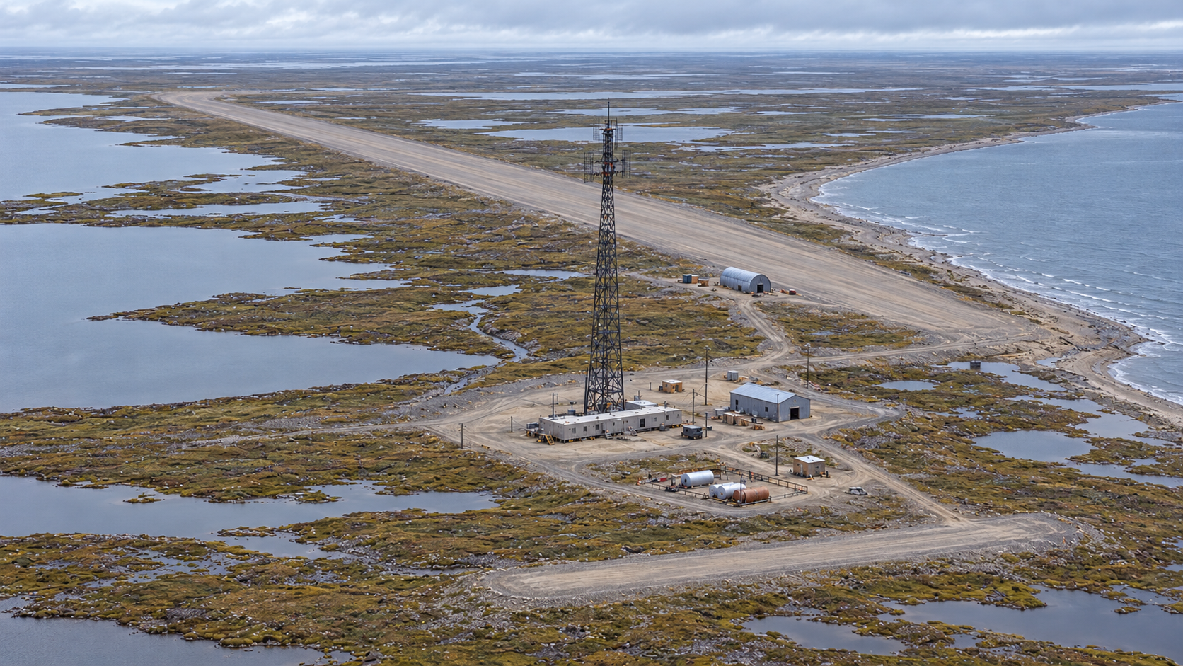
Icy Cape, code LIZ-B, was an intermediate station of the Distant Early Warning Line on Alaska's Chukchi Sea coast. The station's AN/FPS-23 equipment helped detect aircraft passing through the low-altitude gap between the larger radar stations at Point Lay and Wainwright. Icy Cape entered service in August 1957, and the Air Force ended its radar mission on July 21, 1963. [1] [2]
- DEW Line code
- LIZ-B.
- Station type
- Intermediate gap-filler station.
- Radar system
- AN/FPS-23 continuous-wave Doppler system.
- Air Force service
- August 1957 to July 21, 1963.
- Recorded tower
- 240 feet.
- Later use
- Naval Arctic Research Laboratory remote field camp; exact dates unconfirmed.
- Approximate location
- 70.287859, -161.912279.
A Gap in the Arctic Line
The western DEW Line extended along Alaska's northern coast with a sequence of main, auxiliary, and intermediate stations. Icy Cape sat east of Point Lay LIZ-2 and west of Wainwright LIZ-3. It was much smaller than either neighboring station: its job was to strengthen the radar fence between their broader search-radar coverage areas. The Air Force listed Icy Cape as an AN/FPS-23 intermediate site when the line opened. [1] [2] [5]
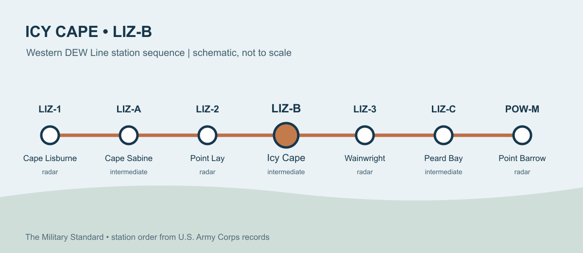
The site was built on raised sand and gravel pads in the low tundra near Kasegaluk Lagoon. The location stood roughly one mile north of the former settlement of Akeonik. Ice, weather, and the distance from roads made aircraft and fuel storage essential to even this small station. [1] [3] [4]
The Radar Mission
The AN/FPS-23 was a continuous-wave Doppler gap-filler known as Fluttar. Its intermediate-site transmitter sent a signal toward receivers at adjacent DEW stations. An aircraft crossing that signal changed what the receivers detected and could raise an alarm. Icy Cape therefore supplemented the long-range rotating search radars at Point Lay and Wainwright. It did not need the large search-radar radome seen at those larger stations. [2] [5] [6]
The Corps recorded a 240-foot tower at Icy Cape. Keeping the transmitter, receiving links, power supply, and communications in service was the station's daily military purpose. The alert was useful only when neighboring stations could receive and pass it into the wider warning system. [1] [2]
Buildings, Tower, and Runways
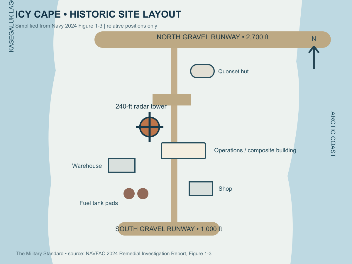
The Corps' field inventory recorded a 3,172-square-foot operations building, a steel shop, a steel warehouse, one Quonset hut, the tower, and a fuel pumping station. Navy records also describe a composite building, radar electrical equipment, fuel tank pads, and gravel roads linking the main buildings to the landing strips and nearby coast. These facilities kept the radar operating and gave a small crew places to work, sleep, store parts, maintain machinery, and handle fuel. [1] [3] [4]
Icy Cape had two gravel runways. The older south strip was about 1,000 feet long; the newer north strip was about 2,700 feet long. A Navy site plan places the north Quonset hut near the longer runway, with the former radar tower and composite building farther south. The short southern strip lay beyond the fuel pads and shop. Aircraft access mattered for personnel rotations, food, parts, and urgent repairs when sea access was difficult. [3] [4]
Working at Icy Cape
The Alaskan DEW Line's coastal segment was operated under civilian contract for the Air Force. A Defense Department history describes intermediate stations as small camps normally staffed by a station chief, a mechanic, and a cook. At such a camp, a technical fault, power problem, or delayed supply aircraft had an immediate effect on the few people keeping the radar fence in service. [7] [8]
Life at Icy Cape centered on the operations building and its nearby support structures, not a large base community. The crew had to keep equipment and generators running in darkness, storms, and extreme cold while depending on infrequent outside deliveries. The two strips and stored fuel made the remote assignment possible, but the small station remained exposed to weather and isolation. [1] [3] [7] [8]
Navy Research and the Former Site
The Air Force closed Icy Cape's radar mission on July 21, 1963. In August 1965, the former station parcels were transferred to the Navy. Navy histories identify subsequent use as a remote field camp of the Naval Arctic Research Laboratory at Point Barrow. The research-camp period is documented, although its precise start and end dates are not. The radar role was over by the time of the transfer. [1] [3] [9]
The station buildings, tanks, and tower were removed during a 1997 cleanup. The gravel strips, roads, and some foundations still mark the former installation. Alaska's environmental records distinguish the older site cleanup from later work on three landfills, which remained an active Navy cleanup case after a 2026 decision. [4] [10]
Chronology
- August 1957: Icy Cape LIZ-B enters service as an AN/FPS-23 intermediate DEW Line station. [1]
- 1959: A second federal parcel is added to the Icy Cape site. [3]
- July 21, 1963: The Air Force ends the Icy Cape radar mission. [1]
- August 1965: The former station parcels transfer to the Navy for the Naval Arctic Research Laboratory's field-camp program. [3] [9]
- 1977: One parcel transfers to federal land management outside the Navy; Navy records say the remaining parcel was already unused before this time. [3]
- 1997: A cleanup removes the former buildings, tanks, and radar tower. [4]
- 2026: Alaska DEC approves a separate decision for the three former-station landfills. [10]
Related Sites
- Naval Arctic Research Laboratory, parent research facility at Point Barrow
- AN/FPS-23 gap-filler radar
- DEW Line station directory and DEW Line history
Information sources (10)
- PDFU.S. Army Corps of Engineers, The Cold War in Alaska: A Management Plan for Cultural Resources, 1994, pp. 187, 201
Station code, equipment, 1957 to 1963 mission, location, tower, and building inventory.
- PDFAir Defense Command, A History of the DEW Line, 1946-1964, Historical Study No. 31, 1965
Contemporary explanation of the intermediate gap-filler radar system and its closure.
- PDFNaval Facilities Engineering Command, Preliminary Assessment for PFAS at Former NARL Barrow and Associated Special Areas, 2019, section 2.3
Two parcels, airstrip lengths, gravel roads, 1965 Navy transfer, and later NARL field-camp use.
- PDFNaval Facilities Engineering Systems Command, Remedial Investigation Report, Former DEW Line Station Icy Cape, 2024, sections 1.2 and figure 1-3
Historic site components, mapped station features, two runways, and 1997 structure removal.
- PDFAerospace Defense Command, Historical Data of the Aerospace Defense Command, 1946-1973
Period station list identifying Icy Cape as LIZ-B with AN/FPS-23.
- WEBDEWLineAdventures, DEW Line Background Information
AN/FPS-23 Doppler gap-filler system and its transmitter and receiver arrangement.
- PDFCongressional Record, October 31, 1963, Alaska air-defense statement
Contemporary account that the Alaskan coastal DEW Line was operated under civilian contract.
- PDFU.S. Department of Defense, Establishing Independence, DEW Line station description
Typical intermediate-station staffing with chief, mechanic, and cook.
- PDFU.S. Navy, Northern Alaska Sites Integrated Natural Resources Management Plan, 2021, p. 2-5
Former DEW Line site's transfer to Navy and later use as a NARL remote field camp.
- WEBAlaska Department of Environmental Conservation, Icy Cape Former DEW Line Station Landfills A, B, and C, hazard ID 25758
Separate landfill cleanup record and approval of a final decision in 2026.