
Peard Bay DEW Line Intermediate Station, Alaska
A 240-foot tower and a small crew helped close a low-altitude gap in Alaska's Arctic radar fence.
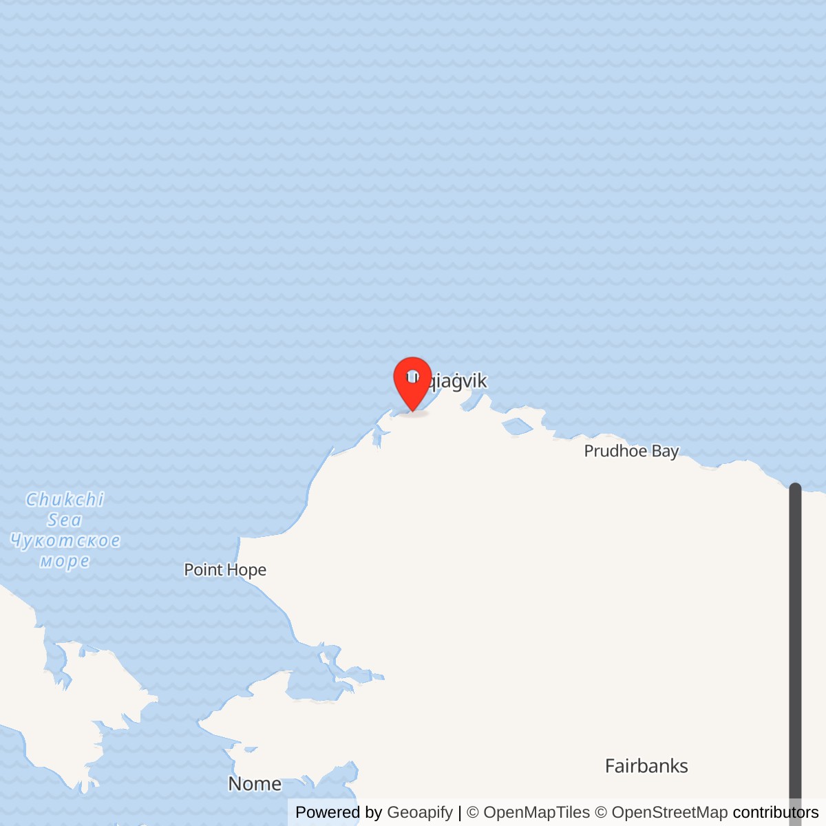
Longitude: -158.25889
Site Number: LIZ-C
Peard Bay, code LIZ-C, was an intermediate station of the Distant Early Warning Line on the Chukchi Sea coast. Its AN/FPS-23 gap-filler equipment supplemented the larger stations at Wainwright and Point Barrow. Peard Bay entered service in August 1957 and its radar mission ended on July 21, 1963. [1] [2]
- DEW Line code
- LIZ-C.
- Station type
- Intermediate gap-filler station.
- Radar system
- AN/FPS-23 continuous-wave Doppler equipment.
- Air Force service
- August 1957 to July 21, 1963.
- Recorded tower
- 240 feet.
- Recorded original airstrip
- About 1,600 by 100 feet in a 1977 federal inventory.
- Approximate location
- 70.80806, -158.25889.
The Western Radar Fence
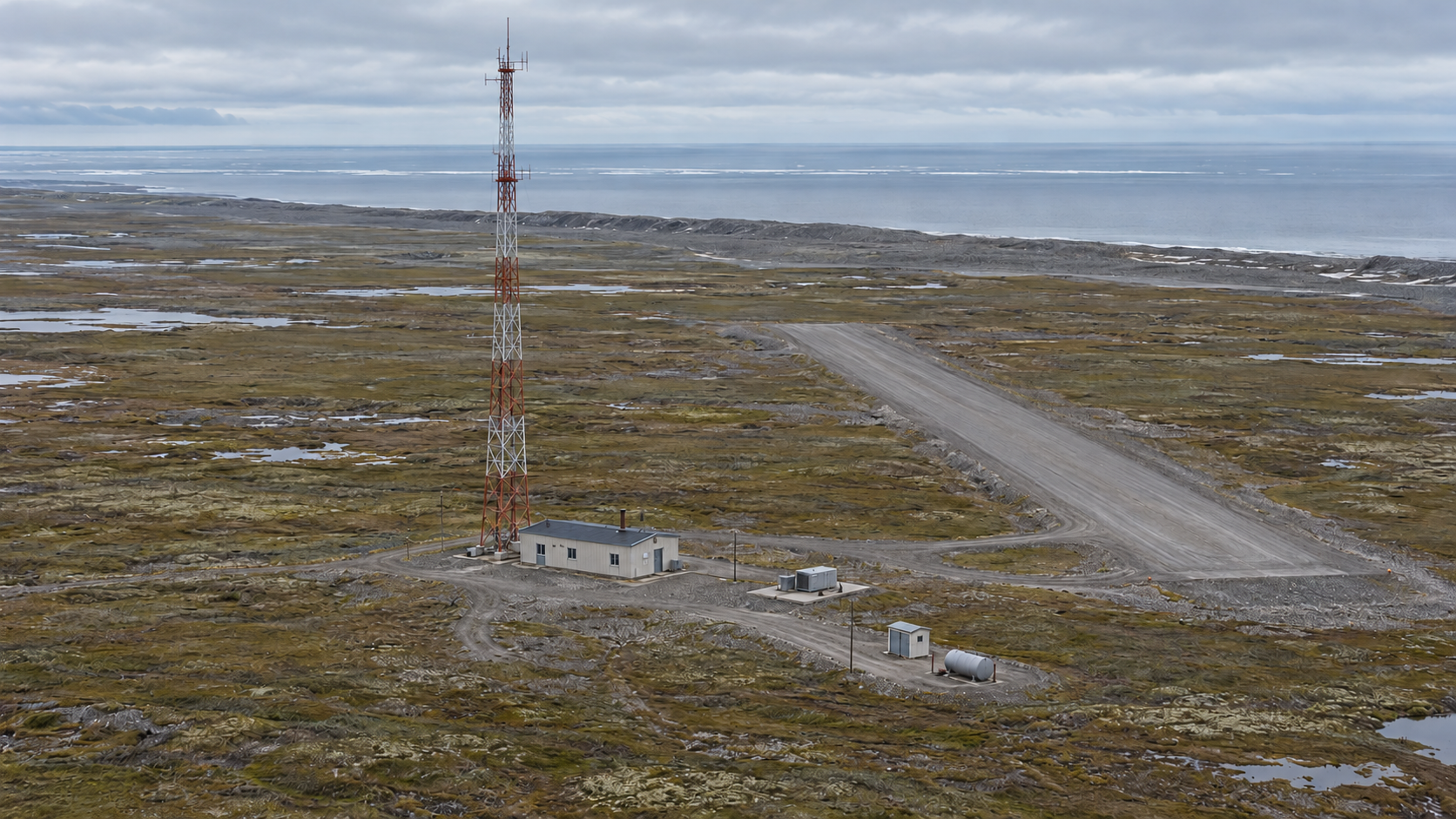
The Alaska DEW Line placed large search-radar stations along the Arctic coast and smaller intermediate stations in the spaces between them. Peard Bay sat east of Wainwright LIZ-3 and west of Point Barrow POW-Main. Its position near the Chukchi Sea helped extend warning coverage over an approach that low-flying aircraft might otherwise exploit. The station had its own equipment and support area. [1] [2]
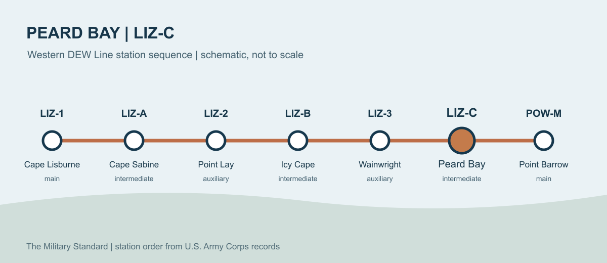
The station stood about a mile inland on an older shoreline ridge. That slight rise offered a firm place for its tower and buildings in otherwise low, wet tundra. The isolated location made the site's landing strip and stored supplies important parts of the warning mission. [1] [3]
The Gap-Filler Mission
The AN/FPS-23, often called Fluttar, was a continuous-wave Doppler system. An intermediate station transmitted toward receivers associated with neighboring DEW sites. An aircraft passing through the monitored area altered the received signal and could trigger an alarm. Peard Bay thus reinforced the larger search radars without operating a large rotating antenna of its own. Its alert had value because the neighboring stations could pass warning information onward through the DEW Line. [1] [2]
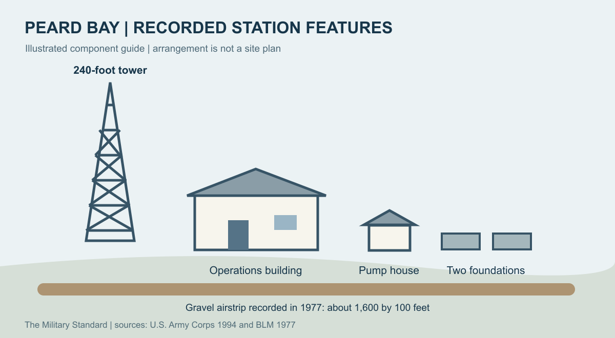
The Corps recorded a 240-foot tower at Peard Bay. The tower and its electrical equipment demanded regular inspection, power, and communications. A failed generator or link could interrupt coverage even when the radar equipment itself was sound. [1] [2]
Tower, Buildings, and Airstrip
The Corps' 1994 survey found the operations building, the 240-foot tower, two concrete foundations measuring 32 by 34 feet, and an 8-by-8-foot fuel-tank pump house. These remains show the compact scale of the former station. The operations building was the working center; the pump house and foundations record part of the support system needed to keep machinery running in the Arctic. [1]
A federal transportation inventory made in 1977 described a gravel airstrip about 1,600 feet long and 100 feet wide, with runway lights and an antenna system. It also recorded one surviving, deactivated DEW Line building at that date. The airstrip brought personnel, equipment, food, and repair parts to a coast without a road connection to the station. [3]
Life at a Small Arctic Station
The Alaskan coastal DEW Line was operated for the Air Force by civilian contractors. A Defense Department account describes a typical intermediate station as a very small camp with a station chief, mechanic, and cook. Such a crew had to share the daily work of keeping heat, power, food, communications, and the warning equipment available in darkness, strong winds, and severe cold. [6] [7]
At a remote station like Peard Bay, routine work included maintaining machinery and fuel systems and preparing for incoming supply aircraft. Radar checks were only one part of keeping the site in service. The sparse buildings and short strip show the small scale of an intermediate station beside the larger DEW Line bases that supported it. [1] [3] [6]
Closure and Later Use
Peard Bay's Air Force radar operation ended on July 21, 1963, as the intermediate gap-filler sites were withdrawn from the line. The former station remained on federal land in the National Petroleum Reserve in Alaska. Federal reports from 1977 still described its short gravel strip and a deactivated DEW building. [1] [3] [8]
The property later served a different purpose. For the 1977 to 1978 petroleum exploration season, a temporary logistics base was built at the old Peard Bay DEW Line site. A federal report described a 25-person camp, fuel and material yards, and a new, much longer airstrip. This new infrastructure came more than a decade after the radar mission ended. [4]
The Corps found the old station structures deteriorating in the early 1990s. A later North Slope transportation study reports that the radar and other military buildings were removed around 2000, while gravel roads and an airstrip remained visible. The surviving ground features mark the place where a small warning station worked for six years on Alaska's western Arctic coast. [1] [5]
Chronology
- August 1957: Peard Bay LIZ-C enters service as an intermediate DEW Line station with AN/FPS-23 equipment. [1]
- July 21, 1963: The Air Force ends the Peard Bay radar mission. [1]
- 1977: A federal inventory records the deactivated DEW building and a roughly 1,600-foot gravel strip. [3]
- 1977 to 1978: A temporary petroleum exploration logistics base operates at the former station property with a new long airstrip and a 25-person camp. [4]
- Early 1990s: The Corps records the operations building, tower, pump house, and two concrete foundations at the former installation. [1]
- Around 2000: The radar and other military buildings are removed; gravel roads and an airstrip remain. [5]
Related Sites
- Wainwright LIZ-3, neighboring auxiliary station to the west
- Point Barrow POW-Main, neighboring main station to the east
- AN/FPS-23 gap-filler radar
- DEW Line station directory and DEW Line history
Information sources (8)
- PDFU.S. Army Corps of Engineers, The Cold War in Alaska: A Management Plan for Cultural Resources, 1994, pp. 187, 205-206
Station code, AN/FPS-23, operating dates, tower, buildings, and historic site description.
- PDFAir Defense Command, A History of the DEW Line, 1946-1964, Historical Study No. 31, 1965
Contemporary account of the intermediate-station radar mission and its place in the warning line.
- PDFBureau of Land Management, Baseline Studies of the Physical and Manmade Environment: The Beaufort Sea Region, 1977, p. 69
Peard Bay airstrip, former DEW building, land status, runway lights, and antenna system in 1977.
- PDFBureau of Land Management, Beaufort Sea Petroleum Development Scenarios, Final Report, April 1978, p. 62
Temporary 1977 to 1978 exploration logistics base, new airstrip, camp, and storage yards.
- PDFAlaska Department of Natural Resources and North Slope Borough, ASTAR Triangle Road Study, historic resources section
Later removal of radar buildings and surviving gravel roads and airstrip.
- PDFU.S. Department of Defense, Establishing Independence, DEW Line station description
Typical staffing and working conditions at intermediate DEW Line stations.
- PDFCongressional Record, October 31, 1963, Alaska air-defense statement
Contemporary account of civilian contract operation on the Alaskan coastal DEW Line.
- PDFBureau of Land Management, National Petroleum Reserve in Alaska Draft Integrated Activity Plan and EIS, volume 1
Identifies Peard Bay as a former DEW Line site on BLM-managed NPR-A land.