
Gibbsboro Air Force Station / Gibbsboro Joint Surveillance System Radar Site, New Jersey
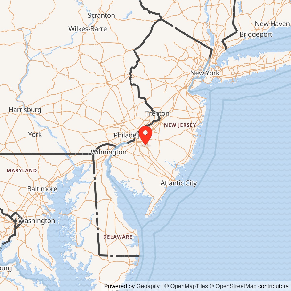
Longitude: -74.95444
Current Role: FAA / Joint Surveillance System ARSR-4 radar site supporting civil air traffic surveillance, air sovereignty awareness, and radar overlap for the Joint Base McGuire-Dix-Lakehurst region; portions of the former Air Force Station landscape are associated with Pole Hill Park and Gibbsboro greenway public access.
Gibbsboro Air Force Station was a Cold War radar post built around one deceptively simple geographic advantage: elevation. In the flat, low country of southern New Jersey, the high ground near Gibbsboro gave the United States a useful line of sight over the Philadelphia air-defense region, the Delaware Valley, and approaches from the Atlantic coast. The site never launched aircraft and never housed a flying wing. Its military value came from antennas, radomes, height-finder towers, operations rooms, communication links, and the people of the 772d Radar Squadron who turned radar returns into air-defense information.
The installation had a layered identity before it became widely known as Gibbsboro Air Force Station. In 1957 it began as an unmanned Air Force gap-filler radar annex, designated P-9A / Z-9A, under Highlands Air Force Station. That first mission was to close low-altitude radar coverage gaps in the Philadelphia and New York air-defense region. Around 1960, the same high ground became important to the Army's Nike air-defense system because the Pedricktown Missile Master control center needed a better elevated radar source than its own sea-level site could provide. In 1961 the Air Force moved the 772d Radar Squadron and the P-63 / Z-63 long-range radar mission from Claysburg Air Force Station, Pennsylvania, to Gibbsboro. The former gap-filler site became the Air Force's RP-63 / Z-63 SAGE radar station for the Philadelphia region.
This was a small installation, but it belonged to a national system. Its radars supported the Semi-Automatic Ground Environment, or SAGE, in which radar sites across North America fed data to large direction centers that identified, tracked, and responded to possible hostile aircraft. Gibbsboro initially fed the SAGE direction center at McGuire Air Force Base. It also shared radar data with Army Nike command-and-control during the period when the Philadelphia Defense Area depended on both Air Force interceptors and Army surface-to-air missiles. The station's significance lies in that joint air-defense role. It was not just a local radar hill. It was one of the sensors that helped tie Philadelphia, southern New Jersey, McGuire, Pedricktown, Highlands, Palermo, and the wider NORAD network into one Cold War surveillance system.
Mission Evolution
Gibbsboro's first Air Force role was low-altitude coverage. The Air Force developed gap-filler radar sites because large long-range radars could miss aircraft flying low through terrain-shadowed approaches. The Gibbsboro site operated as P-9A with an AN/FPS-14 radar from the late 1950s until the Air Force and Army reshaped the site for a larger mission. The gap-filler phase was unmanned or lightly supported and was functionally subordinate to Highlands AFS, but it established the military use of the hill and the physical base from which the later long-range radar station grew.
The Army's Nike system changed the site. By the late 1950s, the Army Air Defense Command used Nike Ajax and Nike Hercules missile batteries to defend major cities and strategic areas. Philadelphia's Nike batteries required command and control from the Pedricktown Army Installation, designated PH-64DC, in southwestern New Jersey. Pedricktown's Missile Master used an AN/FSG-1 computer system and was part of the Army's effort to coordinate multiple Nike firing batteries from a central command post. The problem was geography. Pedricktown was near sea level, while Gibbsboro offered higher terrain closer to Philadelphia. The Air Force gap-filler annex at Gibbsboro was therefore chosen as the future prime long-range radar site to support both services. Temporary radars were placed at Pedricktown until the Gibbsboro installation could carry the mission.
Budget pressure also shaped the decision. Contemporary radar-history sources explain that Congress and defense planners wanted the Army and Air Force to combine radar sites where missions allowed. Rather than maintain a separate inland Air Force long-range radar station at Claysburg, Pennsylvania, and a separate Army radar capability for the Philadelphia Nike system, the Air Force moved the 772d Radar Squadron to Gibbsboro and assumed the long-range radar site there. That move closed the Claysburg prime radar mission, deactivated Gibbsboro's gap-filler mission, and converted the New Jersey hilltop into a shared Army-Air Force radar station.
Gibbsboro began Air Force long-range radar operations in 1961. The early long-range configuration used an AN/FPS-66 search radar and an AN/FPS-6 height-finder radar, while Army height finders also supported the Nike mission. The station initially fed radar data to the SAGE direction center at McGuire AFB. In 1963 an AN/FPS-27 search radar was installed and the older AN/FPS-66 was retired in 1964. By that period the site also used AN/FPS-6A and AN/FPS-26A height-finder radars. This was the mature Cold War version of Gibbsboro AFS: a search radar under a radome, height finders to provide altitude, an operations building, communications links, and a squadron mission built around continuous surveillance.
Around 1966, after the Army's Philadelphia Missile Master structure changed and the Pedricktown Nike role declined, Gibbsboro became an Air Defense Command / Federal Aviation Administration joint-use facility. This shift reflected a broader national trend. Civil aviation and military air defense both needed long-range radar coverage, and the government increasingly sought to reduce duplication between FAA and DoD radar systems. At Gibbsboro, that meant the station remained important even as its exact command relationships changed. The same air picture could support civil air traffic control and military air sovereignty.
The 772d Radar Squadron continued operating the AN/FPS-27 search radar and AN/FPS-26A height finder until 1983. The squadron was deactivated in 1984, marking the end of Gibbsboro as a traditional manned blue-suit Air Force radar squadron site. The station did not vanish, however. In 1986 an AN/FPS-117 minimally attended radar became operational at Gibbsboro under contractor support. That radar was a prototype associated with the newer generation of minimally attended radar technology used in Alaska and the North Warning System. When the test period ended in 1992, the radar was moved to Murphy Dome, Alaska. Gibbsboro then passed through a dormant or caretaker interval before the FAA / Air Force Joint Surveillance System era restored radar activity at the site with an ARSR-4.
Operational Role
The central operational task at Gibbsboro was surveillance. The station looked outward, not inward. Its operators, electronics technicians, maintenance personnel, radar controllers, and support staff kept the radar picture alive for air-defense decision makers. In the SAGE era, radar returns from sites such as Gibbsboro were transmitted to direction centers where computers and operators could identify aircraft, distinguish friendly tracks from possible threats, and direct interceptors or coordinate with other defense systems. The station's daily work was technical, repetitive, and unforgiving. If the radar, height finders, communications links, power, cooling, or operations equipment failed, part of the regional air-defense picture failed with them.
Gibbsboro's earliest operational value was low-altitude warning. As a gap-filler annex, the site helped compensate for radar shadows that could allow aircraft to approach below the coverage of larger stations. Low-altitude coverage mattered because the Cold War bomber threat did not consist only of high-flying aircraft. Penetrating bombers could attempt to use terrain, coastlines, clutter, and low-level approaches to evade detection. A small gap-filler could therefore matter out of proportion to its size if it closed a specific hole in the radar net.
The station's most important operational period began with the 1961 relocation of the 772d Radar Squadron. Once Gibbsboro became RP-63 / Z-63, it was no longer merely filling a gap. It became a prime long-range radar station. The search radar detected aircraft in the station's coverage area. Height-finder radars supplied altitude information. Operators and automated systems turned those returns into usable tracks. The radar picture fed McGuire's SAGE direction center and supported the broader air-defense architecture around Philadelphia, New York, and the mid-Atlantic coast.
Gibbsboro also served a joint Army-Air Force operating role during the Nike period. The Army's Pedricktown Missile Master needed radar data to control Nike missile batteries around the Philadelphia Defense Area. The Air Force needed radar data for warning and interceptor direction. Gibbsboro's search radar was shared, while each service had dedicated height-finder capacity during the early joint-use period. This was a practical Cold War compromise. Instead of duplicating every radar tower and operations facility, the services used one high-ground sensor site to support different weapons and command systems.
The transition from the 1960s through the 1980s changed the station's operational meaning but not the core surveillance function. As SAGE aged, the United States moved toward the Joint Surveillance System, a cooperative FAA and Air Force network intended to replace older SAGE and BUIC radar-control systems with regional operations control centers and modernized radars. National radar-history summaries describe the JSS as an FAA / Air Force cooperative peacetime surveillance and control system. Gibbsboro fit this transition because it was already a joint-use location and because the Philadelphia-New York-Washington airspace corridor remained heavily trafficked and strategically important.
The AN/FPS-117 test period gave Gibbsboro a final active Air Force technical role after the 772d Radar Squadron era. The AN/FPS-117 was a minimally attended radar concept, meaning it was intended to reduce the manpower burden that older radar stations required. At Gibbsboro it operated under contractor support from 1986 until 1992 and served as a prototype for later remote radar deployment. That mission placed Gibbsboro at the boundary between old manned Cold War radar stations and newer unattended or lightly attended surveillance sites.
In the present day, the former Air Force Station remains operational in a different institutional form. The active radar is identified in current airfield and radar references as Gibbsboro Radar Station, identifier QIE, an ARSR-4 site. A Joint Base McGuire-Dix-Lakehurst airfield instruction identifies QIE as a supportive radar feed located southwest of that installation and notes that it can help preserve air traffic control continuity during certain primary radar outages. The old Air Force squadron is gone, but the hilltop still contributes to the National Airspace System and the FAA / Air Force surveillance network.
Units, Organizations, and Systems
The 772d Radar Squadron is the unit most closely associated with Gibbsboro Air Force Station. Its lineage began as the 772d Aircraft Control and Warning Squadron, later redesignated the 772d Radar Squadron (SAGE). Before Gibbsboro, the unit operated at Claysburg Air Force Station on Blue Knob in Pennsylvania. In 1961 the squadron and the P-63 / Z-63 site designation were moved to Gibbsboro as part of the consolidation that created the New Jersey long-range radar station. The 772d remained the central operating unit at Gibbsboro through the SAGE and Aerospace Defense Command years and continued to operate the station's major radars until the early 1980s.
The squadron's command relationships changed as the Air Defense Command system evolved. The 772d had assignments through Air Defense Command organizations such as the New York Air Defense Sector, 21st Air Division, 35th Air Division, and later 21st Air Division again during the period reflected in unit-history summaries. Those assignments are not just administrative trivia. They show how a small radar site in Camden County belonged to shifting regional command structures that controlled air defense across large portions of the northeastern United States.
SAGE was the most important system that Gibbsboro supported. The Semi-Automatic Ground Environment used radar inputs, computers, communication lines, identification data, and human operators to detect and respond to air-breathing threats. Searching the Skies, the Air Force-sponsored Cold War radar history, describes SAGE as a system that received sensor inputs and supported detection, identification, tracking, and interceptor direction. Gibbsboro was one of the sensors feeding that environment. The site did not make national decisions by itself; it helped provide the data without which those decisions could not be made.
The Army's Nike Missile Master system was the second major system tied to Gibbsboro's early history. Pedricktown PH-64DC controlled Nike missile batteries around the Philadelphia Defense Area. Gibbsboro supplied the high-ground radar support that Pedricktown needed. That relationship explains why a former Air Force gap-filler site became a joint-use long-range radar station. The Army needed elevation and radar coverage; the Air Force needed a consolidated long-range radar node. Gibbsboro satisfied both.
The FAA and Joint Surveillance System formed the third major system. By the late Cold War, the United States increasingly integrated FAA air-route surveillance radars and military air-defense feeds. Searching the Skies describes JSS as a peacetime air surveillance and control system replacing SAGE and BUIC, with FAA-operated radars and Air Force operations centers sharing the air picture. Gibbsboro's later ARSR-4 role belongs to that system. The site now supports both civil aviation surveillance and military air-sovereignty awareness rather than operating as a standalone manned Air Force Station.
Facilities and Physical Layout
Gibbsboro's layout was determined by radar geometry, not by barracks tradition. The important structures were placed to support antennas, radar towers, operations, communications, power, maintenance, and access. The site had a former gap-filler building from the P-9A period, search-radar towers, height-finder radar positions, an operations building, a water tank bearing the 772d Radar Squadron emblem, utility structures, fuel and support facilities, and access roads leading up from the Gibbsboro area.
The 1957 gap-filler phase was relatively small. Aerial-photo history describes an L-shaped gap-filler building and an AN/FPS-14 tower shadow visible in the early site layout. When the long-range mission arrived, the site expanded into a more complex radar station. By the 1963 aerial configuration, the site had an Air Force AN/FPS-26A height finder, an AN/FPS-66 search radar, an AN/FPS-27 search radar, two Army AN/FPS-6 height-finder radars, and an Air Force AN/FPS-6 height finder. This was a dense sensor compound on a limited hilltop footprint.
The search-radar towers were the dominant visual features. The AN/FPS-66 gave the station its first long-range search capability after the 1961 transition. The AN/FPS-27, installed in 1963, then became the major search radar. Height-finder radars were physically separate because they performed a different task: they determined altitude. The presence of multiple height finders during the joint Army-Air Force period shows how the site handled parallel service requirements.
Gibbsboro's support functions were not all located at the radar compound. During the Pedricktown Missile Master period, housing, cantonment, and administration for Gibbsboro were tied to the Pedricktown Army Installation. Sources note that the only on-site housing at Gibbsboro was a trailer park. After Pedricktown's Missile Master role ended, housing and administration shifted to McGuire Air Force Base. Around 1974, Gibbsboro inherited former Nike housing near Sicklerville. This arrangement reinforces a key point about Gibbsboro: it was a radar operating site first, not a full self-contained base.
The communications system extended beyond the radar hill. The Ground-Air Transmitter-Receiver, or GATR, site associated with Gibbsboro was located at McGuire AFB. GATR facilities were essential because radar stations needed voice and data links to communicate with aircraft, direction centers, and other parts of the air-defense network. Gibbsboro's military geography therefore included not only the visible radomes in Gibbsboro, but also remote communications and administrative support functions elsewhere.
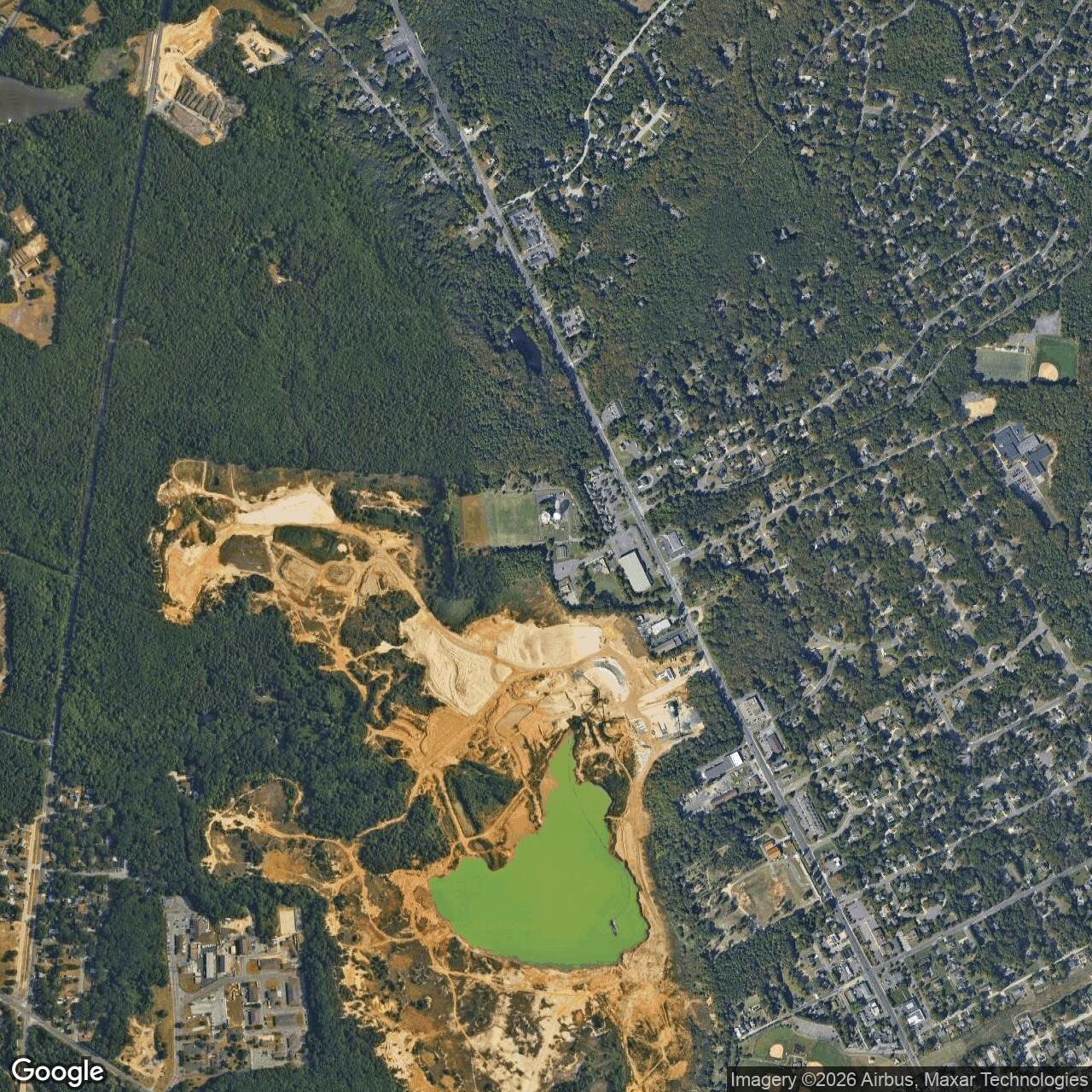
The present physical landscape is a mix of active radar use, partial public reuse, and remnants. Radomes.org site notes and photo documentation describe the ARSR-4 radar within the active compound, the former AN/FPS-27 tower, surviving buildings, and the conversion of parts of the former site into local public space. Local trail sources identify Pole Hill Park and the Gibbsboro greenway system as public access points around the former Air Force installation. The site is therefore still legible, but not as a preserved museum installation. It is an active FAA / JSS radar site surrounded by fragments of a Cold War Air Force Station and municipal recreation space.
Role in the Wider Military Network
Gibbsboro only makes sense as a network node. In the late 1950s it was a gap-filler in the Highlands AFS coverage system. In the early 1960s it became the high-ground radar partner to the Army's Pedricktown Missile Master. In the SAGE era it fed McGuire's direction center and supported regional air-defense decisions. In the FAA joint-use period it helped merge civil air surveillance and military air defense. In the JSS era it remained a radar site because the airspace it watched was still important.
Its location explains why so many systems overlapped there. Gibbsboro stood near Philadelphia but far enough from the urban core to provide an elevated, controllable radar site. It looked over one of the most important transportation and industrial regions in the country. Philadelphia, Camden, the Delaware River corridor, McGuire, coastal approaches, and the dense air traffic of the northeastern United States all made the site valuable. A radar station at Gibbsboro could help protect a city, support missile defenses, feed an Air Force direction center, and later assist civil air traffic control.
The station also illustrates the relationship between Air Force and Army air defense during the Cold War. The Air Force controlled interceptor aircraft and radar-warning systems, while the Army operated Nike missile batteries around cities and strategic sites. Those missions were separate on paper, but they had to share a common air picture. Gibbsboro's early joint-use configuration, with Air Force and Army radars and shared search data, shows the practical solution to that problem. The hilltop became a point where two service systems touched.
Gibbsboro also demonstrates the long transition from manned radar stations to integrated national surveillance infrastructure. In the 1950s and 1960s, radar stations were often staffed, named, and physically recognizable Air Force installations. By the 1980s and 1990s, many of those sites were closed, automated, transferred to the FAA, or folded into JSS. The mission did not disappear. It became less visible. Gibbsboro's current ARSR-4 role is the descendant of the same air-defense need, but it operates through a different institutional and technological model.
Closure, Transfer, and Current Status
The end of Gibbsboro as a traditional Air Force Station came in stages. The 772d Radar Squadron shut down its main AN/FPS-27 and AN/FPS-26A operations in 1983 and was deactivated in 1984. That ended the station's identity as a manned Aerospace Defense Command radar squadron post. The later AN/FPS-117 test mission kept Air Force radar activity at Gibbsboro from 1986 to 1992, but under contractor support rather than the old squadron model. When that radar was moved to Murphy Dome, Alaska, the site entered a dormant or caretaker period.
The FAA / JSS transition followed. Radar-history sources state that a portion of the Gibbsboro site was transferred to the FAA in 1995 for installation of an ARSR-4, while broader summaries often describe the Air Force Station as closed in 1994 and turned over to FAA control. The practical result is clear even if the administrative dates differ by source. The old Air Force Station stopped functioning as an active blue-suit radar squadron base, but the hilltop was too useful to abandon. It reemerged as a modern FAA / Air Force joint-surveillance radar site.
Today the active radar site is associated with the FAA and the Joint Surveillance System. It is identified as QIE and as J-51 / Z-63 in JSS and radar-station references. The ARSR-4 is a long-range, three-dimensional radar type used for both civil air traffic surveillance and military air-defense feeds. Air Force airfield documents from Joint Base McGuire-Dix-Lakehurst still refer to Gibbsboro Radar Station, identifier QIE, as a supportive radar feed. That is the modern operational descendant of the Cold War mission.
Public reuse surrounds the active compound. Parts of the former Air Force Station landscape are now associated with Pole Hill Park, Blueberry Hill trails, and the Gibbsboro greenway system. Visitors in the public area can still see the radar presence that marks the hilltop, but the active radar compound remains a controlled facility. The site is therefore neither fully abandoned nor fully preserved. It is a hybrid landscape: active national airspace infrastructure, surviving Cold War remnants, and local recreation space on the same ground.
Chronology
- 1957 The Gibbsboro site began operation as the P-9A / Z-9A unmanned Air Force gap-filler radar annex under Highlands Air Force Station, using an AN/FPS-14 radar.
- 1960 The Army activated the Pedricktown Missile Master control system for the Philadelphia Nike Defense Area, creating the need for better high-ground radar support.
- 1960-1961 Temporary Army radars operated at Pedricktown while the Gibbsboro long-range radar site was prepared.
- 1961-05-01 The 772d Radar Squadron and the P-63 / Z-63 mission moved from Claysburg Air Force Station, Pennsylvania, to Gibbsboro, New Jersey.
- 1961 Gibbsboro Air Force Station began long-range radar operations with AN/FPS-66 and AN/FPS-6 radar equipment and fed data to the SAGE direction center at McGuire AFB.
- 1961 The former P-9A gap-filler mission at Gibbsboro was deactivated as the site became a prime long-range radar station.
- 1963 An AN/FPS-27 search radar was installed, and the site also used AN/FPS-6A and AN/FPS-26A height-finder radars.
- 1964 The older AN/FPS-66 search radar was retired after the AN/FPS-27 became fully operational.
- 1964-10-15 The Army's Nike Missile Master at Pedricktown was discontinued, reducing the early Army-Air Force joint radar relationship.
- Circa 1966 Gibbsboro became an Air Defense Command / Federal Aviation Administration joint-use radar facility.
- 1966 The site functioned increasingly as an Air Force long-range radar station after the early Army Missile Master relationship ended.
- 1974 The 772d Radar Squadron dropped the SAGE suffix and continued as the 772d Radar Squadron.
- 1983 The 772d Radar Squadron ended operation of the AN/FPS-27 and AN/FPS-26A radar systems.
- 1984 The 772d Radar Squadron was deactivated.
- 1986 An AN/FPS-117 minimally attended radar became operational at Gibbsboro under contractor support.
- 1986-1992 Gibbsboro served as a test and evaluation site for AN/FPS-117 minimally attended radar technology associated with Alaska and North Warning System applications.
- 1992 The AN/FPS-117 was removed from Gibbsboro and sent to Murphy Dome Air Force Station, Alaska.
- 1994 The former Air Force Station closed or ended its remaining Air Force-site status according to common summary accounts.
- 1995 A portion of the site was transferred to the FAA for ARSR-4 installation according to radar-history sources.
- Circa 1997 Gibbsboro reemerged as an FAA / Air Force Joint Surveillance System long-range radar site with an ARSR-4.
- 2000s Portions of the former Air Force Station landscape were reused or associated with Pole Hill Park and Gibbsboro public trail access, while the active radar compound remained controlled.
- 2022 Joint Base McGuire-Dix-Lakehurst airfield instructions identified Gibbsboro Radar Station, identifier QIE, as a supportive radar feed for local ATC continuity.
- Present Gibbsboro remains an active FAA / Joint Surveillance System ARSR-4 radar site and a former Air Force Station landscape partly visible from surrounding public recreation areas.
Information sources (11)
- WEBRadomes.org
Information for Gibbsboro AFS, NJ
- WEBRadomes.org
Gibbsboro AFS, NJ Aerial Photo History
- WEBRadomes.org
The Gibbsboro AFS - Pedricktown AI Relationship
- PDFU.S. Air Force Unit History / AFHRA-derived summary
772 Radar Squadron (SAGE)
- WEBDavid F. Winkler and Julie L. Webster
Searching the Skies: The Legacy of the United States Cold War Defense Radar Program, prepared for U.S. Air Force Air Combat Command, June 1997
- PDFDepartment of the Air Force, 305 AMW Instruction 13-204
Airfield Operations 4 January 2022
- WEBRadomes.org
Recent Photos of Gibbsboro AFS, NJ
- WEBRadomes.org
Photos of Gibbsboro AFS, NJ
- WEBRadomes.org
Aerial Images of Gibbsboro AFS, NJ
- WEBSouth Jersey Trails
Blueberry Hill Trail(s) - Gibbsboro, NJ
- PDFBureau of Ocean Energy Management
Radar Interference Analysis for Renewable Energy Projects Located on the Atlantic Outer Continental Shelf