
Palermo Air Force Station, New Jersey
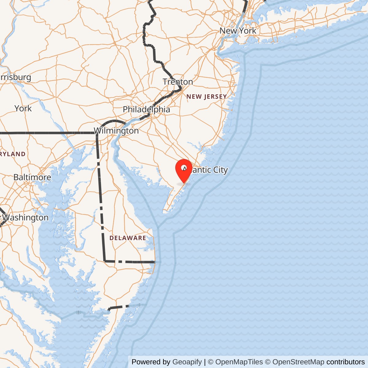
Longitude: -74.687222
Current Role: Osprey Point residential community on the former principal technical and cantonment property. Former housing and detached GATR property disposition and surviving features require parcel-level verification.
Palermo Air Force Station occupied low coastal ground in southern New Jersey, where radar coverage was needed over the Atlantic approaches to Philadelphia, Camden, Wilmington, and the lower Delaware River. Its terrain was far less dramatic than the mountaintop settings associated with many Air Defense Command stations, but its location gave it an unobstructed view across the coastal plain and offshore air routes. The installation became a long-lived sensor in the northeastern warning network because it covered an approach that inland stations could not watch as effectively.
The station was one physical installation with two major Air Force operating phases. The first began with an improvised Lashup radar in 1948 and matured under the 770th Aircraft Control and Warning Squadron, later the 770th Radar Squadron, until that organization moved to Fort Meade in 1961. The second began almost immediately under Detachment 1 of the New York Air Defense Sector and continued under the 680th Radar Squadron until 1970. Those changes altered unit titles and site codes, but they did not create a separate Palermo installation.
Palermo should not be confused with nearby supporting properties. The main station held the search and height-finding radars, operations functions, maintenance shops, administration, and cantonment. A detached Ground-Air Transmitter-Receiver site, ultimately designated R-28, carried radio communications and remained active until 1976 after the main radar station closed. The former family-housing area also followed a different disposal path, reportedly passing to the Coast Guard before later private use.
The accepted site designations trace Palermo's place in successive national systems. The station began as Lashup site L-13, became LP-54 and P-54 in the Permanent System, briefly operated under the interim RP-63C relationship after the 770th departed, and returned to the P-54 designation before receiving the NORAD identifier Z-54. Some secondary accounts repeat L-14, but the Air Force-derived unit history and radar-site documentation identify Palermo as L-13, which is used here.
Geography and Strategic Setting
Cape May County forms the southern end of New Jersey between the Atlantic Ocean and Delaware Bay. Palermo stood inland from barrier-island communities but remained close enough to the coast to detect aircraft approaching from the sea. Radar energy could travel across the relatively flat coastal landscape without the severe mountain shadowing found in other regions, while roads connected the station to regional military and civilian infrastructure. The location was therefore suitable for warning, interception support, and later air-traffic-control assistance.
The defended region extended far beyond the local resort communities. Philadelphia and Camden contained major industrial, transportation, port, and population concentrations, while Wilmington and the Delaware River corridor added chemical plants, ship facilities, refineries, and military traffic. A hostile bomber approaching from the Atlantic could threaten several important targets within a short period. Palermo's mission was to recognize that approach early enough for command centers and interceptor forces to react.
The station also occupied one segment of a much larger northeastern radar belt. Highlands watched the New York Harbor approaches, Gibbsboro later covered airspace east of Philadelphia, Fort Meade and inland stations supported overlapping surveillance, and offshore Texas Towers attempted to move warning farther seaward. Palermo's coverage was valuable because it overlapped neighboring stations while reducing the risk that a low or coastal approach could pass through an unobserved corridor.
Coastal weather imposed persistent technical demands. Salt-laden air, humidity, wind, rain, and winter storms affected exposed antennas, waveguides, electronic components, towers, and radomes. Maintenance personnel had to control corrosion, preserve electrical reliability, and keep antenna drives and communications systems functioning around the clock. The apparent simplicity of a radar antenna turning above flat farmland concealed an installation whose effectiveness depended on constant technical work.
Lashup Origins
Palermo entered service during the uncertain period immediately after World War II. The United States had demobilized much of its wartime air-warning structure, but growing tension with the Soviet Union and the appearance of long-range bombers made that reduction increasingly dangerous. In 1948 the Air Force removed stored radar equipment and placed an AN/TPS-1B search set at Palermo as part of the emergency Lashup network. The station was operating by August of that year.
The Lashup network was deliberately provisional. Palermo transmitted information to a manual control center at Roslyn, New York, using procedures and communications that relied heavily on human plotting, telephone reporting, and local judgment. Operators watched radar displays, identified tracks as best they could, and passed reports through a command system still being rebuilt. The network supplied immediate warning value, but its limitations demonstrated the need for permanent stations with standardized equipment, facilities, staffing, and communications.
Palermo's early call signs, including Pretender and Calico, belonged to this improvised and transitional era. The station was not yet the permanent Air Force community that later photographs would show. Temporary or adapted facilities supported equipment whose performance and reliability fell below the standards expected of the eventual Permanent System. Even so, the site established the coastal coverage requirement that justified a much larger investment after the Korean War began.
The Korean War accelerated continental air-defense construction because it made the possibility of a broader Soviet confrontation appear more immediate. In July 1950 the Air Force received authority to expedite additional radar stations, and the Corps of Engineers proceeded with permanent facilities. Palermo transitioned from a stored-equipment emergency site into LP-54, a permanent general-surveillance and ground-controlled-interception station built to function continuously rather than only as a stopgap.
The 770th Squadron and Permanent Operations
The 770th Aircraft Control and Warning Squadron was constituted in November 1950 and activated on 1950-11-27. As permanent facilities and equipment became available, the squadron assumed the staffed warning and control mission at Palermo. By 1951 the station had AN/CPS-5 search and AN/TPS-10A height-finding equipment. By April 1952 the 770th was operating AN/FPS-3 and AN/CPS-4 sets, a combination that supported both detection and altitude determination.
A general-surveillance station did more than report that an aircraft existed. Operators established tracks, measured bearing and distance, requested or interpreted identification information, estimated formations, and determined altitude through height-finder radar. Controllers could then guide interceptor aircraft toward unidentified targets. The mission required close coordination among scope operators, weapons controllers, identification technicians, communications personnel, radar maintenance shops, weather observers, and command-center staffs.
Palermo's early permanent years remained highly manual. Aircraft tracks were plotted and passed through voice and data circuits to higher control centers, where information from several stations was combined. Each delay or error could reduce the time available for an interception. The station therefore trained repeatedly on recognition, reporting, communications failure, and manual fallback procedures. Readiness was measured by whether Palermo could produce a dependable air picture under pressure, not merely whether its antennas were turning.
The 770th served through several higher headquarters as Air Defense Command reorganized its structure. Assignments included the 503d Aircraft Control and Warning Group, 26th Air Division, 4710th and 4709th defense-wing structures, and the New York Air Defense Sector. These transfers reflected changing command arrangements rather than a new local mission. Palermo remained responsible for the southern New Jersey coastal sector while headquarters sought a more effective way to direct the national radar and interceptor network.
Radar Modernization
Palermo's equipment changed as rapidly as the air-defense threat. In spring 1957 the station became one of the early operational locations for the AN/FPS-20 long-range search radar. Two AN/FPS-6 height finders were installed during the same modernization. The new equipment increased range, improved altitude reporting, and prepared the station to join the computer-linked Semi-Automatic Ground Environment system.
The AN/FPS-20 was a major installation rather than a simple equipment substitution. It required a substantial tower or support structure, reliable power, environmental control, technical spaces, waveguides, communications, calibration, and trained maintenance personnel. Two separate height finders added additional towers, radomes, crews, and maintenance burdens. The station's physical appearance and electrical demand grew as the radar mission became more capable and more complex.
Palermo's equipment also had to operate in an electronic environment that was becoming increasingly crowded. Civil aircraft, military training flights, weather, ground clutter, and anomalous propagation all appeared on radar displays. Operators learned to distinguish meaningful tracks from interference and to coordinate with air-traffic authorities. By late 1959 the station was performing air-traffic-control duties in addition to its military warning mission, showing how military radar data could support safe management of increasingly busy airspace.
In 1963 the AN/FPS-20 was upgraded into an AN/FPS-65 configuration. The station retained two AN/FPS-6 height finders until one was retired in 1968. These changes reflected budget decisions and the improving ability of the network to share information among stations. Palermo continued to provide useful coastal surveillance even as the Air Force reduced older equipment and relied more heavily on overlapping coverage and automated processing.
SAGE Integration
Palermo became a SAGE feeder in June 1958 and the 770th was redesignated the 770th Radar Squadron (SAGE) on 1958-10-01. The station sent radar information to the direction center at McGuire Air Force Base, where computers combined tracks from many sensors. Controllers used the resulting regional picture to identify aircraft, select interceptors, and coordinate defensive responses. Palermo's local radar returns therefore became part of a much larger automated command system.
SAGE did not make the station unmanned or eliminate local judgment. Airmen still maintained the radars, monitored display quality, resolved identification questions, and ensured that data circuits remained usable. Mechanical and electronic failures could still remove an entire coverage sector from the regional picture. Palermo's crews worked at the boundary between analog radar equipment and early digital command processing, converting changing signals into dependable track information.
The station also supported Backup Interceptor Control, eventually reaching a BUIC II capability. BUIC allowed selected radar stations to preserve limited control functions if a SAGE direction center was lost or disconnected. At Palermo, that requirement added communications, display, and control responsibilities beyond ordinary sensor reporting. The station had to be able to continue contributing to air defense even under the degraded conditions expected during a nuclear attack.
SAGE integration made communications facilities critical. Radar data lines, secure or controlled telephone circuits, radio links, and the detached Ground-Air Transmitter-Receiver site connected Palermo with direction centers and aircraft. Backup power protected those functions from commercial electrical interruption. The GATR property's survival until 1976 demonstrates that the communications node retained military value for years after the main station's search radars stopped operating.
The 1961 Transition
On 1961-10-01 the 770th Radar Squadron and the RP-54 designation moved to Fort Meade, Maryland, where Army and Air Force radar functions were combined. Cost reduction and system consolidation favored joint use of existing sensors rather than operating every station independently. Palermo might have become an unmanned gap-filler annex, which would have reduced its mission and staffing sharply. Instead, events elsewhere in the network preserved the need for a staffed long-range radar on the southern New Jersey coast.
Texas Tower No. 4 collapsed in January 1961, eliminating an offshore radar that had extended warning over the Atlantic. Operators also reported unacceptable loss of low-altitude coverage when Palermo's role was reduced. The Air Force therefore cancelled the planned conversion to a gap filler and retained the AN/FPS-20. Detachment 1 of the New York Air Defense Sector operated the radar after the 770th departed, preventing a major gap while the command decided on a permanent organization.
The interim designation RP-63C reflected this transitional arrangement. It did not mean that the main Palermo property moved or became part of Gibbsboro. The code linked the site administratively within a changing network while Detachment 1 continued operating the retained long-range radar. Palermo's survival illustrates how operational coverage requirements could overturn a closure plan even during a period of consolidation.
The 680th Radar Squadron was activated at Palermo on 1962-06-01 after an earlier period at Yaak Air Force Station in Montana. In 1963 the P-54 identity returned to Palermo, now associated with the NORAD code Z-54. The new squadron inherited the same coastal mission, modernized equipment, and SAGE relationships that had made the station valuable under the 770th. This was a unit change within one installation, not a second base.
The 680th Radar Squadron
The 680th operated Palermo through the final eight years of its radar mission. It maintained the AN/FPS-65 search set, the height-finding radars, SAGE reporting, BUIC capability, communications, and air-traffic-support functions. Its higher headquarters included the New York Air Defense Sector and later the 21st, 35th, 33d, and 20th Air Divisions as Aerospace Defense Command repeatedly adjusted regional boundaries and control structures.
The squadron's service was homeland defense rather than overseas combat. It did not deploy as a radar squadron to Korea or Vietnam, and its lineage carries no Palermo-specific combat campaign. Its operational involvement in those years was continuous continental surveillance during crises and periods of heightened military alert. The station's success was measured by uninterrupted readiness and accurate reporting rather than by a discrete battle honor.
Palermo nevertheless supported forces affected by global conflict. The Vietnam War increased military aircraft movement through eastern airspace and required the continental defense system to distinguish routine traffic, training, and potential threats. Cold War exercises tested warning and interceptor procedures against simulated raids. Air-traffic-control assistance added another daily connection between the station and military or civil aviation, even when no hostile aircraft appeared.
The station's 680th period also illustrates the declining economics of older fixed radars. Improved equipment at neighboring stations, changing Soviet delivery systems, tighter budgets, and greater reliance on fewer automated sites reduced the need for every early Permanent System location. By the late 1960s one height finder had been retired, and Palermo's remaining coverage could be absorbed by the wider network without preserving the full staffed station.
Facilities and Physical Layout
The main technical area centered on radar towers, radomes, an operations building, maintenance shops, power generation, communications equipment, administrative space, and security controls. Search and height-finder radars required separate structures and clear operating sectors. The installation also needed roads capable of carrying heavy equipment, fuel and utility systems, fire protection, storage, and specialized electronic workspaces.
A cantonment supported the assigned personnel. Barracks, dining and recreation facilities, offices, vehicle areas, and base-support buildings allowed round-the-clock crews to live and work near the radar plant. Family housing stood apart from the most sensitive technical functions. The separation reduced interference and security problems while giving married personnel a community linked to the station and nearby Upper Township towns.
The detached GATR site carried radio traffic between controllers and aircraft beyond normal line-of-sight limitations of the main operations building. Its R-28 designation after the main station's final phase reflects its continued role in the network. The exact acreage, property boundary, and surviving features of that detached parcel require separate property research, so they are not included within an unsupported combined station acreage.
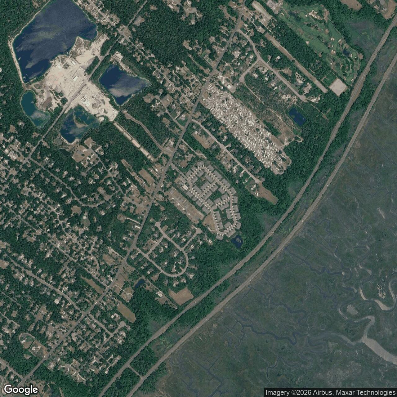
Palermo's physical plant changed after closure. Radar towers, operations buildings, shops, and most support structures deteriorated during years of abandonment. The main installation was demolished in 2003 and redeveloped as the Osprey Point single-family residential community. Recent site photographs show that the Cold War technical landscape has largely disappeared, although isolated communications-related remnants and the former housing area survived longer than the central radar compound.
Closure and Disposal
Radar operations ceased on 1970-03-30. The 680th Radar Squadron was inactivated on 1970-05-30, which provides the most precise administrative close date for the staffed Air Force station. The interval between those dates reflects the distinction between ending the operational mission and completing the unit's inactivation.
The GATR site remained active until 1976, apparently as a detachment associated with the 770th Radar Squadron at Fort Meade. This later communications use did not extend Palermo's main search-radar operating period, but it did prolong an Air Force property and mission relationship in Cape May County. The former family-housing area reportedly transferred to the Coast Guard before later private disposition, creating another closure date that should not be confused with the main station's deactivation.
For years the abandoned technical compound retained deteriorating buildings and towers. Exposure, vandalism, vegetation, and lack of reuse gradually reduced the surviving fabric. Demolition in 2003 removed the main station and cleared the way for residential development.
Current Status
The former main Palermo Air Force Station property is occupied by the Osprey Point residential community in Upper Township. Streets and houses have replaced the central radar, operations, and cantonment areas. The representative coordinate marks the former technical-site location, not an extant military structure or a surveyed boundary.
The former housing and GATR properties followed different paths and may not coincide with the modern Osprey Point boundary. Radar-history sources reported that the housing area was retained after main-site demolition and had previously served the Coast Guard. A communications tower or pole associated with the former GATR function has also been reported. Current parcel ownership and the exact survival of those detached features require cadastral and field verification.
Chronology
- 1948-08 - An AN/TPS-1B Lashup search radar was operating at Palermo and reporting to the manual control center at Roslyn, New York.
- 1950-07 - Korean War conditions accelerated Air Force authorization and Corps of Engineers construction of permanent radar stations.
- 1950-11-27 - The 770th Aircraft Control and Warning Squadron was activated.
- 1951 - AN/CPS-5 search and AN/TPS-10A height-finding radars were added at Palermo.
- 1952-04 - The 770th was operating AN/FPS-3 and AN/CPS-4 radar equipment.
- 1953 - Palermo functioned as a permanent Air Defense Command ground-controlled-interception and warning station under P-54.
- 1957 - Palermo became one of the early operational sites for the AN/FPS-20 search radar and received two AN/FPS-6 height finders.
- 1958-06 - The station began feeding radar information into the SAGE system.
- 1958-10-01 - The 770th was redesignated the 770th Radar Squadron (SAGE).
- 1959 - Palermo added air-traffic-control support to its military warning mission.
- 1961-01-15 - Texas Tower No. 4 collapsed, removing offshore coverage and influencing the decision to retain Palermo as a staffed long-range station.
- 1961-10-01 - The 770th Radar Squadron and the RP-54 designation moved to Fort Meade, Maryland.
- 1961-10-01 - Detachment 1, New York Air Defense Sector, assumed operation of Palermo's retained long-range radar.
- 1962-06-01 - The 680th Radar Squadron (SAGE) was activated at Palermo.
- 1963 - The P-54 designation returned to Palermo as NORAD site Z-54.
- 1963 - The AN/FPS-20 search radar was upgraded to the AN/FPS-65 configuration.
- 1968 - One of Palermo's two AN/FPS-6 height-finder radars was retired.
- 1970-03-30 - Main-station radar operations ceased.
- 1970-05-30 - The 680th Radar Squadron was inactivated, closing the staffed Air Force station.
- 1970-1976 - The detached GATR site R-28 remained in Air Force communications service.
- 2003 - The main abandoned radar station was demolished.
- After 2003 - The former principal technical and cantonment property was redeveloped as the Osprey Point residential community.
- Present - No active Air Force installation remains; detached housing and communications-property details require parcel-level verification.
Information sources (15)
- PDF680th Radar Squadron (SAGE) Unit History
Source for Palermo mission phases, equipment, unit lineage, SAGE service, closure dates, and GATR retention.
- WEBPalermo Air Force Station, Radomes
Source for coordinates, site codes, call signs, radar sequence, operating chronology, and current condition.
- WEBPalermo Air Force Station SAGE, Radomes
Source for the 680th Radar Squadron phase, BUIC II role, and 1970 operational close date.
- WEBSearching the Skies: The Legacy of the United States Cold War Defense Radar Program
Source for Lashup, Permanent System, SAGE, station construction, and national radar-network context.
- WEBAir Defense Command, Air Force Historical Research Agency
Source for the command-level history and continental air-defense mission.
- WEBMIT Lincoln Laboratory, SAGE Air Defense System
Source for SAGE computing, radar-data integration, direction centers, and interceptor-control architecture.
- PDFA Handbook of Aerospace Defense Organization, 1946-1980
Source for Air Defense Command organizational structure and radar-squadron lineage.
- WEBPalermo Air Force Station Notes, Radomes
Source for former-personnel observations and the station's reopening after low-altitude coverage complaints.
- WEBRecent Photographs of Palermo Air Force Station
Source for surviving features and post-closure physical condition.
- WEBPalermo Air Force Station Historical Topographic Map
Source for the former station's mapped location and Sea Isle City quadrangle.
- WEBCape May County Mapping Service
Source for current county mapping and parcel-research access.
- WEBNational Archives, Air Force Aerial Photography
Source for archival Air Force installation and activity photographic research.
- WEBFort Meade Radar Station, Radomes
Source for the 770th Radar Squadron's 1961 relocation and the later Z-227 identity.
- WEBTexas Tower No. 4 Congressional Hearing
Source for the offshore radar-platform collapse that affected Palermo retention decisions.
- WEBGibbsboro Air Force Station Aerial History
Source for southern New Jersey network relationships and the 1961 radar consolidation period.