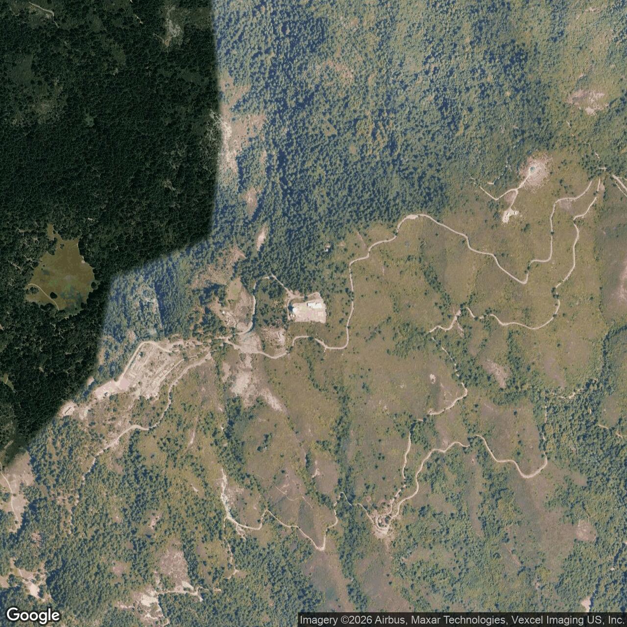
Mill Valley Air Force Station, Mill Valley California
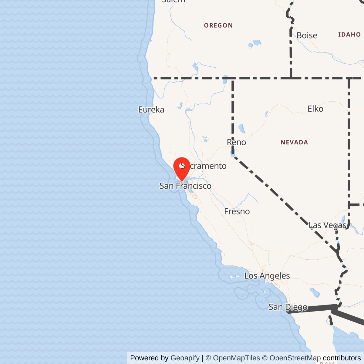
Longitude: -122.59694
Approximate Base Size: 103 Acres
Mill Valley Air Force Station was a Cold War Air Defense Command radar and command-post installation on the West Peak of Mount Tamalpais in Marin County, California. Its name is geographically modest, but its location was anything but. The station stood high above the Golden Gate, San Francisco Bay, the Pacific approaches to central California, Hamilton Air Force Base, the Bay Area Nike missile ring, and the dense civil air corridors entering one of the West Coast's most important metropolitan and naval-industrial regions. Built in 1951 as Mount Tamalpais Air Force Station and soon renamed for nearby Mill Valley, it became one of the Bay Area's most important fixed radar sites during the first generation of permanent Cold War continental air defense.
The installation was not a missile launch site. It belonged in the Air Force air-defense network, with important Army use layered onto the same mountaintop. The Air Force mission centered on long-range surveillance radar, height-finding radar, ground-controlled interception support, SAGE data transmission, and later submarine-launched ballistic-missile warning. The Army mission centered on the Army Air Defense Command Post for the San Francisco Defense Area, which used Mill Valley's high position and radar connectivity to help distribute warning, target, and firing-order information to Bay Area Nike missile units. In that sense, Mill Valley Air Force Station was one of the rare places where the Air Force fighter-interceptor radar system and the Army Nike air-defense system visibly met on the same fenced summit.
The station's physical setting shaped both its importance and its legacy. West Peak was one of the highest and most exposed points in the Marin hills. That made it valuable for radar line-of-sight coverage over the coast and bay approaches, but it also meant the station occupied a visually and environmentally sensitive mountaintop in one of the Bay Area's most beloved public landscapes. Construction flattened and altered the summit, placed radar towers and radomes on the skyline, and created an operating base of roads, barracks, shops, utility structures, housing, recreation buildings, communications facilities, and radar foundations. After the Air Force mission ended in 1980, much of the property passed into National Park Service and Marin Municipal Water District stewardship, while a successor FAA radar presence continued at the summit as Ground Equipment Facility J-33.
Mission Evolution
The first military radar use of Mount Tamalpais predated the permanent Air Force station. During World War II, federal radar and aircraft-warning functions used the mountain as part of the West Coast defense system against the possibility of Japanese ships, submarines, or aircraft approaching the San Francisco area. That wartime radar presence was temporary, but it identified the same basic strategic advantage that the Cold War Air Force later exploited: from Mount Tamalpais, radar could look outward over the Pacific and inward over the bay, giving defenders precious minutes of warning.
The permanent Cold War mission began in 1951. The station was built as part of the early permanent radar network created during the first years of the Korean War and the accelerated U.S. continental-defense buildup. The 666th Aircraft Control and Warning Squadron began operating AN/CPS-6B radar at the Bay Area site in late 1951. In these early years the station served a manual air-defense system. Radar operators detected and tracked aircraft, controllers helped identify unknown tracks, and warning information moved through the Air Defense Command system toward fighter-interceptor units and other defensive forces. Hamilton Air Force Base, across the North Bay at Novato, was the most immediate fighter-interceptor partner in local geography, while the broader system tied Mill Valley into the 28th Air Division and then the San Francisco Air Defense Sector.
The mission deepened as new radars arrived. In 1955 Mill Valley received an AN/FPS-8 radar, later converted to AN/GPS-3 configuration. In 1956 an AN/FPS-4 height-finder radar entered service; by 1958 it had been superseded by an AN/FPS-6. In 1960 the station began operating an AN/FPS-7 search radar in a facility built by General Electric the previous year. By 1961 the 666th was operating the AN/FPS-7, AN/FPS-6, and AN/FPS-6B together. This progression shows the station's transition from the improvised urgency of the early 1950s into a more mature electronic air-defense plant.
The most important mission shift came with SAGE, the Semi-Automatic Ground Environment system. In late 1960 Mill Valley began feeding digitized radar data into SAGE through a Burroughs AN/FST-2 Coordinate Data Transmitting Set. On January 15, 1961, the operating unit was redesignated the 666th Radar Squadron (SAGE). Mill Valley's tracks fed the SAGE system, initially associated with the Beale Air Force Base direction center and later other regional SAGE centers as sector boundaries changed. SAGE did not make Mill Valley a computer center like Beale DC-18; instead it made the station a sensor and data node in a continent-scale network. Local radar returns could become digital tracks available to sector commanders, interceptor controllers, and air-defense decision makers far beyond Marin County.
Mill Valley also became central to Army air-defense command. The Bay Area Nike missile batteries needed early warning and target information before their own acquisition and tracking radars took over. National Park Service material on the Golden Gate Cold War landscape describes Mill Valley Air Force Station on Mount Tamalpais as the early-warning radar source for the Bay Area missile sites and as the location of the Army Air Defense Command Post for the 40th Artillery Brigade and San Francisco NORAD Control Center. The mountaintop command post distributed targets and firing orders to SF-88 and other Bay Area Nike batteries. Battery Integration and Radar Display Equipment, commonly known as BIRDIE, was installed in 1961 to improve the connection between the Army Nike defenses and Air Force warning/control information. That Army use does not make the site an Army base; it makes it a joint-function air-defense node hosted on an Air Force Station.
The station's final Air Force mission layer was missile warning. In 1964 an AN/FPS-26A height-finder radar replaced an earlier height-finder, and the AN/FPS-6B was modified into an AN/FPS-90. In 1966 the AN/FPS-26A was removed from normal SAGE duty and converted into an AN/FSS-7 radar for submarine-launched ballistic-missile detection and warning. This added a different kind of strategic watch to the mountaintop. Mill Valley was no longer looking only for manned aircraft approaching the Bay Area; part of its equipment was also tied to warning against ballistic-missile threats from the sea. The missile-warning function involved the 3d Missile Warning Squadron and later Detachment 3 of the 14th Missile Warning Squadron.
Operational Role
Mill Valley Air Force Station operated as a sensor, identification, and command-link installation. Its crews did not launch aircraft or fire missiles. They watched the air picture, maintained radar systems in harsh mountain conditions, passed tracks, supported identification, and fed the command networks that decided whether an aircraft was friendly, unknown, or hostile. During the early Cold War that mission mattered because warning times were short, radar coverage gaps were dangerous, and the San Francisco Bay Area contained military, political, industrial, and population targets that air defenders could not afford to leave uncovered.
The 666th Aircraft Control and Warning Squadron, later the 666th Radar Squadron, was the station's defining Air Force unit. The squadron's mission changed with its equipment. In the early 1950s it operated manual AC&W radar. By the early 1960s it operated in the SAGE system. In the 1970s, after the Air Defense Command organization evolved into Aerospace Defense Command and later Air Defense, Tactical Air Command, the squadron continued to operate radar functions until inactivation on September 30, 1980. The sequence of redesignations, AC&W Squadron, Radar Squadron (SAGE), then Radar Squadron, captures the technical evolution of the site better than any single mission label.
Daily operations depended on specialized electronic equipment and ordinary base support. The visible radomes and towers were only the most dramatic pieces. Operators, technicians, communications personnel, civil engineers, cooks, administrative staff, motor-pool personnel, security police, weather-exposed maintenance crews, and family-support infrastructure all belonged to the functioning station. HABS documentation records a wide range of structures, including operations, administration, civil engineering, bachelor airmen quarters, housing, mess, exchange, theater, bowling, tennis, heating, utility, and maintenance facilities. At its height, later historic-resource summaries describe the station as containing sixty-two buildings. It was a small mountaintop town built to support round-the-clock electronic defense.
The Army air-defense role added another operational layer. The Army's San Francisco Nike batteries formed an inner ring around the Bay Area after the first line of fighter-interceptor defense. Once hostile or unidentified aircraft were detected, warning and command information moved through Air Force and Army channels. The Mill Valley AFS Army Air Defense Command Post helped direct target assignments and firing orders to Nike units. NPS's preservation history of Nike Site SF-88L describes the chain of command passing from the national command authority through NORAD, ARADCOM, and Mount Tamalpais before reaching the launch and control crews at sites such as SF-88. That chain of command was exactly why Mill Valley mattered: the station linked national warning, regional radar, and local missile batteries.
Mill Valley's SAGE role also connected it to other California and western air-defense installations. Radar information from Mill Valley was part of the data environment serving Beale Air Force Base's DC-18 direction center and later other SAGE direction centers as sectors were reorganized. Related detachments and radar feeds included Mather and other gap-filler or auxiliary functions. The station therefore belonged not just to Marin County but to a chain of radar sites, data links, SAGE computers, fighter bases, and Army missile-command posts stretching across the western United States.
The station's SLBM-warning mission after 1966 reflected the changing threat environment. By the mid-1960s, Soviet bomber attack was no longer the only strategic fear. Submarine-launched ballistic missiles compressed warning time and could approach from the Pacific. Converting the AN/FPS-26A into AN/FSS-7 use at Mill Valley inserted the station into that newer warning problem. It also complicated the station's identity: it was at once a local Bay Area radar station, a SAGE sensor, an Army Nike command partner, and a node in missile-warning architecture.
Facilities and Physical Layout
The former Mill Valley Air Force Station occupied approximately 103 acres at the summit of Mount Tamalpais West Peak. The site was leased by the U.S. Air Force from the Marin Municipal Water District. Its position east of Ridgecrest Boulevard placed the station on a high exposed summit ridge, visually prominent from parts of the Bay Area and operationally valuable for radar coverage. The mountaintop location also meant that the station had to solve problems of access, weather, utilities, visibility, security, and environmental impact that flatland bases did not face.
The radar and operations area formed the heart of the installation. Search and height-finder radars occupied towers and foundations near the summit. Equipment rooms, operations buildings, communications facilities, and power support structures linked those radars to the regional air-defense network. The AN/FPS-26A / AN/FSS-7 tower later became especially important because the FAA reused the structure for an ARSR-4 radar after the Air Force station closed. That reuse makes Mill Valley unusual: the same physical radar-tower footprint that supported Cold War Air Force and missile-warning functions continued to support post-Cold War civil/military air surveillance through the Joint Surveillance System.
The cantonment and support area made the radar mission sustainable. HABS documentation includes records for the guard building, civil-engineering buildings, bachelor airmen quarters, family housing, administration, mess hall, exchange, theater, bowling alley, tennis courts, central heating station, shops, utilities, and other structures. These buildings were mostly products of the 1951 initial construction and later Cold War improvements. The presence of recreational and housing facilities is important because it shows that Mill Valley AFS was not merely a pad with a radar antenna. It was a staffed military station, built to keep personnel on a remote mountain around the clock.
Construction changed the mountain. Later Parks Conservancy and One Tam materials emphasize that the Army Corps of Engineers cut down and reshaped the 2,604-foot West Peak to construct the radar station. That alteration created the flat summit pads and infrastructure scars still central to restoration debates. The same work that gave the Air Force a good radar platform damaged one of the most prominent natural summits in Marin County. Mill Valley Air Force Station's physical history is therefore inseparable from the current environmental and landscape-restoration story.
System-Level Context
Mill Valley Air Force Station belonged to several overlapping systems. The first was the Permanent System radar network built during the early Cold War. That network attempted to close the gaps left by wartime and lashup radar sites and to create continuous warning coverage around the country. Mill Valley's position on Mount Tamalpais made it one of the Bay Area's major sensor sites in that system.
The second system was SAGE. SAGE linked radar stations to computerized direction centers and allowed the Air Force to process and distribute aircraft tracks with far greater speed than manual voice plotting. Mill Valley was not a SAGE direction center; it was a radar station whose data mattered to SAGE. Its significance lies partly in that distinction. The Cold War air-defense system depended not only on famous computer centers and interceptor bases, but on dozens of radar stations like Mill Valley that supplied the tracks.
The third system was the San Francisco Defense Area Nike network. Bay Area Nike batteries ringed the metropolitan area and military-industrial targets. NPS describes Fort Baker as the regional Army Air Defense Command home for the Bay Area Nike sites and identifies Mill Valley AFS as the early-warning source used by those missile sites. "What We Have, We Shall Defend," the NPS preservation history for SF-88L, goes further by placing the Army Air Defense Command Post and San Francisco NORAD Control Center at Mill Valley Air Force Station. That made the station a command bridge between Air Force detection and Army missile engagement.
The fourth system was the FAA / Joint Surveillance System that followed the closure of many manned Air Force radar stations. After the Air Force inactivated the 666th Radar Squadron and the station's Air Force mission ended in 1980, the summit radar function did not vanish. The FAA took over radar facilities, and the site became Ground Equipment Facility J-33 in the Joint Surveillance System. The later ARSR-4 installation continued the summit's air-surveillance role, demonstrating how Cold War military radar geography often became part of the post-Cold War civil/military airspace-control system.
Current Status
Mill Valley Air Force Station closed as an Air Force installation in 1980. Most of the former station property moved into National Park Service and Marin Municipal Water District-related stewardship, while the FAA retained and operates a successor radar facility at the site. The former Air Force station is therefore closed as a military installation but not empty or irrelevant. It remains a highly visible former defense landscape, a communications/radar successor site, an open-space and watershed-management concern, and a restoration challenge.
National Park Service planning material describes the former station as a 103-acre site at the summit of Mount Tamalpais, leased by the Air Force from Marin Municipal Water District in the 1950s and included in the park's authorized boundary in 1972. In 1983, after the Defense Department declared the property excess, the NPS assumed the leasehold interest. The approved planning direction called for removing the site's buildings and restoring the area to a more natural appearance before the lease expired and the property reverted to MMWD control. Not all traces disappeared, however. Foundations, roads, utility remnants, radar infrastructure, and the altered summit form remained part of the West Peak landscape.
Current restoration efforts are led through the One Tam partnership and Marin Water stewardship. One Tam's West Peak materials frame the issue as both ecological restoration and historical interpretation: cleanup should be completed, unique plant communities enhanced, and public access improved so visitors can understand both the mountain's natural value and its Cold War history. The site also has continuing safety and management issues, including damaged legacy power infrastructure identified after severe 2024 storms.
Chronology
- World War II - Mount Tamalpais was used for wartime radar / aircraft-warning purposes tied to the defense of the San Francisco area.
- 1950-07-21 - The Secretary of Defense approved a group of permanent radar stations as part of the accelerated Cold War air-defense network; Mill Valley / Mount Tamalpais belonged to this early permanent radar-building era.
- 1951 - Mount Tamalpais Air Force Station was built and entered service as a Cold War radar site.
- 1951 - The 666th Aircraft Control and Warning Squadron began operating AN/CPS-6B radar at the Bay Area site in late 1951.
- 1953-12-01 - The station was renamed Mill Valley Air Force Station after the nearby community.
- 1955 - An AN/FPS-8 radar was installed and later converted to AN/GPS-3 configuration.
- 1956 - An AN/FPS-4 height-finder radar operated at the station.
- 1958 - The AN/FPS-4 height-finder was superseded by an AN/FPS-6.
- 1959 - General Electric built the facility for the later AN/FPS-7 search radar.
- 1960 - Mill Valley began operating the AN/FPS-7 search radar.
- Late 1960 - Mill Valley began feeding data into the SAGE system through coordinate-data transmission equipment.
- 1961-01-15 - The 666th Aircraft Control and Warning Squadron was redesignated the 666th Radar Squadron (SAGE).
- 1961 - The station operated AN/FPS-7, AN/FPS-6, and AN/FPS-6B radar systems.
- 1961 - Battery Integration and Radar Display Equipment (BIRDIE) was installed to support tighter Nike-defense control.
- 1960s - The U.S. Army shared the site for Nike missile control, designating the San Francisco Defense Area command function as SF-90DC.
- 1963-07-31 - Mill Valley's NORAD identification changed from P-38 to Z-38.
- 1964 - An AN/FPS-26A height-finder radar was added, replacing an AN/FPS-6; the AN/FPS-6B was modified to AN/FPS-90 configuration.
- 1966 - The AN/FPS-26A was removed from SAGE duty and converted to AN/FSS-7 submarine-launched ballistic-missile warning use.
- 1967 - 14th Missile Warning Squadron, Detachment 3, was present at Mill Valley during the AN/FSS-7 missile-warning era.
- 1971-07 - The 13th Artillery Group replaced the 40th Artillery Brigade command post role in the Army air-defense chain.
- 1972 - The former / current Air Force station area was included in the authorized boundary of Golden Gate National Recreation Area.
- 1972-07-08 - Detachment 3 of the 14th Missile Warning Squadron later operated the SLBM-warning radar mission.
- 1974 - With the Bay Area Nike phaseout, the Army air-defense command-post role at Mill Valley ended.
- 1974-02-01 - The 666th Radar Squadron (SAGE) was redesignated the 666th Radar Squadron.
- 1979-10-01 - Mill Valley came under Air Defense, Tactical Air Command jurisdiction.
- 1980-09-30 - The 666th Radar Squadron was inactivated, ending Mill Valley's manned Air Force radar-squadron era.
- 1980 - The site transferred to FAA radar use as part of the Joint Surveillance System transition; the Air Force station closed as a military installation.
- 1983 - After the Defense Department declared the site excess, the National Park Service assumed the leasehold interest in much of the former Air Force station.
- Late 1990s - The FAA replaced AN/FPS-66A use with an ARSR-4 radar at J-33, using the former AN/FPS-26A / AN/FSS-7 tower.
- 2014 - One Tam was founded as a partnership supporting Mount Tamalpais stewardship, including the broader West Peak restoration conversation.
- 2024 - Severe winter storms damaged legacy power-line and pole infrastructure at West Peak, requiring emergency removal work and temporary public-safety closures.
- Present - The former Mill Valley Air Force Station remains closed as an Air Force installation; the summit is a Marin Water / open-space / restoration landscape with continuing FAA radar use at Ground Equipment Facility J-33.