
Cuyama Auxiliary Field No. 6 / Cuyama Airport, Ventucopa California
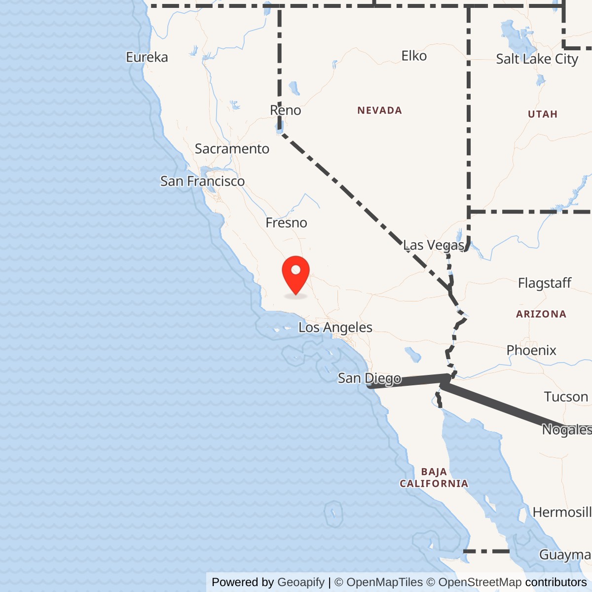
Longitude: -119.4791670
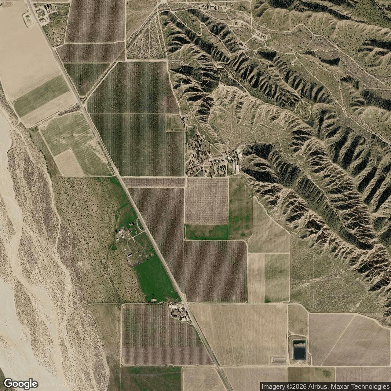
Current Role: Former original-airport footprint in agricultural/private land east of State Route 33 near Ventucopa; no recognizable runway trace in later aerial imagery and no identified active military or airport use. Exact 2026 parcel ownership was not independently reconstructed.
Cuyama Auxiliary Field No. 6 was the most remote and least developed member of Gardner Army Airfield's satellite network. It occupied an existing or emerging airfield site in the upper Cuyama Valley, far southwest of Gardner and immediately east of the road now designated State Route 33. By January 1945 the Army Air Forces directory formally identified it as "Gardner Field Auxiliary No. 6 (Cuyama Airport)," classified the field as Army-Civil, and recorded joint operation by the Army Air Forces and the U.S. Forest Service. The physical site was already appearing on aviation mapping before the War Department acquired its documented military-use permit. Cuyama Airport was absent from the November 1939 Los Angeles Sectional Chart but appeared on the October 1941 edition, where it was depicted as an auxiliary airfield. That chart establishes the existence of an aviation field by 1941, but it does not establish that Gardner controlled it at that time. The military opening date is therefore tied to the later federal permit rather than to the first chart appearance.
The War Department acquired a use permit over 48 acres on 30 December 1942. The Corps-derived history reproduced by California Military History identifies the permit source as the U.S. Forest Service. A December 1945 War Department inventory instead describes the 48 acres as under permit from the Department of the Interior. The January 1945 airfield directory says the property was owned by the U.S. Government and operated by both the Army Air Forces and the U.S. Forest Service. These records agree that the site remained federal land but do not fully agree on the administering-agency terminology. That administrative conflict does not affect the installation's physical identity. The directory coordinates, the 23 July 1943 aerial photograph, later USGS mapping, and the surviving aviation-history reconstruction all place the same narrow runway beside Route 33 in the Cuyama Valley. The evidence supports one distinct Gardner satellite at this location, not a second Army field confused with the later New Cuyama Airport several miles to the northwest.
Prewar and Early Airport Development
The original Cuyama Airport appears to have been established between late 1939 and October 1941. The surviving sectional-chart sequence is the strongest evidence for that period. No deed, county airport resolution, Forest Service order, or civil-airport construction record was located that would establish who first graded or administered the landing ground before the Army permit. The field's early appearance matters because it explains the 1945 "Army-Civil" classification. Cuyama was not simply a purpose-built Army square landing mat like Parker or Allen. It was an austere aviation site that became part of Gardner's wartime training network while retaining a non-Army federal or civil association. The joint Army Air Forces and Forest Service operator listing is consistent with that mixed identity. The exact aviation function before the 1942 War Department permit remains uncertain. A chart symbol can show that pilots were expected to recognize a landing field without revealing who maintained it or how frequently it was used. For that reason, the history does not backdate Gardner's military occupation to 1941 merely because the airport was already depicted.
War Department Permit and Federal Control
On 30 December 1942 the War Department obtained the documented 48-acre use permit. The permit created the military real-estate interest that can be tied directly to Gardner's auxiliary-field mission. Unlike the large leased tracts at several Kern County auxiliaries, Cuyama required only a narrow military footprint sufficient to support the runway and its immediate operating area. The January 1945 directory described a much larger total airport area of 200 acres. That figure should not be substituted for the 48-acre military permit because the directory was describing the entire irregular Army-Civil airport property. The two acreage figures therefore measure different things. Forty-eight acres represents the documented War Department use interest, while 200 acres represents the broader airport envelope recognized by the Army Air Forces directory. The December 1945 War Department inventory reinforces the smaller figure. It lists no owned acreage, 48 acres under permit, $10,480 in construction cost since 1 July 1940, no troop capacity, and an inactive status. The absence of troop capacity and storage agrees with the Corps history and the airfield directory, both of which portray Cuyama as a landing strip rather than a station.
Physical Layout
The best wartime view is the 23 July 1943 aerial reproduced in the January 1945 Army Air Forces Directory. It shows one narrow northwest-southeast landing strip immediately east of the highway. The surrounding terrain is open valley floor framed by rising country, with no visible cantonment or maintenance complex. The airfield was defined by its runway rather than by buildings. The January 1945 directory records a single northwest-southeast sod landing strip 2,640 feet long and 225 feet wide. It lists natural drainage, no reported approach hazards, a wind cone, and no reported runway lighting. The field elevation was 2,749 feet. The directory does not record instrument procedures, a radio range, a control tower, ground-air radio, or other communications equipment.
There were no reported hangars and no shops. Gasoline and oil were unavailable at the airport and were instead available at Gardner Field. There were no transient personnel accommodations at Cuyama. The directory identified Maricopa as the nearest place for lodging in the reference system it used. This support pattern made Cuyama dependent on the parent station and surrounding civilian infrastructure. The Corps-derived history describes the military improvement somewhat differently, reporting a graded dirt strip approximately 3,000 feet long by 100 feet wide and stating that a couple of bulldozers graded the field in one day during 1943. The January 1945 directory's 2,640 by 225-foot sod measurement is the stronger standardized wartime operating description. The two accounts can coexist if the Corps dimensions represent remembered grading work and the directory represents the later defined landing area.
Mission within the Gardner Training System
Cuyama existed to expand the geography available to Gardner's flying school. Gardner trained aviation cadets in basic flying, using aircraft including the Vultee BT-13 Valiant. The parent station needed multiple places where students could practice approaches, landings, takeoffs, traffic-pattern procedures, and alternate-field recovery without placing every training aircraft into Gardner's main pattern. Cuyama was much farther from Gardner than Parker, Taft-Kern, or the Kern-area auxiliaries. That distance changed its practical role. A sortie to Cuyama required a substantial cross-country leg over varied terrain before the student reached the landing strip. The field therefore offered a different training environment from satellites only a few minutes from the parent station.
The Corps-derived history calls Cuyama one of several crude dirt landing strips in the valley associated with bomber and fighter pilot training operations. Local recollections preserved in the same account, however, state that the strip's length allowed only fighters and that it was seldom used. The January 1945 directory gives a runway of only 2,640 feet. These statements do not support a confident claim that bombers routinely operated from Cuyama. Gardner itself was principally a basic flying school rather than a bomber operational-training base. The safer installation-specific conclusion is that Cuyama provided auxiliary, alternate, and training landing capacity for Gardner-area flying. The evidence does not establish a Cuyama-based bomber detachment, fighter squadron, or resident tactical organization.
Aircraft and Training Activity
The Vultee BT-13 was a principal basic trainer at Gardner. A surviving BT-13B held by the Museum of Aviation is documented as having been delivered in February 1944 to the 3034th Army Air Forces Base Unit, Basic Pilot School, Gardner Field. That assignment confirms the aircraft type used by the parent training organization while Cuyama was an active satellite. No serial-number-level sortie record located proves that the museum aircraft, or any specific BT-13, landed at Cuyama. The parent-school aircraft context is therefore used to explain the likely training system, not to create a site-specific aircraft roster. Cuyama had no documented permanently assigned aircraft.
The field's limited facilities made resident operations impractical. There was no fuel, no oil, no shop, no hangar, no radio station, and no quarters. Aircraft had to arrive ready to operate and leave again for servicing elsewhere. That is consistent with a satellite used for landing practice, alternate recovery, and occasional route training rather than a separate flying unit. Local recollection that the strip was seldom used is plausible given its remoteness, but the phrase should not be converted into a numerical sortie rate. No flight logs or daily operations summaries were located. The documentary record proves that the Army Air Forces retained the field in its formal directory and military inventory, even if actual traffic was lighter than at satellites closer to Gardner.
U.S. Forest Service Relationship
Cuyama is unusual among Gardner's auxiliaries because the January 1945 directory names the U.S. Forest Service alongside the Army Air Forces as an operator. The available records do not define the Forest Service's day-to-day aviation role at the field. No dedicated Forest Service aircraft, fire patrol, smokejumper unit, ranger aviation detachment, or permanent airport staff has been identified. The Corps-derived history says no personnel, ground-support facilities, or equipment of any kind were stationed at the site. That statement argues against a conventional staffed Forest Service airport operation during the Army period. Joint operation may have reflected land administration, permission for non-Army use, or shared responsibility for a primitive federal landing ground rather than continuous on-site staffing. The 1945 directory's U.S. Government ownership entry and Army-Civil classification fit that arrangement. Cuyama could serve military training while remaining part of a broader federal land-management setting. The field's history is therefore best understood as a War Department use interest within a federally administered airport landscape rather than as a fully transferred Army reservation.
Command and Organizations
Cuyama had no identified permanent unit. Gardner's training organizations supplied the instructors, students, aircraft, scheduling, maintenance, fuel, and administrative control associated with military use. The auxiliary field itself functioned as infrastructure rather than as the home station of a squadron. Gardner operated under Western Flying Training Command during the principal training period. Its organization changed over time from school squadrons to the standardized Army Air Forces base-unit system. The 3034th AAF Base Unit, Basic Pilot School, is documented at Gardner in 1944. Those units belong in Cuyama's history only as the parent organizations generating training traffic. The lack of a garrison also explains the almost complete absence of installation-specific personnel history. No Cuyama commander, first sergeant, medical detachment, communications crew, or maintenance organization has been found because the site did not operate as a staffed post. Command remained at Gardner.
Inactivation and Military Relinquishment
Gardner's pilot-training requirement contracted rapidly in early 1945. The parent field was inactivated on 28 February 1945. Gardner and its auxiliaries transferred from Western Flying Training Command to Air Technical Service Command on 3 March, and the auxiliary network was placed on inactive status on 10 March. The 10 March date marks the end of Cuyama's active Gardner training mission, but it did not end War Department control of the 48-acre permit. The December 1945 War Department inventory still carried Cuyama as an inactive facility with the permit acreage and construction cost on the books.
The War Department finally relinquished the site to the U.S. Forest Service on 30 November 1946. That day is the most defensible close date for the military installation because it marks the end of the War Department real-estate interest. No evidence was found that Cuyama was reactivated for a later military conflict. There is no documented Korean War, Cold War, Air National Guard, radar, missile, communications, or other postwar defense use at the original field.
Postwar Airport Use
The end of Army use did not immediately erase Cuyama Airport. Aeronautical charts continued to depict the field after the War Department relinquished it. The March 1952 Los Angeles Sectional Chart still showed Cuyama Airport with an approximately 2,700-foot unpaved runway. That March 1952 chart also depicted the newer New Cuyama Airport several miles northwest. The two airfields were distinct. The original wartime Cuyama field beside Route 33 should therefore not be confused with today's New Cuyama Airport, FAA identifier L88, which occupies a different location near the later community of New Cuyama.
The original Cuyama Airport disappeared from the September 1952 sectional chart, establishing an aviation closure window during 1952. A January 1958 USGS aerial nevertheless still showed the old strip as a deteriorated linear feature. A map can stop listing an airport before the physical runway has completely vanished. The 1982 USGS topographic map continued to carry an "Airport" label at the old location even though the field was no longer functioning as a charted airport. By the 1991 topographic edition the airport label was gone. These late cartographic remnants reflect the persistence of place names and landscape traces after active aviation ends.
Federal Land Exchange and Private Reuse
The U.S. Forest Service retained the former military-permit land after the War Department's 1946 relinquishment. The Corps-derived history states that the Department of Agriculture, Forest Service controlled the property for approximately sixteen years after Army Air Forces operations ceased. On 22 June 1963 the Forest Service exchanged 85.28 acres on the east side of Highway 33 to private ownership under the General Exchange Act. The exchange tract included the 48 acres that had been permitted to the Army. That transaction ended the site's federal land-management phase and placed the former military footprint into private hands.
Later descriptions identify orchard use on the former field. By the 1994 USGS aerial, agriculture had erased the recognizable runway pattern, and a 17 April 2013 aerial likewise showed no visible airfield trace. The disappearance is consistent with the site's minimal construction. There were no hangars, barracks, shops, fuel tanks, paved aprons, or administrative buildings to anchor later preservation. Once the graded runway was cultivated, almost nothing remained to distinguish the military landscape from surrounding agricultural ground.
Current Status
The original Cuyama Auxiliary Field site has no identified active military or aviation use. The former runway area lies east of State Route 33 in agricultural land near Ventucopa. Publicly available historical aerial summaries show no recognizable runway trace by the 1990s and 2010s. The 48-acre military-use permit and the 200-acre total airport area should not be interpreted as modern parcel boundaries. The Forest Service's 1963 exchange covered 85.28 acres and reorganized the land after the military period. Present property lines may therefore bear little relationship to wartime administrative descriptions. Today's New Cuyama Airport is a separate facility and is not the physical successor on the same footprint. That distinction is important because modern aviation references to "Cuyama Airport" can otherwise pull researchers many miles northwest of the wartime Gardner auxiliary.
Chronology
- 1939-11 The Los Angeles Sectional Chart did not yet depict Cuyama Airport.
- 1941-10 The Los Angeles Sectional Chart depicted Cuyama Airport as an auxiliary airfield, establishing the field's existence before the documented War Department permit.
- 1942-12-30 The War Department acquired a documented use permit over 48 acres for the Cuyama site.
- 1943 Corps-derived history places the grading of the primitive dirt landing strip in this year.
- 1943-07-23 An Army aerial photograph documented a single northwest-southeast runway immediately east of the highway.
- 1943 The USGS topographic map depicted the site simply as Airport.
- 1944-02 A BT-13B later preserved by the Museum of Aviation was delivered to Gardner's 3034th AAF Base Unit, Basic Pilot School, documenting the parent school's basic trainer during Cuyama's military-use period.
- 1945-01 The Army Air Forces Directory formally listed Gardner Field Auxiliary No. 6, Cuyama Airport.
- 1945-01 The directory recorded coordinates 34 degrees 51 minutes 15 seconds north, 119 degrees 28 minutes 45 seconds west and an elevation of 2,749 feet.
- 1945-01 The directory described a 200-acre irregular Army-Civil airport with a single 2,640 by 225-foot northwest-southeast sod landing strip.
- 1945-01 The directory reported no hangars, shops, on-site fuel, oil, radio range, tower, ground-air radio, instrument approach, or transient accommodations.
- 1945-01 The directory identified the U.S. Government as owner and the Army Air Forces and U.S. Forest Service as operators.
- 1945-02-28 Gardner Army Airfield was inactivated as the wartime training requirement contracted.
- 1945-03-03 Gardner and its auxiliary fields transferred from Western Flying Training Command to Air Technical Service Command jurisdiction.
- 1945-03-10 Gardner's auxiliary network was placed on inactive status, ending Cuyama's active Gardner training mission.
- 1945-12 The War Department inventory listed Cuyama as inactive with 48 acres under permit and $10,480 in construction cost.
- 1946-11-30 The War Department relinquished the 48-acre Cuyama military-use interest to the U.S. Forest Service.
- 1952-03 The Los Angeles Sectional Chart still depicted the original Cuyama Airport with an approximately 2,700-foot unpaved runway and separately showed the newer New Cuyama Airport.
- 1952-09 The original Cuyama Airport was no longer depicted on the Los Angeles Sectional Chart, establishing abandonment during 1952.
- 1958-01-28 USGS aerial photography still showed the former runway in deteriorated condition.
- 1963-06-22 The U.S. Forest Service exchanged 85.28 acres east of Highway 33 to private ownership; the exchange included the former 48-acre Army permit area.
- 1982 The USGS topographic map still retained an Airport label at the former field.
- 1991 The USGS topographic map no longer depicted Cuyama Airport.
- 1994 USGS aerial photography showed agricultural use and no recognizable former airport pattern.
- 2013-04-17 Aerial imagery showed no recognizable remaining trace of the original Cuyama Airport.
- Present The former Gardner Auxiliary No. 6 site has no identified military or airport use and remains an agricultural landscape near Ventucopa.
Information sources (8)
- WEBCalifornia Military History, "Cuyama Auxiliary Field"
Principal Corps-derived source for the 48-acre War Department use permit, 1942-12-30 acquisition, 1943 grading, lack of personnel and facilities, 1946-11-30 relinquishment, 1963 Forest Service land exchange, agricultural reuse, and December 1945 War Department inventory.
- WEBJanuary 1945 Army Air Forces Directory, Gardner Field Auxiliary No. 6, Cuyama Airport
Primary wartime source for the canonical Gardner No. 6 designation, exact coordinates, 200-acre total airport area, 2,640 by 225-foot sod runway, elevation, facilities, ownership, joint Army Air Forces and Forest Service operation, and distance from Gardner.
- WEBAbandoned & Little-Known Airfields, "Gardner Auxiliary Army Airfield #6 / Cuyama Airport"
Source for the 1939-1941 chart sequence, 1943 aerial and topographic mapping, January 1945 directory interpretation, 1952 airport closure window, 1958 and later aerial condition, and distinction from New Cuyama Airport.
- WEBCalifornia Military History, "Gardner Field"
Source for Gardner's training mission, auxiliary-field network, BT-13 and PT-17 context, parent-field commanders and organizations, and broader wartime chronology.
- WEBPacific Coast Architecture Database, "Gardner Field"
Source preserving the Gardner auxiliary roster and identifying Cuyama as Auxiliary Field No. 6.
- WEBWest Kern Oil Museum, "Gardner Army Airfield: The Forgotten WWII Flight School of Taft, California"
Source for Gardner's basic pilot-training mission, cadet program, training aircraft, and local wartime context.
- WEBMuseum of Aviation, "BT-13B Valiant"
Source documenting a BT-13B delivered in February 1944 to the 3034th AAF Base Unit, Basic Pilot School, at Gardner Field.
- WEBVisit Cuyama, "L88 Airstrip"
Current contextual source for the separate New Cuyama Airport, now L88, useful for preventing confusion between the modern field and the original wartime Cuyama site.