
Famoso Auxiliary Field No. 3 / Minter Auxiliary A-3, California
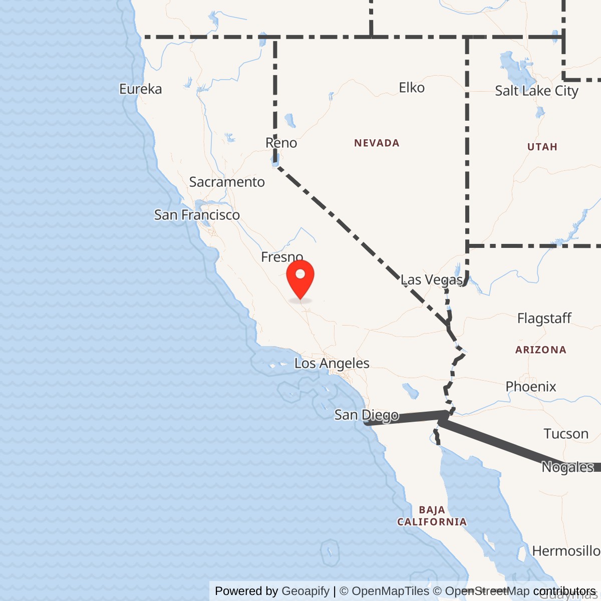
Longitude: -119.2119980
Official Base Website: Former Famoso Auxiliary Field site
Current Role: Former airfield footprint now agricultural and agricultural-industrial land divided by the Friant-Kern Canal; no active aviation use; exact 2026 parcel ownership not independently established
Famoso Auxiliary Field No. 3 was a leased Army Air Corps and Army Air Forces training property built to support the Basic Flying School at Minter Field in California's southern San Joaquin Valley. It was also called Famoso Field, Famoso Auxiliary Field, Minter Auxiliary Field No. 3, and Minter Auxiliary Army Airfield A-3. Federal environmental records later rendered the property name as Famosa Auxiliary Field #3. The installation was not an independent Army air base with its own permanent flying school, cantonment, or resident combat organization. It was a satellite landing field whose purpose was to absorb repetitive flying practice away from Minter's main runway system.
That distinction explains both the simplicity and the importance of the site. Basic flying training demanded large numbers of takeoffs, landings, traffic patterns, forced-landing exercises, and repeated approaches. Concentrating all of that activity at the parent field would have increased congestion and reduced the amount of useful flying each student could accomplish. Famoso provided a separate paved landing surface roughly nine miles north of Minter Field, close enough for instructors and students to use during routine sorties but far enough away to distribute aircraft across a network of auxiliary fields. Its military value came from throughput and repetition rather than from extensive buildings or a large assigned population.
Acquisition, Boundaries, and Opening
The strongest property evidence places the beginning of federal control on 1941-07-01. A USACE-derived property history records that the War Department obtained approximately 500 acres from the Kern County Land Company under Lease W1105-ENG-3215 on that date. The lease was later recorded in Kern County records on 1943-05-19 in Book 1137, page 176. The same history states that the lease was renewed on 1942-07-01 and again on 1943-07-01. This makes 1941-07-01 the best supported opening date for the military property, while the exact day on which the first training aircraft actually used the landing mat remains unverified.
The leasehold figure also resolves an important acreage problem. The January 1945 Army Air Forces Airfield Directory listed Famoso as a 225-acre field, while the property history identifies an approximately 500-acre War Department lease. The directory's number appears to describe the operational airfield area rather than the complete leasehold.
No complete legal boundary reconstruction was located. Later descriptions show that the former military property was divided by the Friant-Kern Canal, a postwar federal water project, which makes modern parcel lines a poor proxy for the 1941 military estate. The representative coordinate used here comes from a later Department of Defense munitions-response inventory and falls very close to the coordinate published in the wartime Army Air Forces directory. That agreement gives high confidence in the general field location while still leaving the exact lease perimeter unresolved.
Site Design and Physical Plant
Famoso was unusually simple even by auxiliary-field standards. The property history describes a paved 3,000-foot by 3,000-foot landing area and only three wooden support structures: a 324-square-foot stage house, a 1,024-square-foot crash truck shelter, and a 36-square-foot latrine. Fencing completed the documented fixed improvements. No barracks, mess hall, hospital, hangar, maintenance shop, fuel farm, ammunition magazine, control tower, or permanent administrative cantonment is identified. The field was designed for aircraft to arrive from Minter, perform training, and return rather than for a large body of personnel to live and work there continuously.
The January 1945 Airfield Directory gives a more operational picture. It described a square road-mix landing mat measuring about 3,000 feet in both principal dimensions, with a 1,570-foot by 100-foot extension projecting from the southeast side. The field was irregular in overall shape and lay at an elevation of about 390 feet. The directory reported natural drainage as adequate and identified no significant approach obstruction within its stated glide-angle criteria. The broad square mat was well suited to training because aircraft could use different landing directions as wind and traffic conditions required without the elaborate paved runway system of a permanent base.
The directory also confirms how limited the support plant remained. It listed no hangars, no shops, no gasoline at the field, no oil supply at the field, no reported radio range or tower, and no transient accommodations on the property. Fuel and servicing resources were available at Minter Field. Transportation references placed U.S. Route 99 west of the airfield and another state road to the east, while rail service was available in the Famoso area. The absence of local fuel, heavy maintenance, and communications facilities reinforces the interpretation of Famoso as a sortie destination and training surface rather than a separately sustained station.
A lighted wind cone appears in the 1945 directory material, showing that the field had at least a basic visual wind indicator for landing operations. Beyond that, the surviving documentation does not support a developed lighting system or instrument approach capability. No evidence was found for a beacon, control tower, permanent radio station, or night-flying complex. The field's simplicity was not a defect. It reflected a deliberate training architecture in which Minter supplied instructors, aircraft, maintenance, fuel, medical support, administration, and communications, while the auxiliary field supplied uncluttered pavement and emergency support for repetitive flight practice.
Mission and Flying Operations
Famoso's mission was basic pilot training for Minter Field. Minter began operations in June 1941 and grew into a major West Coast basic flying school. By July 1942 it was using a network of auxiliary fields that included Famoso, allowing student traffic to disperse across the southern San Joaquin Valley. At Famoso, the most defensible site-specific activities are takeoff and landing practice, traffic-pattern work, instructor-supervised repetition, and the general auxiliary-field tasks associated with the basic phase of Army Air Forces pilot training. The source record does not support turning Famoso into a bombing range, gunnery field, combat station, or depot.
The principal training aircraft at Minter was the Vultee BT-13 Valiant, and the strongest Famoso-specific aircraft evidence also involves a BT-13. Minter additionally operated UC-78s, AT-6s, B-25s, and P-38s at various times, but those parent-base types should not automatically be attributed to Famoso. The most useful visual evidence is a 1944 aerial photograph showing four single-engine aircraft operating along a marked strip across the landing mat. Their exact models cannot be established confidently from the image alone, but the photograph proves that Famoso was an actively used single-engine training field during the wartime program.
Famoso's square mat gave instructors flexibility that a narrow runway could not. Basic students had to learn to judge wind, maintain a pattern, control airspeed, flare, touch down, recover from poor approaches, and repeat those actions until they became routine. An all-direction or broad-mat field reduced dependence on one runway heading and could handle multiple practice cycles with relatively little infrastructure. The southeastern extension documented in 1945 added another defined landing or rollout element to the field. The physical design therefore matched the training mission closely: large usable surface, limited permanent plant, short distance from the parent school, and quick access from the regional road network.
The auxiliary system also served a safety function. Student flying produced frequent mechanical problems, navigation errors, hard landings, stalls, and other mishaps. A network of known auxiliary fields gave instructors and students places to land away from the busy parent field and created reference points across the training area. Famoso's crash truck shelter shows that the Army expected the possibility of aircraft emergencies even though the field had no full fire station or hospital. Emergency response would have been immediate and local at a basic level, with heavier medical and maintenance support coming from Minter.
Units and Organizations
No evidence was found for a permanently assigned Famoso squadron, post headquarters, or separate field commander. The installation functioned under the Minter Field flying-training establishment. Minter's wartime station lists included the Army Air Forces Basic Flying School, aviation cadets, base and support organizations, and multiple Basic Flying Training Squadrons. Those organizations should be understood as the parent system from which Famoso's users came, not as units garrisoned on the auxiliary field. The small number of buildings and lack of barracks make a substantial resident military population unlikely and unsupported.
One unit can be tied to the Famoso area with much greater confidence. The Aviation Archaeological Investigation and Research accident index lists a BT-13, serial 41-10699, from Minter Field's 526th School Squadron in an accident east of Famoso on 1942-04-22. A separate unit-history compilation based on Air Force Historical Research Agency material identifies the organization as the 526th School Squadron, later the 526th Basic Flying Training Squadron, stationed at Minter and equipped with the BT-13A. This does not make the 526th a resident Famoso unit, but it is direct evidence that an identifiable Minter training squadron was operating in the Famoso flying area.
The 526th evidence is important because it allows the site's unit story to remain specific without exaggeration. Other Minter squadrons almost certainly used the auxiliary network, but the reviewed sources do not tie each of them individually to Famoso. The history therefore does not simply copy Minter's full station list into the satellite field's unit section. Famoso was a shared training resource. Its users arrived from the parent school, used the landing surface and limited support plant, and returned to Minter, where personnel were billeted, aircraft were fueled and repaired, records were maintained, and the flying program was directed.
Command responsibility likewise rested at the parent installation. Colonel Carl Pyle is identified in Minter Field histories as the commander when the school began operations in 1941. Famoso's lease and construction occurred within that opening period, but no source located here identifies a separate officer commanding Famoso. The absence is consistent with the field's function and scale. A stage house and crash truck shelter could support temporary duty personnel or field operations without creating a conventional command structure.
1942 Accident and Operational Evidence
The accident on 1942-04-22 is the clearest dated evidence of Famoso-area flying early in the field's life. The indexed Army Air Forces accident record identifies BT-13 serial 41-10699, the 526th School Squadron, Minter Field, and an accident location east of Famoso. Secondary airfield histories describe the accident as occurring at Famoso Field. The exact point of impact has not been reconstructed, so the event should not be placed on the leased parcel without the original accident report or a mapped crash location. It does, however, demonstrate active basic-training flying in the immediate Famoso area by April 1942.
The pilot's name is another small source conflict worth preserving rather than silently resolving. Airfield-history summaries render the pilot as Leroy McDonald, while the indexed accident source gives Larry M. McDonald. Without the underlying individual accident report, it is not possible to determine whether one is a transcription error, a nickname or middle-name issue, or a separate mistake in later summaries. The military significance of the event is unaffected: a BT-13 from a named Minter school squadron was operating near Famoso only months after the War Department acquired the field.
By 1943 and 1944, Famoso was documented cartographically and photographically as part of Minter's auxiliary system. The Airfield Directory used a 1943-07-22 aerial view of the square mat. A Minter local flying-area map also showed the satellite network, and a 1944 aerial photograph captured four single-engine aircraft on the landing surface. Together, these sources establish a stronger operational chronology than a generic statement that the field existed during World War II. Famoso was acquired in 1941, demonstrably used in 1942, photographed as a developed auxiliary in 1943, and visibly active in 1944.
Inactivation and the 1945 Evidence
The January 1945 Army Air Forces Airfield Directory creates the central closure-date problem. It described Famoso as privately owned, operated by the Army Air Forces, and inactive. That combination means the property remained identifiable within the military airfield system even though routine flying operations had ceased or been suspended by the time of the directory.
The lease history does not provide a cancellation or termination document. The War Department lease was renewed on 1943-07-01, but the property history specifically notes that no cancellation or termination information was found. Operational inactivation, lease termination, excess declaration, and final return to unrestricted private use therefore cannot be collapsed into a single event. Famoso was inactive by January 1945, but the exact date on which federal real-property control ended remains unresolved. This distinction is especially important for a leased auxiliary field, where military flying could stop well before legal property obligations were completely settled.
A frequently repeated 1945 accident claim does not solve that problem. Secondary histories state that AT-6C serial 42-44187, flown by Vincent L. Cunniff of Minter's 3008th Army Air Forces Base Unit, crashed at Famoso on 1945-07-16. The Aviation Archaeological Investigation and Research July 1945 index, however, places Cunniff's accident at Fresno Auxiliary Field, California. Because the indexed location conflicts directly with the Famoso attribution, the event cannot be used as proof that Famoso resumed or continued operations in July 1945. The conservative conclusion remains that Famoso was inactive by January 1945 unless a primary accident report or other contemporary source establishes otherwise.
Postwar Transformation
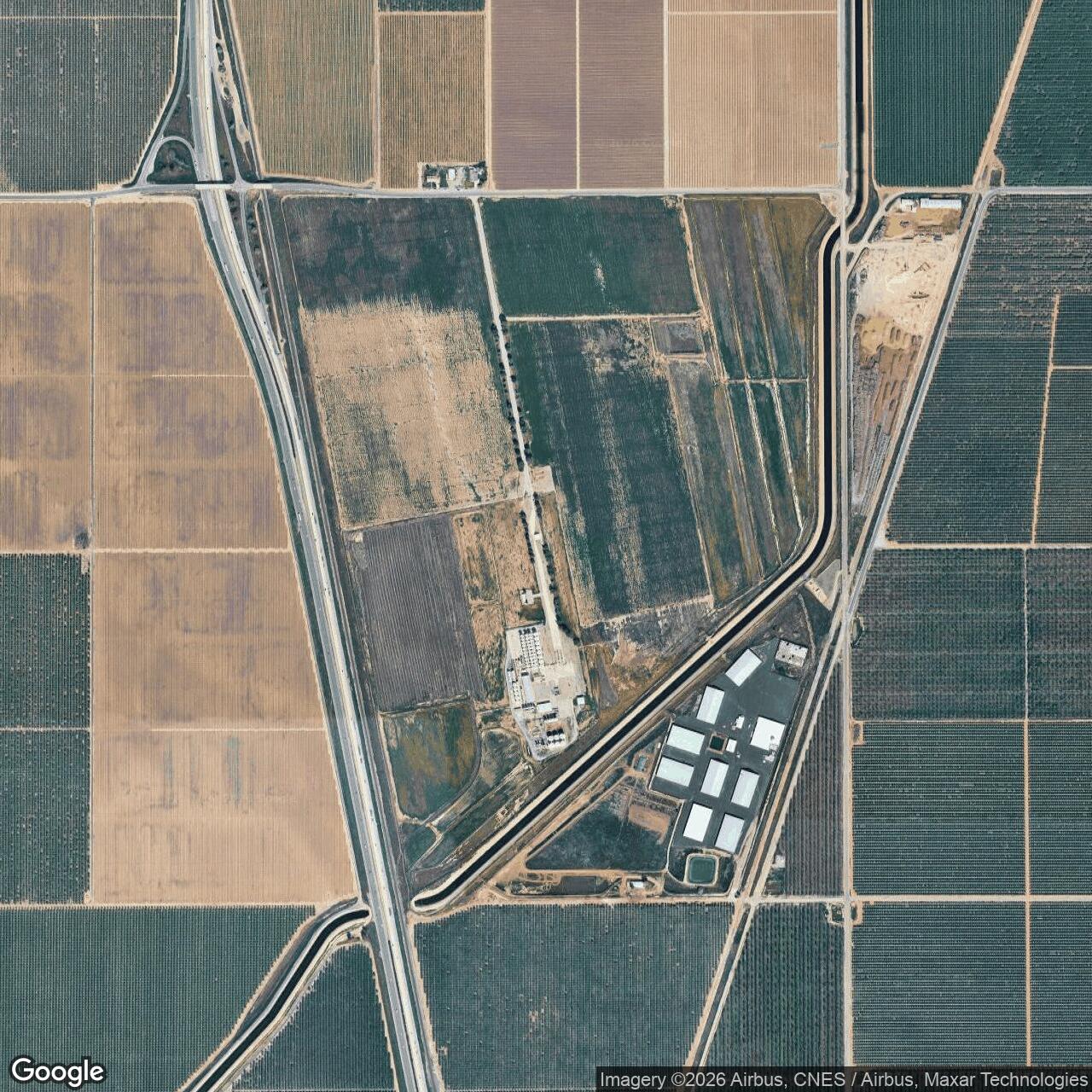
After military flying ended, the field returned to a civilian agricultural landscape and gradually disappeared as an airfield. The property was no longer shown as an airfield on the 1953 USGS topographic mapping cited by later airfield researchers. By the 1990s, aerial photographs showed cultivated land with no clearly recognizable square landing mat. A 2012 aerial likewise showed agriculture, canal infrastructure, roads, and agricultural-industrial development rather than an operating airfield.
One of the largest physical changes was construction of the Friant-Kern Canal. The Bureau of Reclamation records that construction of the canal began in 1945 and was completed in 1951. Later Famoso property descriptions state that the canal divided the former military property into separate parcels. The canal therefore belongs to the site's postwar history rather than to its Army Air Forces layout. It cut across a landscape that had been selected for a broad square landing area and helped make the old wartime geometry less legible as farming and agricultural industry reclaimed the surrounding ground.
Historical property summaries name later private owners and businesses on opposite sides of the canal, including agricultural, winery, cotton, warehouse, and fruit-processing interests. Those names are useful for tracing the site's postwar conversion, but they should not be carried forward as current legal ownership. Exact 2026 parcel title was not independently established in the reviewed public sources. The defensible current-use description is therefore broader: the former field footprint is agricultural and agricultural-industrial land, crossed by the Friant-Kern Canal, with no active military or aviation function apparent in the reviewed record.
FUDS and Environmental Record
The former field remains in the Department of Defense Formerly Used Defense Sites inventory under the property name FAMOSA AUXILIARY FIELD #3, property number J09CA0360. The 2015 USACE California inventory lists one site in the Military Munitions Response Program category. A separate Department of Defense munitions-response listing used the coordinate 35.638302, -119.211998 for the property.
The MMRP classification should not be misunderstood as proof that Famoso was a bombing or gunnery range. The historical property and airfield evidence identifies a basic flying auxiliary field, not a munitions training area. A Department of Defense table covering installations and FUDS properties that achieved Final Response Complete before fiscal year 2021 lists FAMOSA AUXILIARY FIELD #3 with one MMRP site and no IRP site. The table shows the property as having reached the stated response-complete status before FY2021. No site-specific evidence was found here that ammunition was stored, bombs were dropped, or aerial gunnery was conducted on the landing field itself.
The environmental history is therefore best stated narrowly. Famoso entered the federal munitions-response inventory and was evaluated within that program, but the available historical record does not justify importing the more hazardous missions of other Kern County ranges onto this property. Its documented wartime plant consisted of a road-mix landing mat, a stage house, crash-truck shelter, latrine, and fencing.
Current Status and Legacy
Famoso Auxiliary Field No. 3 is closed, erased as an airfield, and no longer under a military flying mission. The old landing surface has been absorbed into an agricultural landscape whose later development includes the Friant-Kern Canal and agricultural-industrial uses. The military footprint is difficult to recognize without historical aerials and property records.
Its historical importance lies in what it reveals about the infrastructure behind mass pilot production. Minter Field could graduate thousands of aviators only because a network of auxiliary fields dispersed repetitive flying and gave students places to practice away from the parent field. Famoso was one of those deliberately austere satellites. Its 500-acre leased property, broad 3,000-foot landing mat, three small support buildings, and direct evidence of 526th School Squadron flying show how little fixed plant was required to create a useful training node. The site disappeared physically because its military purpose was temporary, but its wartime function was integral to the larger basic-training system.
Chronology
- 1941-06 Minter Field begins basic flying operations in Kern County under Colonel Carl Pyle.
- 1941-07-01 The War Department acquires approximately 500 acres from the Kern County Land Company under Lease W1105-ENG-3215 for Famoso Auxiliary Field No. 3.
- 1941 Construction and development create the broad auxiliary landing area and minimal support plant; an exact operational-opening day has not been located.
- 1942-04-22 BT-13 serial 41-10699 of Minter Field's 526th School Squadron is involved in an accident east of Famoso, providing dated evidence of Minter training activity in the Famoso area.
- 1942-07-01 The War Department renews the Famoso lease.
- 1942-07 Minter Field is operating a large network of auxiliary fields that includes Famoso.
- 1943-05-19 The 1941 Famoso lease is recorded in Kern County records in Book 1137, page 176.
- 1943-07-01 The War Department renews the lease again.
- 1943-07-22 An aerial photograph later used in the Army Air Forces Airfield Directory shows Famoso's developed square landing mat.
- 1944 A Minter local flying-area map depicts Famoso within the parent school's auxiliary-field network.
- 1944 A wartime aerial photograph shows four single-engine aircraft operating on a marked strip across the Famoso landing mat.
- 1945-01 The Army Air Forces Airfield Directory lists Famoso as a privately owned, Army Air Forces-operated field that is inactive.
- 1945-01 The directory describes a 3,000-foot square road-mix landing mat with a 1,570-foot by 100-foot southeastern extension and lists 225 acres as the airfield area.
- 1945 Construction begins on the Friant-Kern Canal, which later cuts across the former military property.
- 1945-07-16 A later secondary claim places AT-6C 42-44187 and Vincent L. Cunniff at Famoso, but the indexed accident record places the event at Fresno Auxiliary Field; the Famoso attribution remains unresolved and is not used to extend the operating period.
- 1951 The Bureau of Reclamation completes the Friant-Kern Canal, permanently altering the former airfield landscape.
- 1953 The former Famoso field is no longer depicted as an airfield on the cited USGS topographic mapping.
- 1994 Later aerial research shows the former field under agricultural use with no readily recognizable landing-mat pattern.
- 2012-08-27 Aerial imagery reviewed by airfield researchers again shows agriculture, the canal, and agricultural-industrial development with no obvious surviving airfield trace.
- 2015-09-30 The USACE California FUDS inventory lists FAMOSA AUXILIARY FIELD #3, J09CA0360, with one MMRP site.
- Before FY2021 Department of Defense reporting lists FAMOSA AUXILIARY FIELD #3 among FUDS properties that achieved Final Response Complete before fiscal year 2021.
- 2026 The former auxiliary-field area remains a non-aviation agricultural and agricultural-industrial landscape; exact current parcel ownership has not been independently established in this history.
Information sources (10)
- WEBCalifornia State Military Museum, Famoso Auxiliary Field
Source for the 1941 War Department lease, acreage, lease renewals, buildings, airfield dimensions, later property history, and wartime aerial documentation.
- WEBAbandoned & Little-Known Airfields, Bakersfield Area, Famoso Auxiliary Field
Source for wartime aerials, Minter auxiliary-network context, directory data, accident references, postwar mapping, and later aerial observations.
- WEBCalifornia State Military Museum, Minter Field
Source for Minter Field's opening, command context, training mission, aircraft types, auxiliary-field network, and wartime station organizations.
- WEBAviation Archaeological Investigation and Research, April 1942 USAAF Accident Reports
Source for the indexed 1942 BT-13 accident associated with the 526th School Squadron and the Famoso area.
- WEBAviation Archaeological Investigation and Research, July 1945 USAAF Accident Reports
Source for the conflicting indexed location of Vincent L. Cunniff's 1945 AT-6C accident at Fresno Auxiliary Field rather than Famoso.
- PDF526th Basic Flying Training Squadron unit-history compilation
Source for the 526th School Squadron lineage, Minter station, BT-13A equipment, and unit identification based on Air Force Historical Research Agency material.
- PDFU.S. Army Corps of Engineers, Formerly Used Defense Sites Per State, California
Official source identifying FAMOSA AUXILIARY FIELD #3 as FUDS property J09CA0360 with an MMRP site.
- WEBDepartment of Defense, Munitions Response Site listing at end of FY2014
Official source for the Famosa Auxiliary Field #3 MRS inventory point at 35.638302, -119.211998.
- PDFDepartment of Defense, Status of Active Installations, BRAC Locations, and FUDS Properties Achieving Final Response Complete Before FY21
Official source for the site's Final Response Complete status in the Department of Defense restoration-program table.
- WEBU.S. Bureau of Reclamation, Friant-Kern Canal Project
Official source for Friant-Kern Canal construction beginning in 1945 and completion in 1951.