
Fort Belle Fontaine, Missouri
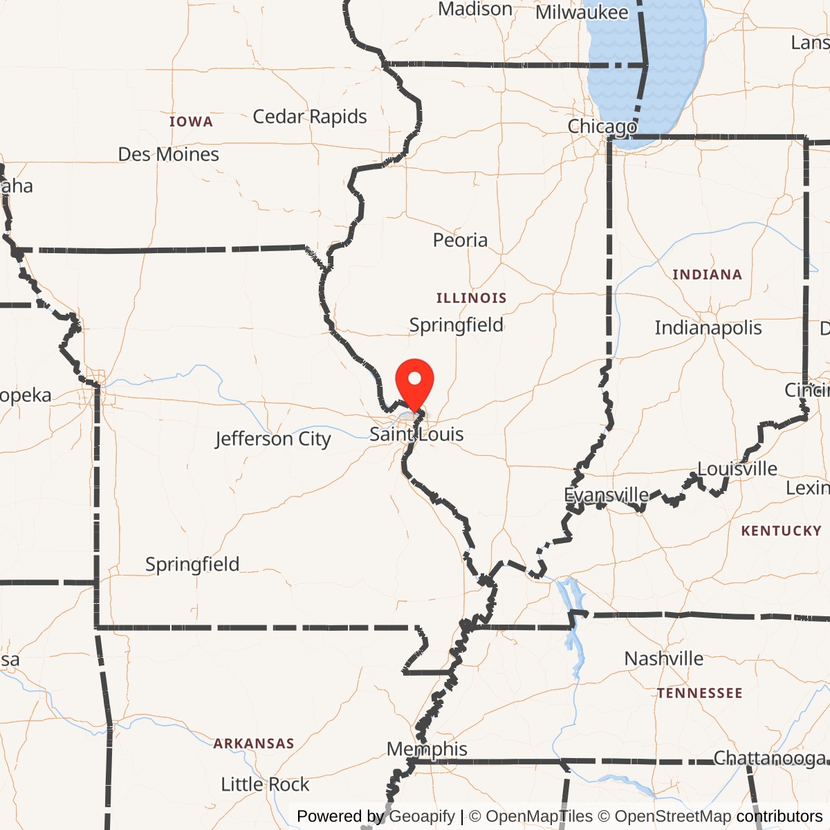
Longitude: -90.2140880
Official Base Website: Fort Belle Fontaine Park
Current Role: Fort Belle Fontaine Park, archaeological site, Lewis and Clark National Historic Trail high-potential site, and WPA-era cultural landscape
Fort Belle Fontaine began where the United States was trying to turn the Louisiana Purchase from a diplomatic acquisition into an administered territory. At the mouth of Coldwater Creek, close to the meeting of the Missouri and Mississippi Rivers, the Army established the first permanent United States military installation west of the Mississippi. The site was not chosen simply because it could be defended. It was chosen because soldiers, traders, Native delegations, government officials, riverboats, supplies, and exploring parties could all converge there. For two decades, Fort Belle Fontaine served as a military post, government trading factory, territorial command center, expedition staging base, river transportation point, and ordnance storehouse.
The installation had two principal physical phases. Cantonment Belle Fontaine, established in 1805, occupied low ground near the Missouri River and the spring known in French as the belle fontaine, or beautiful fountain. That location gave the post direct access to river traffic and to the government trading operation, but it also exposed the soldiers and buildings to flooding, dampness, disease, erosion, and channel movement. Beginning in 1809, the Army shifted the installation to higher ground on the bluff. The second Fort Belle Fontaine, completed in 1811, was a more deliberately fortified post with a rectangular palisade, blockhouses, approximately thirty buildings, and an arsenal.
The term Fort Belle Fontaine Arsenal does not identify a separate major installation. The arsenal was an ordnance storage, custody, repair, and issue function within Fort Belle Fontaine. It was closer to an arsenal of deposit than to a later manufacturing establishment such as Springfield Armory or Rock Island Arsenal. After the main garrison left in 1826, a small arsenal of deposit remained at Belle Fontaine until 1834. The Army then concentrated the former post's two principal functions at newer St. Louis installations. Jefferson Barracks inherited the permanent garrison and troop-support role, while the St. Louis Arsenal became the region's principal ordnance depot and eventually developed limited manufacturing and repair capabilities of its own.
Fort Belle Fontaine's historical footprint also requires careful definition. An early account states that the government acquired 500 French acres for the post, equivalent to approximately 425 modern acres using the Missouri arpent conversion. The current Fort Belle Fontaine Park contains 305.6 acres. Neither figure defines the precise area occupied by buildings at any one time. The original cantonment, the later bluff fort, roads, cultivated areas, landing places, the cemetery, and related support ground shifted across a larger government reservation whose river boundary changed substantially after the Army left.
Mission Evolution
The post's first mission combined military occupation with controlled government trade. The United States had acquired a vast territory but possessed little permanent infrastructure through which to administer it. St. Louis was the region's commercial and political center, yet federal leaders also wanted a post outside the town where Army authority, the Indian factory system, and river expeditions could operate together. Companies of the 1st U.S. Infantry constructed Cantonment Belle Fontaine in 1805 under the direction of Lieutenant Colonel Jacob Kingsbury. Colonel Thomas Hunt became closely associated with the early garrison, while a government factor managed the trading establishment.
The government factory was intended to place trade with Native nations under federal supervision. The post received manufactured goods for exchange and served as a meeting point for Native representatives, soldiers, traders, settlers, and officials. This arrangement was presented by federal authorities as a way to regulate prices and relations, but it was also an instrument of expansion. Trade, diplomacy, military presence, and claims of sovereignty worked together. Fort Belle Fontaine therefore stood at the beginning of a system that offered goods and formal councils while steadily extending American control over Native homelands and river routes.
By 1808, the trading mission was moving outward. The government transferred much of the factory function to Fort Osage on the Missouri River and Fort Madison on the upper Mississippi. That transfer reflected the same expansion that had created Belle Fontaine. Once new posts existed farther into the interior, a trading factory close to St. Louis no longer served the frontier as effectively. Belle Fontaine remained a military cantonment, supply point, and expedition base, but government trade was no longer its defining function.
The second major shift came from the physical failure of the first site. The low river ground was unhealthy and vulnerable. Buildings deteriorated, flooding threatened the cantonment, and the Missouri River altered its course. Lieutenant Colonel Daniel Bissell, who assumed command in 1809 and became military commander of Upper Louisiana, oversaw the relocation to the bluff. The new post sacrificed some convenience at the landing in exchange for drainage, security, and a commanding position above the river. Completed in 1811, the bluff fort was a more conventional military installation than the first trading cantonment.
From approximately 1809 through 1815, Fort Belle Fontaine served as headquarters of the Department of Louisiana. This made it more than a local garrison. The command linked Army posts and detachments across a broad region that included the Missouri and upper Mississippi valleys. During the War of 1812, Belle Fontaine functioned as a regional headquarters and supply point in a theater shaped by scattered settlements, Native alliances, river travel, and long lines of communication rather than by one large battle at the fort itself. The post was threatened and its garrison prepared for danger, but Fort Belle Fontaine was never attacked.
After the war, the installation's importance shifted toward logistics and western movement. Exploring parties, troops, boats, and supplies assembled there before moving up the Missouri. The post supported the ambitious Yellowstone Expedition and associated scientific work, even though delays, contracting problems, unreliable early steamboats, and the river itself prevented the expedition from reaching its original objective. By the 1820s, however, St. Louis had grown, the frontier had moved farther west, and Belle Fontaine's distance from the city had become a burden rather than an advantage. The War Department chose a new permanent garrison site south of St. Louis, and the active military post closed in 1826.
The First Cantonment and Government Factory
General James Wilkinson selected the Coldwater Creek area in 1805. The spring promised abundant fresh water, and the location offered immediate access to the Missouri River. Construction began under Kingsbury with troops of the 1st Infantry. Early descriptions and later local histories identify log quarters for officers, enlisted huts or barracks, a government trading house, bakery, blacksmith shop, storehouses, and other utilitarian buildings. The installation was a cantonment in the practical early Army sense. It was a community of timber buildings and work areas organized to house soldiers and sustain government operations rather than a massive masonry fortress.
The river landing was essential. Supplies from St. Louis could arrive by boat, government goods could be stored for trade, and expeditions could assemble men, boats, weapons, food, instruments, and presents for Native diplomatic meetings. The location made Belle Fontaine a gateway. It also made it vulnerable. The riverbank was a shifting environment, and the same low ground that simplified loading and unloading trapped moisture and exposed the post to high water. Illness became part of the installation's daily reality. The first site demonstrated a recurring problem in frontier post planning: convenient transportation could conflict directly with health and long-term stability.
Fort Belle Fontaine's trading role brought together groups whose interests were not equal. Native nations came to negotiate, trade, seek supplies, and assess the intentions of the new government. French and Spanish residents continued older commercial networks. American soldiers and officials attempted to redirect those networks into a federal system. Private traders competed with the government factory, while Army officers used the post to display sovereignty over territory that the United States had purchased from France but did not physically control in any complete sense. The post was therefore a place of exchange, but also a place where the balance of power was being altered.
The public store impressed the returning Corps of Discovery in 1806. Expedition journals noted that a substantial inventory of Indian trade goods was held there. That stock was not incidental to the fort. It was one of the principal reasons the original cantonment existed. Government merchandise helped support councils, alliances, and the federal attempt to make Native communities economically dependent on official trading channels. When the factory moved west and north in 1808, it carried that policy to Fort Osage and Fort Madison.
Expeditions and Western Reconnaissance
Fort Belle Fontaine's most visible national role was as a threshold between St. Louis and the interior. The site had already been connected to the Corps of Discovery before the fort existed. On 1804-05-14, Lewis and Clark's expedition camped on an island opposite Coldwater Creek after leaving Camp River Dubois. When the expedition returned in September 1806, it found a functioning cantonment where there had been no American fort two years earlier.
On 1806-09-22, members of the Corps reached Belle Fontaine. Sergeant John Ordway described the new fort as a handsome place and recorded that an artillery company fired seventeen rounds from fieldpieces. Most of the returning party was quartered in the cantonment before completing the final journey to St. Louis the next day. The salute made Fort Belle Fontaine part of the public conclusion of the expedition. It was the first American military installation the explorers encountered on their return from the Pacific and a visible sign that federal occupation had advanced while they were away.
Zebulon Pike also used Belle Fontaine as a point of departure. On 1805-08-09, he left with a small detachment to explore the upper Mississippi, locate its source, gather information, and assert United States authority in a region where British commercial influence remained strong. His second expedition departed from the Belle Fontaine landing in July 1806 for the southwest. Pike's parties were small, but their mission combined reconnaissance, diplomacy, mapping, intelligence, and national claims. Belle Fontaine supported those missions by providing soldiers, boats, weapons, stores, and a controlled military starting point.
The post's expedition role reached a larger scale after the War of 1812. On 1818-08-30, Lieutenant Colonel Talbot Chambers led approximately 350 soldiers and boat crewmen from Fort Belle Fontaine as an advance element of the Yellowstone Expedition. The broader operation sought to establish a military presence far up the Missouri and to reinforce American claims against British commercial influence. Colonel Henry Atkinson later assembled a much larger force at Belle Fontaine, while Major Stephen H. Long prepared a scientific component and an experimental steamboat.
The Yellowstone effort exposed the limits of early national power. Contractors struggled to supply the expedition. Early steamboats arrived late or proved unable to overcome Missouri River currents, sandbars, submerged timber, and boiler problems. Major Long's Western Engineer departed Belle Fontaine on 1819-06-24, while the main military steamboats did not leave until 1819-07-05. The expedition reached the Council Bluff region rather than the Yellowstone. Even in partial failure, the operation confirmed Belle Fontaine's role as the Army's major assembly and logistics point at the eastern end of the Missouri River frontier.
The Bluff Fort and Department Headquarters
Daniel Bissell's relocation of the post began in 1809. The new site occupied higher ground above the river, away from the worst flooding and disease conditions of the first cantonment. By 1811, the post included approximately thirty buildings, several blockhouses, a rectangular palisade, and an arsenal. The bluff fort was not a huge work by later standards, but it represented a substantial improvement over the deteriorating riverbank cantonment.
The palisade defined a controlled military enclosure. Blockhouses strengthened the perimeter and provided elevated firing positions. Inside were troop quarters, officer accommodations, administrative and support buildings, storage facilities, and the arsenal. A magazine supported the custody of powder and ammunition. Roads and paths linked the bluff to the river landing, surrounding agricultural ground, St. Louis, and the cemetery. The physical arrangement reflected the post's combined functions. It had to protect its garrison, administer a department, store government property, and move supplies onto the river.
The relocation created a transportation problem of its own. The higher fort was healthier and more defensible, but it was less convenient for boats. Men and cargo had to move between the landing and the bluff. The road to St. Louis was long enough to complicate routine communication. As the city expanded and regional military requirements changed, the Army increasingly wanted a permanent post closer to the urban and transportation center. The very move that prolonged Belle Fontaine's useful life also helped reveal why it would eventually be replaced.
From the bluff, Bissell directed a widely dispersed regional command. Fort Belle Fontaine's importance during these years was administrative and logistical as much as tactical. Orders, reports, personnel, ordnance, rations, trade goods, and intelligence passed through the post. It supported relationships with Fort Osage, Fort Madison, Fort Massac, Vincennes, and smaller posts or detachments across the Department of Louisiana. The headquarters function gave Belle Fontaine authority far beyond its modest garrison size.
War of 1812 Service
The War of 1812 placed Fort Belle Fontaine inside a contested borderland. British officials and traders retained influence among Native nations throughout the upper Mississippi and Great Lakes regions. American settlements and posts were scattered, river communications were slow, and the Army could not assume that distant garrisons would reinforce one another quickly. Fort Belle Fontaine served as the regional command and supply center from which the United States attempted to defend settlements, support other posts, and maintain communication along the Mississippi and Missouri systems.
The installation was not the scene of a major battle. That absence should not be confused with inactivity. The garrison guarded government stores and the regional arsenal, prepared for possible attack, communicated with outlying forces, and supported operations conducted elsewhere. Threats to the St. Louis region, violence along the rivers, and attacks against smaller settlements gave the post's defensive mission real urgency. Its artillery, palisade, blockhouses, and elevated position were practical safeguards, even though no enemy force assaulted the fort directly.
Daniel Bissell's command extended beyond the boundaries of Belle Fontaine. During the conflict he held regional responsibilities and later led troops in operations near the Niagara frontier. The fort's story therefore intersects with wider Army service through its commanders and garrison organizations, but the post should not be credited with battles fought by those individuals after they left Missouri. Its direct contribution was to hold the St. Louis military center, protect supplies, and provide command continuity in the western theater.
The war also reinforced the importance of the river network. Supplies and reinforcements could not simply move over improved roads. Rivers were the principal long-distance transportation routes, and Belle Fontaine stood where the Missouri entered the Mississippi system near St. Louis. The post's location allowed the Army to support both valleys while remaining close to the territory's principal town. That geographic logic remained valid after the war, even as the old fort's physical plant declined.
Operational Role
Daily operations at Fort Belle Fontaine were built around movement and sustainment. Soldiers guarded stores, maintained weapons, repaired buildings, operated boats, escorted officials, drilled, performed fatigue duty, cut timber, cultivated ground, cared for animals, and carried cargo between the landing and bluff. The garrison also supported councils and visiting delegations, processed correspondence, prepared expedition supplies, and maintained the public presence of the United States in the new territory.
The installation's military population changed repeatedly. Companies arrived, departed, or furnished detachments for expeditions and outlying posts. The 1st Infantry was the principal recurring regiment in the fort's history. Artillerymen were present early enough to salute Lewis and Clark in 1806. Riflemen and other troops assembled for Missouri River operations. In 1826, the final reported garrison consisted of four companies of the 1st Infantry under Major Stephen W. Kearny. The post was therefore a working garrison, but not the permanent regimental home that later installations became.
Fort Belle Fontaine also acted as a reception and redistribution point. Government property arriving from the east could be held there, inventoried, repacked, and issued to troops or expeditions. Boats could be built, repaired, or loaded. Personnel moving into the interior could receive final supplies and instructions. Returning parties could report, rest, and surrender government equipment. This throughput role explains why the arsenal and storehouses mattered even when the fort was not under threat.
Medical conditions shaped operations continuously. The low-ground cantonment exposed soldiers to stagnant water, insects, flooding, and contaminated river use. Disease and mortality reduced readiness and helped force the move to higher ground. Even on the bluff, the garrison lived in an era when sanitation, infection control, and medical treatment were limited. The post cemetery became a substantial burial ground for officers, enlisted soldiers, family members, and others associated with the installation.
The fort's labor burden extended beyond uniformed drill. Timber buildings required constant repair. Palisades decayed. Roads washed out. Riverbanks shifted. Boats and wagons wore down. Powder and weapons demanded dry, secure storage. Food had to be grown, purchased, transported, or preserved. The installation's apparent strategic importance rested on this routine work. Without it, the Army could not have projected even small forces into the upper Mississippi and Missouri valleys.
Units / Organizations / Systems
The 1st U.S. Infantry was the installation's most important military organization. Companies of the regiment built the original cantonment under Lieutenant Colonel Jacob Kingsbury and formed much of the recurring garrison. Colonel Thomas Hunt commanded the early post. Four companies of the 1st Infantry under Major Stephen W. Kearny were present in the final June 1826 return before the garrison moved to Jefferson Barracks. The regiment's long association gives Fort Belle Fontaine a direct place in early Regular Army history.
An artillery company was stationed at the post by September 1806. Its seventeen-round salute for the Corps of Discovery is the clearest documented ceremonial event at Belle Fontaine. Artillery personnel also helped give the post a credible defensive capability, supported field expeditions, and maintained cannon, ammunition, and related equipment. The available evidence does not justify assigning a single permanent artillery company designation across the installation's entire life.
The Department of Louisiana headquarters gave the post a command role from roughly 1809 through 1815. This was not a separate combat unit but an administrative and operational system. The department coordinated Regular Army posts and detachments over a broad western region. Fort Belle Fontaine served as the point where strategic direction from Washington met the practical realities of distant garrisons, unreliable communications, Native diplomacy, private trade, and river transportation.
The government factory was another major organization within the first cantonment. A civilian factor and supporting personnel managed trade goods and official exchange with Native nations. The factory was linked to the War Department's broader trading-house system rather than to a private fur company. When the government shifted the operation to Fort Osage and Fort Madison in 1808, Fort Belle Fontaine lost a major tenant and part of its original purpose.
Expedition detachments created temporary organizations around the post. Pike's parties, the Lewis and Clark return reception, Talbot Chambers's advance force, Henry Atkinson's Yellowstone command, Stephen Long's scientific contingent, boat crews, contractors, and support personnel all passed through Belle Fontaine. Their connection to the installation was operational rather than permanent. The fort supplied a starting point and sustainment base, while their exploration, diplomacy, and campaigning occurred far beyond the reservation.
No unit stationed at Fort Belle Fontaine participated in post-World War II conflicts from the installation. The active post ceased in 1826, and the remaining arsenal closed in 1834. Later military service by the 1st Infantry, artillery organizations, Stephen Kearny, Henry Atkinson, or other individuals belongs to their broader unit and personal histories, not to continuing operations at Fort Belle Fontaine.
Facilities / Physical Layout
The first and second posts occupied different landscapes. The 1805 cantonment stood on low ground near the spring and Missouri River landing. Its buildings were largely timber construction suited to rapid frontier use. Quarters, enlisted huts or barracks, a trading house, bakery, blacksmith shop, storehouses, and work areas supported the combined garrison and factory. The arrangement emphasized direct river access more than formal fortification.
The first site has not survived as a stable archaeological footprint. The Missouri River changed channels, eroded banks, deposited sediment, and eventually destroyed or covered the cantonment area. The present river does not preserve the shoreline experienced by the soldiers or Lewis and Clark. Any modern point placed on a map for the first fort is therefore an approximation tied to reconstructed historical geography rather than a visible building location.
The 1811 bluff fort was more structured. National Park Service documentation describes approximately thirty buildings within or associated with a rectangular palisade and several blockhouses. An arsenal and magazine provided secure ordnance storage. The post included quarters, administrative space, support buildings, roads to the landing, and nearby burial ground. The elevated setting gave the Army a commanding view and reduced vulnerability to flooding.
The cemetery lay southwest or southeast along the bluff from the cantonment buildings, depending on the historical reference point used. Later accounts indicate many more burials than the thirty-three marked graves removed in 1904. Officers and enlisted soldiers died at the post from illness, accidents, and other causes during an era of high military mortality. The transfer of identified remains to Jefferson Barracks National Cemetery preserved part of that history, but unmarked burials may remain within the protected archaeological landscape.
Nothing visible in the park should automatically be identified as an original Army wall. The large stone staircase, terraces, change houses, bath structures, and other romantic ruins were built by the Works Progress Administration during the 1930s. They belong to the property's recreation and public-landscape phase, not to the 1805 or 1811 fort. Archaeological remains, artifact scatters, terrain relationships, the spring, the cemetery area, and historical documentation provide the strongest evidence for the military installation itself.
The Arsenal Function
Fort Belle Fontaine's arsenal was a component of the military post. It stored weapons, ammunition, powder, tools, and other ordnance needed by the garrison, expeditions, and outlying forces. The installation also required facilities for inspection, basic repair, packing, and issue. In early nineteenth-century Army language, an arsenal could be a place of deposit and custody without being a major manufacturing complex.
The distinction is important because the name Fort Belle Fontaine Arsenal can suggest a separate factory comparable to later national arsenals. There is no basis for treating it as an independent installation on a different site. The arsenal stood within the bluff fort system and depended on the same garrison, roads, landing, storehouses, and command. Its significance came from regional scarcity. On the early western frontier, even a modest secure stock of powder, muskets, artillery ammunition, spare parts, and tools could determine whether distant detachments remained operational.
When the garrison departed in July 1826, the ordnance function did not end immediately. A small arsenal of deposit remained until 1834. This reduced operation guarded and managed government military property after Belle Fontaine had ceased to be a full Army post. The final closure date of 1834 therefore differs from the garrison closure date of 1826. Recording only one date would erase either the end of the active fort or the final years of federal ordnance use.
The St. Louis Arsenal, established on a new thirty-seven-acre property in 1827, replaced the aging Belle Fontaine ordnance function. Its urban riverfront location was more convenient for transportation, recruiting, repair, storage, and the growing city. Unlike Belle Fontaine, the St. Louis Arsenal developed into a larger depot with arms repair, ammunition work, and an increasingly important role in the Army's western supply network.
Closure and Successor Installations
By the 1820s, Fort Belle Fontaine's buildings were deteriorating and its location no longer matched Army needs. The United States had established posts farther west, St. Louis had grown into the regional center, and the Army wanted a larger permanent installation closer to the city. The War Department selected a site south of St. Louis for Jefferson Barracks.
The last Belle Fontaine return to the War Department was dated 1826-06-30. It listed four companies of the 1st Infantry under Major Stephen W. Kearny. Ten days later, on approximately 1826-07-10, the active military post was abandoned and the troops moved to the new barracks. Jefferson Barracks inherited Belle Fontaine's garrison role and became one of the Army's most enduring installations.
The closure was therefore a transfer rather than a sudden disappearance. Personnel, equipment, administrative responsibilities, and regional functions moved to successor sites. Jefferson Barracks provided a healthier and more accessible troop post. The St. Louis Arsenal provided a better ordnance depot. Belle Fontaine's remaining arsenal of deposit continued only until 1834, and the government disposed of its interests in the property in 1836.
This split succession explains why Fort Belle Fontaine should not be collapsed into either later installation. It was the predecessor to both, but neither Jefferson Barracks nor St. Louis Arsenal occupied the Belle Fontaine reservation. Each developed its own mission, physical plant, units, and history. Fort Belle Fontaine remains the foundational installation that demonstrated the need for permanent Army infrastructure in the St. Louis region.
Post-Military Reuse and Archaeology
After federal disposal, the old reservation passed through private ownership and agricultural use. Buildings deteriorated, materials were removed, and the Missouri River continued to reshape the low ground. By the early twentieth century, only ruins, foundations, cemetery debris, terrain features, and local memory marked the former post.
In 1904, thirty-three identified burials with headstones were removed from the old military cemetery and reinterred at Jefferson Barracks National Cemetery. Contemporary and later research indicates that the cemetery had contained many more interments, including numerous enlisted soldiers whose graves may have lacked durable markers. The transfer connected Belle Fontaine's dead with the successor post, but it did not empty the archaeological cemetery completely.
The City of St. Louis acquired the property in 1913 and established a detention home and training school for boys. This institutional use preserved a large tract from immediate subdivision while introducing new buildings and roads. The Missouri Hills youth facility remains part of the broader property landscape, although it is not part of the former Army installation's military function.
During the 1930s, the Works Progress Administration transformed the riverfront and bluff into a recreation landscape. Workers built the Grand Staircase, terraces, retaining walls, trails, bath and changing structures, picnic features, and scenic improvements. Those stone ruins are now among the park's most photographed elements. They are historically significant in their own right, but they date from the New Deal era, more than a century after the Army left.
Archaeological investigations have been essential because so little original architecture survives above ground. Washington University researchers conducted multiple seasons of testing during the 1990s, helping define the locations and material record of the two military phases. Artifacts, soil features, foundations, documentary maps, and landscape analysis allow historians to reconstruct the fort without presenting the WPA structures as Army ruins.
St. Louis County acquired the park property in 1986. Fort Belle Fontaine was listed on the National Register of Historic Places as an archaeological site in 2016 and is recognized by the National Park Service as a High Potential Historic Site on the Lewis and Clark National Historic Trail. The current park protects the spring, river and bluff landscape, archaeological areas, cemetery vicinity, WPA improvements, and interpretive trails.
Current Status
Fort Belle Fontaine is closed as a military installation. Its active garrison ended in 1826, the reduced arsenal of deposit ended in 1834, and the government disposed of its remaining property interest in 1836. It has no current Army mission, no assigned military unit, and no post-World War II operational history.
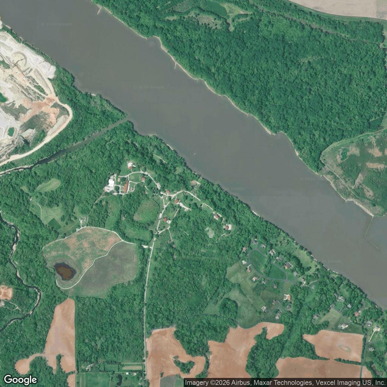
The surviving landscape is Fort Belle Fontaine Park, a 305.6-acre St. Louis County park on the Missouri River. Public access includes trails, interpretive features, river and creek scenery, prairie and woodland, the spring, and the WPA stone landscape. Access conditions can vary because visitors pass through or near the Missouri Hills institutional campus, and flooding can affect lower trails.
Chronology
- 1804-05-14 The Lewis and Clark expedition camped on an island opposite Coldwater Creek shortly after departing Camp River Dubois. The fort had not yet been built.
- 1805-07-23 General James Wilkinson selected the Coldwater Creek and Belle Fontaine area for the new cantonment and government trading post.
- 1805-08-09 Lieutenant Zebulon Pike departed from Belle Fontaine with a small Army party for the upper Mississippi expedition.
- 1805-08-10 Wilkinson reported the establishment of the post.
- 1805 Companies of the 1st U.S. Infantry under Lieutenant Colonel Jacob Kingsbury built Cantonment Belle Fontaine on the low south bank of the Missouri River near the mouth of Coldwater Creek.
- 1805-1808 The original cantonment operated with a federal Indian trading factory, garrison, storehouses, landing, workshops, and support buildings.
- 1806-07-15 Pike's southwestern expedition departed from the Belle Fontaine landing.
- 1806-09-22 The Corps of Discovery reached Belle Fontaine on its return. An artillery company fired a seventeen-round salute, and most of the party was quartered in the cantonment.
- 1806-09-23 Lewis and Clark left Belle Fontaine for St. Louis, completing the final stage of the expedition.
- 1808 The government transferred the factory function to Fort Osage and Fort Madison, leaving Belle Fontaine primarily as a military cantonment and supply post.
- 1808 Colonel Thomas Hunt, an important early commander of the post, died at Belle Fontaine.
- 1809 Lieutenant Colonel Daniel Bissell assumed command and began relocating the installation from the unhealthy low ground to the bluff.
- 1809 The Fort Belle Fontaine military cemetery was established near the bluff-top cantonment.
- 1809-1815 Fort Belle Fontaine served as headquarters of the Department of Louisiana and as the principal regional Army command post during much of the War of 1812 era.
- 1810 Flooding and river-channel change accelerated the abandonment of the first cantonment area.
- 1811 The new bluff fort was completed with approximately thirty buildings, blockhouses, a rectangular palisade, and an arsenal.
- 1812-1815 Fort Belle Fontaine supported regional command, logistics, ordnance custody, and defense during the War of 1812. The post was threatened but not attacked.
- 1818-08-30 Lieutenant Colonel Talbot Chambers led approximately 350 soldiers and boat crewmen from the fort as an advance element of the Yellowstone Expedition.
- 1819-03 Colonel Henry Atkinson began assembling the main Yellowstone Expedition force at Fort Belle Fontaine.
- 1819-05-18 Early steamboats associated with the Yellowstone effort reached the fort after delays.
- 1819-06-24 Major Stephen H. Long's Western Engineer departed Fort Belle Fontaine on the scientific component of the expedition.
- 1819-07-05 The principal military steamboats of the Yellowstone Expedition departed the fort, too late in the season to reach the intended Yellowstone River objective.
- 1825 The War Department moved toward replacing the deteriorating post with a larger permanent garrison nearer St. Louis.
- 1826-06-30 The last Fort Belle Fontaine return listed four companies of the 1st Infantry under Major Stephen W. Kearny.
- 1826-07-10 Approximately ten days after the final June return, the active garrison abandoned Fort Belle Fontaine and moved to the developing Jefferson Barracks site.
- 1827 The federal government acquired a thirty-seven-acre St. Louis riverfront property for the St. Louis Arsenal, replacing Belle Fontaine's principal ordnance-depot role.
- 1826-1834 A small arsenal of deposit remained at Fort Belle Fontaine after the full garrison departed.
- 1834 The remaining Belle Fontaine arsenal operation closed.
- 1836 The federal government disposed of its remaining interest in the Fort Belle Fontaine property.
- 1904 Thirty-three identified military burials were removed from the old cemetery and reinterred at Jefferson Barracks National Cemetery. Other unmarked burials may remain.
- 1913 The City of St. Louis acquired the property and developed a detention home and training school for boys.
- 1936-1940 Works Progress Administration crews created the Grand Staircase, trails, terraces, bath and changing structures, retaining walls, and other public recreation improvements.
- 1986 St. Louis County acquired the park property and developed Fort Belle Fontaine Park.
- 1992-1997 Washington University archaeological investigations examined the military sites and helped refine understanding of the installation landscape.
- 2016-02-23 Fort Belle Fontaine was listed on the National Register of Historic Places as an archaeological site.
- Present Fort Belle Fontaine Park preserves approximately 305.6 acres of river, creek, bluff, archaeological, cemetery, and WPA landscapes. The Army installation and arsenal remain closed.
Information sources (15)
- WEBNational Park Service
Fort Belle Fontaine
- PDFNational Park Service
Pittsburgh to the Pacific: High Potential Historic Sites of the Lewis and Clark National Historic Trail
- WEBSt. Louis County Parks
Fort Belle Fontaine
- WEBDavid L. Browman
Cantonment Belle Fontaine 1805-1826: The First U.S. Fort West of the Mississippi River, Washington University in St. Louis Press
- WEBW. T. Norton
Old Fort Belle Fontaine, Journal of the Illinois State Historical Society, 1911
- WEBUniversity of Nebraska-Lincoln
Journals of the Lewis and Clark Expedition, September 22, 1806
- PDFNational Park Service
Zebulon Pike historical publication
- WEBMissouri Encyclopedia
The Yellowstone Expedition of 1818-1820
- WEBNational Park Service
Stephen H. Long
- WEBSt. Louis Genealogical Society
Fort Belle Fontaine Cemetery
- WEBMissouri Department of Natural Resources
National Geospatial-Intelligence Agency SS-18, history of the St. Louis Arsenal site
- WEBSt. Louis County Parks
History of Jefferson Barracks
- WEBThe Cultural Landscape Foundation
Fort Belle Fontaine
- WEBMissouri State Parks
National Register listings for St. Louis City and County
- WEBSt. Louis County Parks
Bissell House History