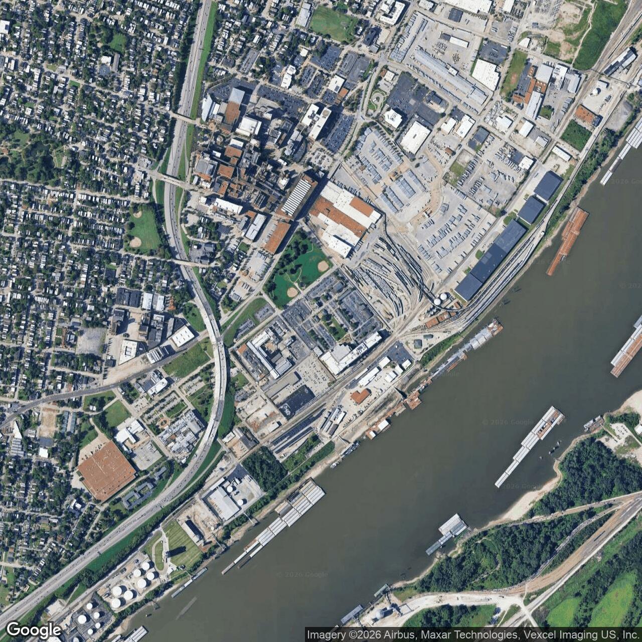
St. Louis Arsenal, Missouri
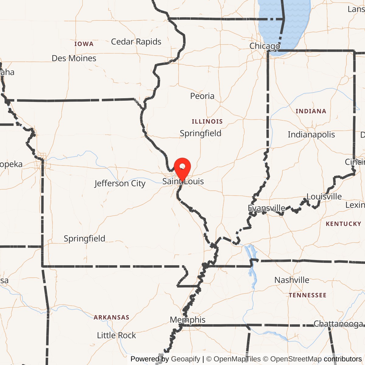
Longitude: -90.2097200
Official Base Website: NGA St. Louis
Current Role: NGA St. Louis / former NGA West federal geospatial-intelligence campus at 3200 S. Second Street; transition to Next NGA West in 2026; Lyon Park occupies part of former arsenal grounds
St. Louis Arsenal occupied one of the most consequential military sites in the nineteenth-century American West. The reservation stood on a bluff-side position near the Mississippi River, outside the older city when construction began, close enough to St. Louis to draw labor, transport, and political attention, but far enough south of the early urban core to function as a guarded federal ordnance reservation. That geography made it more than a warehouse. It was the federal government's arms room for a rapidly expanding frontier, a river-connected military supply point, and in 1861 one of the prizes that could determine whether Missouri would remain under Union control or slide into Confederate hands.
The arsenal was established in 1827, replacing the older and increasingly unsuitable Fort Belle Fontaine arsenal north of St. Louis. The original property was about 37 acres. It served the U.S. Cavalry, regular Army, and militia forces west of the Mississippi as an ordnance depot, recruiting and staging area, arms repair point, ammunition and equipment storehouse, and frontier supply node. Small-arms manufacturing and repair began in 1828, and by the middle decades of the nineteenth century the arsenal supported the Black Hawk War, the Second Seminole War, the Mexican-American War, westward expeditions, emigrant movement, and the mounting sectional crisis that exploded into the Civil War.
The site's identity changed repeatedly. In the 1860s and 1870s, as Rock Island Arsenal assumed many ordnance duties and Jefferson Barracks absorbed related military functions, St. Louis Arsenal shifted increasingly toward storage and support. Part of the property became Lyon Park, memorializing Brigadier General Nathaniel Lyon and the 1861 crisis at the arsenal. The Army continued to use the remaining property for later depot, medical, clothing, mapping, and World War-era functions. In 1952 the property passed from Army jurisdiction to the U.S. Air Force, which used it for aeronautical charting and then for the Defense Mapping Agency and National Geospatial-Intelligence Agency mission. The result is a rare continuity: a nineteenth-century Army arsenal whose ground remained tied to national defense into the geospatial-intelligence age.
Mission Evolution
The first mission of St. Louis Arsenal was frontier ordnance support. St. Louis was the logical military gateway to the trans-Mississippi West. River traffic, wagon roads, proximity to Jefferson Barracks, and the city's commercial reach made it a supply point for regular Army posts, militia forces, expeditions, and settlers moving west. The arsenal stored and repaired weapons, issued equipment, handled ammunition, and supported the Army's ability to project authority along river routes, Indian agency corridors, and overland trails.
Its early role was shaped by the Army's small but dispersed nineteenth-century structure. Frontier posts needed arms, ammunition, tools, accouterments, and repair support but could not maintain full industrial systems of their own. St. Louis Arsenal bridged that gap. It was not a battlefield post, but it mattered because every frontier patrol, militia call-up, expedition, or emergency depended on dependable ordnance supply. Its location near the Mississippi gave the War Department a distribution point that could reach both older eastern supply lines and newer western military needs.
The Mexican-American War expanded that mission dramatically. Demand for arms, ammunition, artillery supplies, and related materiel increased as the United States mobilized forces for operations stretching from Texas and northern Mexico to New Mexico and California. St. Louis was a natural outfitting and movement point. The arsenal's labor force and output rose accordingly, and the installation demonstrated why a permanent federal ordnance facility at St. Louis had been a strategic investment rather than a local convenience.
The Civil War made the arsenal's mission existential. In early 1861, Missouri's political future was uncertain, state officials and secessionist sympathizers maneuvered for control, and the federal arsenal contained arms and powder that both sides understood could change the balance of power. Captain Nathaniel Lyon, Congressman Frank Blair, and Unionist militia forces used the arsenal as their base of operations, moved surplus arms across the Mississippi to Illinois for safekeeping, and then marched from the arsenal to Camp Jackson to neutralize a pro-secession militia encampment. In that moment, the arsenal was not merely supporting the war. It was one of the objects over which the war in Missouri was being decided.
After the Civil War, the mission contracted but did not disappear. Rock Island Arsenal took over many ordnance duties beginning in 1865, and St. Louis Arsenal became more of a storage and support installation. The property was reduced by transfers, including land for Lyon Park. Over time the complex carried names and functions such as St. Louis Depot, St. Louis Barracks, St. Louis Clothing Depot, and St. Louis Medical Depot. By the twentieth century, the older ordnance identity had been layered with logistics, medical, clothing, and mapping activities.
World War II and the Cold War redirected the site again. The Army Air Forces created an aeronautical charting program in St. Louis during World War II, initially using leased urban space. The charting function became more important as global air operations expanded. After the Air Force became a separate service, the charting workforce grew. In 1951 the Air Force established the Aeronautical Chart and Information Center, and in January 1952 jurisdiction over the St. Louis Arsenal property transferred from the Army to the USAF. The former Army arsenal became a base for aeronautical chart production, Defense Mapping Agency work, National Imagery and Mapping Agency functions, and ultimately NGA St. Louis. The installation's mission moved from storing weapons to producing geospatial knowledge, but both functions served the same broad need: giving the military the material or information required to operate at distance.
Operational Role
The operating life of St. Louis Arsenal began with the practical work of nineteenth-century ordnance. Weapons had to be stored, repaired, assembled, inspected, and issued. Ammunition had to be secured, produced or prepared, and protected from fire and theft. Equipment had to be maintained for mounted troops, infantry, artillery, militia units, and federal expeditions. The daily work was industrial and logistical rather than glamorous, but it was the kind of work that made distant operations possible.
By the 1830s and 1840s the arsenal was serving a wide geographic field. It supported the 1832 Black Hawk War and supplied the 1836 Second Seminole War. In the 1840s it produced ammunition and weapons in support of the Mexican-American War and supplied expeditions moving toward the Pacific. The Missouri Department of Natural Resources history notes that pioneers heading west stocked up on weapons and ammunition there during the 1850s. Those functions tied the arsenal to westward expansion, frontier conflict, and federal territorial power in ways that were direct even when the soldiers using the equipment were far from St. Louis.
The arsenal's most decisive operational moment came during the secession crisis. Missouri was a slave state with divided loyalties, and St. Louis was both a commercial metropolis and a center of strong Unionist immigrant politics. The arsenal's weapons and gunpowder were therefore an immediate strategic concern. If the arsenal fell to secessionist forces, St. Louis might follow, and federal control of the Mississippi Valley would be threatened. If the arsenal remained in Union hands, Missouri's largest city and a vast store of arms would remain available to the United States.
In April and May 1861 Lyon and Blair turned the arsenal into a mobilization center. Pro-Union recruits, many of them German immigrants, were armed and mustered there. Surplus arms and munitions were moved across the river to Illinois to prevent their capture. On May 10, 1861, Lyon and Blair led about 6,500 troops from the arsenal to Camp Jackson, where they forced the surrender of the Missouri militia encamped there. The capture helped preserve the arsenal and St. Louis for the Union, but the march of prisoners back through the city sparked violence, deaths, injuries, and days of unrest. The arsenal was therefore both a defensive stronghold and the starting point of one of Missouri's defining Civil War crises.
The site's physical buildings were part of that security story. Historic American Buildings Survey documentation for Building No. 6, a large brick structure built about 1850, states that the building was fortified and involved in the April and May 1861 disturbances, when Confederate sympathizers attempted to seize ammunition and arms. The HABS description identifies the building as originally owned by the U.S. Army and used as an ordnance depot, and later owned by the U.S. Air Force as an aeronautical chart and information center. That one building captures the site's long operational arc from Civil War arms security to Cold War mapping support.
The post-Civil War role was less dramatic but still useful. The arsenal shifted toward storage as Rock Island Arsenal took on many of its ordnance duties. The Army continued operations there for decades, and the property became part of a wider St. Louis military support landscape that included Jefferson Barracks, depots, medical functions, clothing stores, and later charting activities. During World War I and World War II, the old arsenal ground still had enough federal utility and buildings to support military logistics and mapping-related work.
The Air Force and mapping era made the site operationally relevant in a new way. In 1943 the Army Air Forces activated the St. Louis Aeronautical Chart Plant, which opened on May 1 and produced more than 14 million charts in its first seven months. The charting mission supported global air operations during World War II, then expanded again during the Korean War and Cold War. The Air Force established the Aeronautical Chart and Information Center in 1951, transferred the arsenal property from Army to Air Force jurisdiction in January 1952, and moved the chart plant to the former arsenal site that June. From then through the Defense Mapping Agency, NIMA, and NGA eras, the old arsenal supported geospatial products, imagery intelligence, and mapping support for national security operations.
Facilities and Physical Layout
The original St. Louis Arsenal tract contained about 37 acres between the Mississippi River and what became Broadway, near Second and Arsenal Streets. It was chosen partly for river access and partly because it was outside the congested city core. Over time, rail rights-of-way, river-improvement grants, and public-park transfers reduced the remaining federal reservation. National Register documentation for the later St. Louis Air Force Station historic district described the present historic reservation as about 22 acres, with ten buildings dating from 1830 to 1906. Missouri DNR describes the current SS-018 site as approximately 24 acres within the NGA west campus.
The early arsenal had the layout of a guarded ordnance installation. Magazines, storehouses, workshops, barracks, walls, gates, and administrative spaces supported the movement and protection of weapons and ammunition. The surviving or documented building stock reflected Federal, Greek Revival, and later federal military architectural traditions. The National Register material emphasized that the remaining buildings preserved the layout of a major early nineteenth-century arsenal, even after alterations and twentieth-century military reuse.
Building No. 6, documented by HABS before its demolition in 1960, was one of the strongest examples of the arsenal's physical story. It stood at Second and Arsenal Streets, was built about 1850, and was a large two-story brick structure with simplified Greek Revival details. HABS recorded that it had been fortified during the 1861 crisis. Its later use by the Air Force as an aeronautical chart and information center shows how the same durable federal construction could be repurposed across a century.
Lyon Park is part of the physical story as well. Land from the old arsenal was transferred to the city for a park dedicated to Nathaniel Lyon, the officer credited by many Unionists with saving the arsenal and keeping Missouri from passing into Confederate military control. The park is therefore not just adjacent open space. It is a memorial remnant of the arsenal crisis and a visible sign that the federal reservation was progressively carved down after its primary ordnance mission declined.
The current federal campus at 3200 South Second Street retains the broad site identity but not the full nineteenth-century landscape. It has been altered by twentieth-century military and intelligence construction, parking, roads, environmental cleanup, security needs, and changes to the surrounding industrial riverfront. Missouri DNR's SS-018 profile treats it as a cleanup site owned by Scott Air Force Base and operated by NGA, with NGA using the facility for geospatial and imagery products in support of national security. The historic arsenal survives less as an untouched museum complex than as a layered federal reservation with original, altered, demolished, and repurposed elements.
Civil War Crisis and the Camp Jackson Affair
The St. Louis Arsenal became one of the most important military sites in Missouri before the first major battle in the state. After Fort Sumter, Governor Claiborne Fox Jackson refused Lincoln's call for troops and worked with pro-secession elements while Missouri's population remained divided. The arsenal held weapons and gunpowder that could equip whichever side controlled it. The fact that other Southern arsenals had already been seized made the threat credible.
Nathaniel Lyon's response was aggressive. Working with Frank Blair, he helped organize and arm Unionist forces at the arsenal. NPS's Ulysses S. Grant National Historic Site account notes that Lyon shipped surplus weapons across to Illinois for safekeeping. The NPS account also states that the Missouri State Guard encampment at Camp Jackson threatened the federal arsenal, and that Lyon and Blair led a preemptive march on May 10, 1861, with 6,500 troops to force the surrender of a roughly 700-man garrison.
The NPS Civil War Series account of Wilson's Creek adds that Blair and Lyon mustered and armed more than 2,500 recruits at the St. Louis Arsenal, with authorization for many more, and that federal leaders secretly moved virtually the entire cache of arms and munitions across the river to Illinois. It then describes the May 10 march from the arsenal to Camp Jackson and the surrender of 669 militia. The immediate military result was a Union success. The wider political result was explosive.
As Lyon's troops marched the prisoners through St. Louis, hostile crowds gathered and violence erupted. The Camp Jackson Affair caused deaths, injuries, riots, and deep anger. Many Missourians who had opposed secession also recoiled from what they saw as federal coercion. Yet the strategic outcome was that the arsenal did not fall. The federal government retained control of St. Louis, its river access, and its major store of arms. In that sense the arsenal's defense shaped the entire Missouri campaign that followed, including Lyon's advance across the state and the road to Wilson's Creek.
Role in the Wider Military Network
St. Louis Arsenal belonged to several overlapping military networks. In its earliest decades it was part of the Ordnance Department's frontier supply system, serving posts, militia forces, expeditions, and conflict zones west of the Mississippi. It replaced Fort Belle Fontaine in part because the older post could no longer meet the scale and geography of western military requirements. From St. Louis, the Army could move arms and ammunition along the Mississippi, Missouri, and overland routes.
During the Mexican-American War and the era of westward expansion, the arsenal functioned as a logistical hinge between the settled East and the trans-Mississippi West. It supported not only formal campaigns but also the military side of exploration, settlement, and security along western routes. The arsenal's significance therefore extends beyond St. Louis. It was one of the installations through which federal power was converted into weapons, supplies, and movement across a widening continental domain.
During the Civil War, St. Louis Arsenal became a network node in a different way. It linked local Unionist militias, federal regulars, the War Department, Illinois safe-storage measures, and Missouri political strategy. Its successful defense helped keep St. Louis in Union hands and helped deny secessionist forces a major arms reserve. The arsenal mattered because arms in storage could become armies in the field, and because river control depended on control of the cities and depots behind the river line.
In the post-Civil War period, the arsenal's network role migrated toward other institutions. Rock Island Arsenal absorbed many ordnance responsibilities. Jefferson Barracks remained a major military post. St. Louis Arsenal became a supporting depot and later a platform for other federal defense functions. That shift did not erase the site's importance. It demonstrates how an installation could decline in its original mission while remaining useful because of location, federal ownership, buildings, and infrastructure.
The twentieth-century charting mission placed the site in the global air and intelligence network. The Army Air Forces needed aeronautical charts for worldwide operations, and St. Louis offered an inland production and distribution location with a strong transportation network. Under the Air Force, ACIC, Defense Mapping Agency, NIMA, and NGA, the former arsenal supported the mapping and geospatial information systems that replaced ordnance as a decisive operational requirement. The site's old purpose was to help soldiers and armies move with weapons; its later purpose was to help aircrews, commanders, and intelligence users understand the world they had to navigate.
Current Status
St. Louis Arsenal is no longer an Army installation. The Army transferred the property to the U.S. Air Force in 1952. The current SS-018 / NGA St. Louis site is owned by Scott Air Force Base and operated by the National Geospatial-Intelligence Agency, according to Missouri DNR's environmental profile. The site has long produced cartographic and imagery products and provided geospatial information for national security objectives.
The current federal campus is also in transition. Official St. Louis Next NGA West material states that NGA staff are moving from the older Second Street location to the new Next NGA West campus in the historic St. Louis Place neighborhood in 2026. That means the historic arsenal ground remains a federal military-intelligence landscape, but its long NGA occupancy is entering a new phase. Environmental cleanup, property disposition, preservation, and future reuse may become increasingly important parts of the site's next chapter.
Physically, the public-facing historic landscape is limited. Lyon Park preserves the memory of the arsenal crisis and the property transfer that reduced the original arsenal tract. Historic-marker and HABS/NRHP documentation preserve the story of buildings that have been altered, removed, or absorbed into later federal use. The site remains important precisely because it is not a simple preserved ruin. It is a working and changing federal reservation whose history runs from frontier ordnance through Civil War crisis to military cartography and geospatial intelligence.
Chronology
- 1827 Congress authorized and construction began on the U.S. Arsenal at St. Louis at what became Second and Arsenal Streets, replacing the older Fort Belle Fontaine arsenal.
- 1828 Small-arms manufacturing and repair work began at the new arsenal.
- 1832 The arsenal provided materiel for the Black Hawk War.
- 1836 The arsenal supplied the Second Seminole War.
- 1840 By this period the arsenal had become a substantial federal ordnance facility with numerous buildings and a small military and civilian workforce.
- 1843 The arsenal supported Fremont's expedition toward the Pacific.
- 1846-1848 During the Mexican-American War, the arsenal produced and supplied weapons, ammunition, and related military stores for wartime operations.
- 1850s Pioneers and western movements drew on St. Louis as an outfitting and arms-supply point, while the arsenal remained an important federal arms reserve.
- 1861-04 The St. Louis Arsenal became a central target in Missouri's secession crisis after Fort Sumter and the seizure of other arsenals.
- 1861-04-29 Lyon moved surplus arms and munitions across the Mississippi River to Illinois for safekeeping.
- 1861-05-10 Lyon and Blair led troops from the arsenal to Camp Jackson and forced the surrender of the pro-secession Missouri militia encampment.
- 1861-05-10 to 1861-05-12 Violence and rioting followed the Camp Jackson Affair in St. Louis.
- 1861-1865 The arsenal remained in Union hands and supported federal control of St. Louis and Missouri.
- 1865 Rock Island Arsenal began assuming many of the St. Louis Arsenal's ordnance duties, reducing St. Louis Arsenal's role to mainly storage and related support.
- 1870s Portions of the old arsenal property were transferred for Lyon Park and other public or federal uses.
- 1879 Land was given to the city of St. Louis for a public park dedicated to Brigadier General Nathaniel Lyon, according to Missouri DNR's summary.
- Early 20th century The installation continued to carry Army depot, barracks, clothing, medical, and support identities.
- 1943-01 The Army Air Forces activated the Aeronautical Chart Plant in St. Louis.
- 1943-05-01 The St. Louis Aeronautical Chart Plant opened and rapidly produced charts for World War II air operations.
- 1947 The U.S. Air Force became a separate service, setting the stage for the charting mission's later Air Force control.
- 1951 The Air Force established the Aeronautical Chart and Information Center.
- 1952-01 Jurisdiction of the St. Louis Arsenal property transferred from the Army to the U.S. Air Force.
- 1952-06-21 The Aeronautical Chart Plant moved to the former arsenal site.
- 1972 The mapping mission became part of the Defense Mapping Agency.
- 1975-01-17 The St. Louis Air Force Station historic district was listed in the National Register of Historic Places.
- 1996 The National Imagery and Mapping Agency succeeded earlier mapping functions.
- 2003 NIMA became the National Geospatial-Intelligence Agency.
- 2019-09 Missouri DNR accepted the Air Force final record of decision for the SS-018 cleanup remedy.
- 2026 Official city Next NGA West materials state that NGA staff are moving from the Second Street location to the new Next NGA West campus.
- Present The former St. Louis Arsenal site is no longer an Army installation. It is a historic federal military and intelligence property associated with Scott Air Force Base and NGA, with legacy environmental cleanup and future-reuse questions tied to the transition from the older Second Street campus.