
Cape Simpson DEW Line Station, Alaska
A five-module camp and a 240-foot tower kept watch over a low-flying approach to Alaska's Arctic coast.
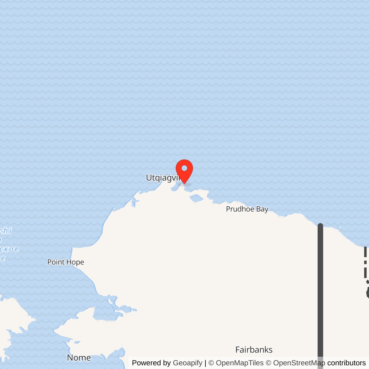
Longitude: -154.73
Site Number: POW-A
Current Role: Former DEW Line station; North Slope Borough-owned property and abandoned former airstrip in later planning records.
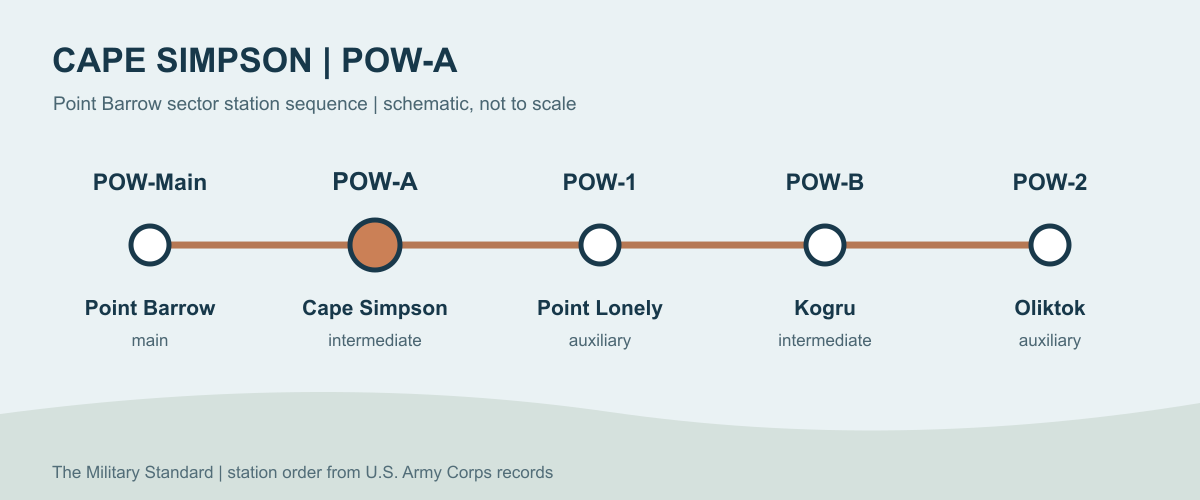
Cape Simpson, code POW-A, was an intermediate station in the Point Barrow sector of the Distant Early Warning Line. It stood east of Point Barrow POW-Main and west of Point Lonely POW-1. The station's AN/FPS-23 equipment helped detect low-flying aircraft between the larger search-radar sites. Cape Simpson entered service in August 1957 and its radar mission ended on July 21, 1963. [1] [3]
- DEW Line code
- POW-A.
- Station type
- Intermediate gap-filler station.
- Radar system
- AN/FPS-23 continuous-wave Doppler system.
- Operating period
- August 1957 to July 21, 1963.
- Documented tower
- 240 feet.
- Documented runway
- About 2,500 by 100 feet in a 1977 inventory.
- Location
- Simpson Peninsula, North Slope, Alaska; approximately 71.057, -154.730.
Building the Station
The DEW Line was built to give North America warning of aircraft approaching across the Arctic. Point Barrow was a main station with a long-range search radar and sector support services. Cape Simpson was a much smaller intermediate site about 50 miles southeast of Barrow. Its position on the Simpson Peninsula placed a gap-filler transmitter between the Point Barrow main station and the Point Lonely auxiliary station. [1] [3]
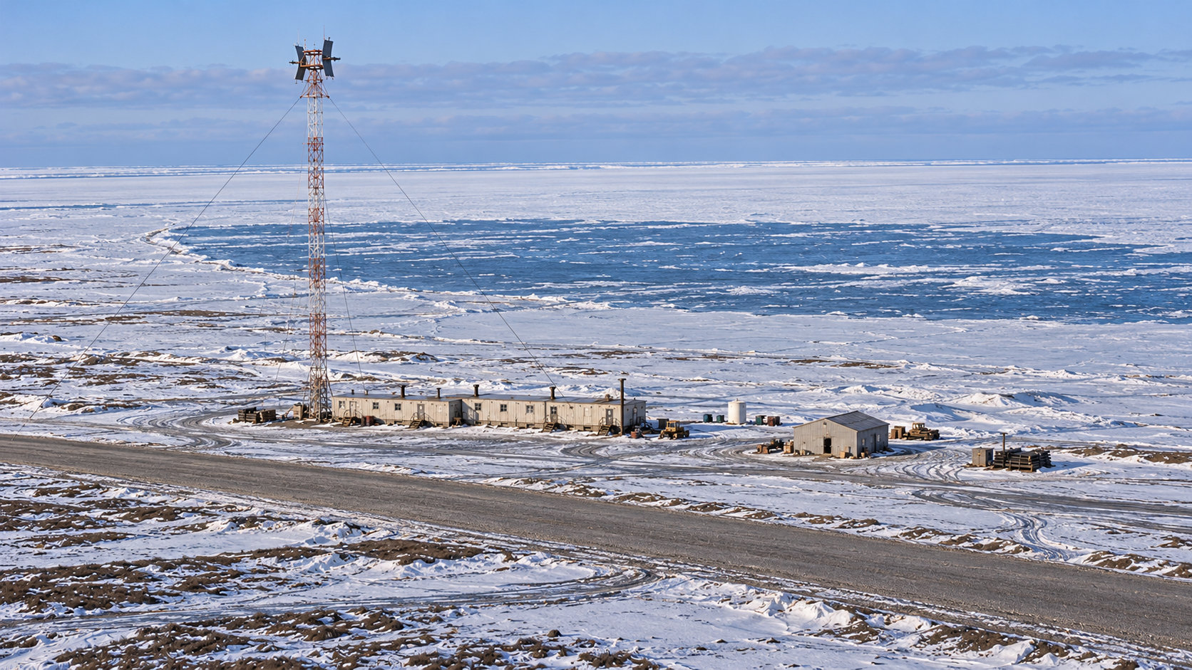
Construction photographs identify a five-module train at Cape Simpson in March 1956. By June, its Doppler tower and antennas had been installed. The connected modules gave the crew an enclosed place to work, eat, sleep, and keep essential machinery running, while the exposed tower carried the radar equipment above the flat tundra. Construction preceded the station's August 1957 entry into DEW Line service. [1] [9]
The Radar Fence
The AN/FPS-23 was a continuous-wave Doppler gap-filler nicknamed Fluttar. Rather than scanning the horizon with a rotating dish, an intermediate station transmitted a signal toward receivers associated with neighboring radar stations. An aircraft crossing the monitored area changed the received signal and could trigger an alert. Cape Simpson's transmitter therefore strengthened the low-altitude warning fence between the larger radars. [3] [4]
In the Point Barrow sector, Cape Simpson was one of several intermediate sites. Kogru, McIntyre, and Brownlow Point lay farther east, while Point Lonely and Oliktok were auxiliary radar stations. The Corps recorded a 240-foot tower and hut at Cape Simpson. The station depended on its generators, communications, and neighboring receivers as well as the tower itself. [1] [3]
Buildings and Airstrip
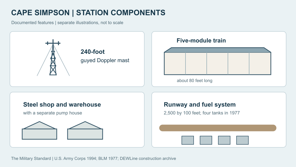
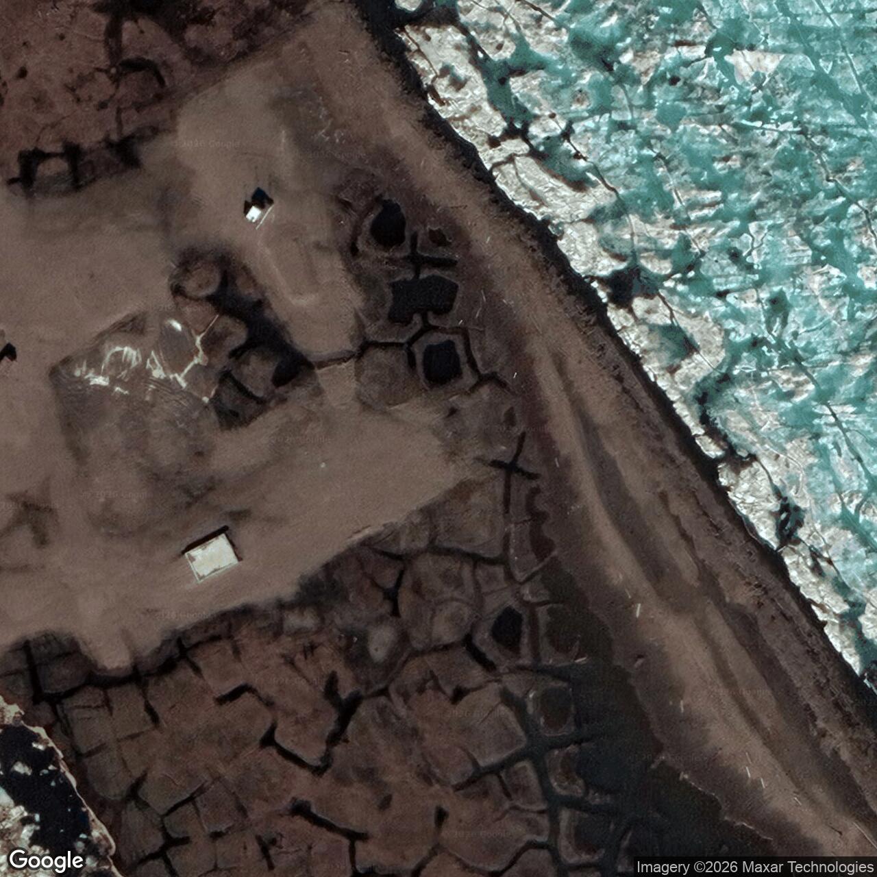
A Corps field inventory in 1987 found the wood-frame operations building, steel warehouse, steel shop, 240-foot tower and hut, pump house, and concrete building foundations. The operations building held the working heart of the small station. The shop and warehouse supported repairs and stored the equipment and provisions needed between supply visits. The pump house served the station's fuel system. [1]
A 1977 federal inventory described three remaining DEW Line buildings, four 20,000-gallon steel fuel tanks, and a gravel runway about 2,500 feet long and 100 feet wide. Runway lights and an antenna system were also recorded. These details show how an isolated radar post could receive aircraft, fuel, replacement parts, food, and mail while operating far from a road network. The 1977 list describes the closed site; the 1987 Corps survey recorded surviving structures in more detail. [1] [2]
Life at POW-A
Intermediate stations were small camps. DEW Line museum and veteran accounts describe a typical complement of about four or five people, including an electronics station chief, a mechanic, and a cook. At Cape Simpson, the five-module train gave that small team an enclosed base beside its tower and support buildings. The radar mission could continue only while the crew maintained power, heat, fuel, food, and communications through Arctic weather. [5] [6] [9]
A typical intermediate module train was about 80 feet long and 28 feet wide. Its first module housed three generators; the second held the Doppler transmitters and VHF radio. The remaining modules combined kitchen and dining space, sleeping quarters, water and fuel storage, and a motor-generator for the radar equipment. That compact arrangement put work and domestic life in one connected building. [5]
Work at an intermediate station extended well beyond maintaining the transmitter. Electronics needed attention, generators had to run continuously, and the mechanic kept vehicles and the runway usable for supply flights. Meals and shared living space were part of the same compact installation. Unlike Point Barrow's main station, Cape Simpson had no large support camp or rotating long-range search radar. Its small crew maintained one link in a much larger chain of early-warning sites. [3] [5] [6]
Closing the Gap-Filler Station
As search-radar coverage improved, the Air Force found the FPS-23 intermediate fence less useful. It ordered the intermediate stations in Alaska and Canada inactivated on July 21, 1963. That ended Cape Simpson's six-year radar mission. Point Barrow and Point Lonely followed different histories as larger DEW Line stations; Cape Simpson did not become a later North Warning System radar site. [1] [3]
The Former Site
When federal investigators surveyed Cape Simpson in 1977, they described the station as abandoned but recorded its runway, remaining buildings, tanks, and lights. The Corps still found several major structures in 1987, although the abandoned installation had deteriorated. The runway was being used by scientists, fishermen, and a local subsistence camp. The Corps considered the former station eligible for the National Register of Historic Places and recorded it through the Historic American Engineering Record program. [1] [2]
A later North Slope Borough planning document lists Cape Simpson's 2,500-foot runway as an abandoned former DEW Line airstrip. Federal planning records identify the former station on North Slope Borough property within the National Petroleum Reserve in Alaska. Its former military purpose is best understood through the short period when a small crew kept the gap-filler radar and its tall tower in service along the Arctic warning line. [7] [8]
Chronology
- March 1956: A construction aerial shows Cape Simpson's five-module train. [9]
- June 1956: A construction photograph records the installed Doppler tower and antennas. [9]
- August 1957: Cape Simpson POW-A begins DEW Line service with AN/FPS-23 equipment. [1]
- July 21, 1963: The Air Force inactivates the intermediate gap-filler station. [1] [3]
- 1977: A federal inventory records the former station's runway, three buildings, four fuel tanks, lights, and antenna system. [2]
- 1987: A Corps field survey records the operations building, steel warehouse and shop, tower and hut, pump house, and foundations. [1]
Information sources (9)
- PDFU.S. Army Corps of Engineers, The Cold War in Alaska: A Management Plan for Cultural Resources, 1994, pp. 187, 195
Cape Simpson code, AN/FPS-23, service dates, 1987 structure inventory, later runway use, and preservation assessment.
- PDFBureau of Land Management, Baseline Studies of the Physical and Manmade Environment: The Beaufort Sea Region, December 1, 1977, p. 69
Former Cape Simpson station acreage, runway dimensions, lights, antenna system, remaining buildings, and fuel tanks in 1977.
- PDFAir Defense Command, A History of the DEW Line, 1946-1964, Historical Study No. 31, 1965
Intermediate-station mission, system organization, and 1963 retirement of the FPS-23 network.
- WEBMIT Lincoln Laboratory, SAGE: Semi-Automatic Ground Environment Air Defense System, DEW Line development section
Technical explanation of the AN/FPS-23 continuous-wave Doppler low-altitude gap-filler.
- WEBDEWLineAdventures, Aux and Intermediate Site Layout
Typical five-module intermediate station arrangement, staff roles, power equipment, and living facilities.
- WEBDEWLine Museum, DEW Line station types overview
Typical intermediate-station complement of about five people and network context.
- PDFBureau of Land Management, National Petroleum Reserve in Alaska Draft Integrated Activity Plan and EIS, Volume 1, Table 3-14
Former POW-A intermediate site identified on North Slope Borough property.
- PDFNorth Slope Borough, Comprehensive Plan 2019-2039, Table 25
Cape Simpson former DEW Line runway, 2,500-foot length, ownership, and abandoned condition.
- WEBDEWLineAdventures, Site POW-A: Cape Simpson, Markham Cheever construction photographs
Site-specific March 1956 five-module aerial and June 1956 Doppler tower and antenna photographs.