
McCallum Radio Relay Station, Alaska
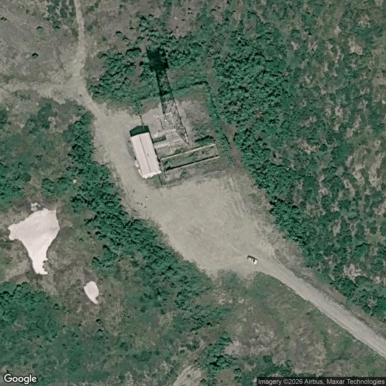
An unattended microwave repeater in the Alaska Range carried missile-warning communications between Black Rapids and Paxson.
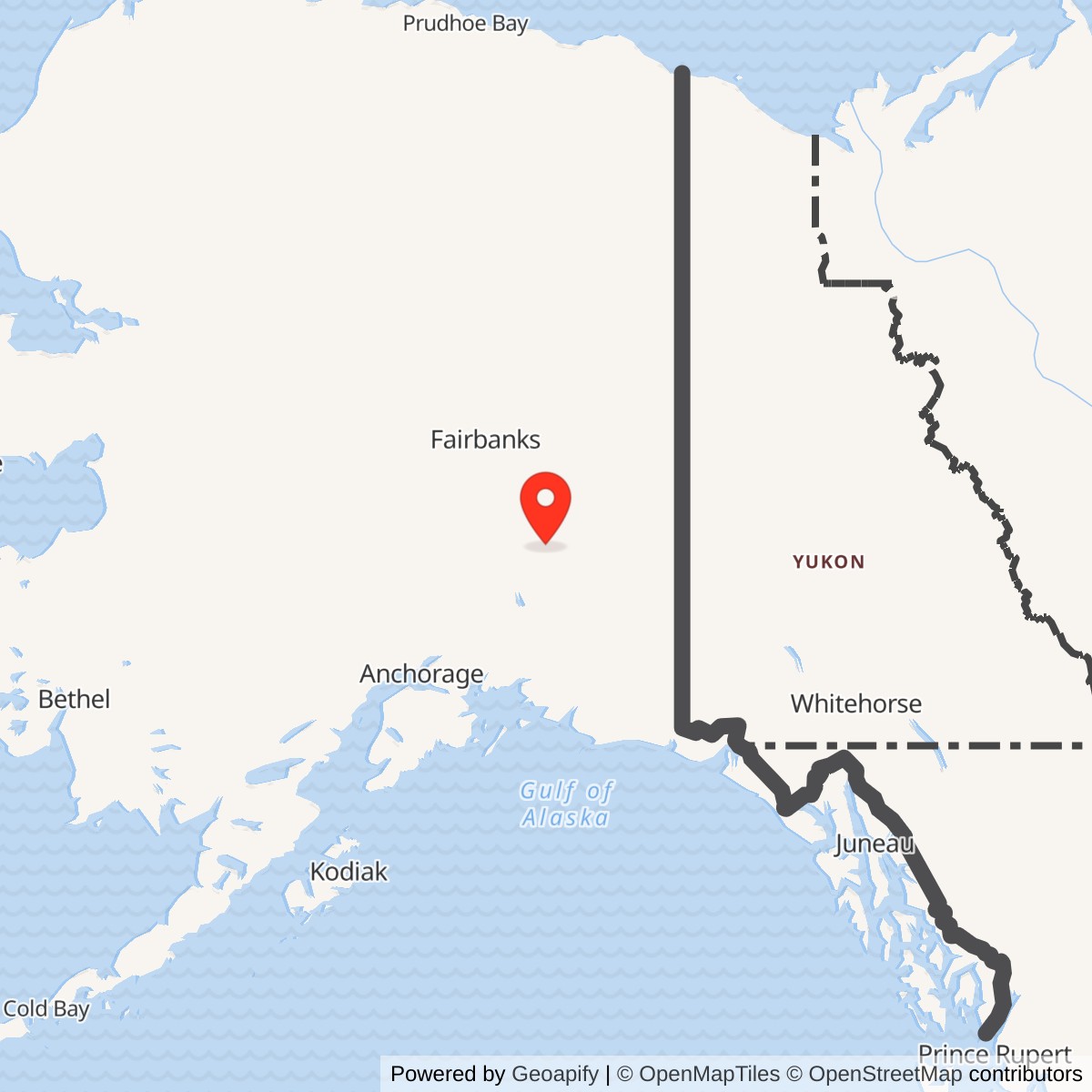
Longitude: -145.648409
McCallum Radio Relay Station was a small U.S. Air Force communications site near Richardson Highway mile 202. It belonged to the White Alice Communications System route built to carry rearward communications for the Ballistic Missile Early Warning System (BMEWS) at Clear. McCallum passed microwave traffic between Black Rapids to the north and Paxson Lake to the south. It was a relay, not a radar or missile-launch installation. [1] [2]
- Military role
- Unattended White Alice microwave repeater on the Clear BMEWS A Route.
- Equipment class
- TD-2 line-of-sight microwave.
- Direct links
- Black Rapids, about 20 miles; Paxson Lake, 20 miles.
- Location
- Near Richardson Highway mile 202 and McCallum Creek, Alaska.
- Map point
- 63.238611 N, 145.645833 W, from a 1976 radio-license notice; not a parcel survey.
Construction and Military Purpose
White Alice first connected Alaska's remote air-defense stations across terrain that made conventional long-distance communications difficult. The Air Force extended the network for Clear's BMEWS warning mission, using a chain of microwave relays on the A Route through Interior Alaska. The Army Corps of Engineers dates construction of this rearward-communications segment to 1960 and lists its stations as opening in 1960 or 1961. A station-specific commissioning day for McCallum has not been established. [1] [2]
The A Route continued through Southeast Alaska to the Ketchikan-Seattle submarine cable and onward to NORAD in Colorado. A parallel B Route crossed into Canada. Together they gave Clear more than one rearward communications path. McCallum was an intermediate A Route repeater where the chain crossed the Alaska Range along the Richardson Highway. [1]
The Black Rapids to Paxson Link
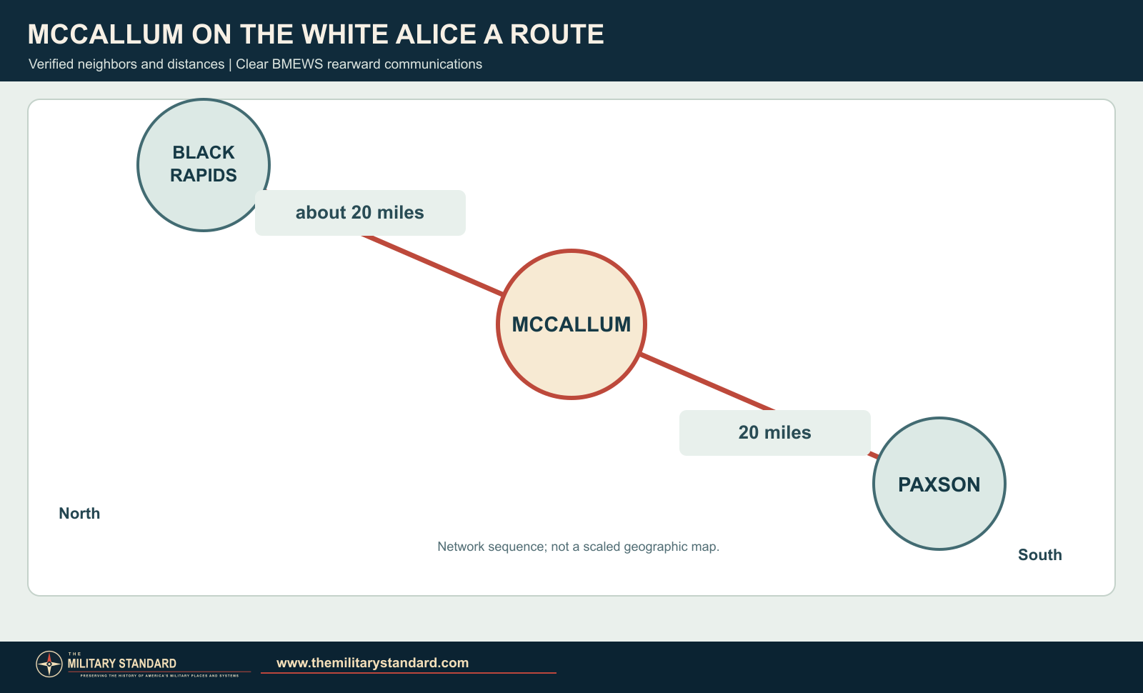
The Corps inventory names McCallum's adjacent stations as Black Rapids and Paxson. It gives the southward hop to Paxson as 20 miles; its table gives 19 miles northward to Black Rapids, while the Black Rapids entry gives 20 miles back to McCallum. About 20 miles is the appropriate description of that northern link. The Air Force's 1983 study calls McCallum an unattended microwave repeater between the same two stations. [1] [2]
Beyond its immediate neighbors, the circuit continued north from Black Rapids to Donnelly Dome and south from Paxson to Aurora. McCallum was not a switching center. Its active radio equipment received, restored and retransmitted a signal so that the next hop could carry it farther along the defense route. [1] [2]
A December 1976 federal notice identifies RCA Alascom microwave applications at McCallum. The listed directions point toward Paxson and Black Rapids, confirming the station's place in the line-of-sight chain. The notice records licensed frequencies and paths at that time, not the date when the original Air Force station first operated. [3]
Station and Location
The Air Force located McCallum at Richardson Highway mile 202. An Alaska geological survey described a microwave-station maintenance road following McCallum Creek about two miles eastward from the highway. A contemporary radio-license coordinate, 63°14'19" N, 145°38'45" W, provides the map point used above. It identifies the licensed radio location, not the corners of the former military property. [2] [3] [4]
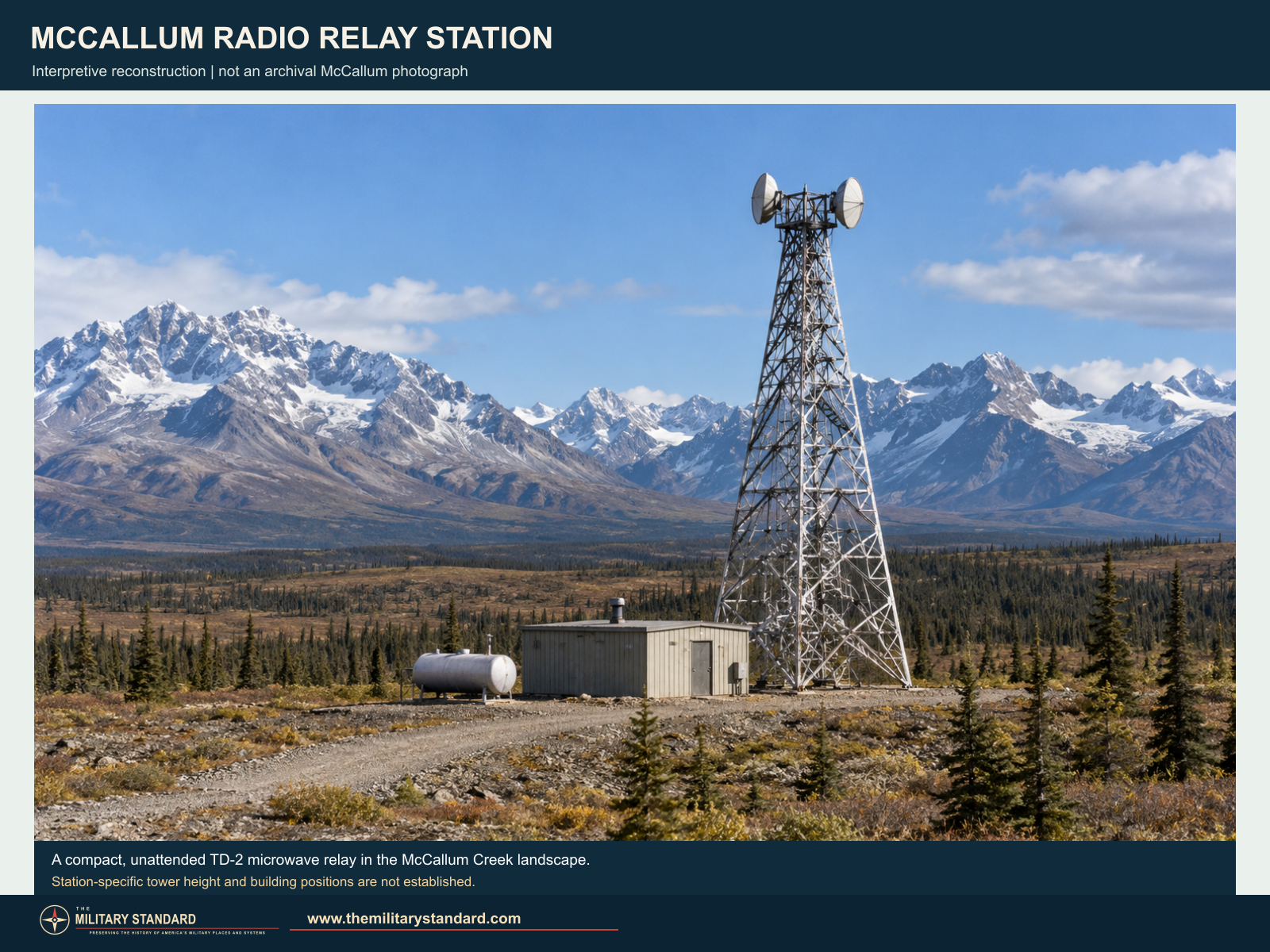
The Corps describes a typical station on this BMEWS segment as having a radio relay building, fuel storage and a TD-2 tower. McCallum's small, unattended role fits that station class. Its microwave dishes were different from the immense billboard-shaped troposcatter reflectors used at other White Alice locations. The image below illustrates the station type, not a measured McCallum layout. [1] [2]
Period documentation of Rabbit Creek, another TD-2 relay, shows the equipment family in operation: directional antennas connected by waveguides to indoor receivers and transmitters, supported by batteries and standby generation. It illustrates the active relay function of a station such as McCallum. [1]
Commercial Transition and Land Records
RCA Alascom began operating White Alice under a system-wide lease in 1976. It expressed interest in buying road-accessible TD-2 properties in 1977, and the Air Force commissioned an appraisal in 1978. McCallum remained among the microwave properties reviewed in the 1983 sale study. A later Alaska facility list names an AT&T Alascom McCallum Microwave Repeater, reflecting the location's continuing telecommunications identity. The precise transfer date and survival of the original Air Force tower remain unverified. [2] [7]
In 1977 the Corps proposed reserving a roughly five-acre tract for the McCallum radio relay site. The Bureau of Land Management terminated the proposed withdrawal in 1989 after the Corps cancelled its application. The five-acre figure describes that proposed land action, not a verified acreage for every military or later telecommunications improvement at McCallum. [5] [6]
Historical Images
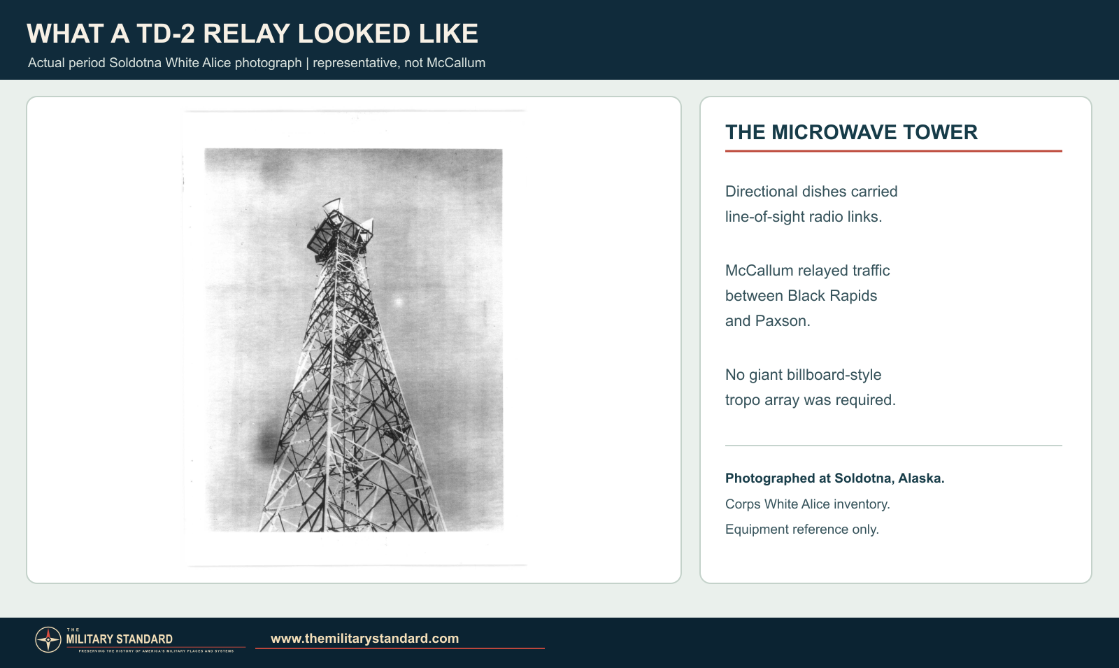
The University of Alaska Anchorage archives hold original Air Force real-property photographs of McCallum in the William F. McDowell papers. That collection has not been digitized. Until those photographs are available, the actual period Soldotna TD-2 tower shown below provides an equipment comparison, not a view of McCallum. [8] [1]
Chronology
- 1960-1961 The White Alice BMEWS rearward route, including McCallum, is built and placed in service.
- 1976 RCA Alascom begins operating White Alice under a system-wide lease.
- December 13, 1976 A federal notice lists McCallum microwave paths toward Black Rapids and Paxson.
- July 7, 1977 A proposed federal withdrawal identifies a roughly five-acre radio-relay tract at McCallum.
- 1978 McCallum appears among TD-2 properties in the Air Force appraisal program.
- October 1983 The Air Force describes McCallum as an unattended repeater in its White Alice property study.
- June 26, 1989 The proposed land withdrawal is terminated after the Corps cancels its application.
Information sources (8)
- PDF[1] Historical Overview and Inventory: White Alice Communications System, U.S. Army Corps of Engineers (1988)
Source for: BMEWS A Route, 1960-1961 route construction and opening period, McCallum links and distances, and typical TD-2 station components.
- PDF[2] A Special Study of the Sale of the White Alice Communications System, U.S. Air Force (1983)
Source for: unattended relay role, neighboring stations, Richardson Highway mile 202, 1976 operating lease, and TD-2 property review.
- PDF[3] Federal Register, December 13, 1976, RCA Alaska Communications microwave applications
Source for: McCallum radio-license coordinate and microwave paths toward Black Rapids and Paxson.
- PDF[4] Geology of the Rainbow Mountain Area, Alaska Division of Geological and Geophysical Surveys
Source for: maintenance road along McCallum Creek and local setting.
- PDF[5] Federal Register, July 7, 1977, proposed withdrawal AA-12950
Source for: proposed five-acre McCallum radio-relay tract.
- PDF[6] Federal Register, June 26, 1989, termination of proposed withdrawals
Source for: cancellation of McCallum application and termination of proposed withdrawal.
- WEB[7] Underground Storage Tank Facilities With Proof of Financial Responsibility, Alaska Department of Environmental Conservation
Source for: later AT&T Alascom McCallum Microwave Repeater name.
- WEB[8] William F. McDowell Papers, University of Alaska Anchorage Archives and Special Collections
Source for: undigitized Air Force real-property photographs including McCallum.