
Smuggler Cove Radio Relay Station, Alaska
The Annette Island terminal of Alaska's coastal White Alice route, combining long-range troposcatter and TD-2 microwave communications.
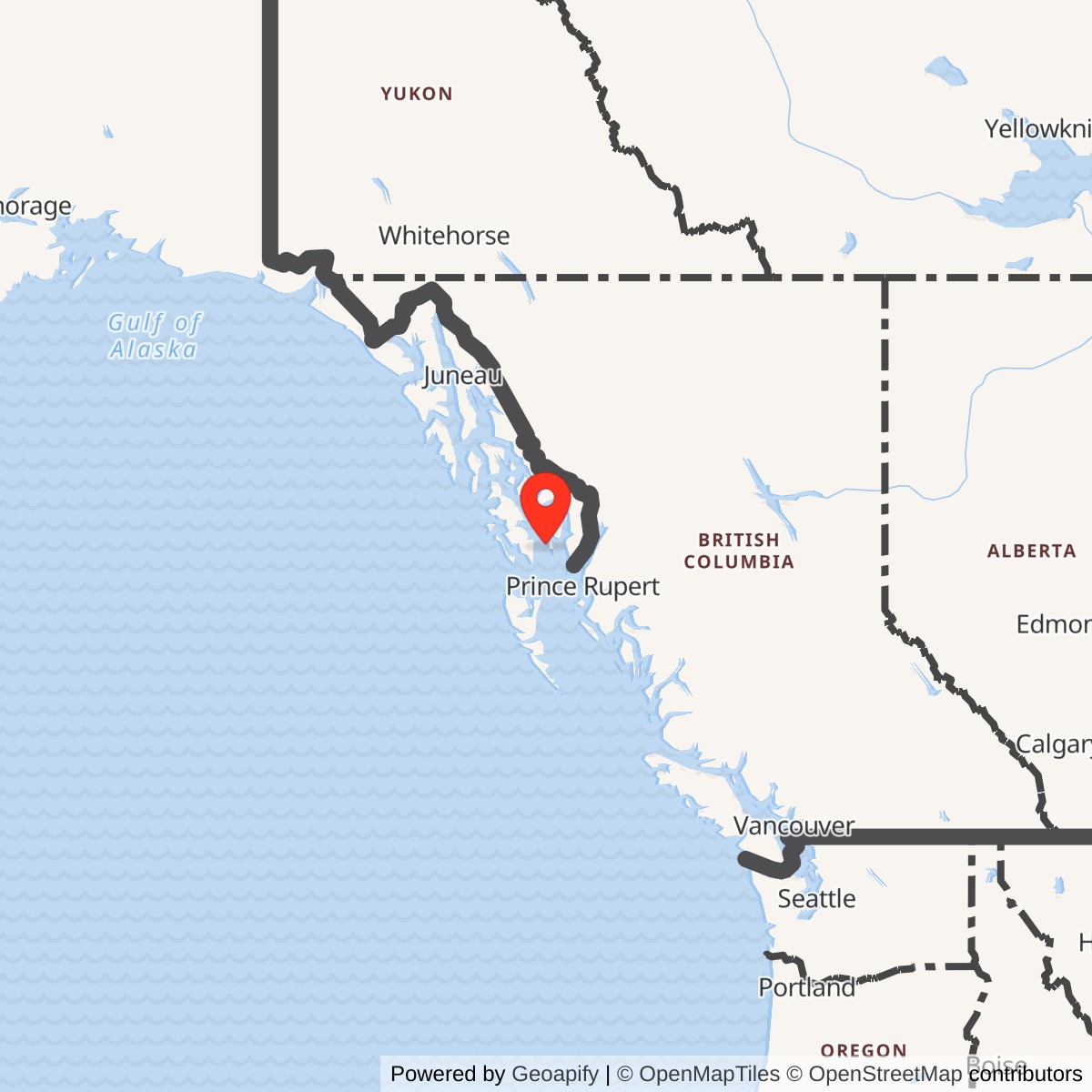
Longitude: -131.577263
Smuggler Cove Radio Relay Station was a U.S. Air Force communications site on Annette Island in southeast Alaska. It stood at the southeastern end of the coastal White Alice A Route, which carried Ballistic Missile Early Warning System (BMEWS) communications. Its verified long-range radio neighbor was Duncan Canal. Smuggler Cove was a relay, not a warning radar. [1] [2]
- Role
- White Alice/BMEWS coastal communications terminal.
- Radio systems
- Tropospheric-scatter relay and TD-2 line-of-sight microwave.
- Verified tropo path
- Direct link to Duncan Canal; 60-foot reflector class.
- Air Force transfer
- RCA Alaska Communications lease effective at the end of June 30, 1974.
- Historic designation
- Alaska Heritage Resources Survey KET-281.
The Southeastern Terminal
The Air Force extended White Alice along Alaska's coast to provide a second path for defense traffic. Moving northwest from Smuggler Cove, the named troposcatter stations were Duncan Canal, Hoonah, Ocean Cape and Cape Yakataga. The Corps' inventory names Duncan Canal as Smuggler Cove's direct troposcatter link and identifies an additional remote connection toward the DEW Line. [1] [4]
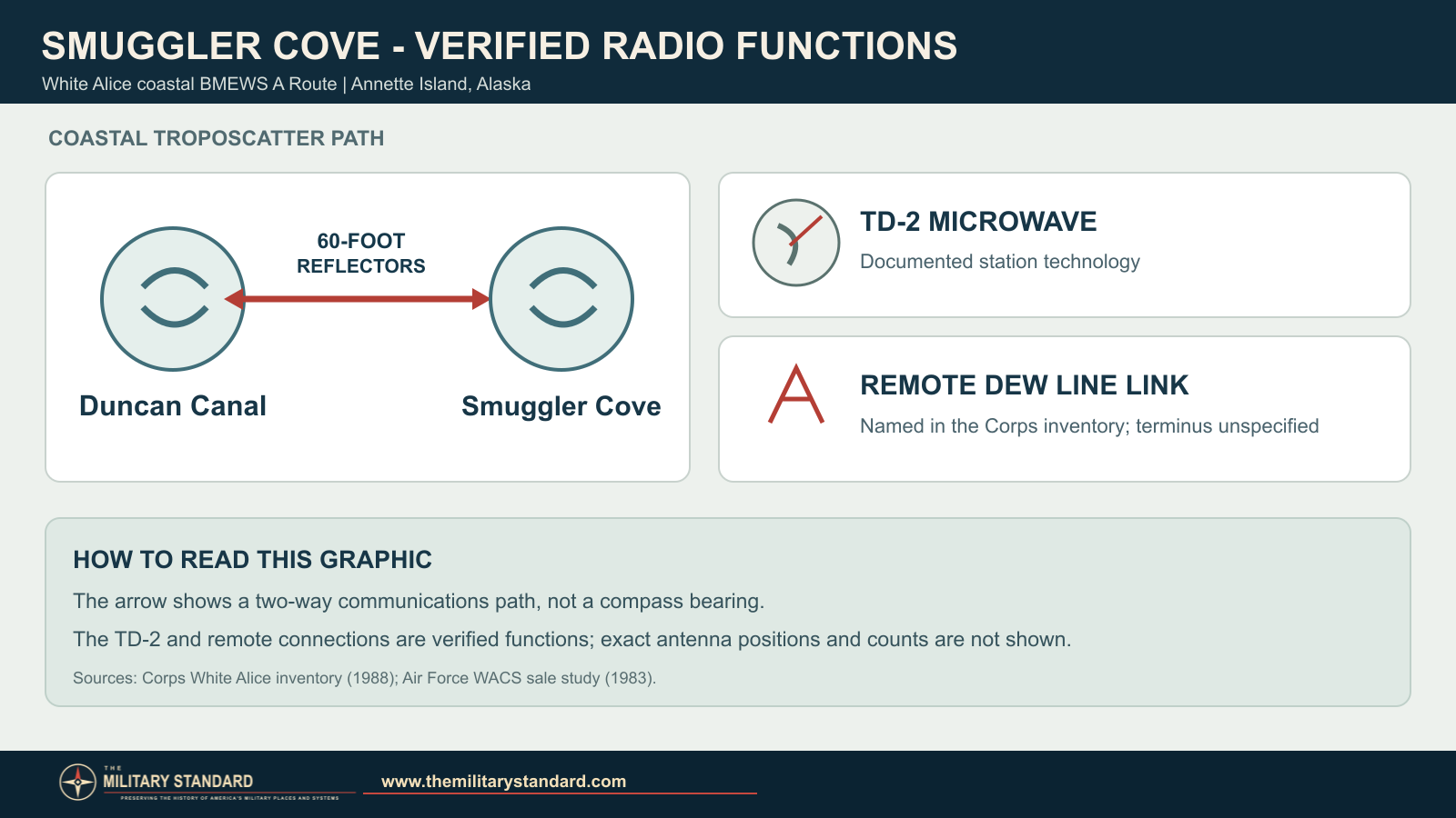
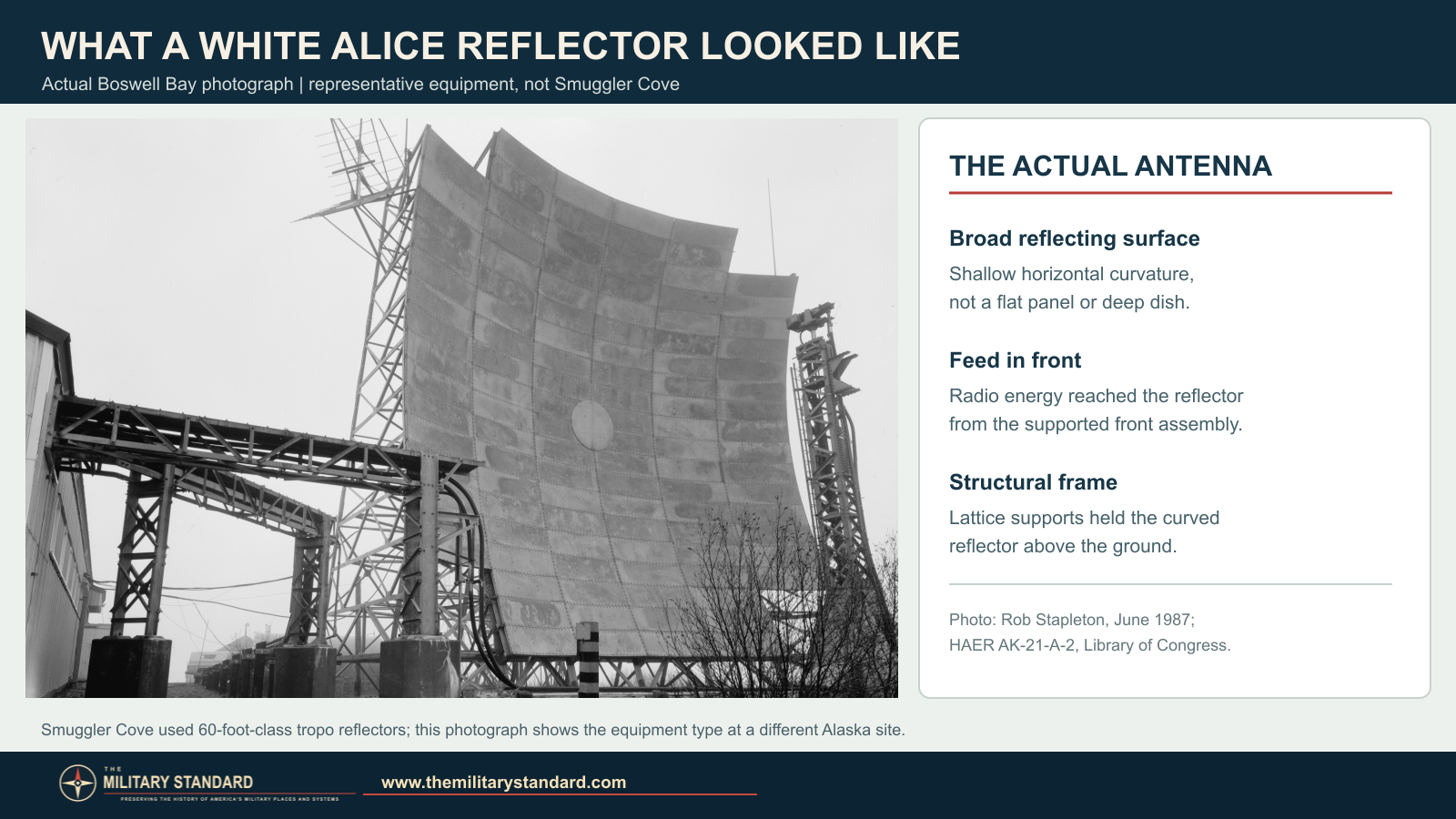
Troposcatter used large, shallowly curved reflectors to carry signals beyond ordinary line of sight. Smuggler Cove also had TD-2 microwave facilities for line-of-sight service, according to the Air Force's system inventory. The combined role made it more than a single-technology terminal. [1] [2]
Construction and Operation
A December 1960 Annette Island and Smuggler Cove photo group in the Anchorage Museum's catalog describes supplies, a communications tower and a troposcatter antenna across the road from station buildings. The images document activity in the area during the route's early years. [3]
The coastal route carried military and civilian traffic. By 1971, some of its links toward Smuggler Cove were approaching capacity. The Air Force then decided that satellite and other terrestrial routes could meet its military need for diverse communications, and announced that it would cease operating the A Route from Neklasson Lake to Smuggler Cove on July 1, 1974. [2]
Transfer to RCA Alascom
To keep the line serving civilian users, the Air Force leased six southeast A Route stations, including Smuggler Cove, to RCA Alaska Communications. The transfer took effect at the end of June 30, 1974. In 1977 Smuggler Cove was among the route properties RCA sought to purchase. The Air Force study reports that RCA had purchased A Route real property other than Ocean Cape's by September 1977. [2]
After Air Force Operation
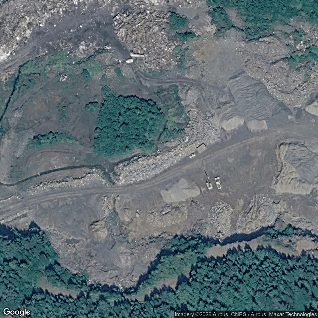
The Corps' 1994 cultural-resources plan identified the former relay as Alaska Heritage Resources Survey site KET-281 and recorded its physical condition as unknown. A later Alaska historic study listed the original White Alice installation as demolished. An October 2000 EPA profile described the former relay property as being used for a community-owned power utility facility at that time. [4] [5] [6]
Smuggler Cove was separate from the World War II Annette Island Army Airfield and the radar installation at Davison Point. Those other facilities were part of the island's defense history, but they were not the White Alice radio relay. [7]
Chronology
- Late 1950s The coastal BMEWS A Route was developed as a White Alice extension.
- December 13-15, 1960 A photographic visit documented Annette Island/Smuggler Cove activity and a troposcatter antenna.
- By 1971 Some A Route links toward Smuggler Cove were approaching capacity.
- June 30, 1974 Six southeast A Route stations, including Smuggler Cove, passed to RCA under lease.
- 1977 RCA pursued purchase of selected A Route assets, including Smuggler Cove.
- 1994 The Corps identified Smuggler Cove as historic resource KET-281.
- October 2000 EPA described utility use of the former relay property.
- 2012 An Alaska historic study listed the former White Alice installation as demolished.
Information sources (8)
- PDF[1] Historical Overview and Inventory of the White Alice Communications System
Source for: coastal BMEWS A Route, Duncan Canal path, 60-foot reflector class and remote-link entry.
- PDF[2] A Special Study of the Sale of the White Alice Communications System (1983)
Source for: combined tropo/TD-2 classification, 1971 capacity issue, 1974 Air Force withdrawal and RCA lease, and 1977 property sale.
- PDF[3] William C. and Frances P. Ray Slides, B2016.006, Anchorage Museum finding aid
Source for: descriptions of December 1960 Annette Island/Smuggler Cove photographs and observed antenna, tower and supply activity.
- PDF[4] The Cold War in Alaska: A Management Plan for Cultural Resources (1994)
Source for: A Route context, KET-281 resource identity and physical status recorded in 1994.
- PDF[5] The Coldest Front: Cold War Military Properties in Alaska
Source for: later historic-study classification of Smuggler Cove's original White Alice installation as demolished.
- WEB[6] EPA Brownfields Showcase Community: Metlakatla Indian Community (October 2000)
Source for: power-utility reuse of the former Smuggler Cove relay property at the report date.
- PDF[7] U.S. Army Corps of Engineers, World War II Historic Resources in Alaska, Part II
Source for: distinction among the Annette Island military airfield, Davison Point radar and Smuggler Cove White Alice facility.
- WEB[8] Boswell Bay White Alice Site, Tropospheric Antennas, HAER AK-21-A-2
Source for: public-domain representative photograph of a White Alice billboard reflector and support structure.