
Bernard Harbour DEW Line Station, Canada
A small Arctic crew kept the Doppler path between two larger DEW Line radar stations operating through six hard years.
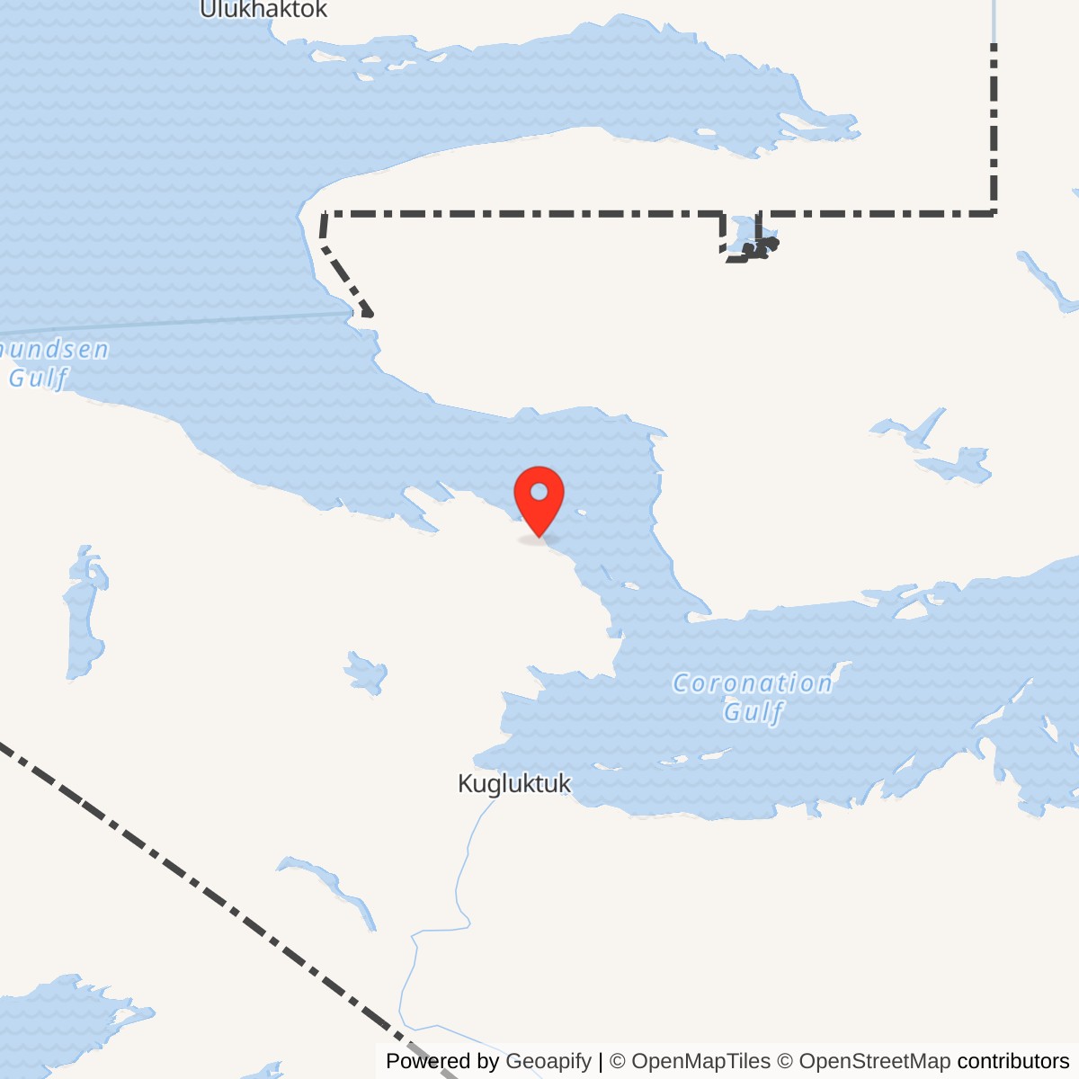
Longitude: -114.83369
Site Number: PIN-C
Current Role: Former station site. Later North Warning System PIN-CB radar is about five kilometres southwest; its beach fuel area overlaps the former PIN-C support area.
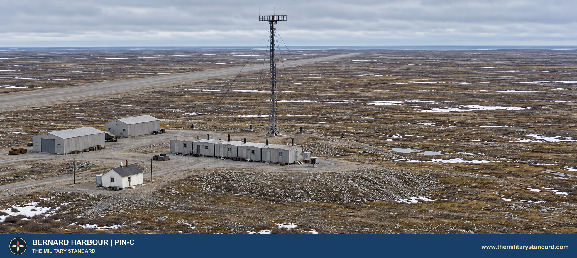
Bernard Harbour PIN-C was a United States Air Force intermediate station on the Canadian portion of the Lady Franklin Point PIN-3 to the east. Unlike those larger auxiliary stations, Bernard Harbour did not maintain a rotating long-range search radar. Its job was to sense aircraft crossing the low-altitude gap between them. [1] [3] [5]
- DEW Line code
- PIN-C
- Role
- Intermediate Doppler station
- Equipment
- AN/FPS-23
- Service
- August 1957 to July 21, 1963
- Approximate location
- 68.78194, -114.83369
A Small Station on the Arctic Coast
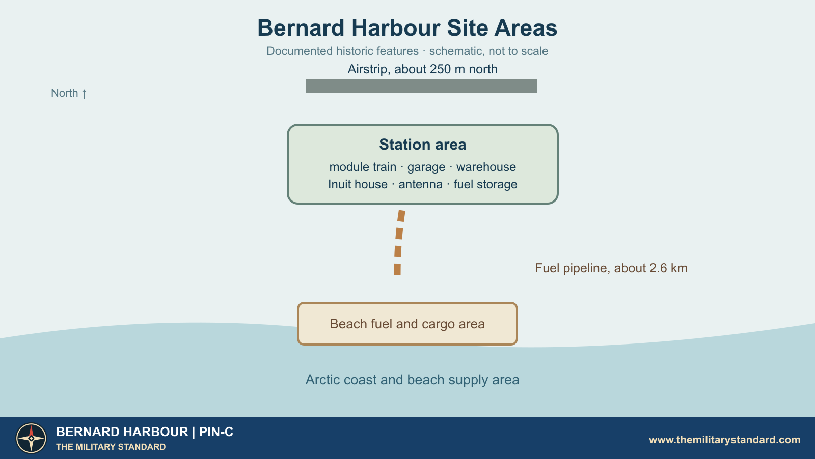
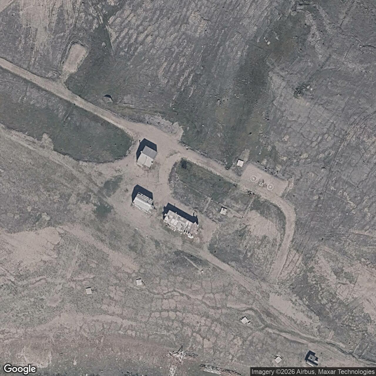
The original station occupied a low coastal site with a separate beach supply area. The station and beach were connected by a fuel line approximately 2.6 kilometres long. The airstrip lay about 250 metres north of the main buildings. This spread-out arrangement reflected the demands of radar coverage, aircraft access and summer delivery of bulk fuel to an otherwise isolated post. [3] [4]
Construction and Opening
The Air Force selected intermediate positions to fill spaces between DEW Line search radars. Bernard Harbour was one of the PIN sector sites built during the large 1955-1957 Arctic construction campaign. Workers had to establish shelter, power, communications, a fuel system and a landing strip before a small crew could sustain a continuous watch. A Canadian government history reproduces a 1957 photograph of the station, establishing its presence by that year. [2] [3]
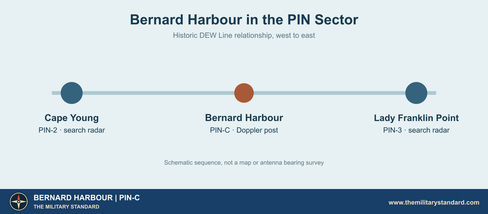
Aerospace Defense Command records place PIN-C in manual operation in August 1957. The original line became operational that summer, linking Alaskan and Canadian stations across the northern approach to North America. Bernard Harbour's equipment entry lists the AN/FPS-23 Doppler radar. Its position between Cape Young and Lady Franklin Point made it part of a chain of detection paths rather than an independent search-radar post. [1] [2] [5]
How the Doppler Watch Worked
The AN/FPS-23, often called FLUTTAR, sent a continuous radio signal toward receiving equipment at the adjoining DEW stations. An aircraft crossing the narrow path altered the received signal and produced an alarm. At PIN-C the fixed antenna paths ran west and east along the line toward the neighbouring radar posts. The operators at those larger stations could then examine the alarm alongside their search-radar picture and report an apparent crossing. [1] [2] [6]
Contemporary military specifications place the FPS-23 in the roughly 475-to-525-megahertz band, with about one kilowatt of transmitter power. The rectangular fixed antennas measured approximately 20 by 6 feet and were mounted high enough to maintain a useful path over the terrain. The exact tower and antenna dimensions at Bernard Harbour require a station drawing; surviving site records identify a downed radar antenna and a tower anchor. [4] [8] [9]
A Doppler alarm was less informative than a full radar plot. It indicated disturbance of a particular path but did not independently provide an aircraft's complete track. Its value came from adding a crossing warning between the widely spaced auxiliary radars. Station personnel therefore had to keep the transmitter, antennas, radio links and power plant available around the clock, even though their own site had no large search radome. [2] [6] [7]
Buildings, Fuel and Water
The Bernard Harbour station area included a connected module train, garage, warehouse and an Inuit house. Later Canadian surveys also identify petroleum tank foundations at both the station and beach. These are the principal building types documented for PIN-C. They placed the radar equipment, generating plant, work space, food service and living quarters close together while leaving fuel storage and cargo facilities where terrain and shipping required them. [4]
The usual intermediate-station train contained five prefabricated modules. Veteran descriptions place generators in one module, the Doppler transmitters and radio gear in another, and kitchen, dining, sleeping, water and storage spaces in the remaining modules. The garage sheltered vehicles and backup equipment; the warehouse held the parts and food needed between supply trips. This compact pattern helps explain daily work at Bernard Harbour, although its surviving inventory does not establish every room's exact as-built arrangement. [4] [7]
Fuel reached the beach during the short open-water season and moved inland by pipeline to storage near the operating buildings. The approximately 2.6-kilometre route crossed the tundra between the shore and station. Diesel kept generators and heat running through winter, making fuel handling essential to the warning mission. Water came from local lakes; the later site study identifies a freshwater lake about a kilometre northwest of the station and another lake roughly a kilometre southeast. [4]
Air service connected the station with the rest of the line and brought personnel, mail, urgent parts and smaller cargoes. The strip north of the buildings and the beach facilities were different parts of one supply system. Bad weather, sea ice and thawing ground could complicate both, so the crew had to maintain vehicles, stored provisions, electrical plant and communications with the same care as the radar transmitter. [3] [4] [6]
The People at PIN-C
Intermediate stations were much smaller than the DEW Line main and auxiliary radar posts. Firsthand accounts describe a regular crew of roughly four or five people, commonly a radar or radio technician, an inside mechanic, an outside mechanic and a cook, with duties combined when necessary. The Bernard Harbour records do not give a complete station roster, but the documented Inuit house shows that the site also made provision for local Indigenous workers or families. [4] [6] [7]
The connected modules made the post livable in severe weather. A person could move from a shift at the transmitter to meals and sleeping quarters without crossing the open tundra. Outside, mechanics still had to work on vehicles, fuel, the airstrip, antennas and the power system. Small crews had little redundancy: a failed generator, radio link or transmitter could silence a section of the warning line until the equipment was repaired. [2] [6] [7]
Summer briefly changed the rhythm. Aircraft and shore deliveries brought supplies and visitors; maintenance and construction work could add people beyond the winter complement. For the regular crew, Bernard Harbour was a place where the national warning mission depended on ordinary jobs such as cooking, pumping fuel, keeping water available and maintaining heat. [4] [6] [7]
Closure and the Later Radar Site
The FPS-23 network proved less effective than planners had hoped. Air Force reviews found that Doppler alarms and their interpretation did not provide a dependable improvement to the warning picture. Aerospace Defense Command withdrew the intermediate FPS-23 stations on July 21, 1963. Bernard Harbour PIN-C closed with that system-wide change, after about six years of operation. [1] [2]
The original station was left on the coast. Decades later, the North Warning System established a different short-range radar location called Bernard Harbour PIN-CB about five kilometres southwest of the former intermediate post. Canadian defence tables date the newer radar to September 1991. Some later fuel storage used the old beach area, but the modern radar and the 1957-1963 station occupy separate locations. [4] [5]
The remaining PIN-C structures, tank foundations, antenna debris and pipeline route preserve the physical outline of a short-lived phase of Arctic air defence: a chain of staffed Doppler posts intended to catch low aircraft between the main search radars. [3] [4] [8]
Chronology
- 1955-1957: DEW Line construction establishes the intermediate post at Bernard Harbour. [2] [3]
- 1957: A Canadian government history reproduces a station photograph dated 1957. [3]
- August 1957: PIN-C enters manual operation with AN/FPS-23 equipment. [1]
- July 21, 1963: The Air Force withdraws the FPS-23 intermediate stations, including PIN-C. [1] [2]
- September 1991: The separate Bernard Harbour PIN-CB North Warning System short-range radar begins operation. [5]
Related Sites
Information sources (9)
- PDFAerospace Defense Command, Historical Data of the Aerospace Defense Command, 1946-1973, DEW Line station table, p. 189
PIN-C designation, August 1957 opening, AN/FPS-23 equipment and July 21, 1963 closing date.
- PDFAerospace Defense Command, A History of the DEW Line, 1946-1964
DEW Line design, staffing, intermediate Doppler operation, test results and 1963 system withdrawal.
- PDFGovernment of Canada, The Big Picture: Contaminated Sites in Nunavut, 2012, p. 19
Canadian government description of the former station, 1957 historical photograph, airstrip, fuel facilities and location.
- PDFCrown-Indigenous Relations and Northern Affairs Canada, PIN-C Bernard Harbour Project Proposal Report, 2025
Station and beach areas, historic building types, airstrip, water sources, fuel pipeline and separation from PIN-CB.
- PDFDefence Research and Development Canada, Survey of COTS-MOTS Lighter than Air Platforms and Communication Relays, 2013, appendix B
Published station coordinates and separate PIN-C and PIN-CB entries.
- WEBPaul Kelley, A Brief Introduction to the DEW Line
Firsthand explanation of intermediate station crews, Doppler paths, runway support and daily operations.
- WEBClive Beckmann and Brian Jeffrey, DEWLine Auxiliary and Intermediate Site Layouts
Firsthand account of the typical five-module intermediate-station building train and its internal rooms.
- WEBThe DEWLine, PIN-C Bernard Harbour station photographs
Station-specific later views of the garage, building remains and Doppler tower anchor. Photographs are research references only.
- PDFU.S. Army Center of Military History, Chapter IV: American Systems, AN/FPS-23 technical table
Military technical summary of FPS-23 frequency, power, antennas and tower height.