
Cape Young DEW Line Station, Canada
For 36 years, a small crew kept Cape Young's radar, generators and communications working on an exposed Arctic point.
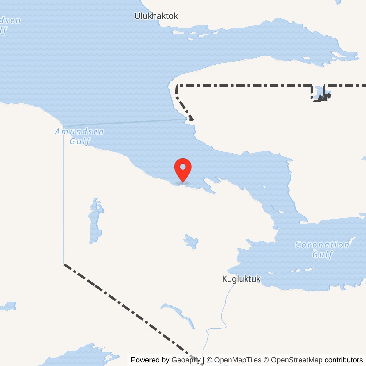
Longitude: -116.92917
Site Number: PIN-2
Current Role: Former radar station; Canadian cleanup program.
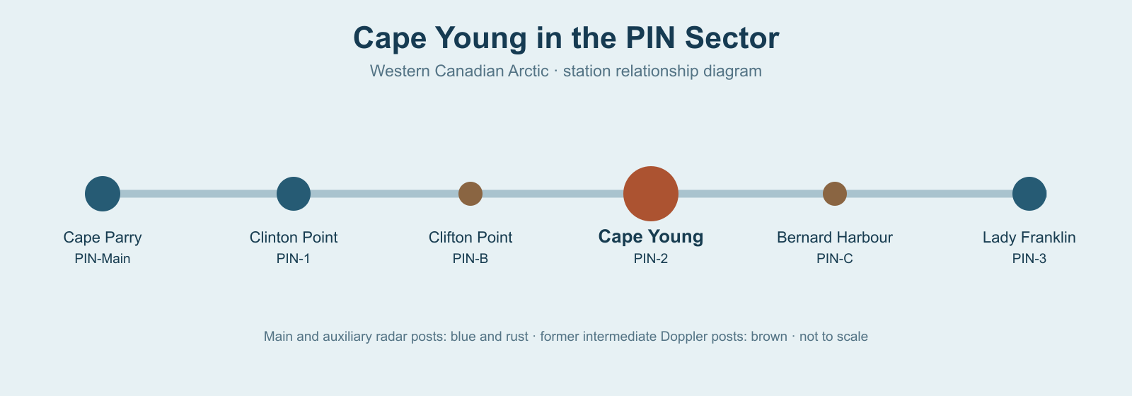
Cape Young PIN-2 was an auxiliary radar station on the Canadian Lady Franklin Point PIN-3 lay farther east. Cape Young formed one of the staffed search-radar posts in the Cape Parry sector, where the warning line followed the Arctic coast. [1] [2] [3]
- DEW Line code
- PIN-2
- Role
- Auxiliary search-radar station
- Equipment
- AN/FPS-19; AN/FPS-23 until 1963
- Service
- August 1957 to August 31, 1993
- Approximate location
- 68.92972, -116.92917
The Station and Its Setting
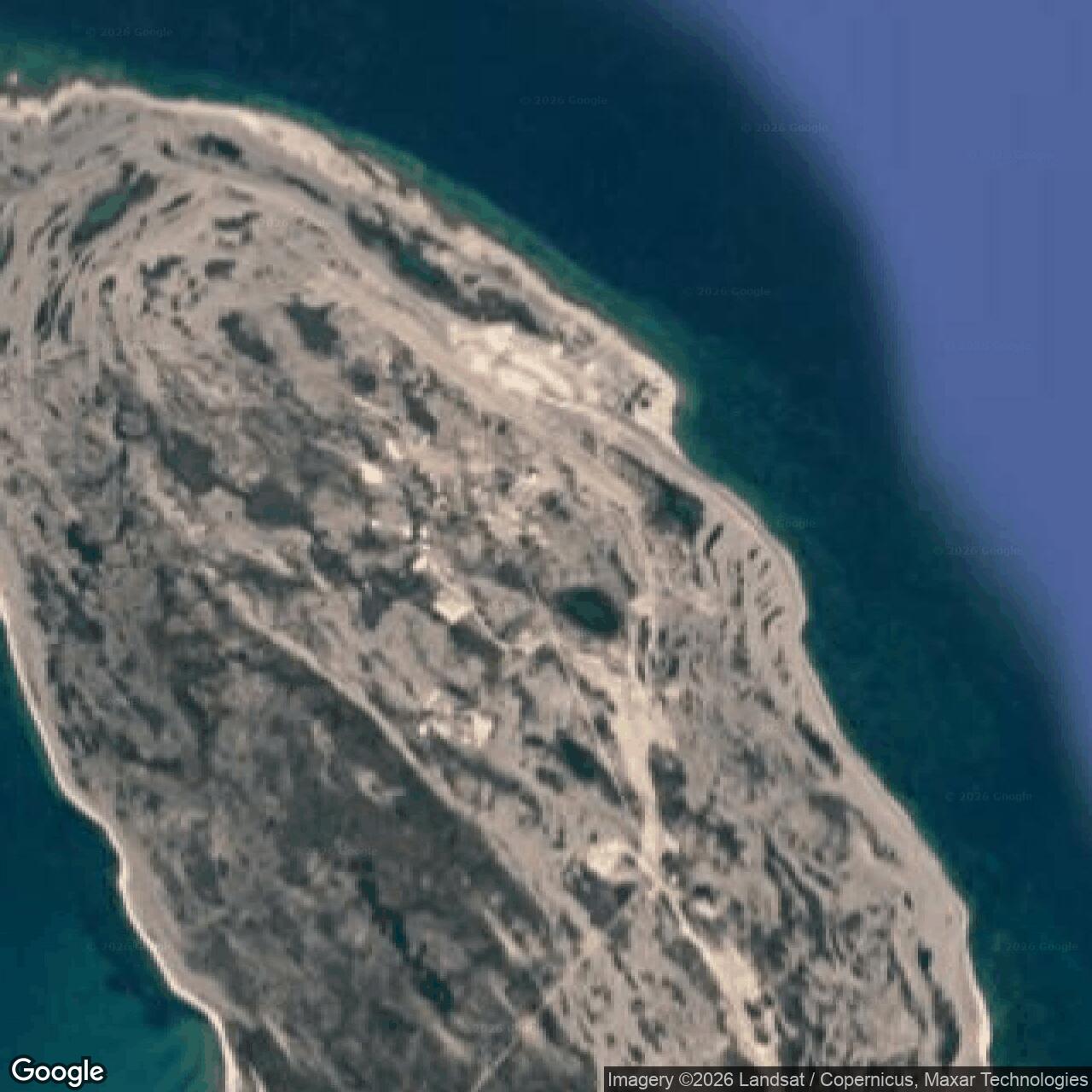
The station stood on a low, wet cape projecting about three miles into the strait. Its historic site description places the installation roughly 60 feet above sea level on a 2,407-acre tract. A small flat tableland, ponds, swamps and poorly drained ground shaped the choice of building pads and roads. Gravel beneath much of the surface offered better subsurface drainage than the marshy ground suggested. The site was reachable by aircraft and, for a short summer season, by sea. [3] [6]
Cape Young was built for a radar mission, but its setting made engineering and supply equally important. Crews had to keep a heated building train, generating plant, water reserve, vehicles, airfield and fuel system working while the station watched the northern approaches to the continent. The fixed location gave the radar a view over the strait, while the connected station buildings reduced exposure to winter weather. [3] [4] [5]
Construction and Opening
Construction was under way by May 1955. Cape Young photographs from that month show a module-assembly shop, a hangar frame and aircraft supplying the work, including a Junkers W 33 and a C-124. The contrast between the small bush aircraft and the large Air Force transport shows the mixed airlift needed to bring people and materials to an Arctic construction site before a permanent station existed. [3]
Western Electric was the prime contractor for the original DEW Line project. A surviving Cape Young station sign identifies the United States Air Force as the responsible service and Federal Electric Corporation as the company operating and maintaining PIN-2 for it. The network began its continent-wide watch in 1957. Aerospace Defense Command records give August 1957 as the beginning of manual operations at Cape Young. The original equipment list identifies an AN/FPS-19 search radar and AN/FPS-23 Doppler equipment. [1] [3] [5]
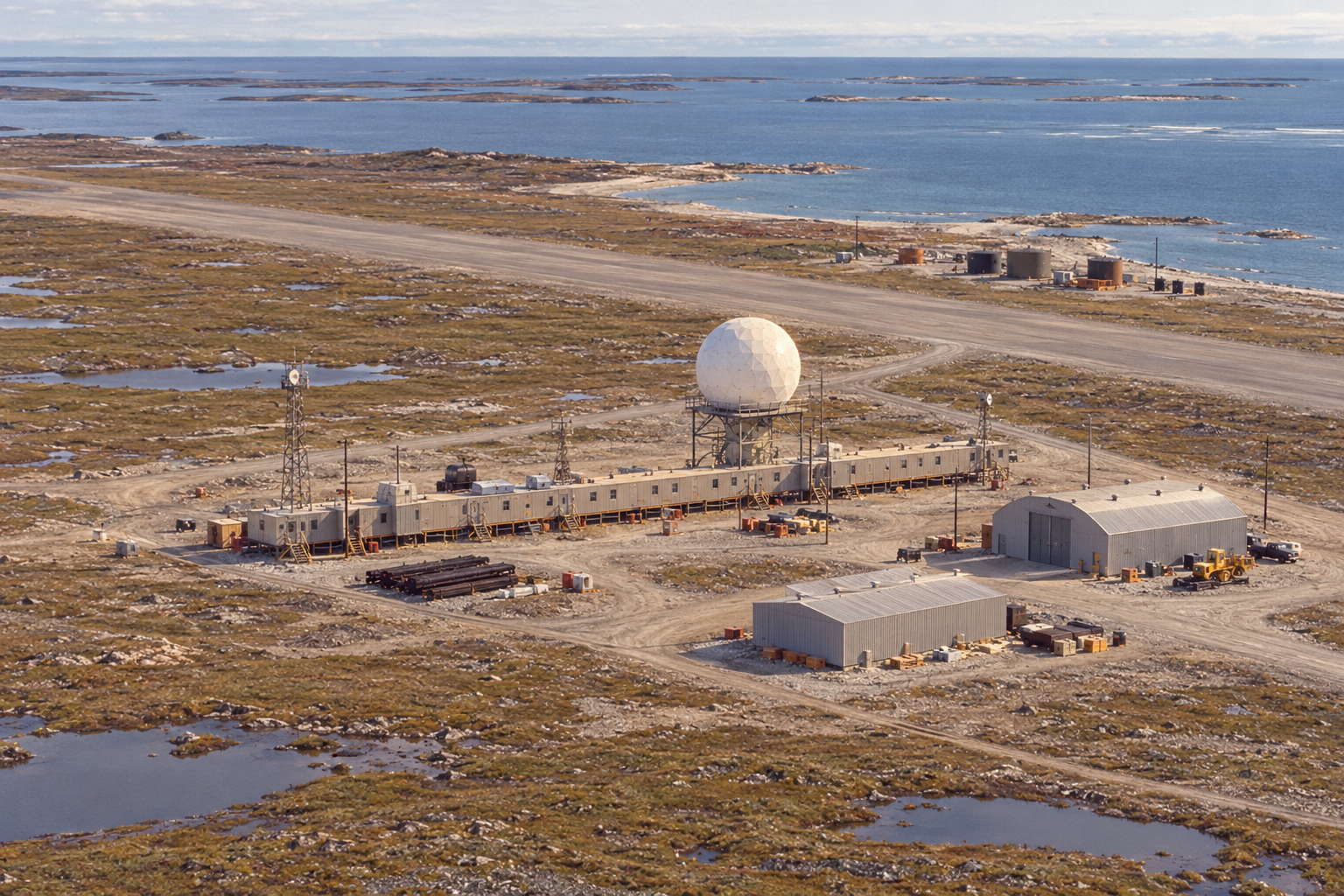
The auxiliary site was larger than an intermediate Doppler post but smaller than the Cape Parry main station. Its building train placed radar and communications equipment, power generation, offices, food service, recreation and sleeping quarters within a connected structure. The Cape Young site plan also shows a hangar, warehouses, antenna positions, fuel facilities and an airstrip. The station therefore worked as a small, self-contained outpost as well as a point on a continent-wide warning system. [4] [5] [9]
Radar and Communications
Cape Young's AN/FPS-19 was the primary search set. Its rotating, back-to-back antennas scanned for aircraft approaching the line, while the radome protected the equipment from Arctic wind, snow and ice. Operators watched the radar presentation, checked returns and sent reports through the sector communications system. At an auxiliary station, the watch depended on operators and technicians working beside the equipment rather than on a remote, unattended radar. [1] [4] [5]
The military equipment handbook describes the FPS-19 as two radar channels operating on one revolving pedestal, each feeding one of the opposed reflectors. It operated in the 1,220-to-1,350-megahertz L-band. A moving-target-indication setting helped distinguish moving aircraft from stationary returns, and automatic alarm channels drew attention to possible targets. The operator still had to examine the presentation and pass a useful report. These technical features made a smaller Arctic crew practical without removing the need for trained radar personnel. [10]
The original line also used AN/FPS-23 continuous-wave Doppler paths between the larger search-radar stations. At Cape Young, receivers could register a disturbance in the path from a neighbouring intermediate station. A Doppler alarm drew attention to a possible low-flying aircraft, and the search radar and station crew helped determine what had crossed. The Aerospace Defense Command table lists both FPS-19 and FPS-23 at PIN-2, and records the system-wide removal of FPS-23 equipment on July 21, 1963. Cape Young continued its search-radar mission after that change. [1] [5]
The station belonged to the Cape Parry PIN sector. The main station coordinated reports and support across its stretch of the line. A report from Cape Young had to move through reliable site-to-site communications before it could contribute to a continental warning. Radio rooms, antenna systems and the operations console were consequently as important to the watch as the radome itself. [4] [5]
Buildings, Water and Supply
A standard DEW auxiliary station used a connected train of 25 prefabricated modules, about 400 feet long. Veteran descriptions of that arrangement place generators and workshop space at one end, followed by radio receivers, transmitters, radar and surveillance rooms. Farther along were offices, storage, kitchen and dining rooms, recreation and library spaces, laundry, washing facilities and sleeping quarters. This pattern explains how a remote auxiliary station could house both an around-the-clock radar watch and the ordinary work of daily living. [4]
The Cape Young plan puts the building train south of a 100-by-4,680-foot runway. A 112-by-130-foot hangar stood close to the runway, with warehouses and the station train grouped on the inland side. A petroleum fill line led from the beach staging area to inland storage, while a separate route ran toward the water supply point. The dispersed layout joined aircraft, shore delivery, radar operations and living quarters into one working installation. [9]
Cape Young's water supply was unusually demanding. The historic station description calls for a twelve-mile round trip to haul potable water in summer. During winter no haul was made; two electrically heated rubber tanks, each holding 65,000 gallons, supplied the station from water stored during the warm season. Power generation therefore supported both the radar and a basic requirement for living on the cape. [3]
Fuel was also a seasonal problem. Aircraft carried personnel, mail and urgent parts, while the open-water season offered a chance to move large quantities of petroleum and bulk supplies ashore. A Cape Young account recalls the tanker USNS Pinnebog delivering fuel in summer 1968, with hoses running from ship to shore. Fuel storage and pumping had to sustain heating, generators and vehicles through months when resupply could be delayed by ice or weather. [5] [8]
The exposed ground, marshes and permafrost made maintenance a continuing task. A road, landing strip, hangar and shore facilities were part of keeping the station in operation. The connected modules let workers move between the radar watch, equipment rooms, meals and sleeping quarters indoors, but antenna, fuel, airstrip and vehicle work still took them outside in Arctic conditions. [3] [4] [6] [9]
People on the Cape
The original auxiliary-site staffing plan called for about twelve people, mostly radar and communications technicians; actual complements changed over time and with seasonal work. Operators maintained the watch in shifts, while mechanics kept diesel generators, heating, water and vehicles working. The station chief, cooks and other support personnel made the site habitable. A crew photograph on the Cape Young station page notes that Ron Blessin was absent because he was on console duty, a small reminder that the watch continued while others gathered for a picture. [3] [4] [5]
Life was concentrated inside the long module train. Its kitchens and dining room served the crew; recreation rooms, a library or music area and a pool table offered relief during dark months. The same corridor also led to technical rooms where a failure could interrupt radar or communications. Summer brought construction and maintenance workers, supply aircraft and ships, but the operational crew had to carry the station through the long isolated season. [4] [5]
A Cape Young family account describes workers turning an old rubber fuel bladder into an improvised swimming hole beside the A train in the mid-1960s. John Hallier later saw it while serving aboard the fuel tanker Pinnebog in 1968. His recollection captures how crews found recreation amid the engineering materials and severe landscape of a remote radar post, and how a summer fuel delivery briefly connected the station to the outside world. [8]
The North Warning System Transition
By the 1980s, Canada and the United States had agreed to modernize northern air defence. The North Warning System used newer, less labor-intensive radar sites to replace much of the old DEW Line network. In Cape Young's area, a new short-range radar station named Harding River PIN-2A was established about eight kilometres southwest of the old auxiliary site. Canadian station tables date Harding River's opening to September 1991. [2] [6]
Cape Young remained a distinct installation during that transition. Its own DEW Line operation ended on August 31, 1993. The Harding River radar stood on a separate site, although the newer system used two petroleum tanks near the old Cape Young beach fuel area. The shared shore support shows continuity in the supply geography without making the two radar stations the same place. [2] [6] [7]
The former Cape Young buildings and support areas later entered the Canadian cleanup program. The military-era landscape had included the module train, radar and communications facilities, fuel areas, access roads and landing facilities. Its long service from 1957 to 1993 left a physical record of the period when the Arctic warning line depended on staffed, isolated radar stations. [2] [3] [6]
Chronology
- May 1955: Construction-era photographs show the module shop, hangar work and supply aircraft at Cape Young. [3]
- July 31, 1957: The original DEW Line becomes operational across the northern approaches to North America. [5]
- August 1957: Aerospace Defense Command records manual operation at Cape Young with AN/FPS-19 and AN/FPS-23 equipment. [1]
- July 21, 1963: AN/FPS-23 equipment is withdrawn from the DEW Line; Cape Young continues as a search-radar station. [1]
- Summer 1968: A veteran account recalls a tanker delivering fuel to the Cape Young beach. [8]
- March 1985: Canada and the United States agree on northern air-defence modernization. [6]
- September 1991: Harding River PIN-2A begins operating as a separate North Warning System short-range radar site. [2]
- August 31, 1993: Cape Young DEW Line operations cease. [2] [7]
Related Sites
Information sources (10)
- PDFAerospace Defense Command, Historical Data of the Aerospace Defense Command, 1946-1973, DEW Line station table, p. 189
Station-specific PIN-2 operating month, AN/FPS-19 and AN/FPS-23 equipment, and 1963 withdrawal of FPS-23 equipment.
- PDFDefence Research and Development Canada, Survey of COTS-MOTS Lighter than Air Platforms and Communication Relays, 2013, appendix B, pp. 120-121
Canadian DEW and North Warning System station table for Cape Young, Harding River, Bernard Harbour and Lady Franklin Point, including coordinates and transition dates.
- WEBThe DEWLine, Site: PIN-2, Cape Young
Station-specific historical terrain and water description, May 1955 construction images and a crew photograph.
- WEBClive Beckmann and Brian Jeffrey, DEWLine Auxiliary and Intermediate Site Layouts
Firsthand description of the standard 25-module auxiliary train and the functions of its power, electronic, living and support spaces.
- WEBPaul Kelley, A Brief Introduction to the DEW Line
Firsthand explanation of auxiliary radar operations, intermediate Doppler paths, sector reporting, staffing and supply.
- PDFDefence Construction Canada, PIN-2 Cape Young DEW Line Site Clean Up Environmental Screening Report, October 17, 2008
Cape Young site location and the distinct Harding River North Warning System radar site about eight kilometres southwest; documents the shared beach fuel area.
- WEBGovernment of Canada, TERMIUM Plus, Cape Young DEW Line site entry
Independent Canadian government confirmation that Cape Young DEW Line operations ended August 31, 1993.
- WEBJohn Hallier, PIN-2: The Swimmin' Hole, in The DEWLine War Stories Volume 3
Firsthand memory of life at Cape Young and a 1968 fuel delivery by sea.
- WEBThe DEWLine, PIN-2 Cape Young Site Plan
Station-specific plan showing the building train, radome area, 4,680-foot runway, hangar, warehouses, beach fuel pads and water supply route.
- PDFU.S. Department of Defense, MIL-HDBK-162A, United States Radar Equipment, volume 1, December 15, 1965, AN/FPS-19 pages 1-2
Contemporary technical description of the dual-channel radar, L-band frequency, opposed reflectors, moving-target indication and operator displays.