
Komakuk Beach Dew Line Station, Canada
Canada's first DEW Line station tested a new Arctic warning system, then watched the Beaufort coast for nearly four decades.
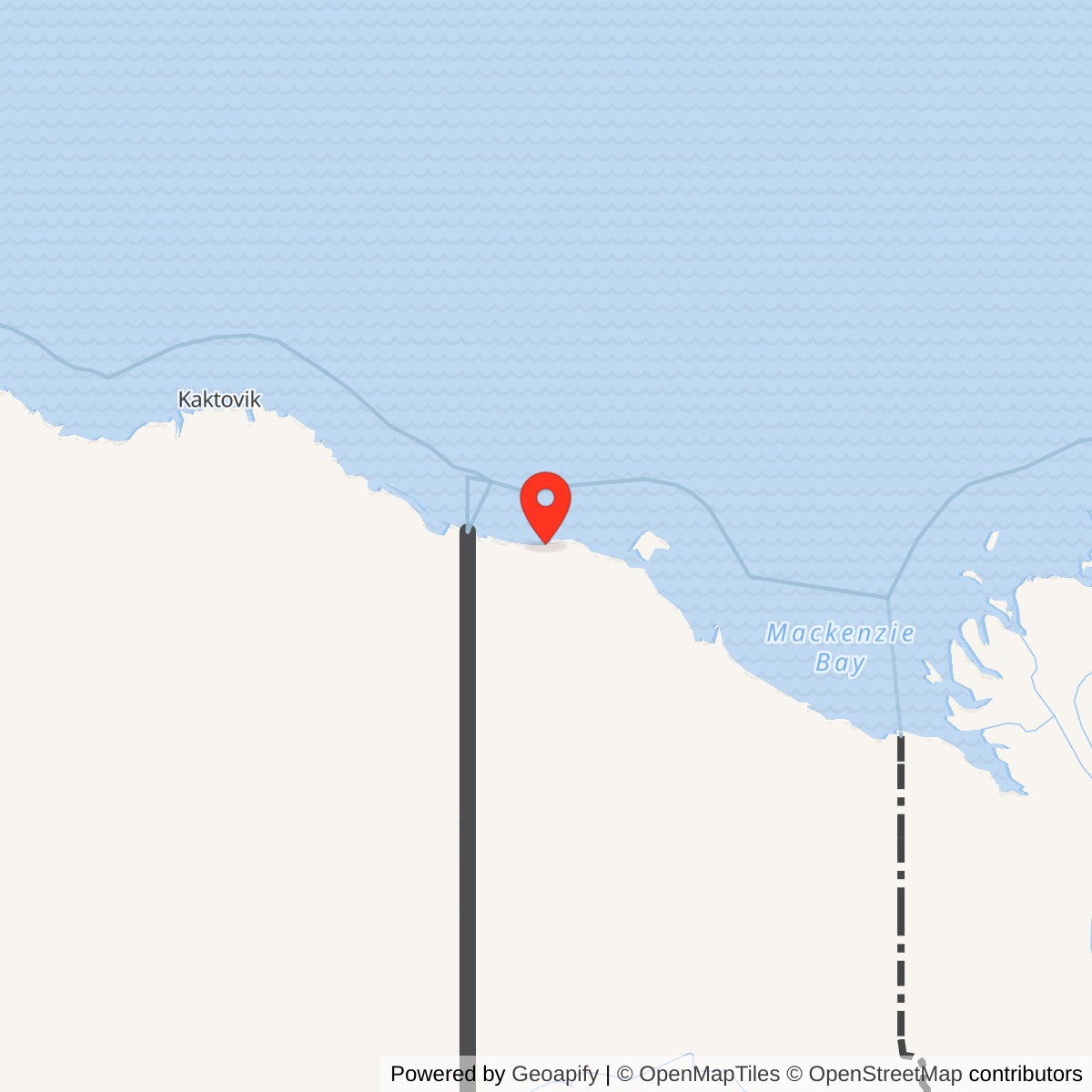
Longitude: -140.17806
Site Number: BAR-1
Current Role: Unstaffed Department of National Defence North Warning System radar in Ivvavik National Park.
Komakuk Beach, code BAR-1, was the first Distant Early Warning Line station built in Canada. The U.S. Air Force and Western Electric placed this auxiliary radar post just east of the Alaska border as a prototype with Barter Island. It was operating by early 1954 and helped demonstrate that a continuous Arctic warning line was technically possible. [1] [2]
- DEW Line code
- BAR-1
- Station type
- Auxiliary radar and communications station; prototype
- Staffed operation
- By early 1954 to June 1993
- Historic site
- Komakuk Beach, Yukon, about 25 km east of Alaska
- Later radar
- Unstaffed North Warning System short-range site, identified as AN/FPS-124
- Approximate location
- 69.595, -140.18
A Prototype Across the Border
Western Electric received the Project CORRODE contract in December 1952. The two prototype stations were first assembled in Illinois, dismantled and shipped north. Components for BAR-1 reached Barter Island by sea and crossed the border on tractor trains in spring 1953. Crews built the coastal station that summer. Contractors used the name Bagnall Beach before Komakuk Beach became the established station name. [1] [2] [3]
Komakuk Beach tested more than a radar set. Its buildings, fuel reserve, runway, communications, maintenance shops and year-round staffing had to work together through Arctic weather. The first winter of operation informed the larger network. In June 1954 the Air Force announced that the prototype project had met its objectives; additional Canadian stations followed, including Stokes Point and Shingle Point farther east. [1] [2] [8]
Radar and Communications
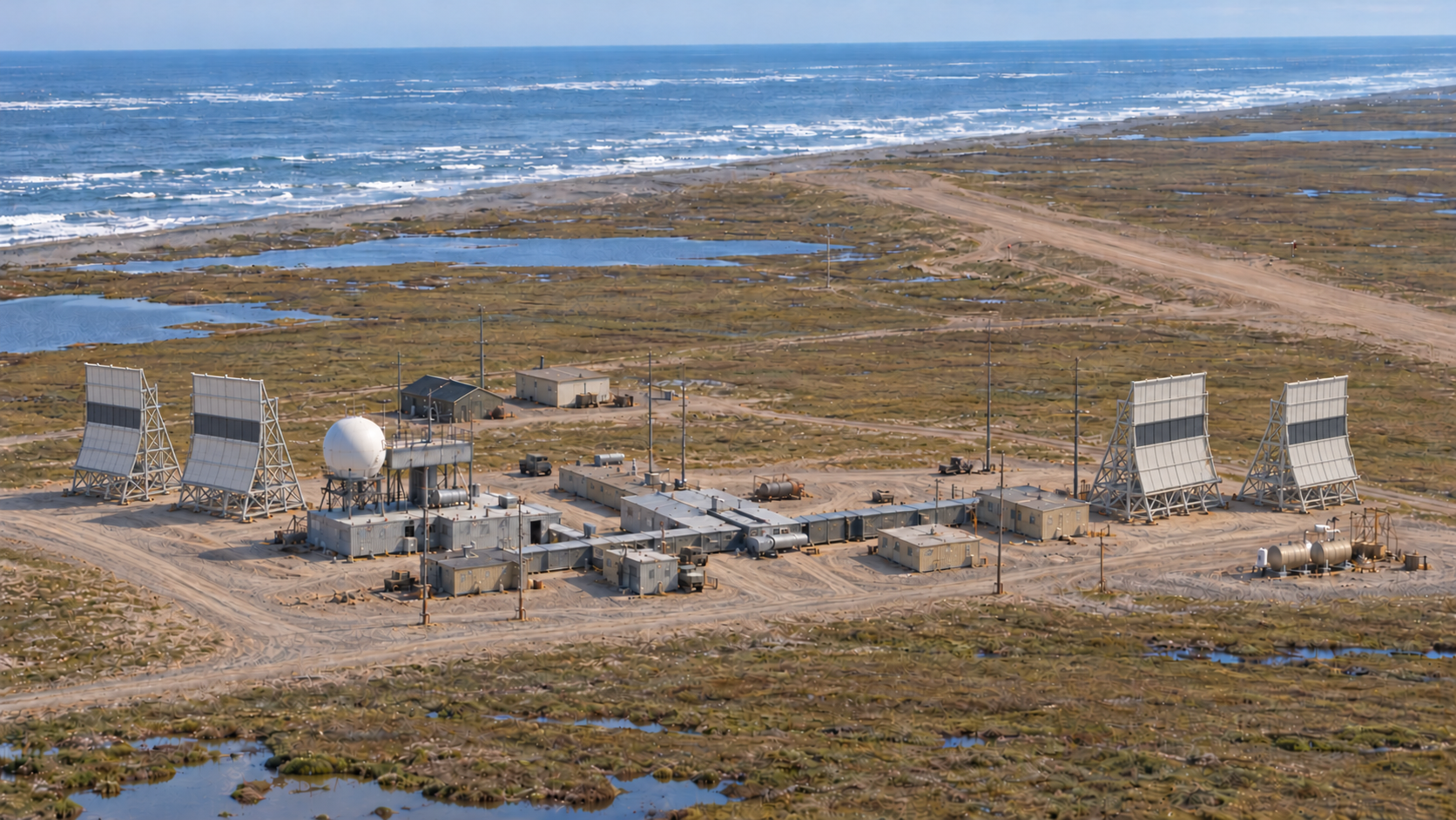
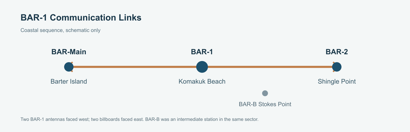
BAR-1 detected and reported aircraft approaching across the polar region. The communications and electronics building held radar, console and radio rooms beneath a rigid, unheated radome mounted on its own raised platform. In the later station layout documented by Parks Canada, two troposcatter antennas faced west toward Barter Island and two billboard antennas faced east toward BAR-2 at Shingle Point. An air-ground antenna array communicated with aircraft. [1]
Five communications and electronics staff covered the detection function described during the historian's 1990 visit: three console operators rotated through round-the-clock monitoring, while two radar technicians maintained the equipment and relieved the console. This was a staffed warning and reporting post, not a fighter base. A local telephone system connected the station buildings and outside lines linked it to the wider DEW network. [1]
Buildings, Power and Supply
Unlike the long, straight module trains used at many later DEW stations, the Komakuk prototype had ten separate one-story buildings joined by enclosed, unheated corridors. The branching arrangement was intended to contain fire within one building, but its many corners trapped windblown snow and made heating less efficient. The communications and electronics building stood on piles; the other connected buildings rested on timber foundations above the tundra. [1] [2]
The connected complex included operations rooms, electronics shop, powerhouse, workshop, kitchen and recreation rooms, and dormitories. A garage and warehouse stood on the north side of the gravel pad. The warehouse held food, spare parts and dry goods; large fuel tanks and a pumphouse occupied the east side. The power plant, oil furnaces, water treatment equipment and repair shops gave the station enough capacity to keep working between supply deliveries. [1]
An airstrip ran inland from the coast, linked to the station by gravel roads. An annual sealift brought bulk supplies and fuel ashore, while aircraft delivered urgent parts, fresh food, mail and passengers. Crews kept the runway and roads open with bulldozers, a grader, trucks and other heavy vehicles. During a severe August 1955 storm the runway washed away and had to be repaired. [1]
The People at BAR-1
The planned auxiliary-station complement was about twenty civilian workers, although staffing changed with the work. A Canadian government visitor counted fourteen men at BAR-1 in August 1955; most were trained in electronics, while two handled outside maintenance. The historian's later account describes four dormitory buildings with private rooms, a dining hall, kitchen, lounge, two television rooms, gym, laundry and small store. Staff typically remained for months at a time, sharing a tight routine of watches, repairs and recreation. [1]
The station also affected the Inuvialuit families who used this coast. A 1955 visitor recorded the Allen families nearby and described Neil Allen's occasional work as a guide and station employee. The DEW Line brought wage work and services but also new outside control and social change. Komakuk's history belongs to the inhabited Yukon coast as well as to continental air defense. [1] [8]
From the DEW Line to the North Warning System
North Warning System construction was under way at Komakuk by 1990, with a new operations building, radar platforms, antenna tower and fuel storage near the older station. The staffed BAR-1 DEW Line station closed in June 1993. Its warning role continued at the site through an unstaffed Canadian North Warning System station; a later station roster identifies the short-range radar as AN/FPS-124. [1] [2] [7]
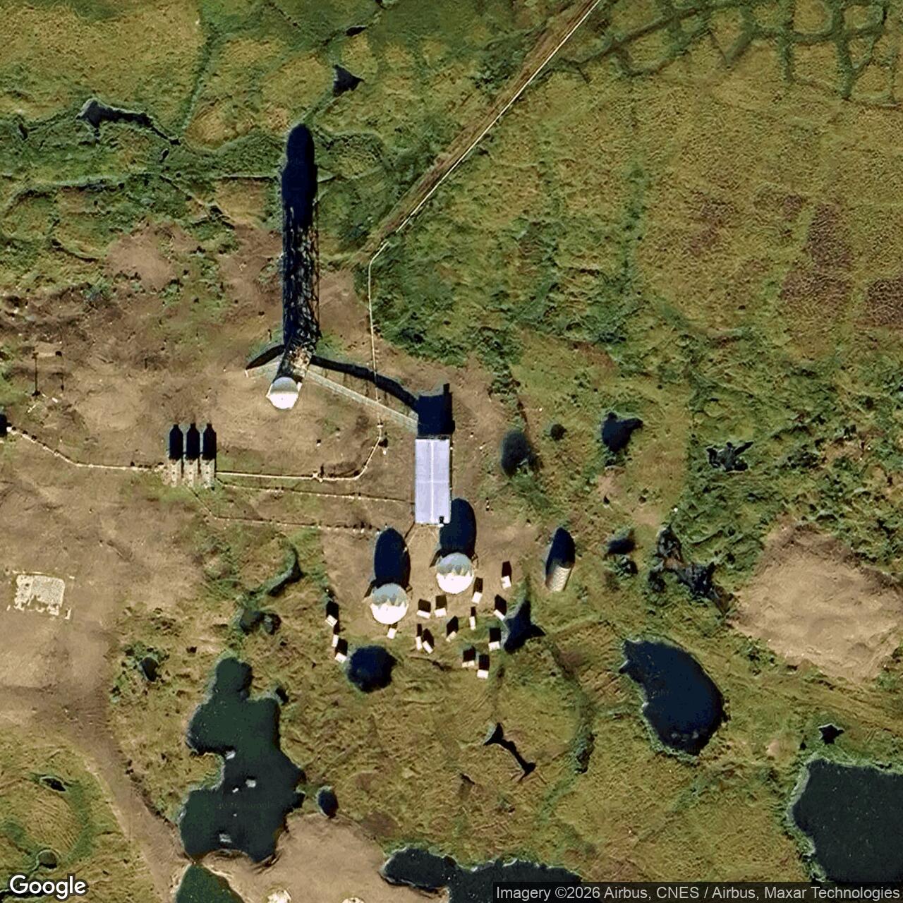
Parks Canada's 2018 management plan identifies Komakuk Beach as one of two unstaffed Department of National Defence North Warning System stations in Ivvavik National Park. Canadian sailing directions published in 2024 describe three visible domes at the site and confirm that the station is unmanned. These later structures are a new phase of warning service at the same coastal location. [4] [5]
Chronology
- December 1952: Western Electric receives the prototype DEW Line contract known as Project CORRODE. [1] [2]
- Spring 1953: Prefabricated station components move from Barter Island by tractor train toward Komakuk Beach. [1]
- Early 1954: BAR-1 and the Barter Island prototype are in operation. [1] [2]
- June 1954: The Air Force announces that the prototype tests met their objectives. [1] [2]
- August 1955: A Canadian visitor records fourteen men at BAR-1; a storm damages the airstrip. [1]
- 1990: North Warning System replacement facilities are under construction beside the older station. [1]
- June 1993: The staffed BAR-1 DEW Line station closes. [1] [2]
- 2018: Parks Canada records the Komakuk Beach North Warning System station as unstaffed. [4]
Related Sites
- AN/FPS-124 radar
- DEW Line directory
- DEW Line history
Information sources (8)
- PDFDavid Neufeld, Yukon Historian, BAR-1 Distant Early Warning (DEW) Auxiliary Station, Komakuk Beach, Yukon Territory
Source for the prototype, station layout, radar and communications, staffing, buildings, supply, daily life and June 1993 closure.
- PDFYukon Archives, Inventory to the United States Air Force, Distant Early Warning System, BAR-1 Auxiliary Station Fonds, 1995
Source for Project CORRODE, the first Canadian DEW station, early 1954 operation, June 1993 closure and the surviving station records.
- PDFDEW Line Coordinating Committee, Minutes and Progress Reports, 1955-63, compiled by P. Whitney Lackenbauer and Matthew Farish, 2019
Source for the early Bagnall Beach name and the BAR-sector station naming and planning context.
- PDFParks Canada, Ivvavik National Park of Canada Management Plan, 2018
Source confirming the unstaffed Department of National Defence North Warning System station at Komakuk Beach in Ivvavik National Park.
- PDFCanadian Hydrographic Service, Sailing Directions ARC 403: Western Arctic, 2024, Komakuk Beach section
Source for the present North Warning System installation, its three visible domes and its unstaffed status.
- WEBThe DEWLine, BAR-1 Komakuk Beach gallery, Markham Cheever construction photographs
Visual reference for the unusual prototype plan, construction camp and 1956 site appearance.
- WEBThe DEWLine, North Warning System station roster, BAR-1 entry
Supplementary source identifying the later BAR-1 North Warning System short-range radar as AN/FPS-124.
- WEBParks Canada, Culture and History of Ivvavik National Park
Source for the Yukon coastal DEW station sequence and Ivvavik historical context.