
Stokes Point DEW Line Station, Canada
A small Arctic radar post watched the gap between two larger DEW Line stations, then gave way to a remote North Warning System radar.
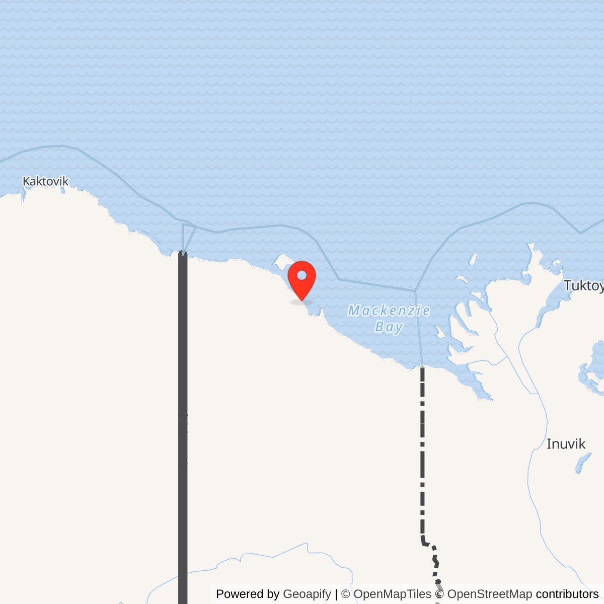
Longitude: -138.73694
Site Number: BAR-B
Current Role: Unstaffed Department of National Defence North Warning System short-range radar in Ivvavik National Park, documented by Parks Canada in 2018.
Stokes Point, code BAR-B, was a small staffed Distant Early Warning Line station on the Yukon coast. Its AN/FPS-23 Doppler equipment watched a low-altitude gap between the larger radar stations at Komakuk Beach and Shingle Point. Air Defense Command records place BAR-B in manual operation in August 1957 and record its inactivation on July 21, 1963. [1] [2]
- DEW Line code
- BAR-B
- Historic station
- Staffed intermediate radar post
- Historic radar
- AN/FPS-23 Doppler crossing-alert system
- Manual operation
- August 1957 to July 21, 1963
- Typical I-site crew
- Five civilian workers
- Later use
- Unstaffed Canadian North Warning System short-range radar
- Approximate location
- 69.3303, -138.7369
Building a Small Arctic Warning Post
The United States Air Force sponsored the DEW Line to warn of aircraft approaching North America from the north. The Barter Island and Komakuk Beach prototype stations established the western end of the system. Stokes Point followed east of Komakuk Beach as the first Yukon intermediate post in that coastal chain. Parks Canada places it among the DEW stations built after the prototype work. [2] [3] [4]
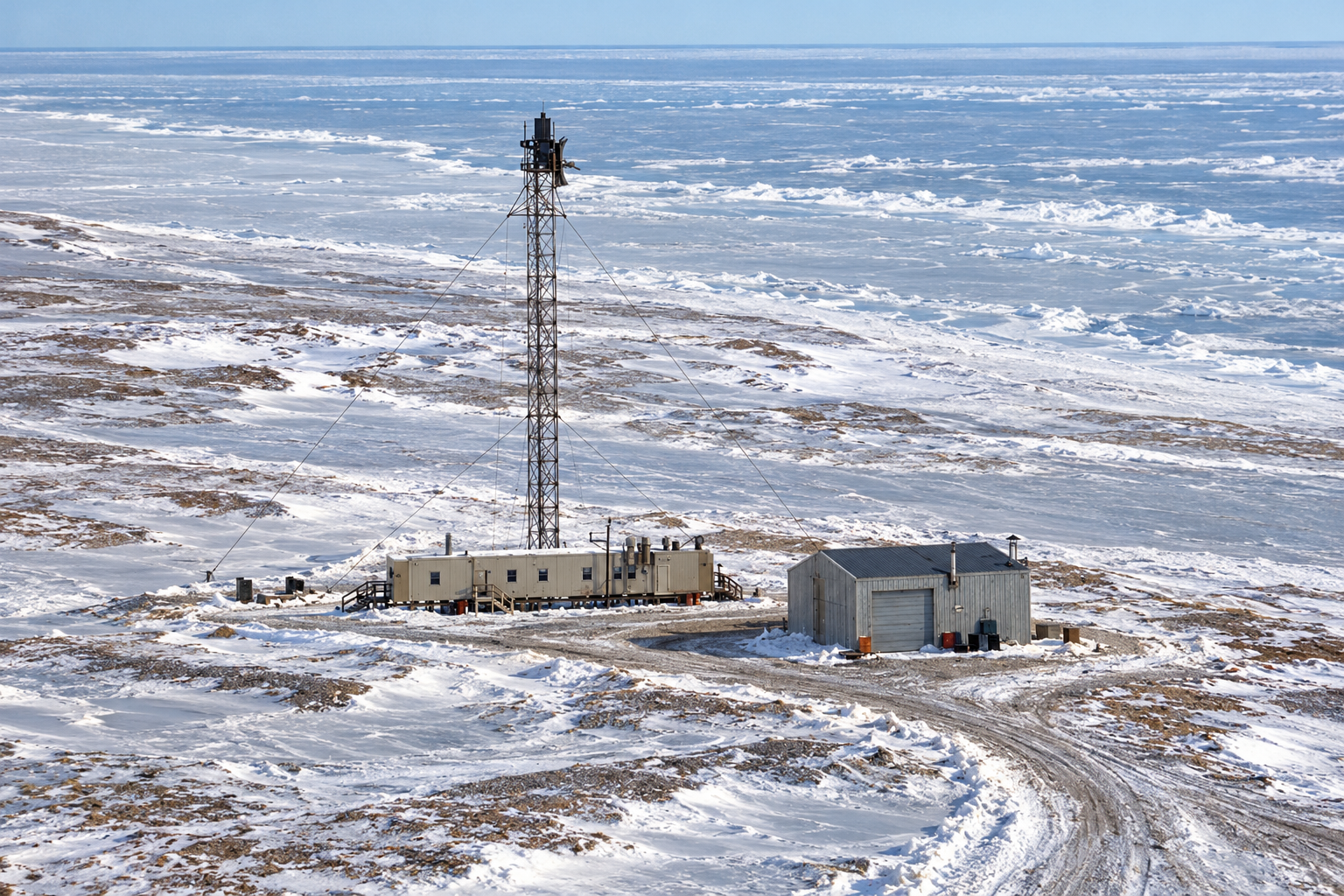
A March 1956 aerial shows a compact construction camp on the low coast. A later 1956 or 1957 ground photograph shows the completed station at the same exposed location: a tall lattice tower, a short connected module train and a separate pitched-roof service building. The station had none of the large search-radar dome and broad billboard arrays that characterized some larger DEW sites. [1] [8]
The permanent post had to function through sea ice, severe cold, long darkness and difficult transport. A gravel airstrip and shore landing area connected the remote camp to its supply network. Fuel storage, power equipment and a garage supported radar operation and the vehicles needed to move people and material across the tundra. [2] [5] [8]
How BAR-B Watched the Gap
The AN/FPS-23 was a continuous-wave Doppler warning system. It sent a radio signal across the interval between larger DEW radar stations and detected the disturbance produced by an aircraft crossing that interval. BAR-B thus added a low-altitude alert where a conventional rotating search radar might have had a limited view near the horizon. It supplied a crossing warning, while the neighboring main and auxiliary stations performed broader search and reporting. [1] [2] [3]
At Stokes Point the compact antenna assembly stood atop a tall guyed steel lattice tower. The 1956 or 1957 station photograph puts the tower directly beside the low module train. An intermediate station used a five-module connected building design. Those rooms housed the working electronics and the functions needed to keep a crew on site, including power, heat and living accommodation. The separate pitched-roof building provided additional utility and vehicle space. [2] [3] [8]
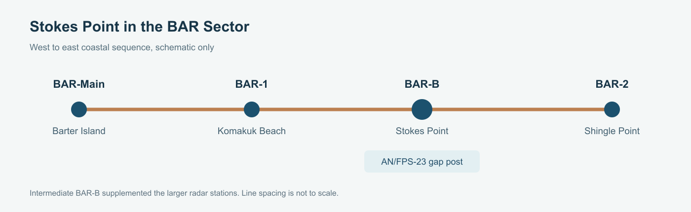
BAR-B belonged to the Barter Island sector, with Komakuk Beach to the west and Shingle Point to the east. Intermediate posts relied on the larger stations for supply and major repairs. The radar reports and communication links of the sector fed the larger continental air-defense warning system. [2] [3]
Crew and Life at Stokes Point
The standard DEW Line intermediate-station complement was five civilian workers. Their small camp required constant attention to the radar, generator, heating equipment, fuel and communications. Supplies and replacement parts had to arrive by the short seasonal shipping window or by aircraft. Routine watches and maintenance filled days at a site far from a town or road. [2] [3]
The station also stood within the long-used Inuvialuit coast. Construction brought wage work and nearby family camps to the area. Historian David Neufeld recorded that some shelters made from construction boxes and crates at BAR-B remained in use as a hunting camp into the early 1990s. Canadian officials even considered moving the Herschel Island RCMP post to the Stokes Point DEW camp during the 1950s, a measure that was discussed but not carried out. [2] [3] [4]
A 1956 photograph shows a tracked vehicle stranded in a snow-covered route near the post. The image captures the practical side of station life: transportation and recovery work were part of keeping even a tiny radar camp connected to its runway and shore landing. [8]
Closure and Later Radar Service
Air Defense Command inactivated BAR-B on July 21, 1963. Improved radar coverage made the staffed intermediate stations unnecessary, though the larger DEW Line continued. Structures and fuel facilities remained at Stokes Point after the radar crew left, and an offshore oil exploration camp used the area during the 1980s. [1] [3] [5] [10]
A new short-range station returned Stokes Point to the northern warning network in the early 1990s. The DEWLine station roster gives July 1991 for its establishment and identifies the later radar as AN/FPS-124. Parks Canada subsequently described the Department of National Defence North Warning System station here as unstaffed. The new radar carried forward an air-surveillance mission at Stokes Point without reviving the old five-person BAR-B camp. [6] [7] [9] [10]
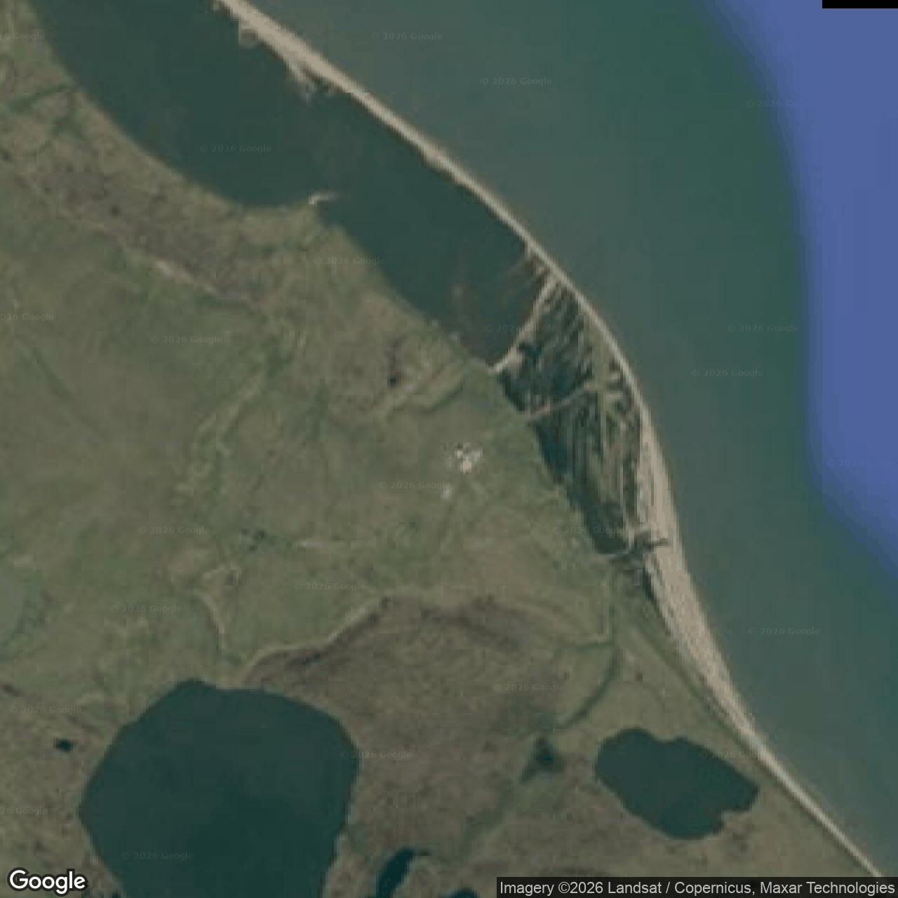
The former DEW site now lies inside Ivvavik National Park. Parks Canada and Inuvialuit partners completed a major cleanup in 2010 and removed remaining DEW-era infrastructure, including a warehouse foundation. The military story of the place therefore includes both the small Cold War crossing-alert station and the later remotely operated warning post. [5] [6] [10]
Chronology
- 1953-1954: Barter Island and Komakuk Beach prototype stations prove the western Arctic warning-line concept. [2] [3]
- March 1956: Aerial photography records a construction camp at Stokes Point. [8]
- 1956-1957: A ground photograph records the BAR-B tower, connected modules and separate pitched-roof service building. [8]
- August 1957: BAR-B enters manual operation with AN/FPS-23 equipment. [1]
- July 21, 1963: Air Defense Command inactivates the BAR-B intermediate radar station. [1]
- 1980s: An offshore oil exploration camp also occupies the Stokes Point area. [5] [10]
- July 1991: A station roster dates the North Warning System short-range radar installation at Stokes Point to this month. [9]
- 2010: Parks Canada and Inuvialuit partners complete cleanup of the former DEW site. [5] [10]
- 2018: Parks Canada documents the Stokes Point North Warning System station as unstaffed. [6]
Related Sites
- AN/FPS-124 radar
- DEW Line directory
- DEW Line history
Information sources (10)
- PDFAerospace Defense Command, Historical Data of the Aerospace Defense Command, 1946-1973, DEW Line station table
Station-specific record for BAR-B at Stokes Point, AN/FPS-23 equipment, August 1957 manual operation and July 21, 1963 inactivation.
- PDFDavid Neufeld, BAR-1 Distant Early Warning Auxiliary Station, Komakuk Beach, Yukon Territory, Parks Canada historical study
Source for the first western DEW sector, intermediate station design, five-module train, civilian complement, regional support and Inuvialuit connections at BAR-B.
- PDFDavid Neufeld, Research Collections Relating to the DEW Line in the Western Arctic
Source for Project CORRODE, the western sector, intermediate staffing and building design, and early Yukon coastal history.
- WEBParks Canada, Culture and History of Ivvavik National Park
Source identifying Stokes Point as a later Yukon coastal DEW Line location and its Inuvialuit cultural setting.
- WEBParks Canada, Stokes Point BAR-B DEW Line Site: A Final Update on the Clean-up, Winter 2011
Source for the former DEW site, later oil camp, surviving garage and warehouse remains, and the 2010 cleanup.
- PDFParks Canada, Ivvavik National Park of Canada Management Plan, 2018
Source confirming an unstaffed Department of National Defence North Warning System station at Stokes Point.
- WEBDepartment of National Defence, North Warning System In-Service Support Backgrounder, 2022
Source for the present Canadian North Warning System mission and remote long-range and short-range radar network.
- WEBThe DEWLine, BAR-B Stokes Point gallery, Dirk Van Nest and Markham Cheever photographs
Visual reference for the station tower, low module train, separate pitched-roof building and construction camp; original photos retained for review only.
- WEBThe DEWLine, North Warning System station roster, BAR-B entry
Supplementary record for the July 1991 North Warning System short-range station and AN/FPS-124 identification.
- WEBGovernment of Canada, Completion of Stokes Point Cleanup in Ivvavik National Park, January 25, 2011
Official statement distinguishing the former BAR-B DEW Line station from the later Department of National Defence short-range radar station.