
Shingle Point DEW Line Station, Canada
BAR-2 watched the Yukon coast with search radar, gap warning and four communications billboards before joining the North Warning System.
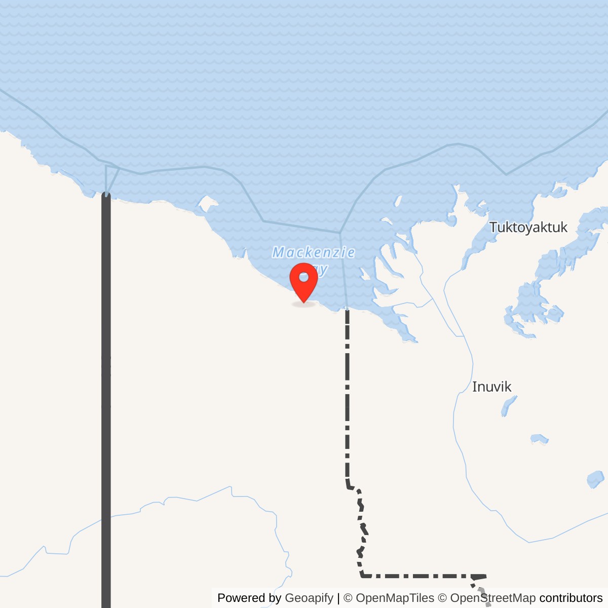
Longitude: -137.265278
Site Number: BAR-2
Airport ICAO ID: CYUA
Current Role: Unmanned North Warning System long-range radar, documented by the 2026 Canadian navigation guide.
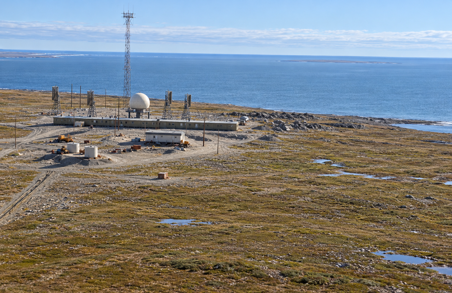
Shingle Point, code BAR-2, was an auxiliary Distant Early Warning Line station on the Yukon Arctic coast. From 1957 it watched the western approach to North America with an AN/FPS-19 search radar and AN/FPS-23 gap-warning equipment. A long connected building, four communications billboards and an airstrip made it one of the larger staffed posts between Barter Island and the Mackenzie Delta. The location became a North Warning System long-range radar site in 1989. [1] [2] [3]
- DEW Line code
- BAR-2
- Historic role
- Auxiliary search-radar and communications station
- Historic equipment
- AN/FPS-19 and AN/FPS-23
- Manual operation
- August 1957
- DEW to NWS transition
- June 1989
- Later radar
- AN/FPS-117 long-range radar
- Approximate location
- 68.9261, -137.2653
Building the Western Arctic Warning Line
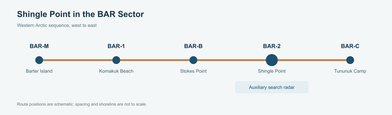
The United States and Canada built the DEW Line to give continental air defenses early notice of aircraft crossing the Arctic. Shingle Point sat east of Stokes Point and west of Tununuk Camp and Tuktoyaktuk in the Barter Island sector. Its BAR-2 designation marked it as an auxiliary station, a larger search-radar post that could maintain watch and communicate reports through the chain. Air Defense Command lists manual operation beginning in August 1957. [1] [3] [4]
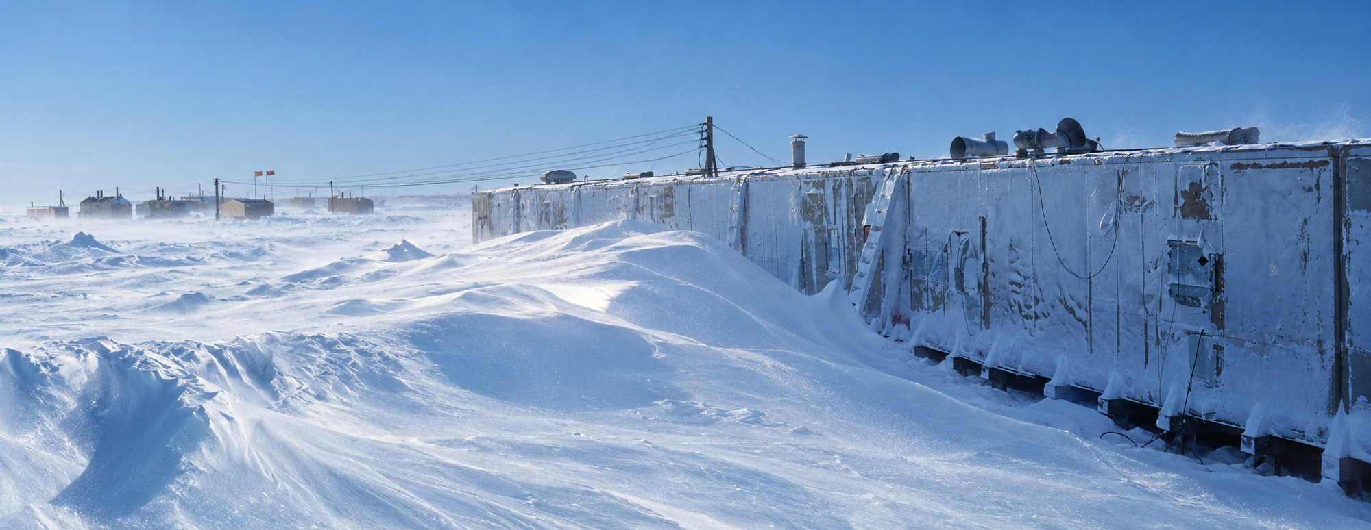
Construction crews set pilings for the module-train foundation in November 1955. Photographs from March 1956 show snowdrifts rising alongside the partly built structure and a C-124 bringing in heavy earthmoving equipment. By April 1957 an aerial photograph showed the completed radar dome, connected building train, communications antennas and tall tower. These photographs record the difficult work of assembling a permanent station before its operational opening that August. [1] [11]
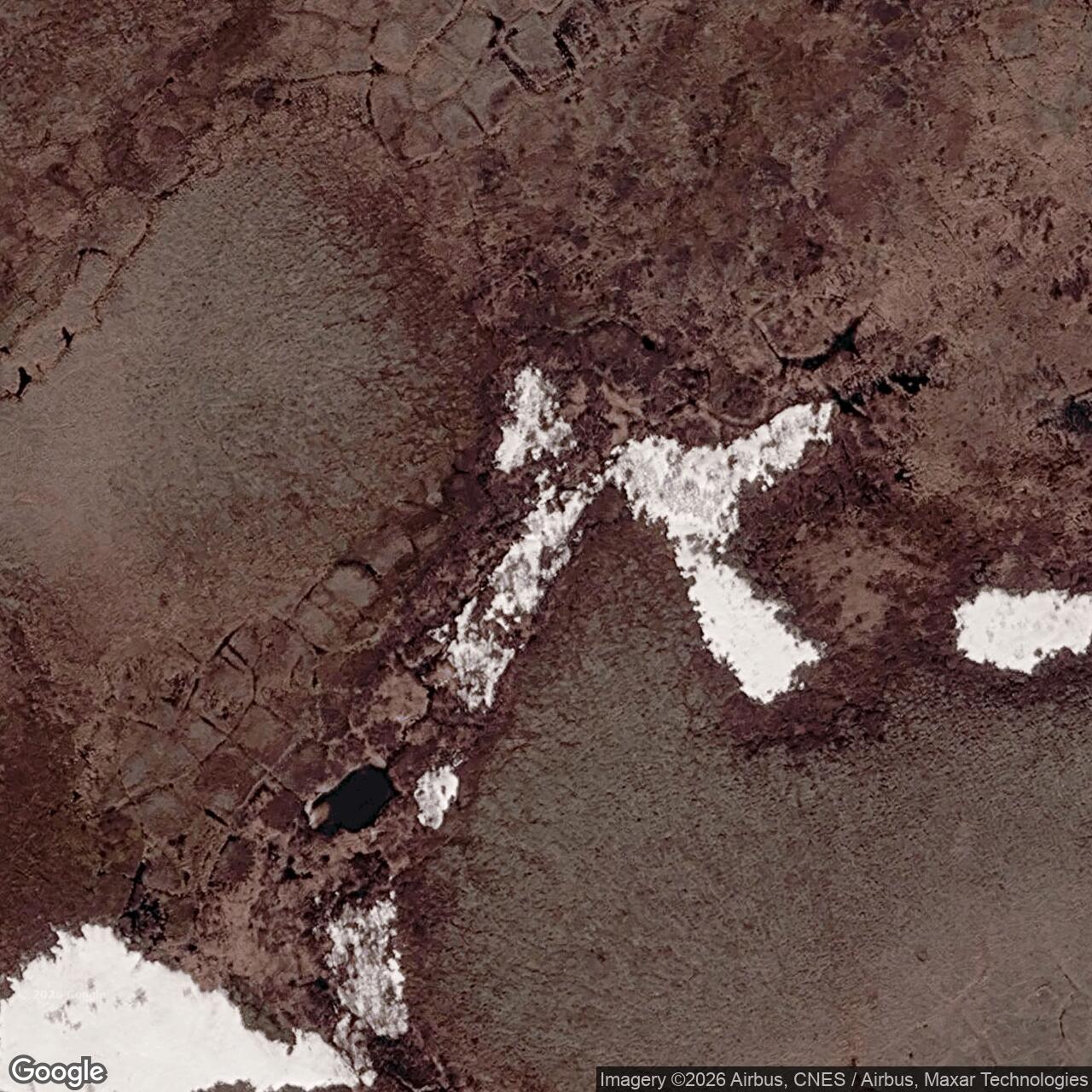
The station occupied the coastal plain near the Blow River, roughly two kilometers inland from the Beaufort Sea. A 1989 Air Force civil-engineering inventory recorded 2,682 acres for the installation and a gravel runway about 3,805 feet long by 110 feet wide, with the strip about 5,400 feet from the main building area. Aircraft and seasonal sea lift linked this isolated site to fuel, food, spare parts and personnel. [2]
The north Yukon coast had long been part of Inuvialuit travel and harvesting. Construction of the DEW Line brought wage work and new traffic to this landscape. Inuvialuit Living History specifically names Shingle Point among the stations that offered building and training opportunities, while Parks Canada identifies the DEW sites as one of the changes that reshaped life on the coast in the 1950s. [5] [6]
Radar, Communications, and the BAR Sector
BAR-2 used the AN/FPS-19 as its principal rotating search radar. Its paired channels and radome protected the search equipment from Arctic weather. Air Defense Command also lists AN/FPS-23 at Shingle Point. This Doppler system strengthened low-altitude warning between the large search radars. Together the two systems helped the western DEW Line detect aircraft that might otherwise pass through a gap near the horizon. [1] [4]
Four communications billboards stood at the station by the late 1980s. The 1990 survey confirmed them in two pairs on the main compound. They carried the directional radio links that moved warning and operational traffic between neighboring posts. Shingle Point also maintained air-ground communications and a beacon for aircraft serving the remote station. [2] [4]
BAR-2 was part of a chain of warning posts. Komakuk Beach and Stokes Point lay farther west toward Barter Island, while Tununuk Camp and Tuktoyaktuk continued the line east. The auxiliary posts provided broad radar search and reporting; the smaller intermediate sites added gap coverage where needed. [1] [3] [4]
Buildings, Crew, and Daily Life
A long module train formed the working and living center of BAR-2. The 1989 facility plan shows the train, a garage, warehouse, several sheds, power and fuel facilities, and four billboard antennas. The connected rooms placed radar work, electrical power, meals, sleeping space and essential services under one roof. Auxiliary stations were designed for a civilian contractor crew of about twenty. [2] [4]
Construction-era photographs show the module train raised on pilings and drifted nearly to roof level during a March 1956 storm. A later gallery photograph places housing for Indigenous personnel beside the road from the airstrip. These views give a sense of the compound beyond its radar equipment: freight, vehicles and people had to move between the runway, living quarters and the watch floor in a treeless, wind-exposed setting. [11]
Keeping the station running required as much practical maintenance as radar skill. The 1989 engineering record describes water hauled by truck from seasonal lakes to treatment equipment in the module train. Generator waste heat warmed the building through a hot-water system. Fuel came by sea lift to beach storage, then moved through the station distribution system. A garage kept vehicles working between the compound, runway and shore. [2]
The runway gave crews a faster link to the south when sea lift was closed by ice. Routine days still centered on radar watches, communications, engines, weather, repairs and food service. Winter darkness, wind and severe cold could interrupt travel even when the machinery worked. The station stood near Inuvialuit seasonal activity rather than in an empty landscape, and local people were part of the broader history of work and travel around the site. [2] [4] [5] [6]
From the DEW Line to the North Warning System
Canada and the United States replaced the aging DEW Line with the North Warning System during the late Cold War. A Canadian defense chronology dates both the end of BAR-2 DEW operations and the establishment of its NWS long-range radar site to June 1989. The 1991 engineering study described an active long-range station then retaining some older facilities during the changeover. [2] [3] [8]
The later radar is identified as AN/FPS-117 in the DEWLine station roster. The 2026 Canadian navigation guide describes an unmanned North Warning System station at Shingle Point, an abandoned former DEW station and an abandoned airstrip. The site therefore preserves two distinct phases of northern warning: a staffed Cold War auxiliary post and a remotely operated successor radar. [7] [8] [9]
Canada also undertook cleanup of former DEW infrastructure at BAR-2; a federal assessment listed its remediation as complete by 2003. The enduring military significance of Shingle Point lies in its continuous place along the Arctic warning route, first through the AN/FPS-19 era and later through the North Warning System. [3] [7] [10]
Chronology
- November 1955: Construction photographs show foundation pilings in place for the module train. [11]
- March 1956: Construction photographs document severe snow drifting and heavy equipment delivered by C-124. [11]
- April 1957: An aerial photograph shows the completed BAR-2 compound. [11]
- August 1957: Air Defense Command records manual operation at BAR-2 with AN/FPS-19 and AN/FPS-23 equipment. [1]
- March 1989: The Air Force civil-engineering inventory documents the station buildings, runway, fuel systems and four communications billboards. [2]
- June 1989: BAR-2 DEW operations end as a North Warning System long-range radar site is established. [3]
- August 1990: A field team surveys the former DEW facilities during the NWS transition. [2]
- 1991: The Shingle Point engineering study describes the station as an operating NWS long-range radar site. [2]
- By 2003: A federal assessment lists BAR-2 among completed DEW Line cleanup sites. [10]
- 2026: A Canadian navigation guide records an unmanned NWS station and abandoned DEW buildings and airstrip at Shingle Point. [7]
Related Sites
- Barter Island BAR-Main
- Komakuk Beach BAR-1
- Stokes Point BAR-B
- Tununuk Camp BAR-C
- Tuktoyaktuk BAR-3
- AN/FPS-19 radar
- AN/FPS-23 radar
- AN/FPS-117 radar
- DEW Line directory
- DEW Line history
Information sources (11)
- PDFAerospace Defense Command, Historical Data of the Aerospace Defense Command, 1946-1973, DEW Line station table
Station-specific BAR-2 listing for August 1957 manual operation and AN/FPS-19 and AN/FPS-23 equipment.
- PDFUMA Engineering Ltd., Environmental Clean-up Study of 21 DEW Station Sites in Canada, Draft Final Report, Volume 4, BAR-2 Shingle Point, 1991
Station-specific 1989 engineering inventory, 1990 site survey, acreage, buildings, runway, fuel and water systems, and the 1991 North Warning System transition.
- PDFDefence Research and Development Canada, DEW Line and North Warning System site chronology, CR 2012-076, BAR-2 table
Identifies Shingle Point as DEW auxiliary and NWS long-range radar site, with the June 1989 transition.
- PDFDavid Neufeld, BAR-1 Distant Early Warning Auxiliary Station, Komakuk Beach, Yukon Territory, Parks Canada historical study
Explains the western BAR sector, auxiliary-station operating model, communications links, and standard crew and module-train arrangements.
- WEBInuvialuit Living History, Our Timeline, DEW Line Construction Begins
Inuvialuit account of the radar construction period and work opportunities at Shingle Point and other Inuvialuit-region stations.
- WEBParks Canada, Culture and History of Ivvavik National Park
Places the Shingle Point DEW station within the history of the Yukon north coast and Inuvialuit land use.
- PDFFisheries and Oceans Canada, ARC 400 General Information: Northern Canada, 2026, Shingle Point entry
Current federal navigation guide distinguishing the unmanned North Warning System station, abandoned DEW Line station and former airstrip.
- WEBDepartment of National Defence, North Warning System In-Service Support Backgrounder, 2022
Official overview of the continuing Canadian North Warning System and long-range radar support.
- WEBThe DEWLine, North Warning System station roster, BAR-2 entry
Supplementary identification of the Shingle Point NWS long-range radar as AN/FPS-117.
- PDFCanadian Arctic Contaminants Assessment Report II, DEW Line cleanup table, 2003
Records BAR-2 among completed Canadian DEW Line cleanup sites.
- WEBThe DEWLine, BAR-2 Shingle Point photo archive
Station-specific visual reference for the interpretive reconstruction; original gallery photos are review-only pending reuse permission.