
Ice Cap 1 DYE-2 DEW Line Station, Greenland
An elevated radar watch on moving ice, sustained by ski aircraft, snow harvesting and repeated structural interventions.
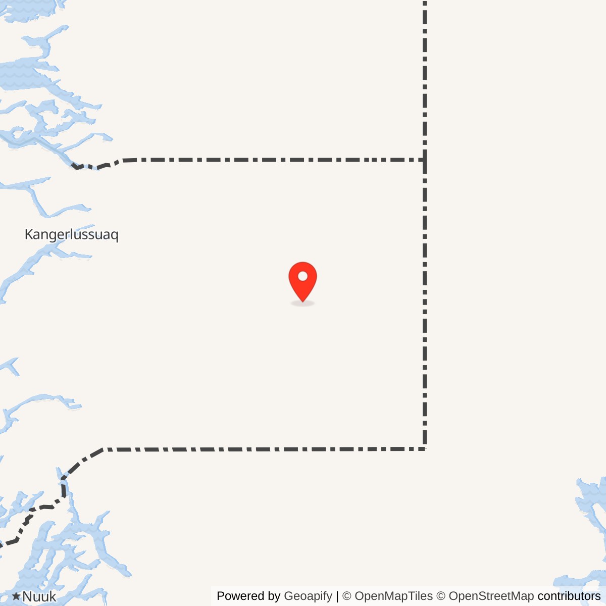
Longitude: -46.30528
Site Number: DYE-2
Current Role: Abandoned former radar structure; nearby Camp Raven is a separate later training and support site. Present condition not independently surveyed.
Station reference point 66.49167, -46.30528. View map [12]
- DEW Line code
- DYE-2 / Ice Cap 1
- Role
- Auxiliary radar and communications station
- Radar
- AN/FPS-30 search radar
- Operation
- August 1, 1961 to 1988; abandonment ordered August 24 with an October 1 deadline
- Historical leased area
- 2,583 acres
- Location
- Inland ice sheet southeast of Kangerlussuaq, Greenland
History
DYE-2, also called Ice Cap 1, was one of two Greenland DEW Line stations built directly on the inland ice. An elevated composite building brought radar, communications, workshops and living accommodation into a single isolated installation. It entered operational service with the Greenland extension on August 1, 1961 and supplied aircraft-warning information through the sector centered on Cape Dyer. [8]
Keeping the station above accumulating snow required repeated lifting. The building also moved with the ice beneath it, while its foundations settled unevenly. These conditions made structural maintenance part of the warning mission itself. The station remained in use far beyond its original planned life before safety concerns brought its staffed radar service to an end in 1988. [7] [13]
Construction and the Airlift
CRREL participated in selecting and developing the ice-cap sites in 1958, using snow studies and wind-tunnel work to address accumulation and drifting. Ski-equipped C-130 aircraft arrived for the construction airlift in 1959. DYE-2 also served as a staging point for scientific traverses, allowing people and equipment to reach the interior much faster than a difficult journey across the ice margin. [4]
The construction supply chain began well before an aircraft reached the skiway. American Bridge fabricated structural steel in the United States; it traveled by ship to Sondrestrom, then through sorting, trucking and palletization for the flight inland. Cargo dimensions and weights had to fit the aircraft. Building a large permanent station therefore depended on managing a long series of transfers, each subject to weather and transport limits. [3]
The original foundations combined heavy timber mats and steel grillage below the snow surface. Paired column members and bracing supported the building above them, while a jacking system allowed it to rise as snow accumulated. Construction photographs show steel erection, installation of the radome ring and work on four buried fuel tanks. Temporary huts and machinery supported the workforce during the building seasons. [3]
The Composite Building and Site Layout
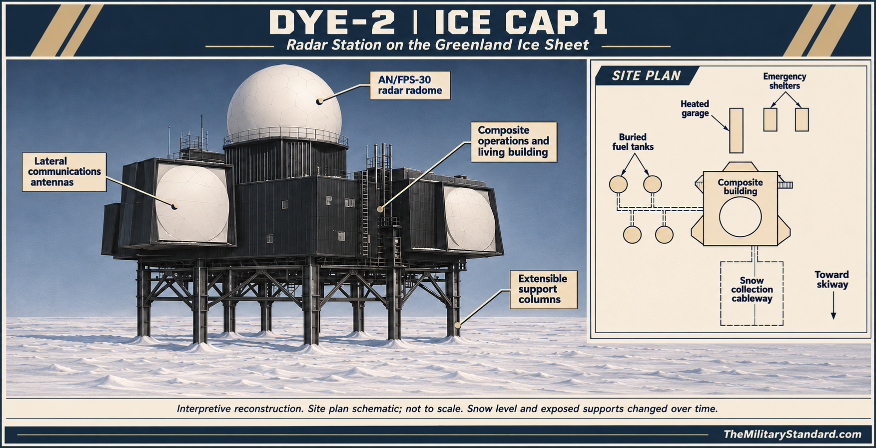
The historical station description records 2,583 acres of leased ice-cap territory and an elevation of about 7,600 feet. The black-clad composite building dominated an otherwise largely featureless snow plain. Its raised position allowed drifting snow to pass beneath it, although the amount of exposed support structure changed as the station was lifted and snow levels rose. [1] [7]
The archived section places radar spaces beneath the main radome, with lateral-communications control, corridors, storage, receiving and mechanical functions within the building. Living rooms and operating spaces shared the structure. This concentrated arrangement reduced the need to move outdoors between essential functions during severe weather. [9]
The wider layout shows four below-surface POL tanks connected to the building by a tunnel system. A separate sewer route led toward a waste-disposal area. A heated garage and emergency shelters stood beyond the main structure, while a cableway served the snow-collection area. The skiway was a separate transport facility rather than a conventional paved runway beside a town. [9]
Radar and the Greenland Warning Watch
The principal search equipment was the Bendix AN/FPS-30. Operating in the 570-630 MHz band, it combined surveillance and identification functions and was credited with detection ranges up to 200 nautical miles under suitable conditions. Its radome protected the rotating radar antenna; the large side enclosures served the separate lateral-communications system. [8]
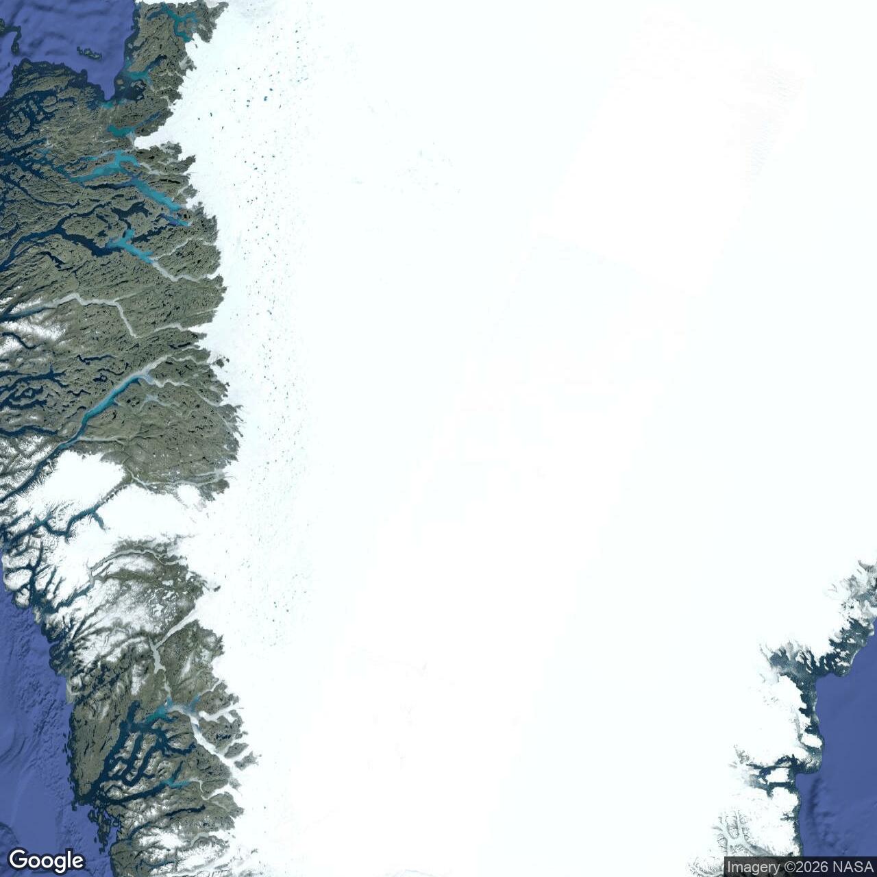
DYE-2 lay between DYE-1 on Greenland's western mountain terrain and DYE-3 farther across the ice sheet. The layout identifies lateral links in both directions. The chain carried warning reports toward Cape Dyer and connected the Canadian DEW network with Greenland and Iceland. Successful operation depended on the communications circuits as well as the search radar. [9] [8]
The extension became operational on August 1, 1961 after installation and testing delays. Tests the following month exercised its detection and tracking capabilities. Federal Electric operated and maintained the Greenland stations under Air Force contract, combining civilian technical staffing with military direction and support. [8]
Ski Aircraft, Personnel and Daily Operation
Sondrestrom was the main logistics base. By 1983 the support system included the 4684th Air Base Group, commercial transport bringing supplies to Greenland and the 109th's ski-equipped C-130 operation. Annual fuel deliveries supported DYE-2 and DYE-3, while large loads included equipment for maintaining and raising the ice-cap stations. [5]
The Raven Gang's flying season was extended to accommodate construction work. Aircraft could bring structural steel, cranes, bulldozers and temporary accommodation, but unloading and restarting in extreme cold were practical constraints. The contemporary account describes engines remaining running during unloading and the close crew coordination needed when whiteout erased the horizon. [5]
The earlier 17th Tactical Airlift Squadron supported CRREL visits to the ice-cap stations. Engineers examined the composite buildings, buried fuel tanks, waste systems and surrounding snow. In 1969 the airlift effort brought a one-tenth-scale DYE-2 model for a local snow-drift study. These were supporting operations, not evidence that an entire airlift squadron was permanently stationed inside the radar building. [4]
American and Danish personnel maintained the Greenland station watch. Isolation made shifts, meals, repairs and recreation parts of the same small community. Inside DYE-2 the building contained the spaces needed to sustain this workforce; outside it, aircraft and weather controlled the arrival of replacement staff, equipment and stores. [12] [9]
Snow, Water and Fuel
Water came from melting harvested snow. A bucket and dragline arrangement worked from a cableway extending about 300 feet from the composite building. This allowed the station to collect snow for its own supply instead of depending on a lake and a long mountain pipeline of the type used at DYE-1. [1]
Fuel storage was likewise adapted to the ice-sheet setting. The original installation included four buried tanks and connecting tunnels, with construction photographs showing excavation, tank assembly and backfilling. Aircraft-delivered fuel and stored reserves supported a station whose heat, electrical power and electronics had to function through the winter. [3] [9]
Water could also become a foundation problem. The 1982 engineering program included development of a well to obtain water for ice backfilling. That work belonged to the life-extension effort; it should not be confused with the everyday snow-harvesting arrangement that supplied the occupants. Managing water around a structure founded in snow demanded attention to both utility service and structural consequences. [6]
Raising and Relocating the Station
The building used eight extensible support columns in two rows. Periodic lifting maintained clearance above the surface. The foundation remained within snow and ice, rather than on fixed rock, so lifting alone could not remove the effects of differential settlement. An FEC account emphasized that snow rose around the structure, even while the larger ice sheet moved toward the coast. [2] [7]
In 1982, DYE-2 moved sideways 64 metres onto new footings. A further 8.2-metre lift followed in 1983. The relocation addressed an increasingly difficult support system, but uneven foundation movement continued. A 1987 intervention reduced and redistributed structural stresses without eliminating the underlying settlement problem. [2]
The work required both practical construction and measurement. Engineers monitored forces, column alignment, footing behavior and snow conditions over successive visits. The earlier survey program and the 1982 water-well study show the breadth of the effort needed to keep an operational radar station supported by a changing frozen foundation. [4] [6]
The 1988 Evacuation and Shutdown
On August 24, 1988, the Air Force decided that DYE-2 should be abandoned by October 1 because of rising structural stresses. The engineering assessment found continuing tilt and settlement, with water at a critical footing raising further concern. Personnel briefly returned after the initial evacuation before the station was finally left without its regular operating crew. [2]
Former console operator Terry Wambolt recalled waking to find staff packing after being told the building might collapse. The operators maintained the communications link until shutdown, taking personal belongings when they left. He later returned with a crew to dismantle equipment. His recollection conveys the speed and practical consequences of the evacuation, while the engineering record establishes the formal decision and deadline. [10]
The closure was part of the final years of Greenland DEW service, but DYE-2's immediate problem was the safety of its supporting structure. Its failure to remain serviceable did not mean that every Greenland warning station closed on the same day or that the entire DEW Line disappeared at once. [13] [11]
The Abandoned Station and Camp Raven
DYE-2 remained on the ice after its military radar mission ended. The main building, furnishings and technical spaces survived into later visits, while drifting snow progressively obscured outlying facilities. The ice-cap stations thus left a different physical legacy from the dismantled bedrock stations at DYE-1 and DYE-4. [13] [1]
A 2003 visit distinguished the abandoned radar building from Camp Raven about a mile away. Raven supported ski-aircraft training and scientific logistics; it was not a reactivation of the old AN/FPS-30 station. The 109th's experience supplying the DEW sites continued into later polar airlift work, including support for Antarctic research. [10] [11]
The surviving structure illustrates the engineering challenge of sustaining a permanent watch on a moving ice sheet. Its radar mission depended on foundations, snow management, stored fuel and reliable aircraft support. These systems explain both the station's long service and the conditions that ultimately forced its evacuation. [7] [12]
Chronology
- 1958 CRREL contributes snow and drifting studies to ice-cap station development. [4]
- 1959-60 Construction airlift and structural erection establish DYE-2. [3]
- August 1, 1961 The Greenland DEW extension enters operational service. [8]
- 1969 A scale model supports a snow-drift study at DYE-2. [4]
- 1982 The station moves sideways 64 metres onto new footings. [2]
- 1983 An additional 8.2-metre lift follows the relocation. [2]
- 1987 A structural intervention redistributes stresses. [2]
- August 24, 1988 The Air Force decides to abandon DYE-2 by October 1. [2]
- October 1, 1988 The formal abandonment deadline follows the August evacuation decision. [2]
- July 2003 A documented visit records the abandoned station and nearby Camp Raven. [10]
Related Sites
Information sources (13)
- WEBThe DEWLine, Site: DYE-2, historical description and photo archive
Historical leased area, ice-sheet setting, snow harvesting and operating photographs.
- PDFMichael R. Walsh and Herbert T. Ueda, Structural Analysis of DEW Line Station DYE-2, Greenland, 1983-1988, CRREL Report 98-3, June 1998
Support arrangement, 1982 relocation, 1983 lift, settlement, repairs and the dated 1988 abandonment decision.
- WEBBill Lane, Construction of DYE-2, text and photographs
Construction airlift, structural erection, buried fuel tanks and temporary camp.
- WEBSteven J. Mock, Greenland Operations of the 17th Tactical Airlift Squadron and CRREL, March 1973
Engineering site selection, construction airlift, annual surveys and the 1969 snow-drift model.
- PDFAIR FORCE Magazine, August 1983, page 71
Sondrestrom logistics, 109th ski-aircraft missions and fuel/cargo support of the ice-cap stations.
- PDFJohn Rand, Developing a Water Well for the Ice Backfilling of DYE-2, CRREL Special Report 82-32, December 1982
Engineering work associated with foundation backfilling and the 1982 life-extension program.
- WEBFEC/ITT, On the Ice Caps of Greenland, archived company newspaper article
Contractor account of the elevated buildings, periodic lifting and continued communications through major alterations.
- WEBThomas W. Ray, A History of the DEW Line 1946-1964, ADC Historical Study No. 31, June 1965
Greenland opening date, AN/FPS-30 characteristics, operational testing and Federal Electric contract.
- WEBHarry Vanderham, DYE-2 site layout and building section, archived by The DEWLine
Room functions, paired support columns, fuel and sewer connections, snow-collection system and outlying structures.
- WEBMichael Lamendola, A Visit to the Abandoned DYE-2 Site, July 14-19, 2003, with photographs by SSgt Cathy Perretta
Former console operator Terry Wambolt recalls evacuation and return; distinction between the abandoned radar station and Camp Raven.
- WEB109th Airlift Wing, History
Official history of the ski-aircraft support mission and its transition beyond the DEW Line.
- PDFJens Fog Jensen, Inge Bisgaard and Jens Heinrich, Anlaeg fra Den Kolde Krig i Groenland, Field Report 34, 2013
Greenland heritage context, ice-cap construction, operating life and inventory coordinate for DYE-2.
- WEBDanish Agency for Culture and Palaces, 3. Dye radarstationer, July 24, 2019
The four Greenland stations and the different fate of the bedrock and ice-cap facilities.