
Aurora Radio Relay Station, Alaska
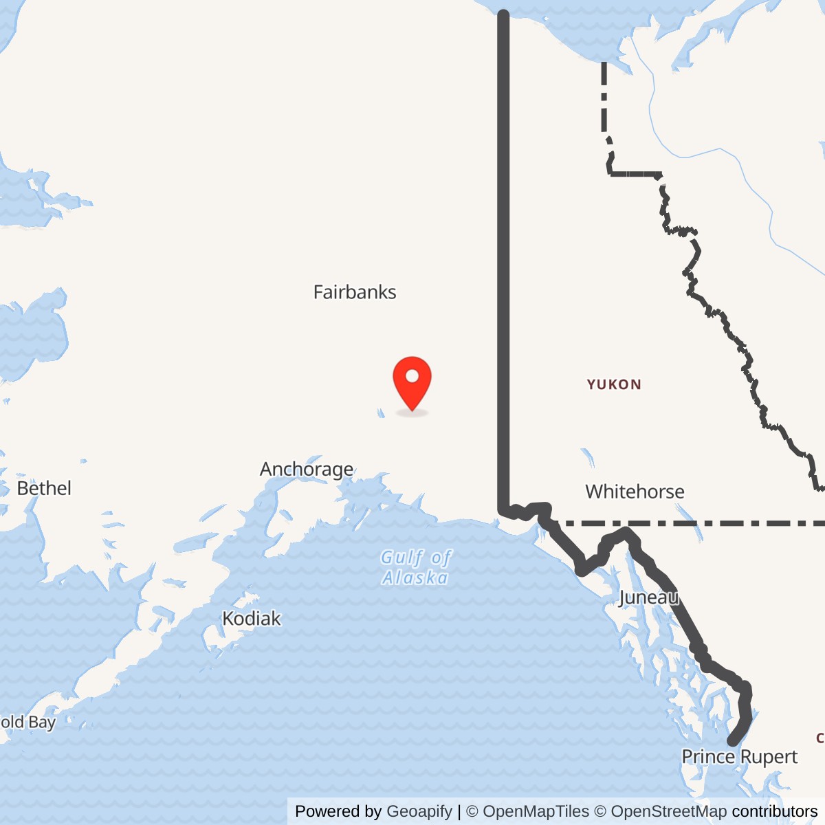
Longitude: -145.109007
Current Role: Former military relay landscape. Current ownership, surviving communications facilities and environmental status need station-specific review.
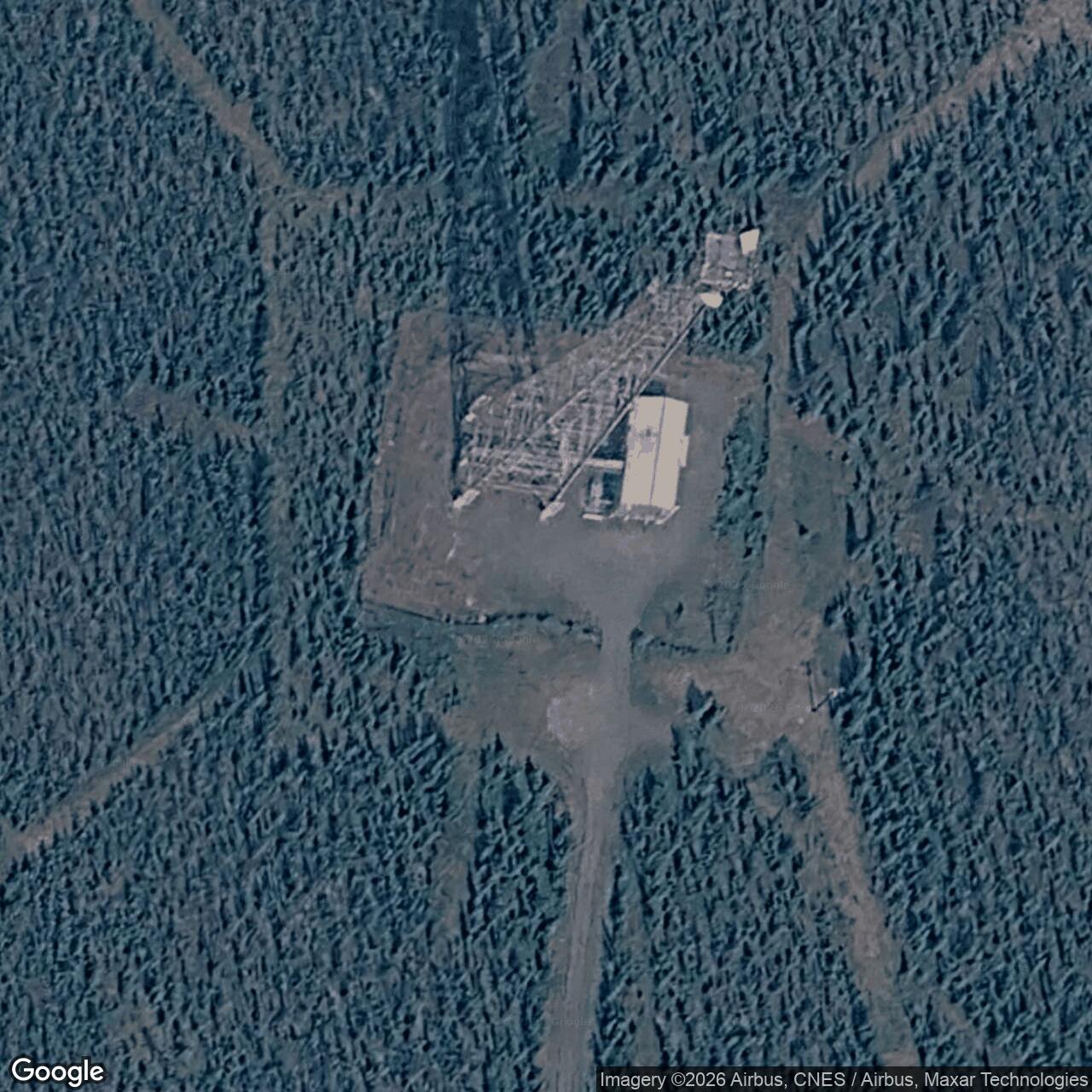
Aurora was an unattended U.S. Air Force TD-2 microwave repeater near Gakona, Alaska. Built for the coastal A Route of the Paxson. The Army Corps of Engineers gives those adjacent radio links as 25 and 40 miles, respectively. A Defense Department history dates Air Force operation from 1960 to 1983. Aurora was a communications relay, not a radar station or an auroral research installation. 1 3
- Role
- Unattended two-way TD-2 microwave repeater on the White Alice BMEWS coastal A Route.
- Direct links
- Glennallen, 25 miles; Paxson, 40 miles, according to the Corps' route inventory.
- Air Force period
- 1960 to 1983, at year-level precision; no exact opening or transfer day verified.
- Location
- Gakona / Copper River area, with a documented Glenn Highway access easement. No source-qualified tower coordinate or legal station boundary available.
- Acreage
- Unverified. Published 73.71-square-mile figure is anomalous; 2.5-acre land action and 5.62-acre cleanup area are not installation acreage.
- Later record
- Alascom purchase reported for 1983; 2010 cleanup addressed adjacent Ahtna land. Current tower and building condition unverified.
Origins and BMEWS Mission
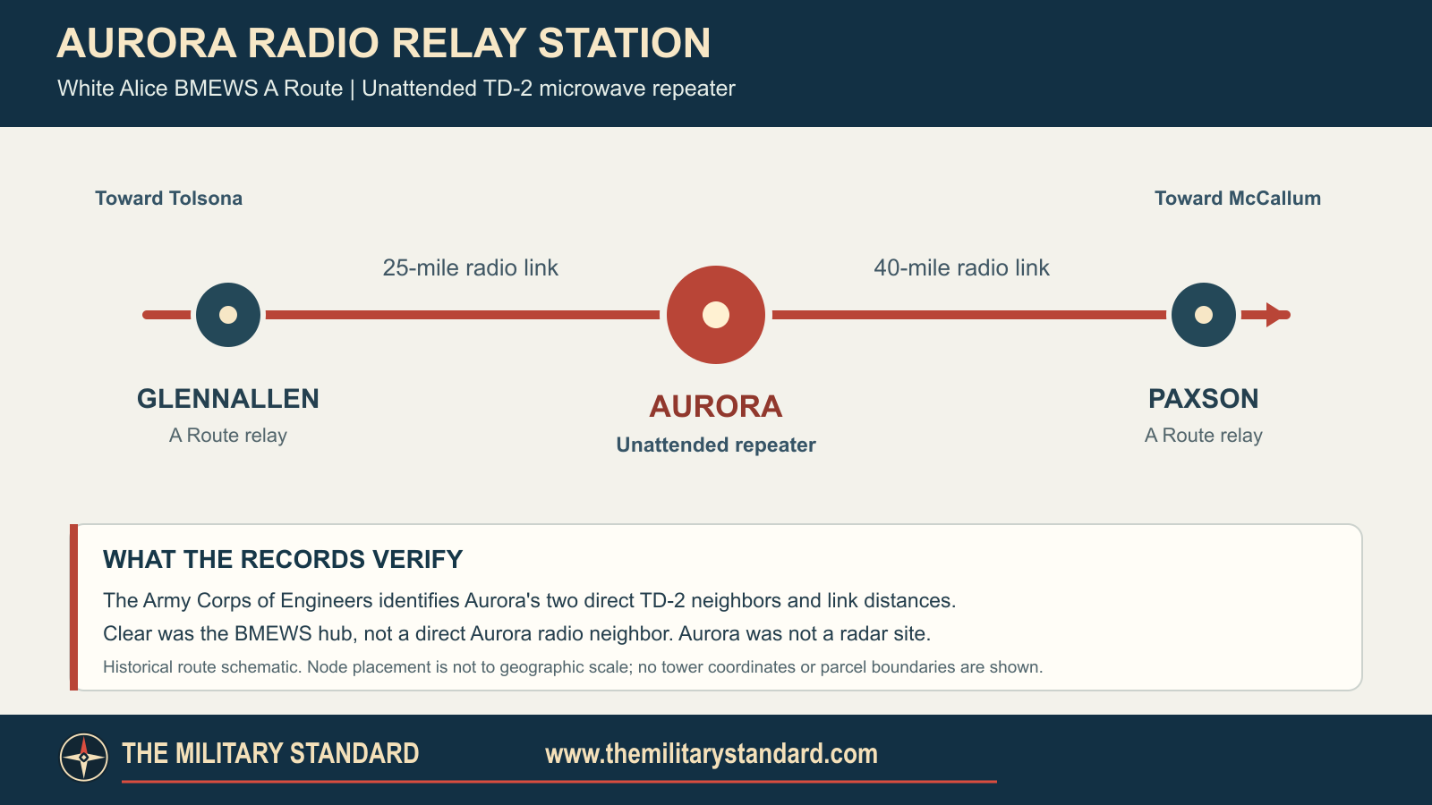
The first White Alice stations tackled unreliable long-distance communications across Alaska. The later BMEWS expansion added two rearward paths for traffic from the missile-warning installation at Clear: a coastal A Route and an interior B Route. Aurora was a new A Route relay, not one of the original 31 stations. It bridged the Glennallen-Paxson gap in the Copper River and Richardson Highway region. Its job was to carry warning and command communications onward, not to detect missiles. Clear was a route hub, but not Aurora's direct microwave neighbor. 1
The Corps says the BMEWS microwave relay class was built in 1960 and opened in 1960 or 1961. The Defense Department's Aurora-specific account begins Air Force operation in 1960. No acceptance order fixes a day or month for this station. The 1983 Air Force sale study is more specific about function: Aurora was an unattended two-way microwave repeater between Glennallen and Paxson and appeared on the TD-2 property list. The two independent accounts establish a distinct relay installation rather than merely a name applied to part of a neighboring station. 1 2 3
Location and Physical Plant
The Air Force study places Aurora 12.6 miles from Big Timber, identified as the Glenn and Richardson Highways junction on the Glenn Highway. A 1981 Federal Register notice describes a 60-foot-wide road easement running north from the Glenn Highway in Section 7, Township 7 North, Range 2 East, Copper River Meridian, to the Air Force Aurora Radio Relay Sites. Its plural wording does not prove two separate operating stations. These descriptions help locate the historical access corridor, but neither is a surveyed antenna coordinate or a polygon for the full property. Accordingly, this page does not print a latitude and longitude that would imply false precision. 2 4
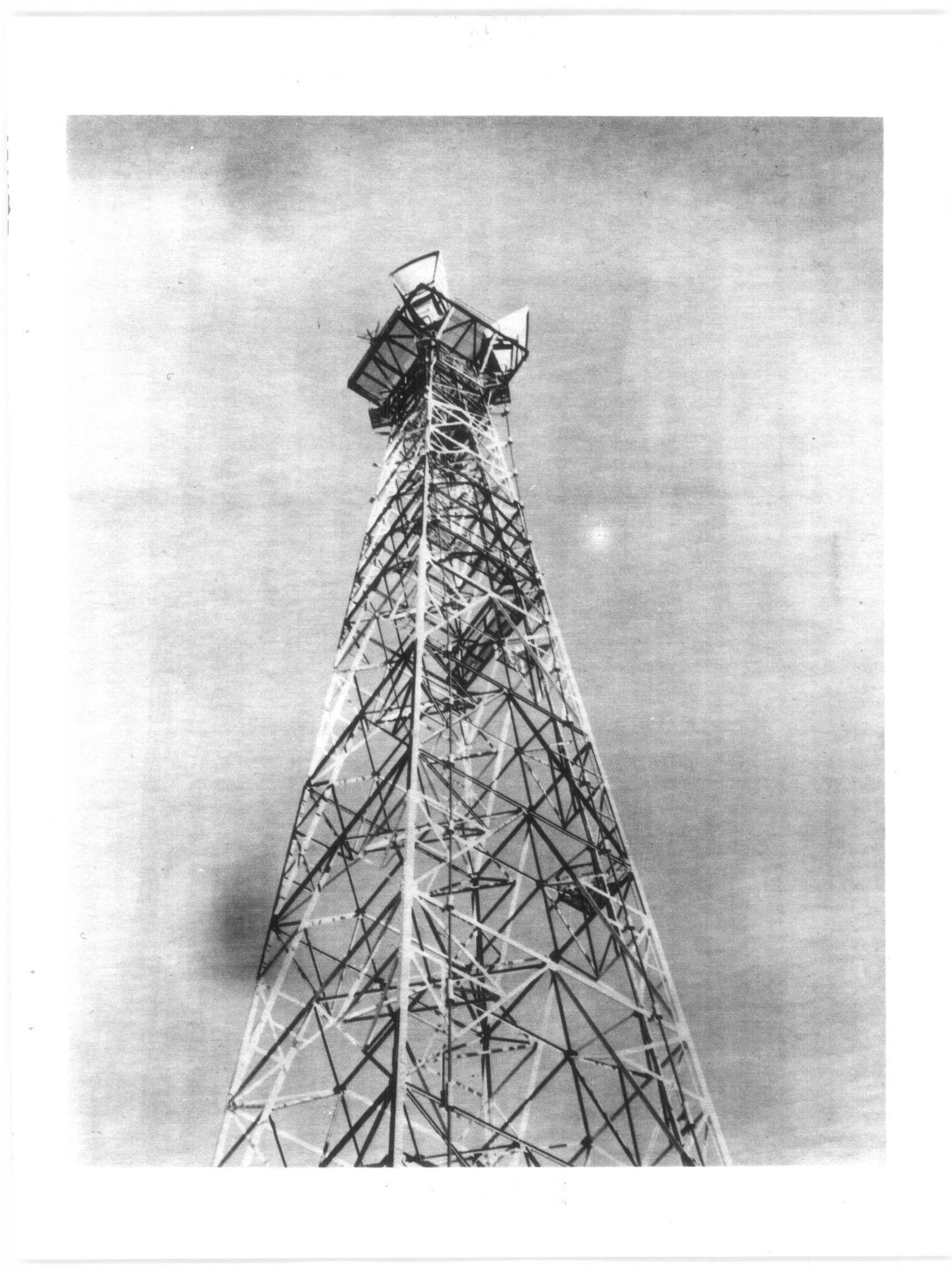
The Corps describes the BMEWS microwave stations as similar to earlier TD-2 relays: most had a radio relay building, fuel tank and tower, with some sites having additional support facilities. That is a network-wide pattern, not an Aurora building inventory. No audited document verifies Aurora's exact number of towers, antenna dimensions, tank size, floor plan, or resident staff. The site was classified as unattended, which means periodic maintenance rather than a proved absence of all personnel. The pictured Soldotna tower illustrates the technology type only. University of Alaska Anchorage's McDowell collection indexes actual Aurora photographs. 1 8
Operation and Wider Network
Aurora received a microwave signal on one path and retransmitted it on the next. The Corps identifies its direct 25-mile leg to Glennallen and 40-mile leg to Paxson. Continuing along the route, Glennallen connected toward McCallum. These route relationships show why Aurora mattered as an intermediate node even though it had no radar of its own. They are historical communications links, not a scale drawing of the geography or evidence of continuous service in 2026. The available station records do not identify a local squadron, outage history or circuit capacity, and such details should not be borrowed from the larger attended White Alice sites. 1 2
Civilian Transfer and Property
Aurora appears among the TD-2 stations examined in the Air Force's late-1970s sale and appraisal process. The Defense Department says Air Force operation ended in 1983 and AT&T Alascom purchased the Aurora RRS that year. That supports a year-level transfer narrative, not an exact deed day or a statement that all original equipment remained. The 1981 road easement and a later Bureau of Land Management entry for an April 27, 1989 Aurora-related 2.5-acre segregation termination show why access rights, a particular land action and the whole communications property must be distinguished. The 2.5-acre figure is not the station's verified size. 2 3 5
The 2013 Defense Department fact sheet prints a "73.71 square miles" surface-area figure for Aurora, but gives no supporting survey. That would exceed 47,000 acres and conflicts with the scale of a microwave repeater. It may be a unit or transcription error; it is not silently converted to acres here. A Bureau of Land Management contaminated-lands report identifies Aurora as FUDS property F10AK0057 and leaves its conveyance path uncertain between an Alascom deed and Alaska Native Claims Settlement Act conveyances. The station parcel, adjacent Ahtna lands and road interests should not be merged into one unverified acreage or ownership claim. 3 6
Environment and Present Condition
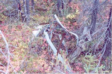
The Native Village of Gakona entered a Defense Department-supported environmental mitigation partnership in fiscal year 2008. Community leaders described metal and other debris around Aurora as a concern for travel, hunting and gathering. In 2010, a project removed 28 drum tops, five grounding posts, about 100 pieces of metal strapping and other debris from 5.62 acres of adjacent Ahtna land. The fact sheet says sampling of that affected Ahtna land found no petroleum contamination in the sampled soil and groundwater. That is a limited result for the sampled adjacent land, not a station-wide cleanup closure. The General Accounting Office separately lists Aurora Radio Relay under FUDS number F10AK0057. 3 7
The reviewed public record does not establish which original Aurora structures still stand or whether communications equipment remains active in 2026. The 2013 Defense Department fact sheet contains a site-specific 2001 debris photograph, which documents a later condition rather than the 1960 relay layout. The UAA archive identifies other Aurora photographs but requires item-level access and rights review. A present-condition survey, title records and station-specific engineering plans would resolve these remaining questions. Until then, Aurora is accurately described as a former Air Force relay with a documented Alascom acquisition and an adjacent-land cleanup history. 3 8
Chronology
- 1960 Defense Department account places the beginning of Aurora's Air Force operation in this year; exact opening day unverified.
- 1960-1961 Corps inventory gives this construction and opening window for the BMEWS TD-2 relay class.
- 1977-05-20 RCA Alascom submitted a list of TD-2 real and personal property it sought to purchase within the wider system.
- 1978-01-26 The Corps awarded a system-wide TD-2 appraisal contract including Aurora.
- 1981-08-06 A Federal Register notice documented the Aurora access-road easement.
- 1983 Defense Department account dates the end of Air Force operation and Alascom acquisition to this year.
- 1989-04-27 BLM index records a 2.5-acre Aurora-related segregation termination, not a measurement of the entire station.
- 2008 Native Village of Gakona entered a Defense Department-supported environmental mitigation agreement.
- 2010 Tribal project removed military debris from 5.62 acres of adjacent Ahtna land and sampled that affected land.
- 2013-05 Defense Department partnership fact sheet reported on the cleanup and published an anomalous area figure.
Information sources (8)
- PDFU.S. Army Corps of Engineers, Historical Overview and Inventory of the White Alice Communications System
Source for BMEWS A Route identity, 1960-1961 build/opening window, typical TD-2 facilities, and Aurora's Glennallen and Paxson links with distances.
- PDFU.S. Air Force, 1983 Special Study of the White Alice Communications System Sale
Source for Aurora's unattended two-way repeater role, locality, equipment class and system-wide property disposition context.
- PDFU.S. Department of Defense, Native Village of Gakona: Aurora Radio Relay Site, May 2013
Source for Air Force operating years, Alascom purchase, adjacent Ahtna land, 2008 partnership, 2010 debris removal and limited sampling findings; the anomalous acreage statement is disclosed but not adopted.
- PDFFederal Register, August 6, 1981, Alaska Native land-selection easement notice
Source for the 60-foot Aurora access-road easement, township-section reference and the notice's plural site wording.
- PDFBureau of Land Management, Alaska Orders Index
Source for the April 27, 1989 2.5-acre Aurora-related segregation-termination entry, not installation acreage.
- PDFBureau of Land Management, 2016 Update to the Report to Congress on Contaminated ANCSA Lands
Source for FUDS property F10AK0057 and uncertainty over the station property's conveyance route.
- WEBU.S. General Accounting Office, Alaska Properties Identified for Potential Inclusion in the FUDS Cleanup Program
Source for the Aurora Radio Relay F10AK0057 inventory entry; its geographic coding and cost figures are not treated as property measurements.
- WEBUniversity of Alaska Anchorage, William F. McDowell Papers
Source for the existence of indexed Aurora White Alice photographs, not for a claim that a specific photograph is cleared for publication.