
Alaska Cold War communications
White Alice Communications System
Find the stations of the network that carried radar reports, military orders, telephone calls, and teleprinter traffic across Alaska.
Start with a place
White Alice was a connected system, not a single installation. Some relay stations occupied their own tracts. Others shared a radar or air-base property. The links below follow the verified installation records and keep those distinctions intact.
The original 31 are grouped by their first documented technical role. Later route lists repeat some stations because existing sites gained new links. A station appearing twice below is not counted as two installations.
First network
Original White Alice stations
Built in the 1950s to connect Alaska's aircraft-warning and command system. The 22 / 6 / 3 breakdown follows federal historic documentation.
Tropospheric scatter22 named places
Microwave6 named places
Troposcatter and microwave3 named places
Expansion
Later routes and extensions
The BMEWS rearward routes, Aleutian Stretchout, and Bluegrass extension reused some original nodes and added others. These are route memberships, not a second count of unique sites.
BMEWS coastal A Route21 named places
BMEWS interior B Route8 named places
Aleutian Stretchout6 named places
Project Bluegrass2 named places
Sheep Mountain's White Alice and Army repeater property relationship is still under review. Atka is named as a Nikolski link in the Corps inventory, but its physical White Alice site and separate installation identity have not yet been confirmed.
Related places
Support Facility and Unbuilt Proposals
These places belong in the White Alice story but are not additional operating radio stations. The Paxson annex maintained highway repeaters; the two Kodiak-area proposals never opened as White Alice links.
Maintenance support1 facility
Never-opened White Alice proposals2 places
How the network worked
Why the giant antennas?
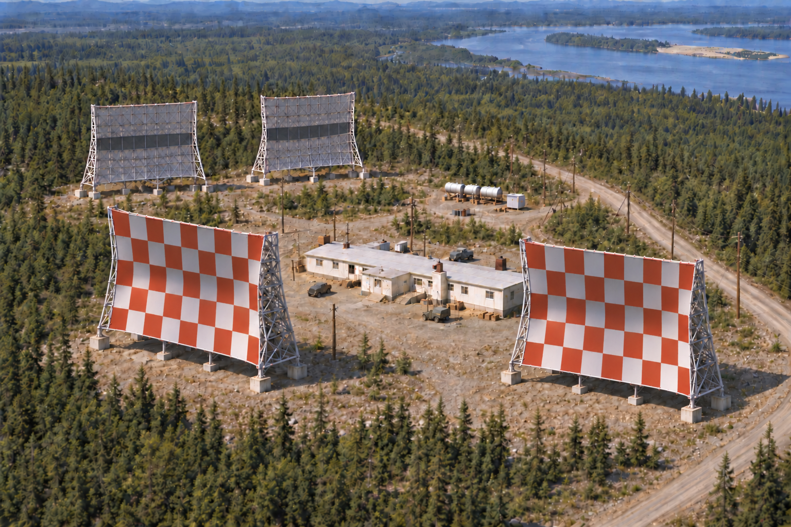
Where a direct microwave path was impractical, paired concave billboard antennas aimed radio energy toward the horizon. A small fraction scattered forward from the lower atmosphere to the next station. Microwave towers served shorter, line-of-sight hops, often along road corridors.
Explore the engineering, history, and later fate of the system
The Library of Congress holds Historic American Engineering Record photographs and drawings for Rabbit Creek and Boswell Bay, including antennas, buildings, and site context.
Rabbit Creek archiveBoswell Bay archiveInformation Sources
Historic American Engineering Record, Rabbit Creek White Alice Site, HAER AK-23
Source for: original 31 station roster, technical categories, later route lists, and co-located stations
https://www.loc.gov/pictures/item/ak0213/
Alaska Office of History and Archaeology, The Coldest Front: Cold War Military Properties in Alaska
Source for: original network classification, BMEWS routes, Stretchout, Bluegrass, and disposition context
https://dnr.alaska.gov/parks/oha/publications/coldestfront.pdf
U.S. Army Corps of Engineers, Historical Overview and Inventory: White Alice Communications System (1988)
Source for: Sitkinak and Cape Chiniak construction and non-operational status
Alaska DEC document archive
U.S. Air Force, A Special Study of the Sale of the White Alice Communications System (1983)
Source for: Paxson Lake Maintenance Annex and its support role
Alaska DEC document archive