
Black Rapids Radio Relay Station, Alaska
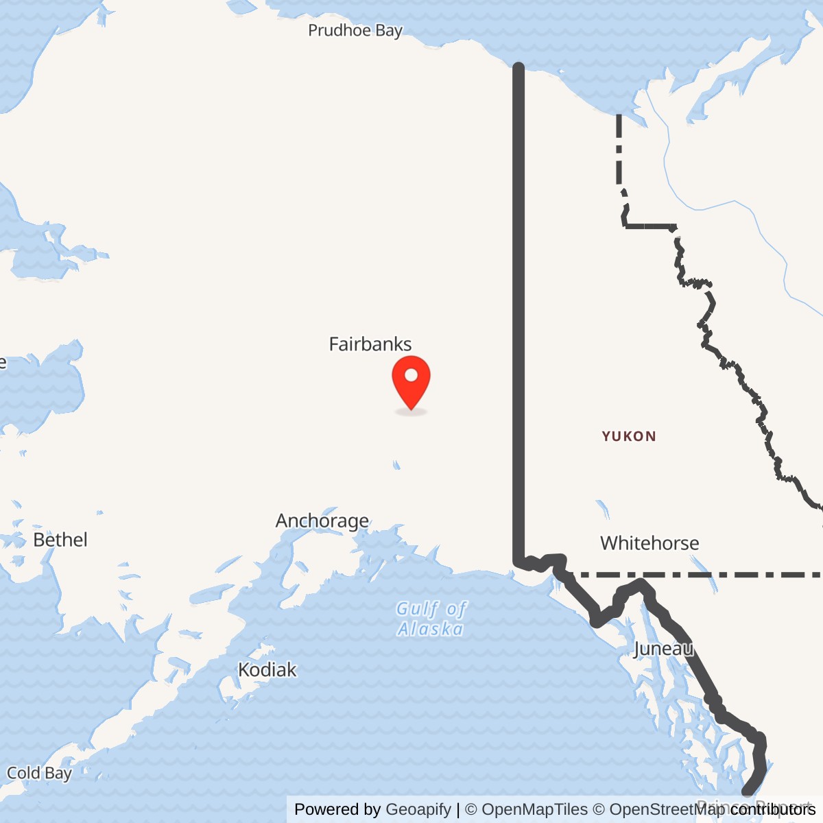
Longitude: -145.849722
Current Role: Later Alascom telecommunications tower registration and license records identify Black Rapids, including a 2025 filing. Whether the original 1960 TD-2 tower, relay building and fuel system remain, and current use or ownership of the original compound, are unverified.
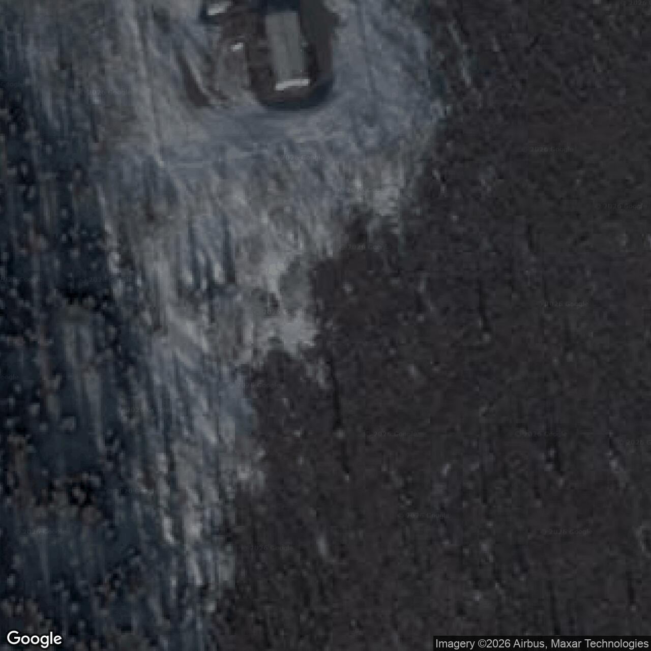
Coordinate note: 63.498056 N, 145.849722 W is a later FCC/Alascom tower point. It is not a surveyed original tower, station centroid, property corner, or boundary.
- Role
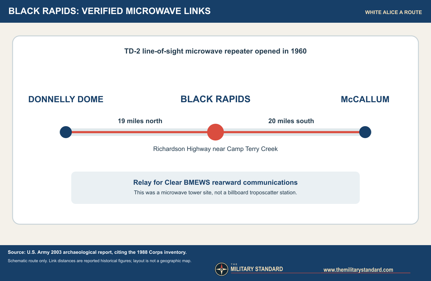
- White Alice TD-2 microwave repeater on the Clear BMEWS rearward communications A route.
- Opened
- 1960, by Army historical account. Exact day not established.
- Direct links
- Donnelly Dome, about 19 miles north; McCallum, about 20 miles south.
- Facilities
- 1,560-square-foot relay building, TD-2 tower, 722 feet of fence, and 2,500 gallons of underground fuel storage.
- Later history
- Declared Air Force excess in 1979; sold to Alascom in 1984; civilian use reported in 1988. Original structure survival unverified.
Black Rapids was a small but strategically placed Donnelly Dome to the north and McCallum to the south. Unlike the better-known White Alice stations with enormous billboard-like tropospheric scatter antennas, Black Rapids used a TD-2 line-of-sight microwave tower. Its mission was to keep a section of the rearward communications route for the Clear ballistic-missile-warning system connected through the Alaska Range. The Air Force declared the station excess in 1979; Alascom bought it in 1984 and maintained it in civilian service at least through 1988. Later licensing records show a telecom tower at the location, but do not by themselves establish that the original relay building or 1960 tower survives. 1237
Identity, location, and boundaries
The Army's archaeological record identifies the White Alice station as Alaska Heritage Resources Survey site XMH-392, near Camp Terry Creek's crossing of the Richardson Highway in the Black Rapids area. That archaeological identity refers to the communications compound, not the adjacent Black Rapids Roadhouse, Black Rapids Airport, or the much larger Army Black Rapids Training Area. The Army's report expressly locates the roadhouse outside the project area it was surveying. A 2004 Army document described the separate training area as a 2,780-acre holding; this is a source-era figure, not a current surveyed area and not relay-station acreage. 14
For map display, approximately 63.498056 N, 145.849722 W is a later Alascom/FCC-licensed tower point labeled Black Rapids, about 60.3 kilometers south of Delta Junction. It is a useful representative site point, not a surveyed boundary, original tower location, building center, or proof of continuous occupancy. A 1976 Federal Register notice independently places the radio station near Richardson Highway mile 227 and gives latitude 63 degrees 29 minutes 54 seconds N, but the available digitized text does not preserve a complete longitude. The near agreement in latitude supports the identification without curing the missing land survey. No defensible station-wide acreage or property polygon was found. 68
Why a relay was needed
White Alice began as a Cold War answer to Alaska's unreliable high-frequency communications over immense distances and difficult terrain. After its original air-defense network, the Air Force expanded the system to carry rearward communications for the Ballistic Missile Early Warning System, or BMEWS, at Clear. Alaska's heritage study describes two supplementary routes designed to preserve communications if one path failed. The coastal route used White Alice microwave and tropospheric segments toward southeast Alaska and an undersea cable, while the interior route reached Canada. Black Rapids belonged to the coastal or A-route microwave chain, even though it lay well inland on the Richardson Highway. It was not itself a radar station or missile-warning sensor. Its contribution was transporting communications generated elsewhere. 23
The particular geography explains Black Rapids' existence. The Army reports a 19-mile microwave shot north to Donnelly Dome and a 20-mile shot south to McCallum. Those relatively short line-of-sight hops were suited to TD-2 microwave equipment and a local tower, not a troposcatter installation. A serviceable highway corridor also made the site more accessible than many remote White Alice mountaintops, although proximity to the highway did not make it a staffed air base. The documented site was a repeater compound, with no verified runway, barracks, radar operations building, or assigned fighter unit. 13
Construction, equipment, and operation
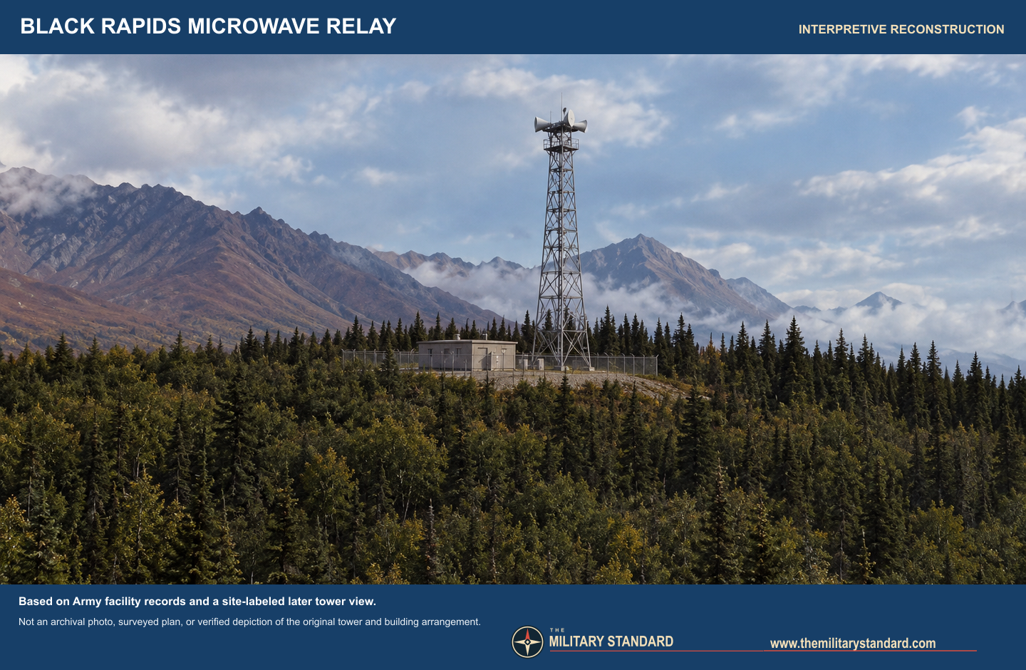
The Army archaeological account says Black Rapids opened in 1960. Its inventory, drawing on the 1988 Corps history, specifies a 1,560-square-foot radio relay building, 722 feet of chain-link security fence, 2,500 gallons of underground fuel storage, and a TD-2 tower. This is unusually precise physical evidence for a small White Alice relay. The building housed relay and support equipment, the tower carried the microwave antennas, the fence separated the operating compound from its surroundings, and the fuel system supported the remote utility load. The cited inventory does not provide an as-built site plan, tower height, antenna model count, or original compound acreage. 13
The 1976 Federal Register notice records contemporary RCA Alascom point-to-point applications for Black Rapids links toward McCallum and Donnelly Dome, including 3.7 to 4.2 GHz and approximately 6 GHz channel groups. It is evidence of planned or licensed paths and station identification, not proof that every listed channel transmitted continuously or that the notice marked the original 1960 activation. Another license notice for Donnelly Dome likewise points toward Black Rapids. The path and azimuth listings align with the Army's description of the two neighboring relay stations. 6
Role in the Wider Military Network
Black Rapids was a link in a chain, rather than an isolated local military installation. To the north, Donnelly Dome connected it toward the Clear-centered network; to the south, McCallum continued the line toward Paxson and the succeeding A-route stations. In a microwave chain, an interruption at a middle repeater could sever the continuity of that particular path even though the repeater itself did not originate warning data. The Air Force built the rearward network because missile-warning information had value only if it could reach command authorities reliably. Alaska's historic-context study describes the expanded White Alice routes as a deliberate redundancy measure. The specific operational traffic carried on an individual Black Rapids circuit is not itemized in the located sources. 1236
This relationship also clarifies the site's organizational identity. Black Rapids was part of the Air Force-owned White Alice system and later the commercial communications network, not an Army training installation because an Army archaeology report happened to document it. The neighboring Black Rapids Training Area and Northern Warfare Training Center are important geographic context, but they had different land purposes and command chains. An Army document as late as 2009 still calls XMH-392 the AT&T/Alascom tower while describing a proposed training project nearby. 145
Excess declaration, sale, and later use
The Army states that the station was declared excess in 1979 and purchased by Alascom in 1984. These are different events. The excess declaration concerns the end of the Air Force's need for this real-property asset; the later purchase documents a commercial disposition. The same historical account says the station was maintained and in use in 1988. Black Rapids therefore cannot be described as wholly abandoned in 1979. More broadly, White Alice's military network was overtaken by satellite communications and changing telecommunications management, but an individual microwave relay could continue to serve civilian or other circuits after its original Air Force purpose ended. 123
Later evidence should be read narrowly. The Alaska historic-context study classified Black Rapids as "empty/abandoned" in its early-2010s BMEWS-route inventory. That classification appears to describe historic White Alice-site condition, not an authoritative 2026 parcel inspection. A public FCC-derived antenna registration for Alascom lists a Black Rapids tower constructed in 1991, with a 2025 filing, near the representative coordinate above. A separate later wireless-license listing also identifies Black Rapids as a telecom tower location. These records support a later communications presence but cannot establish whether the original TD-2 tower was retained, replaced, dismantled, or modified, or whether the 1960 relay building still stands. 278
Preservation, environment, and present condition
The Army's 2003 report says the White Alice location was determined eligible for the National Register of Historic Places in 1988. Eligibility is not the same as an individual National Register listing, and it is not a guarantee of surviving features. The University of Alaska Anchorage archives hold a volume of Air Force real-property photographs that includes Black Rapids, but the collection is not digitized; it could help settle the original tower and building appearance if copies are obtained. A separate online telecom archive displays a later site-labeled tower photograph and route image. 1910
The located sources do not support a Black Rapids-specific statement that the site has been environmentally remediated or that it is contaminated. Underground fuel storage is documented, but the mere presence of tanks does not prove a release. No site-specific Alaska DEC cleanup decision, current land-use control, or full parcel deed was located. Current use is best described as former Air Force relay land with later Alascom telecommunications records, while the condition and ownership of the original compound remain unverified. 1278 9
Chronology
- Late 1950s The Air Force extends White Alice for the Clear BMEWS rearward communications network; Black Rapids is planned as a microwave relay on the A route. 23
- 1960 Black Rapids White Alice station opens between Donnelly Dome and McCallum. 1
- 1976-12-27 The Federal Register publishes RCA Alascom point-to-point station applications naming Black Rapids and its adjoining microwave paths. This is a licensing notice, not the original station-opening date. 6
- 1979 The Air Force declares the Black Rapids station excess. 1
- 1984 Alascom purchases the station. 1
- 1988 The station is reported maintained and in use; the White Alice inventory finds it eligible for National Register consideration. 13
- 1991-09-23 The later Alascom antenna-registration record gives this construction date for a Black Rapids tower; continuity with the 1960 tower is unverified. 7
- 2003 Army archaeological reporting identifies the White Alice compound as XMH-392 near Camp Terry Creek and distinguishes it from other local sites. 1
- 2009 An Army project assessment still identifies XMH-392 as an AT&T/Alascom tower near proposed training-project areas. 5
- Early 2010s An Alaska historic-context study classifies the historic Black Rapids White Alice site as empty or abandoned; the classification is not a current field survey. 2
- 2025-09-15 A public FCC-derived registration index records an Alascom filing for the later Black Rapids tower. 7
Photographs and drawings
The Black Rapids image linked by Long Lines is a site-labeled later view of a microwave tower on a wooded rise. The site also displays a route image. These images are useful visual checks but are not included as reusable page assets because the contributor's publication rights have not been verified. The University of Alaska Anchorage collection identifies original Air Force real-property photographs of Black Rapids, but lists them as undigitized. The accompanying Black Rapids rendering is explicitly interpretive: it uses the Army's documented building, fence, fuel, and tower inventory plus the later view's general terrain, not a verified original-site photograph or surveyed arrangement. 1910
Information sources (10)
- PDF1. U.S. Army Alaska, 2003 Archaeological Annual Report, Fort Wainwright and Fort Richardson, Section 3
Source for: XMH-392 identity and location; 1960 opening; Donnelly Dome and McCallum links; building, fence, fuel and tower; 1979 excess, 1984 purchase, 1988 use and preservation eligibility.
- PDF2. Alaska Office of History and Archaeology, The Coldest Front: Cold War Military Properties in Alaska
Source for: White Alice and BMEWS route context, A-route roster, later site-condition classification, network decline.
- PDF3. U.S. Army Corps of Engineers, Historical Overview and Inventory: White Alice Communications System, April 1988
Source for: Corps-level White Alice station inventory and route context as cited by the Army archaeological report.
- WEB4. U.S. Army Alaska, Transformation Environmental Impact Statement
Source for: Black Rapids Training Area as a separate Army land holding of approximately 2,780 acres, not White Alice station acreage.
- WEB5. U.S. Army Garrison Alaska, 2009 Archaeology Annual Report, Black Rapids theater-specific village assessment
Source for: later identification of XMH-392 as an AT&T/Alascom tower near Army training proposals, distinct from the training site.
- PDF6. Federal Register, December 27, 1976, RCA Alascom microwave applications 548 and 549-CF, pages covering Donnelly Dome and Black Rapids
Source for: 1976 station identification, Richardson Highway mile 227, adjoining microwave directions and licensed channel applications; digitized Black Rapids longitude incomplete.
- WEB7. FCC public filing index, Alascom Antenna Structure Registration 1005549
Source for: later Black Rapids tower registration, 1991 construction field and 2025 filing; not proof of the original TD-2 tower's survival.
- WEB8. FCC public filing index, Alascom wireless license WPYG871
Source for: later Black Rapids telecom tower coordinate 63.498056 N, 145.849722 W; a licensed tower point, not a station boundary.
- WEB9. University of Alaska Anchorage Archives and Special Collections, William F. McDowell papers
Source for: archival Air Force White Alice real-property photographs of Black Rapids in undigitized volume 1 and collection rights guidance.
- WEB10. Long Lines, Black Rapids, Alaska site entry
Source for: site-labeled later tower and route images used only as visual references; publication rights unverified.