
Cape Yakataga Radio Relay Station, Alaska
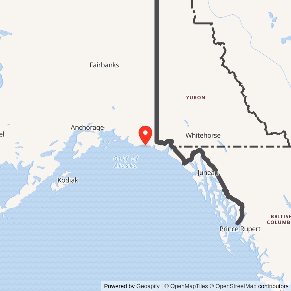
Longitude: -142.431333
Approximate location: 60.069661 N, 142.431333 W. This Alaska DEC WGS84 point identifies the former station area, not a surveyed antenna location or property boundary. [5]
- Mission
- White Alice tropospheric-scatter relay on the BMEWS-era coastal A Route.
- Direct links
- Ocean Cape.
- Antennas
- Four 60-foot billboard reflectors, paired by path.
- Air Force service
- Operations began in 1960; the A Route was leased to RCA Alascom in June 1974.
- Final local path
- The Cape Yakataga-to-Boswell Bay link went offline in 1984.
Overview
Cape Yakataga Radio Relay Station was an Air Force long-distance communications installation on Alaska's Gulf coast. Its four fixed White Alice antennas linked Ocean Cape to the east. The relay formed part of the coastal A Route associated with the Ballistic Missile Early Warning System. Cape Yakataga carried communications; it was not an aircraft-search radar station. The Army Corps dates its start of operation to 1960. [1] [2]
Coastal Route
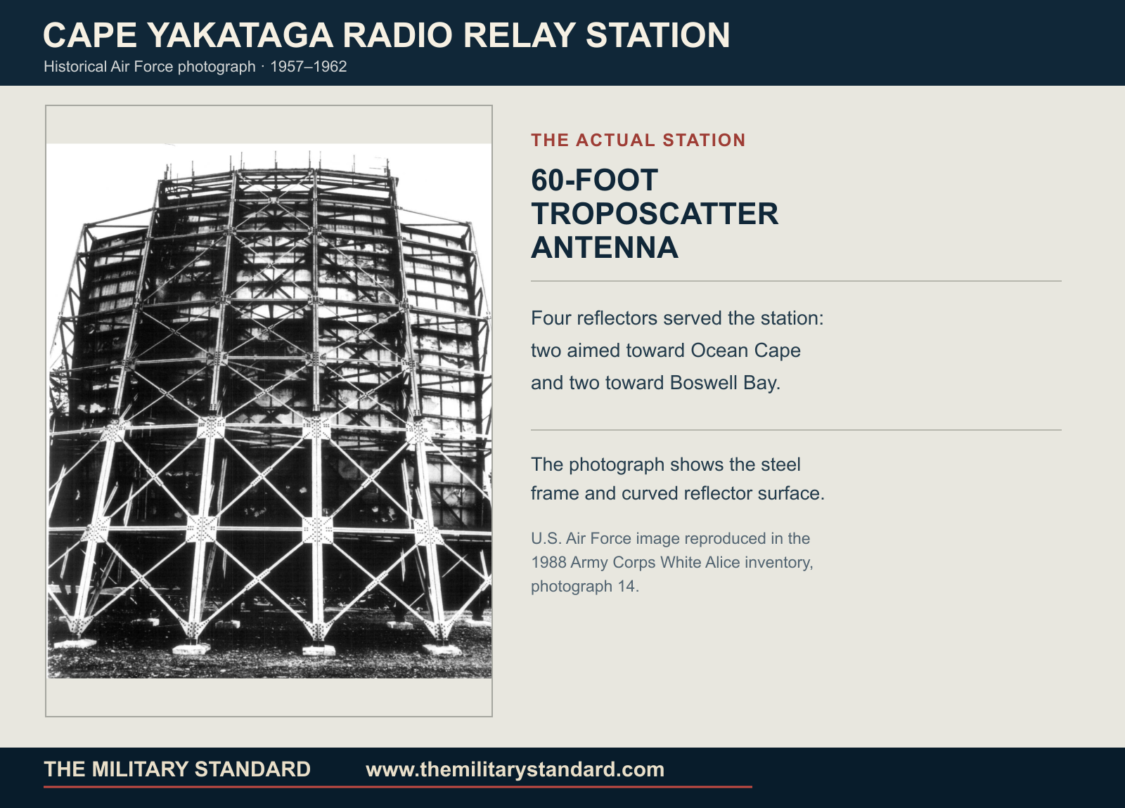
White Alice joined widely separated defense sites through radio relays. The A Route carried warning and command communications along the coast, connecting the western network with southeast Alaska. Cape Yakataga's direct neighbors were Boswell Bay and Ocean Cape. Beyond them, Boswell Bay connected toward Hoonah. [1] [4]
Station and Antennas
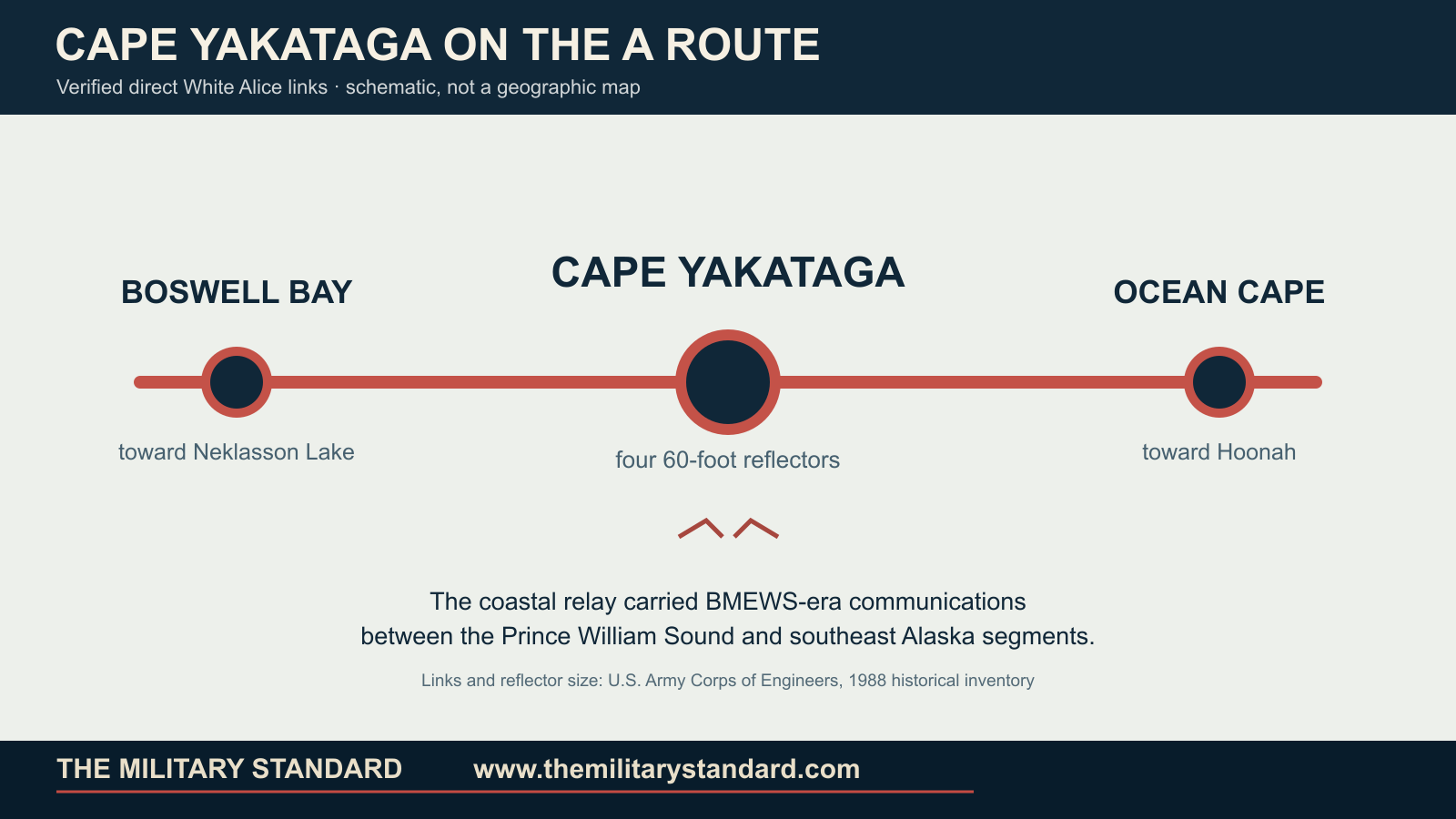
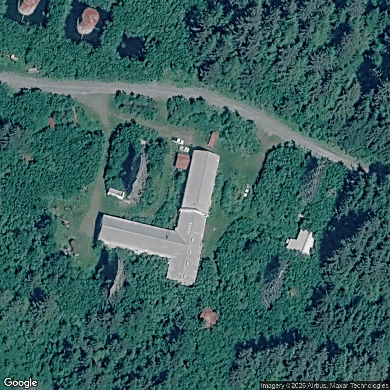
The Corps' 1994 cultural-resource plan describes three buildings and four troposcatter antennas. The 18,042-square-foot composite building contained communications spaces, dormitory rooms, and shops. These functions had to be close to the radio equipment because the isolated station needed continuous power, maintenance, and on-site support. [2]
Two 60-foot reflectors served each of Cape Yakataga's two paths. Their curved faces focused powerful signals toward the lower atmosphere beyond the visible horizon. A small fraction of each signal reached the receiving station. This was how the coastal route spanned distances that ordinary line-of-sight radio could not bridge. The antennas were fixed communications reflectors, not rotating radar dishes. [1] [4]
Air Force Service
Operations began in 1960 as the Air Force expanded the A Route for the BMEWS era. Air Force ownership and communications management continued while RCA Alaska Communications negotiated a lease. In June 1974 representatives of the 1931st Communications Group, RCA Alascom, and the preceding contractor inventoried the six southeastern route sites. The lease transfer took effect at midnight on June 30, 1974. [2] [3]
The 1974 change ended Cape Yakataga's Air Force-operated phase, but the radio route continued under the successor operator. As satellites and newer systems entered service, the older troposcatter chain became less essential. [3] [4]
Later Operation and Sale
The A Route sale involved a separate land-rights problem at Cape Yakataga. On February 14, 1980, route personal property and other route real property transferred to Alascom, but Cape Yakataga's land and buildings remained leased while the government and company worked through existing land and mining claims. The Bureau of Land Management approved a conditional transfer that August, subject to prior rights. [3]
An Alaska historical study dates the broader White Alice sale settlement to August 14, 1983. It identifies the Cape Yakataga-to-Boswell Bay troposcatter connection as going offline in 1984. The operating transfer, property transaction, and shutdown of the final local radio path were separate events. [3] [4]
Later Condition
The Corps' 1994 survey described the former station as abandoned, with the installation still substantially intact but affected by vandalism and deterioration. It recorded the site under Alaska Heritage Resources Survey number XBG-116. [2]
Alaska DEC maintains an active environmental case for the former station. PCB-affected soil outside the composite building was removed in 2014; a groundwater report approved in 2025 documented remaining petroleum contamination near a former tank. [5]
Chronology
- 1960 Cape Yakataga Radio Relay Station begins operations on the coastal A Route.
- June 1974 Air Force and RCA Alascom representatives inventory the route sites.
- June 30, 1974 The A Route operating lease transfers to RCA Alascom.
- 1977 Route sale planning and Cape Yakataga land-rights applications continue.
- February 14, 1980 Most A Route property transfers; Cape Yakataga land and buildings remain leased.
- August 5, 1980 Bureau of Land Management approves a conditional Cape Yakataga land-interest transfer.
- August 14, 1983 The broader White Alice sale settlement is completed.
- 1984 The Cape Yakataga-to-Boswell Bay troposcatter connection goes offline.
- 1994 The Corps surveys the abandoned former station as historic resource XBG-116.
- 2014 PCB-affected soil is removed at the former station.
- 2025 Alaska DEC approves an updated groundwater monitoring report.
Information sources (5)
- PDF1. Georgeanne Lewis Reynolds, Historical Overview and Inventory: White Alice Communications System, U.S. Army Corps of Engineers, 1988
Source for: A Route station links, 60-foot antenna size, photograph 14 and its 1957-1962 date range, network context.
- PDF2. The Cold War in Alaska: A Management Plan for Cultural Resources, U.S. Army Corps of Engineers, 1994
Source for: 1960 start, three buildings, four antennas, composite-building area, 1994 condition, XBG-116 heritage record.
- PDF3. A Special Study of the Sale of the White Alice Communications System, U.S. Air Force, October 1983
Source for: June 30, 1974 lease transfer, 1977 sale arrangements, February 14, 1980 partial transfer, and Cape Yakataga land-rights dispute.
- PDF4. The Coldest Front: Cold War Military Properties in Alaska, Alaska Office of History and Archaeology
Source for: BMEWS A Route context, system sale settlement, and 1984 Cape Yakataga-Boswell Bay link shutdown.
- WEB5. Cape Yakataga Radio Relay Station Site Report, Alaska Department of Environmental Conservation, hazard ID 2810
Source for: WGS84 site point, environmental case identity, 2014 soil removal and 2025 monitoring status.