
King Salmon Air Station / King Salmon Airport Forward Operating Location / Naknek Air Force Auxiliary Field, Alaska
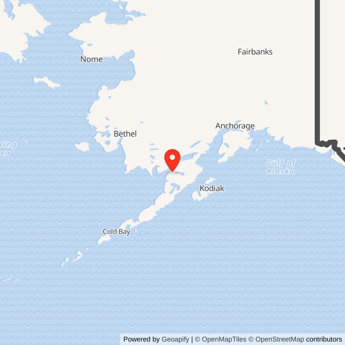
Longitude: -156.649167
Current Role: State-operated King Salmon Airport with continuing U.S. Air Force contingency/divert and exercise use, including documented 2025 F-16 operations. The Air Force main-base right-of-way is not the entire airport.
- Location
- King Salmon, Alaska
- Representative coordinate
- 58.676667 N, 156.649167 W. FAA airport reference point, not a military parcel centroid.
- Identity
- Cold War Air Force airfield and fighter-alert complex at the state airport, distinct from the nearby radar station.
Identity and setting
King Salmon Air Station was the Air Force's airfield, fighter-alert and support installation at the state-operated King Salmon Airport on the Alaska Peninsula. It is a separate historical identity from nearby King Salmon Air Force Station, the F-03 radar and direction-center installation. It is also the postwar successor to Naknek Army Air Base, the World War II airfield on the same physical site. A visitor can therefore encounter three legitimate histories in a small area without there having been three unrelated airports.
The names require care. Air Force and Alaska preservation sources use King Salmon Air Station for the Cold War installation, while an official Air Force biography calls Brigadier General Chalmers R. Carr Jr. commander of King Salmon Air Base and the 5071st Air Base Squadron in 1980. Later military documents call the field King Salmon Airport and the Air Force presence a forward operating location. Some references use King Salmon Air Force Base conversationally. The available official base-lineage material does not establish a separate formal redesignation to King Salmon Air Force Base, so this history retains Air Station as the preferred historical name and records Air Base/AFB as source-qualified aliases rather than inventing another installation.
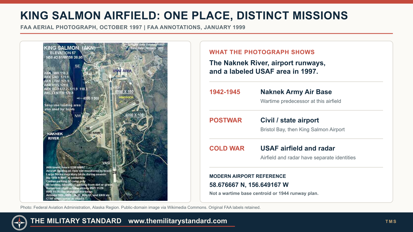
The representative coordinate, 58.676667 N, 156.649167 W, identifies the FAA airport reference point. It is not a surveyed center of the former Air Force cantonment, alert apron, leased parcels or radar station. The current airport and its two paved runways are a useful orientation, but neither the modern runway lengths nor the 1997 FAA aerial should be projected backward unchanged onto the 1940s field.
Army predecessor and early Air Force reuse
The Civil Aeronautics Administration had an airfield presence in the King Salmon area by 1931. The Army took over and enlarged the airfield during the 1941 to 1942 defense buildup. As Naknek Army Air Base it served the difficult Alaska Peninsula and Aleutian air route, offering a place for aircraft to refuel, stage, rest crews and continue toward Cold Bay and other western fields. That function was more important than treating the airfield as a self-contained bomber or fighter combat base. The wartime construction and operations are covered in the separate Naknek Army Air Base history.
The postwar field returned to civil use, but the Air Force recognized its value as a forward fighter location. Alaska State Historic Preservation Office research places the forward operating base phase in mid-1948. F-80 jets from the 57th Fighter Wing went on alert there in September 1948, according to the Air Force's remote-site natural-resources history. This was an alert deployment from the principal Alaska fighter force, not evidence that an entire fighter wing was permanently based in King Salmon. The field's distance from Anchorage and its position near southwestern approaches allowed fighters to launch nearer potential tracks that might otherwise consume precious intercept time.
Fighter alert through changing aircraft generations
The aircraft and parent organizations changed while the airfield's basic purpose persisted. The 317th Fighter-Interceptor Squadron used F-102 Delta Daggers there in 1956. F-106 Delta Darts rotated through in 1963. F-4E Phantoms from the 43rd Tactical Fighter Squadron began an alert period in October 1970. F-15 Eagles followed in 1982. These dates come from the Air Force's King Salmon remote-site account and describe documented phases, not continuous daily presence of one exact aircraft complement. Sorties and alert posture varied with unit assignments, seasonal conditions and command priorities.
The field was not simply a runway with parked aircraft. Fighter alert required hangars, fuel, power, communications, weather support, fire protection, maintenance space and living quarters for crews and the people who sustained them. The 5071st Air Base Squadron provided the local Air Force support structure in the late Cold War. An Air Force biography expressly identifies Carr as the commander of the squadron and King Salmon Air Base in July 1980. The squadron became the 5071st Combat Support Squadron in July 1985 and the 643rd Support Squadron in September 1991. A 1983 contemporary Air Force organization directory places the 5071st Air Base Squadron at King Salmon Airport under Alaskan Air Command. These records support the airfield installation as a real, separately administrated Air Force presence, not merely an annex of the radar squadron.
The radar station and airfield were tightly connected in mission but not identical in location or organizational life. King Salmon's 705th Aircraft Control and Warning Squadron developed a regional control mission and could direct fighter interceptions using its radar picture and reports from remote stations. Fire Island's 1969 control-center closure shifted more southern Alaska responsibilities to King Salmon. Later the AN/FPS-117 Seek Igloo network and Elmendorf Regional Operations Control Center changed where tracking and control were performed. Fighters at King Salmon remained part of the overall air-defense system, yet their alert aprons, support facilities and runway cannot be collapsed into a radar antenna parcel. This distinction matters for historic maps, acreage and environmental case files.
One operational example is the 1985 intercept of several Soviet aircraft by King Salmon-based F-15s, discussed in Alaska's preservation account. The 1987 joint intercept involving King Salmon F-15s and Navy F-14s from Adak similarly shows the base as a forward launch point in a much larger defense network. The history does not attribute an individual intercept to a particular King Salmon radar display or assume that all participating aircraft were permanent residents of the field.
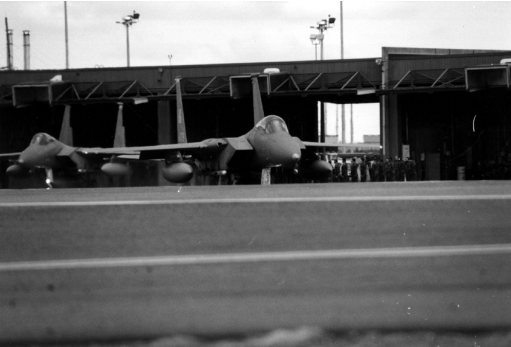
An undated Eleventh Air Force archival photograph reproduced on page 25 of Alaska's Aircraft Control and Warning System history shows two F-15s on the King Salmon Airport apron, with the Combat Alert Cell directly behind them. It is unusually useful physical evidence for the alert arrangement described above. Because the report captions it as undated, the image cannot independently establish a precise year, unit deployment, or aircraft count for any particular day.
Drawdown and retained military utility
The Cold War alert mission wound down in 1994. Air Force fighter alert ended in the spring, while Joint Base Elmendorf-Richardson's historical summary identifies 26 August 1994 as the Air Force withdrawal from King Salmon. Different source accounts use spring, August and September dates for aircraft departure, personnel withdrawal and administrative transition; these are not necessarily contradictory because they describe different stages. The installation did not become useless after the withdrawal. Contract personnel sustained a contingency and diversion capability, and the state continued operating the public airport.
An Air Force remote-site management plan describes a much smaller contractor-maintained presence after 1994, in contrast to roughly 300 personnel before the drawdown. It describes the airport as state operated, with Air Force runway maintenance arrangements, periodic exercises and continuing contingency or divert functions. The presence of an Air Force contract or military aircraft on a public runway does not mean the Air Force owned the entire airport. Conversely, civil airport ownership does not erase the Air Force's continuing rights and responsibilities in its support areas.
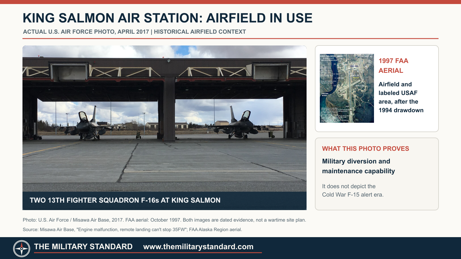
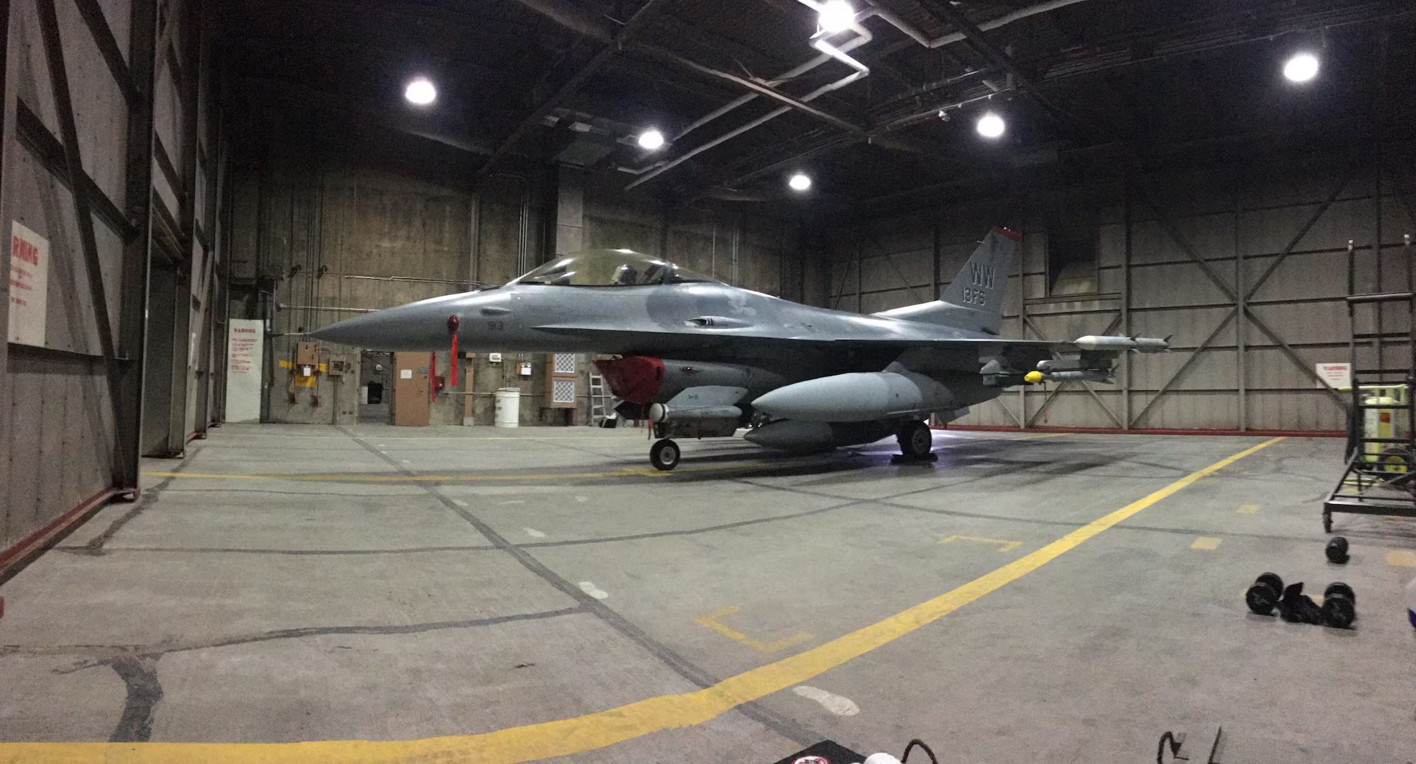
Recent operations demonstrate the continuing value of the location. In April 2017, two Misawa-based F-16s diverted to King Salmon following an engine issue, where personnel coordinated fuel and maintenance support. A 2021 Air Force report described Agile Combat Employment work at King Salmon, including F-22-related contingency use. On 9 September 2025, an official Air Force photograph recorded an F-16 of the 18th Fighter Interceptor Squadron landing at King Salmon Airport during a dispersed alert exercise. These events document use of the active airport and forward location, not the restoration of a permanent 1980s fighter-alert squadron.
Land, facilities and environmental record
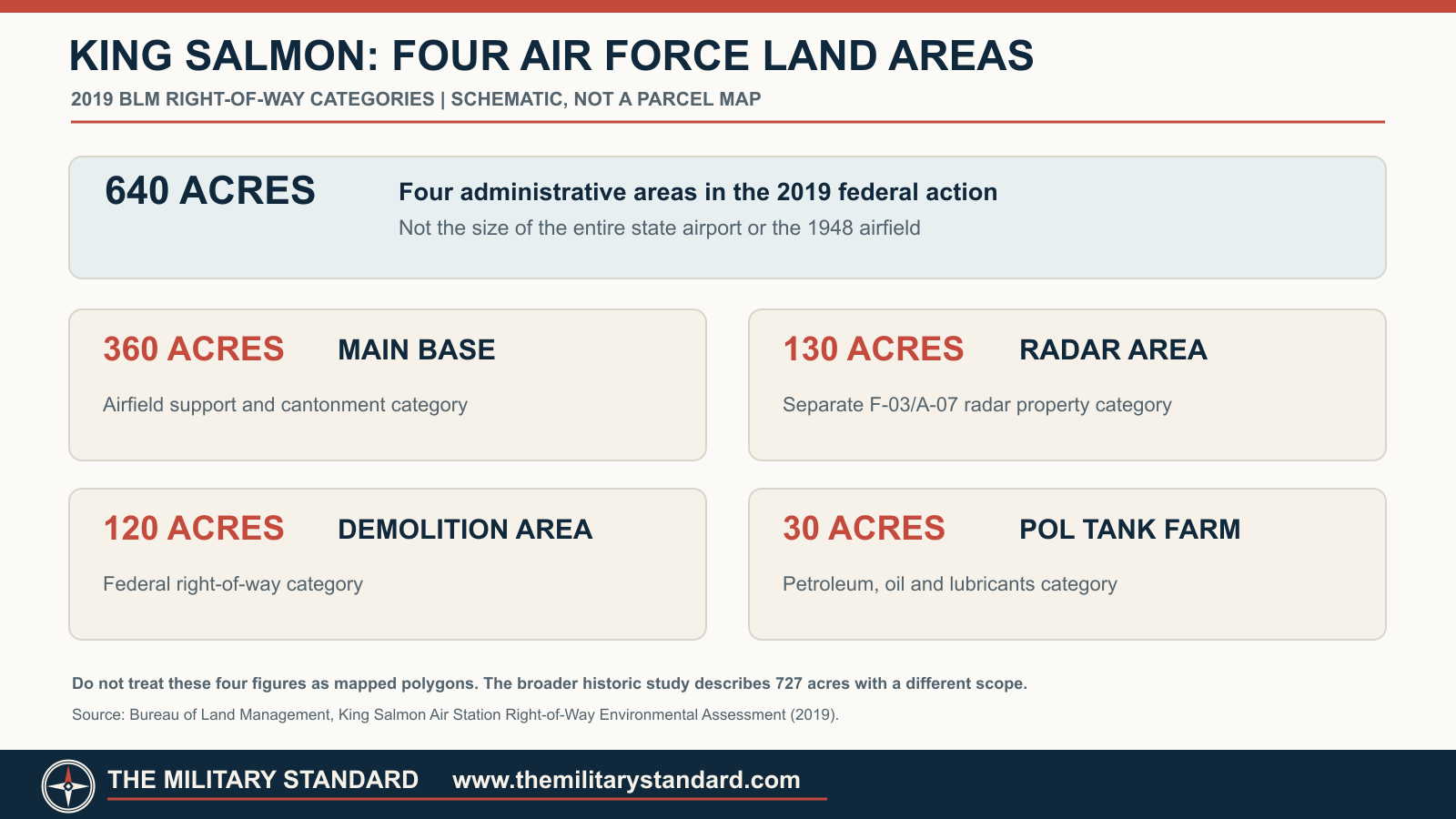
The main-base land must be separated from the airport as a whole. A 2019 Bureau of Land Management right-of-way assessment divided a 640-acre Air Force right-of-way request into a 360-acre main base, a 130-acre radar area, a 120-acre demolition area and a 30-acre petroleum, oil and lubricants tank-farm area. Those figures are administrative parcel categories for that action, not a measured total size of the state airport or an assertion that the 1948 airfield occupied exactly 360 acres. An Alaska preservation study describes a broader 727-acre King Salmon installation in four areas and 16 parcels. The difference reflects differing legal and historical scopes; the two totals should not be combined or silently substituted for each other.
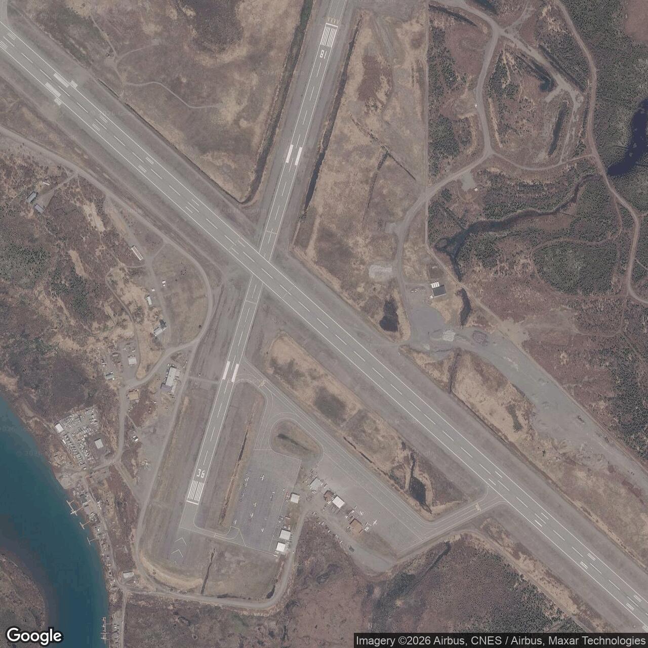
The FAA's October 1997 aerial shows the airfield, river and later development with a labeled Air Force area. It is strong evidence for late-1990s spatial context, but it is not a property survey or a wartime airfield plan. A companion property-scope diagram in this project is explicitly schematic. It lists the BLM's four acreage categories without drawing parcel polygons on unsurveyed imagery. A future accurate parcel map would require the BLM legal descriptions or GIS boundaries matched to the correct date.
The airfield's military structures have not all been preserved. The Alaska preservation study inventories Cold War facilities and discusses alert hangars and support buildings, but surviving structures cannot be assigned to one aircraft generation from an aerial alone. Alaska Department of Environmental Conservation records address groundwater, fuel and waste sites in separately defined zones. A cleanup-complete decision for one tank or building does not clear the entire airfield or the radar installation. Conversely, a continuing case at one subsite is not evidence that every runway or building is contaminated. The relevant DEC parcel and case identification should accompany any claim about present environmental condition.
The airport remains an important regional transport facility. Alaska's 2025-2026 airport master-planning process treats King Salmon as a state-operated gateway serving the Bristol Bay area and continuing military activity. Current published runway lengths belong to the present airport.
Historical significance and open questions
King Salmon illustrates a forward operating location that survived changes in radar technology, interceptors and political geography. Its Army predecessor helped sustain the Aleutian war effort; its Air Force period put jet fighters on alert closer to southwestern approaches; its current public-airport and contractor framework still offers a divert and dispersal point. The separate radar station and the airport worked together, but each has distinct structures, land records, personnel and chronology.
Several questions remain open for a later revision. A complete series of dated Air Force site plans could locate each alert hangar and support function by period. Original lease and right-of-way plats would resolve precise military parcel boundaries and the relation between the 640-acre BLM action and the broader 727-acre historic description. Unit daily histories could document exact alert aircraft complements and any gaps between the F-80, F-102, F-106, F-4E and F-15 phases.
Chronology
- 1931 Civil Aeronautics Administration airfield development begins in the King Salmon area.
- 1941-1942 The Army expands the field for wartime Alaska Peninsula and Aleutian operations.
- 1942-1945 Naknek Army Air Base supports western aircraft staging and refueling.
- 1948 The Air Force begins forward operating use of the postwar airfield.
- 1948-09 F-80 aircraft from the 57th Fighter Wing begin alert duty at King Salmon.
- 1954 King Salmon Air Station name is documented in Air Force installation history.
- 1956 The 317th Fighter-Interceptor Squadron uses F-102 aircraft on alert.
- 1959 Alaska assumes operation of the airport while Air Force use continues under lease arrangements.
- 1963 F-106 aircraft enter the King Salmon rotational alert sequence.
- 1970-10 F-4E aircraft of the 43rd Tactical Fighter Squadron begin alert duty.
- 1980-07 Official Air Force biography identifies the 5071st Air Base Squadron and King Salmon Air Base command.
- 1982 F-15 aircraft replace the F-4E alert generation.
- 1985-07 The 5071st Air Base Squadron is redesignated the 5071st Combat Support Squadron.
- 1985-09-17 King Salmon F-15s participate in a Soviet-aircraft intercept.
- 1987-05-29 King Salmon F-15s participate in a joint Air Force and Navy intercept.
- 1991-09 The local support unit becomes the 643rd Support Squadron.
- 1994-04 The full-time F-15 alert phase ends.
- 1994-08-26 Air Force withdrawal is dated in the Joint Base Elmendorf-Richardson historical summary.
- 1994-10 Contractor-maintained contingency and diversion status follows the military drawdown.
- 1997-10 FAA aerial documents the later airport and Air Force area.
- 2017-04 Two Misawa F-16s divert to King Salmon following an engine malfunction.
- 2019 BLM environmental assessment describes the four Air Force right-of-way areas.
- 2021 Air Force Agile Combat Employment activity uses King Salmon as a forward location.
- 2025-09-09 Official Air Force photograph records 18th Fighter Interceptor Squadron F-16 activity at the airport.
- 2025-2026 Alaska DOT conducts a King Salmon airport master-planning process.
Historical photographs and drawings
Undated King Salmon Airport photograph of two F-15s with the Combat Alert Cell behind them, reproduced on page 25 of the Alaska Aircraft Control and Warning System history. The report credits Eleventh Air Force archives. The image establishes the visible alert-apron relationship but not an exact date. View source.
FAA October 1997 King Salmon Airport aerial, reproduced and labeled in the Alaska State Historic Preservation Office air-defense study. It establishes later airfield context, not the wartime runway plan or a surveyed military parcel. View source.
Alaska State Historic Preservation Office forward operating base booklet includes historic King Salmon radar, airfield and alert-hangar images, with individual photo credits in the document. Review each credit before republication. View source.
Official U.S. Air Force photo of a King Salmon diversion in April 2017, published with the Misawa Air Base account. This depicts modern contingency use, not a Cold War alert launch. View source.
Official U.S. Air Force photo by Airman 1st Class Spencer Hanson, 9 September 2025, showing an F-16 of the 18th Fighter Interceptor Squadron landing at King Salmon Airport. DVIDS labels it public domain; cite photographer and image ID 9335199 if republished. View source.
Information sources (13)
- PDFDefending Attack From the North: Alaska's Forward Operating Bases During the Cold War, Alaska State Historic Preservation Office and Argonne National Laboratory for the U.S. Air Force
Source for predecessor, 1948 forward-base start, fighter generations, airfield support, 1994 drawdown and historic imagery.
- PDF2013 Integrated Natural Resources Management Plan, 611th Air Support Group remote sites appendix, U.S. Air Force
Source for F-80, F-102, F-106, F-4E and F-15 alert sequence, support-unit redesignations, state airport, contractors and contingency use.
- WEBBrigadier General Chalmers R. Carr Jr. biography, U.S. Air Force
Source for official 1980 use of King Salmon Air Base and 5071st Air Base Squadron command wording.
- PDFU.S. Air Forces in Europe and Alaskan Air Command organization directory, Air Force Magazine, May 1983
Source for contemporary listing of the 5071st Air Base Squadron at King Salmon Airport.
- PDFHistory of the Aircraft Control and Warning System in Alaska: Air Defense of Arctic Skies, Alaska State Historic Preservation Office
Source for distinct King Salmon radar installation, its airfield relationships, preservation survey and late-1990s aerial.
- WEBAlaskan Command history, Joint Base Elmendorf-Richardson, U.S. Air Force
Source for 26 August 1994 withdrawal date and subsequent contingency support account.
- PDFKing Salmon Air Station right-of-way environmental assessment, Bureau of Land Management, 2019
Source for 360-acre main base, 130-acre radar, 120-acre demolition and 30-acre tank-farm administrative areas.
- WEBBLM seeks public input on King Salmon Air Station right-of-way, Bureau of Land Management, 2019
Source for continued Air Force right-of-way and land-management context after the fighter-alert drawdown.
- WEBEngine malfunction, remote landing can't stop 35FW, Misawa Air Base, U.S. Air Force, 2017
Source for two F-16 diversions, fuel and maintenance assistance at King Salmon.
- WEBJBER executes ACE at King Salmon, Defense Visual Information Distribution Service, 2021
Source for post-Cold War dispersed operating use and F-22 contingency context.
- WEBAlaskan NORAD Region conducts Agile Combat Employment from King Salmon, U.S. Air Force photograph distributed by DVIDS, 2025
Source for dated F-16 use, photographer, aircraft unit, image ID 9335199 and public-domain credit.
- WEBKing Salmon Airport master-planning notice, Alaska Department of Transportation and Public Facilities, 2025-2026
Source for current state-owned airport planning and modern transport role.
- WEBKing Salmon Air Station Groundwater Zone 5 site report, Alaska Department of Environmental Conservation
Source for separately tracked environmental case areas; not an installation-wide cleanup finding.