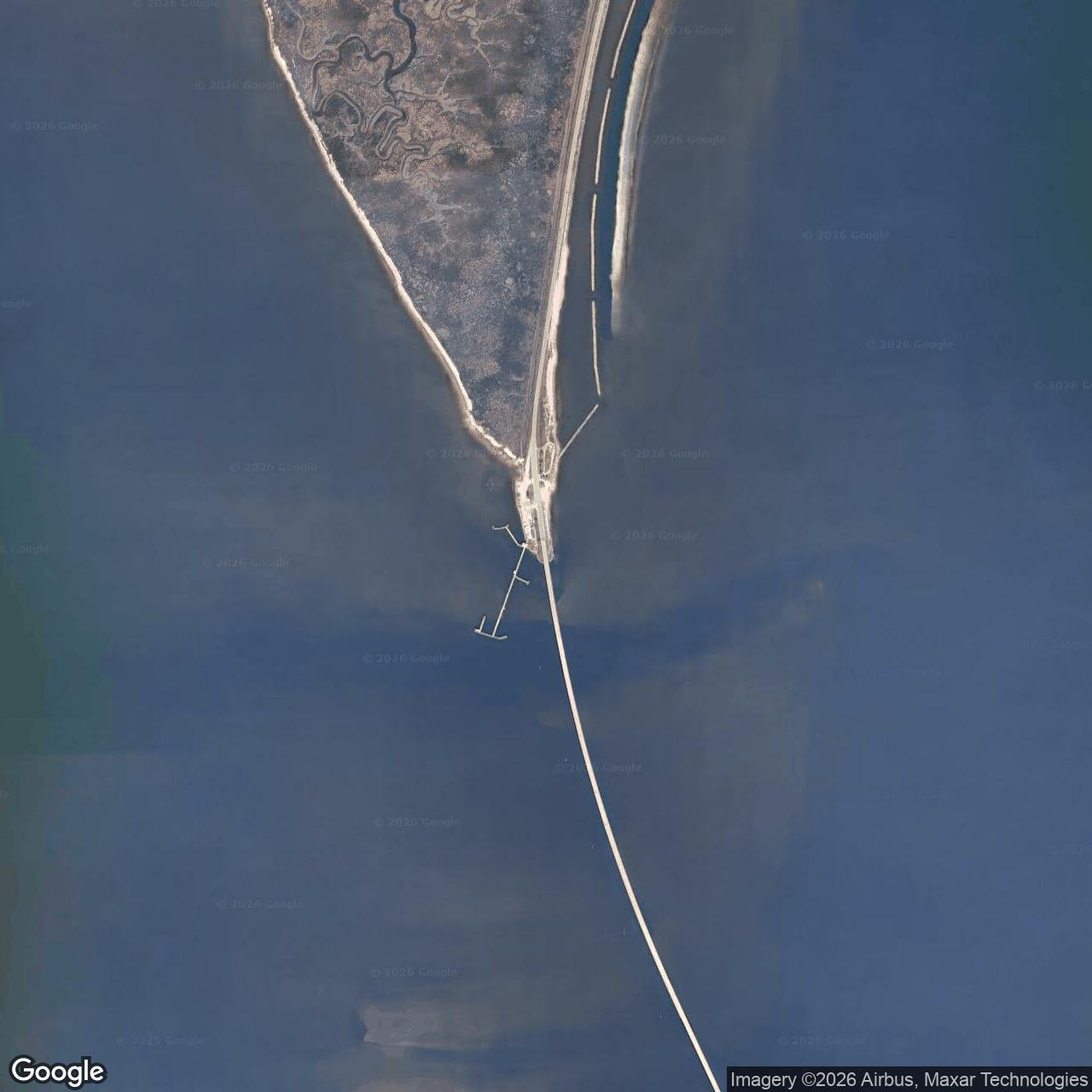
Fort Powell Army Base, Dauphin Island Alabama
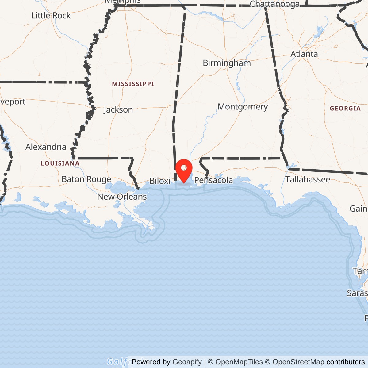
Longitude: -88.137892
Current Role: Submerged former fort site at Grant's Pass / former Grant's Island or Tower Island area; no standing remains, with remnants reported underwater and likely buried from view after Hurricane Frederic in 1979.
Fort Powell was the smallest, most temporary, and least physically durable of the three lower Mobile Bay forts, but its position made it strategically indispensable. Fort Morgan guarded the main ship channel from Mobile Point. Fort Gaines covered the west side of that channel from Dauphin Island. Fort Powell sat apart from both, on the shell-and-sand island at Grant's Pass, where the Mississippi Sound route entered the western side of Mobile Bay. That made it the fort at the back door. A Union naval force that could get through Mississippi Sound and Grant's Pass could support operations inside Mobile Bay without forcing every supply movement through the minefields, guns, and deep-water channel between Forts Morgan and Gaines.
The installation was Confederate-built. It was not a prewar Third System masonry fort planned and built by the U.S. Army Corps of Engineers like Fort Morgan and Fort Gaines. It began as a Confederate wartime battery and then a sand-and-log fortification on a roughly half-acre artificial island of oyster shell and sand. The site became part of the Union/U.S. Army occupation of the Mobile Bay defenses after the 1864 campaign. The National Park Service's Civil War unit record for the 6th Michigan Heavy Artillery documents Company E detached from Fort Gaines at Fort Powell from April 10 to July 9, 1865. Fort Powell was therefore not only a Confederate fortification; it was also a documented U.S. Army-held Mobile Bay post site during the final occupation phase of the war.
Fort Powell's short life makes it easy to underestimate. It was never a permanent Army post, never developed into an Endicott-era battery, and never survived as a public historic fort. Its remains are underwater. Yet in operational terms it mattered because it controlled an alternate line of communication. During the Battle of Mobile Bay, Rear Admiral David G. Farragut and Major General Gordon Granger needed Fort Powell and Fort Gaines reduced so the Union could sustain future land and naval operations inside the bay. The destruction of Fort Powell opened Grant's Pass and helped convert Mobile Bay from a Confederate harbor into a Union-controlled operating area.
Prewar Setting: Grant's Pass and the Western Approach
The military geography of Fort Powell began before the fort existed. In 1817, French engineer Simon Bernard, working for the United States, surveyed the coastal defenses of the Gulf and recommended a fortified tower near the location that would later become Grant's Pass. The problem was clear: the western side of Mobile Bay connected with the protected inland waters of Mississippi Sound, but shoals of oyster shell, sand, and mud made passage difficult for vessels drawing more than a few feet. Whoever improved and controlled that route could shape traffic between Mobile, Mississippi Sound, and New Orleans.
John T. Grant gave the place its name and much of its strategic value. The federal government funded efforts to improve the shoal route in the late 1820s, and Grant later took on the dredging of a cut through the reef. By the 1840s, Grant's Pass had been deepened enough to provide a practical sheltered route for steamers and small craft moving between Mobile Bay and the Mississippi Sound system. A lighthouse and associated structures stood on the shell island that served the pass. Before the Civil War, that island was a navigation and toll point. During the war, it became a military position.
The prewar U.S. government had considered fortifying the area, but disputes over land and money prevented construction. That delay mattered. When Alabama seceded and Confederate forces seized the lower bay defenses in 1861, Fort Morgan and Fort Gaines were already identifiable masonry military sites, even if Fort Gaines was unfinished. The Grant's Pass site had no comparable federal fort. The Confederacy had to improvise its own work from the materials and geography at hand.
Mission Evolution
Fort Powell began in 1861 as an attempt to close the western water door into Mobile Bay. Confederate forces first established a small battery on Grant's Island with three 32-pounder cannon, later supplemented by an 8-inch Columbiad. Oyster shell and sand parapets protected the guns, and Captain Joseph M. Cary's company of the First Alabama Artillery was sent from Fort Morgan to guard the position. The early post was austere. The men lived in tents, the island was low, and the work depended on sand, shell, timber, and labor rather than masonry and permanent barracks.
In December 1862, occupation of the incomplete and developing project began under the name Fort Grant. During 1863, as Union naval pressure increased in the Gulf and along the Mississippi Sound, the Confederate high command recognized that a more substantial work was needed. The installation was later renamed Fort Powell in October 1863 for Colonel William Llewellyn Powell, who had commanded the lower bay defenses before falling ill and dying on September 25, 1863. By January 1864, Lieutenant Colonel James Madison Williams of the 21st Alabama Infantry Volunteers commanded the fort.
The fort's mission was not to defeat Farragut's deep-draft fleet in the main channel. That was Fort Morgan's job, supported by Fort Gaines, torpedoes, obstructions, and the Confederate naval squadron inside the bay. Fort Powell's mission was narrower but critical: prevent Union vessels, transports, supplies, and supporting forces from entering Mobile Bay through Mississippi Sound and Grant's Pass. It was a line-of-communication fort. If it held, Union operations inside the bay would be harder to sustain. If it fell, the Union could supply naval and ground forces from the west through protected waters.
Operational Role
Fort Powell's operational value lay in denying freedom of movement. Army University Press's Mobile campaign staff ride handbook makes this point clearly: once Farragut entered Mobile Bay, Mississippi Sound and Grant's Pass became the logical Union resupply route. Fort Powell therefore had to be seized or destroyed. The fort was not large, but it sat in the wrong place for Union planners. Its guns and its physical presence threatened the route Farragut and Granger needed after the main naval breakthrough.
The fort saw action before the climactic August 1864 campaign. On August 24, 1863, U.S. Navy gunboats moved east through Mississippi Sound and fired on Fort Powell. Later, in February 1864, Farragut began more determined bombardments intended to distract Confederate attention and test the lower bay defenses. Mortar schooners firing heavy projectiles damaged quarters, wharfage, and exposed parts of the work, but the sand-and-shell fort could often be repaired quickly by filling shell holes and replacing displaced material. The fort's vulnerability was real, but so was its resilience against indirect and inaccurate fire.
By 1864, Fort Powell took up essentially the whole island. Its central bombproof contained a magazine, with massive timber and sand protection. The bombproof used 24-inch pine logs and walls of sand reportedly twelve feet thick. Guns were mounted facing south and protected by sod and earth. Soldiers' quarters stood near the wharf, but during bombardments the garrison took shelter in the bombproof. High tide could partially flood the island, so the terreplein had to be raised above high water. Confederate engineer Victor von Scheliha described outer log cribs filled with oyster shells and sand, then faced with rock, to stiffen the island perimeter. Fort Powell was thus both a fort and an artificial landform, engineered to keep a tiny shell island from dissolving under tide, weather, and gunfire.
The fort's weakness was its orientation and armament. It contained a modest number of guns, and not all were ideally placed for the problem it faced. Army University Press describes Fort Powell as a temporary earthwork whose armament was too little and too late. A number of guns faced toward the bay rather than the western approach, and only a small portion of the fort could effectively cover the Mississippi Sound arc. American Battlefield Trust summarizes the lower bay defenses by noting that Fort Powell guarded Grant's Pass with sixteen guns, while Fort Morgan and Fort Gaines guarded the main ship channel with heavier works. Different sources count different available pieces at different moments, but the pattern is consistent: Fort Powell was important because of location, not because it was a powerful permanent fort.
Battle of Mobile Bay
The decisive moment came on August 5, 1864. Farragut's main fleet forced the entrance to Mobile Bay under the fire of Fort Morgan, passing the torpedo field and then defeating the Confederate naval squadron inside the bay. Once the naval battle was effectively decided, Union attention turned to Fort Powell, Fort Gaines, and Fort Morgan. Fort Powell was exposed to attack from two directions. U.S. vessels in Mississippi Sound could fire from the west, and the Union monitor USS Chickasaw could attack from the bay side after the Confederate fleet had been neutralized.
Fort Powell received several hits, and one shell demonstrated the fort's fatal vulnerability by entering a sally port and passing through the bombproof before burying itself in the opposite wall. The sand face shifted under fire. Lieutenant Colonel Williams concluded that the fort could not be held for long and telegraphed Colonel Charles D. Anderson at Fort Gaines for instructions. Anderson told him to save his garrison when the fort was no longer tenable and to hold as long as he could.
Williams chose evacuation. At low tide, the approximately 140-man garrison marched across Grant's Pass to Cedar Point. At about 10:30 p.m. on August 5, 1864, the retreating Confederates blew up Fort Powell. The effort did not entirely destroy every gun or item of ammunition, but it rendered the fort unusable as an organized Confederate work. The Smithsonian's description of a contemporary Fort Powell print records the central fact plainly: after bombardment by Union ships, Confederate forces evacuated the fort and destroyed its cannon so they could not be used by the enemy.
The decision became controversial inside the Confederate command. Major General Dabney H. Maury believed the fort should not have been abandoned and relieved Williams pending investigation. Although Williams was acquitted by early September, Maury continued to disagree with the finding. Fort Powell's fall, together with Fort Gaines's surrender on August 8 and Fort Morgan's surrender on August 23, marked the collapse of the lower Mobile Bay defense system.
U.S. Army Occupation and Post-Campaign Use
Fort Powell's combat fortification had been blown up, but the site did not vanish immediately from military use. The Union held the lower bay after the August 1864 victories, and the Mobile Bay forts became part of the occupation and support system for later operations against Mobile, Spanish Fort, and Fort Blakely. The clearest Army evidence comes from the National Park Service unit history of the 6th Michigan Heavy Artillery. That record states that Companies C, E, F, H, and I garrisoned Fort Gaines from August 23, 1864, to July 9, 1865, and that Company E was detached from Fort Gaines at Fort Powell from April 10 to July 9, 1865.
That assignment is important because it anchors Fort Powell in documented U.S. Army use, even though the fort had originated under Confederate control and had been damaged. The detachment likely represented occupation, guard, observation, and control of the western pass site rather than reconstruction of a permanent fort. By the spring of 1865, the strategic issue was no longer whether Fort Powell could keep Farragut out; it was whether Union forces could control every approach, landing, and water route around Mobile Bay while the final campaign against Mobile unfolded.
After July 1865, Fort Powell had no continuing permanent Army role. Unlike Fort Morgan and Fort Gaines, it did not become part of the postwar masonry fort repair cycle, the Endicott coastal-defense program, or the World War II harbor-defense landscape. Its material basis was too temporary, its island too vulnerable, and its military mission too tied to the Civil War emergency.
Site Design and Physical Layout
Fort Powell was fundamentally different from Fort Morgan and Fort Gaines. Fort Morgan and Fort Gaines were masonry Third System works with thick walls, bastions, magazines, barracks, and long federal planning histories. Fort Powell was a Confederate field fortification built on a shell island. It used what the site could provide: oyster shell, sand, pine logs, sod, sandbags, timber cribs, and wharf structures.
The core work included a bombproof shelter and central magazine. Guns were mounted on the raised terreplein and connected to the bombproof by protected entrances. The fort's southern face held the main gun positions, while quarters and logistical structures clustered near the wharf. Because the island was low, tides and storms were as much a design problem as enemy artillery. The Confederate solution was to build up the gun platform, brace the perimeter with log cribs, fill them with shell and sand, and keep repairing damaged surfaces. Sand absorbed shells differently from brick: it could slump and shift dramatically, but it could also be repaired quickly if the garrison had time, labor, and materials.
The site was always fragile. It was not merely a fort on an island; the fort essentially became the island. Encyclopedia of Alabama notes that what remains of Fort Powell is underwater and that rubble once visible at low tide on calm days was likely buried from view after Hurricane Frederic in 1979. That means any modern coordinate must be understood as approximate and representative rather than a pointer to standing architecture. The former Fort Powell landscape is now a submerged historic site in the Grant's Pass area, not a visitable fort comparable to Fort Morgan or Fort Gaines.
Units, Organizations, and Systems
The earliest known Confederate garrison component came from the First Alabama Artillery, with Captain Joseph M. Cary's company sent from Fort Morgan to guard the Grant's Island battery. By 1864, Lieutenant Colonel James Madison Williams of the 21st Alabama Infantry Volunteers commanded Fort Powell. Army University Press identifies the defending force during the August 1864 action as a small detachment of two companies from the 21st Alabama Infantry and a section of Culpepper's South Carolina Battery, totaling about 140 men.
The U.S. naval forces opposing Fort Powell included vessels operating from Mississippi Sound and, after the main Mobile Bay fight, the ironclad river monitor USS Chickasaw attacking from the bay side. Union operations against the fort therefore combined naval gunfire from shallow-water western approaches with armored pressure from within the bay. The fort did not fall to an infantry assault; it became untenable under naval and joint operational pressure.
The documented U.S. Army occupation element was Company E, 6th Michigan Heavy Artillery, detached from Fort Gaines at Fort Powell from April 10 to July 9, 1865. That company was part of the broader Union garrison system in Mobile Bay after Fort Morgan and Fort Gaines fell. Its presence links Fort Powell to the Department of the Gulf and to the U.S. Army's occupation of strategic points along the bay during the last months of the war.
Role in the Wider Military Network
Fort Powell only makes sense as part of a system. It was never designed to stand alone against a fleet. Its value came from the way it completed a defensive triangle around lower Mobile Bay. Fort Morgan controlled the main deep-water channel from the east. Fort Gaines covered Dauphin Island and the west side of the main entrance. Fort Powell guarded Grant's Pass and the Mississippi Sound route. Together with torpedoes, channel obstructions, and the Confederate naval squadron, those forts attempted to keep Mobile open as one of the Confederacy's last major Gulf ports.
The Union viewed the same system from the opposite direction. Capturing or neutralizing Fort Morgan alone was not enough if Fort Powell still threatened the western line of communication. Army University Press emphasizes that the reduction of Forts Powell and Gaines was essential to sustaining future Army and Navy operations inside the bay. Once Fort Powell was destroyed and Grant's Pass was secure, Union forces could use the protected Mississippi Sound route to support operations in the south bay and later apply pressure toward Mobile's eastern defenses.
Fort Powell therefore illustrates a broader military point: small installations can matter disproportionately when they control movement. The fort's guns, garrison, and construction were modest, but its location at a maritime choke point made it operationally important. Its fall helped shift Mobile Bay from a contested Confederate harbor defense zone into a Union-controlled base for follow-on operations.
Current Status
Fort Powell is closed, destroyed, and submerged. There is no active military installation, no public fort site, and no standing above-water remains. The best current status description is a submerged former Civil War fort site at Grant's Pass in Mobile County. The site is associated with the former Grant's Island or Tower Island area and the former Grant's Pass lighthouse/pass system. A representative coordinate near the Grant's Pass light/fort area is useful for mapping, but it should not be treated as a visible structure or an accessible preserved ruin.
The fort's disappearance is part of its history. Fort Powell was made from sand, shell, timber, and an unstable low island. It was bombarded, evacuated, and blown up in 1864. Its exposed remains were later shaped by tides, storms, shoaling, and hurricanes. By modern accounts, rubble that could once be seen at low tide on calm days was likely buried from view after Hurricane Frederic in 1979. Unlike Fort Morgan and Fort Gaines, Fort Powell's preservation challenge is not restoration of standing walls; it is remembering and mapping a site that has disappeared into water and sediment.
Chronology
- 1817 Simon Bernard, working for the United States, surveyed the Gulf coast and recommended a fortified tower near the later Grant's Pass / Fort Powell location.
- 1828 The federal government funded work to improve the shoal route between Dauphin Island and Cedar Point, setting the stage for the later Grant's Pass navigation project.
- 1839 John T. Grant obtained authority to cut a deeper pass through the oyster-shell and sand shoal to support safer inland water traffic between Mobile Bay and the Gulf coast.
- 1840s Grant's Pass became an improved navigation route through the western side of Mobile Bay, increasing the strategic value of the island where Fort Powell would later stand.
- 1861-04 After the Civil War began, Confederate forces first attempted to fortify Grant's Island with a battery of three 32-pounder cannon, later supplemented by an 8-inch Columbiad.
- 1862-12 Occupation of the incomplete Confederate work, then called Fort Grant, began.
- 1863-08-24 U.S. Navy gunboats attacked Fort Powell from Mississippi Sound; one First Alabama Artillery soldier was slightly wounded by a bursting gun, but no one was killed.
- 1863-09-25 Colonel William Llewellyn Powell, commander of the lower bay defenses, died after illness.
- 1863-10 Fort Grant was officially renamed Fort Powell in Powell's honor.
- 1864-01 Lieutenant Colonel James Madison Williams of the 21st Alabama Infantry Volunteers took command of Fort Powell.
- 1864-02-16 Farragut began a more determined series of naval bombardments against Fort Powell, using shallow-draft and mortar vessels where deep-draft warships could not easily maneuver.
- 1864-02-23 Union mortar schooners fired hundreds of shells at Fort Powell; a limited number struck the fort and surrounding island, damaging quarters and wharf structures but not permanently disabling the work.
- 1864-02-29 Farragut renewed the bombardment effort with additional ships.
- 1864-08-05 morning Farragut's fleet forced the main entrance to Mobile Bay and defeated the Confederate naval squadron inside the bay.
- 1864-08-05 daytime Union vessels bombarded Fort Powell from Mississippi Sound and from the bay side, including pressure from USS Chickasaw after the main naval fight.
- 1864-08-05 evening Williams evacuated the roughly 140-man garrison at low tide, marching to Cedar Point.
- 1864-08-05 at about 10:30 p.m. Retreating Confederate forces blew up Fort Powell.
- 1864-08-08 Fort Gaines surrendered to Union forces, further collapsing the western Mobile Bay defense system.
- 1864-08-23 Fort Morgan surrendered, completing Union control of the lower bay defenses.
- 1865-04-10 Company E, 6th Michigan Heavy Artillery, was detached from Fort Gaines at Fort Powell, documenting U.S. Army occupation or guard use of the site.
- 1865-07-09 Company E's Fort Powell detachment ended, marking the last documented U.S. Army occupation period.
- 1872 The opening of the Mobile and New Orleans Railroad reduced traffic and revenue through Grant's Pass, contributing to the decline of the old pass system.
- 1914 The Intracoastal Waterway superseded the Grant's Pass route in the area, further reducing the importance of the original pass.
- 1979 Hurricane Frederic is said to have finished burying the visible low-tide remnants of Fort Powell from view.
- Present Fort Powell is a submerged former fort site at Grant's Pass with no standing remains; it survives as a mapped, documented, and historically important component of the Mobile Bay defense system.