
Gardner Auxiliary Field No. 4 / Maricopa-Kern Airport, Maricopa California
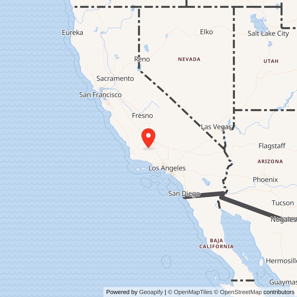
Longitude: -119.4010000
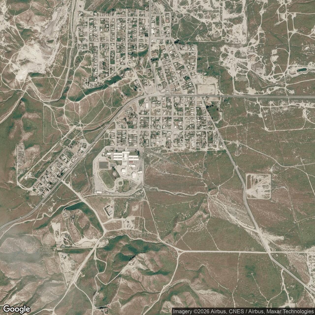
Current Role: Former original-airport area incorporated into Maricopa school and residential development; no recognizable original runway trace in 2017 aerial imagery. Exact 2026 parcel ownership not reconstructed.
Gardner Auxiliary Field No. 4 was the Gardner Army Airfield satellite associated in the surviving six-field roster with Maricopa-Kern Airport, a prewar civilian airfield immediately south of the town of Maricopa. The location fits the roster unusually well. Contemporary and later airfield histories place the original Maricopa Airport at approximately 35.054 north, 119.401 west, while the Gardner roster describes Maricopa-Kern No. 4 as roughly seven miles southwest of Gardner Field. The distance and direction are consistent, making the original Maricopa airport the strongest operational identification for the No. 4 satellite used by Gardner's flying school.
The site did not begin as an Army airfield. Maricopa already possessed a civilian aviation field by 1927, and a 1931 guide described it as a commercial airport operated by the Exchange Club, approximately 2,500 feet square, with three smooth triangular landing strips. A 1932 airway chart portrayed it as a commercial or municipal airport. By 1936 aerial photography showed two unpaved runways with no obvious hangar or parked aircraft. The Army Air Forces therefore inherited an existing aviation landscape rather than creating an entirely new field from open farmland.
That prewar identity helps explain why the site could serve Gardner economically. Gardner needed multiple landing fields more than it needed multiple full stations. A preexisting airport near the training area could absorb repetitive landing work without requiring a duplicate cantonment, hospital, schoolhouse complex, maintenance depot, or barracks district. The military value of Maricopa-Kern lay in its location and usable landing ground, not in an extensive permanent plant.
The administrative identity is less tidy than the operational one. Later federal Formerly Used Defense Sites listings preserve "Gardner Auxiliary #4" and "Maricopa Airport" as separate property names, while the Gardner training-field roster identifies Maricopa-Kern Airport as No. 4. The direct federal records available do not provide parcel coordinates that reconcile those names. For that reason, this history treats the Maricopa site as Gardner's operationally identified No. 4 satellite but does not assign the separate Gardner Auxiliary #4 FUDS property number. That distinction prevents a modern real-estate catalog name from being used to merge properties without supporting boundary evidence.
Prewar Maricopa Airport
The original Maricopa Airport belonged to the small-airport network that spread across California during the 1920s and 1930s. Its appearance in the 1927 Landing Fields of the Pacific Coast shows that the landing ground existed well before the wartime Army expansion. Maricopa's oil economy, road connections, and position southwest of Bakersfield made a local landing field useful even in an era when small airports often consisted of little more than graded strips, boundary markers, and a windsock. The 1931 description of a square field with three triangular landing directions reflects that early aviation practice.
By 1936 the airport had settled into a simpler physical pattern. Aerial imagery shows two unpaved runways crossing the open site and no substantial hangar complex. That physical simplicity later suited auxiliary use because the Army Air Forces could send training aircraft to an existing open field without inheriting a dense civilian terminal district. The absence of large buildings also meant there was little to remove or modify if military traffic temporarily received priority.
The field was used enough before the war to generate an accident record. A June 1939 Bakersfield Californian photograph preserved by later airfield researchers shows a light single-engine aircraft that crashed at Maricopa Airport after encountering a downdraft. That incident was civilian and predates Gardner Field. It should not be presented as an Army training accident, but it demonstrates that Maricopa was an active aviation location before military use and that the local airfield environment already carried the ordinary hazards of light-aircraft operations.
Connection to Gardner Field
Gardner Field opened during the massive prewar expansion of Army pilot training and became a basic flying school in the Western Flying Training Command system. Its training program produced thousands of soldiers and aviation cadets and used basic trainers such as the Vultee BT-13 Valiant, with Stearman PT-17 aircraft also associated with the school. The parent field eventually relied on six satellite fields distributed around southern Kern County and beyond. That network allowed the school to spread training traffic over a much larger operating area than Gardner's main runways alone could support.
The surviving Gardner roster identifies the satellites as Parker No. 1, Taft-Kern County No. 2, Allen No. 3, Maricopa-Kern No. 4, another Kern-area field, and Cuyama No. 6. Maricopa's position roughly seven miles southwest of Gardner made it the logical western or southwestern component of that pattern. A student could depart Gardner, reach Maricopa within minutes, perform repeated approaches and landings, then return to the parent station for fuel, maintenance, instruction, meals, and administration.
An auxiliary field was particularly valuable during basic training because landing practice consumed runway time. Students needed repetition rather than a single demonstration. Each circuit required an aircraft to enter the traffic pattern, establish spacing, descend, land or execute a touch-and-go, climb, and repeat. If every student performed that work at Gardner, congestion would rise rapidly and instructors would spend more time sequencing airplanes than teaching. Maricopa-Kern increased practical runway capacity without the expense of another full military station.
The field also provided an alternate landing location. Wartime trainers were reliable by the standards of their day, but student error, weather changes, engine problems, and other mechanical difficulties remained common enough that additional prepared landing grounds reduced risk. An aircraft that could not safely return to Gardner had another known field within the local training area. The auxiliary's value therefore included both routine throughput and emergency flexibility.
Physical Layout and Facilities
The prewar airfield was described in 1931 as a 2,500-foot-square landing ground with three triangular smooth runways. By 1936 aerial photography showed two unpaved runways. Those descriptions indicate a relatively open landing field rather than the large square bituminous mats seen at some purpose-built Gardner auxiliaries. No wartime source located documents a hangar district, barracks, shops, fuel farm, radio station, hospital, ammunition storage, or other permanent Army support plant at Maricopa-Kern.
The lack of a documented military building complex is consistent with the site's function. Gardner's mechanics, supply personnel, instructors, medical staff, crash crews, administrators, and students were based at the parent station. Maricopa-Kern needed enough ground to land and take off safely, along with whatever minimal field marking, maintenance, access, or temporary support the flying school required. This organizational arrangement concentrated expensive support infrastructure at Gardner while spreading the most runway-intensive phase of training to satellites.
The available records do not establish a defensible military acreage. Converting the 1931 description of a 2,500-foot-square civilian landing ground into an acreage figure would create false precision because the guide describes usable dimensions, not a War Department lease or military boundary. No deed, lease, fee acquisition, or wartime property map tying a specific acreage to the Maricopa military use was found.
Training Mission and Aircraft
Maricopa-Kern's principal wartime mission was basic pilot-training support for Gardner Field. Students used auxiliary fields to practice the high-frequency skills that had to become automatic before advanced training: takeoff technique, climbout, pattern entry, approach control, flare, touchdown, directional control, go-arounds, and repeated circuits. Instructors could use a satellite field to isolate a student's landing work from the traffic and distractions of the main station.
Gardner's best documented basic trainer in this period was the Vultee BT-13 Valiant. The Museum of Aviation preserves a BT-13B that was delivered in February 1944 to the 3034th Army Air Forces Base Unit, Basic Pilot School, at Gardner Field. That assignment demonstrates the equipment used by the parent organization while Maricopa-Kern was part of its auxiliary network. It does not prove that the museum's particular aircraft landed at Maricopa, and no serial-number-level sortie record located ties a specific BT-13 to the auxiliary.
The BT-13 represented a significant step in an aviation cadet's progression. It was heavier, faster, and more demanding than the primary trainers used earlier in the pipeline. Students had to master more complex cockpit procedures and sharper landing characteristics before moving to advanced single-engine or twin-engine training. A nearby field dedicated largely to repeated landing work therefore contributed directly to the efficiency of the training program even though it lacked its own resident flying organization.
Stearman PT-17 trainers are also associated with Gardner's wartime flying activity, but they should be treated as parent-station equipment rather than permanently assigned Maricopa aircraft. Auxiliary fields were used by whichever Gardner sorties required them. The correct organizational description is therefore transient use by Gardner-based school aircraft and personnel, not assignment of a separate Maricopa squadron.
Command and Organizations
No permanent squadron, flight, detachment, or independent garrison has been identified as assigned specifically to Maricopa-Kern. The aircraft, instructors, cadets, maintenance personnel, and command structure belonged to Gardner Field. During the wartime training period Gardner operated within Western Flying Training Command, the organization responsible for a broad network of pilot schools across the western United States.
Gardner's school organization evolved during the war. Early school squadrons gave way to standardized Army Air Forces base-unit structures as the service reorganized its domestic installations. The 3034th AAF Base Unit, Basic Pilot School, is specifically documented at Gardner in 1944. Those organizations generated the flying activity that used the auxiliary network, but they should not be copied into Maricopa's history as resident units unless a site-specific roster establishes physical assignment there.
That distinction matters because an auxiliary landing field could be militarily significant without supporting a resident troop population. Its mission was performed every time a Gardner aircraft used the field. The command relationship was operational rather than residential. Maricopa-Kern was effectively additional runway capacity placed away from the parent station, tied to Gardner through flight schedules, instructor direction, and the wider training syllabus.
Wartime Operations and Safety
The tempo of Gardner's training program was high. Later summaries record thousands of cadets trained at the parent installation and dozens of fatal training losses involving cadets and instructors across the Gardner system. Those losses show the risk inherent in rapidly teaching large numbers of inexperienced aviators during wartime. They do not, however, establish that any particular fatal accident occurred at Maricopa-Kern.
End of Military Use
Gardner's flying school contracted rapidly near the end of World War II. The parent airfield was inactivated on 28 February 1945 after the final class graduated in January. On 3 March Gardner and its auxiliary fields transferred from Western Flying Training Command to Air Technical Service Command jurisdiction. On 10 March the auxiliary fields were placed on inactive status. That date is the best available military close date for Maricopa-Kern's Gardner training role.
The inactive date should not be confused with the end of aviation at Maricopa. The town airport existed before Gardner and survived after Gardner's military mission ended. A 1946 aerial shows the original field in essentially unchanged configuration, and a 1949 California aeronautical chart still depicts "Kern #6" as a commercial or municipal airport. The military-use phase therefore sits inside a much longer civilian airport chronology.
The 1943 transfer of the airport to Kern County also complicates simple ownership narratives. Later airfield research reports that the airport was transferred to the county that year and thereafter called Kern County Airport No. 6. If Gardner was using the airport as an auxiliary at the same time, the arrangement may have involved county ownership with military operational access rather than an outright War Department estate.
County Airport and Postwar Aviation
After the wartime training mission ended, the field resumed or continued a local civil-airport identity. The 1949 chart's commercial or municipal depiction and the 1950 USGS map show that the site remained recognizably aeronautical. By 1950 the map depicted a paved northeast-southwest runway and a small building on the northeast side, indicating that the field had evolved from its earlier open unpaved pattern.
A 1950 California Photo Guide identified the site as Maricopa-Kern County Airport, described a single 2,800-foot Runway 6/24, and named C. C. Meadows as manager. The military satellite may have used an earlier surface arrangement, and the later paved runway may reflect county improvements after the war.
The original airport remained on a March 1953 sectional chart, where it was shown with a 2,800-foot unpaved runway, but it disappeared from the September 1953 chart. The most defensible civil closure window is therefore between those chart dates. The loss of the original field was tied to the expansion of Maricopa's school facilities rather than to a renewed military requirement.
School Redevelopment and Replacement Airport
By a 23 June 1956 aerial photograph, Maricopa Unified School facilities had been built over the western portion of the former runway, although part of the old runway still extended to the northeast. A replacement Maricopa airfield was established farther west, on the opposite side of Route 166. This relocation means that later references to "Maricopa Airport" can point to a different physical site and should not be used automatically for the Gardner auxiliary.
The former wartime location continued to lose its aeronautical character. A 1965 USGS map still depicted the old airport pattern, and a 1976 aerial showed the eastern runway remnant. Those traces illustrate a gradual rather than instantaneous disappearance. Pavement and cleared alignments often outlast official airport closure because they remain embedded in roads, fields, school grounds, or property boundaries.
By 2017 aerial imagery showed no recognizable trace of the original airport. The former airfield was occupied by Maricopa Unified School facilities and nearby houses. California Department of Education records continue to list Maricopa Unified as an active district at 955 Stanislaus Street in Maricopa. That establishes the continuing institutional presence in the area, although it does not by itself prove the current title to every parcel of the former airfield footprint.
Chronology
- 1927 The original Maricopa Airport appeared in Landing Fields of the Pacific Coast, establishing the field's existence well before Army use.
- 1931 Landing Fields of the Pacific West described Maricopa as a commercial Exchange Club airport approximately 2,500 feet square with three smooth triangular landing directions.
- 1932 The Los Angeles Airway Chart depicted Maricopa as a commercial or municipal airport.
- 1936 Aerial photography showed two unpaved runways with no visible hangars or parked aircraft.
- 1939-06-15 The Bakersfield Californian published a photograph of a light civilian aircraft that crashed at Maricopa Airport after encountering a downdraft.
- 1941 Gardner Field became active during the Army Air Forces training expansion; the exact start date of military use at Maricopa remains unresolved.
- 1941-1945 The Gardner auxiliary-field roster identified Maricopa-Kern Airport, roughly seven miles southwest of Gardner, as Auxiliary Field No. 4.
- 1943 Maricopa Airport was transferred to Kern County and thereafter was known as Kern County Airport No. 6.
- 1944 Gardner's basic pilot school remained active under Western Flying Training Command, using its network of auxiliary landing fields for training and traffic dispersal.
- 1944-02 A surviving BT-13B later preserved by the Museum of Aviation was delivered to the 3034th AAF Base Unit, Basic Pilot School, at Gardner Field.
- 1945-01 Gardner's thirty-seventh and final wartime pilot-training class graduated.
- 1945-02-28 Gardner Army Airfield was inactivated as the wartime pilot-training requirement contracted.
- 1945-03-03 Gardner Field and its auxiliary fields transferred from Western Flying Training Command to Air Technical Service Command jurisdiction.
- 1945-03-10 The Gardner auxiliary fields were placed on inactive status, ending Maricopa-Kern's active military-training role.
- 1946 A postwar aerial photograph showed the original Maricopa Airport in substantially unchanged physical configuration.
- 1949 A California aeronautical chart depicted Kern County Airport No. 6 as a commercial or municipal airport.
- 1950 A USGS map showed a paved northeast-southwest runway and a small building on the northeast side of the former Gardner auxiliary site.
- 1950 The California Photo Guide described Maricopa-Kern County Airport with a 2,800-foot Runway 6/24 and identified C. C. Meadows as manager.
- 1953-03 A sectional chart still depicted Maricopa-Kern County Airport with a 2,800-foot runway.
- 1953-09 The original Maricopa Airport was no longer shown on the sectional chart, establishing abandonment between March and September 1953.
- 1956-06-23 Aerial photography showed Maricopa Unified School construction over the western portion of the former runway while an eastern runway remnant survived.
- 1965 A USGS topographic map continued to preserve the former airport pattern after active aviation had ended.
- 1976 Aerial imagery still showed part of the eastern runway remnant.
- 2017 Aerial imagery showed no recognizable trace of the original airport, with school and residential development occupying the site.
- 2025-10-03 California Department of Education directory data continued to list Maricopa Unified as an active school district at 955 Stanislaus Street in Maricopa.
- Present The former Gardner auxiliary and original Maricopa airport site has no identified military or active airport use and is incorporated into Maricopa's school and residential landscape.
Information sources (8)
- WEBAbandoned & Little-Known Airfields, "Maricopa Airport (original location) / Kern #6 Airport / Maricopa-Kern Airport"
Source for the prewar airport history, coordinates, runway evolution, 1943 county transfer, postwar airport use, abandonment, aerial chronology, and present physical disappearance.
- WEBPacific Coast Architecture Database, "Gardner Field"
Source preserving the Gardner auxiliary-field roster that identifies Maricopa-Kern Airport as Gardner Auxiliary Field No. 4 approximately seven miles southwest of the parent field.
- WEBAbandoned & Little-Known Airfields, "Gardner AAF / Gardner Airport"
Source for Gardner's six-field auxiliary network, training aircraft context, final class, inactivation, command transfer, and 1945 inactive status.
- WEBCalifornia State Military Museum, "Conners Auxiliary Field"
USACE-derived source establishing Conners as a distinct 250-acre Kern County Land Company lease and documenting its separate location and Gardner training mission.
- WEBWest Kern Oil Museum, "Gardner Army Airfield: The Forgotten WWII Flight School of Taft, California"
Source for Gardner Field's basic pilot-training mission, personnel, facilities, aircraft, and local wartime context.
- WEBMuseum of Aviation, "BT-13B Valiant"
Source documenting a BT-13B assigned in February 1944 to the 3034th AAF Base Unit, Basic Pilot School, Gardner Field.
- WEBCalifornia Department of Education, "Maricopa Unified - School Directory Details"
Current official directory source confirming Maricopa Unified remains an active district headquartered in Maricopa near the former original-airport site.
- WEBHistorical Marker Database, "Gardner Field"
Source for the modern Gardner Field memorial, wartime training totals, parent-field location, and historical photographs of Gardner and its training aircraft.