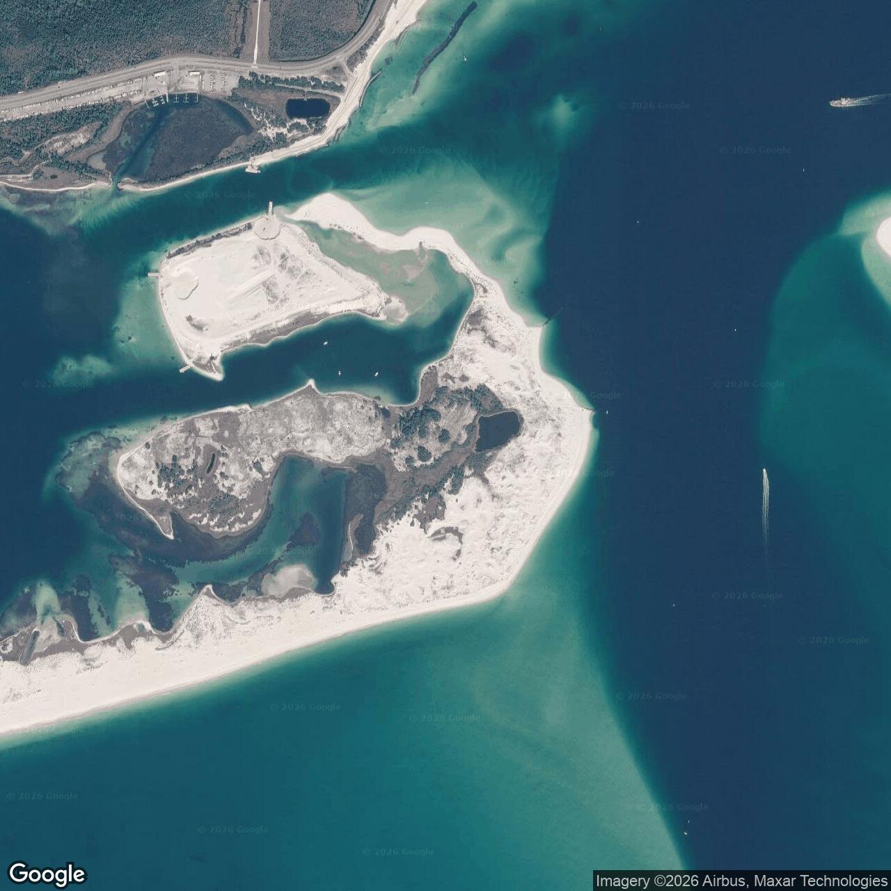
Fort McRee Army Base, Pensacola Florida
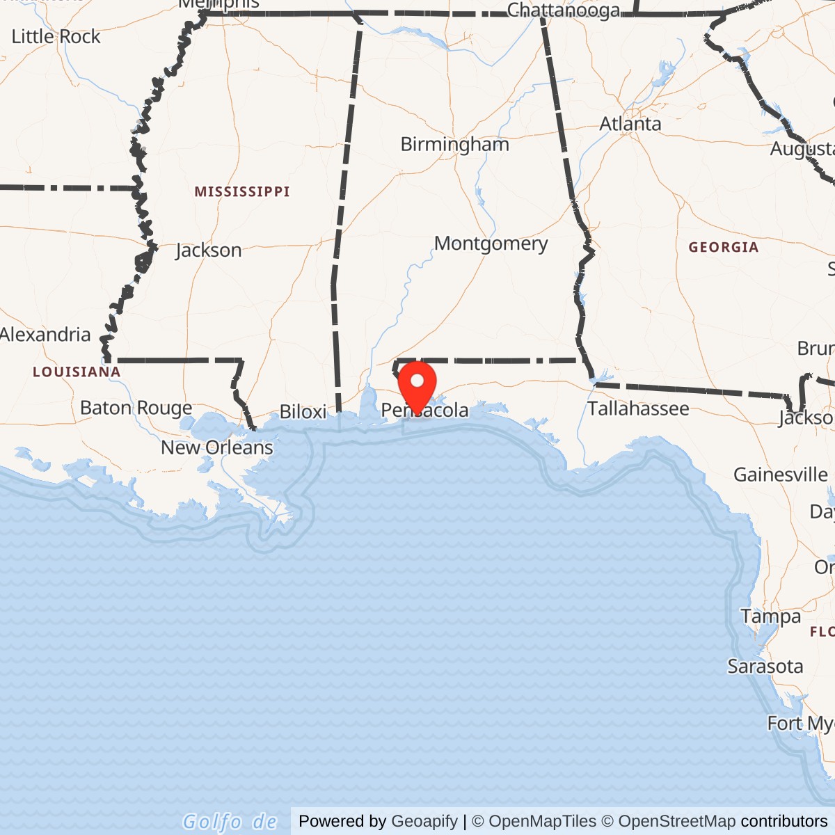
Longitude: -87.316478
Approximate Base Size: 6 Acres
Official Base Website: NPS Fort McRee
Current Role: Gulf Islands National Seashore / Perdido Key Historic District; remote NPS-managed barrier-island historic landscape with no visible above-ground remains of the original Third System fort, but with later Battery 233 and buried/eroded Battery Slemmer and Battery Center remains.
Fort McRee was the most vulnerable member of Pensacola Bay's great nineteenth-century defensive triangle. Fort Pickens stood on Santa Rosa Island, Fort Barrancas stood on the mainland bluff above the Navy Yard, and Fort McRee occupied the exposed eastern end of Perdido Key. Together they were meant to make the bay entrance a killing ground for hostile ships. McRee's job was specific and dangerous: command the western side of the deep-water channel into Pensacola Bay and help protect the harbor, city, and U.S. Navy Yard from a seaborne attack.
The installation was built as a U.S. Army Third System coastal fortification after the United States acquired Florida and committed to permanent defenses for Pensacola. Construction began in 1834 along sandy Foster's Bank, the eastern end of what is now Perdido Key, and the fort was completed in 1839. The National Park Service describes it as a three-story brick fortification with an associated water battery, named for Brevet Colonel William McRee, a distinguished War of 1812-era Army engineer officer. The fort was also known in period and later sources as the "Castle on Foster's Island" or "Castle on Fosters Island," and the alternate spelling "Fort McRae" appears in some historic references.
Fort McRee's story is different from Fort Pickens and Fort Barrancas because the fort did not survive as a standing masonry landmark. It was battered in the Civil War, abandoned by Confederate forces in 1862, eaten away by storms and littoral drift, and largely gone as a visible structure by the early twentieth century. Yet the site did not lose military value. The Army returned to the same strategic point in the Endicott era with Battery Slemmer and Battery Center, then again during World War II with Battery 233. The correct way to understand Fort McRee is therefore as a layered coastal-defense position: an 1830s brick fort, a Civil War battlefield ruin, a late nineteenth-century Coast Artillery battery site, and a World War II harbor-defense location now preserved as a remote National Park Service historic district.
Site Design and Physical Plant
Fort McRee was unusual because its site was unusual. Foster's Bank was a low, sandy, unstable barrier feature at the western edge of the Pensacola entrance channel. It gave the Army a superb field of fire but a poor foundation. NPS notes that unlike heavier masonry forts built on more stable ground, McRee did not receive a conventional foundation; sand was built up until the parade ground reached about five feet above high tide. The fort's geography made construction difficult, maintenance constant, and long-term survival uncertain.
The brick fort was three stories high and wing-shaped, a form that NPS describes as unique among Third System forts because it looked more like earlier Second System works. The perimeter measured about 360 yards. The fort contained roughly 1.5 million bricks from Mobile and the Pensacola area. Its casemates were about twelve feet high and were divided by wooden platforms to create multiple gun tiers. Some casemates on the north and west sides served as barracks. The fort also had staircases, magazines, living spaces, and hot-shot furnaces intended to heat cannonballs for use against wooden ships.
The National Register documentation for the Perdido Key Historic District describes the design in still more military terms. Fort McRee was intended to command the western side of the deep-water channel and, with Fort Pickens and Fort Barrancas, defend Pensacola harbor and city. The nominated document describes the original fort as kidney-bean shaped and designed to mount 80 guns in two tiers of casemates and 53 guns en barbette. That planned armament reflected the heavy-gun logic of the Third System: concentrate overwhelming cannon fire at a harbor entrance and make it too costly for an enemy fleet to enter.
McRee's physical weakness was baked into that same geography. The fort sat low, exposed, and within range of Fort Pickens across the pass. It was a strong element of a coordinated U.S. defense system when all three major forts were under the same flag. It became almost untenable when Fort Pickens remained in Union hands and McRee was occupied by Confederate forces. In that situation, the fort was exposed not only to fire from across the channel, but also to naval fire from U.S. ships that could strike it from angles its designers did not intend it to withstand.
After the Civil War, the original fort deteriorated rapidly. The National Register documentation states that sand movement and littoral drift changed the appearance of Perdido Key and undermined the fort, which had once sat on the eastern end of the key. By the time the Corps of Engineers later built concrete batteries on Perdido Key, the brick fort was effectively gone. NPS states plainly that nothing visible remains today of the Third System fortification, although later coastal-defense structures in the area are often called "old Fort McRee."
Mission Evolution
Fort McRee's first mission was harbor denial. After the War of 1812, the United States understood that Gulf and Atlantic ports needed permanent defenses. Pensacola was especially important because of its deep harbor and the establishment of a Navy Yard and depot on the bay. Fort McRee, Fort Pickens, Fort Barrancas, and the Advanced Redoubt were part of the Army's answer: a mutually supporting system of forts that would protect a Navy installation and one of the Gulf Coast's best anchorages.
In peacetime, the mission was mostly deterrence and readiness. McRee's guns, water battery, casemates, and position were meant to discourage hostile naval action rather than to fight frequent battles. The fort's strategic value came from its place in the system. Alone, it was isolated. Together with Pickens and Barrancas, it helped close the bay entrance.
The Civil War turned that logic inside out. In January 1861, U.S. troops withdrew from Fort McRee and Fort Barrancas and consolidated at Fort Pickens. Supplies that could be moved were taken to Pickens, and other material was destroyed to prevent capture. Southern troops occupied Fort McRee in mid-January and began mounting guns and improving batteries by the end of March. At that point McRee no longer worked with Pickens; it faced Pickens. The fort's mission shifted from U.S. harbor defense to Confederate control of the Pensacola entrance and support of the mainland defenses around the Navy Yard.
The fort's only major combat came in November 1861. On November 22, Fort Pickens opened fire against Confederate positions at Fort McRee, Fort Barrancas, shore batteries, and the Pensacola Navy Yard. U.S. Navy warships USS Niagara and USS Richmond joined the bombardment of McRee. The fort returned fire, but its exposed position proved disastrous. NPS states that after about five hours of artillery exchange, McRee's guns fell silent because the damage made it impossible to operate the cannon. The next day the battle resumed, but Fort McRee did not return fire. The damage to the brickwork, guns, flagpole, and wooden interior structures was severe.
By May 1862, Confederate forces abandoned Fort McRee as they withdrew from Pensacola. The fort's military usefulness as a masonry work was essentially over. It remained a named place in the Pensacola defense landscape, but the brick fort itself was a burned and broken shell. The Army did not rebuild it as a standing fort after the war. Instead, the site became a ruin, a source of historic memory, and eventually the anchor point for later concrete batteries.
Civil War Service and Destruction
The Fort McRee Civil War story began in the secession crisis. On January 10, 1861, the same day Florida seceded, federal troops in the Pensacola area abandoned the more vulnerable mainland and Perdido Key positions and moved to Fort Pickens. Two days later, Alabama and Florida militia occupied Fort Barrancas, Fort McRee, the Advanced Redoubt, and the Pensacola Navy Yard. The result was a tense Gulf Coast standoff that paralleled the better-known crisis at Fort Sumter.
Fort McRee was a Confederate position for nearly a year and a half, but it never had an easy defensive role. Confederate engineers and soldiers mounted guns and added batteries, yet the fort remained exposed. Its masonry, wooden interior platforms, magazines, and sea-level position were vulnerable to plunging and flanking fire. Union possession of Fort Pickens meant the United States could fire into McRee from across the pass, while naval vessels could attack from the water.
The bombardment of November 22-23, 1861, was the decisive moment in Fort McRee's history. Fort Pickens began firing at 9:55 a.m. on November 22. Fort McRee, Fort Barrancas, Confederate shore batteries, and U.S. ships entered a heavy artillery duel whose concussion was remembered far beyond the immediate battlefield. NPS describes Fort McRee as exposed to severe bombardment from front, flank, and rear. USS Niagara and USS Richmond added naval fire. Confederate gunners fired back, but the fort's guns were silenced after hours of sustained punishment.
The National Register nomination states that by noon the guns of Fort McRee had been silenced with the exception of one, and that three hours before sunset the fort and adjoining battery had ceased firing entirely. It adds that McRee was badly damaged and never fired another shot during the Civil War. NPS likewise emphasizes that the next day brought no return fire from McRee, and that the fort's wooden structures had caught fire at least three times.
When Confederate troops abandoned Pensacola in May 1862, Fort McRee was left behind as a ruin. The remaining structure continued to deteriorate through erosion, storms, and the practical scavenging or loss of materials. The ruin became one of the clearest examples of a Third System fort whose engineering purpose depended entirely on system control. As long as Pickens, Barrancas, and McRee were mutually supporting U.S. positions, McRee was a valuable channel defense. Once it faced Fort Pickens as an enemy-held work, its exposed location made survival unlikely.
Endicott-Era and Coast Artillery Reuse
The disappearance of the old brick fort did not end the Army's interest in the eastern end of Perdido Key. By the late nineteenth century, masonry forts had become obsolete against rifled artillery, armor, steam power, and new naval tactics. The Army responded by building reinforced-concrete batteries, dispersing guns, adopting disappearing carriages, improving fire control, and integrating harbor defenses with minefields and searchlights. Perdido Key again mattered because the geography of Pensacola Pass had not changed in strategic terms: the western side of the channel still needed to be defended.
Battery Slemmer was the first of the later batteries built in the Fort McRee area. NPS identifies it as the first concrete battery constructed on the eastern end of Perdido Key, completed in 1899. The National Register nomination describes Battery Slemmer as built in 1898 and armed with two 8-inch rifles on disappearing carriages. It is now completely buried, with only the outline of one gun pit discernible in the historic district. Its name honored Lieutenant Adam J. Slemmer, the U.S. officer who had withdrawn federal troops to Fort Pickens in January 1861.
Battery Center followed shortly afterward. NPS states that Battery Center was added in 1901. The National Register nomination says it began in 1899 and mounted four 15-pounder rapid-fire guns. These were intended for the smaller, faster craft that could threaten minefields, channels, and harbor-control measures. The battery is now largely covered with sand. In function, Battery Center represented the shift from old fort walls to specialized tactical defenses: not every gun needed to destroy a battleship; some needed to stop torpedo boats, minesweepers, and other fast intruders.
The Perdido Key batteries augmented the batteries across Pensacola Pass on Santa Rosa Island. They were not independent in any meaningful way. They were part of a wider harbor-defense network that included Fort Pickens, Fort Barrancas, range-finding stations, support buildings, communications, observation, mines, and later searchlights and radar. The National Register nomination states that when the key, Santa Rosa Island, and mainland fortifications are evaluated together, they are of national significance as the triangular coastal defense of Pensacola harbor.
World War II and Battery 233
World War II brought the last military construction layer to the Fort McRee site. By the 1940s, concrete coast-defense batteries had to respond not only to surface ships but also to aircraft, submarines, and the possibility of sudden raids. Pensacola's harbor defenses were modernized again, even as the entire fixed-coast-artillery system was approaching obsolescence.
Battery 233 was built on high ground in 1940 according to the National Register nomination and was designed for two 6-inch shield guns on barbette carriages. The same document describes its casemated supply and storage rooms as T-shaped, with the top buffered by sand and camouflaged with vegetation. NPS identifies Battery 233 as the third concrete battery on the eastern end of Perdido Key and states that construction began during World War II.
Battery 233 is important because it is the most visible surviving feature many visitors associate with Fort McRee, even though it is not the original brick fort. It represents a final attempt to use the same geographic position for harbor defense. The guns were never installed before the wartime need passed, but the structure preserved the military logic of the site: place guns on the western side of the bay entrance to work with the Santa Rosa Island defenses across the channel.
By 1946, National Register documentation says the Perdido Key Historic District had ceased military use. The broader Fort Barrancas Army post was deactivated in 1947. The end of the war ended the need for fixed seacoast forts around Pensacola. The strategic threats of the postwar era, aircraft, missiles, nuclear weapons, long-range naval aviation, and submarines, could not be answered by brick forts or unarmed concrete batteries on shifting barrier islands.
Role in the Wider Military Network
Fort McRee only makes sense as part of the Pensacola harbor-defense network. Its history was never primarily about garrison size, parade-ground life, or a self-contained post community. It was a tactical piece in a larger Army system built to protect a Navy installation. Fort Pickens, Fort Barrancas, Fort McRee, the Advanced Redoubt, and later the concrete batteries and support structures functioned as overlapping layers of defense around Pensacola Bay and the Navy Yard.
In the Third System era, McRee completed the triangle. Fort Pickens guarded from Santa Rosa Island, Barrancas watched from the mainland bluff, and McRee covered the western side of the channel from Perdido Key. Each compensated for the others. A ship attempting to force the entrance would face crossing fire rather than a single fort. This was the basic idea behind the entire system.
In the Civil War, the same network split politically and militarily. Fort Pickens remained U.S.; Fort McRee, Fort Barrancas, and the Navy Yard passed to Confederate control. That division made the system fire inward against itself. McRee's destruction was therefore not just a local battle story. It was the failure of a carefully planned national defense network once civil war placed linked forts under opposing commands.
In the Endicott and World War II periods, the network changed shape but not purpose. Brick forts gave way to concrete batteries, range finding, mine defense, rapid-fire guns, and later wartime battery construction. The Perdido Key batteries supported and augmented the Santa Rosa Island batteries across the pass. Even when Battery 233 was never armed, its construction shows that the Army still considered the western side of the entrance part of the Pensacola defense problem.
Current Status
Fort McRee today is a vanished fort inside a surviving military landscape. No visible above-ground remains of the original Third System fortification survive. NPS specifically warns that later coastal-defense structures in the area are commonly referred to as old Fort McRee. The visible or partly visible remains belong primarily to the later battery era, especially Battery 233, while Batteries Slemmer and Center are largely buried or eroded.
The site is within Gulf Islands National Seashore, in the Perdido Key area. NPS describes the eastern end of the barrier island beyond the Johnson Beach Road turnaround as accessible only by foot or by boat, with boat-in backcountry camping allowed on the end of the island where remnants of historic structures are located. This remoteness has shaped preservation. Fort Pickens and Fort Barrancas became accessible, interpreted historic sites; McRee remained exposed to storms, sand movement, vegetation, vandalism, and shifting visitor pressure.
The National Register-listed Perdido Key Historic District is the best defined preservation boundary for the Fort McRee military landscape. The nomination gives the district as approximately six acres and identifies the three coast artillery batteries, seawall, old dock, and foundations of military support structures. It also notes that the site's structures had been heavily affected by sand movement and vandalism by the time of the nomination. The district's military value lies in its ability to show how the same strategic point was reused from the 1830s through World War II even after the original fort disappeared.
Chronology
- 1821 Spain transferred Florida to the United States, and Foster's Bank / Perdido Key became part of the strategic geography of the new American Gulf Coast defense system.
- 1825 Federal action established the Pensacola Navy Yard and depot on Pensacola Bay, increasing the need for permanent harbor fortifications.
- 1828 U.S. Army Corps of Engineers officers proposed a fortification on Foster's Bank to complete the defense of Pensacola harbor from the western side of the entrance channel.
- 1834 Construction began on Fort McRee, a three-story brick fortification on sandy Foster's Bank at the eastern end of Perdido Key.
- 1839 Fort McRee was completed as part of the Third System of U.S. coastal defenses.
- Early 1840s The fort on Foster's Bank received the permanent name Fort McRee; the alternate spelling Fort McRae appears in some historical references.
- 1861-01-10 U.S. troops in the Pensacola area withdrew from Fort McRee and Fort Barrancas and consolidated at Fort Pickens as Florida seceded.
- 1861-01-12 Alabama and Florida militia occupied Fort McRee, Fort Barrancas, the Advanced Redoubt, and the Pensacola Navy Yard.
- 1861-03 Confederate forces were mounting guns and additional batteries at Fort McRee by the end of March.
- 1861-11-22 Fort Pickens opened a major bombardment of Confederate positions, including Fort McRee; USS Niagara and USS Richmond also fired on McRee.
- 1861-11-23 The bombardment resumed, but Fort McRee did not return fire because of the damage sustained the previous day.
- 1862-05 Confederate forces abandoned Fort McRee and Pensacola; the fort was left as a burned and fragmented brick shell.
- Early 1890s By this period, the original Fort McRee had largely deteriorated, with much of the old structure undermined or collapsed.
- 1898 Battery Slemmer was built on Perdido Key as the first of the later concrete Coast Artillery batteries in the Fort McRee area.
- 1899 A pentagonal concrete seawall was built around the later battery district; Battery Center construction began around this period.
- 1901 NPS identifies Battery Center as added shortly after Battery Slemmer, completing the second major concrete battery on the eastern end of Perdido Key.
- 1905 The National Register nomination identifies this as one of the key dates in the later Perdido Key battery-development period.
- 1940 Battery 233 was built on high ground and designed for two 6-inch shield guns on barbette carriages.
- World War II Construction continued on Battery 233, but the planned guns were not installed before fixed coast-defense needs passed.
- 1946 National Register documentation states that the Perdido Key Historic District had ceased to be used for military purposes by this year.
- 1947 The broader Fort Barrancas Army post was deactivated, marking the end of the Army's fixed harbor-defense mission in the Pensacola fort system.
- 1971 Fort Barrancas, Fort Pickens, and related areas entered Gulf Islands National Seashore, bringing the former military landscape under National Park Service stewardship.
- 1977-1978 The National Park Service acquired the last five eastern miles of Perdido Key, completing the Johnson Beach / Perdido Key area of Gulf Islands National Seashore.
- 1980-03-10 The Perdido Key Historic District, including the later Fort McRee-area batteries, was listed in the National Register of Historic Places.
- Present Fort McRee has no visible above-ground Third System remains, but the remote Perdido Key historic landscape preserves later battery remains and the strategic setting of the western side of Pensacola Pass.