
Cape Sabine DEW Line Intermediate Station, Alaska
A few buildings and one high tower helped close a low-altitude gap in Alaska's first Arctic warning line.
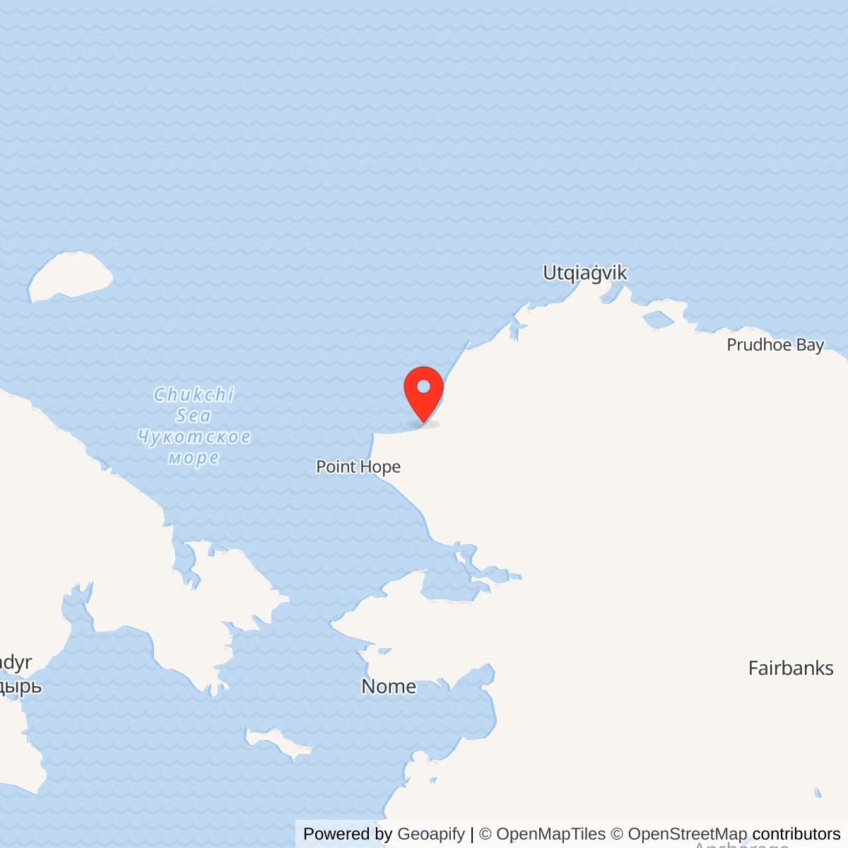
Longitude: -163.852449
Site Number: LIZ-A
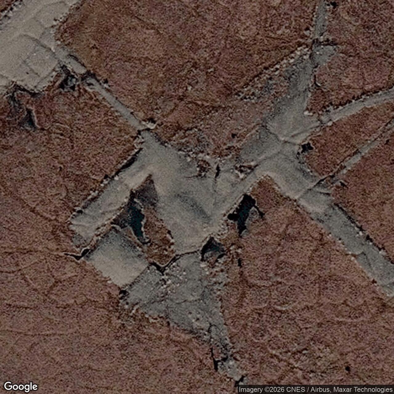
Current Role: Former DEW Line station; structures removed during early-2000s cleanup. USGS records remaining gravel runway and building footings.
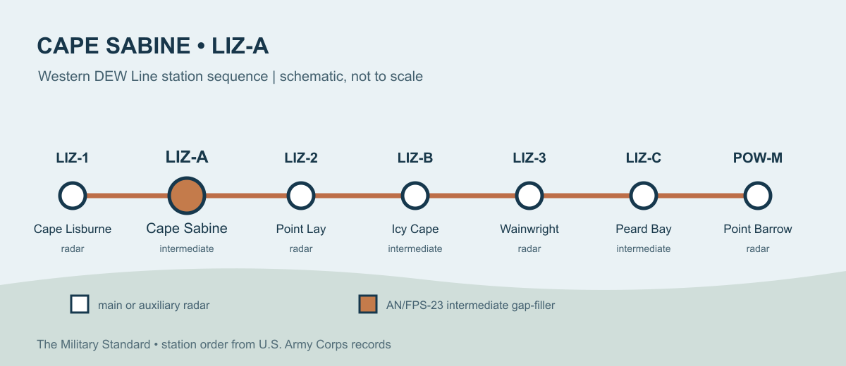
Cape Sabine, code LIZ-A, was an intermediate station of the Distant Early Warning Line on Alaska's Chukchi Sea coast. It stood between Cape Lisburne and Point Lay LIZ-2. Its AN/FPS-23 gap-filler equipment watched a low-altitude approach that the larger rotating radars might miss. The station entered service in August 1957 and its radar mission ended on July 21, 1963. [1] [2]
- DEW Line code
- LIZ-A.
- Station type
- Intermediate gap-filler station.
- Radar system
- AN/FPS-23 Fluttar, with a transmitter at the intermediate site.
- Operating period
- August 1957 to July 21, 1963.
- Recorded tower
- 240 feet.
- Location
- Chukchi Sea coast near Cape Beaufort, Alaska; approximately 69.023967, -163.852449.
An Arctic Gap Filler
The DEW Line placed its largest search radars at main and auxiliary stations. Intermediate stations filled spaces between them. Cape Sabine was one of three LIZ-sector intermediate sites in Alaska, with Icy Cape LIZ-B and Peard Bay LIZ-C farther along the line. This arrangement gave the western Arctic an additional low-altitude warning layer during the years when bomber attack was a central defense concern. [1] [2]
The station name can be confusing on maps. A federal wildlife study explains that many pilots called the DEW site "Cape Sabine," while nautical charts called the same coastal feature Cape Beaufort. The station was near Cape Beaufort, rather than the cape at the Pitmegea River mouth that some maps also label Cape Sabine. [5]
Radar and the LIZ Sector
The AN/FPS-23 was a continuous-wave Doppler system nicknamed Fluttar. An intermediate station transmitted a steady radio beam toward receivers at the larger stations on either side. An aircraft crossing that beam changed the received signal and triggered an alarm. Cape Sabine's equipment complemented the long-range search radar at Point Lay and the wider LIZ sector. The station itself did not have an AN/FPS-19 rotating search radar or its large protective radome. [1] [2] [3]
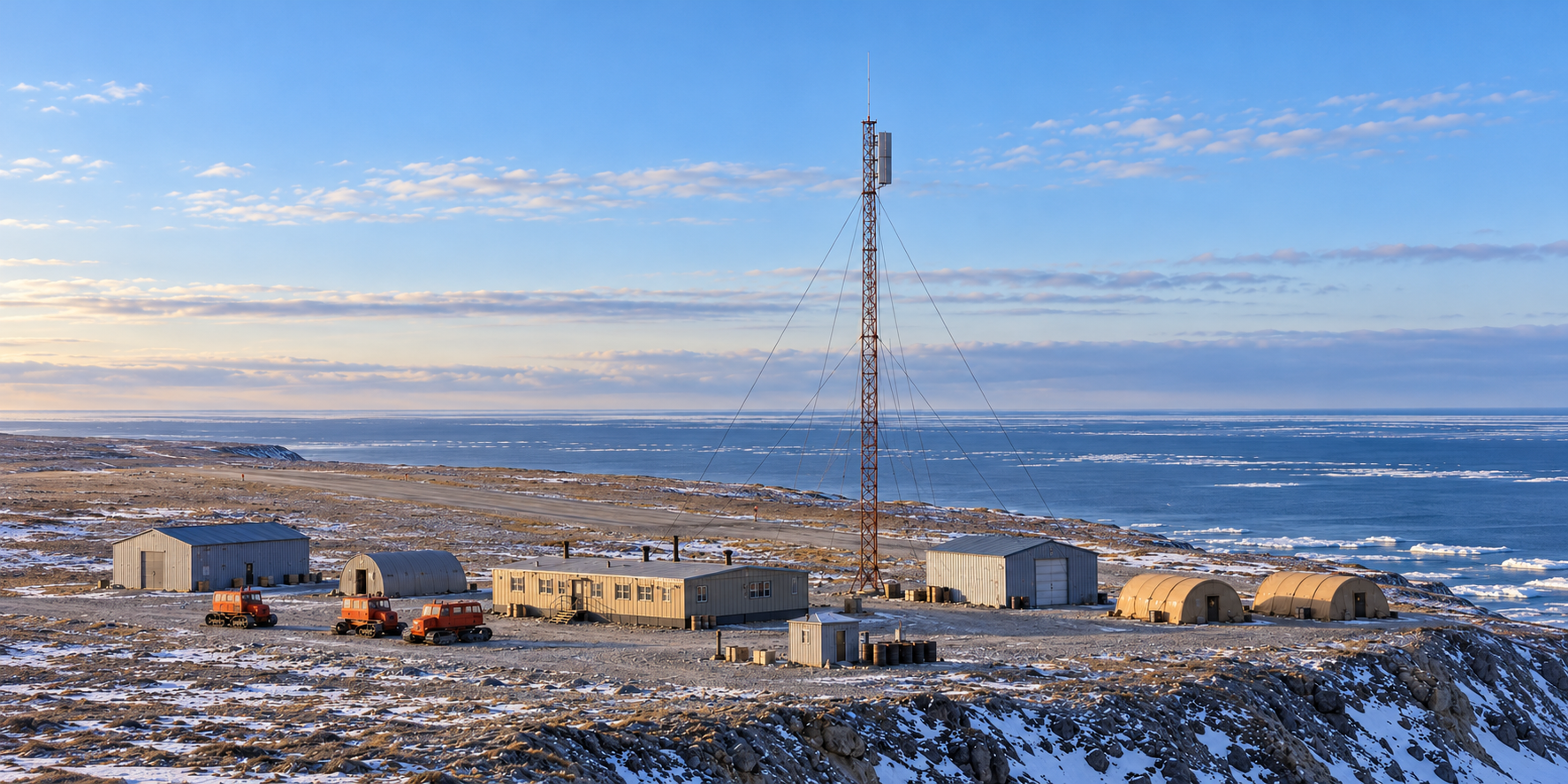
The Corps recorded a 240-foot tower at Cape Sabine. The height helped raise the gap-filler antenna above terrain and surface obstructions. The AN/FPS-23 system was a radar fence, so Cape Sabine's work depended on neighboring stations receiving and interpreting its signal. The Air Force's 1965 history describes the system's tall directional antennas and the practical limits that led to its retirement. [1] [2]
Buildings and Airstrip
A 1985 field investigation, summarized by the Corps in 1994, recorded a 3,172-square-foot operations building, a steel shop, a steel warehouse, one Quonset hut, two Jamesway huts, an 8-by-8-foot fuel pump house, the tower, and three Sno-Cats. The operations building was the center of a station much smaller than the large DEW main camps. Shops, stores, fuel handling, and tracked vehicles kept the radar and its crew working far from a road network. [1]
A gravel airstrip on the bluff provided an essential link for personnel, mail, food, and replacement parts. In a 1972 visit, pilot Francis Blake photographed the closed station and described an airstrip beyond its tower and buildings. He recalled that the site was being used for seasonal geophysical-equipment storage at the time. [8]
The Small Crew
Intermediate stations were staffed, but on a far smaller scale than main and auxiliary stations. DEW Line veteran and museum accounts describe a typical intermediate crew of about four or five people. At a site such as Cape Sabine, the crew's day centered on keeping the transmitter, power, fuel, and communications operating through weather that could delay an aircraft or isolate the camp. The operations building and temporary huts formed their small workplace and camp beside the tower. [1] [6] [7]
That small crew still formed part of a much larger system. A detection at an intermediate gap-filler site was received at a neighboring station and moved into the DEW Line's warning and reporting network. The crew's maintenance work mattered because a silent transmitter would leave an opening in the low-altitude fence. [2] [3]
Closure and the Site Today
The Air Force ended the AN/FPS-23 mission in the Alaska sector on July 21, 1963. Cape Sabine did not become a later North Warning System station. The Corps found the former camp still standing in the 1980s, although it had deteriorated. Later demolition and environmental work removed the structures. A U.S. Geological Survey account says the gravel runway and building footings remained after the early-2000s cleanup. [1] [4] [9]
Chronology
- August 1957: Cape Sabine LIZ-A enters DEW Line service as an AN/FPS-23 intermediate station. [1]
- July 21, 1963: The LIZ-sector AN/FPS-23 gap-filler operation ends. [1]
- 1972: Pilot Francis Blake photographs the closed station during a visit to the area. [8]
- 1985: An investigation records the buildings, tower, pump house, huts, and three Sno-Cats. [1]
- Early 2000s: Demolition and remediation remove the former station buildings. [4] [9]
Related Sites
- Cape Lisburne Air Force Station, neighboring western radar station
- Point Lay LIZ-2, neighboring DEW auxiliary station
- Icy Cape LIZ-B, next intermediate station east of Point Lay
- Peard Bay LIZ-C, eastern LIZ-sector intermediate station
- AN/FPS-23 gap-filler radar
- DEW Line station directory and DEW Line history
Information sources (9)
- PDFU.S. Army Corps of Engineers, The Cold War in Alaska: A Management Plan for Cultural Resources, 1994, pp. 187, 194-195
Station designation, AN/FPS-23 equipment, operating dates, tower, building and vehicle inventory, and former-site condition.
- PDFAir Defense Command, A History of the DEW Line, 1946-1964, Historical Study No. 31, 1965
Contemporary explanation of the FPS-23 gap-filler system, directional antennas, and retirement.
- WEBDEWLineAdventures, DEW Line Background Information, Primary Equipment
AN/FPT-4 transmitters at intermediate sites, AN/FPR-2 receivers at larger sites, and the Doppler-fence mission.
- WEBAlaska Department of Environmental Conservation, Cape Sabine Dewline / DERP, hazard ID 843
Approximate WGS84 reference coordinate and later cleanup record.
- PDFAlaska Department of Fish and Game, Use of Kasegaluk Lagoon, Chukchi Sea, Alaska, by Marine Birds and Mammals, Part III, 1992, Table 1
Geographic-name distinction between Cape Sabine, Cape Beaufort, and the DEW Line station.
- WEBDEWLine Museum, DEW Line station types overview
Typical intermediate-station complement of about five people.
- WEBDEWLineAdventures, Abandoning a DEWLine Site
Veteran account describing the four- to five-person intermediate-station crew and 1963 closure context.
- WEBFrancis Blake, 1972 Cape Sabine photograph and recollection, published by Ruud Leeuw
Contemporary view of the closed station, coastal airstrip, and seasonal reuse.
- PDFU.S. Geological Survey, National Assessment of Shoreline Change: Historical Shoreline Change Along the North Coast of Alaska, Icy Cape to Cape Prince of Wales, 2019, p. 22
1963 abandonment and remaining runway and footings after cleanup.