
Collinson Point DEW Line Station, Alaska
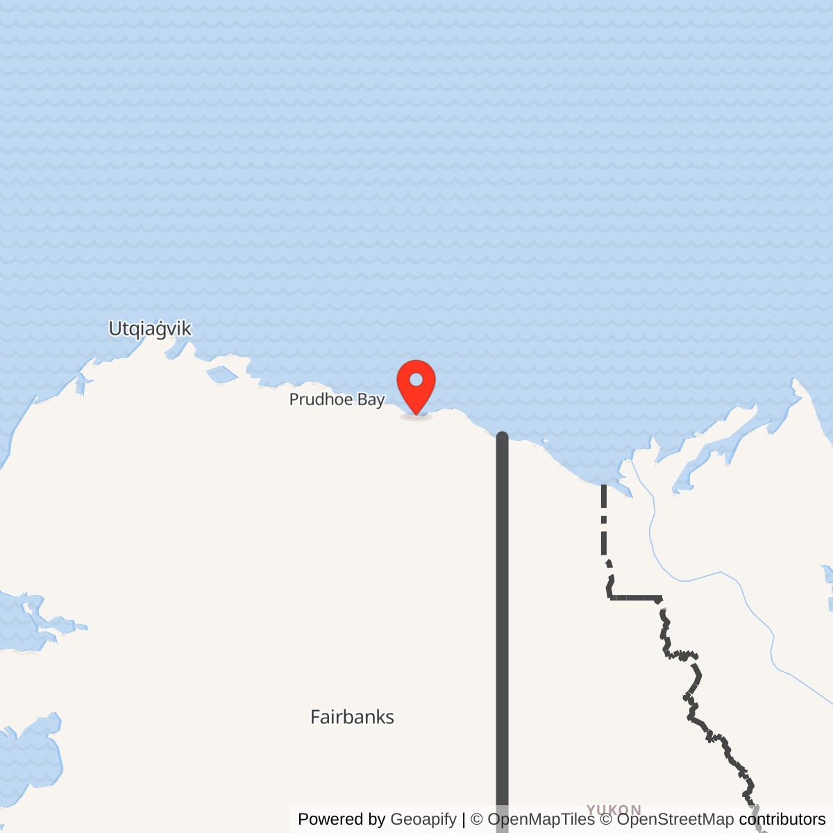
Longitude: -144.837222
Site Number: POW-D
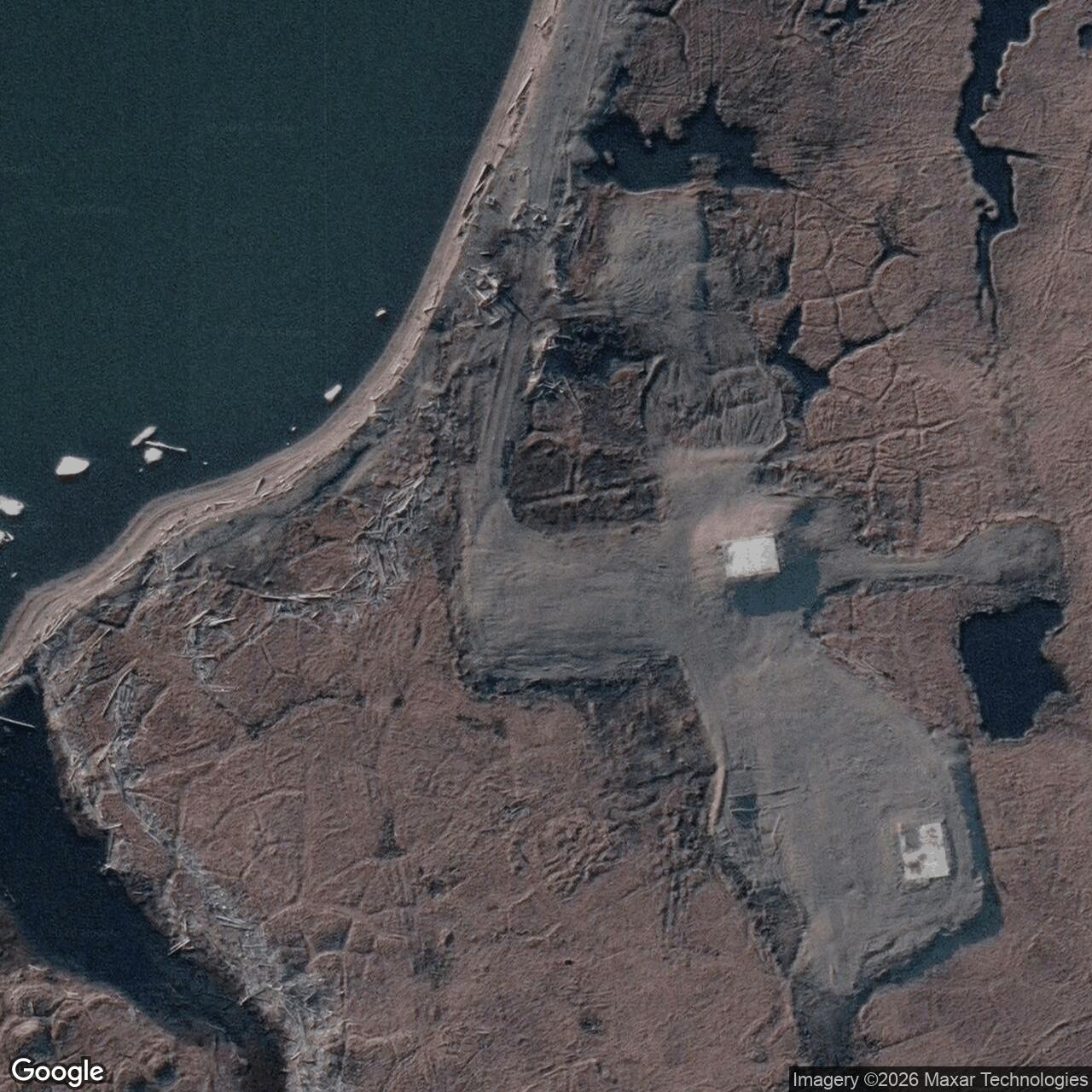
Current Role: Former Collinson Point radar camp; gravel runway and pads remain.
Collinson Point was the operating site of POW-D, the easternmost intermediate station in the Point Barrow sector of the Distant Early Warning Line. Air Force records listed the station as Brownlow Point, but the radar camp stood at Collinson Point near Simpson Cove. Its AN/FPS-23 Doppler equipment helped detect low-flying aircraft between larger search-radar stations. It entered service in August 1957 and the Air Defense Command recorded its inactivation on July 21, 1963. [1] [2] [3]
- DEW Line code
- POW-D; sometimes listed under Brownlow Point.
- Station type
- Intermediate low-altitude gap-filler.
- Radar
- AN/FPS-23 Doppler system.
- Operating period
- August 1957 to July 21, 1963 in Air Defense Command records.
- Camp
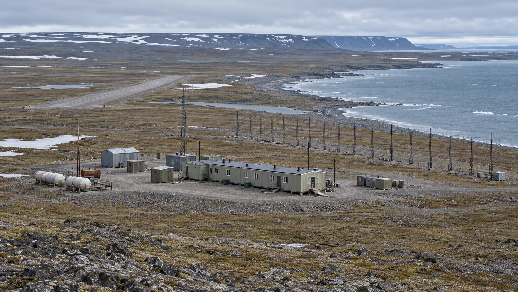
- Five-module building and support facilities.
- Location
- Simpson Cove, Camden Bay; approximate DEC coordinate 69.974722, -144.837222.
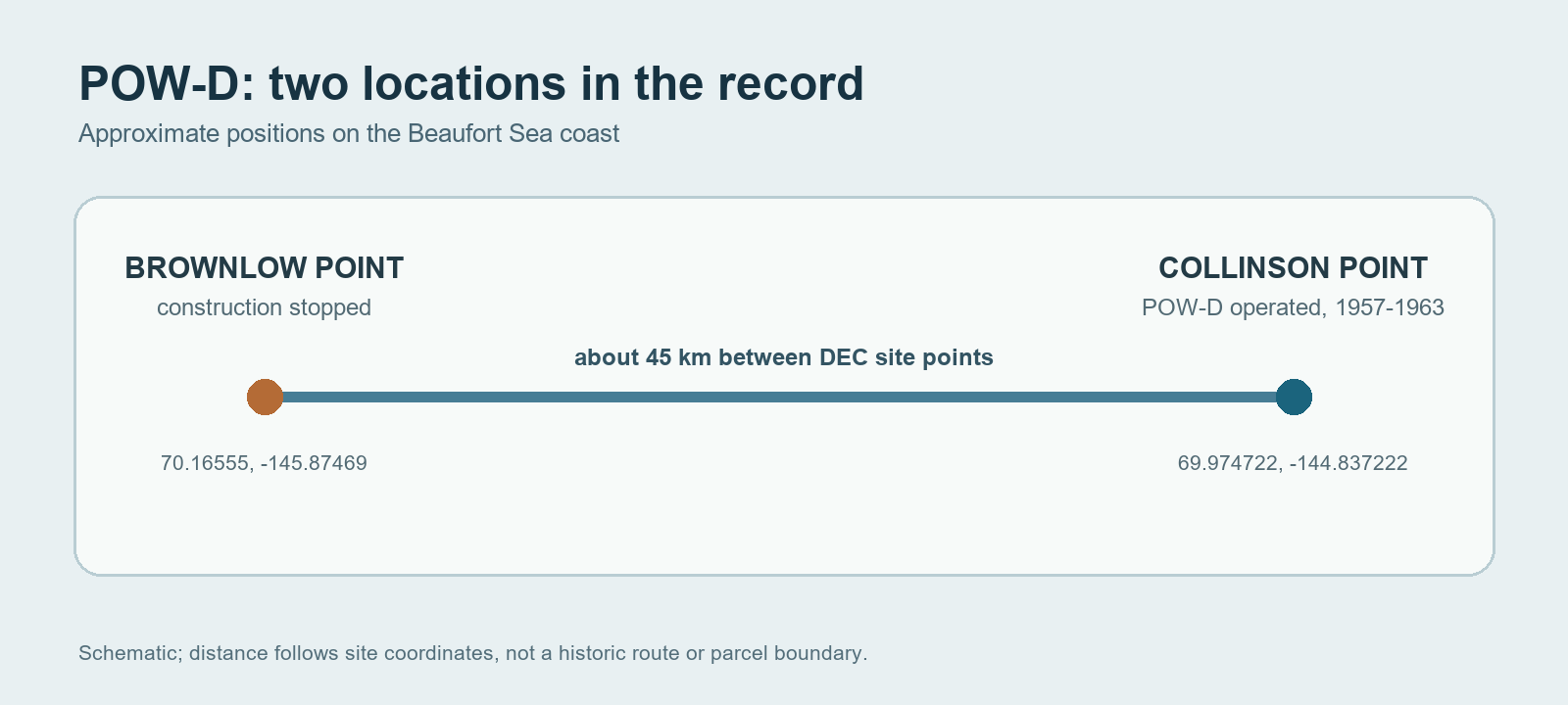
Two Places, One Warning Project
Early DEW Line planning identified Brownlow Point and Simpson Cove as separate locations. The Brownlow Point parcel received a building and foundations before work stopped because the location had been chosen incorrectly. The completed intermediate radar station was established farther east at Collinson Point, on the eastern shore of Simpson Cove. Later records often used Brownlow Point as a name for POW-D as a whole, which explains the differing labels in station lists. [2] [4] [5] [7]
The operational site was in the Arctic National Wildlife Refuge, southwest of Kaktovik. Its position between Bullen Point POW-3 and Barter Island BAR-Main put it on the eastern end of the Alaska coastal warning chain. The remote coast required an on-site camp, fuel supply, maintenance space and an airstrip for access. [1] [3] [7]
Radar and Communications
POW-D was an intermediate station rather than a main or auxiliary radar post. Its AN/FPS-23 continuous-wave Doppler system formed part of a low-altitude detection fence between the larger rotating search radars. The equipment could indicate that an aircraft had crossed the monitored gap, giving the wider network another warning cue. Collinson Point did not need a large search-radar radome to carry out that role. [1] [3] [6]
State site records describe a Doppler-type radar fence, a single five-module building and support facilities. The modules placed radar work and the necessities of a small remote camp together. Power and communications were essential to turn a local detection into a warning for the sector network. [3] [6]
Camp and Daily Life
Collinson Point's five-module building provided the core working and living space. Later site records also identify a garage and shop area, fuel-system remnants and other support structures. Aircraft and seasonal surface shipments connected this isolated coast with the rest of the DEW Line. In a place with continuous summer daylight, winter darkness and permafrost, crews had to keep power, heating, communications and radar equipment running through difficult weather. [2] [3] [7]
The station's scale set it apart from a main DEW Line center. Its compact camp and linear radar installation served a single gap-filling task. The Air Force relied on larger stations for broad-area surveillance and sector reporting, while Collinson Point contributed the local crossing alert. [1] [3] [6]
Closing the Station
The Air Defense Command ended POW-D's intermediate radar mission on July 21, 1963, along with the other Alaska AN/FPS-23 intermediate posts. The larger DEW Line network remained in service. At Collinson Point, the abandoned camp endured for decades; the Corps removed its structures and radar-related debris in 2000. The gravel runway and building pads remained visible after demolition. [1] [3] [5]
Chronology
- 1953: The federal government obtains the separate Brownlow Point parcel during early DEW Line preparations. [4]
- 1955: Planning records list Brownlow Point and Simpson Cove as distinct proposed locations. [7]
- August 1957: The Collinson Point intermediate station enters the operating DEW Line as POW-D. [1] [2]
- July 21, 1963: The Air Defense Command inactivates the intermediate radar mission. [1] [2]
- 2000: The Corps demolishes the former Collinson Point station structures. [3]
Related Sites
- Brownlow Point unfinished construction site
- Bullen Point POW-3
- Barter Island BAR-Main
- Point Barrow POW-Main
- AN/FPS-23 radar
- DEW Line station directory and DEW Line history
Information sources (7)
- PDFAerospace Defense Command, Historical Data of the Aerospace Defense Command, 1946-1973, DEW Line station table
Source for the POW-D Brownlow Point listing, August 1957 opening, AN/FPS-23 equipment and July 21, 1963 inactivation.
- PDFU.S. Army Corps of Engineers, The Cold War in Alaska: A Management Plan for Cultural Resources, 1994, pp. 187 and 192-193
Source for the POW-D operating dates, Brownlow support site, Collinson Point station and Arctic setting.
- WEBAlaska Department of Environmental Conservation, Collinson Point DEW Line Sitewide report, hazard ID 1679
Source for the Simpson Cove location and coordinates, five-module building, Doppler radar fence, support facilities and 2000 demolition.
- WEBAlaska Department of Environmental Conservation, Brownlow Point DERP site report, hazard ID 737
Source for the separate Brownlow parcel, May 1953 acquisition, siting error, unfinished building and foundations, and later erosion.
- PDFU.S. Geological Survey, Historical Shoreline Change Analysis of the Alaska Beaufort Sea Coast, 2015, p. 31
Source for the Collinson Point location, POW-D naming overlap, 1963 abandonment and surviving gravel runway and pads.
- PDFF. Robert Naka and William W. Ward, Distant-Early-Warning Line Radars: The Quest for Automatic Signal Detection, Lincoln Laboratory Journal, 2000
Source for the AN/FPS-23 continuous-wave Doppler gap-filler mission.
- PDFDEW Line Coordinating Committee, Minutes and Progress Reports, 1955-63, compiled by P. Whitney Lackenbauer and Matthew Farish, 2019, planning site lists
Source for the 1955 planning lists that identify Brownlow Point and Simpson Cove as separate proposed locations.