
Demarcation Bay DEW Line Station at Nuvagapak Point, Alaska
On Alaska's eastern Beaufort coast, a small radar camp filled a low-altitude gap in the Distant Early Warning Line.
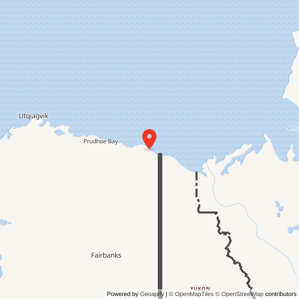
Longitude: -142.31065
Site Number: BAR-A
Current Role: Former radar camp; gravel pad and airstrip remain after structure removal.
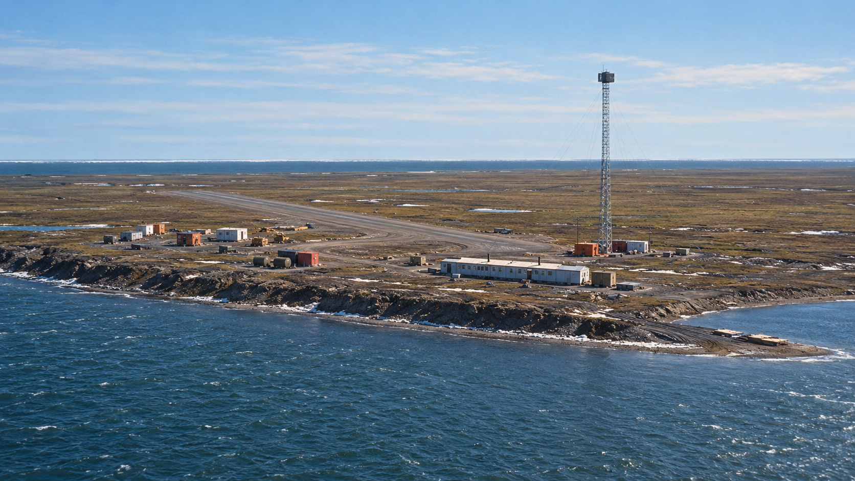
The operating Demarcation Bay station, code BAR-A, stood at Nuvagapak Point, west of Demarcation Bay. It was an intermediate post in the Distant Early Warning Line, using the AN/FPS-23 Doppler system to watch for low-flying aircraft between the larger radar stations. Air Defense Command records give an August 1957 opening and July 21, 1963 inactivation. [1] [2] [3]
- DEW Line code
- BAR-A, Demarcation Bay sector.
- Station type
- Intermediate low-altitude warning station.
- Radar
- AN/FPS-23 Doppler gap-filler with a tall antenna tower.
- Operating period
- August 1957 to July 21, 1963 in Air Defense Command records.
- Physical location
- Nuvagapak Point, approximately 69.885739, -142.310650.
- Access
- Remote coastal camp with a gravel airstrip and fuel facilities.
Station on the Beaufort Coast
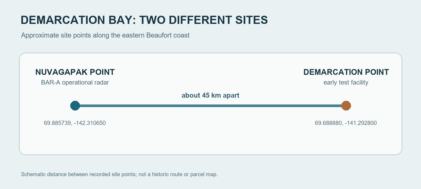
Nuvagapak Point lies on the Beaufort Sea coast near the Alaska-Canada border. Early DEW Line work was under way in this sector by the mid-1950s. The completed BAR-A station was placed here, while an earlier test facility at Demarcation Point occupied a separate site farther east. The names overlap in historical records, but the two locations had different physical footprints. [2] [3] [4] [6]
As an intermediate station, BAR-A sat between the wider coverage of the Barter Island main station and the next Canadian sector. It could alert the line when a low-flying aircraft crossed its monitored gap. The network depended on each remote station's radar, power and communications working together rather than on any one site acting alone. [1] [2] [7]
Radar and Warning Role
The AN/FPS-23 used continuous-wave Doppler principles to detect aircraft crossing the gap between larger DEW Line radar stations. At an intermediate station such as BAR-A, a transmitter sent a signal toward receivers at adjacent stations. Air Defense Command's table lists BAR-A with AN/FPS-23 equipment, and a construction-era photograph shows its tall lattice Doppler tower. BAR-A did not have a large rotating search radar under a radome. [1] [7] [8]
Power and fuel kept the transmitter and supporting equipment working through severe Arctic weather. The tower stood prominently above the low buildings on an exposed, treeless coast. Maintenance visits and communications links connected this isolated point with the larger warning network. [3] [4] [8]
Camp and Daily Work
The Nuvagapak property included a composite operations building, warehouse, shop, pumphouse, storage structures, water supply and fuel tanks. A later Corps inventory also recorded a bunkhouse and a Quonset frame. A 1956 aerial photograph shows a large temporary construction camp beside the developing station, with the landing strip and principal buildings separated across the flat coastal ground. [3] [4] [8]
Construction crews had to establish shelter, fuel handling, power and aircraft access before the station could serve the warning line. After opening, the intermediate post's transmitter operated as part of a network monitored from larger stations. Its airstrip and stored fuel supported maintenance and resupply on a coast without road access. [3] [7] [8]
Closure and Later Land Use
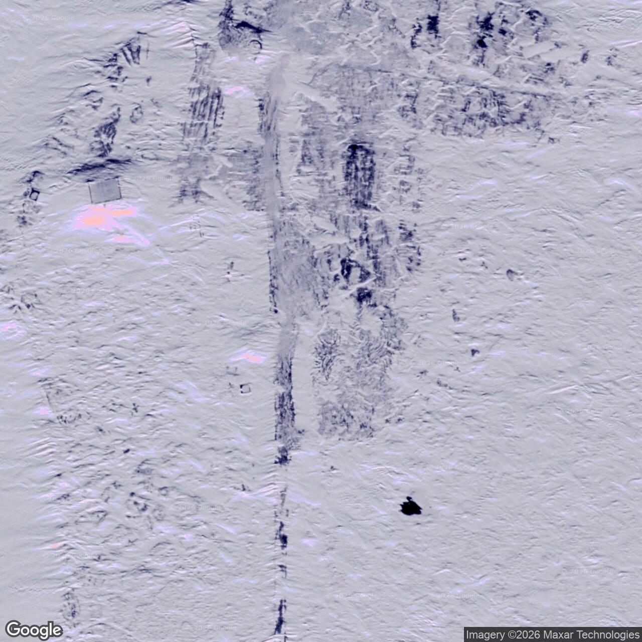
Air Defense Command ended BAR-A's radar mission on July 21, 1963 as part of the intermediate-station closure. The larger DEW Line continued operating. The former site later passed from Air Force to Navy control, then into other federal land administration. Most remaining structures were removed in 2000, while the gravel pad and airstrip remained visible. [1] [3] [5]
Chronology
- August 1953: Construction photographs show the landing strip, low module train and tall Doppler tower at Nuvagapak Point. [8]
- June 1956: An aerial photograph records the temporary construction camp beside the developing station. [8]
- August 1957: The operating Nuvagapak Point BAR-A station enters the DEW Line. [1] [2]
- July 21, 1963: Air Defense Command inactivates the AN/FPS-23 intermediate radar mission. [1]
- August 1965: The former Air Force property transfers to Navy control. [3]
- 2000: Remaining station structures are removed. [5]
Related Sites
- Demarcation Point early DEW Line test site
- Barter Island BAR-Main
- Komakuk Beach BAR-1
- AN/FPS-23 radar
- DEW Line station directory and DEW Line history
Information sources (8)
- PDFAerospace Defense Command, Historical Data of the Aerospace Defense Command, 1946-1973, DEW Line station table
Source for BAR-A Demarcation Bay, August 1957 opening, AN/FPS-23 equipment and July 21, 1963 inactivation.
- PDFDEW Line Coordinating Committee, Minutes and Progress Reports, 1955-63, compiled by P. Whitney Lackenbauer and Matthew Farish, 2019
Source for the planning names and the later BAR-A coordinate and Nuvagapak identity in the compiled site tables.
- WEBAlaska Department of Environmental Conservation, Nuvagapak Point DEW Line Station report, hazard ID 26499
Source for the operating-site location, buildings, tower, fuel facilities and federal transfers.
- PDFU.S. Army Corps of Engineers, The Cold War in Alaska: A Management Plan for Cultural Resources, 1994, Nuvagapak Point and Demarcation Point entries
Source for the two site inventories and surviving Nuvagapak camp structures.
- PDFU.S. Geological Survey, Historical Shoreline Change Analysis of the Alaska Beaufort Sea Coast, 2015
Source for the Nuvagapak identification, 1963 closure, structure removal and surviving gravel works.
- WEBU.S. Minerals Management Service, Beaufort Sea cultural resources inventory, 2003
Source identifying Demarcation Point and Beaufort Lagoon as distinct archaeological site records.
- PDFF. Robert Naka and William W. Ward, Distant-Early-Warning Line Radars: The Quest for Automatic Signal Detection, Lincoln Laboratory Journal, 2000
Source for the AN/FPS-23 Doppler gap-filler role in the DEW Line.
- WEBThe DEWLine, BAR-A site gallery, Markham Cheever construction photographs, 1953-56
Source for the documented construction camp, shoreline module train, landing strip and tall Doppler tower; photographs used as visual references only.