
Kogru River DEW Line Station, Alaska
A five-module camp and a Doppler tower guarded a low-altitude gap along Alaska's Arctic coast.
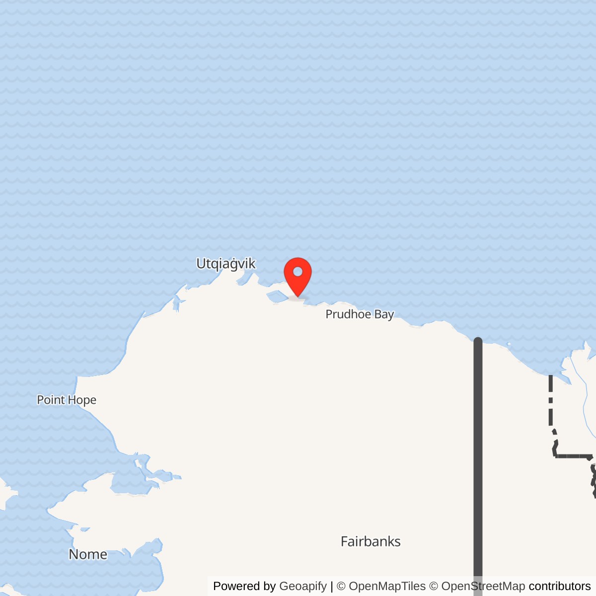
Longitude: -152.26
Site Number: POW-B
Current Role: Former DEW Line station in the National Petroleum Reserve in Alaska; major buildings and tower removed in 1995-1999.
Kogru River, code POW-B, was an intermediate station in the Point Barrow sector of the Distant Early Warning Line. Its AN/FPS-23 equipment helped detect aircraft crossing the low-altitude warning fence between larger radar stations. Kogru entered service in 1957 and its radar mission ended on July 21, 1963. [1] [3]
- DEW Line code
- POW-B.
- Station type
- Intermediate gap-filler station.
- Radar system
- AN/FPS-23 continuous-wave Doppler system.
- Operating period
- 1957 to July 21, 1963.
- Runway
- About 1,800 by 75 feet in a 1977 federal inventory.
- Location
- Kogru River area, North Slope, Alaska; approximately 70.576, -152.26.
Building POW-B
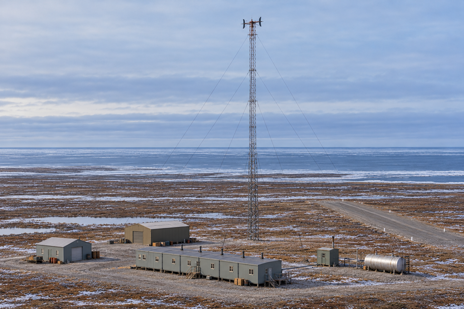
The DEW Line was designed to give North America warning of aircraft approaching across the Arctic. Its Point Barrow main station coordinated a sector that included auxiliary search-radar stations and smaller intermediate sites. Kogru stood on low coastal tundra between Point Lonely POW-1 and Oliktok Point POW-2. The intermediate station supplied an additional low-flying aircraft warning between those larger posts. [1] [3]
Construction was under way in 1956. Photographs from that summer show a temporary canvas construction shelter propped on oil drums above thawing ground and a Cessna being maneuvered on the new gravel strip. These views document the construction camp and aviation access before the permanent radar station opened. The finished station entered DEW Line service in 1957. [7] [1]
The Radar Mission
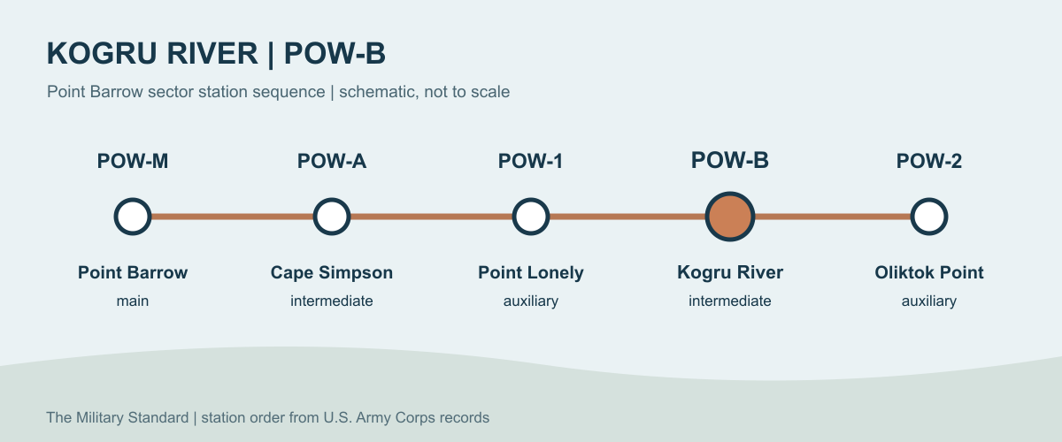
The AN/FPS-23, nicknamed Fluttar, used a continuous-wave Doppler signal to help detect aircraft moving across a low-altitude gap. Unlike the larger main and auxiliary sites, POW-B did not use a rotating long-range search radar in a radome. Its transmitter, receiving network, communications and electrical power all had to work together to pass an alert to the next stage of the DEW Line. [1] [3] [4]
Kogru was one of four intermediate stations associated with the Point Barrow sector, along with Cape Simpson, Point McIntyre and Brownlow Point. Point Lonely and Oliktok were auxiliary stations with a different scale of radar and support facilities. The intermediate posts filled spaces between the larger stations rather than replacing their search radars. [1] [3]
The Station and Airstrip
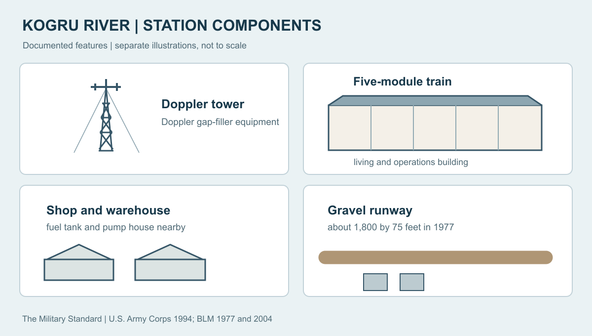
A federal site account describes one five-module operations and living building, support facilities, Doppler radar equipment and a runway. The connected modules concentrated the working and domestic parts of POW-B in a compact structure. A later site inventory identifies a separate shop, warehouse, fuel tank and pump house, and a radio tower. These buildings and systems allowed a remote crew to keep the transmitter running and to store equipment, provisions and fuel. [5] [9]
The 1977 Bureau of Land Management inventory recorded a gravel runway approximately 1,800 feet long and 75 feet wide. It placed the former station in the National Petroleum Reserve in Alaska. Aircraft access was essential to construction, crew changes, food, mail and parts at a post with no road connection to the outside. The runway also gave the closed station a later role as a field staging point. [2] [1]
Life at Kogru
Intermediate DEW Line stations were small, isolated camps. A typical complement was about four or five people, including electronics, mechanical and cooking staff. That figure describes the station class rather than a surviving Kogru roster. The five-module train gave its crew a common enclosed place to operate the radar, run generators, prepare meals, sleep and store water and supplies. [6]
At a typical intermediate site, one module housed three generators and another held Doppler transmitters and VHF radio equipment. The remaining modules contained dining, sleeping, water and fuel storage, and associated machinery. Crew members had to tend the radar and power plant while keeping the camp heated and the runway usable in severe weather. Flights provided the connection to the larger sector network and brought people and supplies to an otherwise roadless station. [6] [2]
Closure and Later Use
The Air Force inactivated the AN/FPS-23 intermediate network on July 21, 1963. Kogru's short radar mission ended, while the larger Point Barrow sector stations followed their own operational paths. By the time of the Corps' early 1990s review, Kogru was abandoned as a military station, but its airfield was still serviceable. Oil exploration and scientific field crews used the location as a staging area and occasionally took emergency shelter in the remaining buildings. [1] [3]
Federal cleanup work between 1995 and 1999 removed the former operations and living building, shop, warehouse, radar tower, fuel tank and pump house. The site is therefore much less intact today than it was when the Corps recorded the surviving buildings. Its history remains the story of a small crew and a compact radar camp filling one low-altitude gap in the Arctic warning line. [5] [8]
Chronology
- 1956: Construction photographs show a temporary shelter supported on drums and a Cessna on the gravel strip. [7]
- 1957: Kogru POW-B enters DEW Line service as an AN/FPS-23 intermediate station. [1]
- July 21, 1963: The intermediate radar mission ends. [1] [3]
- 1977: A federal inventory lists a gravel runway approximately 1,800 by 75 feet. [2]
- Early 1990s: The Corps records surviving operations and warehouse buildings and continuing emergency use by field crews. [1]
- 1995 to 1999: Removal work takes down the remaining major buildings, tower and fuel facilities. [5]
Related Sites
- Point Barrow POW-Main, sector main station
- Point Lonely POW-1, neighboring auxiliary station
- Oliktok Point POW-2, neighboring auxiliary station
- Cape Simpson POW-A, another intermediate station
- AN/FPS-23 gap-filler radar
- DEW Line station directory and DEW Line history
Information sources (9)
- PDFU.S. Army Corps of Engineers, The Cold War in Alaska: A Management Plan for Cultural Resources, 1994, pp. 187, 201-202
Source for POW-B identity, AN/FPS-23, service and closure dates, remaining structures, runway use and post-closure occupation by field crews.
- PDFBureau of Land Management, Baseline Studies of the Physical and Manmade Environment: The Beaufort Sea Region, December 1, 1977, p. 70
Source for the former Kogru POW-B gravel runway dimensions, administrative acreage and setting in the petroleum reserve.
- PDFAir Defense Command, A History of the DEW Line, 1946-1964, Historical Study No. 31, 1965
Source for sector organization, the intermediate-station mission and July 21, 1963 network inactivation.
- WEBMIT Lincoln Laboratory, SAGE: Semi-Automatic Ground Environment Air Defense System, DEW Line development section
Source for the AN/FPS-23 continuous-wave Doppler low-altitude gap-filler concept.
- PDFBureau of Land Management, Alpine Satellite Development Plan Draft Environmental Impact Statement, Volume 1, January 2004, Kogru site section
Source for the five-module building, support facilities, Doppler equipment, runway and 1995 to 1999 removal of structures.
- WEBDEWLineAdventures, Aux and Intermediate Site Layout
Source for the typical intermediate station crew, five-module arrangement, power equipment, radio equipment and living facilities.
- WEBDEWLineAdventures, Site POW-B: Kogru River, 1956 construction photographs
Source for the temporary canvas shelter on drums and a Cessna on the Kogru gravel strip in June 1956.
- WEBAlaska Department of Environmental Conservation, Kogru River Formerly Used Defense Site record
Source for the location, former military site and later building removal and cleanup history.
- PDFU.S. Army Corps of Engineers, Kogru River DEW Line Main Cantonment No Department of Defense Action Indicated Report
Source for the original composite building, shop, warehouse, radio tower, fuel storage, pump house and approximate station position.