
Point McIntyre DEW Line Station, Alaska
Three people could live and work inside this small Arctic radar post, with an airstrip and a few support buildings connecting it to the wider DEW Line.
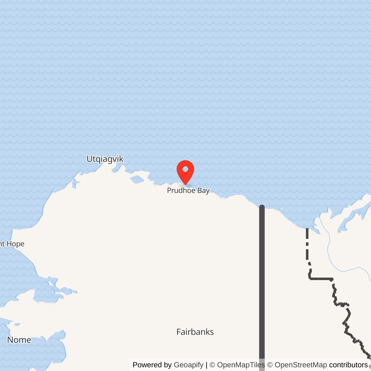
Longitude: -148.679167
Site Number: POW-C
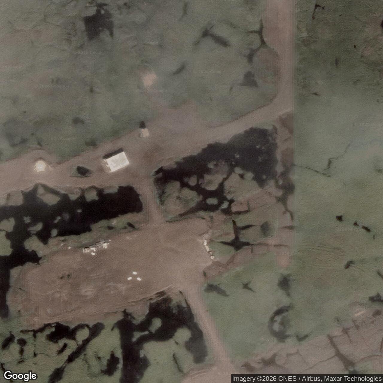
Current Role: Former DEW Line station; Navy-managed property with airstrip and gravel surfaces, buildings removed in 2004.
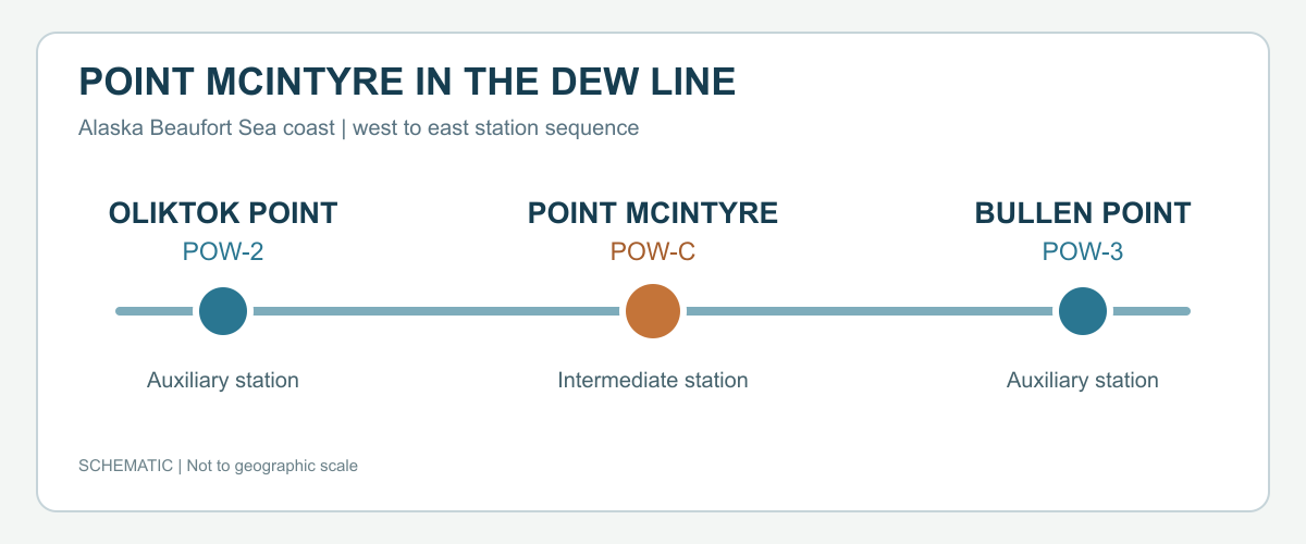
Point McIntyre, code POW-C, was an intermediate station on Alaska's Beaufort Sea coast in the Point Barrow sector of the Distant Early Warning Line. Its AN/FPS-23 gap-filler system watched for low-flying aircraft between larger radar stations. The Air Defense Command recorded manual operations beginning in August 1957 and inactivation on July 21, 1963. [1] [2]
- DEW Line code
- POW-C.
- Station type
- Intermediate gap-filler radar station.
- Radar
- AN/FPS-23 continuous-wave Doppler system.
- Operations
- August 1957 to July 21, 1963.
- Accommodation
- Living space for three people in the operations building.
- Airstrip
- Gravel, approximately 1,636 by 70 feet in a 1977 federal inventory.
- Location
- Near Point McIntyre on the Beaufort Sea coast; approximate site coordinate 70.403333, -148.679167.
Building POW-C
The Air Force placed Point McIntyre along a remote, flat stretch of coast northwest of today's Deadhorse Airport. An airstrip was built in 1955 to serve the construction and operation of the station. The finished post was part of the original northern warning chain, with Oliktok Point POW-2 to the west and the Bullen Point area to the east. Point McIntyre added a low-altitude detection segment between the larger sites. [1] [2] [7]
Builders laid a gravel pad about five feet thick over the permafrost before erecting the station. This raised platform held the operational camp above the wet tundra. The Corps later described the site as roughly 12 miles north of Deadhorse Airport on the Beaufort Sea coast. [1]
The Warning Mission
POW-C operated an AN/FPS-23 continuous-wave Doppler system, often called Fluttar. The equipment was intended to detect aircraft crossing a low-altitude gap between the search radars at larger DEW Line stations. Its fixed antenna and associated electronics served a different role from a rotating long-range radar under a radome. [2] [4]
An alert from a gap-filler post mattered only if it could reach the larger warning network. The Point McIntyre operations building combined the radar-related communications equipment with on-site electrical generation. The three-person accommodation placed the crew beside the machinery they had to keep operating through Arctic weather. [1] [4]
Buildings and Airstrip
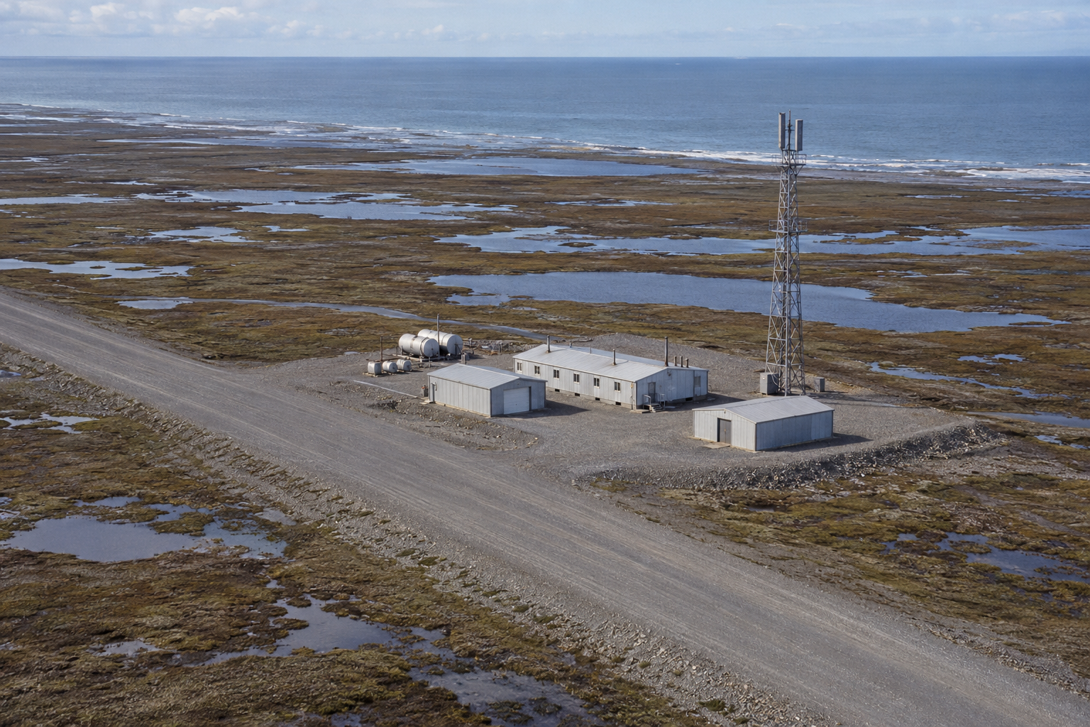
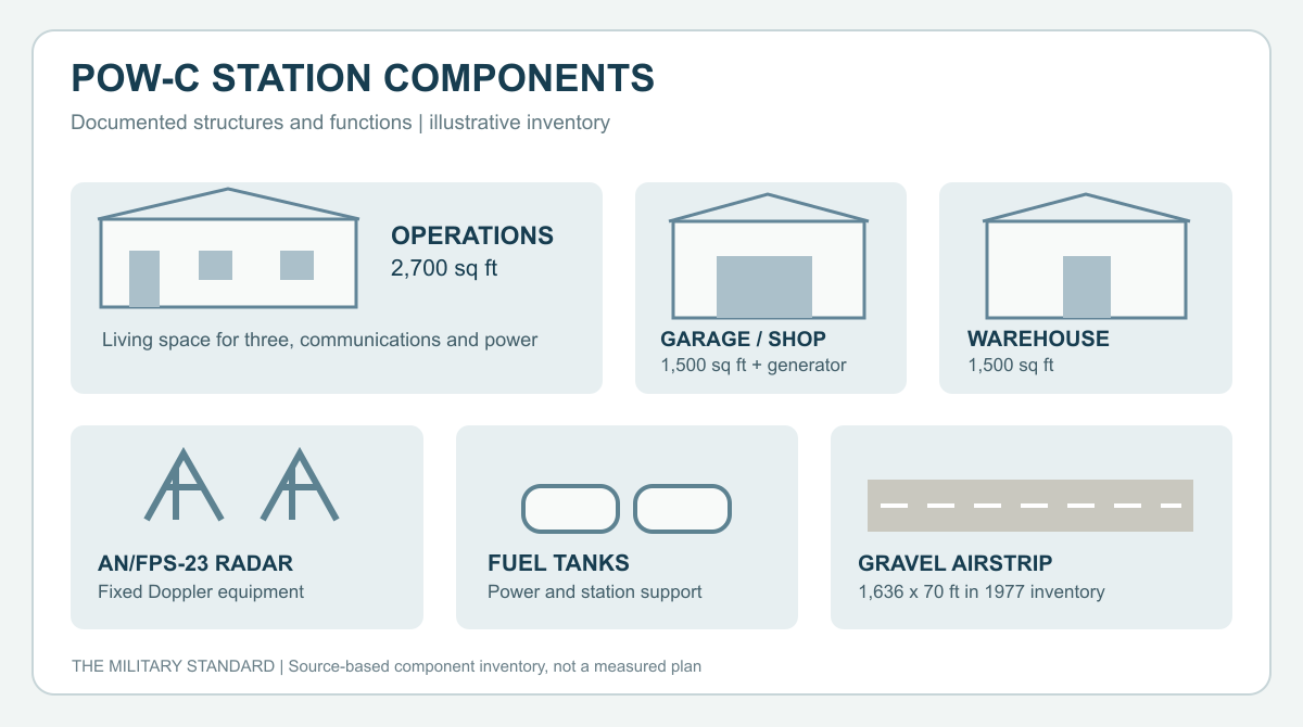
The Corps recorded a 2,700-square-foot operations building with living quarters for three, communications facilities and power-generation equipment. A separate 1,500-square-foot garage and shop had another generator. A 1,500-square-foot warehouse, fuel tanks and the airstrip completed the listed installation. These spaces supported both the radar mission and the routine work of maintaining vehicles, power and supplies at an isolated post. [1]
A 1977 federal inventory described the gravel airstrip as approximately 1,636 feet long and 70 feet wide, with no runway lighting or navigational aids. It also counted three small, deactivated DEW Line buildings. Aircraft had provided the practical connection for construction, deliveries, repairs and crew travel; the strip still mattered after the radar stopped. [3] [1]
Life at Point McIntyre
Point McIntyre's operations building had room for three residents. Their living quarters shared the station with the communications and power equipment, so daily life took place close to the working radar. The separate shop and warehouse held the tools, parts and stores needed to keep the site supplied. Fuel tanks fed the generators and other station needs. [1]
The setting imposed its own routine. The crew lived on a raised gravel pad amid permafrost and wet tundra, with the sea nearby and a short, unlit strip for air access. Keeping electrical power, heating, communications and equipment serviceable was part of maintaining the warning mission. Aircraft brought people, parts and supplies to the remote station. [1] [3] [6]
After the Radar
On July 21, 1963, the Air Force inactivated the intermediate AN/FPS-23 stations, including POW-C. The Point McIntyre property passed to the Navy in 1965 for an Arctic research role. Later, seismic and biological field parties used the remaining buildings as a seasonal base and staging point. Navy activity at the site ended around 1980. [1] [2] [6]
The Navy removed the former buildings and other debris in 2004. Coastal erosion later drove a separate landfill remedy, with waste moved to a new inland cell in 2013 and 2014. The former radar camp has gone, but its gravel surfaces and airstrip trace the brief period when a three-person station helped guard an Arctic gap. [5] [6]
Chronology
- 1955: An airstrip is built to support the Point McIntyre DEW Line station. [7]
- August 1957: POW-C begins manual operations with AN/FPS-23 equipment. [2]
- July 21, 1963: The intermediate radar mission is inactivated. [1] [2]
- 1965: The former Air Force property transfers to the Navy for Arctic research use. [1] [5]
- 1977: A federal inventory records three deactivated station buildings and an unlit gravel airstrip. [3]
- Circa 1980: The Navy's active use of Point McIntyre ends. [6]
- 2004: The Navy removes the remaining station buildings and known contaminated soil. [5]
Related Sites
- Point Barrow POW-Main, sector main station
- Oliktok Point POW-2, neighboring auxiliary station
- Bullen Point POW-3, next auxiliary station to the east
- Kogru River POW-B, another intermediate station
- AN/FPS-23 gap-filler radar
- DEW Line station directory and DEW Line history
Information sources (7)
- PDFU.S. Army Corps of Engineers, The Cold War in Alaska: A Management Plan for Cultural Resources, 1994, p. 203
Source for the POW-C identity, 1963 inactivation, gravel pad, three-person operations building, shop, warehouse, fuel tanks, airstrip and later field use.
- PDFAerospace Defense Command, Historical Data of the Aerospace Defense Command, 1946-1973, DEW Line station table
Source for POW-C manual operations in August 1957, AN/FPS-23 equipment, July 21, 1963 inactivation and the coastal station sequence.
- PDFBureau of Land Management, Baseline Studies of the Physical and Manmade Environment: Beaufort Sea Region, 1977, p. 69
Source for the Point McIntyre airstrip dimensions, lack of lighting and navigational aids, and three deactivated station buildings in 1977.
- PDFF. Robert Naka and William W. Ward, Distant-Early-Warning Line Radars: The Quest for Automatic Signal Detection, Lincoln Laboratory Journal, 2000
Source for the AN/FPS-23 continuous-wave Doppler low-altitude gap-filler design and fixed-antenna role.
- WEBAlaska Department of Environmental Conservation, Point McIntyre / DERP site report, hazard ID 1717
Source for the approximate coordinate, 1965 Navy transfer, 2004 building removal and later landfill remedy.
- PDFU.S. Navy, Integrated Natural Resources Management Plan: Northern Alaska Sites, August 2021
Source for the Navy's later management of Point McIntyre, the end of active Navy use around 1980, and its former airstrip and gravel surfaces.
- WEBCoastView, Point McIntyre, Stefansson Sound, August 24, 2026
Source for the 1955 airstrip construction date and Point McIntyre coastal setting.