
Atkinson Point DEW Line Station, Canada
A four-person-scale Doppler warning post on the Beaufort coast, BAR-D filled the gap between Tuktoyaktuk and Nicholson Peninsula from 1957 to 1963.
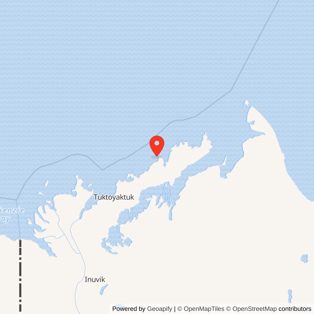
Longitude: -131.45
Site Number: BAR-D
Current Role: Former radar site.
Atkinson Point, code BAR-D, was a small intermediate station in the Distant Early Warning Line on the western Arctic coast of the Northwest Territories. Its AN/FPS-23 Doppler equipment watched the low-altitude gap between the larger radar stations at Tuktoyaktuk and Nicholson Peninsula. Air Defense Command records manual operation beginning in August 1957 and inactivation on July 21, 1963. [1] [2]
- DEW Line code
- BAR-D
- Historic role
- Intermediate low-altitude gap-warning station
- Radar equipment
- AN/FPS-23
- Manual operation
- August 1957
- Inactivated
- July 21, 1963
- Approximate location
- 69.9500, -131.4500
Building a Post at Atkinson Point
The station stood near McKinley Bay, about 80 kilometres northeast of Tuktoyaktuk. Construction in 1957 placed a warning post on open, low tundra where the DEW Line crossed the Beaufort coast. Atkinson Point was also a traditional stopover for Inuvialuit hunters traveling toward Baillie Island and open water, and for people hunting birds and caribou on land. [5]
The intermediate stations followed a compact design: five connected prefabricated modules formed a heated work and living train raised above the ground. A separate garage provided backup power, emergency communications and shelter if the main building failed. Fuel storage and an aircraft landing strip supported the remote post. These are network design features; the surviving Atkinson aerial dates from a later period of reuse. [3] [4] [5]
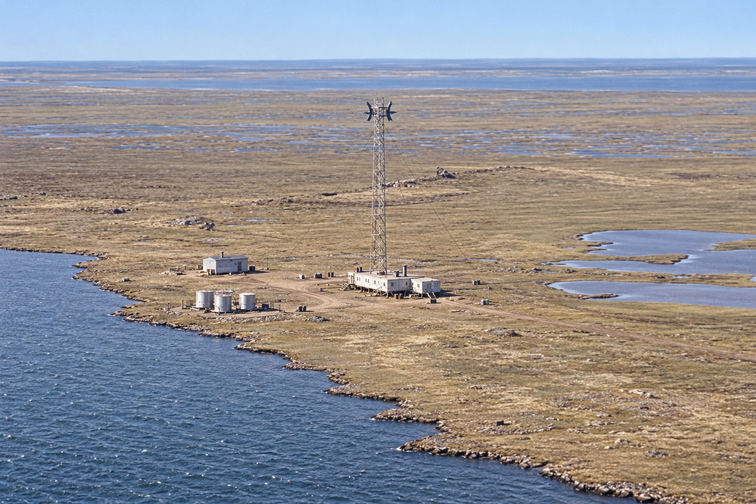
The 2008 Canadian government publication shows the former compound between coastal water and shallow tundra ponds. Buildings, tanks and tracks occupied a narrow strip of ground. Research and industrial uses followed the military closure, so the pictured structures do not all represent the station as built in 1957. [5] [6]
The AN/FPS-23 Warning Mission
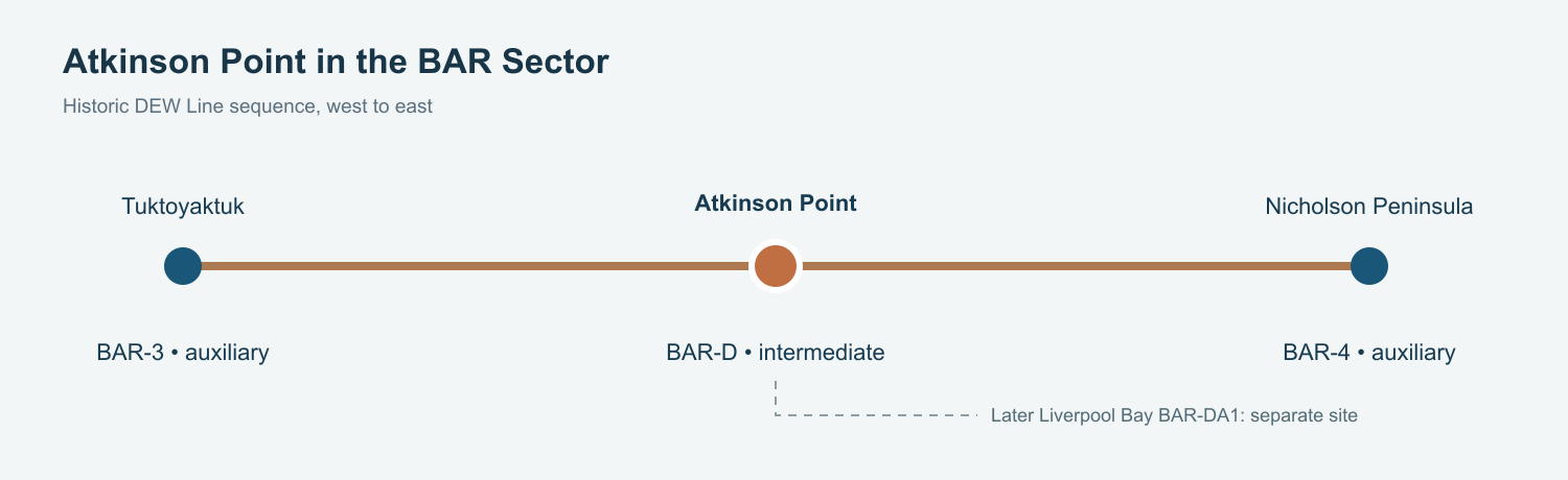
BAR-D filled a gap between Tuktoyaktuk BAR-3 to the west and Nicholson Peninsula BAR-4 to the east. Unlike those auxiliary posts, Atkinson did not carry a broad rotating search radar. Its AN/FPS-23 system used continuous-wave Doppler transmitters aimed along the line toward receivers at adjacent larger stations. An aircraft crossing a beam could trigger a warning even when low flight made it harder for the larger search radars to see. [1] [2] [4]
The station belonged to the Barter Island sector. Local personnel kept the transmitters, power plant, heat and communications running, while the neighboring auxiliary stations and sector main post supplied the wider reporting and support chain. The equipment mattered as part of that chain: a warning from BAR-D had to reach the next station in time to be useful. [2] [3] [4]
Crew and Daily Life
An intermediate post usually had a small civilian contractor crew: a radar technician, an inside mechanic, an outside mechanic and a cook, with one also serving as station chief. Some posts varied from that pattern. No station-specific Atkinson roster has been found, so the standard complement describes the scale of life there rather than an exact BAR-D headcount. [4]
The crew shared a short heated building train and had to keep diesel power, equipment and food service available through Arctic weather. The separate garage was a survival reserve with its own generator and emergency transmitter. Air deliveries and the short summer season shaped supply and maintenance work. The small crew had fewer facilities and less specialist help on site than the neighboring auxiliary stations. [3] [4]
The compact compound and isolation made reliability a daily concern. Snow, cold and equipment failures could turn routine work into a station-wide task. The connected modules reduced exposure during ordinary shifts, while raising the buildings above the tundra helped control drifting snow and protect the frozen ground beneath. [3] [4]
Closure and Later Use
The intermediate warning posts were withdrawn in 1963. Air Defense Command gives July 21 of that year as Atkinson Point's inactivation date. The Canadian defense chronology lists no North Warning System successor at BAR-D; the later Liverpool Bay BAR-DA1 radar occupies a separate location. [1] [2] [3]
The land returned to Canadian administration in 1965. Former station buildings subsequently supported scientific work and reindeer herding. A Parks Canada study reported the structures still present and in good condition in 1986. Canadian site work in 2007 included demolition of buildings and tanks. The military post was gone, but the headland continued to be used and remembered. [3] [5] [6]
Chronology
- 1957: The Atkinson Point intermediate station is constructed near McKinley Bay. [5]
- August 1957: BAR-D begins manual operation with AN/FPS-23 Doppler equipment. [1]
- July 21, 1963: Air Defense Command records BAR-D inactivation. [1]
- 1965: The former station land returns to Canadian administration. [5] [6]
- 1986: A later survey finds Atkinson buildings still present and in use for reindeer and scientific work. [3]
- 2007: Canadian cleanup work includes demolition of buildings and tanks. [5]
Related Sites
Information sources (6)
- PDFAerospace Defense Command, Historical Data of the Aerospace Defense Command, 1946-1973, DEW Line station table
BAR-D entry identifies Atkinson Point, AN/FPS-23, August 1957 manual operation and July 21, 1963 inactivation.
- PDFDefence Research and Development Canada, DEW Line and North Warning System site chronology, CR 2012-076, BAR-sector table
Lists BAR-D as an intermediate station, its approximate coordinate and 1963 ending; separately identifies BAR-DA1 Liverpool Bay.
- PDFDavid Neufeld, BAR-1 Distant Early Warning Auxiliary Station, Parks Canada historical study, pp. 9 and 23
Describes the standard five-module intermediate-station design, raised buildings, separate survival garage, 1963 intermediate-site closures and Atkinson Point reuse by 1986.
- WEBThe DEWLine, A Brief Introduction, intermediate-site organization and staffing
Veteran account of paired east-west Doppler transmitters, small contractor crews, separate garage, emergency equipment and air supply across intermediate stations.
- PDFIndian and Northern Affairs Canada, Inuvialuit Settlement Region newsletter, Winter 2008, Atkinson Point Remediation
Places BAR-D near McKinley Bay, states construction in 1957 and operation to 1963, and includes an aerial of the later compound and an account of traditional Inuvialuit use.
- PDFIndian and Northern Affairs Canada, Contaminated Site Remediation, 2007, Atkinson Point account
Records 1965 transfer, later scientific and reindeer use, and early site work; used only for the brief post-military epilogue.