
Nicholson Peninsula DEW Line Station, Canada
BAR-4 watched the Beaufort coast for 36 years, from a raised radar compound supplied by air and a daily water haul to a new short-range warning post.
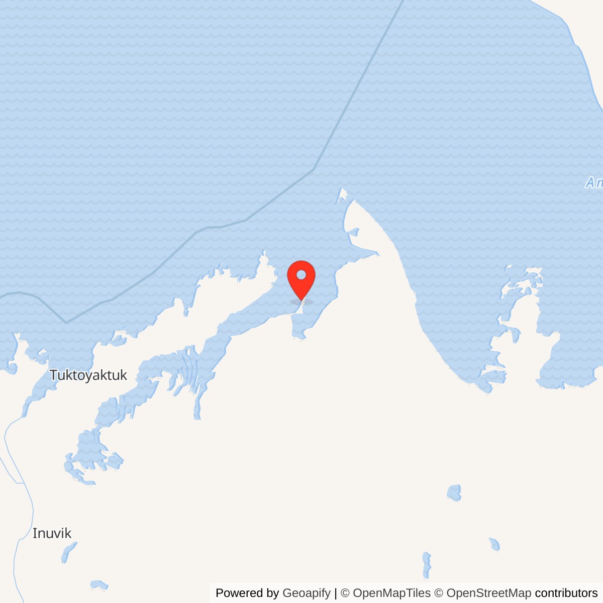
Longitude: -128.970278
Site Number: BAR-4
Current Role: North Warning System short-range radar site (2012 chronology).
Nicholson Peninsula, code BAR-4, was an auxiliary station on the Canadian section of the Distant Early Warning Line. The station began manual operation in August 1957 with AN/FPS-19 long-range search radar and AN/FPS-23 Doppler gap-warning equipment. Its isolated crews kept the radar, communications and power systems working until DEW Line operation ended on September 9, 1993. [1] [2]
- DEW Line code
- BAR-4
- Historic role
- Auxiliary aircraft-warning station
- Radar equipment
- AN/FPS-19; AN/FPS-23
- Manual operation
- August 1957
- DEW operation ended
- September 9, 1993
- North Warning System
- Short-range site established October 1990
- Approximate location
- 69.927222, -128.970278
Choosing the Peninsula
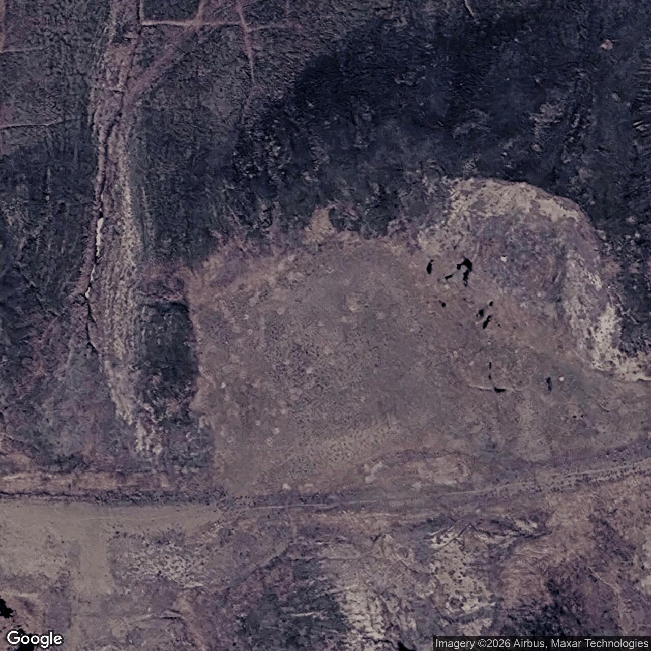
The station occupied high ground on a narrow peninsula projecting northwest into the Beaufort Sea. A historical station description places the main site about 275 feet above sea level on a 2,803-acre tract. The airstrip lay lower on a spit, while cliffs rose along the western shore. That separation shaped nearly every delivery and maintenance trip between aircraft and radar compound. [3]
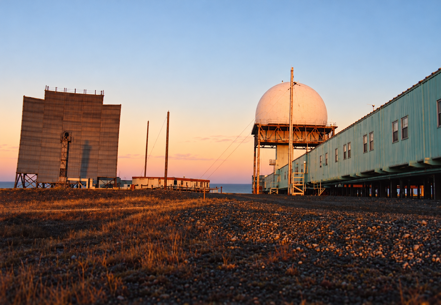
Cold, wind, drifting snow and the short shipping season were normal operating conditions. The station description records a two-mile round-trip haul for potable water in both summer and winter. An airstrip, road, storage areas and fuel reserve made the remote warning post possible, but the crew still had to move essential supplies over exposed ground. [3] [4]
Buildings and Support Facilities
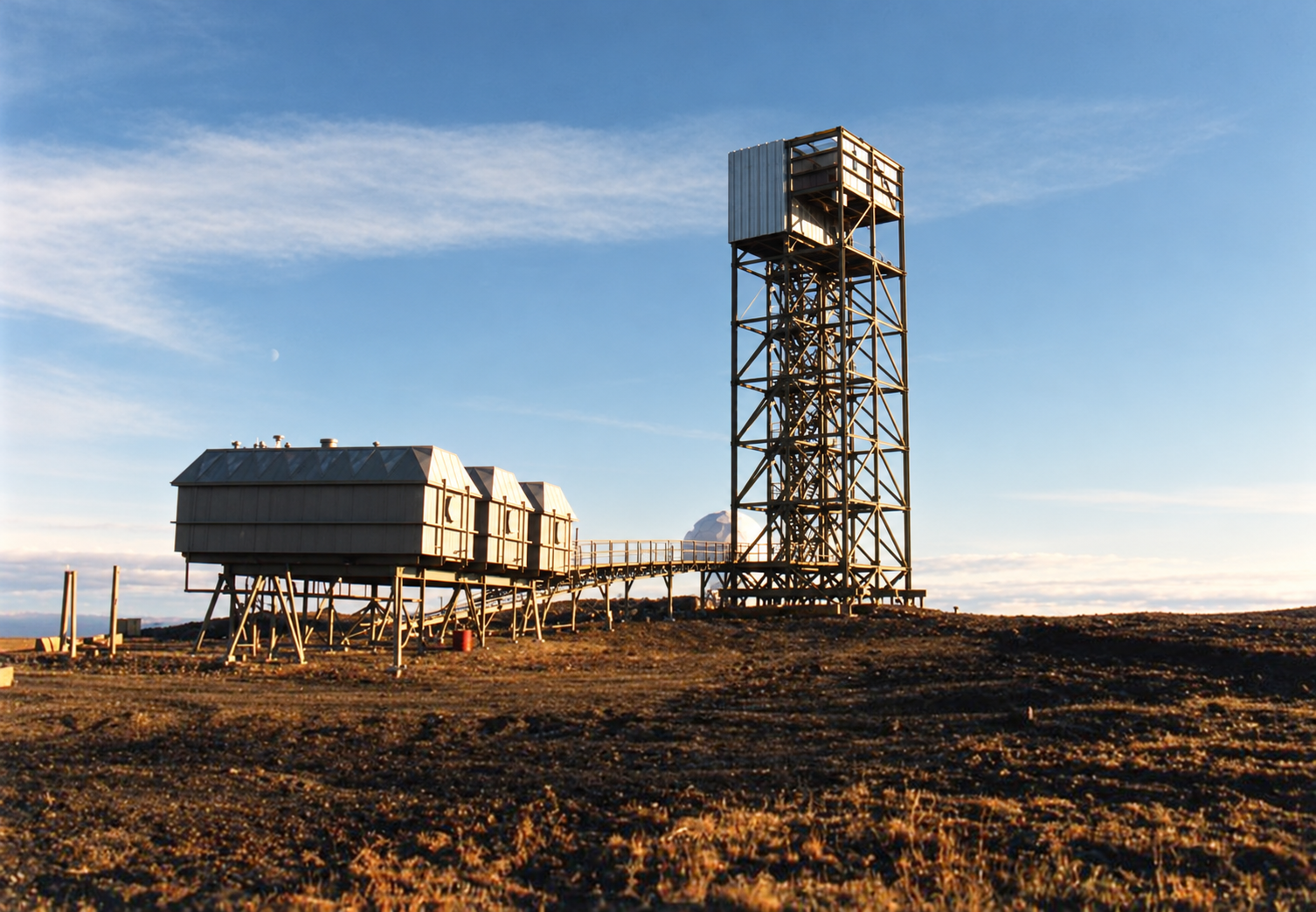
The raised building train stood near two warehouses, a garage and a storage pad. Two 65,000-gallon diesel tanks stood beside the main compound. A road ran away from the buildings toward the beach and airstrip, with power and POL lines following the route. BAR-4 also had a radio shack, beacons, separate housing and a waste-disposal area. [4]
The station used separate summer and winter water sources. Their distance from the compound helps explain why water hauling remained a scheduled station job. The diesel reserve supported generators, heat and radar operation during periods when coastal weather or ice prevented routine resupply. [3] [4]
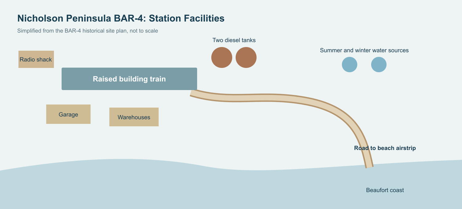
The AN/FPS-19 radome stood above the ground near a large troposcatter billboard antenna and the long pale module train. The buildings combined living and technical functions in one heated complex, allowing personnel to move among work spaces without going outside for every shift. [3] [6]
Radar and Communications Mission
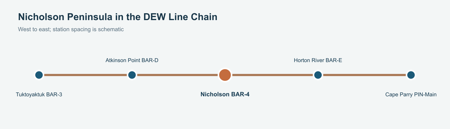
The AN/FPS-19 watched long-range aircraft approaches over the Arctic Ocean. The AN/FPS-23 formed part of the low-altitude warning network between larger radar sites. BAR-4 was one link in a chain that included Tuktoyaktuk BAR-3 to the west and Horton River BAR-E to the east; Cape Parry PIN-Main was the next main station beyond that stretch. [1] [2] [5]
Operators and technicians had to keep radar indications moving through the communications system so a contact could be compared and reported beyond the peninsula. The station photograph records a troposcatter billboard beside the radar, evidence of the large directional antennas used for long-distance links across the sparsely settled coast. [3] [5]
The DEW Line was a warning system, rather than a local fighter base. BAR-4 supplied detection and reporting. Aircraft interception depended on the wider North American air-defense network receiving usable warning in time. [1] [5]
People and Daily Life
Auxiliary stations commonly used civilian contractor crews with radar technicians, power and mechanical specialists, cooks and a supervisor. A typical auxiliary station housed roughly 20 to 25 people. A February 1987 Air Force photograph names R. Wapointe as Nicholson Peninsula station supervisor. [5] [7]
Radar watches, generator checks, cooking, communications maintenance, snow clearing and fuel and water handling divided the workday. The two-mile water haul was a concrete part of the routine at Nicholson. The raised module train gave the crew a connected indoor route through the central living and work spaces, but trips to the garage, tanks, aircraft and water sources still meant exposure to Arctic weather. [3] [4] [5] [6]
The airstrip on the lower spit linked the post to the outside world. Aircraft brought staff, mail, food and parts when weather permitted. The warehouses and tanks let the crew bridge long intervals between deliveries, and technical personnel had to repair failures on site when flights could not arrive. [3] [4] [5]
Transition to the North Warning System
A new North Warning System short-range radar site was established at Nicholson Peninsula in October 1990 while the older DEW station was still operating. A construction photograph shows a new 100-foot tower and raised equipment modules near the old radome. Satellite communications replaced the large troposcatter link as the radar network changed. [2] [3]
BAR-4 ended DEW Line operation on September 9, 1993. The later short-range site continued the warning mission with a much smaller on-site support footprint. National Defence described the Canadian North Warning System in 2023 as a network with 36 unattended short-range radar sites. [2] [8]
Chronology
- August 1957: Nicholson Peninsula begins manual operation with AN/FPS-19 and AN/FPS-23 equipment. [1]
- February 20, 1987: An Air Force photograph identifies R. Wapointe as the station supervisor. [7]
- October 1990: The Nicholson Peninsula North Warning System short-range site is established. [2] [3]
- September 9, 1993: DEW Line operation at BAR-4 ends. [2]
- 2023: Canadian National Defence continues to describe an unattended short-range radar network across the North. [8]
Related Sites
Information sources (8)
- PDFAerospace Defense Command, Historical Data of the Aerospace Defense Command, 1946-1973, DEW Line station table
Identifies Nicholson Peninsula BAR-4, August 1957 manual operation, AN/FPS-19 and AN/FPS-23.
- PDFDefence Research and Development Canada, Survey of COTS-MOTS Lighter than Air Platforms and Communication Relays, CR 2012-076, Annex B, p. 119, March 2013
Lists BAR-4 as a DEW auxiliary and North Warning System short-range radar site, approximate coordinates, October 1990 NWS date and September 9, 1993 DEW ending.
- WEBThe DEWLine, BAR-4 Nicholson Peninsula historical description and station photographs
Station-specific topography, airstrip, water haul, and historic views of the radome, troposcatter billboard and North Warning System construction.
- WEBThe DEWLine, DEW Line site plans, BAR-4 layout, courtesy Lynden T. Harris
Station plan identifies the building train, warehouses, garage, radio shack, beacons, housing, water sources, fuel tanks, access routes and airstrip.
- WEBThe DEWLine, A Brief Introduction, auxiliary-station organization and staffing
Veteran account of civilian crews, radar technicians, mechanics, cooks, radio links and remote-station routines; used for network context rather than an exact BAR-4 roster.
- PDFDavid Neufeld, BAR-1 Distant Early Warning Auxiliary Station, Parks Canada historical study
Documents the standard raised module-train design, utility and radar spaces, contractor life and DEW-to-NWS transition at a comparable auxiliary station.
- WEBU.S. National Archives, R. Wapointe, station supervisor at Nicholson Peninsula, February 20, 1987, photographed by Tech. Sgt. Donald L. Wetterman
Contemporary identification of a named Nicholson Peninsula station supervisor and its place in the U.S. Air Force controlled DEW network.
- WEBDepartment of National Defence Canada, Domestic and Continental Defence, May 2023
Describes the modern North Warning System as including 36 unattended short-range radar sites across northern Canada; provides system context, not a BAR-4 status confirmation.