
Tuktoyaktuk DEW Line Station, Canada
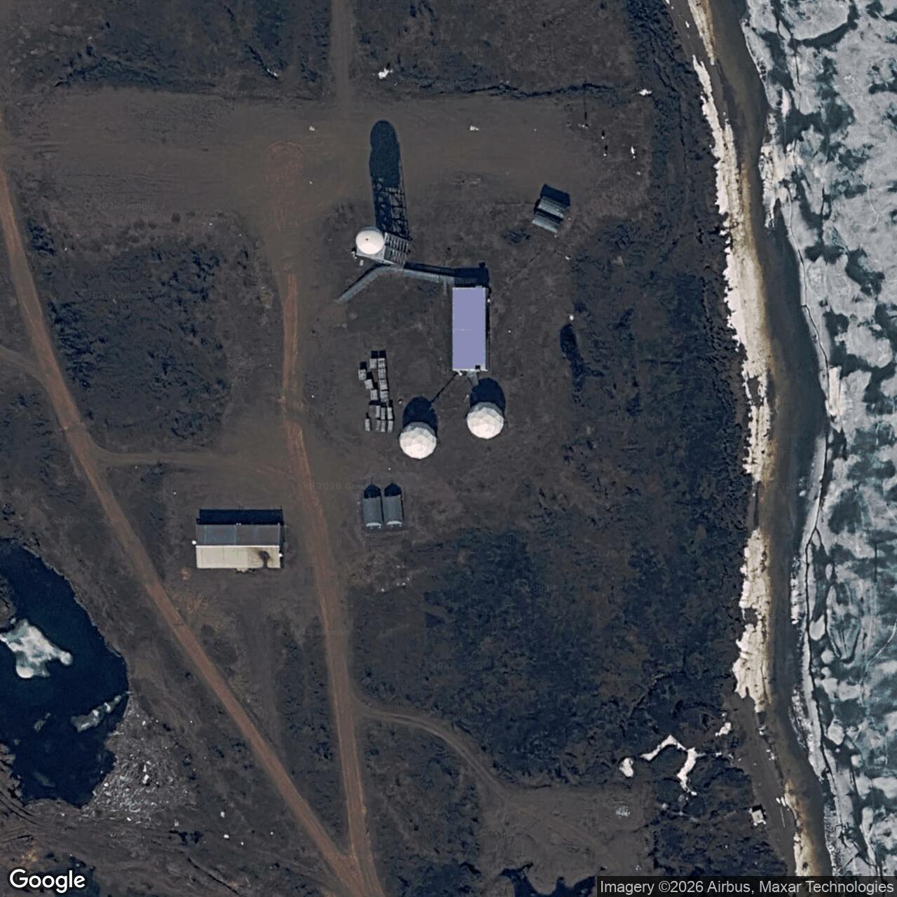
A manned Arctic warning station beside an Inuvialuit community, BAR-3 later became a North Warning System short-range radar site.
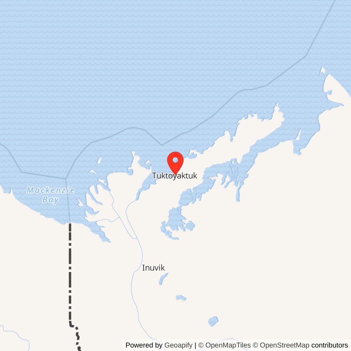
Longitude: -132.998611
Site Number: BAR-3
Current Role: North Warning System BAR-3 short-range radar site (documented 2025).
Tuktoyaktuk, code BAR-3, was an auxiliary radar station in the Distant Early Warning Line beside the Inuvialuit community on the Beaufort Sea. The U.S. Air Force built it for aircraft warning, and a civilian contractor operated the station. Air Defense Command records manual operation beginning in August 1957 with AN/FPS-19 search radar and AN/FPS-23 Doppler equipment. The manned DEW Line mission ended on September 13, 1993, while a newer North Warning System short-range radar continued at the site. [1] [2] [3] [4]
- DEW Line code
- BAR-3
- Historic role
- Auxiliary aircraft-warning radar station
- Historic equipment
- AN/FPS-124 North Warning System SRR
- Approximate location
- 69.4431, -132.9986
Building BAR-3 Beside Tuktoyaktuk
The station occupied a low peninsula beside Kugmallit Bay, close to the village and its protected harbour. Tuktoyaktuk was already an Inuvialuit settlement and trading centre when construction began in 1955. The DEW Line brought wage jobs to local residents, and many Inuvialuit who worked on the project settled in the community. [4] [5]
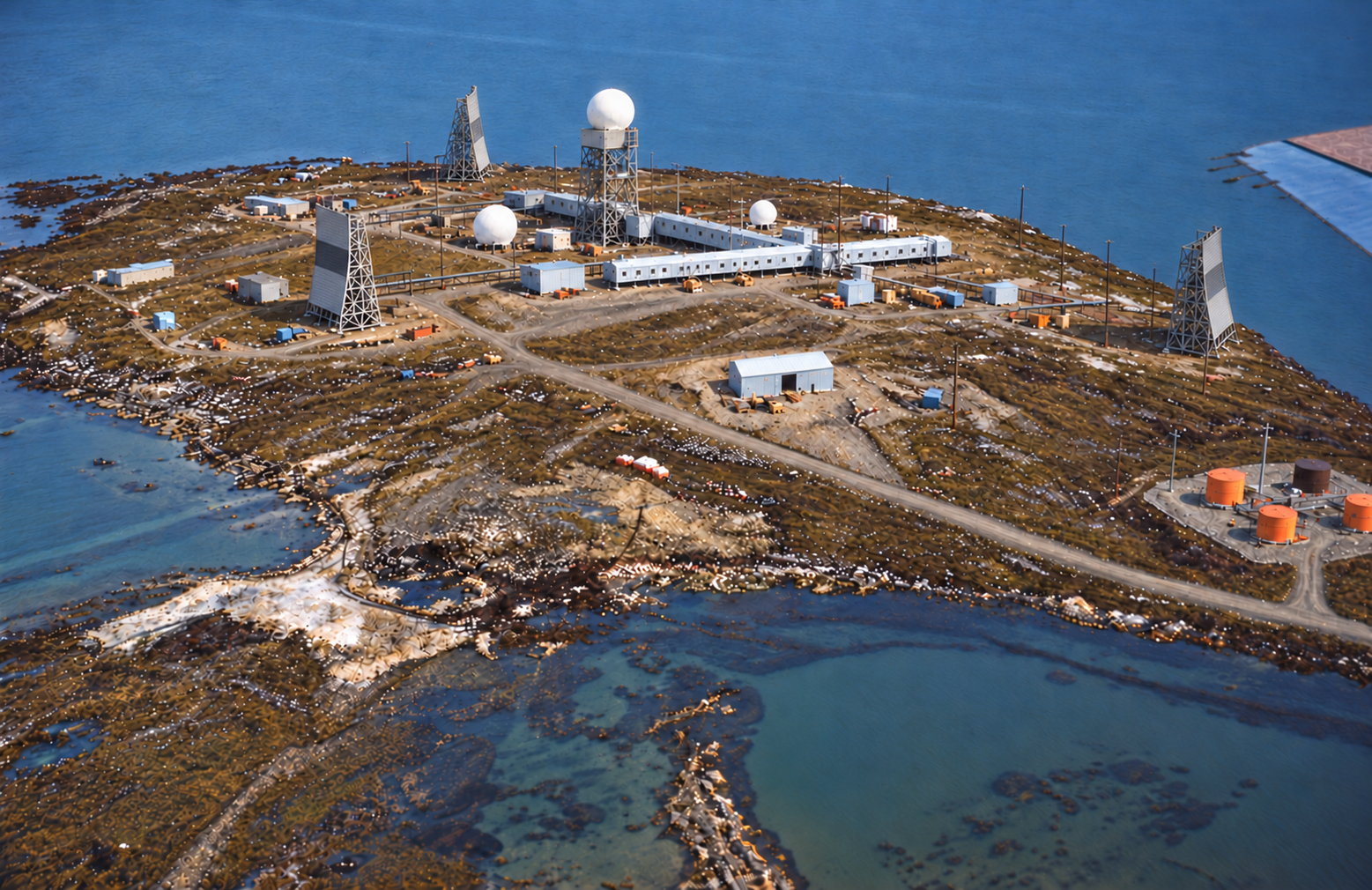
A July 1956 construction aerial shows the long connected module train, gravel roads, a separate utility building and fuel tanks on the peninsula. The station archive also records a nearby airstrip and an aircraft hangar under construction. Supplies could arrive through the harbour as well as by air; the historical station description notes that potable water had to be hauled to the compound. [4]
The connected modules sheltered radar work, accommodation and essential services from Arctic weather. A later station view shows the white radar dome, smaller domes and large reflector antennas rising above the low buildings. This was a larger and more capable installation than Tununuk Camp, the intermediate warning post immediately to its west. [1] [3] [4]
Radar and Communications Mission
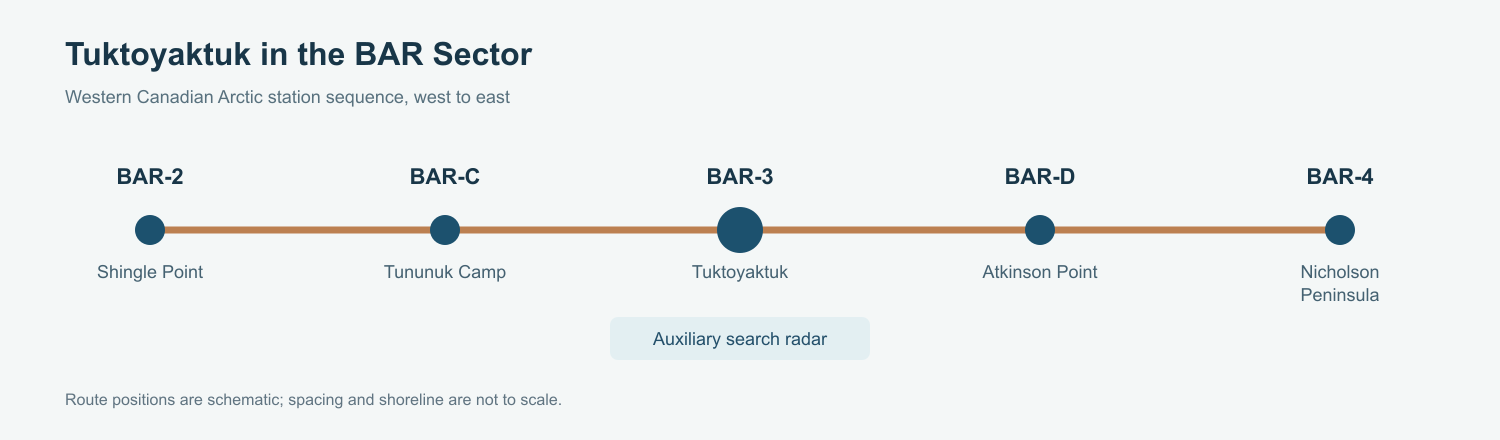
BAR-3 watched the northern air approaches as part of the Barter Island sector. Its AN/FPS-19 provided broad search coverage, while AN/FPS-23 equipment added low-altitude gap warning. Auxiliary stations reported to and drew support from their sector Main station. The chain running east from Shingle Point through Tununuk Camp to Tuktoyaktuk joined radar coverage with communications across the western Canadian Arctic. [1] [2] [3]
The site photographs show tall reflector antennas beside the radar complex. They were part of the communications system that moved reports and operating traffic between stations. Their several bearings reflect separate radio paths, while the central radome housed the search radar. A station worker called a radician, James Gray, appears in a BAR-3 photograph from the mid-1960s. [1] [4]
Radar watch was only one part of the job. Operators and technicians had to keep power, heating, communications, vehicles and the airstrip serviceable so the warning chain could function in every season. Auxiliaries were designed for roughly twenty civilian workers, with larger maintenance and supply support at their Main station. [3] [4]
People and Daily Life
BAR-3 stood beside a living community, so station employment and local life overlapped. The Prince of Wales Northern Heritage Centre records Inuvialuit work on the DEW Line and the resulting growth of Tuktoyaktuk. Construction photographs place the station, its airfield and harbour activity in the same coastal setting. [4] [5]
In 1991, visiting reporter William Claiborne met BAR-3 supervisor Rand L. Anthony, an ITT employee who had worked on the warning system since 1979. Anthony described long workweeks and off-duty time spent with a pool table, darts, books and computer games. Across the Canadian manned sites, contractor crews then averaged about 10 to 15 people per station. [6]
Before modernization, the network depended on regular winter air deliveries and summer ship or barge supply. The station airstrip and harbour access made those links visible at Tuktoyaktuk. Working and sleeping in the connected buildings reduced exposure to wind and cold, but it also concentrated work and leisure inside the same small compound. [3] [4] [6]
From the DEW Line to the North Warning System
North Warning System modernization placed a short-range radar at BAR-3 in September 1990. For a few years the new system overlapped the old manned station. The Canadian chronology gives September 13, 1993 as the end of DEW Line operations at Tuktoyaktuk. [2]
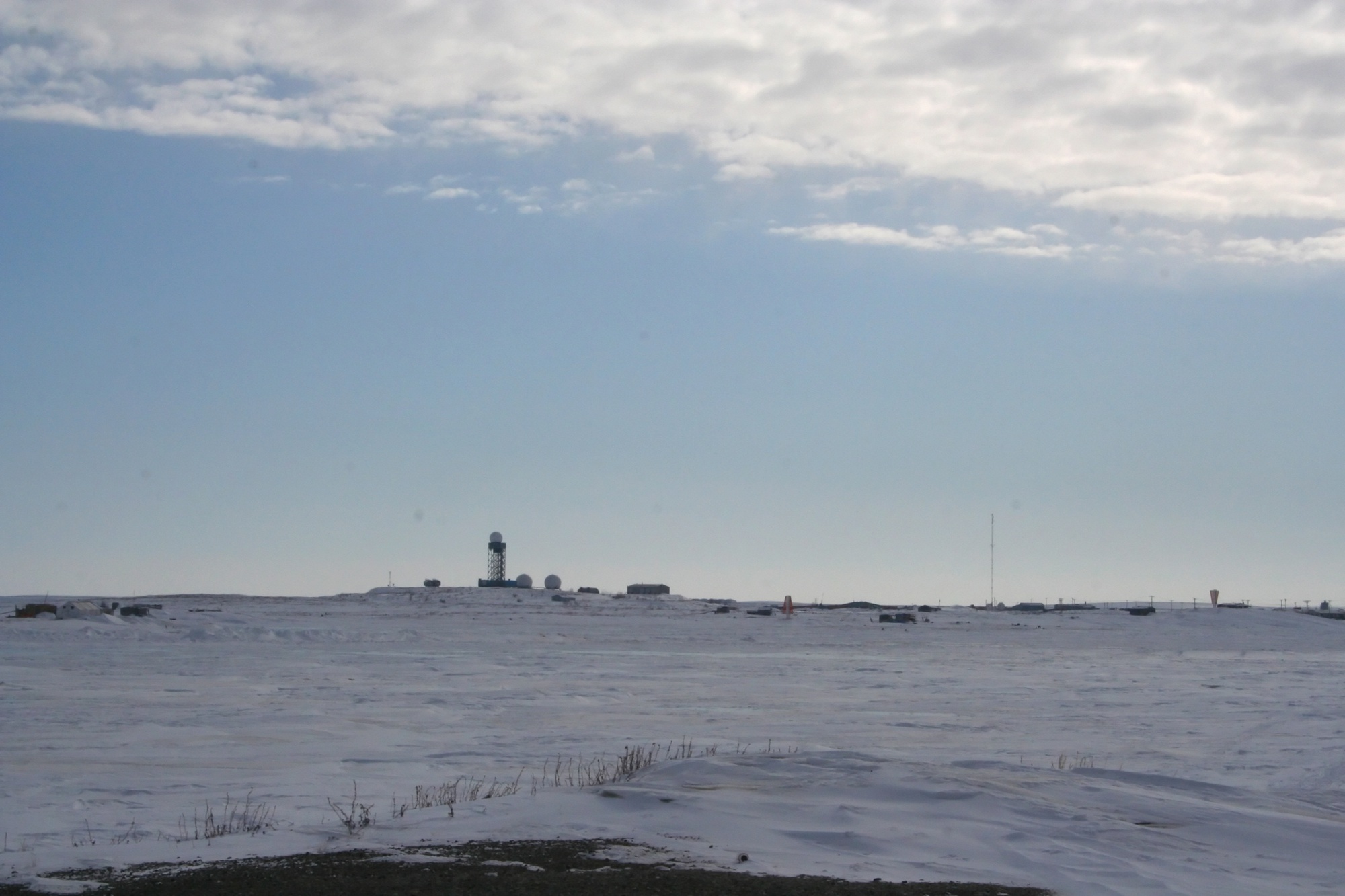
The modern site used AN/FPS-124 short-range radar equipment. A 2008 photograph records the later tower and radar structures on the horizon, and a 2025 North Warning System maintenance solicitation still identifies BAR-3 as an operating short-range radar location. The original connected DEW Line complex no longer defines the working site. [2] [6] [7] [8] [9]
Chronology
- 1955: Construction work begins near the established Inuvialuit community of Tuktoyaktuk. [5]
- July 1956: An aerial photograph shows the connected BAR-3 modules on the peninsula before the radar antennas and dome are complete. [4]
- August 1957: Air Defense Command records manual operation with AN/FPS-19 and AN/FPS-23 equipment. [1]
- Mid-1960s: A station photograph identifies James Gray as a BAR-3 radician. [4]
- September 1990: A North Warning System short-range radar is established at BAR-3. [2]
- July 1991: A contemporary report describes station supervisor Rand L. Anthony, contractor work and recreation at BAR-3. [6]
- September 13, 1993: The manned DEW Line operation at Tuktoyaktuk ends. [2]
- 2008: Ian Mackenzie photographs the later North Warning System radar structures. [7]
- 2025: A maintenance solicitation identifies BAR-3 as a North Warning System short-range radar site. [8]
Related Sites
Information sources (9)
- PDFAerospace Defense Command, Historical Data of the Aerospace Defense Command, 1946-1973, DEW Line station table
BAR-3 station entry gives Tuktoyaktuk, August 1957 manual operation and AN/FPS-19 and AN/FPS-23 equipment.
- PDFDefence Research and Development Canada, DEW Line and North Warning System site chronology, CR 2012-076, BAR sector table
Identifies BAR-3 as a DEW auxiliary and North Warning System short-range radar site; gives its coordinates, September 1990 NWS establishment and September 13, 1993 DEW ending.
- PDFDavid Neufeld, BAR-1 Distant Early Warning Auxiliary Station, Parks Canada historical study
Describes the DEW Line auxiliary-station design, about twenty civilian staff, the relationship to sector Main stations and the broader construction and support system.
- WEBThe DEWLine, BAR-3 Tuktoyaktuk station and photograph archive
Contains a historical site description and images of the 1956 module train, airstrip, completed radar and communications structures, hangar and named personnel.
- WEBPrince of Wales Northern Heritage Centre, Early Tuktoyaktuk
Documents the community before the DEW Line, the start of station work in 1955 and Inuvialuit employment and settlement associated with the project.
- WEBWilliam Claiborne, DEW Line Finally Giving Way to Detente, The Washington Post, July 6, 1991
Contemporary BAR-3 visit naming supervisor Rand L. Anthony and recording contractor staffing, work routines, recreation, supplies and the changeover to unattended radar.
- WEBIan Mackenzie, DEW line radar station at Tuktoyaktuk, April 6, 2008, Wikimedia Commons
Photograph of the later North Warning System installation; the original is licensed Creative Commons Attribution 2.0 and requires photographer credit, license link and disclosure of changes.
- WEBNasittuq Corporation, North Warning System Sleep Mode Replacement, solicitation NAS-NWS-RFSO-0001-2025
The 2025 notice identifies BAR-3 as a North Warning System short-range radar site receiving a sleep-mode replacement.
- WEBU.S. Air Force, AEWS AN/FPS-124 Radome Replacement, North Warning System site list, 2025
Federal procurement attachment names Tuktoyaktuk BAR-3 among AN/FPS-124 short-range radar locations and lists its tower height.