
Byron Bay DEW Line Station, Canada
A staffed search radar watched the Arctic sky from Victoria Island for 36 years.
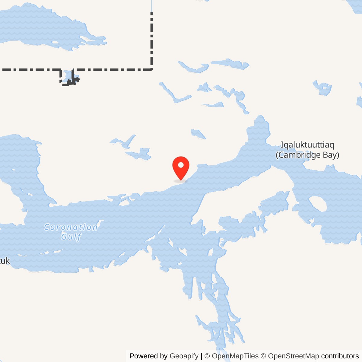
Longitude: -109.07
Site Number: PIN-4
Current Role: Former DEW Line station property; no North Warning System radar at this parcel.
On the south coast of Victoria Island, Byron Bay PIN-4 watched an Arctic approach between Ross Point PIN-D to the west and Cape Peel PIN-E to the east. It was an auxiliary station of the Distant Early Warning Line, a chain built to detect aircraft approaching North America from the north and to give air-defense forces time to respond. Unlike its small intermediate neighbors, Byron Bay held a staffed search radar as well as the receiving equipment for the low-altitude Doppler fence. [1] [3] [4]
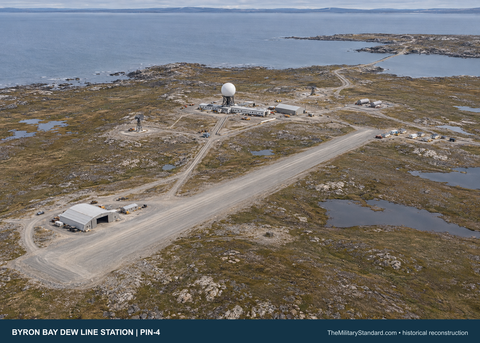
- DEW Line code
- PIN-4
- Role
- Auxiliary search-radar station
- Radar equipment
- AN/FPS-19; AN/FPS-23
- Operating period
- August 1957 to August 21, 1993
- Location
- Byron Bay, Victoria Island, Nunavut
Byron Bay and the Arctic Warning Chain
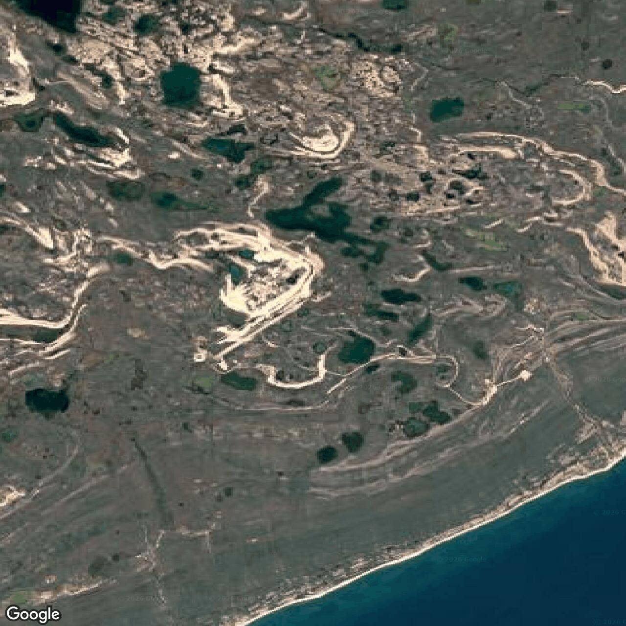
The station occupied a rocky outcrop about 350 feet above sea level near the meeting of Coronation Gulf and Dease Strait. The original station description assigned it a 5,800-acre area amid ponds, lakes, and wet ground. Elevation helped the radar see farther over the horizon, while the surrounding tundra made roads, foundations, water, and seasonal transport central to keeping the watch. [2]
Construction and Opening
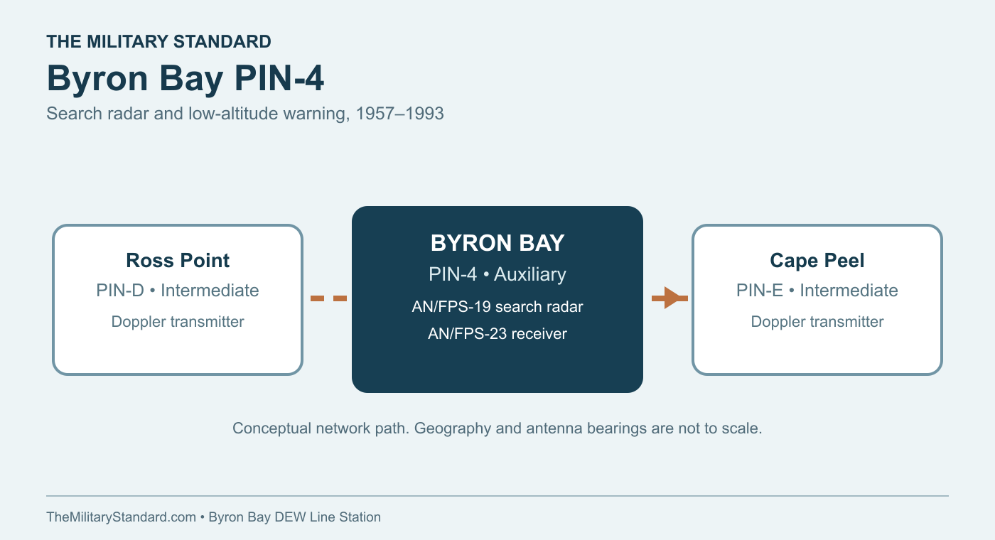
The DEW Line was a United States and Canadian undertaking organized through Western Electric. Builders had to assemble a complete settlement and its supply routes before operators could maintain a continuous radar watch. At Byron Bay, the site plan shows a building train and garage on the station outcrop, a nearby warehouse and fuel area, and a separate runway and hangar connected by roads and utility lines. A route also led toward the beach landing and fuel tanks. [2] [4]
Byron Bay had a gravel runway shown on the original plan as 5,300 by 110 feet, with 65-foot overruns and a hangar measuring 117 by 130 feet. The plan also identifies two 65,000-gallon diesel tanks, a separate rubber-tank fuel pad, a warehouse, drum storage, temporary housing and housing for Inuit employees. Air access was especially important when sea ice restricted shipping and urgent parts or personnel had to reach the post. [2]
The Aerospace Defense Command recorded the start of manual radar operations at PIN-4 in August 1957, shortly after the continental DEW Line opened. Its table lists both AN/FPS-19 and AN/FPS-23 equipment. Byron Bay therefore began as a search-radar station integrated with a wider warning system, rather than a stand-alone airfield or communications post. [1] [4]
Radar and Communications
The AN/FPS-19 was the station's long-range search radar. Its two radar channels swept the Arctic sky and fed operators in the surveillance room with returns that could be checked, plotted and reported through the line. The protected antenna installation and heated equipment spaces were essential for sustained operation in cold, wind and icing. The standard auxiliary layout put the FPS-19 electronics in the radar room immediately beside the surveillance room. [1] [5]
The AN/FPS-23 Fluttar system guarded a different weakness. Transmitters at the intermediate stations sent fixed radio paths toward Doppler receivers at larger stations such as Byron Bay. Aircraft crossing those paths could disturb the signal and raise an alarm where ordinary search radar might miss a very low target. The auxiliary train's standard receiver room housed four Doppler receivers, while the surveillance room and communications center brought the warning into the station's reporting flow. [1] [4] [5]
The Byron Bay site plan marks 60-foot and 30-foot antenna positions beside the building train. These antennas, the search radar, and the station's air-ground and line communications made the post both a sensor and a relay in the warning chain. The first task was local detection; the second was moving a usable warning to the sector network promptly enough for an air-defense response. [2] [4] [5]
Buildings, Power and Supply
The standard auxiliary station used a roughly 400-foot train of 25 connected modules. Power generation, electronics maintenance, radio transmitters and receivers, the surveillance room and radar equipment occupied the working end. Offices, receiving and cold storage, kitchen, dining room, recreation and library spaces, laundry, washrooms, medical space and sleeping quarters occupied the rest. The connected corridor let a crew move between a radar shift, a meal and a bunk without crossing the exposed camp. [5]
Diesel generators supplied electricity for radar, radio, heat, lighting and water handling. The Byron Bay plan places the two large diesel tanks near the train and marks a fuel line extending toward the beach tanks. The hangar had a separate aviation-fuel provision; a DEW Line fuel account describes two 20,000-gallon JP-4 rubber bladders there. Those stores supported aircraft, vehicles and equipment through seasons when landing or navigation was unreliable. [2] [8]
Water posed its own daily workload. The station's historical description says potable water was hauled on a two-mile round trip in summer and winter. A vehicle, driver and dependable route mattered as much as the collection point. The warehouse, garage and hangar supplied sheltered space for spare parts, heavy equipment, airfield work and the constant repairs required at an isolated Arctic post. [2] [6]
People and Daily Life
The initial auxiliary-station plan called for 12 people, mostly technical staff, but a DEW Line veteran describes the usual later complement as 20 to 25. The exact Byron Bay roster changed over time and is not preserved in the available station plan. Radar technicians, mechanics, power and radio specialists, cooks and a station supervisor kept a watch schedule going while maintaining generators, fuel, vehicles, buildings and communications. Contractor employees performed much of this work under the military warning mission. [4] [5]
The site plan's Inuit housing records a local workforce alongside the main station train. Inuit workers across the DEW Line helped maintain outside facilities and move fuel, water, cargo and people in conditions where local knowledge was valuable. The original Byron Bay description gives a severe temperature range, from about minus 56 to plus 78 degrees Fahrenheit, and notes ponds and swampy ground. The station therefore demanded different kinds of field work in winter and summer. [2] [4]
Life was more than the radar console. A 1963 Byron Bay photograph identifies Jim McLeod and Paul Thiel dancing the Twist inside a station recreation room. The standard auxiliary layout also provided a dining room, a recreation room, a bar or library and sleeping quarters. These shared spaces made a long tour at a remote station more bearable, even while radar shifts and outside maintenance continued around the clock. [2] [5]
A first-person account from August 1962 names Steve Shewchuk as a lead radar technician and Rod Roome as a radar technician at PIN-4. Their trip by jeep toward the beach encountered Arctic foxes already changing to white winter coats as the sea began to slush. The episode places two named workers, a service vehicle and the beach road in the station's daily landscape, while showing how quickly summer gave way to winter. [9]
Closure and the Separate North Warning Site
The DEW Line remained in service through the Cold War, although its intermediate Doppler stations were closed in 1963. Byron Bay continued as an auxiliary search-radar station for three more decades. The station inventory records the end of DEW Line operations at PIN-4 on August 21, 1993. [1] [3] [4]
The North Warning System did not continue at the Byron Bay parcel. It established Cape Peel West PIN-EB as a separate short-range radar site in October 1991, east of Byron Bay and distinct from the former Cape Peel PIN-E intermediate station. The two systems overlapped briefly in time, but their station names, roles and properties should be understood separately. [3]
After closure, Canadian records continued to document the former Byron Bay building train, garage, warehouse, fuel system, communications structures, hangar and airfield. Site assessment and cleanup followed. The surviving records and site plan preserve the layout of a staffed Arctic radar community whose warning mission ended in 1993. [2] [6] [7]
Chronology
- 1950s Western Electric construction creates the outcrop station, connected train, fuel system, runway, hangar and coastal supply route. [2] [4]
- August 1957 Aerospace Defense Command records the start of manual PIN-4 radar operations with AN/FPS-19 and AN/FPS-23 equipment. [1]
- Summer 1963 A station photograph documents recreation inside the staffed Byron Bay camp. [2]
- 1963 The intermediate AN/FPS-23 stations close; Byron Bay continues as a search-radar auxiliary station. [1] [3] [4]
- October 1991 Cape Peel West PIN-EB begins as a separate North Warning System short-range radar site. [3]
- August 21, 1993 DEW Line operations cease at Byron Bay PIN-4. [3]
- 1993 and later Canadian photographic and engineering records document the former station and subsequent site work. [6]
Related Sites
- DEW Line station directory
- DEW Line history
- Ross Point PIN-D
- Cape Peel PIN-E
- Cape Peel West PIN-EB
- AN/FPS-19 radar
- AN/FPS-23 Fluttar
Information sources (9)
- PDFAerospace Defense Command, Historical Data of the Aerospace Defense Command, 1946-1973, p. 153
Official station table identifying PIN-4, August 1957 manual operation and AN/FPS-19 and AN/FPS-23 equipment.
- WEBThe DEWLine, Byron Bay PIN-4 historical description, site plan and 1963 station photograph
Station topography, 5,800-acre reservation, two-mile water haul, runway, hangar, building train, antenna positions, fuel facilities and station life.
- PDFDefence Research and Development Canada, Survey of COTS-MOTS Lighter than Air Platforms and Communication Relays, 2013, Appendix B, p. 120
Station inventory identifying PIN-4 as a DEW auxiliary closed August 21, 1993 and Cape Peel West PIN-EB as a separate 1991 North Warning System short-range site.
- WEBPaul Kelley, A Brief Introduction to the DEW Line
DEW Line mission, Arctic construction and supply, standard auxiliary search-radar role, contractor staffing and Indigenous work.
- WEBClive Beckmann and Brian Jeffrey, DEWLine Auxiliary and Intermediate Site Layouts
Standard 25-module auxiliary train and functions of the power, electronics, operations, dining, recreation, medical and sleeping spaces.
- PDFLibrary and Archives Canada, Finding Aid 2021-00207-1, PIN-4 Byron Bay files
Catalog of 1993 station photographs and subsequent engineering records documenting the module train, garage, warehouse, POL system, antennas, hangar and airstrip.
- PDFNunavut Lands and Resources Devolution Agreement, Part B former military site inventory
Government property inventory identifying the former PIN-4 parcel near 68.7583 north, 109.07 west.
- WEBThe DEWLine, POL facilities and auxiliary stations
Station-specific fuel information for the Byron Bay hangar and two JP-4 rubber-bladder tanks.
- WEBThe DEWLine, War Stories, Volume 2, Steve Shewchuk, An Arctic Fox in Trouble
First-person recollection naming Byron Bay lead radar technician Steve Shewchuk and radar technician Rod Roome in August 1962.