
Cape Peel DEW Line Station, Canada
A five-module Arctic outpost kept a Doppler warning path active between two larger radar stations.
Longitude: -107.27862
Site Number: PIN-E
Current Role: Former station site; major Canadian cleanup completed in 2012-2013.
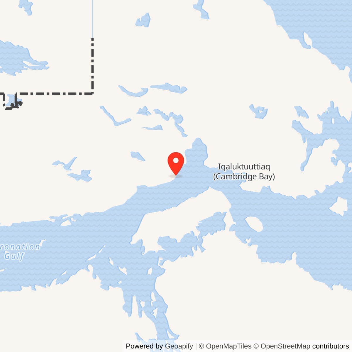
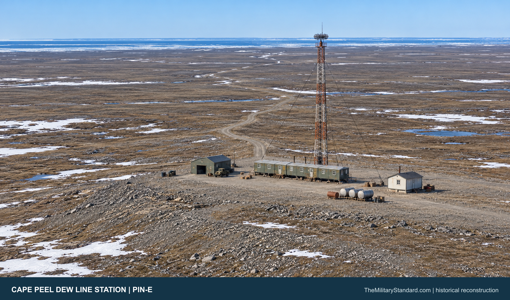
Cape Peel PIN-E stood on the south coast of Victoria Island, about 80 kilometers west of Cambridge Bay and roughly three kilometers inland from Dease Strait. It was one of the small intermediate stations placed between larger radar posts on the Distant Early Warning Line. Byron Bay PIN-4 lay to the west; Cambridge Bay CAM-Main lay to the east. The station helped close the low-altitude gaps between those search radars. [2] [3] [5]
- DEW Line code
- PIN-E
- Role
- Intermediate low-altitude warning station
- Equipment
- AN/FPS-23 Fluttar
- Operating period
- August 1957 to July 21, 1963
- Location
- Cape Peel, Victoria Island, Nunavut
Cape Peel and the DEW Line
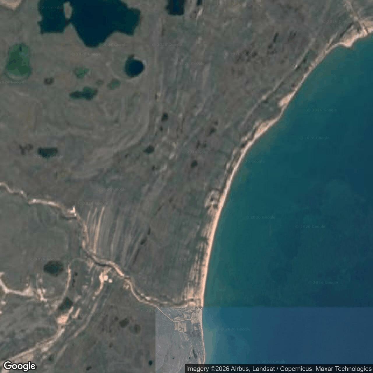
The camp occupied a raised beach terrace about 55 meters above sea level. Its modest elevation offered a clearer radio path over the low coastal terrain, while the distance from the shore required roads to connect the working station with the beach supply area. Cape Peel was a staffed military warning site even though its principal sensor was smaller than the search radar at an auxiliary or main station. [2] [3] [6]
Planning, Construction and Opening
The 1955 United States and Canadian DEW Line planning minutes identified PIN-E as a station in the Victoria Island segment. Canadian records say land was reserved for the installation in 1956. Construction brought prefabricated living and equipment modules to a remote coast where sea delivery, graded tracks, fuel storage and aircraft access had to support the eventual radar watch. [3] [5]
Aerospace Defense Command records Cape Peel in operation by August 1957. That date establishes the start of its documented warning service. The station was part of the first continental DEW Line era, when rapidly built stations linked Arctic sensors into an organized alert system for North American air defense. [1] [5]
Cape Peel had a beach landing and supply area and two airstrips documented in Canadian records, one of them later abandoned. The airstrips and coastal landing area were practical necessities for fuel, food, replacement equipment, construction material and personnel. Each route could be affected by sea ice, weather, drifting snow or the brief summer thaw. [2] [3] [4]
AN/FPS-23 Fluttar and Warning Operations
The station operated an AN/FPS-23 Fluttar, a fixed Doppler warning system rather than a rotating long-range search radar. A transmitter sent a steady radio signal toward a receiving station. An aircraft crossing the radio path could change the received signal and raise a low-altitude warning. Cape Peel therefore contributed a narrow but valuable watch between the broader radar coverage areas at Byron Bay and Cambridge Bay. [1] [5] [6]
Its transmitting antenna stood on a communications tower, and the five-module train held the electronics, power equipment and crew needed to maintain the link. Weather, icing, shifting conditions and electronic drift required technicians to check and retune the equipment. Cape Peel was not designed as a large command center: the warning reached the staffed search-radar and reporting network through the adjoining stations. [1] [3] [6]
A Doppler crossing was an alarm that needed interpretation within the wider network. Operators at the receiving site could compare it with radar returns and other reports before passing a warning onward. At Cape Peel itself, personnel kept the transmitter, communications, generators and local support systems operating so that a missing signal did not become a blind section of the line. [1] [5] [6]
Buildings, Power and Supply
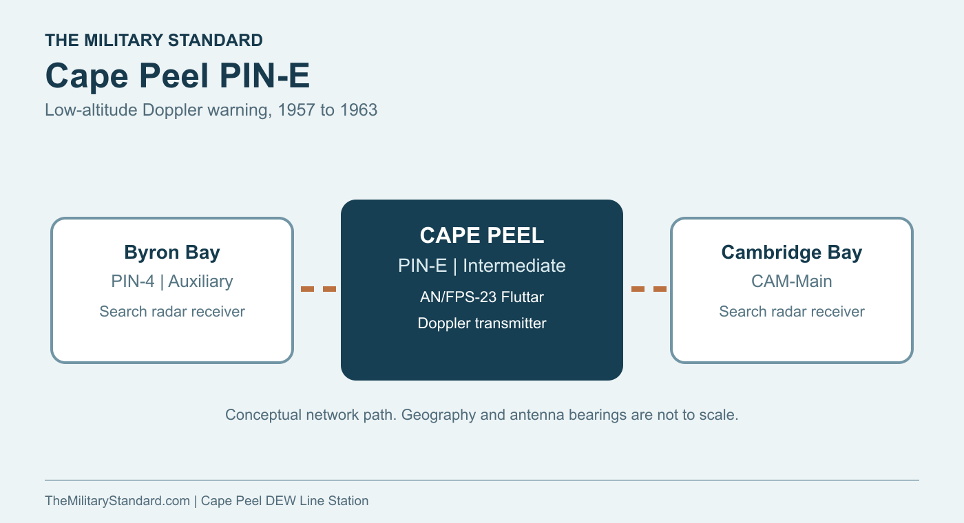
The core of the intermediate station was a train of five connected prefabricated modules, about 80 feet long under the standard design. The modules combined the power plant and technical rooms with the kitchen, dining and sleeping spaces. Connecting them under one roof reduced exposure during a shift change or a repair in severe weather. Cape Peel records identify the module-train pad and power-house area at the former site. [3] [6]
The station also had a separate warehouse and vehicle garage. The warehouse stored parts and supplies; the garage protected machinery needed to maintain roads, move cargo and clear snow. Canadian inventories identify an Inuit family house as part of the camp. That building is evidence that local employees and their families were part of the station community, alongside the technical crew. [2] [3] [6]
Diesel power was essential to the radar link, radios, heat, light and water systems. Station fuel tanks and lines connected that daily demand with seasonal deliveries through the beach supply area. The later site records also locate the former antenna tower, station fuel area, sewage facilities and roads. Together these features show that the small radar outpost was a complete Arctic operating base, not simply a tower in the tundra. [2] [3] [4]
Crew and Daily Life
The standard intermediate design anticipated a crew of four or five, with technicians and a mechanic maintaining the transmitting equipment and power plant. Later staffing could also include a cook and an Inuit equipment operator. The available Cape Peel records do not preserve a station-specific roster, so those figures describe the intermediate-station pattern rather than a fixed Cape Peel headcount. [6]
Life at an intermediate post combined long hours of equipment watch with work outside the modules. A failed generator, radio circuit, vehicle or fuel line could interrupt the warning mission. Crews had to maintain snow access, handle incoming supplies and keep the station warm and habitable. In the short summer season, thawing ground and water could complicate the same routes that winter snow had blocked. [3] [6]
The compact building train meant the working and living rooms were close together. Meals, sleep and equipment maintenance shared a small station footprint, while the coast and airstrips formed the wider working landscape. The presence of separate local family housing also points to the Indigenous labor that helped make a remote military post function, though individual Cape Peel employees have not yet been identified in the accessible record. [2] [3] [6]
Closure and the Later Cape Peel West Site
Aerospace Defense Command gives July 21, 1963 as the end of Cape Peel PIN-E operations. The closure was part of the 1963 shutdown of the intermediate Doppler stations after the original low-altitude fence was reassessed. The larger neighboring search-radar stations continued their own histories after PIN-E stopped transmitting. [1] [6]
Canada later documented the former module train, tower, support buildings, fuel areas, beach facilities and airstrips. Surface work was conducted in 1985, and further assessment and remediation followed. A government aerial in the 2012 booklet shows the remaining road and site pattern after much of the built station had disappeared. [2] [3] [4]
Cape Peel West PIN-EB was established in 1991 as a separate North Warning System short-range radar site. It was neither a reopening of the 1950s PIN-E camp nor the same property under a new name. The original Cape Peel station belongs to the DEW Line intermediate-station story of 1957 to 1963; Cape Peel West belongs to the later radar network. [7]
Chronology
- 1955 Bilateral DEW Line planning identifies Cape Peel PIN-E in the Victoria Island warning chain. [5]
- 1956 Canada reserves land for the station and construction begins in the mid-1950s. [2] [3]
- August 1957 Aerospace Defense Command records PIN-E as operating with AN/FPS-23 equipment. [1]
- July 21, 1963 PIN-E operations cease. [1]
- 1985 Canada conducts surface cleanup work at the former station. [4]
- 1991 The separate Cape Peel West PIN-EB North Warning System site is established. [7]
- 2012-2013 Canada carries out major remediation at the former PIN-E station. [4]
Related Sites
- DEW Line station directory
- DEW Line history
- Byron Bay PIN-4
- Cambridge Bay CAM-Main
- Cape Peel West PIN-EB
- AN/FPS-23 Fluttar
Information sources (7)
- PDFAerospace Defense Command, Historical Data of the Aerospace Defense Command, 1946-1973, station table
Official table identifying Cape Peel PIN-E, AN/FPS-23 equipment, August 1957 operation and July 21, 1963 closure.
- PDFCanada, Remediation of PIN-E Cape Peel, 2012 project booklet, p. 22
Government account of the original station location, buildings, radar tower, fuel storage, beach supply area, two airstrips and post-service condition; includes a former-site aerial.
- PDFAECOM for Indian and Northern Affairs Canada, Cape Peel PIN-E Environmental Screening, March 2010
Station location, 1956 land reservation, five-module train, garage, warehouse, Inuit house, power and fuel facilities, antenna and transport features.
- PDFCanada, 2012-2013 contaminated sites performance report, Cape Peel section
Records the station facilities, 1985 surface work, later assessment and 2012-2013 remediation.
- PDFU.S.-Canada DEW Line Coordinating Committee, 1955 meeting minutes
Contemporary planning record identifying Cape Peel PIN-E between Byron Bay PIN-4 and Cambridge Bay CAM-Main.
- WEBClive Beckmann and Brian Jeffrey, DEWLine Auxiliary and Intermediate Site Layouts
Standard intermediate-station five-module arrangement, staffing, work rooms, warehouse, garage and family housing.
- PDFDefence Research and Development Canada, North Warning System site inventory, Appendix B
Identifies Cape Peel West PIN-EB as a later, separate North Warning System short-range radar site established in 1991.