
Ross Point DEW Line Station, Canada
A four-person Arctic outpost operated a fixed Doppler fence between larger DEW Line radars.
Longitude: -111.107332
Site Number: PIN-D
Current Role: Former station site; major Canadian cleanup and demolition completed in 2012-2013.
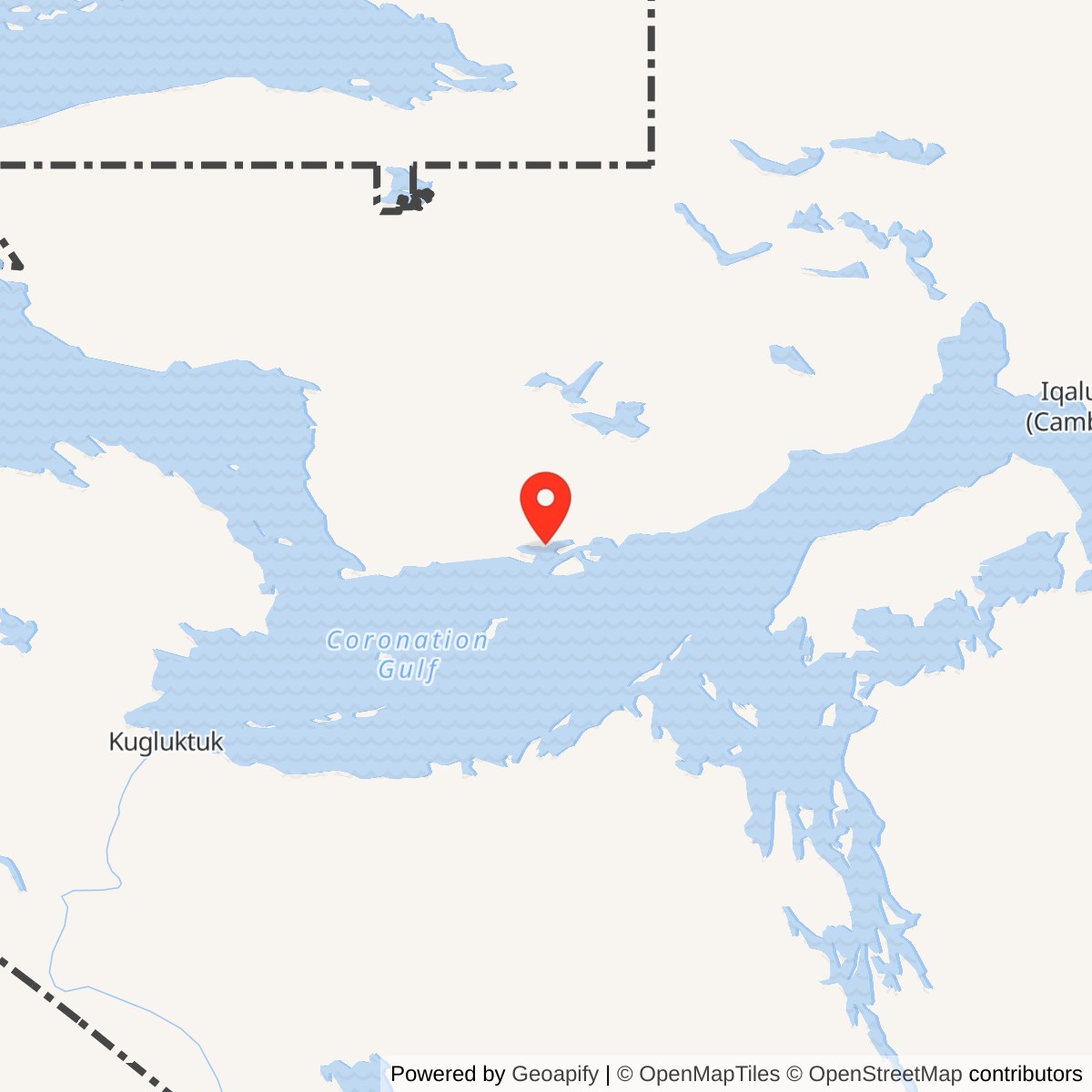
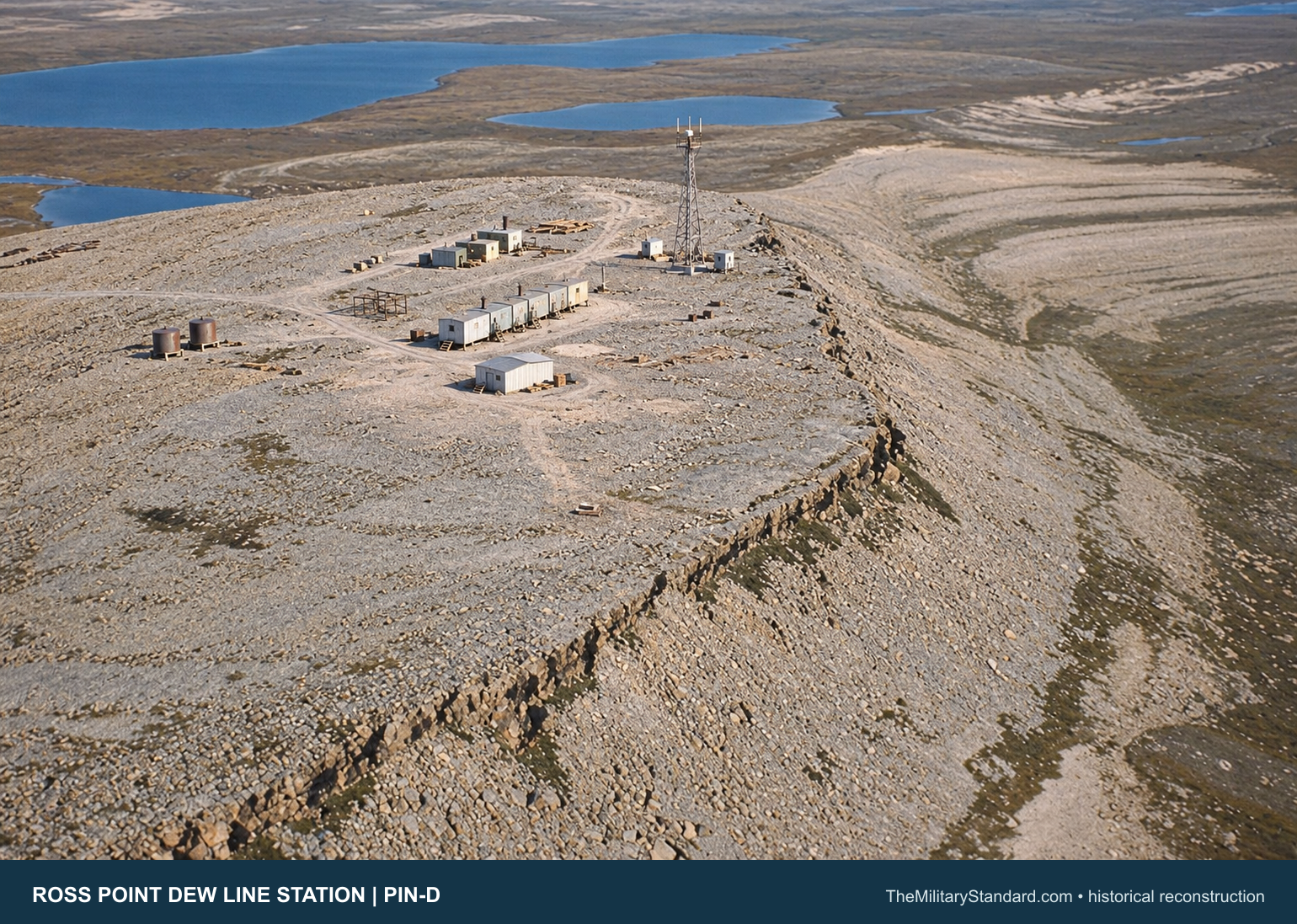
Ross Point PIN-D occupied a gravel mesa about 150 metres above Johansen Bay on the south side of Victoria Island. The camp stood roughly 500 metres inland, about 185 kilometres northeast of Kugluktuk and 250 kilometres west of Cambridge Bay. It was a small intermediate station in the Distant Early Warning Line, between Lady Franklin Point PIN-3 and Byron Bay PIN-4. Its job was to watch the low-altitude gap between the larger search radars on either side. [1] [2] [4]
- DEW Line code
- PIN-D
- Role
- Intermediate Doppler warning station
- Radar system
- AN/FPS-23 Fluttar
- Operating period
- 1957 to 1963
- Location
- Johansen Bay, Victoria Island, Nunavut
Ross Point and the Arctic Warning Chain
The site was a year-round military warning installation even though contractors operated much of the line. Its code, PIN-D, marked its place in the Cape Parry sector. The station did not have the large rotating search radar or radome seen at an auxiliary station. Its fixed Doppler equipment created an electronic fence that complemented the neighboring search radars. [1] [4] [6]
Siting, Construction and Opening
The United States and Canada built the DEW Line to give North America earlier warning of aircraft approaching across the Arctic. Western Electric organized the enormous construction program. Ross Point required a weather-protected camp, radar tower, power plant, fuel system, access roads, landing facilities and airstrips before an electronic watch could be maintained there. [1] [2] [4]
A construction aerial dated March 1956 shows the camp and tracks taking shape on the bare mesa. A second aerial dated July 10, 1956 shows the connected module train substantially complete and the garage shell standing, while the Doppler tower had yet to be erected. Those photographs establish active construction in 1956. The continental DEW Line was declared operational on July 31, 1957, and the station is recorded as operating from 1957 until 1963. [1] [3] [4]
The exposed mesa gave the antenna a clear path toward adjoining radar stations, but complicated construction and daily life. Workers moved materials from the shore over gravel roads, set buildings on supports suited to frozen ground, and established two airstrips. Heavy fuel and cargo arrived during a short navigation season; aircraft carried personnel, mail, food and urgent parts when flying conditions allowed. [2] [3] [4]
The AN/FPS-23 Doppler Fence
Ross Point carried the intermediate-site portion of the AN/FPS-23 Fluttar system. Fixed transmitters sent continuous radio signals toward receivers at the neighboring main or auxiliary stations. A low-flying aircraft crossing one of those paths changed the received signal through the Doppler effect and could trigger an alarm. The system indicated a crossing; it did not supply an ordinary rotating-radar display with target range and bearing. [1] [4] [7]
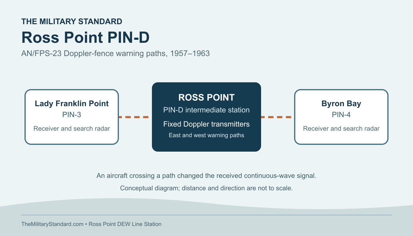
The production fence used AN/FPT-4 transmitters at intermediate stations and AN/FPR-2 receivers at larger stations. A typical intermediate electronics module had two working transmitters aimed in opposite directions and two standby sets. The AN/FPS-23 operated in the 475 to 525 MHz band with one kilowatt of continuous output. At Ross Point, this equipment linked the low-altitude warning paths toward Lady Franklin Point and Byron Bay. [1] [4] [5]
Fluttar addressed a genuine weakness of the search radars: a low aircraft could pass beneath the radar horizon between stations. Its fixed antenna and receiver paths created a narrow warning fence. The equipment also generated troublesome false alarms from weather, propagation, birds and electronic effects. Operators at receiving stations had to interpret the alarm and pass useful warnings through the line's communications system. [1] [7]
Buildings, Power and Supply
A Canadian government account identifies a module train, warehouse, garage, separate Inuit house, petroleum tanks and a Doppler antenna at Ross Point. The beach landing and station were connected by gravel roads and a fuel pipeline. A pump house moved fuel inland. Four station tanks are documented in the later site record, along with a separate beach fueling system. Two airstrips served the isolated post. [2] [8]
The standard intermediate layout used five joined modules, far smaller than the long trains at auxiliary stations. They brought generators, radar transmitters, a kitchen and dining space, bunks, storage and utilities under one enclosed roof. A separate garage supported vehicles and housed emergency equipment. The connected train made routine movement between a shift, a meal and sleeping quarters possible during severe weather. [4] [5]
Diesel generators supplied the radar, communications, heat and lighting. Keeping them running required fuel, spare parts and mechanical skill as much as radio knowledge. The airstrips supported the flow of people and urgent supplies. During the summer, the shore landing and pipeline handled the larger fuel and cargo burden. The limited transport season made storage capacity and maintenance planning essential parts of the military mission. [1] [2] [4]
The People at PIN-D
An intermediate DEW Line station normally had a crew of about four or five rather than the dozens assigned to an auxiliary or main site. The regular jobs included a radar technician, inside and outside mechanics and a cook; one crew member also served as station chief. Federal Electric Corporation operated the line under Air Force oversight. [1] [4] [5]
The crew had to keep the transmitter and generator working while maintaining vehicles, roads, fuel, water, shelter and communications. The separate Inuit house recorded at Ross Point is evidence of Indigenous participation in the station's operating landscape. Across the DEW Line, Inuit workers helped with heavy equipment, outside plant and local travel. At an isolated post, the loss of heat or power could quickly become as serious as a radar failure. [2] [4]
Life at Ross Point was shaped by an unbroken horizon, short summers and prolonged winter darkness. The connected modules reduced exposure during ordinary shifts, while outside maintenance still required work on the tower, fuel line, vehicles and airstrips. The station depended on neighboring sites for its warning function and on seasonal transportation for nearly everything needed to sustain the crew. [1] [2] [3] [4]
Closure and What Remains
The intermediate Doppler stations were shut down in 1963. Persistent false alarms, difficult maintenance and changing air-defense priorities undercut the value of the costly staffed fence. Ross Point closed with that intermediate network, while the larger DEW Line search-radar stations continued their warning mission. [1] [2] [6]
A 1994 investigation found the Ross Point module train and garage still standing but weathered; the warehouse had been dismantled. The station fuel tanks had been removed, while the pump house and much of the pipeline remained. Canadian authorities completed a major cleanup in 2012-2013 that included dismantling remaining structures and managing contaminated soil and debris. This later history explains why little of the original camp survives above ground. [2] [8]
The North Warning System established the Edinburgh Island PIN-DA short-range radar site nearby in October 1991. This later station brought an unattended radar to the Johansen Bay area nearly three decades after Ross Point closed. [6]
Chronology
- 1956 Aerial photographs document the camp under construction in March and its module train substantially complete in July. [3]
- July 31, 1957 The continental DEW Line is declared operational; Ross Point serves as PIN-D in the intermediate Doppler network. [1] [3] [4]
- 1963 Ross Point closes with the intermediate AN/FPS-23 stations. [1] [2] [6]
- 1985 Canadian authorities remove some surface materials from the abandoned property. [2]
- 1991 The separate Edinburgh Island PIN-DA North Warning System radar opens nearby. [6]
- 1994 A survey finds the module train and garage standing but weathered. [2]
- 2012-2013 Canada completes major Ross Point site remediation and demolition. [2] [8]
Related Sites
Information sources (9)
- PDFThomas W. Ray, Air Defense Command Historical Study No. 31, A History of the DEW Line, 1946-1964
Primary history for the AN/FPS-23 Doppler fence, intermediate-station architecture, crew, operating problems and the 1963 shutdown.
- PDFAboriginal Affairs and Northern Development Canada, Northern Contaminated Sites Program Performance Report 2012-2013, pp. 20-21
Station-specific location, buildings, fuel and transport facilities, 1994 condition, 1963 closure and 2012-2013 cleanup.
- WEBThe DEWLine, Ross Point PIN-D construction photographs
March and July 1956 aerial views showing the mesa, developing module train and garage before the antenna tower was erected. Photographs are reference-only pending reuse rights.
- WEBPaul Kelley, A Brief Introduction to the DEW Line
Intermediate-station roles, typical four-person crew, Doppler transmitters, paired receivers and Arctic supply system.
- WEBClive Beckmann and Brian Jeffrey, DEWLine Auxiliary and Intermediate Site Layouts
Representative five-module intermediate train, power, electronics, crew quarters and garage arrangement.
- PDFDefence Research and Development Canada, Survey of COTS-MOTS Lighter than Air Platforms and Communication Relays, 2013, Appendix B
Official station inventory identifying Ross Point PIN-D as a 1963-closed intermediate site and Edinburgh Island PIN-DA as a separate 1991 North Warning System station.
- PDFF. Robert Naka and William W. Ward, Distant-Early-Warning Line Radars: The Quest for Automatic Signal Detection
Lincoln Laboratory technical account of the Fluttar concept, bistatic Doppler detection and the difficulty of automatic alarms.
- PDFEnvironment Canada, Federal Contaminated Sites Action Plan Annual Report 2012-2013, Ross Point and Cape Peel case study
Canadian government account of the intermediate-site building types and the joint 2012-2013 remediation project.
- PDFNunavut Lands and Resources Devolution Agreement, former military site inventory
Federal inventory placing the Ross Point former military property at approximately 68.583333 north, 111.1 west.