
Cape Parry DEW Line Station, Canada
On a ridge above Amundsen Gulf, PIN-Main joined aircraft detection, a staffed data center and a self-contained Arctic community.
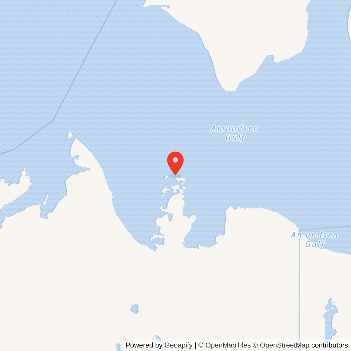
Longitude: -124.725
Site Number: PIN-Main
Current Role: North Warning System PIN-M long-range radar site documented by Canadian government in 2014; current operating status requires confirmation.
Cape Parry PIN-Main was a staffed long-range radar and data center on the western Canadian Arctic coast. It entered DEW Line service in August 1957, served the PIN sector through the Cold War and moved into North Warning System operation in August 1989. [1] [3] [6]
- DEW Line code
- PIN-Main
- Original role
- Main long-range radar and data center
- Original equipment
- AN/FPS-19; AN/FPS-23
- DEW service
- August 1957 to August 1989
- Later use
- North Warning System long-range radar
- Approximate location
- 70.17139, -124.72500
Site Selection and Construction
Cape Parry stood on the Parry Peninsula beside Amundsen Gulf, roughly two miles northwest of the narrow isthmus to the mainland. The station compound occupied a rise about 250 feet above sea level. The reserved area was listed at 2,607 acres, far larger than the group of radar and living buildings. The elevated position gave the radar a wide horizon over the northern approaches and made sea, air and overland supply essential to construction. [3]
Crews began moving building materials into the peninsula in 1955. Construction-era photographs show a Bristol Freighter unloading cargo that June, a temporary camp, the March 1956 garage and erection tent, and two nearly complete modular building trains by June 1956. An October 1956 aerial shows the station close to completion, with the radome and antenna structures taking shape. The work proceeded through the short Arctic building season, with cargo staged at the beach and hauled inland. [2] [3]
The site was one of six Main stations in the original DEW Line. Main stations combined long-range detection, reporting, maintenance, communications and regional support functions that smaller auxiliary and intermediate posts could not provide by themselves. Cape Parry served the central sector coded PIN, gathering alarms and reports from stations along the coast and passing warning information through the defense network. [1] [2] [3]
Buildings and Station Layout
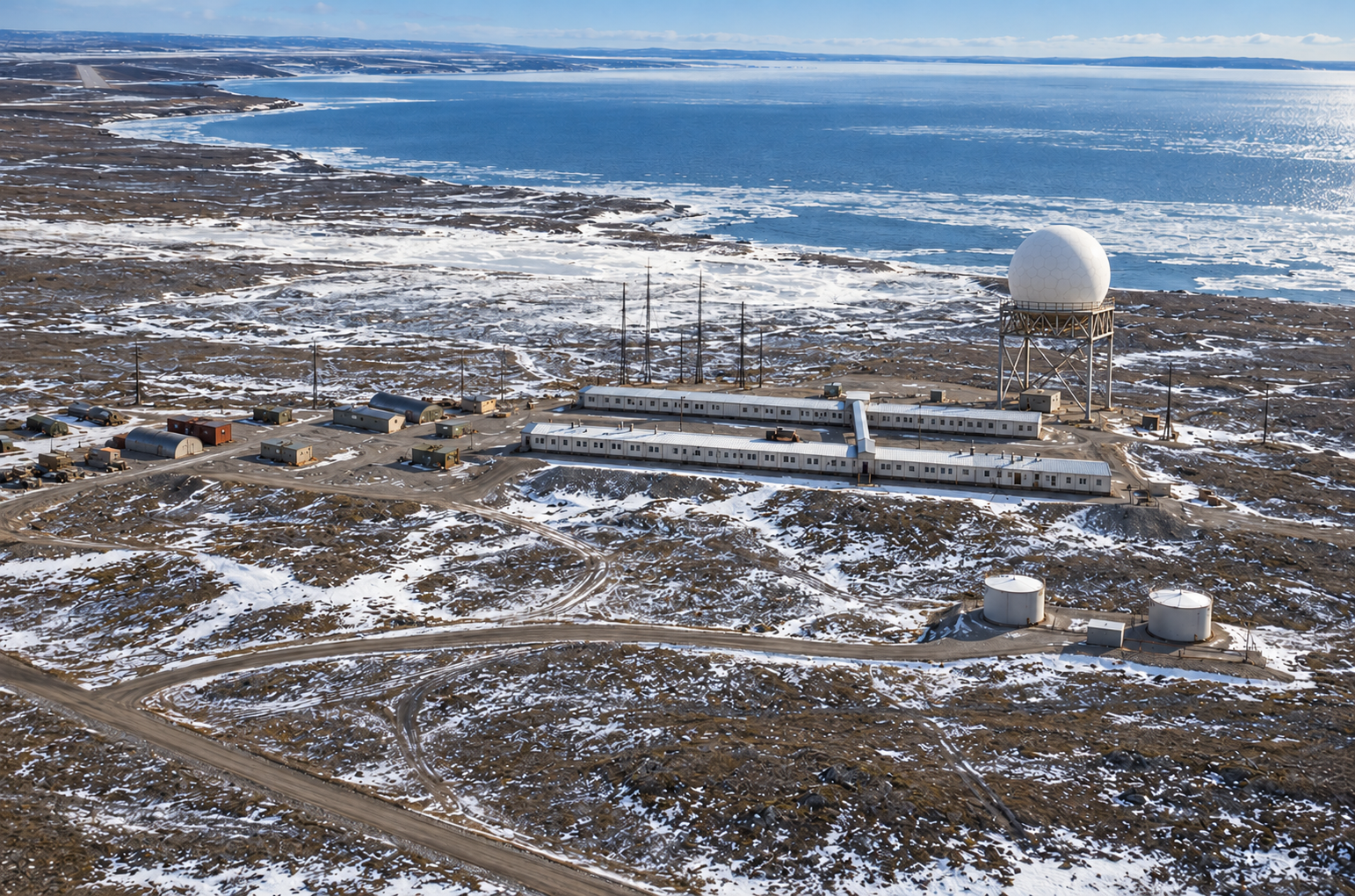
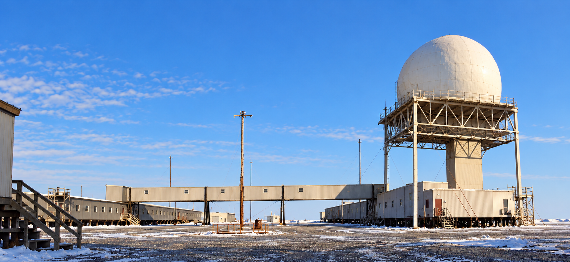
The completed main compound had two long, parallel, low modular building trains, A and B, linked by an enclosed passage. Historical aerials place the trains on a cleared ridge with the search-radar radome at one end, a cluster of tall slim masts and smaller fixed antenna structures nearby. Garage, warehouse, fuel storage, roads and the airfield stood apart from the trains. This arrangement kept living and technical work in connected heated interiors while reserving open ground for radar and service equipment. [3]
A surviving building-layout diagram identifies military sleeping quarters and an adjacent power house at one end of B train. It also marks a general office, briefing room and recreation facilities. A train held the kitchen and dining area, a television room, civilian bar and restricted military-only bar. A separate structure is labeled as the CE building, while three warehouses and additional cold storage appear outside the trains. The diagram shows how a Main station functioned as a small community as well as a radar post. [3]
The nearby air terminal and hangar supported personnel movements and supplies. They also housed a weather office separate from the main radar compound, about two kilometers away according to a 1980 staff account. The road between the airfield and radar hill joined the station's daily operations, but the terminal should not be mistaken for one of the two radar-building trains. [3] [5]
Radar, Data Center and Communications
Air Defense Command records list the AN/FPS-19 search radar and AN/FPS-23 Doppler equipment at Cape Parry when PIN-Main entered manual operation in August 1957. The FPS-19 searched for approaching aircraft, while the FPS-23 system supplied crossing alerts across gaps between the larger search stations. The white radome protected the search antenna from wind and icing. These were separate functions: one surveyed a broad area, and the other strengthened the low-altitude warning fence. [1] [2]
Cape Parry had a military-manned Data Center but no contractor sector-headquarters group. Operators had to examine radar returns, correlate reports from neighboring posts, and forward significant tracks or alarms along the command chain. Its Main-station responsibilities made reliable communications as important as the radar set itself. Radio, teletype and later network circuits connected the remote station to the other PIN posts and the air-defense organization responsible for responding to an incursion. [2] [3]
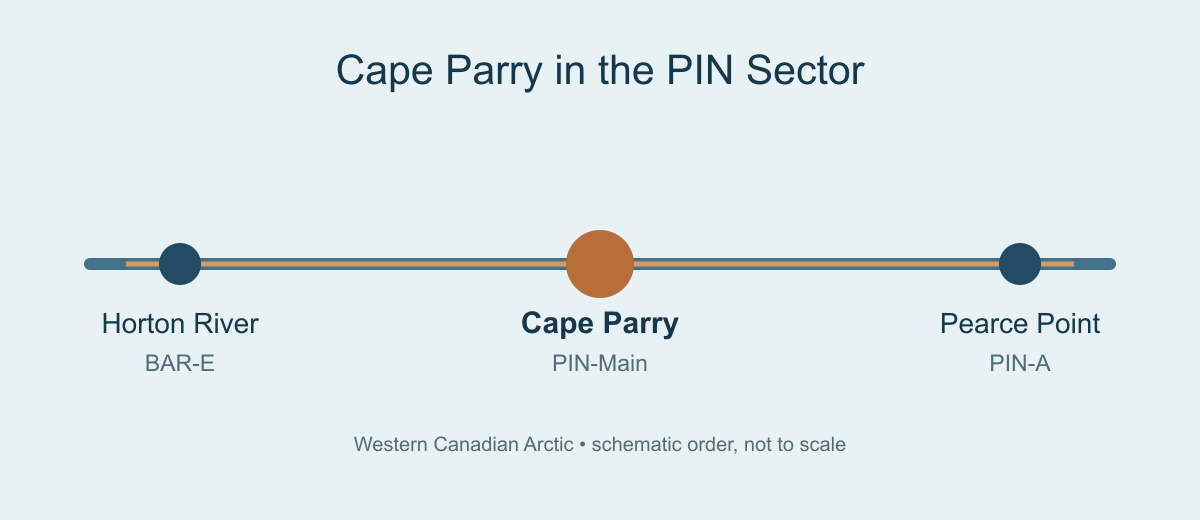
The separate intermediate posts to either side originally carried the FPS-23 transmitters that completed the crossing-alert path. To the west, Horton River BAR-E closed in 1963 with the intermediate-station program. Cape Parry continued as a staffed long-range Main station, with the surviving radar chain and later equipment changes carrying the warning mission through the rest of the Cold War. [1] [2] [6]
Command, Staffing and Daily Life
The early DEW Line was financed by the United States, with civilian contractors maintaining much of its equipment. A Main-station staffing plan called for roughly 45 to 50 civilians and six officers, although that was an authorized pattern for the class rather than a Cape Parry roll call. Military staff directed warning operations; technicians, mechanics, cooks, supply workers and other civilians kept the facility functioning around the clock. [2]
The military command arrangement changed in 1959. Contemporary Canadian reporting says RCAF Air Defence Command assumed major responsibilities for the four Canadian Main stations, including Cape Parry, after a period when USAF liaison officers had performed most military functions. A Canadian commander and staff thus became part of PIN-Main's operating story, while the station remained tied to the joint North American warning system. [4]
The building plan makes the rhythm of station life visible. Personnel slept in the B train, ate in A train, and used recreation and television rooms between watches. The general office and briefing room supported shift handovers and military direction. Food, fuel, spare components and mail came over long routes and in seasons controlled by weather. A 1957 photograph of the Coast Guard cutter Storis near Cape Parry records the importance of the annual sealift. [3]
Water was a persistent logistical job. The station description gives a round-trip potable-water haul of 3.5 miles in summer and 6.5 miles in winter. At this exposed coast, crews also had to maintain heat, generators, vehicles and antenna equipment through freezing conditions and drifting snow. The linked trains shortened outdoor walks, but maintenance at the radome, garage, tanks and airfield still required working in the Arctic weather. [3]
A 1980 weather observer remembered approximately 32 people at PIN-Main, including contractors, military members and Atmospheric Environment Service staff. Three weather employees kept the nearby air-terminal office open around the clock. Other PIN stations sent their observations to Cape Parry every six hours for relay to Edmonton. The number is a useful snapshot of the later staffed station, not a fixed complement for its whole thirty-year DEW period. [5]
Additional Activity at the Cape
Cape Parry also supported scientific sounding-rocket work during the Cold War. NASA recorded three Nike-Tomahawk launches on March 7 and 8, 1969, for upper-atmosphere research. Canadian reporting describes a launcher, telemetry trailer and support gear installed in 1974, followed by Black Brant launches that December. These temporary projects used the remote station's access and communications without changing its principal air-defense mission. [8] [9]
Transition to the North Warning System
The original DEW Line mission at Cape Parry ended in August 1989 as the North Warning System took over the site's long-range surveillance role. The later installation is designated PIN-M and uses the AN/FPS-117 long-range radar. The new approach used automated radar reporting and periodic maintenance rather than a resident Main-station population of the 1950s to 1980s. [6] [7] [10]
A Canadian government facility record describes the successor radar as unattended for most of the year, with quarterly preventive maintenance and visits for repairs. That is a sharp operational change from the two connected living and working trains of the DEW era. Cape Parry nevertheless remained part of the northern warning chain, now with a compact radar installation and remote oversight. [6] [7]
The old DEW complex left an extensive physical legacy of buildings, fuel systems and roads. Canadian records document later demolition and cleanup, while the North Warning System continues to identify Cape Parry as a long-range radar location. The two eras belong in one station history: a staffed PIN-sector headquarters and detection post through 1989, followed by a largely unattended radar site. [6] [7]
Chronology
- 1955: Construction cargo and the advance camp appear in Cape Parry photographs. [3]
- 1956: The parallel module trains, garage and radar structures take shape. [3]
- August 1957: PIN-Main enters manual DEW Line operation with AN/FPS-19 and AN/FPS-23 equipment. [1]
- 1959: RCAF Air Defence Command assumes major military responsibilities at Cape Parry. [4]
- March 1969: NASA records three Nike-Tomahawk research-rocket launches. [8]
- December 1974: Canadian Black Brant sounding rockets launch from Cape Parry. [9]
- 1980: A weather observer records an approximately 32-person PIN-Main community and six-hour weather reporting. [5]
- August 1989: DEW Line operations end and the North Warning System long-range radar era begins. [6] [10]
- 2014: A Canadian facility record describes an unattended radar site with periodic maintenance. [7]
Related Sites
Information sources (10)
- PDFAerospace Defense Command, Historical Data of the Aerospace Defense Command, 1946-1973, DEW Line station table
Station-specific PIN-Main entry for August 1957 manual operation and AN/FPS-19 and AN/FPS-23 equipment.
- PDFThomas W. Ray, A History of the DEW Line, 1946-1964, NORAD Historical Study No. 31
Primary account of the line construction, Main-station mission, staffing plan, radar and communications network.
- WEBThe DEWLine, Cape Parry PIN-Main station record and Markham Cheever photograph captions
Station-specific topography, water haul, Data Center, building layout and dated construction views.
- PDFRoyal Canadian Air Force, Voxair, June 8, 1977, DEW Line Canadian Main stations
Account of the 1959 transfer of major military responsibilities at Cape Parry and other Canadian Main stations to RCAF Air Defence Command.
- WEBCanadian Meteorological and Oceanographic Society, Cape Parry 1980, Ron Haley photographs and notes
Firsthand account of PIN-Main personnel, the separate air-terminal weather station and six-hour weather-report relay.
- PDFArctic Institute of North America, The Distant Early Warning Line: A Bibliography and Documentary Resource List, site table
Cape Parry PIN-Main designation, approximate coordinates and August 1989 transition to a North Warning System long-range radar site.
- WEBGovernment of Canada, National Pollutant Release Inventory, Cape Parry PIN-M, 2014
Government record giving the successor site coordinates and describing an unattended NWS radar with periodic maintenance.
- PDFNational Aeronautics and Space Administration, Aeronautics and Space Report of the President, 1969
Records the March 1969 Nike-Tomahawk research-rocket launches from Cape Parry.
- PDFGovernment of Canada, Department of Communications Annual Report, 1974
Records the 1974 Black Brant launch equipment and scientific launches at Cape Parry.
- WEBThe DEWLine, North Warning System site table, Cape Parry PIN-M entry
Identifies Cape Parry PIN-M as an AN/FPS-117 long-range radar site established in August 1989.